| Guide | ♦ | 36 Triplogs | 0 Topics |
details | drive | permit | forecast | route |
stats |
photos | triplogs | topics | location |
| 92 | 36 | 0 |
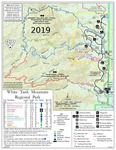
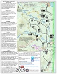
You can’t be more creative than “South Trail” by mt98dew  Overview OverviewThe South trail is one of 13 official trails in the White Tank Mountain Regional Park system. Since this is a county park, there is an entrance fee for utilizing this area. It is located, as the name implies on the south edge of the park. The South Trail has its own trailhead and is the only trail that takes off from this spot. The trailhead has parking for 18 cars. It has bathroom facilities, but no drinking water. There are nine picnic tables, 2 that are shaded, and there is more parking and picnic tables in the general vicinity. There is a white bulletin board at the start of the trail, providing general, common sense, desert advice as well as a trail map of the trails in the area. As mentioned there is no water at this trailhead so come prepared and plan your hike accordingly. Hike The South Trail is a very simple, low-lying trail. The trail begins at the western edge of the parking lot and heads off in a westward direction. Within a few feet the trail zig zags across a wash and then at 0.15 miles junctures with the Mule Deer Trail. Continuing west keeps you on South Trail, turning left at this juncture puts you on the Mule Deer Trail. This juncture is well-signed so there should be no confusion as to which trail you’re on. This trail keeps a fairly straight, westward heading for most of its length.
The South Trail varies in width from 2 to 8 feet as it makes its way to the Goat Camp Trail. It is one of the rockier, flat trails in the park with a decent mixture of embedded and loose rocks. The wideness of the trail allows you to negotiate many of these rock obstacles. The South Trail offers a nice variety the Sonoran desert foliage. This includes saguaro, barrel cactus, creosote, sage, teddy-bear cholla, prickly pear, paloverde, ironwood, and staghorn cholla. As mentioned, the South Trail is very simplistic and it’s just over 1 mile in length with an elevation gain of about 170 ft. When it junctures with the Goat Camp Trail one has several options. You can return the way you came for a 2-mile hike. Or you can take advantage of the connecting trails to make a loop of varying lengths. You can use the map at the TH to plan out your options. Another notable feature of the South trailhead is that it is an excellent starting point for the Maricopa Trail, which enters/exits the park via the Mule Deer trail which junctures with the South Trail. Check out the Official Route and Triplogs. Leave No Trace and +Add a Triplog after your hike to support this local community. One-Way Notice This hike is listed as One-Way. When hiking several trails on a single "hike", log it with a generic name that describes the hike. Then link the trails traveled, check out the example. | |||||||||||||||||||||||||||||||||||||||||||||||||||||||||||||||||||||||||||||||||||||||||||||||||||||||||||||||||||||||||||||||||||||||||||||||||||||||||||||||||||||||||||||||||||||
 Route Editor


