 Route Editor

| Guide | ♦ | 20 Triplogs | 0 Topics |
details | drive | permit | forecast | route |
stats |
photos | triplogs | topics | location |
| 332 | 20 | 0 |
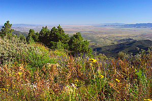
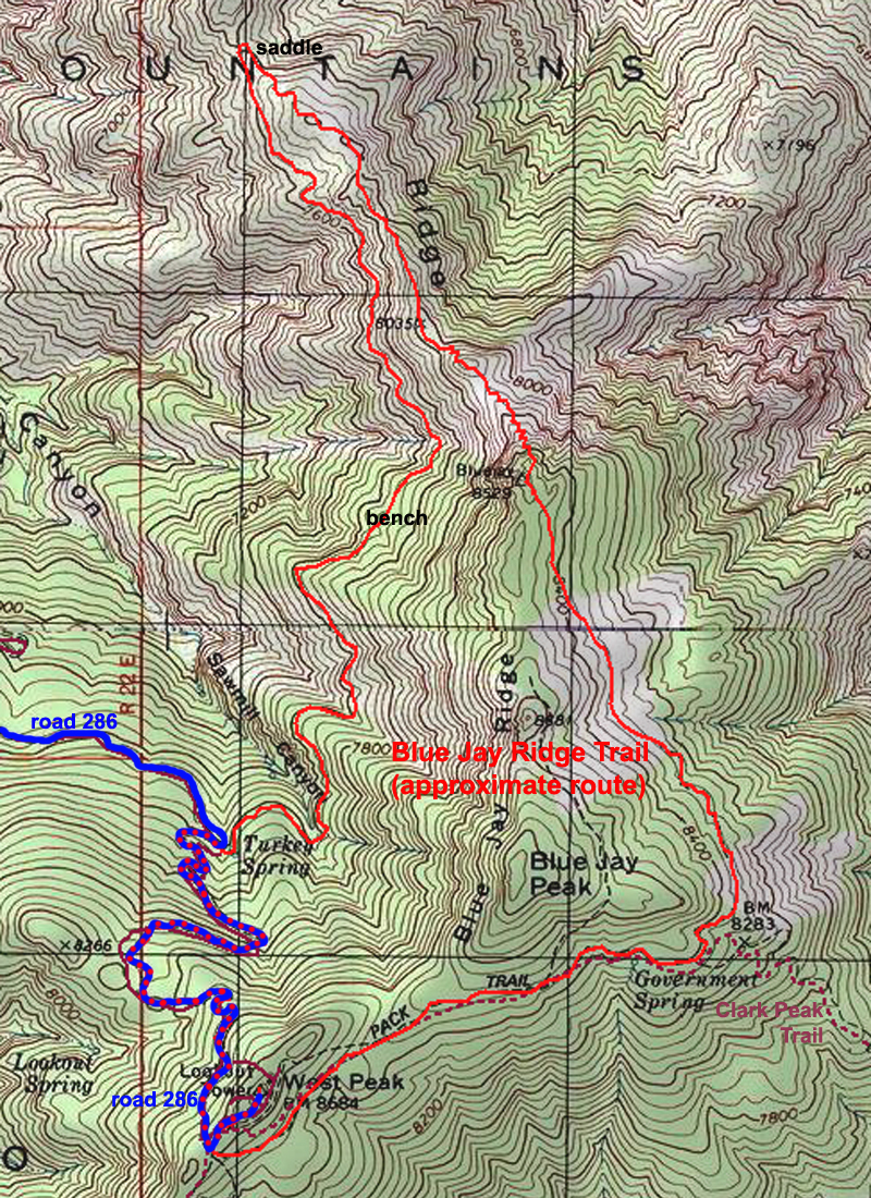
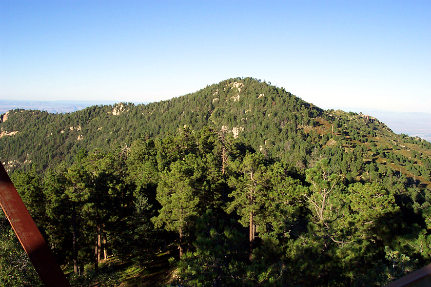
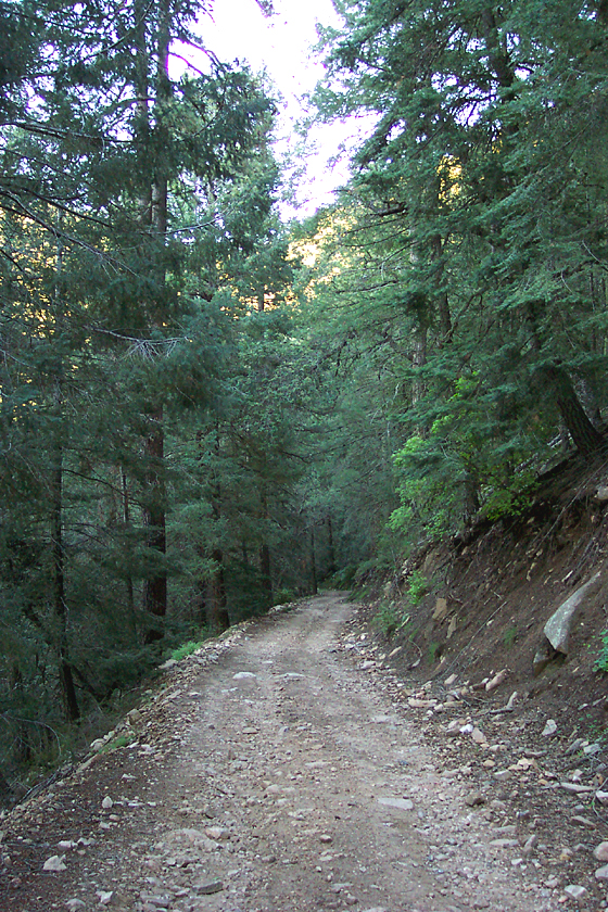
Wildflower Island by PrestonSands  The Blue Jay Ridge Loop encompasses the Blue Jay Ridge Trail #314 and part of forest road 286 on the north end of the Pinaleno Mountains. It begins at the end of a 24-mile dirt road drive from Highway 70, which begins in a creosote bush-filled desert, and ends on a mountainside covered in firs and aspens. Included here is a topo map showing the approximate route of the hike. The Blue Jay Ridge Loop encompasses the Blue Jay Ridge Trail #314 and part of forest road 286 on the north end of the Pinaleno Mountains. It begins at the end of a 24-mile dirt road drive from Highway 70, which begins in a creosote bush-filled desert, and ends on a mountainside covered in firs and aspens. Included here is a topo map showing the approximate route of the hike.Beginning at the Turkey Spring trailhead on a switchback turn of forest road 286, the Blue Jay Ridge Trail leaves the road behind and begins to climb uphill through the white firs and occasional aspens. The trail soon levels out and roughly follows the 7600-foot contour for the next two miles, along a ridge of tan-colored granite. For the first half-mile, the trail remains in the cool shade of the fir forest. After that, where the trail encounters west-facing slopes, the vegetation changes to white oaks and brush, and on the north-facing slopes, there are fir and ponderosa forests. About 1.25 miles in, the trail crosses a forested bench on the side of the mountain, with several nice campsites. After leaving the bench, the trail contours along the steep brushy slopes of Blue Jay Ridge. There are some great views of the Santa Teresa Mountains and the Aravaipa area along here.
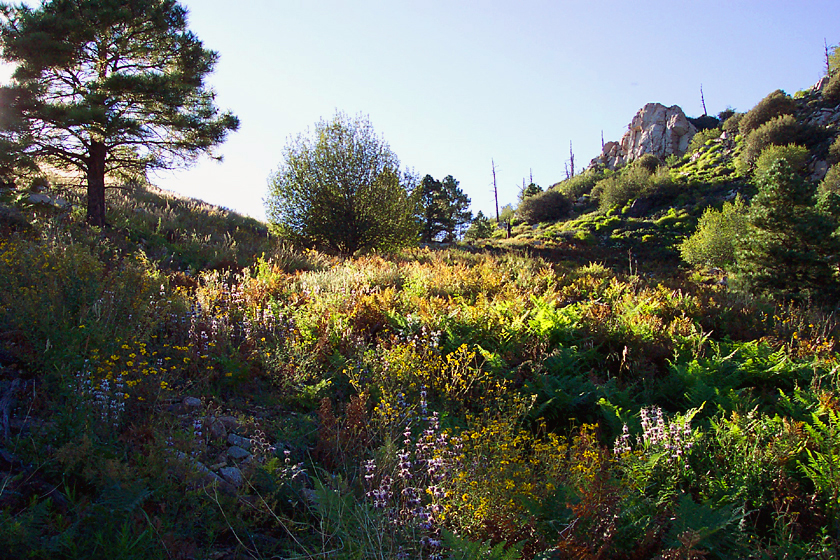
Once on top of the 8529' hill, the trail levels off, passes a small aspen grove and enters a park like area that wraps around the mountain top, formed by a wildfire in the early 1970s. The now easily found trail makes a short descent through an area of orange granite rocks and wildflowers and soon becomes an old 4x4 road. Follow the old road (it is still trail #314) for the next two miles, as it contours along rolling hillsides of ferns and wildflowers, dotted with clumps of young ponderosa pines. The plentiful wildflowers and great views of the Mt. Graham area made this my favorite part of the hike. As the trail rounds 8800 foot Blue Jay Peak, it turns west and passes the junction with the Clark Peak Trail #301. There are some views of the Taylor Pass area and the distant Galiuro Mountains along here. The trail soon passes through another flat saddle as it nears West Peak 8684'. The trail reaches its highest point as it passes through a road cut on the southwestern ridge of West Peak and meets up with the short side road to the fire tower on the peak. This is where the Blue Jay Ridge Trail officially ends, and the route leaves the old burn area. If you turn right and pass the locked gate, a short five-minute walk will bring you to the 45 foot tall West Peak fire tower and 360-degree views. After enjoying the views atop West Peak, begin following forest road 286 as it makes a steep descent down the forested northern slope of the peak. After not seeing any other hikers or wildlife until this point, the excited chattering of a Mount Graham Red Squirrel surprised me as I hiked down the steep rocky road. After about 1.6 miles and a 1000 foot drop from the top of West Peak through the fir forests, you will arrive back at the Turkey Spring trailhead, thus completing the loop hike. Gate Policy: If a gate is closed upon arrival, leave it closed after you go through. If it is open, leave it open. Leaving a closed gate open may put cattle in danger. Closing an open gate may cut them off from water. Please be respectful, leave gates as found. The exception is signage on the gate directing you otherwise. Check out the Official Route and Triplogs. Leave No Trace and +Add a Triplog after your hike to support this local community. | ||||||||||||||||||||||||||||||||||||||||||||||||||||||||||||||||||||||||||||||||||||||||||||||||||||||||||||||||||||||||||||||||||||||||||||||||||||||||||||||||||||||||||||||||||||||


