 Route Editor

| Guide | ♦ | 11 Triplogs | 1 Topic |
details | drive | no permit | forecast | 🔥 route |
stats |
photos | triplogs | topic | location |
| 83 | 11 | 1 |
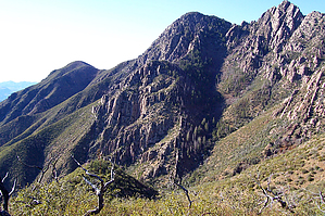
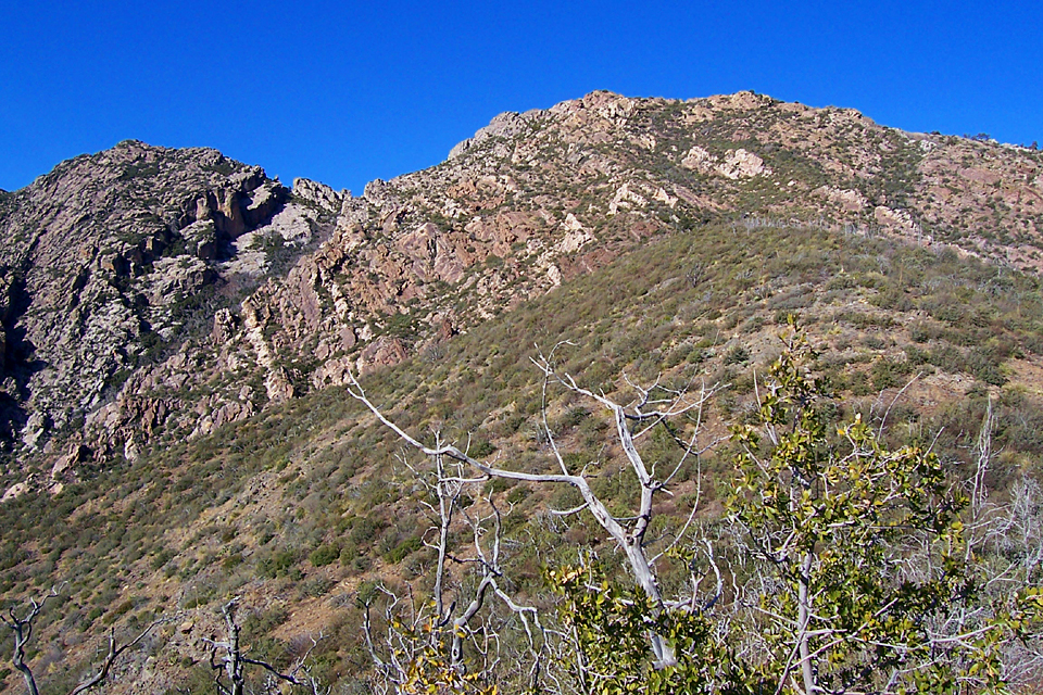
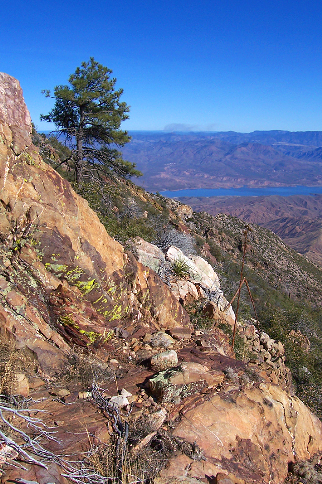
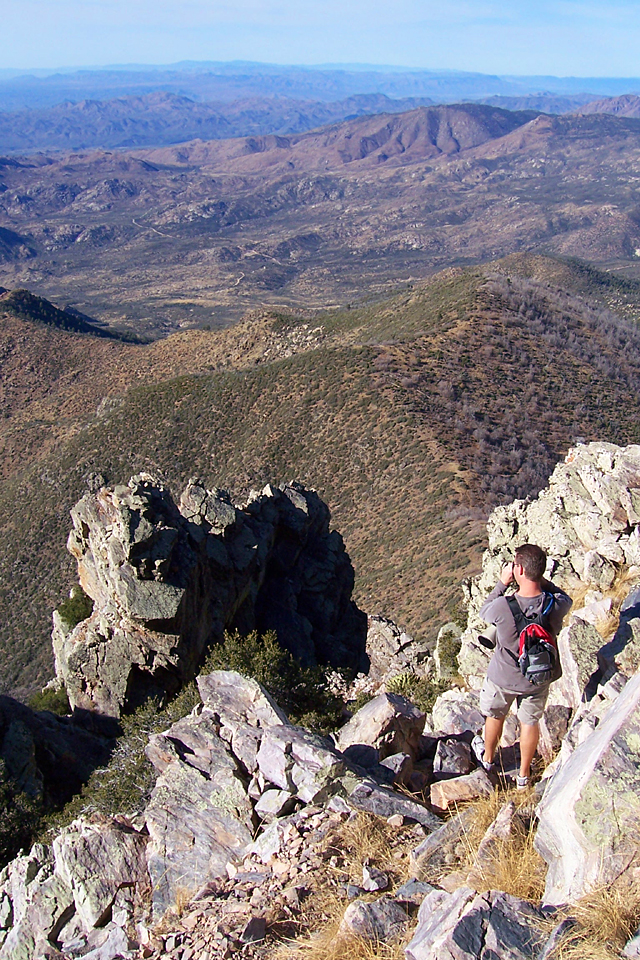
 This loop is a combination of trails and bushwhacking that climbs up and over the highest of the Four Peaks: Brown's Peak. I seriously recommend doing this hike after having completed the Brown's Peak hike first. Otherwise, you may find it challenging to find the return route down the west chute. In addition, the nearly vertical terrain of the chute will be more comfortable with experience. I also recommend doing the loop clockwise, as it will be easier to climb up the east side of Brown's Peak than down. Also, be advised that the chute on the northwest side of Brown's Peak that this hike uses could be hazardous if snow or ice is present. If you don't have a fear of heights, this is an incredible hike with outstanding views! This loop is a combination of trails and bushwhacking that climbs up and over the highest of the Four Peaks: Brown's Peak. I seriously recommend doing this hike after having completed the Brown's Peak hike first. Otherwise, you may find it challenging to find the return route down the west chute. In addition, the nearly vertical terrain of the chute will be more comfortable with experience. I also recommend doing the loop clockwise, as it will be easier to climb up the east side of Brown's Peak than down. Also, be advised that the chute on the northwest side of Brown's Peak that this hike uses could be hazardous if snow or ice is present. If you don't have a fear of heights, this is an incredible hike with outstanding views!Beginning at Lone Pine Trailhead, begin following the Four Peaks Trail #130 east, through surviving remnants of ponderosa forest. The Four Peaks Trail gently contours along the northern slope of Four Peaks, and passes the Amethyst Trail #253 junction at the one-mile mark. The trail passes the turnoff for the Pigeon Trail #134 at the bottom of a little ravine and joins the route of the Arizona Trail. Just around the corner are some tall ponderosas, and Shake Spring. A quarter-mile later, the Four Peaks Trail turns south at the junction with the Oak Flat Trail #123 and begins a steady half-mile ascent of a drainage. At the top of the drainage, the trail passes through a little saddle and then begins a mile-long traverse of the steep eastern side of Four Peaks. Along this stretch, there are spectacular views of Roosevelt Lake and the desert below. Where the trail clings to a north-facing slope, a few maple trees and a scattering of tall douglas firs are encountered. Granite rock gives way to the ancient Mazatzal Quartzite as the trail clings precariously to the mountainside near the head of Baldy Canyon. This colorful rock that forms the Four Peaks themselves is so hard and dense that it gives a metallic sound when pieces clang together under your boots.
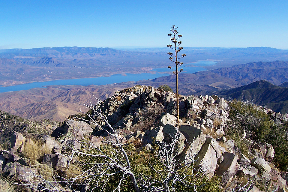
From here, basically follow the county line up to the top of Brown's Peak ridge (look at Joe's gps route). If you stay slightly to the south of the ridgeline during the 1000 foot vertical climb from Alder Saddle, you will avoid the worst of the brush. The higher you climb up the mountainside, the steeper it gets, and the better the views. We didn't encounter any cliffs while climbing up the outcrops of orange, white, and purplish rock on our push to the top, but there are some areas that you will need to use your hands to pull yourself up. Once at the top of the ridge, the terrain eases up a bit, and views north resume. Just follow the jagged ridgeline uphill to the west. A few rippled rocks can be seen; evidence of an ancient ocean. When you are at the highest point on the ridge, you have arrived at the top of Brown's Peak. Many distant mountains can be seen from up here: Humphrey's Peak, the Bradshaw, Pinaleno, and Santa Catalina Mountains, and of course, surrounding areas nearby. After you have taken in the incredible views and names carved in the rock, head as far west as you can on the summit, and look for the trail heading down to the top of the chute. (see the Brown's Peak hike for more information) Once you have completed the white-knuckle descent of the chute to Brown's Saddle, head north on the Amethyst Trail as it heads downhill. A short distance later, you will come to the junction with Brown's Trail #133. Go straight; now you are on Brown's Trail. Continue another mile and a half or so down the relaxing Brown's Trail through a nice patch of ponderosa pine forest as it descends a ridge back to Lone Pine Trailhead.
Check out the Official Route and Triplogs. Note This is a moderately difficult hike. Leave No Trace and +Add a Triplog after your hike to support this local community. | ||||||||||||||||||||||||||||||||||||||||||||||||||||||||||||||||||||||||||||||||||||||||||||||||||||||||||||||||||||||||||||||||||||


