| | -
-
-
-
| |  |
|
3 |
-
|
| | |
|
| Hiking | 10.83 Miles |
1,488 AEG |
| | Hiking | 10.83 Miles | 4 Hrs 26 Mns | | 2.44 mph |
| 1,488 ft AEG | | | | |
|
|
| |
| Partners |
|
none
[ show ]
| no partners | | I had planned to hike to Peter's Cave, but I figured the water might be up a bit too much with the recent downpours, plus my right arm is messed up and I did not want to do any excessive scrambling. Since it has been six years (and 12 days) since I was last did this loop, I figured I would make another visit. Plus, it would give me a chance to do an interim survey of some of the areas at the far end of the park, midway between my semiannual (April & October) Loop 202 South Mountain Freeway right-of-way hikes.
San Juan Road was closed off. Again. Is it ever open?
I parked at the "triangle" (the intersection of San Juan Rd and Summit Rd). At 0730, it was 42 in Phoenix, but only 35 at South Mountain. I wore a windbreaker. I went east down Bajada, then up Ranger. After I crossed Summit Road, the shooting started at the nearby range. I also heard coyotes.
I skipped Goat Hill last time; this time, I initially walked by the trail. The short summit trail was steep & slippery. Great 360 views.
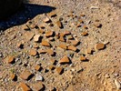
On the way west on National, I checked out every prospect / mine, all of which I had merely eyeballed six years ago.
When I got to Bursera, I turned left/south. After descending into the valley, I turned west on Gila Trail, which at that point is a jeep trail. As I walked along Gila to the housing development, I realized my crappy Garmin 62S was going haywire, tracking me on top of a nearby ridge, instead of along the rather deep wash.
The housing area does not appear to have changed much in three months. After tearing down all the houses along Pecos Rd and in the Dusty Lane community behind the Vee Quiva Casino, it seems kind of wierd that a *new* development would go in between the two. Or that they would build it nearly up to the edge of the soon-to-be north bound lanes of the Loop 202 South Mountain Freeway.
Since I've been in the area so many times, I knew where I was despite my crappy Garmin 62S being so off, and I eventually found my way back onto National, and then Bajada, which is a drag with it's constant wash crossings.
Hike Video: [ youtube video ] |
| _____________________
| http://prestonm.com : Everyone's enjoyment of the outdoors is different and should be equally honored. |
| | |
|
|
|
|
|
| |
 Route Editor


