username
X
password
register
for free!
help
ArticlesGuidesRoutes
 
Photosets
 
 Comments
triplogs   photosets   labels comments more
Thunder River Trail - 27 members in 53 triplogs have rated this an average 4.7 ( 1 to 5 best )
1, 2, 3  Next
53 triplogs
login for filter options
Sep 15 2023
avatar

 Guides 59
 Routes 1,100
 Photos 1,191
 Triplogs 1,290

male
 Joined Jan 01 2023
 Arizona
Tapeats Redux, AZ 
Tapeats Redux, AZ
 
Backpack avatar Sep 15 2023
pseudalpineTriplogs 1,290
Backpack26.55 Miles 8,594 AEG
Backpack26.55 Miles3 Days         
8,594 ft AEG
 
1st trip
Partners partners
shelby147
 Fauna
 Fauna [ checklist ]
[ checklist ]  Chuckwalla
  6 archives
Oct 23 2022
avatar

 Guides 59
 Routes 1,100
 Photos 1,191
 Triplogs 1,290

male
 Joined Jan 01 2023
 Arizona
Tapeats CreekNorthwest, AZ
Northwest, AZ
Backpack avatar Oct 23 2022
pseudalpineTriplogs 1,290
Backpack9.42 Miles 5,390 AEG
Backpack9.42 Miles   5 Hrs   40 Mns   2.07 mph
5,390 ft AEG
 
no photosets
1st trip
Linked   linked  
Partners none no partners
  5 archives
Oct 21 2022
avatar

 Guides 12
 Routes 192
 Photos 863
 Triplogs 356

42 male
 Joined Nov 30 2015
 Phoenix, AZ
Deer / Kanab loop, AZ 
Deer / Kanab loop, AZ
 
Backpack avatar Oct 21 2022
ShatteredArmTriplogs 356
Backpack45.00 Miles 7,500 AEG
Backpack45.00 Miles3 Days   4 Hrs   52 Mns   
7,500 ft AEG
 no routes
1st trip
Partners none no partners
This one had been on the list since I first visited Deer Creek years ago, and finally decided to give it a go. The original plan was to go to Deer Creek, then do two aggressive days to get to Showerbath, and then take it easy on the way out, with an extra night in the Kanab Creek Wilderness. But I hadn't communicated that intent clearly to a couple of the participants, and they were planning on 4 days. I communicated better with my other friends, who planned for up to five nights, so we just figured we could split up after Showerbath.

Camped at a nice campsite a mile from Sowats, dropped a couple cars in the morning, then headed to Indian Hollow, since most of us had already seen Bill Hall trail.

Friday - Indian Hollow to Deer Creek - ~12.5 miles

The first part of this was new to me. Nothing particularly noteworthy, although it was nice getting views of the area from a different angle. Cranberry Canyon really stuck out. Once on the esplanade, the walking was easy, and before we knew it, we were at the Bill Hall junction, where it becomes a superhighway. Got a little hot down in Surprise Valley. One member of our party was struggling a little bit by the descent into Deer Creek, which we had chalked up to lack of sleep, or the heat (they didn't get to Sowats until 3am due to a closure on 89 which required a significant detour). A group of 3 beat us to the campsite and took the nice big area, although they were cool enough and I set my tent up in one of the outlying parts of the big site. Talked to them a little about various canyon adventures we've done. This would be the only day when we would have any amount of "chill" time in the afternoon.

Saturday - Deer Creek to Kanab Creek - ~9.5 miles

Woke up at 5:30am because we knew we'd need all day for the hike to Kanab Creek. NPS insists this stretch is 11 miles, but my GPS had it right at 9.5, and we all know GPS tends to overestimate in canyons. In reality it's probably about 9.

We bypassed the narrows, although nobody in my group seemed to like my decision to do that. Why would we do something harder than necessary? I'm a bit of a wuss when it comes to narrow shelves with a heavy pack.

Once off the main trail, things started getting rough. The path away from the overlook is pretty rough, but not too bad until we got to the river and started picking our way through rocks. Then under a cliff band, and out where we could see the tapeats cliff we'd have to traverse over. At this point, our guy who was struggling yesterday started cramping up. Other friend suggested they turn around (which was the right decision, as we still had about 7 hours of hiking left), so it was down to three of us, and I'd now be doing this trip in four days.

The traverse across the top of the tapeats was by far the easiest stretch of the day, and it was over too soon. After Fishtail it got downright miserable, and I never thought I'd appreciate walking on sand so much. Fortunately it was also mostly shady after Fishtail, on account of the sun being below the opposite cliffs. "Peak BS" occurred about a mile and a half before Kanab, when I narrowly avoided falling into the river thanks to some impossibly strong grass. Would've gone above the cliff had I known what awaited us down there. After that gem of a stretch, the walking got a lot easier the rest of the way to Kanab, which took us a full nine hours from Deer Creek.

It started getting really gusty right before Kanab, so we wanted to find a more sheltered location than right at the confluence. Around the first bend, dropped packs to scout around, and we were getting a bit discouraged, when I found a nice bench at the 2nd bend with some grassy clearings that could easily accommodate our tents, with some mesquites that could maybe provide some meager protection. I declared this our best option, and it actually turned out to be a spot the strongest winds largely avoided. When we went to bed, I discovered my new sleeping pad is garbage, and managed to pop on nothing sharp at all.

Sunday - Lower Kanab to Showerbath Spring - ~10 miles

Gave ourselves an extra half hour until alarm time this morning, which was nice because the drizzle was just ending. We knew this would be another hard day, but we saw the creek in the morning and the prospects were worse. It was several inches higher, and silty. That meant the 100 or so creek crossings would be deeper and require us to check every step. Fun.

The nice thing is it was a heck of a lot more enjoyable than the nonsense along the Colorado.

Stopped at the Whispering Falls grotto for a break, and I took advantage of its clear water for filtering. Kanab had some stretches of easy hiking, and then a few stretches of utter nonsense that let us know that a serious injury could be just one bad step away. Getting to Scotty's Hollow seemed to take forever, and by the time we did, it was almost 4pm, so we didn't have a lot of time to explore it. Just went up to the falls for a quick look.

The rest of the way to Showerbath wasn't too bad compared to earlier in the day, and we got to camp with a good hour of sunlight left. Found the nice campsite a little ways upstream from Showerbath. It was considerably colder this evening than previous nights, but we were happy to have the hard stuff out of the way, and presumably easier walking the next day. Still, we were so tired that we didn't stay up super late, and the three of us couldn't even manage to kill the full 12oz of high proof bourbon I had left.

Monday - Sowats Point via Jumpup and Kwangunk Hollow - ~13 miles

We woke up early again (5:30am) since they had to drive home after, and of course the creek was nice and clear again now that we had the hard stuff out of the way. Barely had to get my feet wet the rest of the way, and the rest of Kanab Creek felt like a dream. Got to Jumpup before 9am.

Jumpup was really impressive, and one of my favorite parts of the trip. There were several flowing springs - not sure if they're all reliable, or if it was just because of the rain. Got to Indian Hollow, but didn't really explore it since we were on a schedule.

Kwangunk started out a little messy, and I was starting to dread it, but once at the bypass to the large pour-offs, things got more interesting. There was a really nice campsite between the two large pouroffs, and then a third (smaller) pouroff where we got to do our only real wall climb of the trip. Great handholds, so a novice climber like myself had no issues, although I'd probably consider lowering the pack if I were going the other direction. I actually really enjoyed Kwangunk Hollow overall, despite slightly less easy walking than Jumpup (but easier than lower Kanab).

Before we knew it, we were at the cottonwood thicket, and back on official trail. The climb out was a grind, but over quickly. Got to the cars at around 2:30pm, and I decided I may as well just drive home since I could get there at a reasonable hour (plus it was freezing up there at this point, and I had no sleeping pad). The muddy road back from Sowats Point provided a bonus adventure, fortunately nobody got stuck.

This was a ridiculously hard route, one that I'm glad I did, but won't do again. The Kanab Creek Wilderness definitely warrants some future exploration, however. The last leg of this trip was by far the most enjoyable (even though the mileage was highest and it had the most climbing).

dry Deer Spring Dry Dry
First time I've seen it dry.

dry Fishtail Canyon Dry Dry
No water at Colorado River

water 1 out of 5water less than maxwater less than maxwater less than max Jumpup Canyon Pools to trickle Pools to trickle
Pools here and there. No flow of course. Couple of flowing springs in the lower stretch.

water 1 out of 5water 2 out of 5water 3 out of 5water less than max Showerbath Spring Gallon per minute Gallon per minute
_____________________
 
Oct 20 2022
avatar

 Guides 59
 Routes 1,100
 Photos 1,191
 Triplogs 1,290

male
 Joined Jan 01 2023
 Arizona
Thunder River TrailNorthwest, AZ
Northwest, AZ
Backpack avatar Oct 20 2022
pseudalpineTriplogs 1,290
Backpack9.73 Miles 807 AEG
Backpack9.73 Miles   4 Hrs   24 Mns   2.47 mph
807 ft AEG
 
no photosets
Linked   linked  
Partners none no partners
  3 archives
Oct 19 2022
avatar

 Guides 3
 Routes 632
 Photos 8,235
 Triplogs 604

54 male
 Joined Apr 13 2011
 Gilbert, AZ
Thunder River & Deer Creek Loop, AZ 
Thunder River & Deer Creek Loop, AZ
 
Backpack avatar Oct 19 2022
ddgrunningTriplogs 604
Backpack39.81 Miles 12,760 AEG
Backpack39.81 Miles5 Days   4 Hrs   25 Mns   
12,760 ft AEG
 
1st trip
I had been angling for a permit to hike the Royal Arch route, but with the access issues, I decided to put in for a return trip to Thunder River and Deer Creek. We did this loop with a few of our younger kids several years ago, but this time, I added two more days to the schedule, for a more relaxed pace, and an opportunity to hike the off-trail route to Tapeats Spring.

I invited my oldest daughter--now a mom of three herself, to join me for a father-daughter adventure. She has often complained that she missed out on the really cool family hikes we've done because she left home before the younger kids were old enough for us to take on many ambitious adventures. So, it was something of a "make-up" trip. I also invited a good friend and GC hiking companion, whose youngest daughter also joined. Then, somewhat last minute, my wife came down with a case of FOMO and decided she wanted in after all. Luckily, getting an extra spot on the permit was as easy as a call to the BCO (which also adjusted our itinerary to get us what I considered the ideal camping spots :y: ).

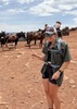
Day 0--Drive to the TH and Camp on the Rim: Four of us drove up to Jacob Lake, where we rendezvoused with my daughter, who drove down from Utah. We parked her car at the Kaiabab Lodge (with the owner's permission) and headed off towards the Bill Hall TH.

The temperatures had been relatively warm and many of the aspens were still looking green and leafy. On our return a week later, not so much ...

The drive out to Crazy Jug Point was uneventful, and the roads were in good condition. At the four-way intersection just before Crazy Jug Point, we turned right to find the sweet camp spot right on the edge of the rim. Unfortunately, it was already taken, so we continued on towards the TH, where there are two other nice pull outs for camping (but with the views of the canyon more obstructed by trees). We set up camp in one of these, then drove back to Crazy Jug Point and hiked down a bit to enjoy a beautiful sunset. Once there, we wished we had set up camp at the nice camping spot next to the parking area for CJ Point. Oh well.

We enjoyed a cool night, but with a blazing campfire for company!

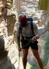
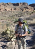
Day 1 Bill Hall TH to Upper Tapeats: Woke early and drove the 1/2 mile or so to the TH. Several cars in the parking area. Off we went, starting with the counterintuitive uphill climb to the drop in spot at Monument Point. The initial descent was as steep and rocky as I remember. With a little more familiarity with the landscape, I looked down on the Tapeats Amphitheater, eyeing what would be the off-trail destination for Day 2--Tapeats Spring.

Rounding the corner below Monument Point offers the equivalent of the South Kaibab "Ooh Ah" Point, where the Esplanade comes into view, along with miles and miles of zig-zagging Canyon, heading off towards Havasupai and beyond, with Mt. Trumbull providing some contour to the north rim landscape.

The "tricky" downclimb at about 1.5 miles was fine, generally requiring handing down packs. That was followed by another steep drop via dozens of short switchbacks, which we dubbed "squiggle-backs," until reaching the junction with the Thunder River trail at the edge of the Esplanade.

As we crossed the Esplanade, we cached water for our night 5 camp and continued on. the Esplanade is a very cool, Sedona-like area, and I was excited to return and enjoy the Esplanade a little more fully than can be taken in during a crossing on the way to somewhere else.

At the south edge of the Esplanade, we stopped for lunch and looked down on the most desolate area of the trip--Surprise Valley. We wondered where the name came from and speculated that, with all of the amazing surrounding territory, the desolation of the valley was "surprising." Turns out that the name was actually tied to John Wesley Powell's second expedition, when the crew's photographer, E. O. Beaman, "accidentally" stumbled upon the Deer Creek valley. Per some authorities, and for unknown reasons, the U. S. Geological Survey moved the map location around 1960 to its current inaccurate location between Deer Creek and Thunder River. http://www.allhikers.com/Other/Grand-Ca ... ames.htm#S.

Anywhoo, we descended the rocky route down into the Valley and hung a left at the trail junction. At this point, I began thinking of the NAU student, Bryce Gillies, who died near here in July 2009 after erroneously following the route down the Bonita Creek drainage and getting cliffed out, instead of continuing over to the Thunder River drainage. I remember reading about this tragedy and wondering how he could have made that mistake. But after hiking it this time, I can definitely see why--first, the trail across Surprise Valley to Thunder River requires going both UPHILL and AWAY from the Colorado River--both of which would seem very counterintuitive, if one didn't know better.

Luckily, we knew better and headed away and uphill, eventually coming into earshot and then seeing Thunder River pouring out of the side of the canyon wall like a giant faucet, several hundred feet below. It is truly an amazing sight.

We hung out at the falls/spring for awhile and then finished our descent into the Upper Tapeats campground, securing the large camping spot. Surprisingly, we had no company in the campground and only passed one other set of hikers the entire day. We would stay here for two nights.

No marauding mice, but I did make the mistake of putting a fresh apple at the bottom of my ratsack, and a ringtail spent a good chunk of time overnight nibbling tiny very tiny bites out of it through the small metal mesh. :-/

Day 2--Rest Day OR Tapeats Spring: On day 2, my buddy and I had our eyes on making our way up to Tapeats Spring. Our two daughters were up for some exploration up Tapeats Creek, but turned around after about a mile up canyon. My wife was content to take the day off and relax and read around camp. After turning up the Tapeats drainage at about 1.5 miles from camp, the going gets rough--and sketchy (which is saying something on this hike, where the trail portions can get pretty sketchy).

After a lot of hard work and a lot more up and down than I was anticipating (crossing boulder slides and side drainages), we made it to the spring. Very cool area, where once again the creek literally emerges from the rock. It's not as spectacular an exit as Thunder Spring, but still worth a visit.

It took us about 4 hours to cover the 3.2 miles from camp. The return trip was not as long or strenuous, but honestly, going down was more nerve-wracking than going up. Thankfully, we navigated it all well and arrived back at camp by late afternoon.

Another pleasant night on in the campground.

Day 3--Upper Tapeats to 135 mi. Rapid: Day three was a short jaunt down to a camp on the River at 135 mile rapids. We played in the creek and hung out at the confluence of Tapeats Creek and the Colorado, watching rafters and kayakers run the rapids. Several NPS rafts were tied up at the confluence, and a team had headed up creek to scope out a replacement for the bathroom facilities at Upper Tapeats. The remaining crew were relaxing at the river. I chatted with them and they graciously filled our water bladders for our dry camp that night (the River was silty).

As planned, we camped at 135 mile rapid. It was more rocky than last time and we wished we had set up camp at a nice, but small beach a little further up river.

Day 4--River to Deer Creek: I got up early on Day 4 and wandered down towards Granite Narrows to watch the sun rise. It was a beautiful morning. After breakfast, we packed up and headed over to Deer Creek. There is some solid uphill climbing to get to the saddle before descending back to the Deer Creek drainage.

Given the short distance, we arrived fairly early and headed up to snag the large campsite on Deer Creek. After setting up camp and eating lunch, we headed back downstream to the Patio, Narrows, and Deer Creek Falls. All were a major highlight of the trip, though the Patio was swarming with rafters on our way down--probably about 25-30 people lounging in the area.

When we got to the falls, there were about 15 rafts or dories tied up. Luckily, while the rafters were at the Patio, we enjoyed the falls in relative solitude. Then, when we headed back to camp, the rafters had all retreated and we had the patio to ourselves in the late afternoon.

That night, after we hit the hay, it started raining--and it continued raining all night long, literally 6-7 hours non-stop. Thankfully, the storm tuckered out by the time we got up in the morning, and we didn't have to hike in the rain or set up/take down camp in the rain. We did note by looking across the canyon at the south rim that there was snow at the higher elevations.

Day 5--Deer Creek to Esplanade: We shared the Deer Creek camping area with two other groups. In the morning, we packed up and headed out for our biggest climbing day--first up to Surprise Valley and then up to the Esplanade. Along the way, we stopped at the now-dry Deer Spring, and hung out and relaxed in the "Throne Room," which has around a dozen or so "thrones."

We arrived at our camping spot on the Esplanade by mid-late afternoon. It was chilly, with a stiff breeze whipping up the wind-chill factor. We adjusted our camping location to take advantage of some natural wind breaks. The wind mostly died down around sunset, which was spectacular, with the clouds providing an amazing backdrop, and the water-filled potholes on the Esplanade reflecting all of the light.

Before bed, the breeze kicked in a bit and wafted down some brief snow flakes (but nothing that stuck). We went to bed at 7 and stayed in the tents for a good 12 hours. :-) My daughter (and mom to 3 boys--5, 3, and 2) said she got more sleep on our backpacking trip than she's had in years!

Day 6--Esplanade Out: Our last day was a relatively short (but steep) hike out to the TH. We passed a couple of groups and asked about road conditions. Apparently, the rain from the prior night dropped 4-5 inches of snow on the rim, but all reports were that he roads were okay. Once at the TH, we found snow on the car and icicles hanging from the bumper. The drive out was fine, but there were more ruts and an occasional slight fishtail here and there.

Once back on the main road to Jacob Lake, we found the aspens to have quickly shed their leaves and winter had set in. We had hoped to catch a shower at the Kaibab Camper Village, only to find that they had closed for the season one week earlier. :-( We stopped at Jacob Lake for a hot meal, and then headed to public showers near the Marble Canyon Lodge. I give them a one-star rating--one was too hot; another too cold; and a couple that just ate quarters without any shower at all. Despite that, we managed to get relatively clean and had an uneventful return to civilization--and an inbox with about 700 emails in it. Welcome back to reality!
_____________________
  1 archive
Sep 15 2022
avatar

 Routes 5
 Photos 435
 Triplogs 119

female
 Joined Mar 26 2022
 Flagstaff, AZ
Cranberry Canyon attempt, AZ 
Cranberry Canyon attempt, AZ
 
Backpack avatar Sep 15 2022
shelby147Triplogs 119
Backpack42.00 Miles 10,500 AEG
Backpack42.00 Miles4 Days         
10,500 ft AEG28 LBS Pack
 no routesno photosets
1st trip
Took 4 days to backpack around Deer and Tapeats creeks. We were hoping to return to Indian Hollow via the cranberry route but couldn't find the redwall route before it got very hot. Overall the trail was slow (or NPS mileages were off) but it was very rewarding.

Day 1: Indian Hollow to Deer Creek. There were thunderstorms the previous afternoon and for a couple hours fog was evaporating off the esplanade - what a pretty effect. Potholes were abundant on our hike down and somewhat more limited on the return trip. We didn't have trouble following the old trail along the esplanade to Bill Hall jct although others reported it was difficult.

It was already warm by the time we reached Surprise Valley but we promptly found a big rock with ample shade. We made sure to stay on top of food and electrolytes and still got hot by the time we reached the creek, where we took a long break in the water. The trail to deer creek is slow over boulders and talus, but the rocks are stable. On the way to the campsite we found some flowers which were absolutely swarmed by tarantula hawks. I got excited about the photo opportunity until I noticed a truly giant wasp....

After setting our tents we continued to the patio and the beach. Wow. Possibly my favorite mile in the whole canyon. We debated and decided you'd likely die if you fell off the ledges above the narrows so we made sure to return to camp sober and before dark. As soon as we arrived on the beach a boater walked straight over and offered us beers and trash service - how wonderful! We had enough time for a quick dinner and wade around the falls before heading up to bed.

Day 2: loop through Thunder River/ Tapeats Creek. We started early and were treated to beautiful light once we got over our intial hill - golden beams shining onto the opposite side of the canyon. The trail was easy walking for about a mile and reminded me of Beamer. Some big pontoon boats passed below - that was my first time seeing them and... they're a bit much.

After a quick wade in the river we started up into Tapeats Creek. It got hot fast when we were on the hotter rocks. The trail was a little exposed on both sides of the river, but river left was worse. The Thunder River crossings weren't evident so we made our best guess. We found a nice pool and probably spent a good hour sitting in the river around noon. This paid off later because our hike out to Surprise Valley was cooler than the rest of the day had been. There were also two easy access points to the waterfall and we took advantage to keep cool. Back in Deer Creek we enjoyed dinner at the patio and filtered lots of water (thank goodness for gravity filters) to prepare for our tough next day.

Day 3: Cranberry crack attempt. We got an early start and each carried 7-8L water. Right off the bat we took the hard way up to the ancient lake bed, going over the lower saddle instead of the upper. The lakebed was very cool and the easiest walking of the entire trip. We lost elevation rather than try to sidewalk on the talus below our goal slope. First we headed straight up and lost access to cross the big ravine to climbers right. We descended partway after realizing and found a cairn indicating where to enter the ravine. There was another cairn in the ravine that wasn't visible from the first cairn, so we added one to fill the gap. The scrambling got easier for a little while, although it continued heating up. The nastiest section was talus at the base of the redwall.

Thinking our chute was at climber's left, we climbed to the base of the redwall and used handholds on the cliff to stay secure on this nastiest bit of talus. My friend climbed to the only possible chute we saw and said it was no-go. We'd already decided that was our last ditch and we weren't wasting time in the heat searching for our chute, so we promptly turned around. I think the proper chute was actually slightly to the right above us but I'd accidentally deleted my reference photos, GPX, and notes - ugh! We had a hot, slippy, slow climb back down the talus and were relieved to return to a semblance of flat ground. This time we took the higher saddle to exit the ancient lakebed with much better results. When we reached the trail he proceeded to the patio for a very welcome rest, then down to the beach/ falls again for dinner.

Day 4: Missing the Cranberry route meant we had a long hike out. We hit the trail at 5:15am and worked hard to ascend out of Surprise Valley before the sun hit us. We took a bit more time on the esplanade, finding a few nice shady spots on the slickrock where we couldn't resist breaking. Only the largest/ most sheltered potholes were still full.

I had some nasty hot spots developing (strangely, I never noticed them until I took my shoes off each evening so they got quite bad) and I was quite "over it" by the time we began our final ascent to Indian Hollow. After dumping excess water (my pack was probably now below 15lbs) I got a second wind and was marching along... until the trail routed around a dead tree. The tedium of scrambling 15ft down loose talus just 5 minutes from the trailhead nearly broke me. Once on the rim, I was hardly interested in a last look into the canyon, but that's about normal for me. Happily, I had grilled cheese fixings waiting in my car.
 
Jul 04 2022
avatar

 Guides 4
 Routes 491
 Photos 10,890
 Triplogs 1,257

55 male
 Joined Nov 20 2012
 Phoenix, AZ
Thunder River TrailNorthwest, AZ
Northwest, AZ
Hiking avatar Jul 04 2022
BiFrostTriplogs 1,257
Hiking1.57 Miles 331 AEG
Hiking1.57 Miles      40 Mns   2.36 mph
331 ft AEG
 
1st trip
Linked   none no linked trail guides
Partners partners
slowandsteady
The Bill Hall Trail is the popular way into Deer Creek and Thunder River. However, the Indian Hollow Trailhead is actually marked as the Thunder River Trail which is odd because it adds an extra 6 miles or so to the Thunder River access over Bill Hall. We also had never seen the trailhead so with some extra time we decided to check it out.

From the trailhead the goal was just to check out the top part without dropping into the canyon much and that's exactly what we did. Great views along the trail as it mostly contours over to the break and first big switchbacks. We didn't make it quite that far turning around at under 1 mile. Regardless it was nice to check this out for future reference.
_____________________
  1 archive
Jul 03 2022
avatar

 Guides 4
 Routes 491
 Photos 10,890
 Triplogs 1,257

55 male
 Joined Nov 20 2012
 Phoenix, AZ
Bill Hall Trail - Thunder River, AZ 
Bill Hall Trail - Thunder River, AZ
 
Hiking avatar Jul 03 2022
BiFrostTriplogs 1,257
Hiking17.52 Miles 5,445 AEG
Hiking17.52 Miles   14 Hrs   2 Mns   1.77 mph
5,445 ft AEG   4 Hrs   9 Mns Break
 
1st trip
Linked   linked  
Partners partners
slowandsteady
Spent 4th of July weekend on the North Rim Grand Canyon car camping at elevation was very nice. Not having an overnight permit we opted for day hike down to Thunder River. Started somewhat early from Bill Hall Trailhead and empty parking lot.

Down the initial descent and onto the Esplanade went relatively quickly. Easy hiking across the flats to the top of Surprise Valley. We took a break overlooking the valley about 930 and reminder that it’s hot in July. After the break dropped down the switchbacks to Surprise Valley and hiked across to the access for Thunder River. First look at Thunder River from above is impressive with the lush green patch of trees against the stark canyon backdrop. Next we descended the switchbacks down to Thunder River and the oasis in the canyon.

Reaching Thunder River we had the whole place to ourselves. Probably July had something to do with that but I thought maybe we would see some people. We spent about 3 hours enjoying the falls and the constant cool mist that must have cut the temps by 25 degrees. Very tough to leave this place but eventually we had to return and face the heat.

The initial switchbacks up were very hot but after that it was tolerable. By the time we reached the Esplanade it was much nicer so we took another good break under some rock overhangs. Finishing up the Esplanade we just had the final climb out to the rim. That’s always the toughest part and took it slow with a few short breaks. Arrived on the rim as it was getting dark to find a group preparing for hike in next morning. Fortunately our car camp spot was all setup and relatively close to the trailhead so easy night at camp after a great hike!
_____________________
  1 archive
Apr 17 2022
avatar

 Routes 137
 Photos 1
 Triplogs 105

44 female
 Joined Oct 21 2016
 Tempe, AZ
Bill Hall TrailNorthwest, AZ
Northwest, AZ
Backpack avatar Apr 17 2022
MAPTriplogs 105
Backpack23.72 Miles 7,727 AEG
Backpack23.72 Miles4 Days   3 Hrs   52 Mns   
7,727 ft AEG
 
no photosets
1st trip
Most magical hike of the GC so far! This is the GC spectacular. Seriously, this hike has it all. All the indescribable views, all the adventure, all the giant waterfalls, narrows, springs, wide open esplanade, ALL the fantastic ups, everything wonderful and nothing terrible.

DAY 1: Bill Hall TH to Deer Creek Camp AX7 (~8 hours, 8.7 miles, 634 ft aeg)
We camped up near the Bill Hall TH Saturday evening and started hiking around 7:30 am Sunday. Got all warmed up hiking the little bit of up to Monument Point before heading down down down...and then some more down. The views the entire hike down this section through the Kaibab, Toroweap, and Coconino Sandstone Formations are majestic. There are a couple of areas we had to sit & scooch or drop a bag down but nothing of any difficulty. It is pretty slow moving over the first couple of miles though. We reached the Thunder River Trail connection around 9:30 am and a couple of people in our group stashed water for the hike back out. From this point, the hike down is less steep and fairly smooth moving across the Esplanade. The Esplanade is an alien world and I love everything about it. Some of the people in our group were starting to get pretty warm hiking across the Esplanade; the rest of us were just in awe of the wild rock sculptures. We stashed water in the rock pockets just above the Redwall decent, chatted with a Park Ranger and showed him our permit, and headed down around 11:30 am. We were all feeling the heat now. The hike down the Supai and Redwall Formations to Surprise Valley is really hot mid-day, even in the cool Spring months. And it's A LOT, even going down. But the views are fantastic and that helps to ease the physical part. The fork in the trail (right to Deer Creek, left to Thunder River and Tapeats Creek) is marked by a couple of tall sticks haha. No formal sign or anything so keep an eye out. At the intersection, we headed west on the Deer Creek Trail. This is where it began to feel like the trail would never end & the sun/heat was sucking the energy out of me. I got a boost of energy as we started to descend toward Deer Creek buuuuut slowly realized there was still a long way to go. There's a sketchy turn in the descent and a sketchy crossing of scree but the narrow turn is super short and the scree is stable. AND this is right around the point where Deer Spring is visible. Finally FINALLY beautiful cold water! We played in the spring for a while, climbed up behind the waterfall, got refreshed and cooled down. There were rafters at the spring who had hiked up from the river and they looked much less rough than we did. We left the spring and just a few hundred feet down reached Deer Creek. A few from our group were hanging out under the big beautiful Cottonwood tree just as the trail meets Deer Creek. We all trudged the final half mile to the campground in a daze. Everything looked like a paradise after the hot long miles we had just come from. We got to Deer Creek camp (AX7) around 3:30 pm and found our perfect shady spots to set up camp.

DAY 2: Deer Creek Camp to Deer Creek Falls and Back (~2 hours hiking time, 1.5 miles, 500 ft aeg)
After a peaceful and beautiful night's sleep in the canyon, we woke up Monday and packed day packs to head down to Deer Creek Falls and the Colorado River. Whatever we were feeling from the day before, the Deer Creek Narrows awakened something special in every one of us. This is a sacred place. I felt like I was moving through a place where words lost meaning and people were instantly calmed and quiet. The narrows feel enormous but there are a handful of tight squeezes as you move closer to the river. A small daypack was fine but I would not want to carry a backpacking pack through the tight parts. There were groups of rafters moving through the Narrows as we headed down and everyone was kind and friendly. At the end of the Narrows you walk out of the canyon and get a spectacular view of the Colorado River...and 50 rafts on either side. Woah. It's a strange feeling to go from quiet & solitude to a bustling city of rafting trips. After a few switchbacks and a steep drop down along the trail...the great ginormous Deer Creek Falls in all its glory. We hung out at the falls (most of our group jumped in!) for about an hour before the people thinned out & the rafts left & we had the place to ourselves. What a treat! The GC is amazing. There are entire perfect worlds tucked away in her canyons. Deer Creek Falls and the Narrows are definitely one of the most magical canyon worlds. We hiked back up to camp & got ready for our early start the next day. Oh and hikers who came in late saw the pink rattler up near the toilet! We tried to find them but weren't as lucky.

DAY 3: Deer Creek Camp AX7 to Upper Tapeats Camp AW7 (~6 hours, 5.5 miles, 1,400 ft aeg)
Got up early to beat the heat & started hiking around 4:30 am. About a half mile in the trail splits & we stayed left to take the high route. We hiked a few miles of the river trail in darkness but it was straightforward to navigate. As soon as the sky started to fill with light the views of the Colorado River were unbelievable. We came to the "climb" at the mouth of Bonita Creek around 7 am and it is not bad at all coming from the Deer Creek side. Most of our group scrambled up with no problem. I passed my bag up & someone threw a handline down to me but I didn't need it. Honestly, it looked like a totally different story looking down from the top so I'm happy we got to climb up instead of down. We got to Tapeats Creek, took a break, and headed up and up and up and up. It felt like the up was never-ending. The trail along Tapeats Creek definitely had the most sketchy sections of trail (narrow trail with steep drops) and there were many of these sections. Those actually didn't bother me even though I'm afraid of heights but they bothered others in our group who are good climbers so go figure. The hike up Tapeats Creek has the most insanely incredible views of the entire trip the ENTIRE hike up! Maybe I was too obsessed with the views to notice how sketchy the trail was. We got to Upper Tapeats campsite (AW7) around 10:30 am and basically plopped down in the creek & sat there forever to cool down. There is not much shade during the day at the Upper Tapeats camp but luckily the water is right there & is nice & cold. We explored the little moss-covered waterfalls upstream and explored the rock ledges above our camp where my friend found a sleepy rattlesnake. One person in our group had bad blisters and another was feeling very anxious about the heat so we decided to only stay one night out of our planned two nights at Upper Tapeats. It was for the best since a group the same size as ours came to camp and wanted to stay at the site we were already set up at. We decided to hike to Thunder Spring in the morning and hang out there all day until evening when the sun would be blocked.

DAY 4: Upper Tapeats Camp AW7 to the Esplanade (~4.5 hours, 3.4 miles, 3,160 ft aeg)
Got started around 10:30 am and hiked one hour (0.7 miles and around 1000 ft elevation gain) to reach Thunder Spring. And that's where we stayed until 5 pm. :sweat: Thunder River Falls is like a magical fairyland if fairies were into death metal. There are beautiful moss-covered pockets and crystal clear water and it is LOUD. It was a fun relaxing place to spend the day. We all made some food & filled up with cold water and headed on up to Surprise Valley with the sun blocked the whole way up. Surprise Valley was lovely in this light and seemed more lovely and interesting on this side compared with the Deer Creek side. We powered up the Redwall (which surprisingly felt much better going up vs going down - probably because of the lack of direct sun) and made it to the top and to the Esplanade just as it got dark (around 7:10 pm). The rest of our group got to the top and we found our water cache in the rock pockets where we had left it. At that point, it was 8:30 pm & dark dark. Hiking the Esplanade in the dark was too difficult so we decided to sleep on the rocks (not disturbing the cryptobiotic soil) and hike out in the morning. It was a crazy windy night but we were happy to have one big "up" behind us and a great view of the stars above.

DAY 5: Esplanade to Bill Hall TH (~4 hours, 4.6 miles, 2,025 ft aeg)
Morning Esplanade! I sure love this place. Started hiking at 7 am and reached the Thunder River Trail connection and the second stash of water an hour & 20 minutes later. Now for the real fun part. Those final 2.25 miles were a struggle and a half. But I just kept up my little train that could - slow & steady choo choo. We saw a number of groups heading down as we went up. It's funny, everyone wants to chat heading down but the feeling is not mutual going up. We took a break in the cave and kept going for the final push to the top. Made it to Monument Point at 10:30 am and what a relief! It did not feel like 3 1/2 hours...more like 10. Epic epic everything.

Seriously, I want to live here. Or visit all the time. It's all hard. And usually hot. And pretty darn real. And I think people probably come out changed. These places will be a part of me forever. They are that special and I'm grateful to get to visit.
_____________________
 
Oct 08 2021
avatar

 Routes 8
 Photos 2,243
 Triplogs 204

38 male
 Joined Mar 07 2009
 Colorado Springs
Thunder River loop, AZ 
Thunder River loop, AZ
 
Hiking avatar Oct 08 2021
ultrazonaTriplogs 204
Hiking13.00 Miles 4,260 AEG
Hiking13.00 Miles4 Days         
4,260 ft AEG
 no routes
1st trip
Fall colors popping on the rim. Did loop clockwise. Lots of pools on Espande. Attempted hike up Tapeats to cave, but ran out of time (overgrown/slow going), probably need the better part of a day. Thunder River Trail, Deer Creek Trail and parts of Tapeats Creek have washouts and need some repair. Took full lower route from lower Tapeats to Deer Creek. One section of lower route (past Western junction with Upper Route) has a narrow ledge and exposure (see photos). All toilets at mass capacity! Lots of road closures in area, consult FS before planning route. Route from Fredonia in great shape.
foliage observationfoliage observationfoliage observationfoliage observationfoliage observation
Autumn Foliage Observation Light
Light below the rim. Peaking up took in areas.
_____________________
  2 archives
Apr 16 2021
avatar

 Photos 27
 Triplogs 9

30 male
 Joined Jun 08 2016
 Peoria, Arizona
Thunder River TrailNorthwest, AZ
Northwest, AZ
Hiking avatar Apr 16 2021
sdudzinskiTriplogs 9
Hiking13.00 Miles 4,260 AEG
Hiking13.00 Miles
4,260 ft AEG
 no routes
1st trip
Linked   none no linked trail guides
Partners none no partners
We did the full Thunder River Deer Creek loop in 3 days for Haley’s birthday! We hiked into Surprise Valley for the first night and then hiked down to Deer Creek Falls and traversed the Granite high route and camped at upper Tapeats for the second night. It was a bit of a push but totally worth it.
_____________________
 
Oct 28 2020
avatar

 Guides 59
 Routes 1,100
 Photos 1,191
 Triplogs 1,290

male
 Joined Jan 01 2023
 Arizona
Thunder River TrailNorthwest, AZ
Northwest, AZ
Backpack avatar Oct 28 2020
pseudalpineTriplogs 1,290
Backpack9.73 Miles 807 AEG
Backpack9.73 Miles
807 ft AEG
 
no photosets
Linked   linked  
Partners none no partners
  2 archives
Nov 09 2019
avatar

 Photos 392
 Triplogs 25

38 male
 Joined Apr 01 2018
 Phoenix, AZ
Bill Hall TrailNorthwest, AZ
Northwest, AZ
Backpack avatar Nov 09 2019
bretinthewildTriplogs 25
Backpack24.00 Miles 9,855 AEG
Backpack24.00 Miles3 Days         
9,855 ft AEG
 no routes
1st trip
Check this one off the bucket list. :DANCE: Awesome trip with friends over Veteran's Day weekend. We had a permit for Upper Tapeats on Saturday and Esplanade on Sunday.

Friday -- Called in some Cornish Pasty for pick-up on the way through Flagstaff. Got up to Jacob Lake and car camped off FR 461 in the pines. With a long drive from Phoenix and having not been to Bill Hall previously we opted to do most of the forest roads the following morning.

Saturday -- Drove to Bill Hall trailhead; roads all in really good shape. Hiked down and we each cached 2-3L water on the Esplanade, which we saved for the hike out on Monday. Made it down the Red Wall Break, through Surprise Valley and past Thunder River to Upper Tapeats for the night. It's a nice camp; sites are pretty spread out for privacy. Easy access to the creek. Toilet was super full (gross) and there were mice at our site. But we enjoyed nonetheless and let the creek roll us off to sleep. 8.8 miles.

Sunday -- This was our big day. Our group split up in 2 pairs. One group decided to hike back up to the Esplanade the way we came, knowing it was going to be tough enough just to get back up the Red Wall section. I opted with a friend to take the "scenic" route looping around along the Colorado River to Deer Creek Falls and back up. It did not disappoint and was probably my toughest day in the canyon yet.

Leaving Upper Tapeats, we took the route west of the creek down to the river. We thought about doing the east route but couldn't quickly find a suitable place to cross the creek. After turning up the river we opted for the lower route once it splits off, mostly because it looked shorter. There were a couple places where the trail was pretty narrow with some exposure, but it's definitely passable. Reminded me of some tight spots on the Tonto and Clear Creek trails.

We dropped our big packs at Deer Creek, got through the narrows and to Deer Creek Falls for lunch. Had the falls to ourselves for about 10 minutes before some rafting folks came by. Filled up our water at Deer Creek and started the grueling last part of our day up into Surprise Valley and over the Red Wall Break.

Sun went down on us at the beginning of the wall so we did most of it in the dark. On the Esplanade someone has tied very small reflective string to guide the route, which was super helpful at night. Made it to camp exhausted and happy. 11.5 miles.

Monday -- Relatively quick hike out but all uphill. Glad we camped at the Esplanade to cut down on some of the mileage and elevation. 3.7 miles. Called in some Diablo Burger for pick-up on the way back through Flagstaff.

Overall, great trip to a special place... If we had more time I would've liked to stay an extra night at Deer Creek to split up the hike, which would have let the others in our group experience it as well. Next time...
 
Sep 30 2018
avatar

 Guides 37
 Routes 556
 Photos 10,872
 Triplogs 1,052

43 male
 Joined Jan 21 2013
 AZ
Bill Hall TrailNorthwest, AZ
Northwest, AZ
Hiking avatar Sep 30 2018
FOTGTriplogs 1,052
Hiking22.39 Miles 7,353 AEG
Hiking22.39 Miles   12 Hrs   57 Mns   1.96 mph
7,353 ft AEG   1 Hour   30 Mns Break
 
Partners none no partners
I had been wanting to get back to this area for sometime now and decided a day hike was easier than applying for a permit. Originally, I had planned to make a loop with Tapeats via the river trail, but I will be honest I decided to enjoy the moment a little at the falls and skipped on turning this awesome day hike into a death march. Likewise, there were some nasty clouds rolling in and with a drive back to Phoenix still on the schedule for later in the evening, so discretion won out. Skipping the loop turned out to be the right choice, as the Tapeats area really got socked in for a moment with a pretty nasty cell, which I still got some of, but with a little less intensity it appeared.

Early start for this one. In fact, it was almost a real early start until I realized my phone had switched to Navajo time and I was eating my morning oat meal and drinking my morning coffee at 2:30 in the morning and not 3! I did as best as I could to rest for another 45 minutes or so and was on the trail at 4:20 a.m. I cruised on the descent and cruised across the esplanade, which set me up for the amazing experience of witnessing first light from above Surprise Valley. After the descent into Surprise, it was time for my summit of Cogswell Butte. The route is pretty straight forward and appears to be about the only way up from the perspective of descending into Surprise Valley. The route was a little loose and steep, but by Canyon standards the summit was a walk up. There was a pretty well visited register on top and the great morning light and awesome views west into the great gorge were amazing. After slipping and sliding down Cogswell, it was on to Deer Creek.

The area was pretty busy and full with hikers and boaters, but I did not mind. I was just happy the patio was free of people, as the last time I had went through that area I could not really enjoy it much because of all the people. Once I got to the falls, I decided I was just going to make this hike an out and back. I think I had the additional seven miles in me, but I decided swimming and lounging around the falls seemed like a more pleasant option than the hot hike across to Tapeats. There were some boaters there, but they were all pretty cool and even offered to move their chairs for me to take some pics. From the falls, it was the long hike back to the north rim. There were moments I felt very tired and then moments where I felt strong, but overall I think at times I was a little low on energy from a lack of eating. I had the food, but when it gets warm, my appetite goes away. I had to force myself to get some food in me during some dedicated breaks on the way up. Luckily, a storm rolled in and the thunder and lightning gave me that nice flight or fight boost of energy needed to reach the north rim.

Cogswell Butte is my 14th Grand Canyon summit.
_____________________
 
Sep 29 2018
avatar

 Guides 37
 Routes 556
 Photos 10,872
 Triplogs 1,052

43 male
 Joined Jan 21 2013
 AZ
Thunder River TrailNorthwest, AZ
Northwest, AZ
Hiking avatar Sep 29 2018
FOTGTriplogs 1,052
Hiking7.67 Miles 1,926 AEG
Hiking7.67 Miles   4 Hrs   17 Mns   1.98 mph
1,926 ft AEG      25 Mns Break
 
1st trip
Linked   none no linked trail guides
Partners none no partners
This was my first hike of a three day (cut short by a flat tire) car camping and hiking trip to the north rim. I was a little groggy after driving through the night and morning and had a big hike planned for the next day, so I kept my Saturday limited to this hike and touring the popping fall colors by vehicle.

The archaeological site was very cool and I think the glphys may be perhaps some of the most intriguing I have been to. I put myself in one of the pictures to try to capture how large the two "ghost" like figures were and how high up they were. I thought about checking out a spring in the area, but I was a little tired and not very motivated, so I headed back to the car. A cool area to explore, but I felt bad about tramping around too much due to all of the cryptobiotic soil.
_____________________
 
Sep 19 2018
avatar

 Guides 1
 Routes 136
 Photos 1,367
 Triplogs 364

47 male
 Joined Jun 10 2011
 Phoenix, AZ
Bill Hall TrailNorthwest, AZ
Northwest, AZ
Backpack avatar Sep 19 2018
The_DudeTriplogs 364
Backpack27.51 Miles 8,498 AEG
Backpack27.51 Miles4 Days         
8,498 ft AEG50 LBS Pack
 
1st trip
Linked   linked  
Partners none no partners
I have not posted in a while, mostly due to not having much hiking time, and those hikes I have done have all been the basic in town variety. This one was well worth a write up. I started out from the North Rim with a group of 5 others Wednesday afternoon for our planned 5 day excursion. We hiked down to the Esplanade on the first day after making the drive up, just a little over 4 miles on the trail. I started out with 2 and a half gallons of water since we were planning on dry camping the first and last night, so I left a gallon cached at our campsite that we were going to use on the way up. Beautiful area with lots of interesting flora for sure. The second day we broke camp fairly early and headed down the Redwall into Surprise Valley. Slow going on the trail, very rocky and steep heading down the wall, felt a little reminiscent of Piestewa with the big stone steps except I had a 50 pound pack on my back. We made our way through Surprise Valley and headed east towards Tapeats Creek. Our group had folks of different hiking abilities and ages, so we ended up splitting into a few groups. When I made it to Thunder Falls, I enjoyed a great rest cooling off in the shade of the trees right by the ice-cold stream. Absolutely fantastic, and possibly some of the best tasting water I have had in the backcountry. Now revived, we made our way to the Upper Tapeats camp area and secured the site right on the creek. The rest of the day we just took turns jumping in the creek and setting up camp. The water was really cold, but felt great after a long day of efforting in the heat, I would imagine it was right around 100 degrees at camp. We had planned to do the loop with Deer Creek as a day hike the next day, but some of our group were really struggling (a few were first and second time backpackers, I would suggest getting more smaller trips in before trying this one) so that idea was scrapped and we planned on hiking up the first major gain by Thunder Falls the next day once the sun went behind the canyon walls. I took off on my own in the morning to at least go down to the Colorado River to enjoy the scenery and try my hand at fishing. I took the west bank trail down to the river, and there was quite a bit of gain and some mighty thin trails. On the way back to camp, I decided to ford Tapeats Creek to get to the east bank, the crossing was a little dodgy but I found a good spot to make it across. Back at camp I enjoyed some lunch and then packed up my tent so we could make the afternoon ascent. Filled up as much water as I could at the falls since now the next two nights would be dry camps. We found a spot in Surprise Valley to sleep for the night so we could make an early morning approach on the Redwall. The next day I made it back to our first camp mid-morning, and then we waited a few hours for the rest of the group to catch up. Spent a lazy few hours in the shade soaking up the surroundings and reading a book. By the time everyone was back to camp, it looked like a few folks were running really short on water and would be hurting for the next day. I left over a half gallon for the group, and about 3 in the afternoon I decided to hike out to the car with one of the other guys. There was water at the car, so we would have as much as we needed once we got up top, even though we ran out on the way up. Climbing up the White wall with the afternoon sun blaring on my back was not the best, but we made it up with many breaks along the way. Got up on top of the rim just after the sun set and made our way by moonlight back to the car to set up camp on top. Greeted the sunrise the next morning from the use trail right to rim's edge with a cup of tea and my last Clif bar. We waited a few hours for the other folks to make their way up (they all got a real early start), and went and had lunch at the Jacob Lake lodge before heading back home to the Valley. All in all, a fantastic first backpack trip for me in the Grand Canyon!
 Geology
 Geology [ checklist ]
[ checklist ]  Cryptobiotic Soil
 Named place
 Named place [ checklist ]
[ checklist ]  Tapeats Rapids
 Meteorology
 Meteorology [ checklist ]
[ checklist ]  Sunrise  Sunset
_____________________
 
May 29 2018
avatar

 Guides 22
 Routes 6
 Photos 512
 Triplogs 466

34 male
 Joined May 17 2007
 CA
Thunder River TrailNorthwest, AZ
Northwest, AZ
Backpack avatar May 29 2018
rally_toadTriplogs 466
Backpack23.40 Miles 4,260 AEG
Backpack23.40 Miles
4,260 ft AEG
 no routesno photosets
1st trip
Linked   linked  
Partners none no partners
Started at Bill Hall, spent two nights at Upper Tapeats.

First day we started a little later than we should have. Surprise Valley is always hotter than hell. You don't want to be in there in the summer at any point when the sun is hitting you. We started feeling it mid-way down the red wall and it was a hot trudge to Thunder River and Tapeats. Thunder River was a welcome site and the water was even more welcome when we got there.

On the second day, just did a day hike to the river and back down Tapeats Creek. Stayed on the West side of Tapeats. There seems to be disagreement about whether the creek should be crossed and how often. I didn't see an ideal place to cross but there is some decent exposure on the West side of Tapeats. I wouldn't want to do this with a full backpack and was glad that we camped at Upper Tapeats. Good day hike. Hot. Spent most of the day lounging at camp, chilling in the water and watching fish.

Third day we got up at 4 AM to get an early start. We really did not want to be in Surprise Valley with the sun on us. It was a race. We got to the esplanade before the sun hit us and were glad we got up and started so early. The last haul up Bill Hall seemed to last forever.

Really enjoyed Thunder River. Had wanted to get there for a while.

A notable fauna observation, a Western Blind Snake just crawled up to me while we were playing cards in camp. These guys spend there entire lives underground so they are uncommon to see. No bigger than a good sized earthworm. No pictures because it caught me so off-guard and was gone shortly after I identified it. :/
wildflower observationwildflower observationwildflower observationwildflower observationwildflower observation
Wildflowers Observation Isolated
Some nice flowers on the first half mile of Bill Hall before the trail plunges off the rim.
_____________________
"Who are you guys??!!" -Farnsworth
 
Nov 22 2017
avatar

 Guides 8
 Routes 12
 Photos 1,918
 Triplogs 662

39 female
 Joined Dec 02 2009
 Grand Canyon
Indian Hollow Esplanade Tom Foolery, AZ 
Indian Hollow Esplanade Tom Foolery, AZ
 
Backpack avatar Nov 22 2017
HippyTriplogs 662
Backpack33.00 Miles 3,330 AEG
Backpack33.00 Miles5 Days         
3,330 ft AEG
 no routes
1st trip
Linked   linked  
Partners none no partners
Spent 5 days out in GC on what turned out to be some sort of archeologists paradise.

Parked my vehicle at Indian Hollow Campground, the 3 of us (me, Jamie and our good friend Dennis Foster) rode in Dennis's truck to Jumpup-Naile Trail which is just before Sowats Point but reached on the same road.

Late noon:30 start. Down the trail in 45mins that trail is steep and loose pebbly stuff the whole way down, it's a coconino break what do you expect.

Shade break under the cottonwood there, located the pack horse trail heading south, also running water within 5mins of the cottonwoods.

About 7 miles from the car to first camp, we stayed in this camp 3 nights!

Day 2, 5-6 mils exploring...Hiked to two different springs in the area and explore 4 native American arch sites as well as 3+ pioneer historic sites.
What an area! (Yeah, being vague on purpose, deal with it)

Day 3, 8 miles total across Esplanade to Racetrack Knoll, summit, then back. This made my 21st Grand Canyon summit. Back to camp.

Day 4 (6 or 7mi) up and over Fishtail Mesa saddle, unfortunately did not take time to summit Fishtail Mesa :( good thing too, reaching camp that night was interesting. We went up and over the saddle from the NW side, down The East facing side to the Esplanade...then it got HOT. The guys carried 6-8 liters of water, I had 5.5 myself and when we reached camp that night we have 2 liters total between us all... whaaaaaat?? How do three humans even drink that much!!

Anyway, hit the Esplanade headed east toward Fishtail Canyon and set up camp under the "pancake rock". It was 3pm.i pitched our tent Because the men decided to head down to grab water from a spring that was situated 1500ft below us... "150ft above the Redwall" it's 3:20pm when we left...barely hour and half if sunlight :lol:
We reached the spring right as last tiny bit of dusky light was waning. I led the way up the insane route back to the Esplanade.

This spring has some seriously awesome historic trail construction, crazy routed Cairns, a wee mite bit of exposure, it took 2hrs to get to it and an hour and 45mins to get back (in the dark). Finding the exact route down was generally quite fun!
If you're ever in the Fishtail Canyon area hit me up and I'll help ya solve this jigsaw puzzle of a water source.

12 liters of water hiked out that fun route with us. We got to camp and went to bed the latest night of the trip! 9pm in the bags! Record setting.

Next morning (day 5) we explored more arch and History sites in the area including a stunning panel out near Cranberry Canyon, whoo!

Headed east on Esplanade again to the bottom of Yee Ole Thunder River Trail. That thing was hard to find from a west approach. Much easier to access from the east. The break through the coconino is obvious from any angle in that area so head for that and you'll find the trail tucked away in two very tiny "ravines" it goes up up up quickly and in the heat it would be brutal. I think it's 2 miles? From Esplanade to Rim. have to double check that. We were out around 1pm shuytled my car back to sowats, Dennis took his truck we all meet up at Big Saddle Camp where Jamie and I had to check on a few things. We then explored the uppermost part of the Crazy Jug Route aka Big Saddle Route ala The Cowboy Trail (you'll hear more on this route in May 2018 from me)

Early dinner at Jacob lake...just kidding it was packed! We grabbed some munchies and all headed our ways. Dennis back to flagstaff, Jamie and I got a hotel in Kanab and visited the north rim next day to see friends.
_____________________
Canyon Freak Adventures!
  1 archive
Oct 10 2017
avatar

 Guides 26
 Routes 21
 Photos 562
 Triplogs 1,393

female
 Joined Jan 04 2011
 Las Vegas, NV
Ghost Rock GCNP, AZ 
Ghost Rock GCNP, AZ
 
Backpack avatar Oct 10 2017
autumnstarsTriplogs 1,393
Backpack18.43 Miles 3,139 AEG
Backpack18.43 Miles2 Days         
3,139 ft AEG
 no routes
1st trip
Linked   linked  
Partners none no partners
A quick trip from the north rim of Grand Canyon in perfect weather to spend one night down on the Esplanade and do some off-trail exploring.

Day 1
We started from the Indian Hollow trailhead rather than Bill Hall, just to try a different trail. Being built for livestock, this trail proved more mellow in terms of grade, but it also spent twice as many meandering miles getting to the intersection with Bill Hall, so you pick your poison. Where Bill Hall is relatively well-traveled, this was quite faint at times and clearly sees much less foot traffic. It is hard to complain about the views on any trail in Grand Canyon, and Thunder River Trail lived up to what we expected with open views toward Deer Creek and Fishtail Canyons. Once down on the Esplanade, the trail began to feel a bit like the Tonto, contouring around the head of each arm of Deer Creek Canyon. We hiked to the intersection with Bill Hall Trail and set up camp in a promising-looking spot among the slick rock before a quick post-dinner jaunt. It always feels so tremendous to hike around in sandals without your heavy pack when backpacking! :y:

Day 2
Slept in until the sun rose, then packed up for a day of exploring. Off-trail on the Esplanade has its own challenges due to dense black brush and trying to avoid damaging the cryptobiotic soil crusts. This slowed us down quite a bit until we got back onto bare slick rock. We managed to find a nice little route along a slick rock ledge for the last 0.5 mi or so to our objective. Ghost Rock has two of the largest pictographs I had ever seen in person. Interesting to contemplate, even accepting I will never understand their purpose or significance. One thing we noted was that anywhere in southern Nevada with such nicely-developed desert varnish would have a lot of petroglyphs to complement the pictographs, but we saw none at Ghost Rock.
Our bread had gotten moldy past the point even I would consider eating it, so there was no lunch, but we have plenty of extra snacks and motored back to the Thunder River Trail much more quickly than we had come out. Then, up and up back to the trailhead and the end of more wonderful time spent in the Canyon.
foliage observationfoliage observationfoliage observationfoliage observationfoliage observation
Autumn Foliage Observation Isolated
Not too many leaves left on most trees on the rim, but still some spots of color remain.
_____________________
"Let it ride / Let it roll / Let it go"
 
Mar 16 2017
avatar

 Guides 59
 Routes 1,100
 Photos 1,191
 Triplogs 1,290

male
 Joined Jan 01 2023
 Arizona
Deer Creek Falls to Tapeats RapidsNorthwest, AZ
Northwest, AZ
Hiking avatar Mar 16 2017
pseudalpineTriplogs 1,290
Hiking7.33 Miles 2,576 AEG
Hiking7.33 Miles
2,576 ft AEG
 
1st trip
Partners none no partners
'Plan A' river trip: Day 15 generic boater's loop.
 Named place
 Named place [ checklist ]
[ checklist ]  Deer Creek Falls
  4 archives
average hiking speed 2.1 mph
1, 2, 3  Next

WARNING! Hiking and outdoor related sports can be dangerous. Be responsible and prepare for the trip. Study the area you are entering and plan accordingly. Dress for the current and unexpected weather changes. Take plenty of water. Never go alone. Make an itinerary with your plan(s), route(s), destination(s) and expected return time. Give your itinerary to trusted family and/or friends.

helpcommentissue

end of page marker