|
| | | Center Reynolds Lasso Loop, AZ | | | |
|
|
Center Reynolds Lasso Loop, AZ
| | |
| |
|
| Hiking | 9.00 Miles |
2,706 AEG |
| | Hiking | 9.00 Miles | 6 Hrs 41 Mns | | 1.44 mph |
| 2,706 ft AEG | 25 Mns Break | 20 LBS Pack | | |
|
|
| |
| Partners |
|
[ show ]
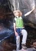
| partners | | Hike #3 of 4 from our Sierra Ancha 2022 camping/hiking trip.
Like Lucky Strike, this was another hike we hadn't done in a LONG time... in this case, over 9 years!
That time we only hiked to the ridge overlooking Cherry Creek followed by a quick stop at the summit of Center Mountain, so our plan was a bit more adventurous.
So what was the plan?
Well... looking at the out-&-back mileage after connecting with the Reynolds Trail we figured Murphy Ranch was a bit more than we wanted to take on with warmer temps than hoped, so where would be a good place to turn back?
Hmmm... thinking of our unsuccessful summit of Murphy Benchmark in 2018 (yup, the one when we encountered the charging bear) I thought, why not?
On satellite view the terrain appeared to be more open coming up from Reynolds Trail than from Abbeys Trail area. But in retrospect, the satellite view featured snow which may have given the impression the terrain was more open than the route we attempted it from.
So in my preplanning before the trip Murphy BM was a tentative goal. However, while scanning all the different maps I noticed a dotted line cutting across the ridgeline of Peak 7677 between Center Mountain Trail before it reached Reynolds, and reconnecting with Reynolds Trail just below Murphy Benchmark. It was on both HAZ Topo and FS Topo but neither had it labeled with any trail number. Looking at it on satellite view more than a few bits were quite obvious, so whether we hit the benchmark or not, maybe we'd make a lasso loop by taking advantage of that route. Whatever, we'll see when the time comes.
As usual we had the short bit on Lucky Strike Trail to get limbered up for the climb up Center Mountain Trail, which thankfully had plenty of switchbacks. Once up top it was uneventful other than some nice views. On the way out we skipped hitting the ridge for the views over Cherry Creek figuring we'd seen it before and the rest of the trip will be a new experience for both of us.
Center Mountain seemed to go on forever before beginning the steep descent down the drainage SE of Center Mountain heading toward Reynolds Trail. At the bottom where the trail does a 180 we noticed a bit of a trail heading south, which must be the unmarked trail.
Hmmm... so,
#1 Should we continue on to Reynolds and try the ridge route on the return trip?
Or...
#2 Since it looks pretty steep on this end and we'd rather climb a new-to-us slope rather than descend into the unknown, maybe we should go up now and return on the freshly cleaned-up Reynolds Trail? (Thanks to @AnchaGladtrailz)
We were unanimous on option #2. Let's climb it now. Well, that worked for all of 15 minutes and 100 vertical feet... what may have been the trail was really hard to follow due to non-use and so much deadfall over spots where it appeared to have been. Enough of this, we dropped back down and continued on to Reynolds Trail. once on Reynolds it was a steady climb, with sky appearing a number of times to give the idea we were almost at the saddle adjacent to Murphy BM, only to have our hopes dashed over and over again.
Eventually we reached the intersection with the unnumbered 'trail' heading east across Peak 7677. As wide and clear as it appeared it was FAR too enticing NOT to follow the road-less-traveled for the return trip. And after glancing up toward Murphy BM we both decided it was not gonna happen! So, across the ridge of Peak 7677 it is!
It looked great to begin with, but barely a few hundred feet in it seemed to disappear into a mass of fallen trees. Not willing to give up that quickly, we each took a side trip in search of reconnecting with the trail, and sure enough, around the other side of the mass there was a relatively obvious elk trail, which shortly after we started on it opened up to what actually would be the best tread of the whole day for at least a third of the way across. Of course, as I would later find out, this used to be a road which began just past Workman Creek Falls, up to a saddle on the south end of Baker Mountain before cutting across the contour of Murphy before crossing Reynolds Trail and continuing for 3/4 mile across Peak 7677.
For that 3/4 mile things were going great, either enough of the old road was still easily visible, when it wasn't there were old cairns. When the road stopped completely there was just enough of the trail to keep going. Once we began the descent it appeared the trail would simply drop off the side of the mountain into the upper reaches of Pueblo Canyon. Whoa! Are we still following the route? Yes, we are, but it looks like there's a 200' cliff where we need to go. But an elk had been nice enough to show us the way, steep as it was. It was close, but thankfully we never quite had to scoot on our butts.
While the elk had been following the old trail to a certain degree, it was obvious even elk didn't care for deadfall, which it turned out is why we had such a problem attempting to follow the trail up before. As we've found out from experience, while it may be harder to descend on unknown terrain, rail, it's easier to see a trail from above than below and eventually we found our way back to the Center Trail just in time for the climb back up the drainage.
Whew! it's getting warm again and we're hungry so at the next smooth boulder in the shade, we are stopping! And about half-way up we found the perfect spot... on large boulders immediately above a large pour-off, barely a half-dozen feet from the trail. It was such a nice spot, for almost the first time ever, I actually took my boots off to dry out my throughly-wet socks. Ah, what a relief!
Ok, enough of the eatin' and nappin' it's time to finish the climb. Crazy enough for me, the climb seemed to get easier the steeper it got, and by time the slope eased off I was feeling energized again. Could it be because I ate everything in my pack at our lunch stop? Or just the benefits of weight loss, which at the time of the hike I'd lost 20 lbs since mid-February. (As I write this 10 days later I'm another 3 pounds lighter.)
On the hike back across Center Mountain we figured we just had to take a look out over Cherry Creek, only to realize when we headed over that way we had little to see as we'd already passed the best observation site. Oh well, continuing on.
Pretty well worn-out by now we took our time on the switchbacks down to Lucky Strike Trail and soon we were back to camp at the end of what would be our longest (miles & time) and the most elevation gain of all four hikes. But 90% was new ground for us so it was well worth the effort. |
| _____________________
| | |
|
|
|
 Route Editor


 The first one was a spring near the top. He and Wally did that while Joe, Alex and I continued down the main trail.
](https://hikearizona.com/dex2/images/smilies/eusa_wall.gif "Brick wall") Or else he set me up on another bushwhack.
Or else he set me up on another bushwhack. 
 The forecast for the bottom was 86, but my thermometer said 96. While was steep hiking down, it seemed even steeper hiking up. I had to stop several times to catch my breath, which I normally don’t need to do. It was normally about the time that I stop for lunch, but I wasn’t feeling hungry at all. In fact, I felt a tad nauseous. I was feeling thirsty even with regular sips from my Camelbak and was beginning to have some real concerns about not having enough water to make it to the top. After an hour, we decided to stop in a shady spot and have lunch. I ate most of my usual Taco Bell lunch, drank a liter of water, and topped of my Camelbak again. From there, the rest of the hike was much easier for me. I hadn’t eaten in almost 8 hours at that point, and I think that had a lot to do with it, along with the heat at the bottom and the steep terrain. By the time we got to the junction of the Grapevine Trail again, the cloud cover increased, giving us some shady relief, and the breezes were more common. I checked my thermometer again and it read 86, which made a huge difference.


 . alex recognized a spot he was sure we walked thru. Once I got home and downloaded the track, we were 9 yards short of completing the whole trail