|
| | | Rose Schell Reno Bear Wallow, AZ | | | |
|
|
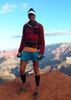
Rose Schell Reno Bear Wallow, AZ
| | |
| |
|
| Backpack | 16.51 Miles |
3,711 AEG |
| | Backpack | 16.51 Miles | 3 Days | | |
| 3,711 ft AEG | | | | |
|
|
| |
| Partners |
|
[ show ]
| partners | | Lee offered to drive, and since you can get to Rocky Point, San Diego, LA, Durango, and a few other places in less time, that was a welcome offer.
Having never been to this part of the White Mountains, I was intrigued. Especially after the fire. Some of the ridgelines were moonscape, but a very surprising part of the fire area are untouched, or only affected a little bit. Borderline healthy. In the moonscape areas, the aspens are growing strong with thick stands now 5-10 feet tall. In not too many years, these areas will be fantastic!
After playing Elk Pinball on the Coronado Hwy at dusk, we arrived at the Rose Spring TH and crashed there for the night. In the morning we headed out on the Rose Spring trail and were a little frustrated by the unanticipated elevation gains. It hurt a little bit to get out to the Schell junction. Which btw, is impossible to find if you don't have a track. The upper drainage has no noticeable route, and the sign is mostly burned.
Once headed down Schell, the route becomes evident, and the canyon is a real pleasant hike. The slope is perfect, and the foliage makes for a shaded, scenic trip. There's a fantastic grassy camp spot at the junction with the South Fork Bear Wallow Creek, which is also where the first water appeared for us. Just over half a mile later we reached the confluence of the north and south forks where they create the main stem of Bear Wallow Creek.
We set up camp a few hundred yards downstream of the confluence. After a short break, we headed up the north fork one mile to the junction with the Reno Trail where we ascended 2 miles to the road. The Reno trail is a gem! A nice moderate grade is an easy hike from the road to Bear Wallow Creek the lower half of which is shaded in pines with running water in the creek, and the upper half which is in burn area with well-established new aspen.
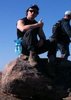
At the road, we hiked the additional half mile to the lookout tower. The views were great, but a little stunning. Looking north, as far as you could see, the landscape was affected by the Wallow Fire in 2011. Only Baldy to the northwest was untouched. On the horizon, the hills around Greer and Escudilla were torched. The fire began within a couple miles of this tower, and these landmarks are 30 miles away. All torched. That's a lot of land!
Even though Lee wanted to hike an additional 9-10 miles (depending on how we cut the switchbacks in the road) to make a loop back to camp, I decided I'd rather get back before dark and enjoy the beer I had left in the creek. Had I not been there to wuss out, I'm sure he would have done the extra miles on his own. But I value some relaxation time when I'm backpacking, and getting to camp after dark isn't my first choice. Unless that's the original plan.
Back at camp, we cooked up dinner, spent some fun time under the party lights, and retired for the night.
Sunday we hiked out via the South Fork canyon. There was an occasional wildlife trail, but for the most part we hiked in the creek, which had water in it all the way to where we headed up a very steep ridge toward the trailhead.
If I were to do it again, I might skip the Rose Spring trail, and drop into the creek via our exit route. It is steep but short, and cuts a few miles off the hike. But you have to be prepared for a very steep, off-trail hillside until you get to the creek.
Nice weekend with good people. Never been this far south in the White Mtns. I will surely be back.
Note: Bear Wallow Creek is the king of Poison Ivy. I've never seen so much PI in Arizona anywhere. Including Vasey's Paradise! The lower stretches of Schell, South Fork, and Reno also have poison ivy growing wildly along the trail. As a crazy-allergic poison ivy person, I prepared ahead of time and hiked with "dirty" clothes. As soon as I got to camp, I changed clothes and kept all my gear clear. Sleeping bag, tent, backpack, etc. The "dirty" clothes went in a ziploc bag and straight in the washer at home. I also scrubbed with Technu and rinsed in the creek. It'll be another day before I know for sure, but I think I came out of it all clear. Knock on wood. |
| _____________________
| I'm not sure what my spirit animal is, but I'm confident it has rabies. |
| | |
|
|
|
 Route Editor