|
| | | |
| |
|
| Hiking | 7.89 Miles |
2,222 AEG |
| | Hiking | 7.89 Miles | 4 Hrs 29 Mns | | 1.80 mph |
| 2,222 ft AEG | 6 Mns Break | | | |
|
|
| |
| Partners |
|
[ show ]
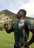
| partners | | Another delightfully rainy day in the desert! 
This one was a bit of a gamble. Radar estimates showed it hadn't received as much rain as other areas, but I took a stab that there'd be flowing water given the burn scar. Despite not having closures in place like other parts of the burn, this is sort of low elevation so I figured I wouldn't be able to get back there until cooler weather to check it out.
Well, in a twist of luck, cooler weather is exactly what happened! And rain. Plenty of wonderful rain. The forecast looked reasonable, and the Flash Flood Warning in effect for the area was noted.
FR 319 is heavily rutted. Even worse than before. Unless there's a rancher that needs access or the TRAL people get involved, I can see this one settling into some extra hiking mileage. The burn here was bad and the runoff is eroding the road with every new storm. I gave up when reaching the 2260 intersection and we walked from there.
The spring area at the end of 2260 was torched, including the big cottonwoods. The whole drainage down suffered the same fate at varying levels of severity. Some of the overgrown thickets that were a challenge before are now easygoing.
Our entire hike in was in a pleasant and lightly running stream. The morning showers had given way to cloudiness and even an occasional splash of sun. When we reached the heart of the wilderness we stayed high on the south side of the creek and followed an old use path down to creek level below the narrows. All of this has burned, but of course the geology hasn't changed, and most of this desert scrub will be back soon enough.
The water was flowing strongly as we headed downstream and explored up some side drainages. Water was deep enough to require bypasses to avoid swimming. A pure delight for midsummer in the desert.
Somewhere along the line, the rain picked up again, and I donned my umbrella. We headed upstream in the creek, somewhat wary of the short stretch that would not allow for an easy exit to higher ground should the water rise quickly. A bit farther upstream we happened upon the magnificent waterfall that enters from the north. I've seen this one flowing before, and it always amazes me for the relatively small area it drains.
After a lunch break by the falls and satisfied with the survey of fire damage, we headed back up toward the top of the slots to begin our trek back to the truck. Seeing the cascade here it was evident the flow of the creek had increased and turned decidedly more turbid. There's not a huge catchment here and the flow was still quite easy for walking, enjoyable really, so we splashed on upstream. As we did so, the rain picked up considerably. I commented to 9L to be aware of the possibility the flow could increase with the heavier rain band.
We stopped at one of the small cascades along the creek to capture a photo when it appeared that a bit more water began to pour over the rocks. Seconds later, and at the same time we both heard the impending rush of water barreling down canyon and quickly climbed out of the creek and up to a safe perch. In what seemed like 15 seconds (but was actually about a minute and a half) the creek had gone from a flow of maybe 5cfs to probably over 100cfs. It crashed over the cascade we were just photographing and filled the entire creek channel we had been hiking in. We would have survived the flow had we been cluelessly unaware and not highly alert for just such an event, but the rush of seeing this occur was also quite exhilarating.
We proceeded upstream staying on the burned banks, crossing where it was narrow enough to jump, until eventually the flow had receded enough to splash in the creek bottom once again. There were more muddy drainages flowing back near the truck, but thankfully the road was still intact for the drive back out to the highway.
There's a lot of sad sights here now with saguaros and cottonwoods that will not return in my lifetime. But other parts will probably be ok in short order. And this day was one for the memory bank, not soon to be forgotten. |
| _____________________
| I'm not sure what my spirit animal is, but I'm confident it has rabies. |
| | |
|
|
|
 Route Editor