username
X
password
register
for free!
help
ArticlesGuidesRoutes
 
Photosets
 
 Comments
triplogs   photosets   labels comments more
Park Creek Falls - 8 members in 17 triplogs have rated this an average 4.4 ( 1 to 5 best )
17 triplogs
login for filter options
Jan 01 2025
avatar

 Guides 8
 Routes 10
 Photos 1,028
 Triplogs 40

44 male
 Joined Jun 14 2019
 nomadic
Salome Creek Wanderings Day 1, AZ 
Salome Creek Wanderings Day 1, AZ
 
Backpack avatar Jan 01 2025
eruTriplogs 40
Backpack
Backpack
 no routes
Partners none no partners
Satellite showed no snow and water levels are super low so we decided to swing over to Phoenix earlier than usual. Driving out of town New Year's Day morning was great, hardly any traffic. Some dude was puking in the shoulder of 60.

No snow visible anywhere on the drive up or on trail. We decided to shortcut in a bit by walking up FR 2770 and XCing up to the #55 trail. Parked at a wide dirt area off 288 33.88902, -110.96459 and followed FR 2770 until we passed a wash with some corrugated drainage tubing 33.89063, -110.97156, then cut left on a very faint road a few hundred feet and headed up towards the trail. Rolly fairly open scrub forest, we got lucky and came across a log over an old barbed wire fence at 33.89044, -110.97331 and then hit trail, passing a few old large cairns.

I brought my old Gregory Baltoro 70 pack out of storage for water carries in the SW this year, and and uh, it worked well after sitting around for the decade I've been using lighter packs. Went up with 11.4L of water, a drone with all it's accessories, and an Anker 737 battery to recharge the drone batteries. The dumbest pack I've carried, but kept it slow and made it to camp fine (my partner brought in all the food and 4.5L of water herself).

McFadden Creek was dry everywhere we saw it aside from some tannic but clear looking puddles below the striking falls alongside the #55 trail (we call it triple falls). Park Creek had a few pools but was mostly dry - one above Park Falls was disgusting and smelled like a cow tank, you could scramble down above into the intermediary ledge system and get a pool of frozen but seemingly non-disgusting water.

Park Tank was.... low.

Rock Spring actually looked less disgusting than last year - I'd assumed it'd be more pressured by cattle.

Turkey and Little Turkey were dry where FR 2747 crossed them, but had pools and/or flow in other places. We kicked up some cow patties out of the way and set up our camp. A new looking fire ring off to the side, one of the old ones from last year had been destroyed. Neither were particularly well built, but the new one is further off from the main camping area at least. :)

water 1 out of 5water less than maxwater less than maxwater less than max Cataract Creek - Sierra Ancha Pools to trickle Pools to trickle
Some clear pools, best bet are smaller ones that usually are flowing vs the deeper permanent pools. Some frozen over.

water 1 out of 5water less than maxwater less than maxwater less than max Indian Camp Canyon Pools to trickle Pools to trickle
Some clear pools, best bet are smaller ones that usually are flowing vs the deeper permanent pools. Some frozen over.

water 1 out of 5water less than maxwater less than maxwater less than max J R Canyon Pools to trickle Pools to trickle
Some quite clear pools in here, many frozen.

water 1 out of 5water 2 out of 5water less than maxwater less than max Little Turkey Creek - Sierra Ancha Light flow Light flow
Flowing better than Salome Creek above this oddly enough.

water 1 out of 5water less than maxwater less than maxwater less than max McFadden Creek Pools to trickle Pools to trickle
Dry aside from small pools below falls to the side of the #55 trail.

water 1 out of 5water less than maxwater less than maxwater less than max Park Canyon Creek Pools to trickle Pools to trickle
Some pools, mostly dry.

water 1 out of 5water less than maxwater less than maxwater less than max Park Canyon Creek - Lower Falls Pools to trickle Pools to trickle
Some pools below the falls, one above that was disgusting.

water 1 out of 5water less than maxwater less than maxwater less than max Park Canyon Creek - Upper Falls Pools to trickle Pools to trickle
Some pools below the falls, one above that was disgusting.

water 1 out of 5water less than maxwater less than maxwater less than max Park Tank 1-25% full 1-25% full
Maybe a little over 25% but not much.

water 1 out of 5water 2 out of 5water less than maxwater less than max Rock Spring Quart per minute Quart per minute
Maybe a quart per minute. Had some flow out of it. No actual cow feces in the pool this time.

water 1 out of 5water 2 out of 5water less than maxwater less than max Thoroughbred Pasture Tank 26-50% full 26-50% full

water 1 out of 5water less than maxwater less than maxwater less than max Triple Falls - McFadden Pools to trickle Pools to trickle
No flow, decent pool below upper falls

water 1 out of 5water less than maxwater less than maxwater less than max Turkey Creek Pools to trickle Pools to trickle
Dry at the FR crossings. Some pools above and below.

water 1 out of 5water less than maxwater less than maxwater less than max Turkey Creek Falls - Upper Pools to trickle Pools to trickle
Pools only.
  9 archives
Apr 14 2024
avatar

 Routes 386
 Photos 49
 Triplogs 792

43 female
 Joined Jun 23 2015
 Phoenix, AZ
Park Creek FallsPayson, AZ
Payson, AZ
Hiking avatar Apr 14 2024
emilystardustTriplogs 792
Hiking6.46 Miles 2,685 AEG
Hiking6.46 Miles   5 Hrs   28 Mns   1.38 mph
2,685 ft AEG      48 Mns Break
 no routesno photosets
Linked   none no linked trail guides
Partners none no partners
Looks like we missed the better flow last weekend, but still an enjoyable amount of water out there. Successfully navigated to the bottom of the first falls this time.
_____________________
 
Apr 06 2024
avatar

 Guides 37
 Routes 556
 Photos 10,872
 Triplogs 1,052

43 male
 Joined Jan 21 2013
 AZ
Park Creek FallsPayson, AZ
Payson, AZ
Hiking avatar Apr 06 2024
FOTGTriplogs 1,052
Hiking9.32 Miles 3,034 AEG
Hiking9.32 Miles   6 Hrs   13 Mns   1.74 mph
3,034 ft AEG      51 Mns Break
 no routes
1st trip
Linked   linked  
Partners partners
chumley
John9L
I covered some new ground in the Mazzies with John and Chumley Saturday. I was not sure what to expect, but the falls and hike down the canyon exceeded my expectations. I found the trail to be a pretty good too, however, that ascent will get one's attention.

The approach to the falls is not a gimmie due to the steep and relentless uphill nature of Park Trail. However, the hike and scramble down canyon was fun and engaging. There were several cascades along the way and some nice pools. We took a break at the confluence and them made our way to the main attractions. Both falls did not disappoint. The big one is a tad spooky to look over, but it has a nice ascetic despite its unphotogenic nature. The double falls are more user friendly and probably represented one of the nicest attractions of the day. After visiting the falls, we took the use trail back to the main trail and began the somewhat knee rattling descent back to our cars. We ran into a fellow HAZ user along the way, because of course you would run into another HAZ user in the bottom of a random canyon in the Mazzies. Great day out overall and perfect conditions, in spite of some heavy wind at times. It was nice to see John and his driver again.
 Named place
 Named place [ checklist ]
[ checklist ]  Park Creek
wildflower observationwildflower observationwildflower observationwildflower observationwildflower observation
Wildflowers Observation Isolated
A few here and there.

water 1 out of 5water 2 out of 5water 3 out of 5water less than max Park Creek Medium flow Medium flow

water 1 out of 5water 2 out of 5water 3 out of 5water less than max Park Creek @ the Park Trail Medium flow Medium flow
_____________________
  2 archives
Apr 06 2024
avatar

 Guides 2
 Routes 127
 Photos 1,478
 Triplogs 129

male
 Joined May 07 2019
 Tempe, AZ
Park Creek FallsPayson, AZ
Payson, AZ
Hiking avatar Apr 06 2024
mikemcgTriplogs 129
Hiking7.01 Miles 2,751 AEG
Hiking7.01 Miles   8 Hrs      1.18 mph
2,751 ft AEG   2 Hrs   3 Mns Break
 
1st trip
Linked   linked  
Partners none no partners
Route Scout Route Recorded  on Route Scout | Pop | Map | Popup | MapDEX
We started at 1100. Sunny and 50-60° temps. The creek at the beginning had light, pleasant flow. The first mile had 560 feet AEG and a lot of grassy overgrowth that obscured the trail, as well as numerous flower buds that have not yet bloomed. The second mile was a little steeper (900 feet AEG) and had expansive views, including some nice waterfalls off in the distance. At 2.8 miles, we could clearly hear the creek, so we left the trail and headed down, trying to avoid the thorns.

The creek was flowing great, with a series of nice cascades. We played in them a little, and they weren't as cold as expected. We ran into some more experienced HAZers at the creek, who provided valuable advice, showed their battle wounds from the catclaw, and then disavowed having ever been there.

We made our way over to the 30 foot falls, which were impressive. We climbed down and played in the pool at the bottom. We then checked out the 100 foot falls (the little that we could see from the top). We then headed back up to the trail, and down to the trailhead, which was occupied by a number of people and dogs who had set up camp there.

Overall, a beautiful day, great views, nice falls, and excellent company.
 Named place
 Named place [ checklist ]
[ checklist ]  Park Creek
wildflower observationwildflower observationwildflower observationwildflower observationwildflower observation
Wildflowers Observation Light
Numerous flower buds throughout the first mile, which will be very impressive when they bloom. Scattered patches of wildflowers the rest of the way.

water 1 out of 5water 2 out of 5water 3 out of 5water less than max Park Creek Medium flow Medium flow

water 1 out of 5water 2 out of 5water less than maxwater less than max Park Creek @ the Park Trail Light flow Light flow
  2 archives
Apr 09 2023
avatar

 Routes 386
 Photos 49
 Triplogs 792

43 female
 Joined Jun 23 2015
 Phoenix, AZ
Park Creek FallsPayson, AZ
Payson, AZ
Hiking avatar Apr 09 2023
emilystardustTriplogs 792
Hiking6.11 Miles 2,648 AEG
Hiking6.11 Miles   6 Hrs   6 Mns   1.39 mph
2,648 ft AEG   1 Hour   42 Mns Break
 no routesno photosets
Linked   none no linked trail guides
Partners none no partners
_____________________
 
Mar 19 2020
avatar

 Routes 154
 Photos 1,505
 Triplogs 266

31 male
 Joined Jun 02 2019
 Phoenix, AZ
Park Creek FallsPayson, AZ
Payson, AZ
Hiking avatar Mar 19 2020
LJWTriplogs 266
Hiking11.47 Miles 3,440 AEG
Hiking11.47 Miles   7 Hrs   52 Mns   2.14 mph
3,440 ft AEG   2 Hrs   30 Mns Break
 
1st trip
Linked   linked  
Partners none no partners
Route Scout Route Recorded  on Route Scout | Pop | Map | Popup | MapDEX
I met a friend from Flagstaff at the Deer Creek Trailhead before heading down the 188. Clouds were awesome driving up the 87, and when I got to Deer Creek I hiked up about a half mile to take some pictures of the storm over Mazatzal Peak and the constant, fleeting rainbows while I waited for my friend to arrive.

We took his car to the Park Trail Th, and when we got onto fr409 the car immediately went sideways. Road's in great shape, but it was too muddy from the storms the night before. We parked on the opposite side of the 188 and walked down the road, adding about 3.5 miles.

Park Creek at the trailhead was an absolute river. Got half way across rock-hopping before taking our boots off. Park Trail is in superb shape.

Hiked up the little peak 4759 just north of the trail and watched the clouds roll over Mount Ord and the Tonto Basin. Sierra Anchas, the higher Mazatzal peaks, and the Mogollon Rim got a fresh layer of snow.

Left the trail at the drainage that leads down closest to the falls after getting up around 4800ft. Stayed east of the drainage where the mountainside was clear, but eventually worked our way down along the water.

Took a while to find a good spot to cross Park Creek above the falls. Water level was high and jumping freaked me out with white water crashing down the smooth granite toward the falls. Really the only danger was in getting wet and cold and ruining my camera. I found a spot where I could cross on submerged rocks in water a little less than knee deep. My friend and his dog simply jumped across and back.

Working down below the upper falls took time. Eventually we found a route that climbed up and then down to the lower falls. Good bushwhack, and the scrambling was more exciting on account of being slippery with wet lichen.

We worked our way onto the mountainside north of the lower falls after checking out the upper. We didn't go south of the lower falls, but I reckon the best views are from that north side.

Much faster going back having established a route. We were back on the trail within an hour. Climbed back onto 4759 one more time and soaked in the views. Great visibility, and the clear air seemed to bring out more color. Didn't see anybody except a camper at the trailhead.
 Meteorology
 Meteorology [ checklist ]
[ checklist ]  Rainbow
wildflower observationwildflower observationwildflower observationwildflower observationwildflower observation
Wildflowers Observation Light
More to bloom soon
 
Feb 16 2019
avatar

 Guides 3
 Routes 202
 Photos 3,513
 Triplogs 530

male
 Joined Jan 24 2016
 Arizona
Park Creek FallsPayson, AZ
Payson, AZ
Hiking avatar Feb 16 2019
MountainMattTriplogs 530
Hiking6.92 Miles 2,976 AEG
Hiking6.92 Miles   5 Hrs   36 Mns   1.85 mph
2,976 ft AEG   1 Hour   51 Mns Break45 LBS Pack
 no routes
Linked   linked  
Partners none no partners
Led a group of friends up to the well earned views that reside in the impressive canyon segment of Park Creek.
As we started I knew we would be in for a treat since the creek had well over double the flow from my last visit almost exactly three years ago.
Trail is still in great condition thanks to the cattle, hunters and hearty canyoneers one of which recently ribbon marked the upper portion of the trail.

We lucked out with such a great weather window as the majority of the day was warm, had plenty of sun and even a nice 10 minute spurt of pleasant mellow snowfall.
Aretta was kind enough to hang out with Payton above the twin falls while I led Dave and Josh down to the base of them and then to finale, PC Falls itself gushing in full glory.
[ youtube video ]

Getting the hard work done first on this hike makes for a leisurely stroll back down soaking in the expansive views of the mighty Tonto Basin that never get old.
wildflower observationwildflower observationwildflower observationwildflower observationwildflower observation
Wildflowers Observation Moderate
Poppies are really beginning to come to life along the middle section of the trail in the burn area.

water 1 out of 5water 2 out of 5water 3 out of 5water 4 out of 5 Park Creek Heavy flow Heavy flow
_____________________
 
Jan 25 2017
avatar

 Routes 54
 Photos 1,508
 Triplogs 325

39 male
 Joined Mar 18 2015
 Payson, AZ
Park Creek FallsPayson, AZ
Payson, AZ
Hiking avatar Jan 25 2017
The_NTriplogs 325
Hiking7.05 Miles 2,927 AEG
Hiking7.05 Miles   5 Hrs      1.76 mph
2,927 ft AEG   1 Hour    Break
 no routes
1st trip
Linked   linked  
Partners none no partners
Took Rosie out for a little exploration. We stopped at Deer Creek TH first and started up Gold Ridge before I changed my mind. Decided I'd rather see water instead of just snow. I knew Park Creek was close and had never been so off we went. The turnoff from 188 (FR409 I think) was in great shape despite recent weather. Park Creek was raging at the TH / crossing. Park Trail was wet and muddy but well cairned and fairly clear of brush. A nice waterfall came into view shortly after gaining elevation. I could hear water at practically every turn. We didn't hit snow on the trail until about 4600ft. At the turnoff down to the upper creek / falls area snow turns to mud and quicksand while catclaw and it's friends become more numerous. I'm not one to complain but wear pants! I didn't and my legs took a beating on the off-trail parts. There's a ton of water currently. Every drainage was running and big waterfalls loomed in almost every direction. The views of Ord, Tonto Basin, the Rim and Anchas were nice as well. Temps were in the 40s and the sun was hidden most of the day. We cherished every minute of sunshine. We explored the falls area going up canyon first before heading down toward the big falls. I took a spill right before the fixed rope / dropoff. One of those quick, no time to react moments and I was on my back on a wet rock slab next to a rushing creek. Left knee and elbow took the blow. Following Chumley's route, we attempted to bypass the falls and get to a better vantage point but it wasn't happening with Rosie tagging along. I had to help her up a couple short climbs and eventually the bushwacking became too much for her. She's a trooper for enduring what she did. We settled on a sunny overlook on the hill. Both had a snack, I had a cold beverage and we soaked in all the beauty before heading back the way we came. Definitely a nice destination right now with all of the water. Lots of Deer sign but to my surprise we didn't see any wildlife other than some quail and a few other birds. I'm willing to return without the dog and see what else this place has to offer.
 Flora
 Flora [ checklist ]
[ checklist ]  Cheatgrass
 Named place
 Named place [ checklist ]
[ checklist ]  Mount Ord  Park Creek

water 1 out of 5water 2 out of 5water less than maxwater less than max Corner Spring Quart per minute Quart per minute
Didn't set eyes on the actual spring but there was water flowing down onto the trail.
_____________________
If there is no struggle, there is no progress.
 
Feb 18 2016
avatar

 Guides 3
 Routes 202
 Photos 3,513
 Triplogs 530

male
 Joined Jan 24 2016
 Arizona
Park Creek FallsPayson, AZ
Payson, AZ
Hiking avatar Feb 18 2016
MountainMattTriplogs 530
Hiking6.00 Miles 3,400 AEG
Hiking6.00 Miles   6 Hrs   30 Mns   1.33 mph
3,400 ft AEG   2 Hrs    Break
 no routes
Linked   linked  
Partners none no partners
Another fun day exploring in the Mazzies! Obviously was not expecting a high flow in this seasonal creek due to this constant dry weather we have been having but due to the rarity of my days off from work & this place being on my list for awhile I wanted to give it a shot! All in all it was beautiful and diverse hike that has me wanting more! The hike had some great elevation gain and gave my legs such a good burn by the time of reaching "The Pyramid". My friend and I descended into the Park Creek from the western side drainage instead of head on because I got eager when I heard water! The creek itself had great flow with surprising amounts of numerous pools that were over 5ft deep in certain areas. Unfortunately the main attraction didn't have quite the flow power to provide a waterfall that was able to capture with my iPhone camera but at least I could see it with my own eyes. I can only imagine how spectacular this place must look with a heavy flow! So much fun traversing across some very precarious ridges along the lower main falls area, truly one slip around there and you are falling into the dark abyss! Im curious if it's possible to ascend the Parker Creek Canyon from the very bottom and work your way up scrambling without technical climbing gear all the way up to the base of the main falls, anyone out there know if it's possible? While sitting at the eastern vantage view point of the lower main falls I noticed a possible route down to the base of the main falls but I did not want to risk it because my hiking partner was out of sight already.
wildflower observationwildflower observationwildflower observationwildflower observationwildflower observation
Wildflowers Observation Light

water 1 out of 5water less than maxwater less than maxwater less than max Corner Spring Dripping Dripping

dry Packard Spring Dry Dry
_____________________
 
Jan 17 2016
avatar

 Guides 94
 Routes 840
 Photos 22,055
 Triplogs 1,993

52 male
 Joined Sep 18 2002
 Tempe, AZ
Park Creek FallsPayson, AZ
Payson, AZ
Hiking avatar Jan 17 2016
chumleyTriplogs 1,993
Hiking7.72 Miles 3,404 AEG
Hiking7.72 Miles   8 Hrs   12 Mns   1.72 mph
3,404 ft AEG   3 Hrs   42 Mns Break
 no routes
1st trip
Linked   linked  
Partners partners
JoelHazelton
After lazily sitting on the couch watching football on Saturday I was happy when Joel suggested a 6-7 mile hike on Sunday. He neglected to mention the 3000 feet of gain. ](*,)

I'm not sure what the term is -- must be related to bucket list -- but different. In any case, I'm glad to get it checked off while hoping to never again have to hike in the snow through catclaw (two things that should never occur together). Add off-trail and after dark and one wonders why more people don't come here! :lol:

Ultimately, it was a fantastic day. Awesome water flow in the entire canyon. Plenty of amazing cascades, along with the incredible waterfalls downstream. I'm impressed by the canyoneer folks who rappel down this thing. It's impressive.

Love to see the water flow at this time of year. Hopefully that el nino thing happens because except for a 5-day stretch two weeks ago, it's been a whole lot of sunny.
 Culture
 Culture [ checklist ]
[ checklist ]  Cag Shot
 Named place
 Named place [ checklist ]
[ checklist ]  Park Creek
_____________________
I'm not sure what my spirit animal is, but I'm confident it has rabies.
 
Oct 18 2014
avatar

 Guides 14
 Routes 115
 Photos 4,830
 Triplogs 3,536

male
 Joined Oct 29 2005
 Scottsdale, AZ
Sunflower- Camp Reno - Park Trail Loop, AZ 
Sunflower- Camp Reno - Park Trail Loop, AZ
 
Hiking avatar Oct 18 2014
topohikerTriplogs 3,536
Hiking30.43 Miles 5,755 AEG
Hiking30.43 Miles   15 Hrs   4 Mns   2.75 mph
5,755 ft AEG   4 Hrs    Break
 
1st trip
I've been looking for a way to loop the Bushnell Tanks, Park trail and FR422. I drew up a route on HAZ and away we went.
Fan & I started about 7:30 and the weather was very cool. We came across two hunters who had spotted a bear in the area.

Soon we were hiking down the backside of MT.Ord on FR524. We hopped off of FR524 to an old ATV trail that took us close enough to the Camp Reno. We bushwhacked around a bit before hitting the Camp Reno road. Fan took a break as I explored around Camp Reno.

Park Trail #66
We topped off our water at the Park creek. We knew it was going to be warm climbing up in the sun.
The Park trail is no "walk in the park". The trail goes from 2,700 feet to 5,000+. There is little shade. The lower part is easy to follow. But once you get to 4,000 foot range, it changes. The tall grass hides the trail and cairns. We keep on missing the trail and bushwhacked back to it. We started to dread the HAZ split stats because we slowed down to a mile an hour!
The trail is there, it's just the tall grass increases the route finding. After a couple of hours we made it to the Edwards park. Now that is a one great park!

We headed down the AZT to a point where we bushwhacked to a series of abandoned Jeep roads that lead us back to the Jeep.

We were amazed at the amount of flowing water everywhere. The song that keep playing in my head was the "The Rime of the Ancient Mariner". The verse was “Water, water everywhere nor any drop to drink" Except it was good potable water. The 1st mile of FR22 was wet and overgrown with plants. This area got hit with a lot of rain. It looks like the road moved again.
_____________________
"Everywhere is walking distance...If you have the time"
-Stephen Wright
 
Apr 21 2011
avatar

 Guides 13
 Triplogs 205

38 female
 Joined Jan 29 2009
 Murray, UT
Park Creek FallsPayson, AZ
Payson, AZ
Hiking avatar Apr 21 2011
SparkyJackieTriplogs 205
Hiking6.00 Miles 2,716 AEG
Hiking6.00 Miles
2,716 ft AEG
 no routesno photosets
1st trip
Linked   none no linked trail guides
Partners none no partners
_____________________
 
Jan 22 2011
avatar

 Guides 3
 Routes 4
 Photos 8,687
 Triplogs 931

46 male
 Joined Mar 28 2005
 Gilbert, AZ
Parallel Play CanyonPayson, AZ
Payson, AZ
Canyoneering avatar Jan 22 2011
VapormanTriplogs 931
Canyoneering6.00 Miles 2,400 AEG
Canyoneering6.00 Miles   8 Hrs      0.75 mph
2,400 ft AEG
Intermediate Canyoneering - Difficult or dangerous; Tech Climb; rope reqd; descent anchor; exit technical;
B - Up to light current; wading/swimming; possible wet/dry suit
Risky - Extraordinary risk factors exist; solid skills/judgement reqd; no beginners
III - Normally requires most of a day
 no routes
Linked   linked  
Partners partners
alpineclimber
suzaz
AKA Park Creek Falls in the hiking community.

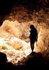
Well a climbing trip fell thru when a partner got sick, so Michael & I fell back on this canyon as a backup. After doing Parker Canyon, we'd been talking about the flow of snow runoff down this equally amazing canyon across the lake. Susan's plans fell thru also, so she was a last minute addition than morning. Gotta love the fluidness of canyoneering! :D

With 200ft ropes & full wetsuits, we slogged up the Park trail passing a hunter with a recent kill of a beautiful bobcat. ;) The views of Tonto Basin were amazing, but we were so glad to be done climbing up the mountainside and dropping into the lightly flowing canyon. :y: Geared up, rock hopped a bit downstream, and made the first 40ft drop. A little further downstream is the amazingly HUGE ~250ft waterfall. :o The creek oddly went underground here and came out a crack in the wall about 100ft from the bottom. This is a mulit-stage rappel and the first drop is about 150ft down that slick angled chute and then head to a midway ledge on the right (looking up canyon). Once all down on the ledge, we pulled the ropes while soaking in this super sweet waterfall & rigged the anchors for another ~100ft drop into the hallway below. From this amazing waterfall, we again pulled the ropes, and made another 20ft drop into a chilly swimmer. Wow, that was flipping amazing! :D A little further downstream, we hit a second huge multi-stage drop past a series of falls & cascades. :y: It starts off with a 40ft drop past a huge chockstone to the top of the main falls, but we rappelled 100ft into a dry grotto on the rightside. That put us down to a ledge with a few options, but the quickest way is to down climb the slick flowing chute and wade another chilly pool. That was the end of the rappels, but we left the gear on until we knew we were done with the cold pools. ;) Loads of rock hopping, some more down climbing, and a few pools to try and avoid as we continued down canyon until we felt confident enough to drop the gear and put on some dry clothes. :) The canyon slowly opened up and eventually we popped out of the mountains and into the flat Tonto Basin where we got out of the rocky canyon and bushwhacked back to the TH. :sweat:

Such a great short & sweet canyon that I'm glad to have come back and caught when it was flowing on this relatively dry winter (so far). :D
foliage observationfoliage observationfoliage observationfoliage observationfoliage observation
Autumn Foliage Observation Moderate
_____________________
Yea, canyoneering is an extreme sport... EXTREMELY dramatic!!! =p
 
Nov 20 2010
avatar

 Guides 3
 Routes 4
 Photos 8,687
 Triplogs 931

46 male
 Joined Mar 28 2005
 Gilbert, AZ
Parallel Play CanyonPayson, AZ
Payson, AZ
Canyoneering avatar Nov 20 2010
VapormanTriplogs 931
Canyoneering6.00 Miles 2,400 AEG
Canyoneering6.00 Miles   7 Hrs   35 Mns   0.79 mph
2,400 ft AEG
Intermediate Canyoneering - Difficult or dangerous; Tech Climb; rope reqd; descent anchor; exit technical;
A - Dry or little water; shallow or avoidable water; no wet/dry suit
Risky - Extraordinary risk factors exist; solid skills/judgement reqd; no beginners
III - Normally requires most of a day
 no routes
Linked   linked  
Partners none no partners
Wow, yet another amAZing canyon tucked away in the Mazatzals. :y: AKA as Park Creek Falls in the hiking world. I wanted to do a dry run down this canyon on a warm fall day to get a feel for the canyon before heading back next spring to catch it flowing from snow runoff. : rambo :

The road is looks to be recently graded so my car made it in no problem. Like Preston says, the trail receives little maintenance and is overgrown with thorny bushes as you climb 2000ft in 2 miles but nothing that my half shredded canyoneering pants & shin guards can't handle. ;) Once a little past Pyramid Peak, I bushwhacked down to the dry creek and soon reached that first day fall. The upper creekbed had a few clear pools but nothing I couldn't thankfully avoid since I didn't bring the wetsuit in order to make hauling two 200ft ropes up the mountain a tad easier. :sweat: Geared up and dropped down that first 40ft rappel to the rocky creekbed. I left the rope in place to run down and check the anchors for the big rappel #2 & after finding some interesting yet solid anchors I rock hopped back up and pulled the rope. The main falls is actually more like sloping 225-250ft drop. :o About 150ft down, there's a ledge on the left LDC with another anchor to rappel from but you need to angle that way on rappel in order to reach it. Midway down I threw the rope the rest of the way to get a feel for the length and there looked to be another 25-50ft of drop past the ropes end before reaching the hallway at the bottom. So I pulled the rope and setup from the ledge anchors and dropped another ~100ft into that super sweet hallway. There's another 20ft drop out of the hallway and another set of anchors in there also but I decided to snap some quick photos and continue on using the same anchors from above. There's a cold knee-high pool to wade and from across the way after a little bit of struggling I was able to get a good angle and make the rope pull. In hindsight, It might be best to just make the rope pull from the hallway and get an additional rappel, especially if the water is flowing descent. I gave this canyon an extra R due to this huge mulit-stage rappel and it's exhilerating enough when it's dry and can only imagine how sweet it is when it's flowing. :D A pool around the corner I avoided and then you're faced with a 3rd falls with a few different options though they might be more limited when its flowing. I found an anchor on the left side that was shreeded and easily came loose when I test pulled it :o plus it dropped down almost into a tree. So I went back to try another way and choose the middle option. I ended up build an anchor and dropping down 20ft thru a tight chute to get past that huge chockstone and found myself on top of the next set of anchors. Hmm, looks like an interesting one... I rappelled under a chockstone hanging there so that the rope pull would be easier and continued down that angled chute a good 100ft before reaching a ledge flat. Hmm, no anchors down here but it looks down climbable so I pulled the rope, scrambled down, and waded across another knee-high pool. It looked like that was the end of the technical section, as it was, but I kept the gear on in case I ran into something further down canyon. No more rappels, but I did do some light down climbing and loads & loads of rock hopping while enjoying more fall colors. :sweat: Eventually I reached a flat bench on the side of the creek that I could scramble up and made pretty good time weaving thru the brush back to the TH while enjoying the sweet view of the Tonto Basin.

Now that I know the canyon better I could prob shave an hour from todays time but I suspect that flowing water would add another hour or two on top of that. ;)
foliage observationfoliage observationfoliage observationfoliage observationfoliage observation
Autumn Foliage Observation Moderate
_____________________
Yea, canyoneering is an extreme sport... EXTREMELY dramatic!!! =p
 
Mar 16 2010
avatar

 Guides 170
 Routes 148
 Photos 5,914
 Triplogs 2,097

48 male
 Joined Apr 12 2004
 Tucson, AZ
Park Creek FallsPayson, AZ
Payson, AZ
Hiking avatar Mar 16 2010
PrestonSandsTriplogs 2,097
Hiking6.20 Miles 2,716 AEG
Hiking6.20 Miles
2,716 ft AEG
 
Linked   none no linked trail guides
Partners none no partners
Our Salt River rafting trip over, the Sands boys went home. I continued north to Preston country (Mazatzalia) for spring break. Park Creek was flowing nicely, so I decided on an afternoon visit to an old friend in the Mazatzals. The Park Trail gave a good workout on this warm spring day. I met a couple from Tonto Basin who frequently hike the Park Trail, and help maintain it. We exchanged pleasantries and continued on.

In the wake of the Edge Complex Fire, the off trail descent to Park Creek was much easier, and I reached the upper falls quickly. Nostalgia set in. Was it February 2001? Were the Mazatzals still my backyard? Today, yes. I carefully descended the upper falls, then set up the tripod in the creek to capture its beauty. Excitement was in the air as I reached the edge of Park Creek Falls. Wow! What a treat to be here again! :D And just as terrifying as I remember. I noticed the juniper tree on the lip of the abyss where I had hung over the edge on my last visit, taking photos. "Oh ####! I can't believe I did that!" I guess I'll have to do it again. Against my better judgment, I scrambled down to the tree. Adrenaline coursed through me as I stood on the precarious precipice again. The juniper served as a tripod for photos and video. A dead agave stalk was thrown into the abyss, quickly growing tiny and vanishing. Ooh! With the hour growing late, I made my trip back up the canyon. Darkness arrived, and I finished the trail by flashlight. A quick clean up, and I was off to Payson for supplies, before disappearing into Cypress Thicket for a few days. What a great day. I didn't have a care in the world.

VIDEO: https://www.youtube.com/user/PrestonTheY ... EMdXxl6Tpc
 Geology
 Geology [ checklist ]
[ checklist ]  Fault
 Named place
 Named place [ checklist ]
[ checklist ]  Park Creek
wildflower observationwildflower observationwildflower observationwildflower observationwildflower observation
Wildflowers Observation Light
_____________________
"…you never know when a hike might break out" -Jim Gaffigan
 
Apr 28 2008
avatar

 Triplogs 30

male
 Joined Mar 17 2004
 Scottsdale, AZ
Park Creek FallsPayson, AZ
Payson, AZ
Hiking avatar Apr 28 2008
hazardTriplogs 30
Hiking6.00 Miles 2,716 AEG
Hiking6.00 Miles
2,716 ft AEG
 no routesno photosets
1st trip
Linked   none no linked trail guides
Partners none no partners
Trail appears to be seldom traveled and was slightly difficult to follow at times. Wildfower's were abundant and varied, I had not previously seen some of the varieties in the lower desert. Didn't make it all the way to the falls but would reccomend this hike after rain or snow melt, got close enough to see there was only trickle of water.
wildflower observationwildflower observationwildflower observationwildflower observationwildflower observation
Wildflowers Observation Substantial
_____________________
 
Feb 22 2001
avatar

 Guides 170
 Routes 148
 Photos 5,914
 Triplogs 2,097

48 male
 Joined Apr 12 2004
 Tucson, AZ
Park Creek FallsPayson, AZ
Payson, AZ
Hiking avatar Feb 22 2001
PrestonSandsTriplogs 2,097
Hiking6.00 Miles 2,716 AEG
Hiking6.00 Miles
2,716 ft AEG
 
Linked   none no linked trail guides
Partners none no partners
Hiked up the Park Trail to the 4800 foot level, left the trail, and went down to Park Creek itself. The creek was flowing well with snowmelt. Got to an upper fall, descended it on the right (east) side, then continued downstream to get to a 160 foot waterfall I had seen on the topo map. With one arm around a juniper branch, I leaned over the edge of the abyss and took some pictures of the big sloping waterfall. On the way back, a big rock rolled over my foot. In pain, I carefully hiked out, getting back just after dark. Thus ended my Park Creek adventures. This was one of my most memmorable hikes from "back in the day". :)
 Geology
 Geology [ checklist ]
[ checklist ]  Fault
wildflower observationwildflower observationwildflower observationwildflower observationwildflower observation
Wildflowers Observation Substantial
_____________________
"…you never know when a hike might break out" -Jim Gaffigan
 
average hiking speed 1.56 mph

WARNING! Hiking and outdoor related sports can be dangerous. Be responsible and prepare for the trip. Study the area you are entering and plan accordingly. Dress for the current and unexpected weather changes. Take plenty of water. Never go alone. Make an itinerary with your plan(s), route(s), destination(s) and expected return time. Give your itinerary to trusted family and/or friends.

helpcommentissue

end of page marker