|
| | | |
| |
|
| Hiking | 15.33 Miles |
2,844 AEG |
| | Hiking | 15.33 Miles | 8 Hrs 58 Mns | | 1.92 mph |
| 2,844 ft AEG | 1 Hour Break | 25 LBS Pack | | |
|
|
| |
| Partners |
|
none
[ show ]
| no partners | | I did the Seven Springs Inner Loop as a scouting trip for a point-to-point hike that I'll be doing later in December. I was not familiar with most of these trails, though after starting, I realized that I had been on Cave Creek #4 and Skunk Tank #248 before.
In any case, I decided to do it in a CCW direction, specifically:
Starting from Cave Creek TH, I went south on Cave Creek #4, south on Cottonwood #247, south and then west on Skunk Tank #246, south on Quien Sabe #250, east and then south on Skull Mesa #248, east and then north on Cottonwood #247, and, finally, north back to trailhead on Cave Creek #4.
The short section of Cave Creek #4 was straightforward, though it was cold starting off. I was feeling sluggish from not sleeping well the night before - one of our cats woke me up shortly after falling asleep. It was cold enough that I saw frost on the ground.
Cottonwood #247 crosses Cave Creek; fording the creek was easy, but I (initially) missed the spot where it headed uphill out of the creek. There was a sign and there were cairns; I just wasn't observant enough. #247 headed uphill for a while which warmed me up and got me to feeling better.
Soon thereafter, I was at the intersection with Skunk Tank #246. There was even more hiking uphill along this stretch, but it felt good because even more cobwebs were cleared away from my brain. It started looking familiar to me and I realized that I had hiked here many years ago.
Quien Sabe was scenic and easier to follow than I expected. I only referred to my GPS watch once to find my way back to the trail after a side path led me the wrong way.
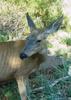
Skull Mesa was probably the most fun due to the challenging route finding. I probably wouldn't have been able to figure it out without the GPS track. That said, there were cairns, but they weren't spaced closely enough to be able to walk from cairn to cairn. I think that cows might have grazed this area in the past, because there seemed to be an abundance of faint trails. I would follow one for twenty yards or so and then check my watch to see that I was off route. With the aid of my watch, I'd get myself back on route, sometimes finding a cairn along the way. I'd proceed a ways further along a likely looking path (or sometimes just wandering across the desert along no path), get off route, get back on route, etc, etc.
After a while of doing this, I found myself on a hillside wondering if the trail followed the contour that I was on - which sort of looked like a trail - or headed downhill or even back uphill. I consulted the map on my phone and found that it went downhill. When I got to the bottom, I located a well trodden trail and wondered how I ever missed it. That said, the trail wasn't visible from where I had been on the hill.
The Skull Mesa Trail started heading steeply downhill w/ switchbacks. Route finding got easier here, but the footing was less certain. I used both hiking poles to make it down some sections. The views were absolutely stunning here.
When I got to the Cottonwood Trail, I expected the going to be easy due to that section now being part of the Maricopa Trail. Shortly after leaving the intersection with the Skull Mesa Trail, the Cottonwood Trail entered Cottonwood Creek. The trail is routed to repeatedly cross the creek, going in a fairly direct fashion through islands of brush and trees. It's somewhat overgrown in this area, which means some amount of bushwhacking if you actually intend to follow the trail. I did two bushwhacking sessions between creek crossings before deciding to just walk in wide open dry creek bed. This was somewhat longer, but was a lot easier and quicker too. I suspect that it added somewhat to the overall distance that I hiked that day.
The Cottonwood Trail left Cottonwood Creek and went over a ridge. Soon thereafter, it crossed Bronco Creek and, shortly thereafter, I came to the intersection with the Bronco Trail. I continued on Cottonwood #247, walking in Bronco Creek for a while. The trail then headed up high the right (east) bank for a good while. I got slightly confused at the point where it turned to go up the bank because there was another path which continued onward for a short way lower along the bank. But, once I got up high on the bank, #247 was easy to follow.
It eventually headed back downhill and dumped me into Bronco Creek. Once in the creek, I checked the track on my GPS watch and saw that I (somehow) should have been high on the left (west) bank at this point. There didn't seem to be any obvious way to achieve this from where I was, however, since the bank was very steep and also densely vegetated. In retrospect, I should have probably backtracked south along the creek to figure out where the trail crossed over, but I didn't... Instead, I continued northward in Bronco Creek, keeping an eye on the diverging track that my watch showed. Shortly before reaching the Cartwright Ranch boundary, I noticed a faint trail heading up out of the creek; better still, there was a 247 trail marker! I headed up the faint trail and, after some amount of bushwhacking, encountered a much better trail, which I took to be the newer and rerouted 247 trail that I should have been on. This diversion undoubtedly added a bit more distance to my route.
At this point, it was fairly straightforward to get back to #4, and from there back to the trailhead. I did mess up slightly after getting back on #4, probably due to fatigue.
I really enjoyed this hike; winter seems like a good time to do it. I brought two 3L water reservoirs with me and drank about 4L of the 6L that I brought. The only water that I saw (that could be filtered) was in Cave Creek. There were a few spots in Cottonwood Creek which were damp. It may be that digging a short ways would have yielded water. |
| _____________________
| | |
|
|
|
 Route Editor


 Tank back. Easier yet, still adds some AEG. Didn't see a single hiker the entire time.


 There are some nice views: Mazzie, Catherine, Sheep, Saddle, 4pks etc. Temps and weather were perfect - we had a great day. Only saw a tiny tarantula, a couple of rabbits and no hikers - I guess they were all on TR 4.