username
X
password
register
for free!
help
ArticlesGuidesRoutes
 
Photosets
 
 Comments
triplogs   photosets   labels comments more
West Rim Trail - Zion - 12 members in 24 triplogs have rated this an average 4.5 ( 1 to 5 best )
1, 2  Next
24 triplogs
login for filter options
Jun 06 2025
avatar

 Guides 41
 Routes 1,626
 Photos 14,983
 Triplogs 2,760

69 male
 Joined Jan 20 2009
 Far NE Phoenix,
Zion Day 3, UT 
Zion Day 3, UT
 
Hiking avatar Jun 06 2025
The_EagleTriplogs 2,760
Hiking8.74 Miles 1,829 AEG
Hiking8.74 Miles   3 Hrs   49 Mns   2.47 mph
1,829 ft AEG      17 Mns Break4 LBS Pack
 
1st trip
Linked   linked  
Partners none no partners
Route Scout Route Recorded  on Route Scout | Pop | Map | Popup | MapDEX
Day 3 in Zion

Once again, I did not get selected for an Angels Landing permit. Although that cut into my beer-drinking funds, I wasn’t too upset. I reverted to Plan B.

West Rim Trail to Scout Lookout Plus
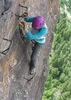
This hike includes everything from the Angels Landing hike—except the last 300 feet of elevation gain, the chains, and the conga line of people. After finishing Walter’s Wiggles, I headed over to plead with the two rangers checking permits. I whined and cried about not being picked for two days and asked if I could just head up. They’d heard all the stories before and wished me a good day—somewhere else.

I later learned from others on the bus that there are two alternate ways to get in:

Go in the late afternoon, after 2:30 PM. Sometimes the rangers are gone by then.

Talk to people on the way up and see if they have any openings on their permits. If they do, you can check in with them and go up together.

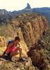
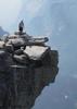
Anyway, a suggestion from our BnB host was to just continue up the West Rim Trail. You get higher than Angels Landing, avoid most of the crowds, and enjoy just as good views—just without the bragging rights. I was very happy with this choice and would recommend it to others.
[ youtube video ]

This was supposed to be our last hike in Zion before heading over to the North Rim for a few days. But after checking my email and voicemails, I found out that storms on Sunday, June 1st, had blown out a transformer. The North Rim was without power and had no estimated repair time, so our reservations were canceled. Oh, joy.

Luckily, we were able to extend our stay at our BnB by a day. This is the same BnB that wasn’t our first choice—our original hotel canceled us three weeks ago because construction wasn’t finished. I’d highly recommend the BnB we stayed at (The Harvest House, between stops 3 and 4 on the Springdale line). Adults-only, clean and quiet rooms, and a great breakfast.

Taylor Creek Trail
Next, we headed out of the main part of the park and made the 45-minute drive to the far northwest section to check in with the ranger station there. We were in sampling mode now, trying to see as much as we could while we were still around.

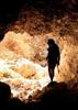
The Taylor Creek Trail (out and back) is about 6 miles. I chose to just go out to the first cabin (Larson), which made it a short 2-mile round trip. The scenery improved the farther in we went, so I’d like to return and do the full route, including the second cabin and the alcove/cave at the end, reportedly 15 degrees cooler.

Kolob Viewpoint
We hopped back on E. Kolob Canyon Road and drove it to the top/end. We didn’t hike but took in the incredible views. This parking area is also the start of the Timber Creek Overlook Trail—one for another trip.
[ youtube video ]

Lava Point Overlook
Back out of the park and headed toward Springdale. Near the town of Virgin, we turned onto North Kolob Terrace Road. It was 91°F when we started and 65°F when we reached our first stop 22 miles later. Once again: stunning views, made even better by thunder boomers to the north. No hiking here, just oohs and aahs.

Kolob Reservoir
A hop, skip, and a jump from Lava Point, we briefly checked out Kolob Reservoir.

Then it was back to town to suck down some suds and take in a calzone at Zion Pizza & Noodle.
wildflower observationwildflower observationwildflower observationwildflower observationwildflower observation
Wildflowers Observation Isolated
_____________________
There is a very fine line between "hobby" and "mental illness."
Dave Barry 🦅
  2 archives
Mar 31 2024
avatar

 Guides 33
 Routes 286
 Photos 445
 Triplogs 251

35 male
 Joined Oct 23 2017
 Tempe
West Rim Trail, UT 
West Rim Trail, UT
 
Hiking avatar Mar 31 2024
KingLeonidasTriplogs 251
Hiking6.57 Miles 1,767 AEG
Hiking6.57 Miles   3 Hrs   56 Mns   1.99 mph
1,767 ft AEG      38 Mns Break6 LBS Pack
 
1st trip
Linked   linked  
Partners none no partners
Route Scout Route Recorded  on Route Scout | Pop | Map | Popup | MapDEX
West Rim Trail: Better and Beyond Angel's Landing
Angels Landing may be one of the most popular attractions in the park, but it is only a short spur trail off the much longer and more impressive West Rim Trail. The West Rim Trail goes from upper Zion Canyon all the way to Lava Point in the Kolob Canyon Area (a 16-mile hike one-way). Day hiking the lower portion is as good if not better than Angel's Landing itself and does not require you to win the permit lottery to hike.

Logistics/Getting There:
The West Rim Trail goes from upper Zion Canyon all the way to Lava Point in the Kolob Canyon Area. Doing the whole length involves either an arduous day hike or backpacking, arranging a shuttle, and getting a wilderness permit. If you are starting from the bottom, take the shuttle to the grotto (shuttle stop #6), cross the river, and the hike starts from there. From the top, you would start from Lava Point and hike down into Zion from there (exiting via the shuttle). Note: Lava point is often closed in the winter due to snow, this was the case for us and limited us to the bottom-up day hike.

Trailhead:
The Grotto Trailhead offers restrooms and water filling stations.

Navigation:
The West Rim Trail is a well-defined but strenuous route. From the Grotto shuttle stop #6, cross the Virgin River and follow the trail towards Scout Lookout/Angels Landing. After Refrigerator Canyon and Walters Wiggles, you will arrive at Scout Lookout. This is where the Angel's Landing spur trail is, turning left will keep you on the West Rim trail.

Weather:
Zion National Park experiences hot summers and cool winters. Spring (March-May) and fall (September-November) are ideal times for the West Rim Trail, offering comfortable hiking temperatures. Summer heat can be brutal on this exposed trail, so start very early and bring plenty of water. Be aware of potential flash flood dangers during monsoon season and anytime there is significant precipitation. We actually had a winter storm roll in when we hiked it in Late March/Early April which forced us to turn back before reaching Cabin Spring (our intended destination) but snow this late in the year is rare.

Trail Conditions:
What starts as a paved trail begins its ascent through a series of switchbacks, offering stunning views of the canyon below. After scout lookout the trail is mostly rock including some slickrock (although most the stone is more grippy sandstone). With the few inches on snow on the ground we had, even the sandstone was slippery. This portion of the trail is very steep and has lots of switchbacks. After Cabin Spring the elevation gain moderates, and the terrain becomes a forested plateau. None of the trail is technical but trekking poles will help with the snow if you didn't bring crampons.

General Comments and Musings:
We were intending to get Angel's Landing Permits and applied to the daily lottery 3 days in a row in our attempts to do the hike. Unfortunately, we struck out each time and instead resolved to do the West Rim trail instead. This turned out to be a blessing in disguise. The West Rim trail encompasses the majority of the Angel's Landing hike (only the last spur is permit only) and continues to ascend to further viewpoints that are overlooking and more impressive than Angel's Landing. Despite this, the vast majority of people on the trail stop and Angel's Landing and do not venture further, missing out on the best part of the hike! We intended to go all the way to Cabin Spring, but the winter storm was dropping significant volumes of snow to the point that trekking poles alone were no longer cutting. Crampons, which we did not have, were in order. Even sandstone will eventually become slickrock if you put enough snow and ice on it. Deciding that discretion was the better part of valor, we turned back at that point. The descent was phenomenal with the snow and sun occasionally peeking through the clouds providing incredible views. We stopped frequently on the descent to take photos. I can see the appeal of the full 16-mile top down thru hike. This was a beautiful hike and a real gem of Zion.

water 1 out of 5water 2 out of 5water 3 out of 5water less than max Refrigerator Canyon Medium flow Medium flow
Waterfall was energetic
_____________________
 
May 01 2022
avatar

 Guides 12
 Routes 192
 Photos 863
 Triplogs 356

42 male
 Joined Nov 30 2015
 Phoenix, AZ
Lee Pass to Zion Canyon, UT 
Lee Pass to Zion Canyon, UT
 
Run/Jog avatar May 01 2022
ShatteredArmTriplogs 356
Run/Jog40.21 Miles 5,027 AEG
Run/Jog40.21 Miles   10 Hrs   28 Mns   4.33 mph
5,027 ft AEG   1 Hour   11 Mns Break
 
no photosets
1st trip
The Zion traverse has become one of the hot things to do in the ultrarunning world, right up there with R2R2R. I'm usually not into that type of stuff, but some friends were going, so why not? Then the rock slide happened, closing the East Rim trail and shortening the route to 40 miles, which I was perfectly OK with.

Started at first light down La Verkin Creek trail, and it was quite chilly after dropping in. Big inversion. Once the sun came up, it was nice. A group of three guys from Colorado passed us just before the Kolob Arch trail; the internet sleuth in our group later found that they missed the Hop Valley turn and, as a result, failed to beat us. We did the little side trip up to the arch, which was nice.

Hop Valley trail was pretty, but there was way too much sand. This was the most difficult part of the whole trip. After leaving the valley it got much better, and we got to the Hop Valley trailhead in like 4+ hours. I didn't think we needed to worry too much about daylight, but if the rest of the way turned out to be that slow, we might. Also ran into another group from Colorado doing the same route, except they skipped Kolob Arch, and passed us while we were up there. They left from the TH 10-15 minutes before us.

Once on the Connector Trail, things got much better. Views started opening up as well. Maybe 3 miles in we caught up with the other group, my competitive instinct kicked in, and I picked up the pace so that we wouldn't see-saw with them over and over. But they kept pace for the 4 miles or so to Wildcat Spring, which I'm pretty sure they regretted, as they were looking a lot more rough. They mentioned that one of their guys ran a 50k last week, so later in the conversation someone made sure to mention that one of the ladies in our group ran a 100k last week. I know it's not a competition or anything, but I do feel it's important that we represent the State of Arizona well.

When we hit West Rim trail with ~16 miles to go, I was actually feeling pretty good, which these days is pretty rare that far into a run. I got in a zone and decided to hammer it a little, and got out ahead of the group a little. I last saw them in the distance with about 10 miles to go. It had gotten really windy by this point, but the scenery was really outstanding those last 10 miles. Once I was about 4 miles from the end, I started running into the tourists. Angel's Landing didn't look super crowded with the new permit system, but there were plenty of obstacles below the junction.

Great day out there, and actually really enjoyed this route.

water 1 out of 5water 2 out of 5water 3 out of 5water less than max Beatty Spring Gallon per minute Gallon per minute
_____________________
 
May 04 2018
avatar

 Guides 13
 Routes 38
 Photos 1,651
 Triplogs 577

60 male
 Joined Nov 15 2005
 Jackson, CA
West Rim Trail - ZionSouthwest, UT
Southwest, UT
Hiking avatar May 04 2018
toddakTriplogs 577
Hiking27.00 Miles 3,500 AEG
Hiking27.00 Miles   11 Hrs   30 Mns   2.35 mph
3,500 ft AEG
 no routes
1st trip
Linked   linked  
Partners none no partners
Inspired by carriejane's recent monster Zion traverse, I wanted to do something similar, with all the best scenery but none of the running. A West Rim / East Rim traverse, Lava Point to the East entrance, was the ticket.

The Lava Point campground wasn't open yet and the last mile of the road down to the West Rim trailhead was gated shut, but it was still possible to walk through the campground to access Barney's shortcut trail to the trailhead. Easy forest walking to start, down and back up thru Potato Hollow, then huge views along the Rim route (west side of the split). Increasing crowds down into the main canyon and a short road walk, but much less traffic on the East Rim trail, a bit less scenic but still very pleasant. Excellent day.

Didn't check any of the springs and didn't see any water other than in the main canyon.
_____________________
 
Aug 14 2016
avatar

 Guides 73
 Routes 176
 Photos 10,174
 Triplogs 2,324

46 male
 Joined Sep 08 2006
 
West Rim- Telephone Canyon Trail LoopSouthwest, UT
Southwest, UT
Hiking avatar Aug 14 2016
JimTriplogs 2,324
Hiking16.50 Miles 4,100 AEG
Hiking16.50 Miles   9 Hrs      1.83 mph
4,100 ft AEG10 LBS Pack
 
Linked   linked  
Partners none no partners
Did a loop from the Grotto TH up the West Rim, and took the long way around to the west side, and then came back on the Telephone Pole Canyon Trail. Views are better on the West Rim section. Down the West Rim, up and back on Angels Landing, and then a steak diner at the Zion NP Park Lodge, followed by Key Lime Pie.

Didn't see anyone at the lodge training for their next sanction. Then again the Eiger Sanction was 40+ years ago, and ownership seems to have passed from George Kennedy to some new entity, I don't know, the National Park Service, or something. I guess they're OK.

Miles are added up from sections I found online, combination SP and NPS, and a HAZ route that checks out, and elevation is a best guess and based on a trimmed route. It may be off, but I am unsure as there is a lot of up and down. I added in a bit since you continue to gain some elevation on the plateau.

Excellent hike, a solid day hike for those looking to have views and escape the valley crowds. I'll try to do a description soon. Ironically, this is another example of a place where a fire opened up the views and improved things!
 Geology
 Geology [ checklist ]
[ checklist ]  Navajo Sandstone
_____________________
🍭
  4 archives
Jun 12 2016
avatar

 Guides 26
 Routes 21
 Photos 562
 Triplogs 1,393

female
 Joined Jan 04 2011
 Las Vegas, NV
Behunin CanyonSouthwest, UT
Southwest, UT
Canyoneering avatar Jun 12 2016
autumnstarsTriplogs 1,393
Canyoneering8.10 Miles 2,000 AEG
Canyoneering8.10 Miles
2,000 ft AEG
Intermediate Canyoneering - Difficult or dangerous; Tech Climb; rope reqd; descent anchor; exit technical;
A - Dry or little water; shallow or avoidable water; no wet/dry suit
III - Normally requires most of a day
 no routes
1st trip
Partners none no partners
This was a great one!

We caught the first shuttle of the day, exiting at the Grotto stop, like most folks on the bus. They were all headed to Angel's Landing, while we had a bigger adventure on our plates. Shouldering our packs and heading up the trail, it was a constant stream of questions. Some people wanted to know more, while others seemed downright terrified when we described what we would be doing.

Fun canyon with plenty of nice rappels. The rappels were varied, as was the canyon itself, making for a good day out there. Great, amazing views of the main Zion canyon from the last and 2nd to last rappels.

Much of the hike up we were in full shade, thanks to the early start :D Really, the weather all day was pretty delightful for mid-June. So far as we were on trail, the path is in good shape up to Scout's Lookout.
wildflower observationwildflower observationwildflower observationwildflower observationwildflower observation
Wildflowers Observation Isolated
_____________________
"Let it ride / Let it roll / Let it go"
 
May 25 2016
avatar

 Guides 1
 Routes 105
 Photos 1,740
 Triplogs 228

33 male
 Joined Feb 26 2015
 Gilbert AZ
West Rim Trail - ZionSouthwest, UT
Southwest, UT
Hiking avatar May 25 2016
DallinWTriplogs 228
Hiking10.12 Miles 3,819 AEG
Hiking10.12 Miles
3,819 ft AEG
 no routes
1st trip
Linked   linked  
Partners none no partners
Stopped at Zion with my buddy Alex on the way back to AZ.

We hit the park around 7:00 AM in order to avoid the worst of the traffic jams on Angel's Landing. I wanted to catch the first bus out of the visitors center at 6:00 AM but I kept hitting snooze on my alarm. Going up we encountered a couple of groups coming back down, but it was mostly smooth sailing up to the top. About half a dozen other people on top when we finished the climb, coming back down we encountered a lot of traffic jams. Even with the massive amounts of traffic this hike receives I feel it's totally worth it. The views are incredible and the scrambling adds an extra element of fun to the hike.

I thought the "sketchiness" of Angel's Landing is overrated. The chains felt unnecessary and I never really used them. On the way back down I did most of it with my hands in my pockets. I actually have a fear of heights and climbing, but it wasn't an issue for me, yet most other hikers were holding on to the chains for dear life. :roll: If it was wet or icy, I can see the need for the chains.

Next we headed further up the canyon along the West Rim trail to Cabin Spring. I like this area a lot. My first ever backpacking trip was from Lava Point to the canyon floor along the West Rim trail and the scenery blew me away when I wasn't focused on how thirsty I was because I hadn't brought enough water. :) It's still just as stunning. The white slick rock and pines could fool some (when looking at a photograph) in to thinking they are looking at Yosemite. Very peaceful back there.
_____________________
 
Jun 06 2015
avatar

 Triplogs 348

32 male
 Joined Oct 13 2012
 Tucson, AZ
West Rim Trail - ZionSouthwest, UT
Southwest, UT
Hiking avatar Jun 06 2015
iborregoTriplogs 348
Hiking15.00 Miles 500 AEG
Hiking15.00 Miles
500 ft AEG
 no routesno photosets
Linked   none no linked trail guides
Partners none no partners
_____________________
  1 archive
Jun 03 2015
avatar

 Photos 377
 Triplogs 579

female
 Joined Jun 19 2009
 AZ
Right Fork of North Creek Canyon, UT 
Right Fork of North Creek Canyon, UT
 
Canyoneering avatar Jun 03 2015
oceanwithinTriplogs 579
Canyoneering15.80 Miles
Canyoneering15.80 Miles2 Days         
32 LBS Pack
Intermediate Canyoneering - Difficult or dangerous; Tech Climb; rope reqd; descent anchor; exit technical;
B - Up to light current; wading/swimming; possible wet/dry suit
V - Average one and a half days
 no routesno photosets
1st trip
Linked   linked  
Partners none no partners
You know it's been a good adventure when the skin on your hands is so sanded off that afterwards, your iPhone no longer recognizes your thumbprint!

This 2-day canyon was the grand finale of our CO-UT road trip. We did the Hammerhead/Direct approach, which added more rappels and a long, deep, cold section of water-filled narrows. The first day was full of hiking and several drops before we reached the direct route, which takes you through a seemingly endless string of frigid potholes. At first they are super fun and warm, like splashing through bathtubs, but then they get deeper, colder and a bit more difficult. Although this section was pretty amazing, we were all happy when the walls began opening up a bit again.

Soon after, we were upon the obstacle known as the "black pool", a very long swim through a dark and narrow sculpted corridor. Simply beautiful, but pretty cold and tiring even with 2 layers of wetsuits on. More hiking and rappels afterwards... nearing almost 11 hours of non-stop action, we were all running on empty but kept pushing on. Shortly after encountering a serene spotted owl who didn't seem to mind us passing by, we finally arrived at the aptly-named Grand Alcove, our campsite for the night. The views here were out of this world, as we were perched above a long hallway of hanging gardens and pristine pools. I fell asleep staring up at the only slice of stars I could see from below the canyon walls, feeling very satisfied, alive and humbled to be in such a place with some of my favorite people.

Day 2, no rest for the weary. Several rappels and a few incredible waterfalls later, we were back on something that sometimes resemble a trail. After several hours and a hot climb out of the canyon, we were at the cars celebrating the success of another amazing adventure.

This was a remarkable journey indeed, incredibly demanding but also superbly rewarding. The area between the Grand Alcove and Double Falls was one of the most beautiful I have ever seen... it just kept getting better and better. We were all a bit worse for wear when we finally climbed out to the cars as pants were shredded, packs ripped, and camelback bladders broken. A seldom traveled area in Zion National Park, Right Fork of North Creek was a trip I'll never forget!
_____________________
  1 archive
Jun 23 2014
avatar

 Guides 26
 Routes 21
 Photos 562
 Triplogs 1,393

female
 Joined Jan 04 2011
 Las Vegas, NV
West Rim Trail - ZionSouthwest, UT
Southwest, UT
Hiking avatar Jun 23 2014
autumnstarsTriplogs 1,393
Hiking8.98 Miles 3,256 AEG
Hiking8.98 Miles
3,256 ft AEG
 no routesno photosets
1st trip
Linked   none no linked trail guides
Partners none no partners
Wanted to get some hiking in after picking up the permit for the next day's Narrows backpacking trip. The Observation Point Trail is closed during the weekdays right now for a trail crew, so I decided to see what the crowds were like at Angel's Landing on a June Monday. The answer was mobbed. And far too few people carrying any water at all, let alone enough for 102-degree weather [-X

By Scout's Lookout, I just had to get away from the crowds, so turned off and continued along the West Rim Trail. This proved to be a great choice, as the only other people until arriving back at Scout's Lookout were 4 backpackers headed down.

It has been something like 15 years since I last hiked the West Rim Trail. At that time it was my first backpacking trip ever, so it was interesting to see how my memory of the trail matched with the reality. The overall impression from this segment of trail was right on - slickrock and stunning views. A lot of the details were pretty far off, though. I had completely forgotten how much of the trail is paved between slickrock sections, the wonderful switchbacks cut into the side of a cliff, and lots of others details about how the trail looks and what it passes. So, it was somewhat like hiking on a completely new-to-me trail :D

Hiked up to the rim, a side trip to check out the spring, and decided I should head back. Was meeting up with the rest of my Narrows group at the campground, and wanted to spend some time hanging out with them.
wildflower observationwildflower observationwildflower observationwildflower observationwildflower observation
Wildflowers Observation Isolated
Still some penstemon flowering and even a few lilies up high. Everything else is done and dry.

water 1 out of 5water less than maxwater less than maxwater less than max Cabin Spring Dripping Dripping
Although the spring wasn't flowing much, hikers have created a small pool to filter out of, and this was full. Water full of algae - make sure to purify.

_____________________
"Let it ride / Let it roll / Let it go"
 
Mar 15 2014
avatar

 Triplogs 348

32 male
 Joined Oct 13 2012
 Tucson, AZ
West Rim Trail - ZionSouthwest, UT
Southwest, UT
Hiking avatar Mar 15 2014
iborregoTriplogs 348
Hiking10.00 Miles 2,500 AEG
Hiking10.00 Miles   3 Hrs      3.33 mph
2,500 ft AEG
 no routesno photosets
Linked   none no linked trail guides
Partners none no partners
_____________________
 
Apr 26 2013
avatar

 Guides 6
 Routes 183
 Photos 5,612
 Triplogs 1,647

male
 Joined Mar 12 2004
 Scottsdale, AZ
Zion West Rim with Angels Landing, UT 
Zion West Rim with Angels Landing, UT
 
Hiking avatar Apr 26 2013
John9LTriplogs 1,647
Hiking13.30 Miles 4,200 AEG
Hiking13.30 Miles
4,200 ft AEG
 
1st trip
Partners partners
zukerrach
Rachel and I went up to Zion for the weekend and hit the trails hard! We started on Friday morning with no set itinerary. While on the bus we decided to start with one of the park's premier hikes Angels Landing. This will be my second summit. My first one was done with Hernia back in Oct 2011. It wasn't very fun and I had surgery soon after. Anyway this time was a lot more fun! The climb to the summit is a joy. I rarely used the chains and was able to avoid a lot of the casual hikers who were taking their time being extra careful. Most people were happy to let me pass as they caught their breath. We reached the summit and had a snack and discussed our options.

Decided on the West Rim Trail which starts right at Scouts Landing. We started the hike up and headed deeper into the park. The going is along a very well kept trail. In fact it's pretty much paved most of the way. You steadily gain elevation and the grade steepens as you hit some switchbacks that wind up to the rim. Both of us were short of breath on this. I checked and the elevation was right around 5,500. After more work we reached the rim where things leveled off. We made our way over to the spring and enjoyed a long lunch at an overlook and watched the Swallows whip by with a mixture of Ravens, Vultures and a Red Tail.

After our lunch we cruised back down to the valley floor. Along the way we had a nice conversation with a guy from southern Az. We would cross paths again the next day. Anyway we arrived back at the valley floor and followed the Virgin River south to the Zion Lodge. While there we relaxed and ate some food and consumed some much needed caffeine. Afterward we made a casual stroll over to the Emerald Pools. The pools are very soothing and beautiful. There were a pair rappelling down the Upper Pool but we didn't stick around to watch. We returned to the lodge and picked up the bus and headed for the Parus Trail.
_____________________
 
Apr 26 2013
avatar

 Guides 1
 Routes 54
 Photos 843
 Triplogs 189

37 female
 Joined Jan 21 2013
 Delafield, WI
Zion West Rim with Angels Landing, UT 
Zion West Rim with Angels Landing, UT
 
Hiking avatar Apr 26 2013
zukerrachTriplogs 189
Hiking13.30 Miles 4,200 AEG
Hiking13.30 Miles
4,200 ft AEG
 no routes
1st trip
Partners partners
John9L
Our first day in Zion, John and I planned to start out by heading up to Observation Point. Instead, we changed our minds at the last minute and decided to do Angel's Landing to try to avoid the weekend crowds the next day. The switchbacks leading up to Scout's Lookout were steep but manageable, and it felt great to stretch our legs after the long car ride and a good night's rest! Once we reached Scout's Landing (and a second "no seriously, this hike is sorta dangerous.. please try not to die" sign), John took off ahead up Angel's Landing while I took my time (and many pictures)! There was a happy little tree at the top, and lots of cairns! :D

After a quick snack, we decided to see where the West Rim Trail would lead us... I believe I recall John saying that it would be an easy, relatively flat trail. Pshyeah. While no part of the trail was exceptionally steep, we did gain quite a bit of elevation, and started feeling pretty winded (perhaps due to the high altitude?) near the top. Despite my false expectations, I still really loved this trail. The geology was unlike anything I'd seen before, and the time flew by. There were lots of plants growing out of solid rock, stupid lizards that reeeeally wanted to be stepped on, and John even found some snow!

The way back down was a breeze, and we headed over to the lodge for some (delicious) food before visiting the Emerald Pools. Which were... pools. No; they were pretty cool.. there were just way too many people there for me to really enjoy the area. I'm guessing it's because the name sounds so inviting. They should be called something like "the dentist's office" instead-- I guarantee that would keep people away.
 Fauna
 Fauna [ checklist ]
[ checklist ]  Cliff Chipmunk
_____________________
 
Apr 13 2013
avatar

 Photos 99
 Triplogs 872

male
 Joined Mar 18 2012
 Goodyear, AZ
West Rim Trail - ZionSouthwest, UT
Southwest, UT
Hiking avatar Apr 13 2013
MikeSTriplogs 872
Hiking16.50 Miles 2,200 AEG
Hiking16.50 Miles   5 Hrs   5 Mns   3.25 mph
2,200 ft AEG15 LBS Pack
 no routesno photosets
1st trip
Linked   none no linked trail guides
Partners none no partners
Started a mile from the Lava Point trailhead and hiked to the bottom of Zion's canyon on a one way hike. Incredible views.
_____________________
Subscribe to my adventure videos at: [ youtube video ]

Follow my adventures on Instagram at: adventures_az
 
Nov 27 2011
avatar

 Guides 13
 Triplogs 205

38 female
 Joined Jan 29 2009
 Murray, UT
West Rim Trail - ZionSouthwest, UT
Southwest, UT
Hiking avatar Nov 27 2011
SparkyJackieTriplogs 205
Hiking7.00 Miles 3,200 AEG
Hiking7.00 Miles   3 Hrs   12 Mns   2.19 mph
3,200 ft AEG
 no routesno photosets
1st trip
Linked   none no linked trail guides
Partners none no partners
_____________________
 
Jul 16 2011
avatar

 Guides 3
 Routes 4
 Photos 8,687
 Triplogs 931

46 male
 Joined Mar 28 2005
 Gilbert, AZ
Imlay CanyonSouthwest, UT
Southwest, UT
Canyoneering avatar Jul 16 2011
VapormanTriplogs 931
Canyoneering10.00 Miles 300 AEG
Canyoneering10.00 Miles2 Days         
300 ft AEG
Advanced Canyoneering - Mix of exposed/aid/complex rope/poor anchor/problem-solving
B - Up to light current; wading/swimming; possible wet/dry suit
Risky - Extraordinary risk factors exist; solid skills/judgement reqd; no beginners
V - Average one and a half days
 no routes
1st trip
Partners partners
suzaz
So sweet to finally do one of the BIG canyons of Zion! :y: We elected to do the full overnight canyon via the West Rim TH, so most of our hike was downhill thankfully. Loads and loads and loads of rappels like 30+, not to mention all the down climbing, and plowing thru thick log stew. :sweat: The water levels were full so thankfully we were able to swim right over the nasty keepers. Save those for another trip. :) This is by far the most amazingly beaUTiful & challenging canyons I've yet to do... ;)

Unfortunately things took a turn for the worst when this trip turned seriously EPIC requiring two SAR rescues. :stretch: Thankfully only busted right ankles were sustained when things could have been much, much worse! :cry:
http://home.nps.gov/applications/digest ... =incidents
 Culture
 Culture [ checklist ]
[ checklist ]  Search and Rescue
 Named place
 Named place [ checklist ]
[ checklist ]  Imlay Canyon
_____________________
Yea, canyoneering is an extreme sport... EXTREMELY dramatic!!! =p
 
May 06 2011
avatar

 Guides 3
 Routes 4
 Photos 8,687
 Triplogs 931

46 male
 Joined Mar 28 2005
 Gilbert, AZ
Behunin CanyonSouthwest, UT
Southwest, UT
Canyoneering avatar May 06 2011
VapormanTriplogs 931
Canyoneering8.00 Miles 2,000 AEG
Canyoneering8.00 Miles
2,000 ft AEG
Intermediate Canyoneering - Difficult or dangerous; Tech Climb; rope reqd; descent anchor; exit technical;
A - Dry or little water; shallow or avoidable water; no wet/dry suit
III - Normally requires most of a day
 no routes
Partners partners
azrocketchick
nonot
SparkyJackie
Such a beaUTiful canyon and still one of my favorites in Zion! :y: One the hike up, we took a sweet sidetrip up Angels Landing before pushing up the West Rim trail to Behunin Pass. :sweat: The upper canyon has the usual amount of sand, bushwhacking, and pool bypassing before reaching the initial 4-stage rappel sequence. So amazing to do these scenic drops one after another down the side of the 300ft angled cliff! :D Once at the bottom, it was a sandy walk until hitting a short rappel followed by much more sand and some pools to practice our stemming on. Another short rappel bypassing a deep pool puts us into the main canyon proper before heading towards the lower narrows and final rappel sequence. It starts with a double short drop rappel into some waist-high pools, traverse around the corner for a 3-drop 150ft rappel with an ever tricky rope pull, and then ends with a flipping amazing 160ft mostly free hanging scenic rappel. :y: Took another sidetrip to check out the 300ft falls of Heaps canyon. I definitely would not mind doing this canyon at least once a year. :GB:
 Culture
 Culture [ checklist ]
[ checklist ]  Throwing a Wendy
_____________________
Yea, canyoneering is an extreme sport... EXTREMELY dramatic!!! =p
  1 archive
Sep 04 2010
avatar

 Photos 128
 Triplogs 312

39 female
 Joined Feb 01 2007
 Phoenix, AZ
West Rim Trail - ZionSouthwest, UT
Southwest, UT
Hiking avatar Sep 04 2010
lb4449Triplogs 312
Hiking14.00 Miles 3,200 AEG
Hiking14.00 Miles
3,200 ft AEG
 no routesno photosets
1st trip
Linked   none no linked trail guides
Partners none no partners
_____________________
 
Jul 24 2010
avatar

 Guides 3
 Routes 4
 Photos 8,687
 Triplogs 931

46 male
 Joined Mar 28 2005
 Gilbert, AZ
Telephone CanyonSouthwest, UT
Southwest, UT
Canyoneering avatar Jul 24 2010
VapormanTriplogs 931
Canyoneering8.00 Miles 3,000 AEG
Canyoneering8.00 Miles   7 Hrs   45 Mns   1.03 mph
3,000 ft AEG
Intermediate Canyoneering - Difficult or dangerous; Tech Climb; rope reqd; descent anchor; exit technical;
A - Dry or little water; shallow or avoidable water; no wet/dry suit
III - Normally requires most of a day
 no routes
1st trip
Linked   linked  
Partners partners
alpineclimber
nonot
The first day of 4 amazing days playing in Zion! :y: We hiked up the West Rim trail past Angels Landing, past Behunin Pass, up on the West Rim and then north to drop into this upper Telephone Canyon. :sweat: This canyon was mostly dry & kinna warm this time of year, has great down canyon views of Zion canyon in the distance, and featured a dozen or so interesting rappels. :sweat: The canyon starts off with a 30ft slanting rappel/down climb to a tree rigged for a mostly free hanging 100ft drop. After a quick snake thru some narrows, you hit a 50ft drop and another 30ft drop from bolts. The next couple rappels come soon afterwards and are slanting angled rappels which are quite awkward to descend. :roll: This is followed by a normal 70ft vertical half free hanging rappel into a half-grotto that made a great place for a lunch break before down climbing some slickrock. After a short walk, we hit the next section with a handful of short rappels in the 15-40ft range. Most of these had awkward starts from chockstones and dropped you further into the light narrows before ending with a larger 60ft drop. After that final rappel the canyon snakes a bit with some light obstacles and bushwhacking, but the canyon soon opens up into Little Siberia. :D

We've canyoneered a few times together, so we've gotten pretty good at rope management and leap frogging each other on the many rappels to prevent us from getting slowed down at any of the many rappels. :sweat: We were planning on doing Behunin Canyon afterwards but a major thunderstorm rolling across the east rim in the distance crashed our party. :roll: Instead we ran down the West Rim trail, back past Angels Landing, and down the the valley floor while watching the canyons & buttes across get hammered with lightning & walls of rain. We later learn that three canyoneers got injured when Spry Canyon flashed on them. :o
 Culture
 Culture [ checklist ]
[ checklist ]  Aircraft
_____________________
Yea, canyoneering is an extreme sport... EXTREMELY dramatic!!! =p
  1 archive
May 30 2010
avatar

 Guides 3
 Routes 4
 Photos 8,687
 Triplogs 931

46 male
 Joined Mar 28 2005
 Gilbert, AZ
Behunin CanyonSouthwest, UT
Southwest, UT
Canyoneering avatar May 30 2010
VapormanTriplogs 931
Canyoneering7.50 Miles 2,300 AEG
Canyoneering7.50 Miles   10 Hrs      0.75 mph
2,300 ft AEG
Intermediate Canyoneering - Difficult or dangerous; Tech Climb; rope reqd; descent anchor; exit technical;
A - Dry or little water; shallow or avoidable water; no wet/dry suit
III - Normally requires most of a day
 no routes
Partners partners
oceanwithin
Wow, what an amazing canyon this turned out to be! :y: The 4 mile 2000ft elevation gain approach up the West Rim trail ended up being much easier than anticipated and took us 2.25 hours followed by loads of bushwhacking with light wading & scrambling until the canyon opened up and we hit the first set of rappels. While getting our gear out, a Park Ranger group snuck up on us and checked our permits. ;) Such an amazing view down canyon! :o Rappel 1 was an easy sloping 80-footer down to a tree that we used for rappel 2 that was another angled 150-footer to another tree that was used for rappel 3 that was a mostly vertical 150ft drop down the falls to a pool & ledge with some bolts that made for the 120ft vertical rappel 4. :sweat: Wow, talk about a rush doing so many big drops back-to-back-to back... We took a short break in the sandy bottom after stuffing the ropes & taking a quick trip up some nearby narrows. We continued another quarter mile down canyon and did the easy 90ft drop followed by the beginning of the sweet narrow section with some knee waders to wade or try to avoid. On rappel 6, we avoided dropping into the swimmer by scrambling up and doing the 50ft drop to the edge of the pool where we enjoyed the views of the dryfall, pool, and looking up the main fork of the canyon. :D The narrows got even sweeter when we hit the short 2-stage rappel 7, followed by a narrow traverse past a pool, a sweet view ahead that told us the final drops are very nearby :scared: , some boulders to bypass, and then we were above that 150ft rappel 8 with a sweeping view of Zion Canyon of Emerald Pools down below. :o This was the tricky rappel of the day for us. :? So I threw the rope out a bit trying to clear some ledges though I ended up getting it snagged on some some flakes but I didn't realize this until I was 30ft down from the anchors... So as I'm rappelling down, the end of the rope is pulling me away from the natural center line and it was rather difficult to pull up on it to get some slack for my brake hand. Luckily there was a ledge I could traverse on, lock off, and pull/flick the rope off of the flakes and unstick it. Though once all the way down the rope pull was futile, so I ascended 30ft back up to a ledge to get a better angle and was able to pull it down and did a short drop off of a chockstone to get back down to the ledge for the 165ft final rappel. :) After that difficult rappel, this final rappel turned out to be the sweetest of them all with most of it being free hanging while enjoying the amazing view & woohooing at the top of my lungs. :y: Once done, we stuffed the ropes, took a much needed break, boulder hopped down to middle Emerald Pools, took the short trail up to upper pools to check out the final rappel/falls of Heaps Canyon, before hiking down canyon to the Lodge for some amazing ice cream cones. :D
 Culture
 Culture [ checklist ]
[ checklist ]  Throwing a Wendy
_____________________
Yea, canyoneering is an extreme sport... EXTREMELY dramatic!!! =p
  1 archive
average hiking speed 1.8 mph
1, 2  Next

WARNING! Hiking and outdoor related sports can be dangerous. Be responsible and prepare for the trip. Study the area you are entering and plan accordingly. Dress for the current and unexpected weather changes. Take plenty of water. Never go alone. Make an itinerary with your plan(s), route(s), destination(s) and expected return time. Give your itinerary to trusted family and/or friends.

helpcommentissue

end of page marker