|
| | | |
| |
|
| Hiking | 6.70 Miles |
1,200 AEG |
| | Hiking | 6.70 Miles | 3 Hrs 13 Mns | | 2.36 mph |
| 1,200 ft AEG | 23 Mns Break | 10 LBS Pack | | |
|
|
| |
| Partners |
|
none
[ show ]
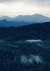
| no partners | | A little cool snap, and the wife said we could go hiking somewhere North this weekend. We Wanted a place that might have some birds, so we selected the Watson Lake.
We decided to start at the Flume and Watson Dam Trailhead, a no fee area and hike into the Watson Lake Loop and then hike out the Dam Trail. Glad we did, the Flume hike is probably the nicest part of the hike. It's short, but secluded, and we spotted a Porcupine near the flume.
Initially, I was planning on doing this hike in a clock-wise manner, but the trail was narrow at the flume area, and Mr. Porcupine was going clockwise, so we decided we would alter our plans. This turned out probably the better way to go anyhow.
I have mixed fillings in this hike, there is a little bit of everything, The flume hike goes over some rock formations, then along a streambed to the flume, after that its back over the rocks. Eventually you start hitting the common use areas, There are lots of spin-off loops along the main trail, and ALL trails are marked with white dots, so if you are trying to stay on the official route, good luck with that. You can tell this is a highly used area, and there are plenty of signs with maps on them, so you shouldn't get lost.
At the south end of the lake you will be going parallel to the freeway for a while on a road, not a real nice experience. Next, on the South-West side you will be on a "trail" that appears to be converted from an old train track. This is more like a dirt road, and seems to be popular for bikers.
Eventually you leave the road-trail and you are back at scrambling amongst the rocks, generally away from people. |
| _____________________
| | |
|
|
|
 Route Editor