|
| | | |
| |
| |
| |
| Partners |
|
none
[ show ]
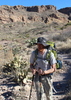
| no partners | | On 12/26/2023 – 1/1/2024, I completed the Phantom/Crystal Loop from George Steck's Grand Canyon Loop Hikes. It's a glorious loop covering a really interesting variety of terrain. Almost every mile was slower than I anticipated. Pay attention to the times Steck lists, not the distances you've measured on the map. Steck's times are stout!
12/26: down the South Kaibab to Bright Angel Campground.
12/27: Bright Angel Campground to Hippie Camp. Checked in with a ranger about the Redwall route in Upper Phantom. He reassured me that "it's a thing people do," although he didn't think anyone had been there in a while. I then set off up to Utah Flats, descended into upper Phantom, and proceeded up to Hippie Camp. The Utah Flats route is a well-marked use trail. Travel in Phantom is generally easy and pleasant, with minimal brush. There was tons of water in Phantom up to Haunted Canyon, although it petered out as I approached Hippie Camp. Found a light trickle a hundred yards below Hippie Camp.
12/28: over Shiva Saddle via the "Shiva Exit" route to just above Dragon Spring. From Hippie Camp to Shiva Saddle took me 6 hours -- almost certainly the slowest terrain I've ever encountered (maybe 3 hours per mile). There are some good cairns marking the ascent up the talus pile to the bottom of the Redwall climb, but no clear indication of where to start climbing. The climb itself is about ~100 ft of tough class 4, maybe low class 5 climbing. The rock is solid, and with careful scouting, it's possible to find a route that doesn't involve technical climbing moves. But the exposure is terrible, the route is not obvious, and it feels more like free-soloing than scrambling. I inched through with a mindset of grim concentration. There's webbing at the top, and perhaps a safer way through would be to ascend with a rope but no pack, rappel down, and retrieve your pack and reascend using the rope. The traverse ledge at the top is wide and no problem, except for the one infamous gap. I got around the gap by climbing up and around; not hard, but again the exposure is serious. The route through the Supai involves only a little climbing (just a few scrambling moves), but is loose, brushy, and very very slow. There's a good cairn indicating the top of the initial climbing; from there on, just contour over to the ascent ravine under the saddle. Descending from the saddle, there are good cairns marking the steep descent into the Dragon drainage. I camped at some potholes just above the Tapeats chockstone.
12/29: from above Dragon spring to the Tonto east of Crystal creek. First step was to get up and around the chockstone; some cairns help identify the route. The spring was gushing. The descent from there to the river is fast and easy, although it's quite a long way. From the river, the climb up to the Tonto is steep and slow, but non-technical, and the gap to aim for is obvious. I found a nice camp along a dry creek bed a little ways east of where I joined the Tonto. The Tonto offers many dry camping opportunities for the solo hiker who isn't pitching a tent.
12/30: past 94-mile canyon, back up to the Tonto. A good cairn marks the entrance to 94-mile canyon (I didn't investigate the more direct route through the Tapeats that Steck mentions). It's a steep and loose descent into the canyon, but there's no exposure. The canyon floor was an easy stroll except for one dryfall that requires one quick class 3 move. I loaded up with water at the river (8 liters) to prepare for a dry camp. The river was running like chocolate milk. Steck's instructions about reascending to the Tonto are brief, and the ascent looks worrisome from afar, but it's really no problem. Ascend from the river to the base of the Tapeats cliffs, then follow a sheep trail that is right under the cliffs; this leads quickly to the exit ravine. I saw the chimney Bob Bordasch mentions, and it looks OK, but it isn't necessary; the sheep trail is fast and easy. There's a Puebloan structure of some sort (a granary? or a residence?) in the Tapeats. Found another good site on the Tonto, and let my water sit over night with alum to clear up.
12/31: to Utah flats. Around the Tonto to Trinity. Was lucky to find a nice pothole in Trinity, where I tanked up again. This enabled another dry camp; otherwise, I was planning on returning to upper Phantom. There's a cairned deer/use trail in the cliffs above Trinity leading to the Cheops/Isis saddle. I lost it for a while, but it seemed to reappear as I approached the saddle. Maybe it continues throughout? Travel was certainly much easier on the trail than off it, so it's probably worth trying to follow.
1/1: down to Bright Angel Campground, where I saw the first people I'd seen since I left the campground five days earlier. Then turned on my "burger beacon" and rocketed up the South Kaibab. Back in time for lunch! |
| | |
|
|
|
 Route Editor