username
X
password
register
for free!
help
ArticlesGuidesRoutes
 
Photosets
 
 Comments
triplogs   photosets   labels comments more
Little Wolf Creek to Big Bug Mesa - 5 members in 14 triplogs have rated this an average 2.8 ( 1 to 5 best )
14 triplogs
login for filter options
Sep 17 2020
avatar

 Routes 5
 Photos 110
 Triplogs 10

78 female
 Joined Jul 28 2011
 Phoenix, AZ
Big Bug Mesa Rd 103 and Trail 9434, AZ 
Big Bug Mesa Rd 103 and Trail 9434, AZ
 
Hiking avatar Sep 17 2020
nancyesanTriplogs 10
Hiking9.00 Miles 370 AEG
Hiking9.00 Miles   4 Hrs   30 Mns   2.00 mph
370 ft AEG
 no routes
1st trip
Linked   linked  
Partners none no partners
We needed a new place to escape the Phoenix heat which would likely allow social distancing, so decided to drive our Jeep up Poland Rd from Poland Junction, about 4 miles north of beautiful downtown Mayer off Hwy 69. We hadn't driven Poland Rd since before the fires of 2016 and 2017 and remember it being very rough. Surprisingly, it was smooth gravel all the way through Breezy Pines to the five corners intersection where we turned a sharp left onto 103 which climbs steeply onto Big Bug Mesa, our first exploration of this area. What a shock to find 103 also freshly graded, suitable for any passenger car or camper.

Since our goal was to find a nice place to hike in the cool morning hours, we parked at a wide intersection of a side road and hiked 103 all the way to its end at a point overlooking Little Wolf Creek and surrounding area, a dramatic view even in spite of the smokey air. About half way to the point the road became rougher with exposed boulders, so a car would have to park there and start the hike, but our Jeep could have handled it easily. During our entire 9 mile hike we did not see another person, so it has a special place on our list of beautiful, pandemic avoiding places.

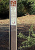
The mesa top has a healthy growth of mature pines, juniper and oak spaced far enough apart to hopefully save them from another wildfire. Most of them have blackened bark and there was very little brush between them, so apparently their fire resistance saved them. Closer to the end of the road the trees were smaller and mostly dead with a heavy growth of bushes on the slopes. We saw no sign of any trail going off the end of the point as shown on trail maps for trails 9434 and 304. We did, however see a marker for 9434 along the road leading to the point and also found an unmarked trail going east from the road and across a cattle guard through a fence, and then heading south along another fence.

Prescott NF road maps for this area show dispersed camping is allowed along 103 and other roads in the area. Areas along the road have been cleared and graded for campers to drive in. The area ranges from 7000 ft when first reaching the top after driving from the bottom, to 6700 ft at the end point. I can't think of a nicer place to escape the heat for a weekend.
 Fauna
 Fauna [ checklist ]
[ checklist ]  Wild Turkey
wildflower observationwildflower observationwildflower observationwildflower observationwildflower observation
Wildflowers Observation Moderate
Broom Snakeweed
Buckwheat sp.
Common Mullein
Scarlet Bugler
Slimleaf Plainsmustard (Pink Windmills)
Wild Chrysanthemum
Large-Flower Brickellbush
Wild Geranium
Fleabane sp. - f
Goldenrod sp.
Common Sunflower
Fendler's Ceanothus
Arizona Thistle
Slender Goldenweed - f
White Heath Aster - f
Annual Goldeneye
Western Yarrow
Toadflax Penstemon
Wright's Deervetch
Thistle sp. tbd.
Mountain Parsley
Cudweed
Canadian Horseweed
Camphorweed
Fall Tansyaster
Dandelion
_____________________
 
Jun 22 2019
avatar

 Guides 264
 Routes 2,797
 Photos 14,494
 Triplogs 5,894

55 male
 Joined Nov 20 1996
 
Little Wolf - Pine Creek - Grapevine Loop, AZ 
Little Wolf - Pine Creek - Grapevine Loop, AZ
 
Hiking avatar Jun 22 2019
joebartelsTriplogs 5,894
Hiking16.29 Miles 3,766 AEG
Hiking16.29 Miles   10 Hrs   23 Mns   1.89 mph
3,766 ft AEG   1 Hour   45 Mns Break14 LBS Pack
 
Partners partners
BiFrost
The_Eagle
Route Scout Route Recorded  on Route Scout | Pop | Map | Popup | MapDEX
Moderate drive, pines, creek, relaxing pine road walk on the mesa. Those are memories from 6 years ago. An element of nature has changed it for the balance of my lifetime.

The drive in is semi gnarly. Confident 2WD probably squeaks through. It'll rattle your noggins regardless.

Luckily Karl drove. He got us 0.8 mi further then our 2013 lasso loop. Scorched pines among other mayhem greet you to the grapeless vine vicinity. We negotiated mild brush from 0.8 mi to 1.5 mi heading up towards Coyote Springs. Karl took a slightly lower route. Which I now see as a fair game trail on satellite.

This loop was possible in late June due to rare cooler than average temps. We still slow poked and enjoyed more breaks than average. Early on it was apparent it was going to be a long day.

Little Wolf Creek Trail #304
We stumbled upon a fencing crew as mentioned in this caption. No one loves this trail but I'm glad it exists and gets enough traffic to keep it relevant.

FR 67
Cabins in the vicinity meant the fire was tackled for a stretch. The nice forested views didn't last long. We stretched the 1.9 mi road-stroll out to 50 minutes.

Back to Business Men
After an easy 0.3 mi on a narrow path Bruce called a fire break ( not, never was, wrong! ) things got real. Roughly 10 yards of the path disappeared to dense chaparral. Karl busted through while Bruce and I suited up. We took turns slaying manzanita uphill with Karl directing overhead. Next, after 0.55 miles of easy off trail it was another chaparral war
7.27 mi - 12:02pm
7.72 mi - 12:42pm
Not terrible like the 10 yards of manzanita but listen kids, it's June...lol

We forged on another mile on a good trail to the Seaton Spring vicinity for a well deserved lunch break.

Bug Up!
Getting up Bug Mesa turned out to be another slice of adventure. I fell backwards on the slope near the top. Aside from a nasty bruise on my left thigh today it was no big deal and we continued onward.

"Top" of the mesa was supposed to be a relaxing stroll. It was far better than bushwhacking. I wouldn't advertise as enjoyable.

Bug Down
The anticipated horrible part of the day just held our attention intensely. It was over quicker than figured.

Seedless, still juicy
Grapevine was a welcomed trail. There is plenty to desire. There is plenty to dissuade it from being crowded.

Synopsis
Bruce has officially written this one off. Understood. Yesterday I thought I was in that boat. Short stretches were enjoyable. Minus a fist sized bruise on my thigh, the pain has worn off. I'll probably plow through this crap again someday.
wildflower observationwildflower observationwildflower observationwildflower observationwildflower observation
Wildflowers Observation Moderate
Bluestem Prickly Poppy
_____________________
- joe
 
Jun 22 2019
avatar

 Guides 41
 Routes 1,626
 Photos 14,983
 Triplogs 2,760

69 male
 Joined Jan 20 2009
 Far NE Phoenix,
Little Wolf - Pine Creek - Grapevine Loop, AZ 
Little Wolf - Pine Creek - Grapevine Loop, AZ
 
Hiking avatar Jun 22 2019
The_EagleTriplogs 2,760
Hiking16.32 Miles 3,867 AEG
Hiking16.32 Miles   10 Hrs   24 Mns   1.81 mph
3,867 ft AEG   1 Hour   23 Mns Break
 
1st trip

Big Bug Mesa Trail 9434 seems to have taken a hit after the Big Bug Mesa fire of June 2016.
There was some trail at the beginning and some at the end towards the saddle. In between, we scrambled around the washouts. The first of many scrambles on the day.

At the saddle is where we intersected the Little Wolf Creek Trail #304. This one was in great shape because of recent fence repair and horse traffic. So recent, that we ran into the group doing repairs. We expressed our thanks and exchanged pleasantries in different languages and were on our way.

A bit of road walk over to where we went off trail last time. I remembered this section only being bad after jumping out of the wash. This is the last time for this hiker taking this "Shortcut". Manaznita push is not fun.

Great to be back on a trail again. We took the Pine Creek Trail #289, up to the dry Seaton Spring area for a well deserved lunch.

After lunch, Off Trail again, straight uphill to the NE and North through more thick stuff and rock climbing.
Joe woke up a rattler on the way up.

The walk across the mesa was a welcome one with flashbacks of flash floods, 6 years ago, hiking with Joe and Turtle.
[ photo ]

We opted to drop off the mesa to the east to get to Grapevine Springs. In hindsight, we should have continued a little further to a/the real trail.

Once on the Grapevine Springs Canyon Trail #4, It was clear sailing. Plenty of water, tons of Columbine, Ponderosa, and croaking frogs. This is the section that gets all the traffic to the area.

Thanks to Karl for driving allowing us to cut 1.6 miles off of the hike.
wildflower observationwildflower observationwildflower observationwildflower observationwildflower observation
Wildflowers Observation Light

dry Coyote Spring Dry Dry

water 1 out of 5water 2 out of 5water 3 out of 5water 4 out of 5 Grapevine Springs Gallon + per minute Gallon + per minute

dry Seaton Spring Dry Dry
_____________________
There is a very fine line between "hobby" and "mental illness."
Dave Barry 🦅
 
Jun 22 2019
avatar

 Guides 4
 Routes 491
 Photos 10,890
 Triplogs 1,257

55 male
 Joined Nov 20 2012
 Phoenix, AZ
Little Wolf - Pine Creek - Grapevine Loop, AZ 
Little Wolf - Pine Creek - Grapevine Loop, AZ
 
Hiking avatar Jun 22 2019
BiFrostTriplogs 1,257
Hiking16.32 Miles 3,867 AEG
Hiking16.32 Miles   10 Hrs   24 Mns   1.81 mph
3,867 ft AEG   1 Hour   23 Mns Break
 no routes
1st trip
Joe and Bruce had hiked this same loop in 2013 but it's changed a lot since the fire that pretty much took out 80% of the route. We had various conditions from road hike, trail, bad trail, and no trail. The no trail was particularly rough with very thick Manzanita and scrub Oak that took us awhile to negotiate. However, to counter the tough sections we took some nice breaks in the sections that survived the burn. There are some good stands of ponderosa still left especially on Big Bug Mesa and the area around Seaton Spring where we had lunch.

Near the end of the hike we dropped off Big Bug Mesa and did more off trail down to Grapevine Spring. It was steep down to the spring but not the thick brush we encountered earlier in the hike. Again some of the ponderosa forest survived above the spring and made for a decent hike. The spring had good water with decent pools along the creek. From here it was probably best trail of the day for the last 2 miles back to the vehicles.
 Flora
 Flora [ checklist ]
[ checklist ]  Yellow Columbine
 Named place
 Named place [ checklist ]
[ checklist ]  Little Wolf Creek
wildflower observationwildflower observationwildflower observationwildflower observationwildflower observation
Wildflowers Observation Light
_____________________
  1 archive
May 06 2017
avatar

 Triplogs 40

56 male
 Joined Jul 29 2016
 Dewey
Little Wolf Creek to Big Bug MesaPrescott, AZ
Prescott, AZ
Hiking avatar May 06 2017
clem5123Triplogs 40
Hiking3.60 Miles 1,753 AEG
Hiking3.60 Miles
1,753 ft AEG40 LBS Pack
 no routesno photosets
1st trip
Partners none no partners
Plan A was to take Big Bug Mesa 9434 from FR 67 south side of the Mesa up to the Mesa camp. Then take #304 down and back to the truck. At this time there are no markings on the trail head. From where we parked just across the road at some campsites there looks to be two options. To the left is a Jeep trail, straight ahead is what looks like a quad track through a creek bed. Between the two is a post with notches in it where signs used to be.Which way?
Thanks to a fellow at the campsite we took the Jeep trail putting us in the right direction. We missed where 9435 was supposed to be, so in reaching 9434 and 304 marked by a cairn I thought it was 9435 and stayed right.

Well into #304 I figured out that we are on 304 due to the terrain.

Plan B. 304 to the mesa, camp, Jeep trail 301 ( the fellow told us) connects to 9434, and back to the truck. Beautiful views, photo opportunities, and water in the creek at various places for the dog. Many great campsites on the mesa. It was just us, the way I prefer. Next morning. South on 301 jeep trail to find 9434.
After looking fairly hard, No 9434. Nothing marked. No old hidden trail that we could find. We could see it from the mesa's edge several hundred feet down. Every attempt at a "medium" bushwack ended shortly.

Plan C. Up to 304, down 304, back to the truck. Looking for 9435 on our way out, did not see it on the way out either.

The trails do not look like what PNF fseprd501333.pdf shows. The trails on this site resemble it closer, although it shows 9434 connecting with jeep 301.
After looking on google maps earth. It looks as though 9434 was at the cairn but does not connect with Jeep 301. It may have at some time ago that it did or does if you are willing to do serious bushwacking. The trail peters out near the end of jeep 301 below the mesa. I cannot tell how far down.

dry Coyote Spring Dry Dry

water 1 out of 5water 2 out of 5water less than maxwater less than max Pipeline Canyon Light flow Light flow

water 1 out of 5water 2 out of 5water less than maxwater less than max Taft Canyon Light flow Light flow
_____________________
 
Oct 03 2015
avatar

 Routes 11
 Photos 260
 Triplogs 423

64 male
 Joined Mar 12 2011
 Cave Creek, AZ
Little Wolf Creek to Big Bug MesaPrescott, AZ
Prescott, AZ
Hiking avatar Oct 03 2015
Hiking_FoolTriplogs 423
Hiking10.00 Miles 2,000 AEG
Hiking10.00 Miles
2,000 ft AEG
 no routesno photosets
Linked   none no linked trail guides
Partners none no partners

dry Coyote Spring Dry Dry
Dry
_____________________
 
Sep 14 2013
avatar

 Guides 41
 Routes 1,626
 Photos 14,983
 Triplogs 2,760

69 male
 Joined Jan 20 2009
 Far NE Phoenix,
BB Mesa-L Wolf Crk-Pine Crk-Grapevine Lp, AZ 
BB Mesa-L Wolf Crk-Pine Crk-Grapevine Lp, AZ
 
Hiking avatar Sep 14 2013
The_EagleTriplogs 2,760
Hiking18.65 Miles 3,795 AEG
Hiking18.65 Miles   11 Hrs   3 Mns   2.12 mph
3,795 ft AEG   2 Hrs   15 Mns Break14 LBS Pack
 
1st trip
The drive in on Grapevine Road is definitely not for anything but HC Vehicles. If there is even the slightest chance for rain, park at the Gate and walk the additional .8 miles (4x4 recommended). Expect Arizona pin-stripping unless you are in a small Samari sized vehicle.

Beautiful sun filled morning and 58 degrees to start. At 11am it was in the 80's when the clouds rolled in and the temps started dropping down into the 50's. A 20% chance of rain dumped on us for the better part of the late morning until about 3:30pm. We had to hunker down for 45 minutes waiting for the Hail and Lightning to subside. This storm caused all the washes up on the Mesa to run, 3 of which we were forced to cross the freezing water.

13 second Sampler :next: http://youtu.be/pnEHvD7_ZOg

A second wave came through for the last 1-1/2 hours of the hike, but luckily was not as strong as the first.

This ended up being a plan "B" hike, we ended up just doing a loop when the bushwhacking in spots slowed us to a crawl and the strong storm forced us to seek shelter. The original plan would have forced us to cross more of the newly formed rivers.

We saw 3 large racked Mule deer, one Denny and I considered trophy sized.


Big Bug Mesa Trail #9434 - Real pretty trail that gets little use.
Little Wolf Creek Trail #304 - Continuation of the above, becomes two track close to the south end.
Pine Flat 67 Road walk - It's a road.
Bushwhack - This was probably a fire break at one point. Took it to a drainage to try and find the 9439 trail indicated on Topo. "Thick" in many spots and hard to follow.
Pine Creek Trail #289 - Back to a real trail! Pleasant with nice views
Big Bug Mesa walk - Pretty easy walk with a GPS to guide you. Deer Country, lots of old tree stands observed.
Grapevine Canyon - not a bad bushwhack if you stay close to the drainage. When bypassing the 30' to 40' waterfall, go to the NW side
Grapevine Springs Canyon Trail #4 - Pretty area, lush, green, lots of water.
 Named place
 Named place [ checklist ]
[ checklist ]  Coyote Spring

water 1 out of 5water less than maxwater less than maxwater less than max Coyote Spring Dripping Dripping
Wet area with filterable water

water 1 out of 5water 2 out of 5water 3 out of 5water less than max Grapevine Springs Gallon per minute Gallon per minute
Numerous areas with running and/or pooled water

water 1 out of 5water 2 out of 5water less than maxwater less than max Grapevine Waterfall Light flow Light flow
Light flow over the waterfall

water 1 out of 5water 2 out of 5water less than maxwater less than max Little Wolf Creek Light flow Light flow
Running in spots probably due to recent rains

dry Seaton Spring Dry Dry
No water observed in the area of the spring
_____________________
There is a very fine line between "hobby" and "mental illness."
Dave Barry 🦅
 
Sep 14 2013
avatar

 Guides 264
 Routes 2,797
 Photos 14,494
 Triplogs 5,894

55 male
 Joined Nov 20 1996
 
Little Wolf - Pine Creek - Grapevine Loop, AZ 
Little Wolf - Pine Creek - Grapevine Loop, AZ
 
Hiking avatar Sep 14 2013
joebartelsTriplogs 5,894
Hiking18.70 Miles 3,630 AEG
Hiking18.70 Miles   11 Hrs   3 Mns   2.01 mph
3,630 ft AEG   1 Hour   45 Mns Break14 LBS Pack
 
Partners partners
The_Eagle
Tortoise_Hiker
We parked in the spot before the green gate 0.8mi before the official trailhead for Grapevine #4. Followed #4 0.2mi from the TH to #9434 turnoff. Followed #9434 for a mere tenth of a mile.

Next we followed Coyote Springs Canyon aprox 1.4mi up to Little Mesa Saddle. No clue where Bruce got the track but there was an actual trail in fair shape. Route finding was questionable near the bottom and top otherwise a fantastic quaint canyon.

There was a minor blip trying to locate the trail down LWC which Bruce fought a rusty barbed wire fence. We took a break for him to tape up his leg. Then found the trail down that jj and I ascended in late August. This doesn't really agree with topo as #304... we did go to the spot as depicted on topo for the top (turn) of #304 and did not find any sign or trail heading SSW.

Upper LWC is not shaded yet I continue to enjoy the views all around. Met up with FS67 and followed it 1.9mi to another mysterious track Bruce acquired.

From 10:35am to noon we traveled 1.4mi through uncertain "which way do we go" terrain to Pine Creek Trail #289. The last ten minutes got interesting as a storm started to unleash splat sized raindrops.

We boogied up to the Seaton Spring Overlook for lunch in the same spot jj and I took a break. Things weren't looking so great. We tried to stick to our planned loop however it just wasn't happening. The next few hours involved a lot of swearing, arguing, gang signs and whatnot before we found a way to survive unexpected tortures. I'm just glad no one got hurt. Especially Bruce as at one point I nearly took my 1.5-inch jj knife and killed him if he said "turn right" one more time.

After turmoil we found FS 103 and headed off-trail down to Grapevine Waterfall. Along the way I got an unexpected stinging pain moving an oak branch. It felt like I grabbed a filament haired cactus such as prickly pair. Thought it might be Mala mujer. Turns out I grabbed an automeris caterpillar. Having recently read phrases containing "poison" and "toxin" I was concerned. Everything turned out fine. Later read "deadly in severe cases". Imagine that would be dozens with an allergic reaction or such.

Unsure about my hand we didn't spend much time checking out the waterfall. A third storm sprinkled on us back to the end. Perhaps some time needs to pass to heal the wounds... I'd still like to check out these trails more in the future. The Bradshaws continue to intrigue...

water 1 out of 5water less than maxwater less than maxwater less than max Coyote Spring Dripping Dripping
just enough filter, several tiny and shallow pools dot the canyon below

water 1 out of 5water 2 out of 5water 3 out of 5water less than max Grapevine Springs Gallon per minute Gallon per minute
Typical flow, perhaps a tad more.

water 1 out of 5water 2 out of 5water less than maxwater less than max Grapevine Waterfall Light flow Light flow
More than a trickle. Slightly disappointing considering all the rain. Either the immediate catch area did not receive what we experienced or it really soaks in fast.

water 1 out of 5water 2 out of 5water less than maxwater less than max Little Wolf Creek Light flow Light flow
very light flow in some areas
One riparian area was about the same as late August, the rest was recent runoff.

dry Pipeline Canyon Dry Dry
bottom of Pipeline was dry

dry Seaton Spring Dry Dry

dry Taft Canyon Dry Dry
bottom of Taft was dry
_____________________
- joe
 
Sep 14 2013
avatar

 Guides 1
 Routes 148
 Photos 9,924
 Triplogs 3,652

63 male
 Joined Apr 02 2005
 Mesa, AZ
BB Mesa-L Wolf Crk-Pine Crk-Grapevine Lp, AZ 
BB Mesa-L Wolf Crk-Pine Crk-Grapevine Lp, AZ
 
Hiking avatar Sep 14 2013
Tortoise_HikerTriplogs 3,652
Hiking18.65 Miles 3,795 AEG
Hiking18.65 Miles   11 Hrs   3 Mns   1.69 mph
3,795 ft AEG
 no routes
1st trip
Another adventure hiking with Joe and Bruce.There were Springs,Pioneer Ruins,Mining stuff and Mine,4 or 5 old Deer stands,Flowers,Mushrooms,Huge Juniper,a Healthy Forest,3 big Bucks,a Little Waterfall,and some Nice Views.There was also the gash in Bruce's Leg.(great stitchwork hom-ec came in handy for Bruce)Then the Rain and Hailstorm.Then the Flash Flooding.Then Joe's encounter with the Toxic Catepillar :o :scared: .A couple of tough Hombres!A pleasure to hike with them and I hope they are both OK!
 Culture
 Culture [ checklist ]
[ checklist ]  HAZ Gear  Hunting Blind
 Meteorology
 Meteorology [ checklist ]
[ checklist ]  Flash Flood  Hail
_____________________
Tortoise Hiking. Stop and smell the Petrichor.
 
Aug 28 2013
avatar

 Guides 264
 Routes 2,797
 Photos 14,494
 Triplogs 5,894

55 male
 Joined Nov 20 1996
 
Grape Taft Bush Push, AZ 
Grape Taft Bush Push, AZ
 
Hiking avatar Aug 28 2013
joebartelsTriplogs 5,894
Hiking17.48 Miles 4,501 AEG
Hiking17.48 Miles   10 Hrs   29 Mns   1.75 mph
4,501 ft AEG      30 Mns Break14 LBS Pack
 
1st trip
We came in peace, got razzled and left satisfied.

The interesting road to the trailhead and remote location keeps this gem in check. Humidity tipped the scales. I explained to jj to enjoy our first leg through Grapevine Canyon as the rest of the hike would pale in comparison.

Heading off-trail up Big Bug Mesa we stumbled upon a dripping waterfall. It has a rock lined trail ending at the falls. We likely missed the continuation and it may indeed be the Grapevine Trail #4?

Moving on the terrain is beautifully shaded by dense oaks or pines. Topping out on the mesa we picked up a cow patty mud mixed road. This is part of #9434 according to NF GIS dataset. It starts back down near the Grapevine Trailhead and is only marked by a carsonite post. I'm calling it Big Bug Mesa Trail, it deserves a name. Our game plan was to take it down the southern edge of the mesa to a trail that heads west to Taft Spring.

It petered out in bushes at the edge. Ten minutes later heading down we came across a great trail. I'm guessing we didn't find where it drops off Big Bug Mesa.

The trail heading over to Taft Spring is an old road bed. Really old as in probably hasn't seen much traffic since the Model T. jj did a good job of keep us on the grade until it tucked back into the lush Taft Spring oasis.

From Taft Spring we bombed out finding the trail as depicted on topo. Hints of trail were routinely swallowed by thickets. In hindsight, looking at satellite imagery, the creek was the ticket. Since we didn't know that we studied a tiny map I printed and opted to jump the ridge over to Crystal Springs.

Chaparral was thick and the steep terrain added to the difficulty. It took us 1.5 hours to move 0.4 miles. The sun broiled our backs and dwindled our water supplies. Luckily no catclaw.

Despite the mini tragedy the balance of the hike was a winner. We arrived at upper Pipeline Canyon and found our trail. We looked over the map and changed the hike to meet our time and water supply. Crystal Springs down to Wolf Creek might be one of the nicest creeks near Phoenix.

Little Wolf Creek Trail #304 is a nice trail with wide distant views. Returning on #9434 (that is according to NF GIS dataset, #9432 on topo ) was pleasantly brush free. It is steep.

Crossed paths with an Arizona Mountain Kingsnake and the skin of a rattler along the way. Big Bug Mesa might be named after the monster sized beetles scurrying around in the waning hours.

The Bradshaws continue to intrigue...
 Flora
 Flora [ checklist ]
[ checklist ]  Arizona Grape
 Named place
 Named place [ checklist ]
[ checklist ]  Grapevine Waterfall
wildflower observationwildflower observationwildflower observationwildflower observationwildflower observation
Wildflowers Observation Light

water 1 out of 5water 2 out of 5water 3 out of 5water less than max Crystal Spring Gallon per minute Gallon per minute

water 1 out of 5water 2 out of 5water 3 out of 5water less than max Grapevine Springs Gallon per minute Gallon per minute

water 1 out of 5water 2 out of 5water 3 out of 5water less than max Taft Spring Gallon per minute Gallon per minute
_____________________
- joe
 
Oct 06 2012
avatar

 Routes 11
 Photos 260
 Triplogs 423

64 male
 Joined Mar 12 2011
 Cave Creek, AZ
Little Wolf Creek to Big Bug MesaPrescott, AZ
Prescott, AZ
Hiking avatar Oct 06 2012
Hiking_FoolTriplogs 423
Hiking5.60 Miles 1,200 AEG
Hiking5.60 Miles
1,200 ft AEG
 no routesno photosets
Linked   none no linked trail guides
Partners none no partners
_____________________
  1 archive
May 06 2009
avatar

 Guides 47
 Routes 96
 Photos 850
 Triplogs 385

81 male
 Joined Dec 24 2005
 Phoenix, AZ
Little Wolf Creek to Big Bug MesaPrescott, AZ
Prescott, AZ
Hiking avatar May 06 2009
MEWhitemanTriplogs 385
Hiking8.00 Miles 1,850 AEG
Hiking8.00 Miles   3 Hrs   50 Mns   2.09 mph
1,850 ft AEG
 no routesno photosets
1st trip
Linked   none no linked trail guides
Partners none no partners
This was an enjoyable hike except for the overgrown scrub. I'd recommend a long sleeved shirt and bug spray. The drive in to the trail from Mayer is 6.4 miles from where Jefferson becomes unpaved. The sign where the trail begins as noted in the directions says "9434". It was interesting to note that there was a trail sign on top of the mesa where this trail meets a jeep trail at a cairn. It says this is trail "304". The official Prescott Nat'l Forest map showed both but didn't have enough detail to be helpful in terms of which trail is which. I hope to find more trails in this area.
_____________________
 
Oct 18 2008
avatar

 Routes 1
 Photos 7
 Triplogs 1

56 male
 Joined Jul 04 2008
 New River, AZ
Little Wolf Creek to Big Bug MesaPrescott, AZ
Prescott, AZ
Hiking avatar Oct 18 2008
Mike KTriplogs 1
Hiking8.10 Miles 1,800 AEG
Hiking8.10 Miles   5 Hrs      1.62 mph
1,800 ft AEG
 
1st trip
Linked   none no linked trail guides
Partners none no partners
This wasn't a bad hike. I went in mid October and the temperature was about 80 degrees F. A hotter day would have made the hike much harder.

Along the creek you'll come across the remains of an old stone cabin. Only the base of the walls and fireplace remain. It's interesting to think that someone had probably lived there once. Shortly after the cabin you could see two piles of dirt like you might see at the top of an old mine. The trail didn't go by them though and I didn't investigate, but I suspect that the cabin's occupant was trying his hand at mining.

The trial up to Big Bug Mesa gets pretty steep. Nothing that's particularly treacherous, but I'll admit that I had to stop and rest quite a few times before getting to the top.

When you come up the edge of the mesa (where the large cairn is), there's actually a bit more climbing to do, though it's not nearly as steep. The trail continues to the top of the mesa (which isn't quite flat on top) and seems to end at a dirt road. The road was on my top maps, but remains unnamed. I continued along this road for a bit, had lunch, and turned around.
_____________________
I think God must be a cowboy at heart,
He made wide open spaces from the start.
 
Jun 29 2008
avatar

 Guides 16
 Routes 11
 Photos 1,006
 Triplogs 410

39 male
 Joined Mar 22 2006
 Phoenix, AZ
Little Wolf Creek to Big Bug MesaPrescott, AZ
Prescott, AZ
Hiking avatar Jun 29 2008
JoelHazeltonTriplogs 410
Hiking7.00 Miles 1,800 AEG
Hiking7.00 Miles   5 Hrs      1.40 mph
1,800 ft AEG
 no routesno photosets
1st trip
Linked   none no linked trail guides
Partners none no partners
This is a great little area. I hesitated to post this hike because the solitude was so great, but I think the place can use some more foot traffic, considering the main attraction of the Bradshaws is off-roading. A fair amount of scrub oak to wade through, but it wouldn't have been as rough if it wasn't in the 90's yesterday. Better than 110 in Phoenix! I'll definitely be back to try and find some of the connecting trails shown on my map. Might be a good area to backpack!
_____________________
"Arizona is the land of contrast... You can go from Minnesota to California in a matter of minutes, then have Mexican food that night." -Jack Dykinga

http://www.joelhazelton.com
 
average hiking speed 1.83 mph

WARNING! Hiking and outdoor related sports can be dangerous. Be responsible and prepare for the trip. Study the area you are entering and plan accordingly. Dress for the current and unexpected weather changes. Take plenty of water. Never go alone. Make an itinerary with your plan(s), route(s), destination(s) and expected return time. Give your itinerary to trusted family and/or friends.

helpcommentissue

end of page marker