|
| | | Crooks Canyon - Ash Creek Canyon Loop, AZ | | | |
|
|
Crooks Canyon - Ash Creek Canyon Loop, AZ
| | |
| |
|
| Hiking | 16.88 Miles |
3,392 AEG |
| | Hiking | 16.88 Miles | 7 Hrs 29 Mns | | 2.74 mph |
| 3,392 ft AEG | 1 Hour 19 Mns Break | 15 LBS Pack | | |
|
|
| |
| Partners |
|
[ show ]
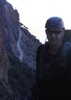
| partners | | With a 70% chance of Rain, we were all ready to get soaked on the day. Only problem, Ma Nature just decided to crank up the humidity a bit. Chums wanted to try the area Joe and I had been to before and I wanted to click off the Venezia Trail and search south of Palace Station on FR82 and Crooks Canyon.
I showed the guys Palace Station, the Palace Station Cemetery and headed down tree covered Crooks Canyon. Nice area w/ lots of camping opportunities. I still need to head further south in the future. The Elouise Mine area was posted "No Tresspassing", but it didn't appear that anyone had driven up there in quite some time.
We made a turn to the west, past the Bodie Mine area. At this point we were climbing and out of the trees, so none of us felt the urge to hike down to the area.
After 9L had us pass up the Collins Trail, we back tracked to get back on this single track.
Up the E Cross L now, it climbs steadily for 3 miles, up 1300', to an old forest road. Once at the top, we opted to cut a couple of road miles off by scrambling down a "steepish" slope to the Senator.
The Venezia trail does offer some pretty views as it climbs 400' up from the Senator to meet the E Cross L Trail. Anyone hiking the E Cross L trail, should either hike it, ending at the TH by Palace Station, or take the official GPS Track. The lower sections are overgrown and it's easy to see where Joe and I got offtrack last time here.
Temps for the most part were 75 - 80 with scattered clouds, so it made it real nice for hiking. Good company, good conversation, fun times.
Thanks for driving Mr. Chums |
|
Wildflowers Observation Isolated
|
|
 |
Spence Spring |
Dry |
Dry |
| | | Nothing in the spring box. Pools in Crooks creek though. |
  |
White Well |
26-50% full |
26-50% full |
| | Water in the well, as well as trash from idiots.
Crooks Creek offers plenty of filtering opportunities | | _____________________
There is a very fine line between "hobby" and "mental illness."
Dave Barry  |
| | |
|
|
|
 Route Editor