username
X
password
register
for free!
help
ArticlesGuidesRoutes
 
Photosets
 
 Comments
triplogs   photosets   labels comments more
Angel's Landing - 25 members in 78 triplogs have rated this an average 4.5 ( 1 to 5 best )
1, 2, 3, 4  Next
78 triplogs
login for filter options
Aug 04 2025
avatar

 Guides 1
 Routes 14
 Photos 7,202
 Triplogs 5,208

68 male
 Joined Mar 16 2008
 chandler,az
Columbia Gorge Hikes, OR 
Columbia Gorge Hikes, OR
 
Hiking avatar Aug 04 2025
johnlpTriplogs 5,208
Hiking5.13 Miles 1,677 AEG
Hiking5.13 Miles
1,677 ft AEG
 no routes
1st trip
Linked   linked  
Partners partners
RonONew
Hikes with Ron to Angel's Rest and Bridal Veil Falls in the Columbia Gorge OR. :)
_____________________
“Good people drink good beer.” Hunter S Thompson
 
Dec 05 2024
avatar

 Guides 21
 Routes 1,183
 Photos 36,909
 Triplogs 1,571

69 female
 Joined Feb 26 2004
 Phoenix, AZ
Scout Lookout, UT 
Scout Lookout, UT
 
Hiking avatar Dec 05 2024
tibberTriplogs 1,571
Hiking4.61 Miles 1,386 AEG
Hiking4.61 Miles   3 Hrs   53 Mns   1.81 mph
1,386 ft AEG   1 Hour   20 Mns Break
 
1st trip
Linked   linked  
Partners none no partners
Posting 4-28-2025. Believe it or not... or not, I am way behind on trip reports from last year including most of my two week Camino trip in Spain. Since I'm going to HI to hook up with my 1st cousins 1x removed, I thought I would try and at least, finish off our days at Zion and Page. To refresh your memory, if you're following along :) , Cousin Connie and I picked up her girls (Jenaya and Jaelyn) at Las Vegas airport and stayed in La Verkin. This was our first destination on our Zion zaga.

I had last done Angels Landing in Oct 2012 at age 56, and because I'm getting a tad older, I really didn't want to hold the girls back from their ascent of Angels Landing. I opted to get to Scouts Lookout, where we all have lunch, and then wait for them. It worked out fine, except the mountain shadow over where I was sitting kept it a bit nippy.

The hike went pretty well, the girls stopped a couple times when I would usually give them a little lesson about the geology. The hike certainly does have its steep parts but it's all paved, so I shant complain as much as normal :lol: . I could have used those rubber tip poles, they would have been much more effective. I enjoyed the tafoni as usual and looking straight up a lot to see the mountain sides above me. Fall colors were limited as we ascended except for a couple trees; needless to say, their yellow-colored leaves really stood out. I did spot the horseshoe prints on one of the turns... these are from the late 20s.

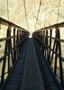
Finally made it to Walter's Wiggles. They are as steep as I remember but what's great is that this time, I got to stop at the top as there was Scouts Lookout. I did run into some rangers and had asked them if the trail was always paved the whole way and they said yes. For some reason, I thot they had added paving. With the amount of usage, I guess it only makes sense. For the record, here is my 2012 trip [ photoset ] .

We had our lunch and then the girls headed up Angels Landing, so I had to entertain myself and what a great theatre I was in for that. So many times when we hike we don't get these kind of moments to breathe in our environment. I got to look all around me, up and down and sideways to see things I would probably not see. I considered myself lucky that day; well actually the whole trip because I got to be with my cousins.

I filmed the last bit of them coming down Angels Landing. They seemed in a good mood so I think they had a good time and it met their expectations. And now, for the down, where I would be able to keep up with them except when filming or being distracted by the geology and such. I would have to yell out at them to stop so I could get their pictures, and for the most part, they obliged... altho, I think like the rest of you, they get a little annoyed sometimes. We were lucky this day as the traffic was quite limited; I think due to our late start.

I gave them the tafoni lecture and included them in the tafoni. Pictures turned out cute. After coming out of Refrigerator Canyon and heading down, the Sumac trees had turned from the rust color earlier to a bright red in the filtered light, so that was a treat. The light for a lot of this hike was not the best. We made it down to the river and over to where Connie was waiting for us.

We had a snack and then drove back to La Verkin (the girls had rented a nice Vrbo) with a stop at River Rock Roasting Company for pizza. It's a quaint place and has heated outdoor seating. The food looked great, but didn't taste as good as it looked... which is surprising, considering how hungry we were.

I put together a couple videos of our drive and hike and drive. Also includes additional interpretive information per usual lately:
[ youtube video ]
[ youtube video ]
_____________________
For me, sometimes it's just as much about the journey as the destination.
Oh, and once in awhile, don't forget to look back at the trail you've traveled.
 
Sep 05 2024
avatar

 Guides 69
 Routes 37
 Photos 3,010
 Triplogs 2,387

55 male
 Joined Oct 24 2010
 Phoenix,Az
Angel's LandingSouthwest, UT
Southwest, UT
Hiking avatar Sep 05 2024
mt98dewTriplogs 2,387
Hiking6.25 Miles 1,700 AEG
Hiking6.25 Miles   3 Hrs   27 Mns   1.81 mph
1,700 ft AEG
 no routes
1st trip
Linked   none no linked trail guides
Partners none no partners
Early morning in Zion!! Reserved a room for a couple of nights at Zion Lodge which allowed for an early attempt at Angel’s Landing. This was prefaced on getting a permit to hike it. (They are now requiring a permit to hike Angel’s. This is based on a lottery. They have an advanced lottery - done, 3 months in advance or a daily lottery where they randomly chose hikers to get a permit).

Left the lodge around 5:30am. Still dark out so I hiked the road up to grotto 6. Awesome views, with starry skies framed by black, towering cliffs. Had to use a headlamp for the first hour. Made it up through most of the “wiggles” before I could turn off the lamp. Nice and cool on the climb, but no views. Surprised by the trail. The first .5 miles of the trail was flat and made up of dirt, but as soon as the trail started to climb it turned to cement. It was that way all the way to Scout’s Lookout. Made for an easy hike. Still a little dim out when I made it to Scout’s Lookout, but it was bright enough for me to see what I had gotten myself into. :scared: If you have a fear of heights, this trail will challenge you! Looking at Angel’s Landing in the distance, I had to ask myself how much I wanted it. I’ve found the best way to deal with heights is not to acknowledge them. Not easy when you have drop offs a few feet off the trail, but I did my best not to let my eyes wander. I’m sure I did a disservice to the panoramic views provided by the trail, but I knew my best chance for success was to minimize my awareness of my surroundings. I didn’t let myself look around until I made it to the top. What a view. What a feeling! :y: Had the Landing all to myself. Took about 10 minutes to take it all in. As I was hiking down the incoming flow had started. Encountered about 30 people along the spine. Everyone was very considerate in passing.

Surprised. I felt much more comfortable with the return trip. Actually, stopped and enjoyed the views along the way. Enjoyed the hike down the “wiggles” as well. Able to see what I missed on the way up. The flat section between “wiggles 1” and “wiggles 2” was a nice treat. Passed about 150 plus on the way up as I headed down. Hate to imagine that kind of crowd on the spine. Hiked back to the lodge along the Grotto Trail. This hike was one for the ages, especially psychologically. It’s going to be hard to top.
_____________________
  1 archive
Oct 03 2021
avatar

 Routes 386
 Photos 49
 Triplogs 792

43 female
 Joined Jun 23 2015
 Phoenix, AZ
Angel's LandingSouthwest, UT
Southwest, UT
Hiking avatar Oct 03 2021
emilystardustTriplogs 792
Hiking5.00 Miles 1,700 AEG
Hiking5.00 Miles
1,700 ft AEG
 no routesno photosets
1st trip
Linked   none no linked trail guides
Partners none no partners
_____________________
 
Oct 22 2018
avatar

 Photos 104
 Triplogs 47

32 female
 Joined Oct 17 2016
 Phoenix
Angel's LandingSouthwest, UT
Southwest, UT
Hiking avatar Oct 22 2018
peculiargalexyTriplogs 47
Hiking5.40 Miles 1,700 AEG
Hiking5.40 Miles   2 Hrs   50 Mns   1.91 mph
1,700 ft AEG
 no routesno photosets
1st trip
Linked   none no linked trail guides
Partners none no partners
First hiking trip out of the state! Very spontaneously planned. I knew I was taking a week off work but had no idea where I was going. Threw together a week in Utah with a hike in each park and off I went! Got to Zion Tuesday morning and had no idea what to expect. The drive into the park was absolutely blowing my mind and I wish I could've parked my car and walked the entire road there. But then driving through the tunnel and coming out of it was absolutely amazing. One of the most beautiful sights I have ever seen :D

Found parking near the shuttles and boarded one to take me to the famous Angel's Landing. Hauled butt up the trail and made it to the halfway point thinking it was the top. Then I realized that that wasn't the top and that we got to hike on that tiny little crack of a ridge to the real top. Oh boy. My kinda hiking :D

Followed the hordes of people up. Luckily most were polite and would stop to let people up or I'd stop to let them go down. After becoming a caver I became a lot more familiar with rock and felt pretty safe on it but some of the people going up made me hella nervous. I'm honestly surprised so many people do it with that kind of exposure but I guess more people are fearless than I thought. The views from the top were absolutely amazing and Zion is definitely one of my most favorite places now. I plan to go back and knock out a few of the other hikes there and just explore this amazing place :)

Also totally raided the gift shop and bought all the geology books I could find :lol:

Need trail info? PM me.
_____________________
  2 archives
Jan 13 2018
avatar

 Routes 18
 Photos 580
 Triplogs 1,081

42 male
 Joined Nov 16 2010
 Kingman, AZ
Angel's LandingSouthwest, UT
Southwest, UT
Hiking avatar Jan 13 2018
nikorock28Triplogs 1,081
Hiking5.00 Miles 1,700 AEG
Hiking5.00 Miles
1,700 ft AEG
 no routesno photosets
1st trip
Linked   none no linked trail guides
Partners none no partners
My triplogs have been suffering from neglect. The 15 day looked like it was going to be a warmer and sunny weekend, so I decided to make my first trip to Utah. The Canyon road is open this time of year and parking was tight. It took a couple passes up, down and around, but I was able to nab a spot just in time to negotiate this before sundown.

Cool and shaded pretty much the entire way until the top part. I was expecting more exposure, but never really noticed any. Not hordes of people on the chains, but you did have to be patient at times and wait to proceed. I left my water bottle at the base and failed to retrieve it on the descent. It was cold so I wasn't concerned and didn't need to drink.

My kind of hike, short and steep (except the beginning) with killer views the second half. My first impression of the park was it reminded me of a larger Phantom Ranch in the canyon, mixed with Sedona.
_____________________
 
Nov 20 2017
avatar

 Routes 26
 Photos 1,288
 Triplogs 124

66 male
 Joined Oct 28 2003
 Andover, NJ
Angel's LandingSouthwest, UT
Southwest, UT
Hiking avatar Nov 20 2017
big_loadTriplogs 124
Hiking7.00 Miles 1,700 AEG
Hiking7.00 Miles   4 Hrs      1.75 mph
1,700 ft AEG
 no routesno photosets
1st trip
Linked   none no linked trail guides
Partners partners
gretchNboo
Well, it seemed irresponsible to visit Zion and not go to Angel's Landing. We were safely past the weekend, but we hadn't thought about how many people would be there on the Monday of Thanksgiving week. After a beautiful ride in the Mount Carmel Highway (this time during the day), we made brief stops at the Visitor Center and the Lodge before an ill-fated attempt to park further upstream, which led us back to the Lodge, where we were lucky to find a spot.

Mrs. big_load was a little sore from the previous two days, but she was game for another day of AEG. It wasn't early anymore when we started, but it was still cool. Yes, the multitudes were out there, but traffic on the trail was surprisingly light after the first few hundred feet. We quickly reached our lunch spot a thousand feet up at the bottom of the chains.

After a short rest, Cousin G. and I joined the hordes waiting to ascend while Mrs. big_load waited patiently. Right away the vibe changed. There were too many people on the chains. Some of them were rudely impatient, while others were frozen with terror. Those two groups combined badly, with a few of the former actually crawling on top of the latter, inspiring even greater terror. Despite some jostling and dirty looks for humoring the slowpokes, we quickly finished the first 100 feet to the flat spot before the dip. And then we saw what we were up against. About 25 people were lined up waiting for the chance to proceed, and a couple hundred people making very slow progress on the spine ahead of them. Those in line had already been waiting quite a while and new arrivals didn't improve their mood. It just didn't seem worth the wait, especially since we could get almost the same view from several other places.

We talked about it for 30 seconds and turned around and were almost instantly back to the start of the chains. While Cousin G. and Mrs. big_load spent some time taking pics, I scampered up the West Rim Trail for about a mile to scout out some good views, which were abounded without competition. I caught my breath and headed back to pick up the rest of the crew, and we slogged back to the car for burgers and coffee in Springdale.

The next morning we packed up and said goodbye again to Cousin G. and headed our separate ways back to AZ.
_____________________
  1 archive
Oct 24 2017
avatar

 Guides 10
 Routes 673
 Photos 7,281
 Triplogs 4,660

67 female
 Joined Nov 17 2008
 phoenix, az
Zion National Park, UT 
Zion National Park, UT
 
Hiking avatar Oct 24 2017
trekkin_geckoTriplogs 4,660
Hiking9.34 Miles 2,564 AEG
Hiking9.34 Miles
2,564 ft AEG
 
1st trip
Partners none no partners
in 2009, we hiked most of the shorter hikes available from the shuttle stops
hidden canyon, emerald pools, weeping rock, riverside walk and angel's landing
this year, we wanted to do angel's landing again, along with some new stuff
got going around 0845 or so
a little chilly to start with
wasn't all that crowded
an easy approach, then a steeper grade, through refrigerator canyon, up walter's wiggles and to scout's lookout
the fun starts with the climb up the ridgeline, navigating the chains and scrambles
a little crowded here, with one big traffic jam - not too annoying, though
spent a few minutes on the small summit, admiring the canyon and river views
the descent was even less crowded
glad we did this one, but i probably don't need to do it again; just too many people on it
next, we went over to the visitor center and hiked watchman trail from the campground
this was a lot of fun, switchbacking up to a little butte
the trail makes a loop around the top and the western edge has great views of zion canyon and springdale
really enjoyed this hike, and there were not many people on it
after some chips and salsa in the picnic area and a stop at the visitor center, headed out the east side
hit the canyon overlook trail just east of the tunnel
fun hike on a mix of slickrock and sand with good views to the west
a little late in the afternoon so the light wasn't great
headed for bryce, and saw some bighorn sheep near checkerboard mesa on the way out
_____________________
hazhole
 
Sep 16 2017
avatar

 Routes 1
 Photos 2,050
 Triplogs 425

46 male
 Joined Sep 16 2011
 Phoenix
Angel's LandingSouthwest, UT
Southwest, UT
Hiking avatar Sep 16 2017
VolcanoCLMBRTriplogs 425
Hiking5.00 Miles 1,700 AEG
Hiking5.00 Miles   4 Hrs      1.25 mph
1,700 ft AEG
 no routes
Linked   none no linked trail guides
Partners none no partners
_____________________
The world is my playground!
 
Sep 07 2017
avatar

 Guides 6
 Routes 183
 Photos 5,612
 Triplogs 1,647

male
 Joined Mar 12 2004
 Scottsdale, AZ
Angel's LandingSouthwest, UT
Southwest, UT
Hiking avatar Sep 07 2017
John9LTriplogs 1,647
Hiking4.26 Miles 1,700 AEG
Hiking4.26 Miles   1 Hour   50 Mns   2.32 mph
1,700 ft AEG
 
Linked   none no linked trail guides
Partners none no partners
My trip was winding down and I wanted to hit a couple of trails in Zion before heading back to Phoenix. It was early afternoon when I parked at the visitor center and jumped on the bus heading for The Grotto. I hit the trail around 3pm and headed up. The lower trail is mostly paved which makes for fast travel. I headed through the refrigerator section and up the wiggles. There were plenty of people out but they were spaced out and easy to pass. I hit the chains and continued up. I felt really good and loved the climb up. The top section is so much fun and the views are ridiculous. This was my third time here so I didn't spend much time. I took a few pics from the summit and then started the return. The descent was easy going and fewer people were out. I cruised down and jumped on another bus. I'll have a couple of hours to explore the Narrows and then head back to Phoenix.
_____________________
  1 archive
Jul 01 2017
avatar

 Routes 1
 Photos 2,050
 Triplogs 425

46 male
 Joined Sep 16 2011
 Phoenix
Angel's LandingSouthwest, UT
Southwest, UT
Hiking avatar Jul 01 2017
VolcanoCLMBRTriplogs 425
Hiking5.00 Miles 1,700 AEG
Hiking5.00 Miles   4 Hrs   30 Mns   1.11 mph
1,700 ft AEG
 no routes
Linked   none no linked trail guides
Partners none no partners
Lots of people on the trail. Lots of heat. Exposure on the ridgeline to the summit was fun.
_____________________
The world is my playground!
 
Mar 10 2017
avatar

 Photos 5
 Triplogs 1,041

36 female
 Joined Oct 04 2012
 Phoenix, AZ
Angel's LandingSouthwest, UT
Southwest, UT
Hiking avatar Mar 10 2017
WaitingForRainTriplogs 1,041
Hiking5.00 Miles 1,700 AEG
Hiking5.00 Miles
1,700 ft AEG
 no routesno photosets
1st trip
Linked   none no linked trail guides
Partners none no partners
We powered up this trail! Guess a week of hiking paid off. I loved this hike so much, even though it was pretty scary at the top.
_____________________
 
Dec 31 2016
avatar

 Guides 3
 Routes 633
 Photos 8,249
 Triplogs 605

54 male
 Joined Apr 13 2011
 Gilbert, AZ
Angel's LandingSouthwest, UT
Southwest, UT
Hiking avatar Dec 31 2016
ddgrunningTriplogs 605
Hiking5.75 Miles 1,700 AEG
Hiking5.75 Miles   4 Hrs   31 Mns   1.27 mph
1,700 ft AEG
 
1st trip
Linked   none no linked trail guides
Partners none no partners
Hit up Zion on the second leg of our trip to Brianhead for some skiing. It was New Year's Eve, and the trail was snow/ice covered on top, so we thought we might avoid crowds. I'm sure it was busier earlier int the week, but there were still a fair number of folks out enjoying one of Zion's most popular trails. The parking area at the Grotto was full, along with the nearby pullouts along the road. We must have been doing something right, as we happened to be in the right place at the right time, when one of the early morning visitors was pulling out of a parking spot. :y:

The crowds thinned out substantially beyond Scout Lookout (including all but 4 of our family group turned around here), where the chain section begins. Also, the clouds were covering the Landing from Scout Lookout on up, so there wasn't much in the way of views. That said, it's still a cool experience to hike in the clouds. We improvised some poor-man's Yak Trax, by putting some 1/4 inch sheet metal screws in the bottom of our shoes. It worked reasonably well to provide some traction in the snowy/icy sections. We took our time and ascended/descended with care. Passed one guy on our way up, who had done the whole thing with Tevas and no socks. And I thought we were a little crazy :scared: .

Notwithstanding the lack of views up top, we enjoyed the trip. On our descent, the cloud level began to rise, and by the time we approached Scout Lookout, you could make out the valley floor below and get a stronger sense of the exposure. Gave me the opportunity to capture some video to post on social media and make my height-averse friends wriggle in their seats a bit.

The colors of the canyon walls below the cloud level were gorgeous, with the wet rock making them very vibrant. By the time we got back to the TH, the cloud level had lifted almost to the top of the landing. I guess we timed our ascent one hour too soon. Oh well. All the reason to come back in the spring for another go-around. That, and my desire to hit up Hidden Canyon and Observation Point as well ....
_____________________
 
Nov 06 2016
avatar

 Routes 39
 Photos 353
 Triplogs 128

37 male
 Joined Sep 30 2015
 Carrboro, NC
Angel's LandingSouthwest, UT
Southwest, UT
Hiking avatar Nov 06 2016
afrankieTriplogs 128
Hiking5.00 Miles 1,700 AEG
Hiking5.00 Miles   3 Hrs      1.94 mph
1,700 ft AEG      25 Mns Break
 no routes
1st trip
Linked   none no linked trail guides
Partners none no partners
A busy Saturday in the national park, we embarked on the renowned Angel's Landing - my wife, a friend, and myself. The trail begins with a steady incline, with some switchbacks stacked nearly atop one another to achieve initial gain prior to wrapping towards the north and saddle. Go figure, the first half (maybe) is all paved. On a weekend this was especially busy with many gathering at the saddle where a latrine and trail fork exists. Beyond there, it's the exposure, the chains, and the fun!

Just weeks before a friend noted to my wife - I did it without using any of the chains. Well, challenge accepted and fulfilled. There are no doubt some edges with exposure (sometimes best just not to look down), but for those Arizonans accustomed to desert hikes I don't think the hike is that out of the ordinary. That doesn't mean it's not a blast hiking along the ridgeline or cliff-sides, but it receives a disproportionate amount of attention being that this is so well known in a national park.

The top was blustery and offered rewarding views of the canyon, but just as interesting were the views to the north overlooking Zion's Horseshoe Bend. In the afternoon the southern sun was warm looking over the canyon, but shadows were creeping hard to the north. Plenty of squirrels joined us for a pinnacle lunch and then we began our descent.
_____________________
Good judgment comes from experience. Experience comes from bad judgment.
Evan Hardin

Footloose adventures are documented instagram @afrankie8.
  6 archives
Aug 21 2016
avatar

 Guides 9
 Routes 33
 Photos 780
 Triplogs 4,634

44 male
 Joined Nov 25 2008
 Scottsdale, AZ
Angel's LandingSouthwest, UT
Southwest, UT
Hiking avatar Aug 21 2016
BoonemanTriplogs 4,634
Hiking5.50 Miles 1,700 AEG
Hiking5.50 Miles   2 Hrs   15 Mns   2.44 mph
1,700 ft AEG
 no routes
Linked   none no linked trail guides
Partners none no partners
Brooke and I headed out early to beat the masses and enjoyed a relatively quiet hike up to Angel's Landing. It's just as fun as I remembered!
_____________________
 
Aug 14 2016
avatar

 Guides 73
 Routes 176
 Photos 10,174
 Triplogs 2,324

46 male
 Joined Sep 08 2006
 
West Rim- Telephone Canyon Trail LoopSouthwest, UT
Southwest, UT
Hiking avatar Aug 14 2016
JimTriplogs 2,324
Hiking16.50 Miles 4,100 AEG
Hiking16.50 Miles   9 Hrs      1.83 mph
4,100 ft AEG10 LBS Pack
 
Linked   linked  
Partners none no partners
Did a loop from the Grotto TH up the West Rim, and took the long way around to the west side, and then came back on the Telephone Pole Canyon Trail. Views are better on the West Rim section. Down the West Rim, up and back on Angels Landing, and then a steak diner at the Zion NP Park Lodge, followed by Key Lime Pie.

Didn't see anyone at the lodge training for their next sanction. Then again the Eiger Sanction was 40+ years ago, and ownership seems to have passed from George Kennedy to some new entity, I don't know, the National Park Service, or something. I guess they're OK.

Miles are added up from sections I found online, combination SP and NPS, and a HAZ route that checks out, and elevation is a best guess and based on a trimmed route. It may be off, but I am unsure as there is a lot of up and down. I added in a bit since you continue to gain some elevation on the plateau.

Excellent hike, a solid day hike for those looking to have views and escape the valley crowds. I'll try to do a description soon. Ironically, this is another example of a place where a fire opened up the views and improved things!
 Geology
 Geology [ checklist ]
[ checklist ]  Navajo Sandstone
_____________________
🍭
  4 archives
May 29 2016
avatar

 Guides 2
 Routes 25
 Photos 1,890
 Triplogs 604

41 male
 Joined Sep 13 2009
 Mesa, AZ
Angel's LandingSouthwest, UT
Southwest, UT
Hiking avatar May 29 2016
jochalTriplogs 604
Hiking5.50 Miles 1,700 AEG
Hiking5.50 Miles   3 Hrs   30 Mns   1.89 mph
1,700 ft AEG      35 Mns Break
 no routesno photosets
1st trip
Linked   linked  
Partners none no partners
40 minutes up, 20 minute wait in line to start the ridge, 60 minutes to the landing (lots of waiting), 15 minutes on landing, 35 minutes back to saddle, 30 minutes down. 10 minutes to walk the grotto trail back to lodge area.
_____________________
 
May 25 2016
avatar

 Guides 1
 Routes 105
 Photos 1,740
 Triplogs 228

33 male
 Joined Feb 26 2015
 Gilbert AZ
West Rim Trail - ZionSouthwest, UT
Southwest, UT
Hiking avatar May 25 2016
DallinWTriplogs 228
Hiking10.12 Miles 3,819 AEG
Hiking10.12 Miles
3,819 ft AEG
 no routes
1st trip
Linked   linked  
Partners none no partners
Stopped at Zion with my buddy Alex on the way back to AZ.

We hit the park around 7:00 AM in order to avoid the worst of the traffic jams on Angel's Landing. I wanted to catch the first bus out of the visitors center at 6:00 AM but I kept hitting snooze on my alarm. Going up we encountered a couple of groups coming back down, but it was mostly smooth sailing up to the top. About half a dozen other people on top when we finished the climb, coming back down we encountered a lot of traffic jams. Even with the massive amounts of traffic this hike receives I feel it's totally worth it. The views are incredible and the scrambling adds an extra element of fun to the hike.

I thought the "sketchiness" of Angel's Landing is overrated. The chains felt unnecessary and I never really used them. On the way back down I did most of it with my hands in my pockets. I actually have a fear of heights and climbing, but it wasn't an issue for me, yet most other hikers were holding on to the chains for dear life. :roll: If it was wet or icy, I can see the need for the chains.

Next we headed further up the canyon along the West Rim trail to Cabin Spring. I like this area a lot. My first ever backpacking trip was from Lava Point to the canyon floor along the West Rim trail and the scenery blew me away when I wasn't focused on how thirsty I was because I hadn't brought enough water. :) It's still just as stunning. The white slick rock and pines could fool some (when looking at a photograph) in to thinking they are looking at Yosemite. Very peaceful back there.
_____________________
 
May 05 2016
avatar

 Routes 17
 Photos 485
 Triplogs 510

77 male
 Joined Jan 07 2010
 Chandler, AZ
Angel's LandingSouthwest, UT
Southwest, UT
Hiking avatar May 05 2016
Mike_FelsTriplogs 510
Hiking4.94 Miles 1,720 AEG
Hiking4.94 Miles   3 Hrs   12 Mns   1.89 mph
1,720 ft AEG      35 Mns Break
 
no photosets
1st trip
Linked   none no linked trail guides
Partners none no partners
Up until about 7 months ago I had not even heard of this hike. But as soon as I did I knew it was one I just had to try. Since then I have heard and read so many stories about it that the day before the hike I was getting very apprehensive. Would I be able to complete it? :scared:

My wife hates steep inclines, so the plan was that at the TH I would head up to Angel's Landing and she would try another trail. We got there fairly early and I started up at 7:45am. The floor of Zion is already starting to get pretty warm during the day, so the cool of the morning was nice. And being early I was avoiding a lot of the rush. Even so there were several people starting out with me.

The trail, actually named the West Rim Trail starts out almost level but before long starts to incline. By the time of the first set of switchbacks, I think there were 7, it's gotten quite steep. Then you hit refrigerator canyon. A ranger told me that the trail in that area never gets direct sun all year long. It's full of vegetation, but that's from reflected light. This keeps it nice and cool, hence the name. The trail is almost level here so with the cool shade the body recovers from the first part of the hike quickly.

Suddenly there ahead is Walter's Wiggles. A set of 21 switchbacks. According to the park ranger these were designed and pushed by Walter Ruesch back in about 1921. When these were complete it allowed Zion to set up horseback rides up to Scout Lookout. I would rather hike it. But the trail is still so smooth that horses could easily do it.

At the end of Walter's Wiggles it's only a short jaunt to Scout Lookout. This level area actually has a set of outhouses. Seeing this made me laugh and wonder who has the task of cleaning those out and hauling the waste down. Somehow I doubt a pump truck makes it up there. I bet it's the task of the rookie ranger.

I was quite proud that I had made it this far. And only one "young" guy, from Germany, had passed me on the trail. I talked to a couple people at the lookout for a few minutes but then figured it was time to do the final climb. From here the ridge looks too narrow to climb and it's steeper than anything so far. But the park service put in chains to hold and useful to pull yourself up much of the -last half mile. There are areas of the trail where the ridge is probably 2 feet wide and over a thousand feet drop on both sides. Other places the trail is a ledge only a foot wide with a wall on one side and the thousand foot drop on the other. Going up I found I had my hand wrapped around and sliding up the chains most of the way. People had said just don't look down, well unless your peripheral vision is limited to maybe one degree you can't help but see the bottom if you look at the trail. Mine isn't that narrow! :o

Almost to the top the ridge widens to probably 20 feet or so. But it's shaped by flat slabs of rock in an inverted V so I was walking along the side of an incline steep enough that a trip would be a very long one. Then it flattens out and I am at the top. I had made it! :y: After about a half hour up there I found I'd gotten quite comfortable with the exposure and could stand on the edge to really appreciate the views. And the views are fantastic! Returning to Scout Lookout I found I only touched the chain 2 or 3 times.

After being on top the way down is very anticlimactic. Which is odd because it has a lot to offer.

When I got down to the TH I met up my wife and she amazed me with the information that she had made it to Scout Lookout and back. I was very proud she had been able to do that. :app: She said she had considered trying the last climb to Angel's Landing but her legs were tired enough to not be steady. And steady legs really are important on the last push.
_____________________
 
Oct 09 2015
avatar

 Routes 1
 Photos 29,248
 Triplogs 1,448

45 female
 Joined Jan 18 2011
 In the Wild
Angel's LandingSouthwest, UT
Southwest, UT
Hiking avatar Oct 09 2015
LucyanTriplogs 1,448
Hiking5.00 Miles 1,700 AEG
Hiking5.00 Miles
1,700 ft AEG
 no routes
Linked   none no linked trail guides
Partners none no partners
foliage observationfoliage observationfoliage observationfoliage observationfoliage observation
Autumn Foliage Observation Isolated
_____________________
  1 archive
average hiking speed 1.79 mph
1, 2, 3, 4  Next

WARNING! Hiking and outdoor related sports can be dangerous. Be responsible and prepare for the trip. Study the area you are entering and plan accordingly. Dress for the current and unexpected weather changes. Take plenty of water. Never go alone. Make an itinerary with your plan(s), route(s), destination(s) and expected return time. Give your itinerary to trusted family and/or friends.

helpcommentissue

end of page marker