|
| | | |
| |
|
| Hike & Climb | 36.10 Miles |
12,000 AEG |
| | Hike & Climb | 36.10 Miles | 2 Days | | |
| 12,000 ft AEG | | | | |
|
|
| | |
| Partners |
|
[ show ]
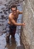
| partners | | To begin, this is, without rival, the most difficult summit I've done in the Lower 48. We started down the South Kaibab at 6:45 a.m., moving through intermittent rain, snow, and patches of sun. We stopped north of Haunted Canyon for lunch, then filtered water (4L each) just before heading up the Redwall. There are two pretty sketchy climbs here, the 2nd of which is among the sketchiest of the 8 we encountered on the whole route, in my personal opinion. Pack hauls helped here. The traverse after is airy, fun, and generally awesome. Then a long, obnoxious stretch of side-hilling brought us to the Sheva-Isis saddle. It was now 4 pm. We had a brief discussion about our next move and decided to press on, knowing that we'd have to bivy somewhere up there.
A steep grunt and traverse across the first bay on the north side of Isis led to the crux pitch. Eric skillfully led this awkward climb, which had a little bit of everything (lie-back moves, face climbing, traversing - you name it!) We all followed, which is fun with a full pack and angled nature. This pitch, however, removed the need for the long traverse that JJ and Joe undertook. I cannot possibly express how impressed I am with those two after now having seen the terrain and knowing the amount of time they spent on it! We stashed the rope and harnesses here, but Richard kept some webbing for possible handlines up higher, which came in handy.
Getting through the room-sized boulder/crack was "fun" with our full packs. By the top of this, snow flurries were upon us, and so was evening . We found an amazing sheltered site on a ledge below the 3rd Supai layer and called it a night. This campsite is one I'll always remember - "nice view" is an understatement. It did rain off and on throughout the night, which added to the adventure.
Up at first light, we negotiated the fun fin/crawl pitch, then found a highly sketchy crack climb after that. Two more somewhat sketchy climbs found us atop the Supai. We drank from the full waterpockets here, then trudged up and across the traverse. Legs burning now, we crossed the "spooky gully," which was actually fine with the recent rains. The Coconino climb went ok (loose rock everywhere!) and after a little route-finding, we spied the summit, and topped out in windy, cold, cloudy conditions around 8 a.m. No pencil/pen in the register still, but we didn't care. A short summit photo shoot ensued, but we didn't linger long, knowing we had to get all the way back to Phoenix tonight. We began to retrace our steps, and I was admittedly nervous about the 5 hair-raising downclimbs before having the ability to rappel the last 3. They actually passed without much issue, and setting up and completing the rappels was a welcome change. There is now a new anchor at the top of Pitch 1 in the Redwall.
Elated to be on safe ground, but dreading the 16.5 mile exit hike, we shifted to summer hiking mode and enjoyed the warm, breezy afternoon as we moved steadily back towards civilization. Upon finishing the heinous descent of the Utah Flats Route, we chatted with a ranger at Phantom Ranch who'd actually climbed Isis before (and was good friends with Richard's uncle!) He even offered us a free night of camping at Phantom! I cannot express how hard it was to pass that up, but life called us home. Up the deserted (yes, you read that correctly) Bright Angel Trail we went at 5:30, and were at the car by 9:30, ready to start the long drive home.
Thanks for the Grand Canyon adventure of a lifetime, guys! |
| _____________________
| | |
|
|
|
 Route Editor


 Thankfully my noisey neighbors made sure I didn't get too much sleep. Next day went up to Utah Flats and then explored around Phantom and Haunted Canyons. Spent a cold night (21 degrees) below Cheops. Hiked out on the 3rd day.