|
| | | |
| |
|
| Hiking | 19.56 Miles |
2,758 AEG |
| | Hiking | 19.56 Miles | 7 Hrs 46 Mns | | 2.67 mph |
| 2,758 ft AEG | 27 Mns Break | | | |
|
|
| |
| Partners |
|
none
[ show ]
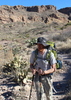
| no partners | | With the influx of rain, I wanted to get out in the Supes. Thought about waterfall hunting, but opted to avoid the crowds who undoubtedly had similar plans. Based on my observations, I don't think there was enough water as of Saturday to get much sustained waterfall action (though there might be now, as I'm writing this up).
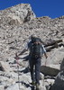
Arrived at First Water TH a bit before 6:30 in the rain. Crossed several running washes along the way. From the get-go, it was just me, and I had total solitude for the next 16 miles.
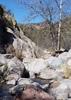
I hadn't done any extensive hiking in this area since the last fire, and it was depressing to hike through mile after mile of pretty thoroughly charred wilderness.  Evidence of the char continued all the way until about a mile from Charlebois. Evidence of the char continued all the way until about a mile from Charlebois.
I had been up to Bull Pass before, but hadn't descended the east side, nor hit the Black Top Mesa summit. The summit is a real gem, with fantastic views all around. There is a nice flat spot for a camp on the southern tip which would make for a great viewing location at sunset/sunrise, with Weaver's on display. After returning, I read about some Spanish hieroglyphs, but didn't know to look for them. Another time.
On my way down from Black Top Mesa, I was treated to a lovely rainbow off to the north. Definitely the visual highlight of the day.
Descending from Bull Pass, I clipped through the upper end of Needles Canyon, where I'd been previously after some solid rain. As with other washes, it wasn't really running, but there were lots of pools.
I continued on to rejoin the Dutchman trail. Originally, my plan was to loop back north along the Cavalry trail, which I haven't done before, but the draw of getting the Charlebois Spring and covering that section of Dutchman proved to strong, and I ended up heading that direction.
It was nice to be out of the burn area, and the sporadic cottonwoods along the creekbed stand testament to the stronger water sources in the area.
Charlebois, as always, is a lovely oasis in the Supes. No one camping there, and I again made a mental note of my desire to do so one of these days.
By that point, I was 10 miles in and realized I needed to hightail it back, as I had to pick up my wife from the airport by 3 pm. So, I turned on the jets and abandoned any thought of the Cavalry loop on the return, and instead opted to follow Dutchman proper from the eastern Bull Pass junction.
The trail through this section of Dutchman was brushy, and with the rain, ended up soaking me thoroughly. No matter. It wasn't cold and I just embraced the wet. This section also avoided the fire scar.
Saw a snake in a tree (looked like a garter) and several small orange frogs, but didn't have time to get my phone out--and with everything wet, I probably couldn't get it to respond to my swiping anyway.
The final several miles from the Black Mesa Junction back to FW were a grind. In the last couple of miles, I finally saw signs of life with one single hiker and a couple out for an afternoon jaunt in the Parker Saddle area.
Back to my car, I headed back towards Mesa just in time to get my wife's text that she had landed. Headed straight to the airport and arrived just as she was exiting the terminal. Perfect timing! |
| _____________________
| | |
|
|
|
 Route Editor


 Alta
Alta 


 , we set out again early Sunday morning to fix this problem !! well after searching around for better part of hour and about ready to call it another failed trip ( we were burning daylight and not reaping the reward ) I heard a
  from Roger he finally spotted the Map hidden behind a thick stand of brush
 ... Took our Pics and headed back home Happy Times Again !!
  HAZ for all the fond memories and multiply reasons to get off the couch and explore the great outdoors....


