|
| | | |
| |
|
| Backpack | 26.17 Miles |
5,315 AEG |
| | Backpack | 26.17 Miles | 14 Hrs 50 Mns | | 2.03 mph |
| 5,315 ft AEG | | | | |
|
|
| |
| Partners |
|
none
[ show ]
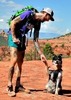
| no partners | | Have been wanting to come to Sycamore Canyon for awhile. We had a bunch of rain the Sunday before Thanksgiving, and with a nice warm/dry Thanksgiving weekend forecast I'd figure it'd be the perfect ingredients for a solid outing there.
Drive-in was uneventful, 525C is in excellent condition as it sees lots of traffic and is maintained by by Yavapai County (for the most part, unmaintained as you get closer to the trailheads for this route). You could probably get to Casner/Dogie in a passenger car with careful driving but I'd at least want high clearance. It's bumpy/rutted in parts.
Casner Mountain Trail
Ended up parking at Mooney TH, hiking down to Casner TH. Two campers in a SBS passed me on the way up before the switchbacks, and their way down when I was still climbing, this was our conversation:
Them: "I can't believe you hiked up that!"
Me: "I can't believe I didn't ask you for a ride!"
Anyways Casner was in decent shape. Muddy and deeply rutted in parts, kinda sad to hike through the burned areas but still amazing views of Sedona and Sycamore Canyon. Don't love the buzzing sounds the power lines make either, but still worth the effort. Just remember you're not done climbing after you make it to the top of the mountain! The road undulates and is long and shadeless. Come prepared.
Taylor Cabin Trail
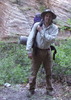
CANNOT say this one is worth the effort though! I was already feeling beat just getting here and was not expecting the battle this "trail" was about to put up. Had trouble finding the trailhead to begin with as it's not marked, the only sign is the ominous "Entering burned area" warning sign. I got turned around right at the beginning and had to navigate some burned deadfall to get back on track. Once I found the trail it was faint, overgrown, and narrow, you'll need sure footing right from the get-go or a fall to the left would be deadly. There's several sketchy washouts near the beginning as well.
After this you have maybe a few hundred yards of decent trail before it hits the burn area proper and then the bushwhacking begins. There's some tape and cairns to help you through, but it's so overgrown here that the trail is no longer discernible. Just follow the markers as best you can until you hit the wash, then jump in and start boulder-hopping the wash downstream. Some beautifully sculpted Navajo sandstone appears as you leave the wooded part of the wash behind, and you'll soon run into your next major obsctable: a 10ft. dryfall. Look for a small cairn to your right and follow the bypass up and around this, then you'll enter into the most scenic part of the trail with more Navajo sandstone. Past the fall there's no major boulder-hopping and it's a pretty easy walk through the wash until you're dumped out into Sycamore Canyon.
Sycamore Basin Trail
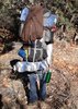
The Canyon is a real treat this time of year. The creek was flowing at the intersection with Taylor, and was just superb in the mid-afternoon light with lots of fall colors. Like Taylor this trail is pretty hard to follow, overgrown and faint in parts and just completely nonexistent in others. I'd say sticking to the creek is easier but it would be really easy to miss Taylor Cabin altogether if you're not paying attention, so keep an eye out for cairns and don't be afraid to double back and boulder-hop through the creek if the trail gets hard to follow.
Taylor Cabin is in excellent shape! Nice and clean with the roof recently repaired and completely covered. No windows but I saw some window frame measurements written out on a block of wood on the cabin, so maybe the FS is preparing to install some? There's a big pool of fresh, clean rainwater in the creek right by the cabin and plenty more close by.
Dogie Trail
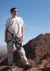
Had a late start the next morning. The morning light is something special in the canyon! My destination was where Dogie crosses Sycamore Creek, where I was planning to setup camp and do a long dayhike to see the ruins up Packard Trail (provided there was enough water by the crossing). I didn't wanna miss any fall colors/water opportunities so I made the poor decision to just stick to the Sycamore Basin Trail and eventually hop up onto the ridge above the creek for some smooth sailing. Unfortunately this did not happen - while the route for Sycamore Basin Trail apparently leaves the creekbed shortly after Taylor Cabin I wasn't able to find this, even after doubling back for a little bit. I ended up doing some more boulder-hopping until I found another spot where the trail intersected a wash and hopped up that way. Honestly was a blessing in disguise, while the water pools got murkier and smaller the further I went the fall colors didn't disappoint. Up on the trail close to the intersection with Dogie is another depressing burn area, but offers some nice views of the cliffs and canyon below.
I took Dogie to the final creek crossing and while the campsite there was vacant and seemed pleasant there was no good water around. A large pool was nearby at the confluence with Cedar Creek but it was a dark brown and I didn't want to take the risk, so I kept going up Dogie to cut the trip short (again-bleh). Dogie is easy to follow and offers some fantastic views, I think this might be the Best Trail in this wilderness area. Made it to the trailhead in good time and saw a couple trucks there, from Dogie TH it's a short mile-and-a-half roadwalk to Mooney and made it home before dark.
While this was a beautiful trip I can't recommend this route. Taylor is just dangerous at this point. If I could do it over, I'd do a 3-day out-and-back via Dogie and just dayhike up to Taylor to checkout the nice parts of the wash on the second day.
If you can make it here, come soon! I don't know how long the water and the fall colors will last!! |
|
Autumn Foliage Observation Moderate
Fall hanging on in the Canyon, but fading fast |
|
| _____________________
| | |
|
|
|
 Route Editor