username
X
password
register
for free!
help
ArticlesGuidesRoutes
 
Photosets
 
 Comments
triplogs   photosets   labels comments more
Marshall Lake to Fisher Point - 9 members in 25 triplogs have rated this an average 3.2 ( 1 to 5 best )
1, 2  Next
25 triplogs
login for filter options
Jul 06 2024
avatar

 Guides 170
 Routes 148
 Photos 5,914
 Triplogs 2,097

48 male
 Joined Apr 12 2004
 Tucson, AZ
Marshall Lake to Fisher PointFlagstaff, AZ
Flagstaff, AZ
 Hiking avatar Jul 06 2024
PrestonSandsTriplogs 2,097
 Hiking2.70 Miles 400 AEG
 Hiking2.70 Miles
400 ft AEG
 no routesno photosets
1st trip
Linked   none no linked trail guides
Partners none no partners
Evening hike up the Anderson Mesa Incline railroad route to the top of the mesa. Saw an old log trestle remnant, a rail and a solitary railroad spike. Hiked this in Oct 2022 at night. Better in the day when I could see my surroundings.
_____________________
"…you never know when a hike might break out" -Jim Gaffigan
 
Jul 29 2022
avatar

 Guides 107
 Routes 249
 Photos 2,067
 Triplogs 514

male
 Joined Nov 18 2005
 Phoenix, AZ
Anderson Mesa - AZT #30Flagstaff, AZ
Flagstaff, AZ
Hiking avatar Jul 29 2022
nonotTriplogs 514
Hiking27.40 Miles 1,500 AEG
Hiking27.40 Miles
1,500 ft AEG
 no routesno photosets
The Anderson Mesa portion (geographically, not just the AZT segment) is extremely muddy, difficult to hike in the morning, and impossible to hike while raining, due to the goopy mud. I would recommend anyone exit at Sandy Canyon trail and hike the Lake Mary rd until the AZT crosses south of Upper Lake Mary.

Over 2 days hiking I only had to shelter from lightning for about 45 minutes, but spent hours hiking in the rain. I'd guess the area got 4 inches over those 2 days.
wildflower observationwildflower observationwildflower observationwildflower observationwildflower observation
Wildflowers Observation Isolated

water 1 out of 5water less than maxwater less than maxwater less than max Prime Lake 1-25% full 1-25% full
a little bit of water way out in the mud flats

water 1 out of 5water 2 out of 5water 3 out of 5water less than max Upper Lake Mary 51-75% full 51-75% full
Maybe 51-75% full? About 9 feet below the spillway.
_____________________
http://hikearizona.com/garmin_maps.php

Hike Arizona it is full of sharp, pointy, ankle-twisting, HAZmaster crushing ROCKS!!
Hike Arizona it is full of sharp, pointy, shin-stabbing, skin-shredding plants!
Hike Arizona it is full of striking, biting, stabbing, venomous wildlife!
  1 archive
Jul 17 2022
avatar

 Guides 2
 Routes 2
 Photos 774
 Triplogs 70

66 male
 Joined Dec 02 2020
 Phoenix, AZ
Fisher Point via Sandys Canyon TrailFlagstaff, AZ
Flagstaff, AZ
Hiking avatar Jul 17 2022
TheHikingGolferTriplogs 70
Hiking4.45 Miles 324 AEG
Hiking4.45 Miles   1 Hour   57 Mns   2.67 mph
324 ft AEG      17 Mns Break
 no routes
Linked   linked  
Partners none no partners
Started on the Marshall Lake portion of the AZT. Did 2.75 miles through the forest. Not a lot of elevation change, just a nice walk through the woods. At 2.75 mi I decided to head back and drive over to Sandys Canyon. Weather was great, about 75-80 and clear. Started hiking 7:30am.

Sandys Canyon was much more interesting. After about .1 mi, you drop about 400' in .3 or .4 mi into the canyon. I knew that after doing 5.5 mi at Marshall Lake the hike out wasn't going to be fun. It flattens out once you get to the bottom of the canyon and it's a nice walk through the meadow. At about 2.1 to 2.25 mi you come to the cave. Very picturesque area. I could see clouds building when I got toward the end about noon. Sure enough, heading toward Williams I was in and out of light rain.
 Fauna
 Fauna [ checklist ]
[ checklist ]  Horned Lizard
 
Dec 10 2021
avatar

 Routes 297
 Photos 6,928
 Triplogs 552

49 male
 Joined Dec 30 2007
 Avondale,Az
Marshall Lake to Fisher PointFlagstaff, AZ
Flagstaff, AZ
Hiking avatar Dec 10 2021
StoicTriplogs 552
Hiking3.40 Miles 625 AEG
Hiking3.40 Miles   1 Hour   45 Mns   1.94 mph
625 ft AEG
 no routes
Linked   none no linked trail guides
Partners none no partners
Perfect weather for hiking in the snow. 32-35F, Sunny and no wind.
_____________________
 
Oct 05 2020
avatar

 Guides 10
 Triplogs 432

63 male
 Joined Feb 25 2002
 Scottsdale
Marshall Lake to Fisher PointFlagstaff, AZ
Flagstaff, AZ
Hiking avatar Oct 05 2020
TimTriplogs 432
Hiking6.70 Miles 390 AEG
Hiking6.70 Miles   2 Hrs   25 Mns   2.77 mph
390 ft AEG
 no routesno photosets
1st trip
Linked   none no linked trail guides
Partners none no partners
Paul, Carolyn and I did this as an out-and-back Monday morning at 9:00. It was 66 degrees when we started and 78 degrees when we finished. the first mile of this hike is flat and exposed to the sun nut once it drops into first drainage one is amongst the trees for a nice hike through the woods. I went in about 3.35 mile before turning around while Paul and Carolyn went about a quarter mile further. This COVID thing has kept me on the couch too much and this cup cake hike at elevation really fatigued me. It came in at 6.7 miles with just 390 feet of AEG in 2 hours and 25 minutes.
_____________________
 
May 06 2018
avatar

 Guides 21
 Routes 1,183
 Photos 36,909
 Triplogs 1,571

69 female
 Joined Feb 26 2004
 Phoenix, AZ
Walnut Canyon - AZT #31Flagstaff, AZ
Flagstaff, AZ
Hiking avatar May 06 2018
tibberTriplogs 1,571
Hiking8.23 Miles 614 AEG
Hiking8.23 Miles   3 Hrs   45 Mns   2.53 mph
614 ft AEG      30 Mns Break
 
Linked   linked  
Partners partners
desertgirl
Paintninaz
Sredfield
Marshall Lake to Sandy's Canyon Junction of the AZT and then to Canyon Vista Campground TH. Day Two of our weekend to finish off this Segment and link up with the previous segments (most of 28, 29-34 about 100 miles). After another morning of pancakes and bacon breakfast it was a 70 mile drive to Marshall Lake TH. We got going fairly early for what we thot was going to be about a 6 1/2 mile day... oops!

You start hiking on the flat for awhile before you take these elongated switchbacks down and into the forest for the rest of the hike. At about the 1.40 mile mark is where the first deviation of the route started and would continue deviating for the next 2 1/2 miles. I didn't realize how much off-route we did as HAZel Pin to Start didn't have a verbal alert going. We came upon Marshall Mesa Tank which had some water in it. And you know us desert rats and water, it was photo op time.

We crossed FR 9481Q and instead of going straight up the hill the trail switchbacked. As we proceeded you could see various areas where the trail had been blocked off with debris in a few areas for what I thot were pretty long stretches. I guess they are serious about keeping ATVers off those trails/roads. I put up a picture of the official track vs our track and it's pretty different especially after 2 1/2 miles. As Tracy said, you can see where the new track seems to follow the contour lines now.

We came across one very large tree that had fallen; it had a tap root that was as big as a small tree. Earlier we had seen where another tree had split and crashed all over the trail. Also in a few sections there were colorful stripe circles on a few trees. Seems to be some aggressive work going on in that regard. Not sure of its purpose however. In one area a tree had a blue/white stripe tape around it, another had turquoise spray paint and then there was the standard orange markings.

I kept waiting for us to get closer to the climbing area as I recall that being a cool part of the trail but that doesn't appear to be the case anymore. That's when I realized we were just not doing much of what Wendy and I had done in June 2011. So we continued to add miles to what was once a 2 1/2 mile section through the forest on nice trail to almost 4 miles now. Good thing we set up the previous day's shuttle or we would have wondered why it was taking so long to finish.

And then we came upon a newly ripped section of trail that hadn't been fixed up yet. We actually ended following it to where it ended as it had not been blocked off. So we back-tracked and then threw some tree debris so that others wouldn't make the same mistake. It would be nice and faster if they bring up the excavator to finish off that new section of trail. I'm not sure how far the new section is extending or its final objective but it will be interesting to see in a couple years. This is not Arizona Trail work but forest service.

Finally we got back to the section I was familiar with again which is the old road that is rockier than all get out. We did encounter two biker backpackers; they hadn't come to the newly ripped trail yet. I don't think they will like that at all altho I was impressed with what they had already come up. From this road you get a nice glimpse to the San Francisco Peaks. The sky was overcast now and had been for awhile. You hike between the burn area. You do seem to drop to the canyon floor fairly quickly. I saw two trails that headed south but I don't know where they would eventually end up but we had to stay on the AZT anyway.

We came to the section with the cross hatched colorful canyon walls. They were as spectacular as I remember. After a gazillion pics on my part we took a break at the cave before our Victory Dance at the Junction with Sandy's Canyon Trail. And of course, once at the junction we celebrated with a selfie before finishing off our day via Sandy's Canyon Trail to Canyon Vista Campground TH.

We loaded up into Shawn's truck, stopped at Lake Mary store for some refreshments and then up to Marshall Lake TH to pick up Tonto Jr. It was a quick shuttle but a good thing since Ambika and me would be heading back to Phoenix. We had lunch at the Long Valley Cafe per another HAZer's report that it was pretty good. My lunch was fine but they only have one vegetarian choice.

Part 1 [ youtube video ]
Part 2 [ youtube video ]

We have now done more AZT miles this year than we have the last individual three years and we're looking to do some AZT once a month for the rest of the year.

 Named place
 Named place [ checklist ]
[ checklist ]  Marshall Mesa Tank

water 1 out of 5water less than maxwater less than maxwater less than max Marshall Mesa Tank 1-25% full 1-25% full
based on the stake in the tank, more toward the 25%
_____________________
For me, sometimes it's just as much about the journey as the destination.
Oh, and once in awhile, don't forget to look back at the trail you've traveled.
  3 archives
Sep 28 2017
avatar

 Guides 117
 Routes 339
 Photos 11,415
 Triplogs 895

63 male
 Joined Dec 20 2010
 Sunnyslope, PHX
Marshall Lake to Fisher PointFlagstaff, AZ
Flagstaff, AZ
Hiking avatar Sep 28 2017
kingsnakeTriplogs 895
Hiking14.58 Miles 1,220 AEG
Hiking14.58 Miles   5 Hrs   4 Mns   2.88 mph
1,220 ft AEG
 
1st trip
Partners none no partners
This was me & my wife’s third annual Flagstaff fall colors romantic getaway weekend. The past two years, I’ve done a shorter hike the Thursday we arrive in in town. Last year, I hiked Colton Crater. A month ago, hiking Sandy Canyon, I had skipped climbing to the top of Fisher Point — which overlooks the intersection of Sandy Canyon, Walnut Canyon and Skunk Canyon — due to being wore out from too much bushwhacking. Eventually, I settled on hiking from Marshall Lake to the Flagstaff Sam’s Club, via Fisher Point, on Arizona Trail passage’s #31 and #33. For some reason, I thought a twelve mile hike would be a good ‘warmup’. :?

At the Arizona Trail trailhead on the southwest ‘shore’ of dry Marshall Lake, my wife spotted several used tampons. Eww! ‘Leave no trace’ would never have been so appreciated. :o

It was an easy walk across Anderson Mesa. Just before Marshall Mesa Tank, a large fallen tree blocks the trail. There is already a use trail around it. Not sure if it is scheduled for removal?

The ‘descent’ to the tank is only 200 ft., and the ‘climb’ back out only 100 ft., so it seemed a bit fussy to me for it to have something like 10 switchbacks. The odd number of switchbacks would be a theme all the next four miles to the rim of Sandy Canyon. The switchbacks add unnecessary, and unexpected, distance to Arizona Trail #31. (A trail sign at Marshall Lake says it is 5.7 miles to the base of Fisher Point: It is now actually 7.4 miles.) Nonetheless, it is a pleasant stroll.

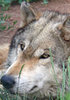
On the descent to Sandy Canyon, I narrowly avoided squishing a tarantula. I hate spiders. They scare me. But for some reason, tarantulas don’t bother me near as much. Maybe because they look like furry, eight-legged, puppies?

Atop Fisher Point, I couldn’t see much to the north, but could see for miles south, including Mormon Mountain. I took more photos & video at Fisher Point than anywhere else on my hike, but I never felt like I quite ‘got’ the feel of the area. After the photogasm, I took a twenty minute break for lunch, relaxing in the shade, enjoying the views.

After descending back to the canyon floor, I headed up AZT #33 towards Flagstaff. Like Sandy Canyon — if you are not bushwhacking! ;-) — Skunk Canyon is a narrow, but grassy-bottomed terrain feature. Arizona Trail #33 very gradually heads up 1.75 miles to the Flagstaff Loop Trail. Only 200 yds. further, the trail turns east through an ungated fence unto an old forest road.

The next 1.5 miles, to the Rio de Flag — yes, that is its name — wetlands, is also on old jeep trail, through the same grassy terrain with plenty of shade trees that typified the first 12.5 miles of my hike.

Just after my final break, with about 1.5 miles to go, I heard something over my shoulder. I looked back to see a toothless, woolen-capped, homeless guy riding a mountain bike out of a trailless draw. We exchanged greetings, and off he peddled towards town. I wouldn’t be surprised if it was for supplies, and he was wild camping up that draw.

At the Rio de Flag wet lands, the Arizona Trail #33 turns to pavement, heading under I-40, past the Rio de Flag Reclamation Facility, to the Sam’s Club parking lot, where my patient wife was waiting for me.

Rather than continue sidewalk hiking, we headed off to check in at The Inn at 410 on Leroux, before heading downtown for a (literally) steaming hot post-hike feast at Na-D-Li Korean on San Francisco St. :y:

Hike Video: [ youtube video ]
 Fauna
 Fauna [ checklist ]
[ checklist ]  Tarantula
foliage observationfoliage observationfoliage observationfoliage observationfoliage observation
Autumn Foliage Observation None
Mostly pine & evergreen along AZT #31 and AZT #33.
wildflower observationwildflower observationwildflower observationwildflower observationwildflower observation
Wildflowers Observation Isolated
Not much left, not even Sandy Canyon, which was awash in blooms only a month ago.

water 1 out of 5water 2 out of 5water less than maxwater less than max Marshall Mesa Tank 26-50% full 26-50% full
Entire catchment area not full, but the main / fenced sink looked close to full.
_____________________
http://prestonm.com : Everyone's enjoyment of the outdoors is different and should be equally honored.
  1 archive
Nov 16 2015
avatar

 Routes 297
 Photos 6,928
 Triplogs 552

49 male
 Joined Dec 30 2007
 Avondale,Az
Marshall Lake to Fisher PointFlagstaff, AZ
Flagstaff, AZ
Hiking avatar Nov 16 2015
StoicTriplogs 552
Hiking11.81 Miles 1,282 AEG
Hiking11.81 Miles   5 Hrs   3 Mns   2.42 mph
1,282 ft AEG      10 Mns Break
 no routes
Linked   none no linked trail guides
Partners none no partners
I car camped last night near Marshal Lake. It rained and showed most of the night. With it snowing that morning, I decided not to start my hike. I drove to Marshal Lake and back to the trailhead. The weather had calmed down. I put on my backup shoes and sweatshirt. (my good boots and jacket where soaked from last nights hike.) I planned on hiking until my socks start getting wet. If my socks or feet would start getting wet, I would then turn around. With careful hiking, I was able to keep my toes warm and socks dry for over 11 miles. The first mile of the trail was underwater. I had to hike next to the trail. Once the pups and I hit a thicker tree line, the trail turned back to snow and the trees blocked most of the wind. The next 4 miles where great. Light winds with snow flurries. We turned around where the trail meets the Sandy Canyon Trail #137. The snow had now picked up. We then hiked back to the truck. We drove down a couple 4x4 roads for a short distance and to the nearby observatory.
Over all a great day. We saw a few squirrels, a heard of 15 elk and 10 deer.
 Fauna
 Fauna [ checklist ]
[ checklist ]  Mule Deer
 Culture
 Culture [ checklist ]
[ checklist ]  HAZ PicMimic  Telescope
 Meteorology
 Meteorology [ checklist ]
[ checklist ]  Snow
_____________________
  1 archive
Jun 25 2011
avatar

 Guides 21
 Routes 1,183
 Photos 36,909
 Triplogs 1,571

69 female
 Joined Feb 26 2004
 Phoenix, AZ
Marshall Lake TH to Canyon Vista Campground, AZ 
Marshall Lake TH to Canyon Vista Campground, AZ
 
Hiking avatar Jun 25 2011
tibberTriplogs 1,571
Hiking8.00 Miles 1,053 AEG
Hiking8.00 Miles   4 Hrs      2.67 mph
1,053 ft AEG   1 Hour    Break
 
1st trip
Partners partners
writelots
It's funny in that as I was walking back from the mailbox I was going to go ahead and post this report I had written a couple days ago. I had been waiting to see where Wendy would post hers, ha!

I think we had originally planned to hike Kendrick while Mr. Wendy fished somewhere. We ended up hiking Marshall Lake to Sandy Canyon and Gary attempted a try at fishing on a very windy day at Ashurst Lake. After a longer than expected drive :roll: to Flagstaff and getting stuff for the evening, we finally set up camp just east of the AZ Trail TH by Prime-Vail Lake/Observatory. Gary helped us set up a shuttle at Canyon Vista campground (which seemed a long way away and I was wondering how long a hike Wendy was REALLY taking me on 8-[ )and then took us back up to the TH above Marshall Lake.

At 2:15 we started this hike which begins on the Anderson Mesa and takes you down a little elevation to the roads at Marshall Lake where you continue west a bit on the road before heading south on the gravelled trail. You go several miles through what I would call wide open forest with occasional glimpses of the SF Peaks. We encountered 4 people with 5 horses on this part of the trail. Wendy kept promising we would get to Walnut Canyon and I was looking forward to that.

We finally got to the Canyon and would start heading down on a pretty rough old jeep road. We found some of the rocks quite interesting. We are hoping someone can identify this: (see photo igallery/image_page.php?id=4542. And of course, Wendy reminds me we gotta come up the other side :STP:; she loves teasing me about that "up" stuff.

As we're getting ready to make a swing to the north, Wendy decides we should check out a faint trail we can see that is heading south. So over we go where we can finally look into Walnut Canyon :DANCE: . Surprisingly, we saw two sets of climbers on each side of the view point we had come out on. Across the way we could see some RVs and Wendy said that was probably the campground we had left Tonto at... I thot "no way". Well soon we would discover "way".

We also noticed the crumbled volcanic rock across from us which was pretty neat looking. After watching the climbers for a bit. The gal seemed to attack that wall (see photos when I post them) and came over what looked like an impossible ledge before gracefully rapelling back down (see video). We took a photo of each other :D and then it was off to see what else awaited us.

Not too far from there and just a little off the trail Wendy spotted some aspens shooting out of the canyon along with a rock fall so we scooted over there to observe and also get some photos of the aspen framing the SF Peaks. It didn't take long to get to the bottom and soon we came across the meadow between the canyons. The east side of the canyon in this particular section had some of the most beautiful rock I had ever seen with extreme hues of gold, pink, red, and grey...magnificent.

Eventually we would get to the center of the canyon floor where we come to the intersection with the trail to Sandy's Canyon to the south and Fisher Point (2 miles) to the north. We decided we weren't inclined nor had the time to make the 4 mile round trip to Fisher Pt so we just walked up about 1/3 of a mile, give or take, before turning back and heading down the Sandy's Canyon trail. It was a little past the trail sign that we took our first and only break.

The canyon was all in shade now as we continued our way south along the "blue line" (creek bed) and eventually west toward the road (Lake Mary road). We kept expecting to have a good climb out but it was nice and gradual and thru a pretty area. Shortly we would encounter the AZ Trail intersection where you can continue to the road or to the south and east on the Sandy's Cany trail to the Canyon Vista campground. This is where we started encountering additional hikers.

Eventually we would discover that we were directly across from where we had been not more than an hour or so ago and that, in fact, the climbers were in an area designated for them as there is a trail sign for that. We also were impressed by the volcanic rock area we had seen from the other side and again by the climbers on the other side of the canyon as they seemed so small from this vista.

Before you knew it, we were back at Tonto and on our way back up to camp. It hardly seemed an 8 mile hike but Wendy and I had a lot of catching up to do :-$ so maybe that's why.

We got the rest of our camp set up including a lesson in setting up and getting in and out of a hammock (Thx Wendy), had a beer and then started getting serious about making dinner. I was glad the wind died down for the evening too as it had been gusting pretty heavy all day. Wendy and Gary got to try out their new Kelly Kettle; it's quite the contraption. And while Wendy was making our mac and cheese and grilling the dogs, we also embibed in some white wine :) .

Soon it was time to give the hammock a :zzz: test. Other than being slightly chilled now and again (even with the underquilt), it was much better than I anticipated; especially since I'm a "cat napper" when sleeping in the wild. It was great to be able to look up at the star-lit sky and watch the moon come up :y: in-between tossing and turning and being almost wide awake at times. I had plenty of room and could shift pretty easy. I felt great in the AM :whistle: . So we'll give this one more test using my new slightly inflated 4 R-value Exped mat at the bottom of the hammock.

Great day, great hike, great dinner and great company... :A1:

This is a somewhat long video but I didn't want to make two separate videos. You can always watch it in sections but I think it flows fairly quickly: [ youtube video ]
_____________________
For me, sometimes it's just as much about the journey as the destination.
Oh, and once in awhile, don't forget to look back at the trail you've traveled.
  1 archive
May 29 2011
avatar

 Photos 832
 Triplogs 173

47 female
 Joined Oct 13 2007
 Loveland, CO
Marshall Lake to Fisher PointFlagstaff, AZ
Flagstaff, AZ
Hiking avatar May 29 2011
hhwolf14Triplogs 173
Hiking7.00 Miles 570 AEG
Hiking7.00 Miles
570 ft AEG
 no routesno photosets
1st trip
Linked   none no linked trail guides
Partners none no partners
_____________________
 
May 18 2011
avatar

 Guides 2
 Routes 251
 Photos 4,593
 Triplogs 3,214

63 male
 Joined Feb 26 2008
 Scottsdale, AZ
Walnut Canyon - AZT #31Flagstaff, AZ
Flagstaff, AZ
Hiking avatar May 18 2011
BobPTriplogs 3,214
Hiking7.10 Miles 639 AEG
Hiking7.10 Miles
639 ft AEG
 no routesno photosets
1st trip
Linked   linked  
Partners none no partners
Raising money for The Foundation for Blind Children

I met Mike Armstrong at The Best Western in Flagstaff at 6am Wednesday May 18th. It was a cold and dreary morning but we were both in great spirits. Today, the plan was to start Passage 31 and then do the re-supply Passage 33 that runs thru the town of Flagstaff and up to Buffalo Park and then terminating at Shultz Pass.

The passage starts at the Marshall Lake TH and heads west and is pretty much flat in the beginning. At about 3/4 of a mile, we reach a gate and the weather is a little rainy. In about another mile, we pass a road just past Marshall Mesa Tank. At the 3.5 mile mark, we cross FR 128B. The trail dropped a little then climbed a little but it was mostly flat and we were making decent time. The weather started getting a little rougher as we hit the Jct for the Flagstaff Urban Trail. It was here that we decided to make lunch plans. Let's see, we have another mile on this passage and then about 4.5 miles until we hit a Taco Bell. The mile went pretty quick and we hit the Fisher Point Trail Jct and we were done with this passage. I didn't bring my camera for this passage 31,or 33.

http://azdailysun.com/news/local/articl ... 1e959.html
_____________________
https://www.seeitourway.org
Always pronounce Egeszsegedre properly......
If you like this triplog you must be a friend of BrunoP
 
Mar 19 2011
avatar

 Guides 2
 Routes 24
 Photos 3,436
 Triplogs 230

47 male
 Joined Dec 22 2007
 Mesa, AZ
Marshall Lake to Prime Lake, AZ 
Marshall Lake to Prime Lake, AZ
 
Hiking avatar Mar 19 2011
skatchkinsTriplogs 230
Hiking5.10 Miles
Hiking5.10 Miles
 no routes
1st trip
Partners partners
bigredjeepchick
The brother-in-law was taking his niece up to snow board so sis and I hitched a ride up with to bum around in the trees. We didn't have too long so we headed out to Marshall Lake for starters. The road was closed still one mile out so we hiked down then walked half the lake until deciding to head away on the 9482Q. We took the fence line cutting across to Little Dry Lake (which was decently full), and ate lunch at the old Ford work van. We set out from there towards Prime Lake staying off the road in hopes of coming across more critters. The wind Saturday added some headwind work crossing the mesa. Made it to Prime and then headed back to the truck. Getting closer to their pick-up time, we headed back up the mountain and did a quick hike to Veit Springs.
_____________________
May he guide you through the wilderness : protect you through the storm;
May he bring you home rejoicing : at the wonders he has shown you;
Armchair Crisis Design
 
Nov 21 2010
avatar

 Guides 5
 Photos 1,229
 Triplogs 181

female
 Joined Mar 18 2008
 Flagstaff, AZ
Marshall Lake to Fisher PointFlagstaff, AZ
Flagstaff, AZ
Hiking avatar Nov 21 2010
fotogirl53Triplogs 181
Hiking
Hiking
 no routes
1st trip
Linked   none no linked trail guides
Partners none no partners
With Joe heavy on my heart yesterday, I headed up to Marshall Lake for the late afternoon/sunset. I consider this to be one of my "spiritual places". While I'm not a religious person, this place speaks to me and helps soothe my soul.

Thank you to all who have been and continue to search. Remain strong and safe.
_____________________
Allergic to cities.
 
Sep 25 2010
avatar

 Routes 36
 Photos 2,658
 Triplogs 1,348

67 male
 Joined Jul 28 2004
 Scottsdale, AZ
Marshall Lake to Fisher PointFlagstaff, AZ
Flagstaff, AZ
Hiking avatar Sep 25 2010
mazatzalTriplogs 1,348
Hiking11.50 Miles 570 AEG
Hiking11.50 Miles   5 Hrs      2.30 mph
570 ft AEG
 no routesno photosets
1st trip
Partners none no partners
Out and back. Also went further down Walnut Canyon past the caves.
_____________________
  1 archive
Sep 16 2010
avatar

 Guides 1
 Photos 151
 Triplogs 181

46 male
 Joined Feb 04 2004
 Patagonia, AZ
Marshall Lake to Fisher PointFlagstaff, AZ
Flagstaff, AZ
Hiking avatar Sep 16 2010
airicTriplogs 181
Hiking5.00 Miles 570 AEG
Hiking5.00 Miles
570 ft AEG
 no routesno photosets
1st trip
Linked   none no linked trail guides
Partners none no partners
Transferring missing hikes to HAZ. Tedious.
_____________________
 
Sep 05 2010
avatar

 Guides 1
 Photos 79
 Triplogs 10

57 male
 Joined Jul 24 2010
 Prescott Valley,
Marshall Lake to Fisher PointFlagstaff, AZ
Flagstaff, AZ
Hiking avatar Sep 05 2010
ZCore13Triplogs 10
Hiking12.00 Miles 570 AEG
Hiking12.00 Miles   5 Hrs   30 Mns   2.18 mph
570 ft AEG
 no routes
1st trip
Linked   none no linked trail guides
Partners none no partners
A little late in posting this hike, since I did it 3 weeks ago, but better late than never I guess. To start with, the main page of this hike says it is 5 miles each way. It is actually about 6 miles each way. It is 4.7 miles from the Marshal Lake trail head to the bottom of Walnut Canyon, then another mile to either Fisher Point, or about 1.2 miles to the caves, which is where we went.

The hike from Marshal lake down is very easy. You follow the Arizona Trail and it's a dirt/rock trail all the way. One little strange thing we found though, for some reason the trail is rougher to walk on in some places then just walking off the trail into the grass. There are places with an uneven walking area or lots of rocks, just walk right next to the trail in the grass for a second and you'll get right around.

We started our hike around Noon and were disappointed we saw absolutely no wildlife at all the whole way. The wildlife is why we decided to take this hike, hoping to get some pictures of elk or deer. No animals for the full 6 miles down, although we did see some people coming from some camp grounds at the 4.7 mile mark. Some very nice views here and there, but nothing really special.

We arrived at the Fisher Point area, which is a short climb to an elevated area, which I assume just give you a good view of the canyon. Rather than do that, we continued to the right and found a few caves, including one that was a natural air conditioned cave. Much cooler and breezy on the inside than on the outside. A nice place to rest before the trek back.

The walk back was a little tougher. Uphill for most of the 6 miles. The one good thing was by the time we got to about 5 miles it was getting to be sundown and the wildlife was coming out. I guess the best time is either very early in the morning or at sundown. We saw 2 squirrels, 3 deer and about 6 or 6 elk. Our dog thinks squirrels are our cats and deer and elk are other dogs to play with, so she scared everything away before we could get any pictures. She stays home on the next hike with wildlife picture opportunities.

The whole hike was pretty uneventful compared to the other hikes we've taken. It was a challenge to do the longest hike we've done, but other than the few animal sightings, a nice meadow and a couple of nice picture moments, it was just an average hike for us.
_____________________
 
Aug 26 2010
avatar

 Guides 41
 Routes 1,627
 Photos 14,983
 Triplogs 2,762

69 male
 Joined Jan 20 2009
 Far NE Phoenix,
Walnut Canyon - AZT #31Flagstaff, AZ
Flagstaff, AZ
Hiking avatar Aug 26 2010
The_EagleTriplogs 2,762
Hiking19.99 Miles 2,470 AEG
Hiking19.99 Miles   8 Hrs   11 Mns   2.44 mph
2,470 ft AEG
 
1st trip
Met up with Dave and Mike to complete Passage #31 of the AZ Trail.

It's a bit of a problem finding the Northern TH in the dark. Make sure you have the GPS coordinates loaded. I drove by it a few times before I found it. Previous posters for this Passage did not finish at the actual official Norhtern TH.

After getting the shuttle set up, we head out to the Marshall Lake TH to begin our hike at 6am. Being a little tired on this one, I was awakened in the first 15 minutes of the hike when we came across 7 Mulies (5 nice Bucks and 2 doe) and then 10 minutes later 24 Elk! That's a great way to get the ole' heart jumpin in the AM!

The next part of the hike was uneventful, except for the finding of a survival knife, two bent up railroad spikes, a jacket, denim purse, sweater, Hooded sweatshirt, and voting instructions. All these were found over a stretch of about 45 minutes, in different locations, before dropping into Walnut Canyon.

Walnut canyon is beautiful... We made our way out to the intersection where the AZT heads out of the canyon and up to Fisher Point. There is a trail that stays in the canyon, instead of going out....

Has anyone ever gone down that way? I was wondering if you could follow this all the way to the Walnut Canyon Ruins?

Anyway we went up and took a break at Fisher Point for some great views.

We also stopped at another unnamed view point that was also worth the hike to get to. We scrambled over the rocky spine to get out to the end and ate some lunch. This area appeared to be the place for the Elk to Party. Lots-o-sign.

Dave was having shoe problems most of the day. It finally blew out and he did an interesting patch job to complete the hike.

Thanks Dave and Mike for a great time in this beautiful area to hike in!
wildflower observationwildflower observationwildflower observationwildflower observationwildflower observation
Wildflowers Observation Substantial
_____________________
There is a very fine line between "hobby" and "mental illness."
Dave Barry 🦅
 
Aug 26 2010
avatar

 Guides 16
 Routes 81
 Photos 1,269
 Triplogs 1,145

51 male
 Joined Apr 30 2008
 Tucson, AZ
Walnut Canyon - AZT #31Flagstaff, AZ
Flagstaff, AZ
Hiking avatar Aug 26 2010
azdesertfatherTriplogs 1,145
Hiking19.99 Miles 2,470 AEG
Hiking19.99 Miles   7 Hrs   45 Mns   2.58 mph
2,470 ft AEG
 no routes
1st trip
Partners partners
mikecarlile
The_Eagle
Nice day...elk sightings, and a few smaller critters. Just after sunrise walked through the canyon to see large open areas of grass with purple tops. Some of these heads opened into really pretty flowers.

Great weather, great views both inside and above the canyon. We took the first two of the three point overlook detours, one was to Fisher which was only 0.1 miles out. Another was 0.7 miles (I forget the name), which took us on a point a long ways out into the canyon for lunch ... nice.

Had a boot blowout, stuffing in left boot quickly into the hike disentegrated, making me take every step with the side of my foot on the sidewall. Then the whole seam split open from toe to heel. Tied my sweatrag around it for the last 3-4 miles to keep it together. In the last 5-6 miles with my boot issues, my "git 'er done" kicked in and I turned on the music and took off for the end. : rambo :

Nice hiking with Mike as he joined the Eagle and I in our catching up to Joe & the Tortoise.
 Fauna
 Fauna [ checklist ]
[ checklist ]  Horned Lizard
wildflower observationwildflower observationwildflower observationwildflower observationwildflower observation
Wildflowers Observation Substantial
_____________________
"I went to the woods because I wished to live deliberately, to front only the essential facts of life, and see if I could not learn what it had to teach, and not, when I came to die, discover that I had not lived." — Henry David Thoreau
 
Jun 18 2010
avatar

 Guides 1
 Routes 148
 Photos 9,928
 Triplogs 3,655

63 male
 Joined Apr 02 2005
 Mesa, AZ
Walnut Canyon - AZT #31Flagstaff, AZ
Flagstaff, AZ
Hiking avatar Jun 18 2010
Tortoise_HikerTriplogs 3,655
Hiking17.70 Miles 1,660 AEG
Hiking17.70 Miles   7 Hrs   25 Mns   2.39 mph
1,660 ft AEG
 no routes
1st trip
I was thinking I might do the AZT a section at a time over the next five years or so. I talked it over with Joe and he said he would do this section with me. The logistics of getting a car to both trailheads may be a challenge. For this trip Grace was nice enough to follow us to are ending point to drop my car off and then take us to Marshall Lake trailhead. ( :kf: THANKS). The lake was dry. We stared off a little after 7:00am. The first section is gravel than turns to a pretty good dirt trail. The first couple miles are through the pines and oaks and pretty flat. We saw a coyote and a deer in this section. After that you drop into the canyon.There were a few Aspen here and some nice rock formations. It's wider than I thought it would be in this section. There were some ravens picking over a small( :( ) elk carcass here. You stay in the canyon for awhile then climb out just this side of the bottom of Fisher Point. We saw a couple in the canyon and a few ladies and a biker later on but the all seemed to come in from a different access point. We checked out Fisher Point from the top. You could see for miles but not much of the canyon. From here you go along the canyon for awhile then started moving away from it. This section was Pine and oak mostly also but not as straight as the first few miles in the beginning. It seemed that whenever the oaks got taller the pines got shorter. :? We took a short lunch around the halfway mark and it would have been so easy to take a nap there in the shade. You drop in and out of one more canyon then the trail straightens out a little. Joe picked up the pace a little here and I cut back on the pictures and we made pretty good time from here. We saw a couple Game water set-ups and went through a couple gates by the Walnut Canyon National Park boundry. The last couple miles are in juniper trees and Joe showed me the different kinds. Nice view of the Peaks from here. Ahhh there's the car we made it! :D We grabbed a quick bite at El Capitan's(mmmmm) in Flagg and were gone. Thanks to Joe for navigated! 1 down and 42 to go!!!!
_____________________
Tortoise Hiking. Stop and smell the Petrichor.
 
Sep 14 2008
avatar

 Guides 71
 Routes 98
 Photos 9,967
 Triplogs 1,009

65 male
 Joined May 14 2003
 Ahwatukee, AZ
Prime and Vail LakesFlagstaff, AZ
Flagstaff, AZ
Hiking avatar Sep 14 2008
Randal_SchulhauserTriplogs 1,009
Hiking4.00 Miles 50 AEG
Hiking4.00 Miles   3 Hrs      1.33 mph
50 ft AEG
 no routes
Linked   linked  
Partners none no partners
Loop hike with Hannah and the dogs. Amazing yellow seas of wildflowers punctuated by these marshy wetlands. Got slightly off-track picking up an old 4x4 trail that we thought was the Arizona Trail. Should have brought that GPS along...
wildflower observationwildflower observationwildflower observationwildflower observationwildflower observation
Wildflowers Observation Extreme
_____________________
 
average hiking speed 2.39 mph
1, 2  Next

WARNING! Hiking and outdoor related sports can be dangerous. Be responsible and prepare for the trip. Study the area you are entering and plan accordingly. Dress for the current and unexpected weather changes. Take plenty of water. Never go alone. Make an itinerary with your plan(s), route(s), destination(s) and expected return time. Give your itinerary to trusted family and/or friends.

helpcommentissue

end of page marker