username
X
password
register
for free!
help
ArticlesGuidesRoutes
 
Photosets
 
 Comments
triplogs   photosets   labels comments more
Towel Creek Trail #67 - 11 members in 16 triplogs have rated this an average 2.8 ( 1 to 5 best )
16 triplogs
login for filter options
Mar 09 2024
avatar

 Guides 99
 Routes 1,484
 Photos 16,072
 Triplogs 1,374

male
 Joined Jan 07 2017
 Fountain Hills,
Towel Peaks East, AZ 
Towel Peaks East, AZ
 
Hiking avatar Mar 09 2024
DixieFlyerTriplogs 1,374
Hiking7.84 Miles 2,056 AEG
Hiking7.84 Miles   5 Hrs   39 Mns   1.65 mph
2,056 ft AEG      54 Mns Break
 
1st trip
Linked   linked  
Partners none no partners
Route Scout Route Recorded  on Route Scout | Pop | Map | Popup | MapDEX
This was a hike to the summit of Towel Peaks East (elevation of 5,546 feet and prominence of 1,146 feet), which is the highpoint of the Towel Peaks. The Towel Peaks are off of Fossil Creek Road, a bit south of the Towel Creek Trail. On the way there I stopped to check out a heritage siteruin, which I'll call a "meteorite shrine".

Meteorite Shrine
This is an interesting ruin site, although there is not a whole lot left of it, other than an outline of the perimeter wall which makes for an impressive satellite view: [ photo ]

I drove right past this site a year and a half ago while driving to another ruin site, but did not stop to check this one out at that time. This time, I drove within about 1,000 feet of it and walked the rest of the way.

The site is laid out in almost a perfect square, and I'd guess that each side was about 150 feet long. It is said to have had about 40 rooms, but at this point you really can't distinguish the rooms. It looked to me like the outer walls were double walled.

The interesting thing about this site is that it is one of 2 known "meteorite shrines", both of which are in Arizona (the other is near Winona). When this site was excavated 100 years or so ago, archaeologists found a stone-lined vault inside one of the walls. The vault held a bundle wrapped in a blanket made of turkey feathers, and the bundle inside the blanket was a chunk of a meteorite that weighed 135 pounds. The meteorite came from the same strike that left Meteor Crater near Winslow.

Even though there wasn't a whole lot to see, I am glad that I stopped by to check out this bit of history. It was cool standing in the middle of the ruin site and looking at a satellite view of it on Route Scout.
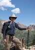
Towel Peaks East
The Towel Peaks and Towel Creek got their name sometime around 1900 when a cowboy named Charlie Wingfield camped in the area while taking part in a rodeo. Charlie lost a bath towel and "never ceased mourning for it during the whole rodeo". For years the peaks and the creek were known as Taul Peaks and Taul Creek. It was not until the 1960's that the USGS realized that the western pronunciation of "towel" should not be spelled "taul", and in 1968 the names were changed to their correct spelling.

I had no beta whatsover on this hike, so I wasn't sure if it would work or not. I started the hike near Needle Rock at the Towel Creek Trailhead parking area, and hiked on the Towel Creek Trail for about 3 miles until I got to Towel Tank. From there I could look up and see the peak, and since the shortest distance between two points is a straight line between the points, I decided not to out think it and just basically head straight to the peak. It worked out well, although it was steep at the top and I had to do some scrambling near the summit, but nothing worse than class 2. It was nice not to have to deal with false summits or to have to traverse a ridgeline -- instead I just went straight up to the summit. There some cool views at the summit, so I am glad that I did this one.

The weather was kind of crazy -- on the ascent it was nice and sunny, but on the way back it was cloudy with rain, snow, and graupel.

Synopsis
This was a most enjoyable day of checking out a ruin and bagging a peak!

dry Pambo Tank Dry Dry
This tank was bone dry.

water 1 out of 5water 2 out of 5water 3 out of 5water 4 out of 5 Towel Tank 76-100% full 76-100% full
The tank wasn't completely full but it pretty close to being full
_____________________
Civilization is a nice place to visit but I wouldn't want to live there
  5 archives
Dec 27 2023
avatar

 Guides 99
 Routes 1,484
 Photos 16,072
 Triplogs 1,374

male
 Joined Jan 07 2017
 Fountain Hills,
Hackberry Mountain - CNF, AZ 
Hackberry Mountain - CNF, AZ
 
Hiking avatar Dec 27 2023
DixieFlyerTriplogs 1,374
Hiking5.43 Miles 1,857 AEG
Hiking5.43 Miles   4 Hrs   21 Mns   1.68 mph
1,857 ft AEG   1 Hour   7 Mns Break
 
1st trip
Linked   linked  
Partners partners
SecretMtnLover
Route Scout Route Recorded  on Route Scout | Pop | Map | Popup | MapDEX
This hike was to the summit of Hackberry Mountain (elevation of 5,831 feet and prominence of 1,391 feet), which is within the Verde River Valley in the Coconino National Forest.

Hackberry Mountain got its name in the 1870's because of the many hackberry trees that were on it. Hackberry trees have pulpy wood which has no commercial use, but they do have edible berries. While I saw lots of juniper trees on the hike, I did not see any hackberry trees.

I started the hike at the Towel Creek TH parking area, which is on Fossil Creek Road about 8.5 miles south of Highway 260. Fossil Creek Road had been regraded earlier this year and was in good shape. I was last on the road in 2019 and it was very, very washboardy at that time.

From the parking area we crossed the road, climbed over a fence, and made our way to the Towel Creek Trail. After going a short distance we took an old road for about 1.5 miles. Topo maps show Hackberry Trail #177, but the trail does not exist in the location of on the topo maps. I am not sure if the road that I took was the elusive Hackberry Trail, or if it was simply just a ranch road. In any event, I was happy to hike on the road instead of being off-trail.

We followed the road around to the north of a bump marked on topo maps as "5212". We left the road shortly before getting to a dried up unnamed tank, and then went off-trail to the west of 5212. We then ascended Hackberry Mountain on the northwest slopes of the mountain. The off-trail portion was enjoyable and fairly easy. Vegetation was mostly some grass and juniper trees which were easy to navigate around. The mountain was in view the whole way which simplified the route finding.

The summit was very nice -- it was relatively flat and about half the size of a football field. Vegetation was mostly grass, although there were a few shrub live oaks that were no taller than knee high. Thus, we had some nice panoramic 360 degree views, and we hung around up there for 35-40 minutes. We then returned to the TH the way that we came up there.

The highpoint was a boulder about 3 feet high that has RM1 on top of it. I also located the benchmark and the other reference mark -- all were easy to find. I did not search for the azimuth mark however.
_____________________
Civilization is a nice place to visit but I wouldn't want to live there
  3 archives
Dec 10 2022
avatar

 Triplogs 3

66 male
 Joined Oct 25 2003
 Phoenix, AZ
Towel Creek Trail #67Camp Verde, AZ
Camp Verde, AZ
Backpack avatar Dec 10 2022
deserttarheelTriplogs 3
Backpack5.50 Miles 1,323 AEG
Backpack5.50 Miles2 Days         
1,323 ft AEG
 no routesno photosets
1st trip
Linked   none no linked trail guides
Partners none no partners
Did this from Fossil Springs Road to the Native American ruins with Greg O., Eugene (a new friend!) and Buddy the VLD (Very Large Dog--Greg always takes a VLD along, even if he has to borrow one, as he did this time). The first couple of miles - until the 2nd stock pond (marked Towel Tank on some maps) and its associated corral - is an old 4WD road, so the hiking is easy. Once you pass the through the two gates there, however, the 4WD road soon ends and the true trail begins dropping down to your right (the 4WD goes uphill to your left). The trail is not the greatest: rocky, ravined in places, and indistinct to non-existent in others. Once we got to the creek (which had a trickle of water with small pools), we lost it entirely for a while, and boulder-hopped down the creek until we found it again. But it quickly deteriorated to merely cairns w/ no discernable track. And as others have noted, the grass was high and thick enough that you often couldn't see the rocks you were stepping on, which also slowed us. By the time we got to a flat area directly across from the ruins, we realized that we would run out of daylight before getting to the river, which was our original destination. Perhaps in late February, with more daylight, it would be doable. Definite GPS/map/compass and route finding country. Despite the fact that it was recently burned over, it is still beautiful high chaparral/juniper/pinion mountain/cliff country w/ great views.
_____________________
Molon Labe ("Come and get them.")
 
Apr 23 2021
avatar

 Routes 174
 Photos 471
 Triplogs 184

51 male
 Joined Mar 16 2019
 Phoenix
Towel Creek Ruins - West AccessCamp Verde, AZ
Camp Verde, AZ
Hiking avatar Apr 23 2021
AugustWestTriplogs 184
Hiking7.33 Miles 1,534 AEG
Hiking7.33 Miles   4 Hrs   11 Mns   1.90 mph
1,534 ft AEG      20 Mns Break
 
1st trip
Linked   linked  
Partners partners
Abs02
Route Scout Route Recorded  on Route Scout | Pop | Map | Popup | MapDEX
The end of FR 574 approximately 15 miles south of Camp Verde leads to a very, very cool area. Multiple access points lead into the Cedar Bench Wilderness and also to one of the key access points down to the Verde River.

I was in Camp Verde for my second COVID shot and decided to make a day of it. We arrived at the River Trail Trailhead at Double T Ranch at around noon. The property owner came down to ask if we had any questions and was incredibly friendly. 3 of his horses came ambling up the trail as we were starting out. I have been around horses most of my life and these horses were of an extremely high pedigree.

River Trail leads down to the river in about 2/3 of a mile. We crossed just up from some very light class 2 rapids. The water reached my midriff and was not unbearably cold. I crossed too far downstream from Towel Creek and we had to bushwack up about a quarter of a mile.

Towel Creek from the river to the ruins has views of the Verde Rim front and center. Cedar Bench, Pine Mountain, and Mazatzal's are all seen in clear view. The line cabin area was another highlight. It looks more like a storage shed, but the cabin and the surrounding areas are all clearly still actively used. The trail also features massive cairns and lots if them.

Ultimately the trail to the ruins is far more worn than Towel Creek Trail continuing on towards FR 708 in the Coconino NF. The ruins are interesting and the Towel Creek riparian zones were quite beautiful with the shaded canopy.

FR 574 is a 4WD and high clearance road. Maybe not the way in but definitely on the way out. It isn't over the top, but there are some steep sections coming out that the 4WD helped with.

There is so much to explore in this area. Chasm Creek, Oxbow, and Cold Water Trails (leading into the Cedar Bench Wilderness) all start off this road. The Verde River is itself a miracle and worth the drive to experience and swim if you are two or four pawed! We saw one group of 4 hikers close to the ruins which was a suprise and a single truck parked at the trailhead.

water 1 out of 5water 2 out of 5water 3 out of 5water less than max Brown Springs Gallon per minute Gallon per minute
Amazing how much water was coming from this area!

dry Gap Creek Dry Dry
Zilch

water 1 out of 5water less than maxwater less than maxwater less than max Towel Creek Pools to trickle Pools to trickle
Some pools deep enough for Luna to splash in.
_____________________
Wildflower seed in the sand and wind
May the four winds blow you home again
 
Oct 21 2019
avatar

 Guides 99
 Routes 1,484
 Photos 16,072
 Triplogs 1,374

male
 Joined Jan 07 2017
 Fountain Hills,
Towel Creek Ruins, AZ 
Towel Creek Ruins, AZ
 
Hiking avatar Oct 21 2019
DixieFlyerTriplogs 1,374
Hiking13.30 Miles 2,340 AEG
Hiking13.30 Miles   6 Hrs   48 Mns   2.53 mph
2,340 ft AEG   1 Hour   32 Mns Break
 
1st trip
Linked   linked  
Partners partners
SecretMtnLover
The Towel Creek Ruins have been on my radar screen for a while, and I decided to check them out today. It was a pretty day, and I was able to persuade Tracie, my favorite and intrepid hiking partner, to join me on the hike.

We made our way to a couple of ruins -- one small one and one larger one. The larger one was pretty decent, and we enjoyed checking it out. There was plenty of bat guano on the floor, but no bats. The second ruin wasn't all that great, but it gave us a nice place in the shade to hang out for a while and enjoy some nice views of the valley below and the mountain tops out in the distance.

While the ruins were decent and are worth taking a look at, this hike wouldn't make my top 10 list. The Towel Creek Trail #67 doesn't have the greatest tread in the world: most of the time you are hiking on baseball and softball sized ankle-busting rocks, so you have to watch your step. Most of the scenery is typical of a high desert: chaparral, juniper, prickly pear, mesquite, among other things. The trail was mostly easy to follow, especially the first 3 miles or so. There were a few places where the trail was a bit overgrown though.

The ruins are easily to see from the trail, and it is a pretty easy off-trail scramble to get to them. We were a bit premature in leaving the trail to get to the ruins: we wanted to check out some overhangs that we saw before we got to the ruins. Doing that meant that we did a bit more bushwhacking than we otherwise would have done.

To get to the TH, we went about 9 miles on Fossil Creek Rd, off of 260. The road looked well-graded, but it was VERY washboardy the whole way. You certainly don't need a 4WD or even a HCV, but you might want to drive a vehicle with a decent suspension/shocks. We parked at the TH parking area, which was on the left side of the road, across from Needle Rock. We then walked 0.3 miles along the road to get to the trail.

The ruins were neat, but this is probably a one-and-done hike for me: I didn't like the trail all that much, and the washboardy road wasn't all that great either.
 Fauna
 Fauna [ checklist ]
[ checklist ]  Tarantula Hawk
 Named place
 Named place [ checklist ]
[ checklist ]  Needle Rock  Towel Tank
wildflower observationwildflower observationwildflower observationwildflower observationwildflower observation
Wildflowers Observation Substantial
There were LOTS of yellow wildflowers along the trail today

water 1 out of 5water 2 out of 5water 3 out of 5water less than max Towel Tank 51-75% full 51-75% full
_____________________
Civilization is a nice place to visit but I wouldn't want to live there
 
Apr 29 2014
avatar

 Guides 14
 Routes 115
 Photos 4,830
 Triplogs 3,536

male
 Joined Oct 29 2005
 Scottsdale, AZ
Oxbow / Cold Water Loop, AZ 
Oxbow / Cold Water Loop, AZ
 
Hiking avatar Apr 29 2014
topohikerTriplogs 3,536
Hiking29.91 Miles 6,949 AEG
Hiking29.91 Miles   13 Hrs      2.60 mph
6,949 ft AEG   1 Hour   30 Mns Break
 
1st trip
This was my first time in the Pine / Cedar Bench wilderness(s). The drive in was pretty easy. Dugas road was recently graded. There was one interesting sign stating that it is illegal to drive on the road when it’s wet. That’s one way to keep the road in good condition

My original plan was to a big loop with the Verde Rim trail. When I got to the parking spot and got out, the wind was so fierce that it closed my jeep road for me. The wind was bitter cold. I didn't want to spend the day fighting the wind. I went to a plan B, hike down Pine mountain to the Verde River.

I parked 2 miles from the Oxtail TH. The road starts to get rocky after this point. The wind was brutal along Dugas road. I had to wear a wool hat and gloves under I dropped under 4,500 feet!

The Oxtail trail

The trail starts right off of Dugas road by a tank. You enter a gate and take a hard turn to the left. The trail drops fast down to drainage. I lost the trail for a couple of minutes in the drainage. The trail was well cairned and very easy to follow. There was a cairn almost every 15 feet. Sometimes there were to many cairns. This is a very old trail and there’s been recent trail maintenance done to it. The views on the trail very great. I saw snow on Humphreys. My only gripes is the amount of rocks and drops off. There are a lot of rocks on the trail, sometimes it’s almost like scree. There are sections with drops. Sometimes you would get both. Scree rocks with drop-offs! This made for a very slow moving hike. The trail ended at the Brown Spring TH. I took the Towel trail to the Verde. The Towel trail is an old road that follows and crisscrosses the Towel creek. The Towel trail crosses the Verde and continues to Fossil Creek RD. This was an great place to explore, but I had a big climb ahead of me so I didn’t stay long.


Cold Water trail

The Cold Water trail is an old jeep road that doesn’t believe in switch backs! The trail has some great views of the Verde valley. After the Cedar Bench the road turns into trail. The cold water trail is also very easy to follow. There’s been recent maintenance done to this trail as well. Shortly after the Tule Rim intersection, the Cold Water trail takes a sharp turn to the right and climbs up to Dugas road. This was the monster climb of the day. The trail gained 1,000 feet (5,200 to 6,200) in a little more than a half mile. I felt like I should have had a climbing rope! Half way up, the wind started to blow. The Cold water trail ends about a quarter mile from the Verde Rim trail. Once on top, the wind died down.


I went a little down the Verde Rim trail just to see what I pasted up for the day. Once I got on the trail section, I was not impressed. It started out right as a cairn hunting exercise. I liked the Cedar Bench trails better.
It was a fun hike. The Cedar Bench wilderness is a cool area. The trails are cleaned up and the views are great. The cold wind was a bit much. I’ll return on a warmer day.

This was my first hike with HAZ tracks. It was cool to get hiking stats as you hike. The only down side is that the HAZ lady reminds me how slow I am at climbing :(
_____________________
"Everywhere is walking distance...If you have the time"
-Stephen Wright
 
Feb 15 2012
avatar

 Triplogs 24

female
 Joined Dec 24 2011
 Sedona, Az.
Towel Creek Trail #67Camp Verde, AZ
Camp Verde, AZ
Hiking avatar Feb 15 2012
hikermaryTriplogs 24
Hiking13.25 Miles 2,500 AEG
Hiking13.25 Miles
2,500 ft AEG
 no routesno photosets
1st trip
Linked   none no linked trail guides
Partners none no partners
_____________________
 
Feb 04 2012
avatar

 Guides 13
 Routes 38
 Photos 1,651
 Triplogs 577

60 male
 Joined Nov 15 2005
 Jackson, CA
Towel Creek Trail #67Camp Verde, AZ
Camp Verde, AZ
Hiking avatar Feb 04 2012
toddakTriplogs 577
Hiking14.00 Miles 2,000 AEG
Hiking14.00 Miles   8 Hrs      1.75 mph
2,000 ft AEG
 no routes
1st trip
Linked   none no linked trail guides
Partners none no partners
A mostly pleasant stroll down to the river and back. Maps show a Hackberry Trail that cuts off the corner to the north, but I couldn't find any trace of it.
_____________________
 
Jan 18 2010
avatar

 Guides 19
 Routes 40
 Photos 5,624
 Triplogs 341

52 female
 Joined Nov 22 2005
 Tucson, AZ
Towel Creek Trail #67Camp Verde, AZ
Camp Verde, AZ
Backpack avatar Jan 18 2010
writelotsTriplogs 341
Backpack14.20 Miles 1,800 AEG
Backpack14.20 Miles2 Days         
1,800 ft AEG
 no routesno photosets
1st trip
Linked   none no linked trail guides
Partners partners
drewboy
I looked more closely at the topo map for this hike, and between that and the description in Bruce Grubb's book is where I got the overall mileage and AEG. Let me tell you, though, I think that with a detailed topo or GPS route you'd get a lot more AEG, because you just keep going up, and down, and up, and down, and up, and down...

Did as a backpack with some other strong hikers from the ABC. Awesome group to hike with. Makes me all warm and fuzzy that they let me in their little club :D . The writeup that we got from Dave made it sound like a walk in the park - or so we thought. I wouldn't rate it as easy, though, especially not with a pack on! Overall, though, I was more impressed with this hike than I think others have been in the past. The canyons and rock formations in this area are quite beautiful, and the expansive views from the saddles and highpoints are a real tribute to the value of the Verde wilderness. It has interesting cultural elements - though we didn't actually make it out to the ruins, so I've still got more exploring to do there. Saw very little real wildlife, though Lilo's first encounter with a Slow Elk was pretty entertaining.

We thought of stopping and making camp at the cowboy cabin, since our hiking day was short and there was plenty of still water in the stream just below the camp. However, the call of the river was too strong, and we pressed on, climbing over yet another low ridge. Past the cabin, the trail is much harder to follow, but the cairns are good and keep you on track. It feels like you're heading in the wrong direction at this point, but just trust in the cairns and you'll make it.

The end of the trail is a rocky stretch of shallow bank near what seems to be an old beaver dam. The water looks slow and deep here (good for swimming?), but there aren't as many trees and vegetation as one might hope for on a hot summer day. We found sufficient camping, and with a little creativity Andy and I were able to have some sweet hanging. Lilo is actually getting used to sleeping in the hammock, and with the very cold night, it was nice to have the extra body heat!

The hike out seemed harder than it should have, but still felt shorter than the way in. It's hard to keep your pace with all of the ankle turners. Made decent time getting out (about 4 1/2 hours) and headed into Camp Verde for some grub. Seems like most everything is closed on Sundays there (typical small town!). Although I loved the salsa and cabbage salad at Las Margaritas, my meal was a tad bland. I was hungry enough that it didn't matter!
_____________________
-----------------------------------
Change will not come if we wait for some other person or some other time. We are the ones we've been waiting for. We are the change that we seek.- Barack Obama
 
Jan 16 2010
avatar

 Routes 3
 Photos 76
 Triplogs 23

68 male
 Joined Aug 03 2004
 Gold Canyon, AZ
Towel Creek Trail #67Camp Verde, AZ
Camp Verde, AZ
Backpack avatar Jan 16 2010
drewboyTriplogs 23
Backpack8.00 Miles 1,500 AEG
Backpack8.00 Miles   4 Hrs      2.00 mph
1,500 ft AEG
 no routesno photosets
1st trip
Linked   none no linked trail guides
Partners partners
writelots
We did this as an overnight backpack trip, hiking down to the Verde River from the Towel Creek trailhead and camping out there. We found a nice campsite with fire ring just as you reach the river. A couple of us were hammock campers and were able to find trees to hang from just downstream from the campsite. I estimate it was a couple of miles past the ruins to get to the river, for a total one way distance of 8 miles. Part of the way down we did find a place on towel creek that had a nice pool of clear looking water. There were many cattle tracks and cow pies throughout. In the middle of the night we heard a loud smacking sound against the water, and a while later another one as some critter kept moving around the river. We guessed this must have been a beaver slapping his tail. There were signs of an old beaver dam there. We spoke with a couple of kayakers who were floating down from Camp Verde. Overnight low was around 28 degrees, we had frozen water bottles and ice crystals on our tents in the morning. The ruins were very impressive. Overall a very fun and interesting trip. I will definitely do this one again.
_____________________
 
Jan 16 2010
avatar

 Guides 1
 Routes 11
 Photos 691
 Triplogs 94

45 female
 Joined May 14 2008
 Tucson, AZ
Towel Creek Trail #67Camp Verde, AZ
Camp Verde, AZ
Backpack avatar Jan 16 2010
SaraeTriplogs 94
Backpack14.00 Miles 1,500 AEG
Backpack14.00 Miles2 Days         
1,500 ft AEG
 no routesno photosets
1st trip
Linked   none no linked trail guides
Partners none no partners
ABC leadership council retreat. This trail felt really long. Not sure if that was because I was still fighting a cold, or if the mileage is really off. There were cool views of cliff dwellings and a cowboy line shack along the way to the river.
_____________________
In every walk with nature one receives far more than he seeks. ~John Muir
  3 archives
Mar 16 2008
avatar

 Triplogs 3

58 female
 Joined Sep 06 2003
 Flagstaff, AZ
Towel Creek Trail #67Camp Verde, AZ
Camp Verde, AZ
Hiking avatar Mar 16 2008
dsolteszTriplogs 3
Hiking6.40 Miles 1,500 AEG
Hiking6.40 Miles
1,500 ft AEG
 no routesno photosets
1st trip
Linked   none no linked trail guides
Partners none no partners
We did this as a three-day backpack from Fossil Springs Road, setting up basecamp near the cowboy line shack (since there was plenty of water in Towel Creek). The ruins are visible from the line shack - look in the white cliffs upstream from the shack. We hiked to the Towel Creek crossing upstream from the shack (just a hundred feet or so), then struck out along the stream towards the ruins, bushwhacking up a drainage near the ruins, and up a not-too-steep slope to the ruins. We explored along the cliff edge. The first cave has just the remains of an interior wall, the second an almost complete wall (this is visible from the shack). We continued upstream past a drainage to another ruin with a complete wall with a small doorway in it. We'd started our day with a hike down to the Verde River, and explored the ruins for a couple hours in the late afternoon.

It took us ~3.5 hours to get from the trailhead to the line shack, and around 1.5 hours to get from the line shack to the Verde River. The trail's a bit rocky and slippery in places. Towel Creek had plenty of water (wet winter). Poppies were blooming in large groups on the hillsides, and we also spotted an occasional paintbrush, lupine, and a few other wildflowers.
wildflower observationwildflower observationwildflower observationwildflower observationwildflower observation
Wildflowers Observation Light
_____________________
 
Feb 10 2007
avatar

 Guides 73
 Routes 176
 Photos 10,174
 Triplogs 2,324

46 male
 Joined Sep 08 2006
 
Towel Creek Trail #67Camp Verde, AZ
Camp Verde, AZ
Hiking avatar Feb 10 2007
JimTriplogs 2,324
Hiking6.40 Miles 1,500 AEG
Hiking6.40 Miles   4 Hrs      1.60 mph
1,500 ft AEG
 no routesno photosets
1st trip
Linked   none no linked trail guides
Partners none no partners
I didn't do the whole thing because the trail was hard to find, and it was getting late. The sign identifying the trailhead (if you can call an unmarked gate in a fence a trailhead) faced opposite of the direction that the FS tells you to access the trail, and there really wasn't much impressive to see. I might feel differently had I made it to the river, but never did, I don't think I ever will. I don't recommend this one. It will how ever, be free of hikers, so it does offer some solitude.
_____________________
🍭
 
Feb 15 2004
avatar

 Routes 36
 Photos 2,658
 Triplogs 1,347

67 male
 Joined Jul 28 2004
 Scottsdale, AZ
Towel Creek Trail #67Camp Verde, AZ
Camp Verde, AZ
Hiking avatar Feb 15 2004
mazatzalTriplogs 1,347
Hiking9.00 Miles 1,500 AEG
Hiking9.00 Miles   4 Hrs   40 Mns   1.93 mph
1,500 ft AEG
 no routesno photosets
1st trip
Linked   none no linked trail guides
Partners none no partners
We went about 4.5 miles in and I think we were just about at the ruins but we turned back at the top of another descent. I'll have to come back!
It was a bit warm for February!
_____________________
 
May 24 2003
avatar

 Triplogs 3

53 male
 Joined Mar 31 2004
 Flagstaff, AZ
Towel Creek Trail #67Camp Verde, AZ
Camp Verde, AZ
Hiking avatar May 24 2003
rpasellTriplogs 3
Hiking14.00 Miles 1,500 AEG
Hiking14.00 Miles   11 Hrs      1.27 mph
1,500 ft AEG
 no routesno photosets
1st trip
Linked   none no linked trail guides
Partners none no partners
I will be making this trip again this weekend.

Easily one of the hardest hikes due to conditions I've ever done. I knew it would be hot, and purposely got to the trail head at 7:00 am. I figured we'd get to the Verde by 11:00 am. The trail head is fairly well marked from the road if you are looking for it. The first couple miles are on a jeep trail through pretty country. Once you reach the second tank, the trail begins it's descent (I'm guessing about 1000 feet initially). At the bottom there was a small (but life saving) pool of water. Another 2 miles or so, and you should see the ruins on the north wall. These are fairly spectacular. They do require a bit of bush-wacking to get to. We continued down the trail with the Verde being the goal. After passing the old Cowboy line shack, you will cross the dry creek bed. At this point the trail became impossible to find. The quadrangle I was using didn't have the last 2 miles of the trail on it, and it was passing noon, and half our water gone, so we turned back. This is the dangerous part. My hiking companions Camelback had the hose come off at the base of the bladder and we lost all her water. This time of year it was already 110 degrees. Needless to say the hike out in that heat with half rations of water was eventful. I would highly recommend the hike as a challenging, and interesting experience. Can't wait to do it again when it's not as hot.
_____________________
 
Apr 16 2003
avatar

 Triplogs 5

51
 Joined Mar 29 2003
 Phoenix, AZ
Towel Creek Trail #67Camp Verde, AZ
Camp Verde, AZ
Hiking avatar Apr 16 2003
James M. PoehnerTriplogs 5
Hiking6.40 Miles 1,500 AEG
Hiking6.40 Miles
1,500 ft AEG
 no routesno photosets
1st trip
Linked   none no linked trail guides
Partners none no partners
Take 260 into Camp Verde. From Camp Verde follow 260 for about 7 miles to FR 708 on right. Follow FR 708 for about 8mis on gravel road until you see Needle Rock on the right. Go about 50 yards further until you see the Clearing on the left for parking and the ranch entrance on the right. The actual trail head is about 50-60 yards further on 708. There is a brown sign marking the trail head only visible from the opposite direction. Directly from the sign to the right is a yellow entrance gate. Enter the gate. Look for carins that will lead you to the actual trailhead marker. At marker make a left and follow the cattle trail. About 100yds you will enter another cattle gate. Continue to follow the cattle trail up a steep rocky path. Be careful! Follow cattle trail for about 2.5mis until you see the entrance to a grazing pasture. Go through the entrance. The trail is not highly visible here but continue straight along fence line and it will pick up again. You will have to cross another entrance near the cattle pond on your left. Then another on your right. This is where the trail will begin to follow the creek on the right. The trail is highly visible in some areas and almost non-visible in some. Look for carins to remain on the trail. Many are marked with small white reflector tape. Continue traveling on the trail for about 4.5 miles. Take full advantage of the many shaded resting places that cross the creek. There are many nice rocks to sit with many clear pools of water alongside. After following trail for about 4.5mis you will see the ruins high up on the opposite cliff. The trail becomes very vague as you get directly across from the ruins. Look hard for the carins that will lead you down and across the creek to the other side of the canyon where you can do an easy climb up to the ruins. At the ruins there are several tools and pieces of pottery laying about on stones. Becareful at the large cave ruin as it is home to several large cats. Wear sturdy climbing boots as the trail is steep and rocky perfect for ankle injuries especially on the way back when your muscles are tired. Take plenty of water and some high energy food. You will need it on the way back. I've seen this hike rated moderate. I rate it strenous simply for the distance and rugged up and down trail.
_____________________
 
average hiking speed 1.89 mph

WARNING! Hiking and outdoor related sports can be dangerous. Be responsible and prepare for the trip. Study the area you are entering and plan accordingly. Dress for the current and unexpected weather changes. Take plenty of water. Never go alone. Make an itinerary with your plan(s), route(s), destination(s) and expected return time. Give your itinerary to trusted family and/or friends.

helpcommentissue

end of page marker