username
X
password
register
for free!
help
ArticlesGuidesRoutes
 
Photosets
 
 Comments
triplogs   photosets   labels comments more
Martinez Cyn via Cottonwood & Box Cyn - 9 members in 32 triplogs have rated this an average 4.1 ( 1 to 5 best )
1, 2  Next
32 triplogs
login for filter options
Apr 27 2025
avatar

 Guides 41
 Routes 1,626
 Photos 14,983
 Triplogs 2,760

69 male
 Joined Jan 20 2009
 Far NE Phoenix,
Martinez Cyn via Cottonwood & Box CynGlobe, AZ
Globe, AZ
Hiking avatar Apr 27 2025
The_EagleTriplogs 2,760
Hiking13.62 Miles 2,431 AEG
Hiking13.62 Miles   6 Hrs   25 Mns   2.34 mph
2,431 ft AEG      36 Mns Break12 LBS Pack
 
1st trip
Linked   none no linked trail guides
Partners partners
joebartels
Route Scout Route Recorded  on Route Scout | Pop | Map | Popup | MapDEX
This area had always been on my radar for a return since we hiked a North Butte and South Butte loop in 2013. Joe pushed this out as an option and I was in.

Price Road was as remembered wash 4 miles of pavement followed by 6 miles of off and on washboard. Turning onto N. Box Canyon Road, the plan was to drive as far a comfortably possible for the Subi without getting hung up rocks or stuck in sand. 4.5 miles in, driving through a narrow single lane box, where turning around/backing up would of difficult, I found a spot to park. Good choice, 100 further up was an area that would have been sketchy without more clearance.

A 7:30 start to our hike and Joe claims he hears kids voices, in the middle of nowhere where we had not seen a single person. (nothing new, he hears voices all the time). Around the corner a family was climbing on the rocks taking photos. (Sorry I doubted your sanity....once more)

4.3miles on Box Canyon and then Martinez Canyon road until we reached the gate the marks the end of motor traffic. We'd only seen the one vehicle with the kids and a pair of motorcycles.

Starting the loop portion I was pleasantly surprised at the riparian area we were hiking through combined with the towering cliffs of Martinez Canyon. We decided on a CCW attack on the loop hitting the crumbling Martinez Cabin section first, followed by the Martinez Mill. I could of spent more time here checking out the many artifacts in and around the Mill. I don't have a clue how, back in the day they were able to get all this heavy. heavy machinery out to the middle of nowhere, on those roads, without the aid of modern vehicles. We briefly checked out the Martinez Mine and another in the vicinity. Without a flashlight, I only went in 50' or so, stomping my feet to alert any potential mine worms.

We continued on and started the climb up to Columbia Mine. This one still and the cart track laid down an intact. With a light, this would have been a fun one to explore more. We bypassed going into the Silver Bell mine, finished our climb and enjoyed the views from the top.

Getting back down on this side of the loop was a bit steeper and more loose-er-er. We had lunch back in the Martinez Cabin area and then finished our hike back to the vehicle. I expected to see more SXS activity, it being a weekend with perfect temps, but was pleasantly surprised at the lack of traffic.

I would go back to this area in a minute if I had a vehicle capable of driving to the gate.
wildflower observationwildflower observationwildflower observationwildflower observationwildflower observation
Wildflowers Observation Isolated
_____________________
There is a very fine line between "hobby" and "mental illness."
Dave Barry 🦅
 
Apr 27 2025
avatar

 Guides 264
 Routes 2,797
 Photos 14,494
 Triplogs 5,894

55 male
 Joined Nov 20 1996
 
Martinez Cyn via Cottonwood & Box CynGlobe, AZ
Globe, AZ
Hiking avatar Apr 27 2025
joebartelsTriplogs 5,894
Hiking13.23 Miles 2,325 AEG
Hiking13.23 Miles   6 Hrs   27 Mns   2.28 mph
2,325 ft AEG      39 Mns Break
 
1st trip
Linked   none no linked trail guides
Partners partners
The_Eagle
Route Scout Route Recorded  on Route Scout | Pop | Map | Popup | MapDEX
The drive passes Country Thunder grounds. Further in, there is a fabulous stretch of saguaros. Based on their pristine condition, it's clear that the focus on this well-visited area is still further in.

SubiBru got us started well into the narrows of Box Canyon. The first thing we heard stepping out was kids playing, seemingly from above.

The lure of Box Canyon is obvious, being remarkably close to the valley. We quickly realized a family with a shiny new Bronco was just ahead of us, playing around on the rocks. Two motorcycles, and that was it for human life until our last miles on the return.

A riparian area about 4.5 miles in for us was an unexpected treat. There was a spring, with a small flow into a pool 0.2 mi north of the unnamed spring on Topo.

Martinez Mine and Mill has enough intrigue to make your mind ponder.

I pitched an in-and-out/get'er-done hike. The driver wanted the full tour to make me squeal, and it didn't disappoint.

Synopsis
Schullhauser wrote a classic guide in 2007, and it's been on my someday list ever since. The 18-year before/after difference in structures is worth a gander.

The loop had a couple of unfriendly spots for me, but the whole enchilada was mighty intriguing once. There was more fascinating geology throughout than I expected.

High clearance in the best of conditions is possible to where we started, with the right driver and a small vehicle. You won't get much further without increasing luck.
 Named place
 Named place [ checklist ]
[ checklist ]  Martinez Canyon  South Butte
_____________________
- joe
 
Feb 19 2024
avatar

 Routes 255
 Photos 1,071
 Triplogs 245

68 male
 Joined Feb 10 2008
 Kent,wa
Martinez Cyn via Cottonwood & Box CynGlobe, AZ
Globe, AZ
Hiking avatar Feb 19 2024
fdv75Triplogs 245
Hiking5.11 Miles 1,279 AEG
Hiking5.11 Miles   3 Hrs   41 Mns   1.75 mph
1,279 ft AEG      46 Mns Break
 
1st trip
Linked   none no linked trail guides
Partners none no partners
Route Scout Route Recorded  on Route Scout | Pop | Map | Popup | MapDEX
Used high clearance 4x4 vehicle on the long crappy jeep road. The drive through Box Canyon was very enjoyable, however. The hike to Martinez Cabin and Martinez Mine is very interesting. The hike up to Columbia Mine and Silver Belle Mine didn't have much to offer for the extra effort.
_____________________
  4 archives
Feb 15 2020
avatar

 Routes 2
 Photos 64
 Triplogs 10

35 male
 Joined Sep 09 2015
 Tucson, AZ
Box & Martinez Canyon 4x4, AZ 
Box & Martinez Canyon 4x4, AZ
 
4x4 Trip avatar Feb 15 2020
derpsquadTriplogs 10
4x4 Trip
4x4 Trip
 no routes
1st trip
Partners none no partners
Drove in on Cottonwood Canyon and made our first stop at Ajax mine. Took an unnamed road to check out Myers and Herring mine in Box Canyon. Box Canyon rd to Martinez Canyon rd. Hiked to Martinez mine and looped around Columbia and Silverbell mine (linked guide). Camped in a super cool spot off Martinez canyon rd.

Drove out Box Canyon rd to Price Rd and back to Florence.

Pretty crowded area on the weekends but there's so much to explore. Easy to get away from the crowds if you stay away from the hot spots or hike.
 Named place
 Named place [ checklist ]
[ checklist ]  Martinez Canyon
_____________________
 
Apr 12 2018
avatar

 Guides 44
 Routes 162
 Photos 24,766
 Triplogs 2,411

75 male
 Joined May 04 2004
 Mesa, AZ
Martinez Mines Loop, AZ 
Martinez Mines Loop, AZ
 
Hiking avatar Apr 12 2018
CannondaleKidTriplogs 2,411
Hiking4.80 Miles 1,444 AEG
Hiking4.80 Miles   3 Hrs   3 Mns   1.57 mph
1,444 ft AEG12 LBS Pack
 no routes
1st trip
Partners partners
trixiec
I hadn't been in Martinez Canyon since the day before the BLM closed the access road in November 2012, but with most of the ATV-owning winter-visitors gone and a bit of cool weather we decided it was a worthy destination.

The drive? One word... NASTY!
If I still had the Cherokee the drive would not have presented an issue at all, but with the 4Runner having much less clearance and no front locker it presented many issues... one even had Tracey saying enough and bailing out for a few hundred yards.
I'll admit I was in almost the same panic mode, backing down the hill was not an option!
What made it even worse, even though the Vehicle Stability Control is supposedly disabled (dash light even shows it disabled) when nearing the top of a steep hill and the front wheels got light, the VSC decided began applying brakes seemingly incoherently to different wheels, which slowed the 4Runner down so much I wasn't sure I'd top the hill.
So it was pretty much full throttle in low-range to make it. Only after I was down the other side was Tracey willing to be co-pilot again.

The hike: My main interest was to see how the road had fared in 5+ 5 years with no vehicle traffic,just natural erosion. We can attest it is in as bad a shape as one could expect... even hiking the old loop route above the mines was nasty, especially since falling is absolutely not an option for me.
Even without any near-misses my back was giving warning signs before the halfway point so we did no exploring up top and didn't set foot in either of the mines I had explored in-depth back in early-2012.
Of course even if did go in, Tracey wouldn't have any part of that.
So, we just continued along the long-unused road past the Silver Bell, Columbia & Martinez mines and a very short stop at the mill.
Not much has changed at the mill, probably the number of visitors has dropped significantly due to the longer hike in.
As dry as it's been in general this year, we were a bit surprised by how much green we found.
Once our mission was accomplished, we agreed it was unlikely we'll be out here again... unless we win the lottery and can afford to buy an ATV or another more modified vehicle.
Fat chance of that happening!
Because of the astronomical odds you say? Nope! Cuz ya gotta play before you can win.
 Fauna
 Fauna [ checklist ]
[ checklist ]  Gila Monster
 Named place
 Named place [ checklist ]
[ checklist ]  Columbia Mine  Silver Bell Mine
_____________________
CannondaleKid
 
Feb 23 2017
avatar

 Guides 177
 Routes 249
 Photos 10,213
 Triplogs 2,215

74 male
 Joined Feb 12 2002
 Gold Canyon, AZ
Martinez Cyn via Cottonwood & Box CynGlobe, AZ
Globe, AZ
Hiking avatar Feb 23 2017
AZLOT69Triplogs 2,215
Hiking2.62 Miles 517 AEG
Hiking2.62 Miles
517 ft AEG
 no routes
Linked   none no linked trail guides
Partners none no partners
Nice to visit again. Most of structures still standing.
_____________________
It's best for a man to remain silent and be thought a fool, than to open his mouth and remove all doubt.
--Mark Twain
 
Mar 03 2013
avatar

 Photos 27
 Triplogs 4

54 male
 Joined Mar 16 2008
 chandler
Martinez Cyn via Cottonwood & Box CynGlobe, AZ
Globe, AZ
Hiking avatar Mar 03 2013
djmason9Triplogs 4
Hiking 517 AEG
Hiking   5 Hrs   30 Mns   0.00 mph
517 ft AEG   3 Hrs    Break3 LBS Pack
 no routes
1st trip
Linked   none no linked trail guides
Partners none no partners
I did this trip on 3/3/2013 and it was really fun. We went to martinez mine via box canyon which i highly recommend. I was in my jeep wrangler which was needed for a few of the rocks. I would recommend a good 4x4 (mines stock with 32 inch tires and no lift.) I made it with out an issue. I will say one thing after looking at other peoples pictures im sad to say some of the stuff is now gone or destroyed. the rock cabin looks as if someone dismantled it and took parts of it away. And some of the machinery is gone too. Not sure if someone stole it or what. The bridge that once crossed the river to the mine/mill is collapsed now. They have gated off the main road leading up to the cabins and mine so you can't drive up there (which might be good to keep people honest). But the hike is short and easy.

From when we turned onto Box Canyon Rd to when we reached the mine was about 2.5 hrs give or take but we stopped a lot and got a little turned around.

i suggest go sooner than later its very run down and might not be there in a few years like it is.
 Named place
 Named place [ checklist ]
[ checklist ]  Martinez Canyon
_____________________
 
Dec 20 2012
avatar

 Guides 14
 Routes 115
 Photos 4,830
 Triplogs 3,536

male
 Joined Oct 29 2005
 Scottsdale, AZ
Artisan Well- Martinez - Coke Oven -Loop, AZ 
Artisan Well- Martinez - Coke Oven -Loop, AZ
 
Hiking avatar Dec 20 2012
topohikerTriplogs 3,536
Hiking29.31 Miles 5,283 AEG
Hiking29.31 Miles   11 Hrs   50 Mns   2.98 mph
5,283 ft AEG   2 Hrs    Break
 no routes
1st trip
I've wanted to hike the entire Martinez canyon ever since I've seen it from the new AZT # 16 section. We'll this time I worked it into a hike.
I parked at the artisan well. The road in was a bit rougher from the last time.

I headed on the old AZT. At one point I almost slipped on rock and noticed there was ice on it. I looked around and found some icicles hanging and dripping. The drippings formed ice stalagmites! I saw a couple more ice spots. I was only at 3,500 feet.

I made it to the new AZT16 TH and saw CannondaleKid's water cache. I went on the AZT down to the old corral and then headed into Martinez canyon. There was an old cement spring box at the bottom.

The trip down the canyon was pretty mild. It was what I expected from what I could see from other hikes. The canyon was pretty wide with not much vegetation. I had to go down a couple of 3~4 foot dry water falls.
About 3/4 a mile down, I found two wooden boxes in the grass. I couldn't figure out what here were for. About a mile in, my GPS showed I was on a road and going past Martinez's well. I didn't see any well or any evidence of a road. In fact the canyon started to close up and become rockier.
I was about 200 feet from where explored the canyon from the other side when I hit a showstopper! ](*,) :scared: I ran into a narrow 15 foot waterfall! I wasn't so committed to finishing this canyon, I would have turned around. I was able to climb up and over this area. Climbing is not something I enjoy. So I decided this was a one-time hike. I hit another waterfall, but this one was only 6 feet and getting around it was easier. I finally made it to the old mill!
A section of track that went over the canyon has fallen down. (see my pics).

On the way out of the canyon I saw the new locked gate. Martinez canyons is now closed to motor vehicles, but open to horse and foot travel. I did see a motor cycle track print in the canyon!
I went to the corral on the way out and had lunch. I headed over to the Cochran Coke ovens. I then proceeded down Battle Axe Road. I checked out the Gila River, it's flowing pretty wide and fast.

I returned to the Jeep via Battle Axe road. I was very surprised on the360 degrees views from Battle Axe road. The views are spectacular. I was also checking on the road conditions for a possible family outing to the Cochran Coke Ovens.

The temps would have been perfect if it wasn't for the gusting cold winds. Surprisingly I didn't see one person the entire day. Not even any vehicles or hunters.
_____________________
"Everywhere is walking distance...If you have the time"
-Stephen Wright
 
Nov 16 2012
avatar

 Guides 44
 Routes 162
 Photos 24,766
 Triplogs 2,411

75 male
 Joined May 04 2004
 Mesa, AZ
Martinez Cyn via Cottonwood & Box CynGlobe, AZ
Globe, AZ
4x4 Trip avatar Nov 16 2012
CannondaleKidTriplogs 2,411
4x4 Trip16.20 Miles 1,832 AEG
4x4 Trip16.20 Miles   2 Hrs   22 Mns   6.85 mph
1,832 ft AEG
 
Linked   none no linked trail guides
Partners none no partners
Our group of 8 Jeeps left Price Rd near Florence and headed into Box Canyon. Although this part is plenty easy for most 4x4's, whenever the leader spotted an extra challenge next to the road we would pass over it and those who cared to would follow. Being third in line and following the only other Cherokee I had a chance to see the route over each obstacle so had no problem following. The last major obstacle we came to was a big boulder that looked a bit tougher, yet the Cherokee ahead went right over. Unbeknownst to me, he had broken a rock loose and since I was angled up at the time, I didn't see it and I just continued. Unfortunately with that rock out of place I dropped the left side slightly off the rock and the running board got hung up on the boulder. Although it already had thousands of Arizona pinstripes, this was the first dent for the Cherokee. I was able to back off and continue, but I'm already thinking of adding rock-sliders to prevent another occurrence.

On the north end of Box Canyon we turned east onto Martinez Canyon Road, following it out to the Martinez cabin area. From there we continued through a few boulder fields and up to the mill. One of the other Jeeps had no lockers so decided not to continue, so since I was more interested in filming that driving, I parked there as well and hiked alongside the other 6 Jeeps as they made their way around the loop up the mountain and past the mines.

Once the last of the Jeeps were passing through The Luge I ran back down the mountain to the Cherokee where the other driver was waiting patiently. I got turned around and we headed back out, catching up with the others back at the cabins again. From there it was back out to Box Canyon, where I turned right and headed north all the way out to the US 60.
_____________________
CannondaleKid
 
Nov 16 2012
avatar

 Guides 44
 Routes 162
 Photos 24,766
 Triplogs 2,411

75 male
 Joined May 04 2004
 Mesa, AZ
Martinez Cyn via Cottonwood & Box CynGlobe, AZ
Globe, AZ
Hiking avatar Nov 16 2012
CannondaleKidTriplogs 2,411
Hiking5.20 Miles 1,271 AEG
Hiking5.20 Miles   6 Hrs      1.73 mph
1,271 ft AEG   3 Hrs    Break3 LBS Pack
 
Linked   none no linked trail guides
Partners none no partners
While this was to be a day of four-wheeling one last time through the Martinez Mine loop, for me it turned out to be a 4x4/hike/run all rolled into one including a healthy dose of filming. I said one last time because BLM has already put the gate rails in place and will be installing the permanent gate very soon. :(
It will prevent vehicle access only and those on foot will now have a short 1.5 mile hike to the Martinez Mill.

Ok, back to the triplog...
Although I could have continued all the way with the other Jeeps in the Cherokee, I decided this 'last trip' called for a series of videos best shot from along the road, if you could call it that. I left the Cherokee with one other Jeep that had no lockers while I walked alongside the other six who drove the full loop.

Going through the boulder-field was plenty of work for man and vehicle so about halfway up the east side we stopped for lunch. Well, the others did... since I had the last-minute change of plans I realized my lunch and all but a small Gatorade bottle in my fanny pack was at least a mile back at the Cherokee. :whistle:
I guess I'll be thirsty and starving later.

After lunch we had the long slog up the hill past Columbia and Silver Bell mines. Although there were plenty of scrapes going over and around the boulders, with all the skid plates and rock sliders on the vehicles there was no damage, only more evidence of passage. The only mechanical issue was an air compressor check valve that came unscrewed and fell off. I had mentioned to the driver a few minutes earlier that it sounded like he had a leak, to which he replied, I just had it checked out yesterday and they said it was all good. Then a few moments later there was a pop and hiss of air. :o

When we opened the hood I looked down by the compressor and the check valve had dropped into the only spot that kept it from falling on the ground and being run over. The only Teflon tape around was two miles away in my Cherokee so I put it back on as is. Wrenches were available but none that would fit in such tight quarters so I tightened it as tight was I could by hand and we hoped for the best. Luckily it stayed tight the rest of the trip... but he'll have a word with the folk who pronounced it fit. I have a feeling although they did use some Teflon tape they likely tightened it by hand as well and with the under-hood heat it loosened up. Oh well, we made do.

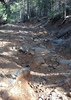
Now to the downside of the trip... literally! Hmmmm, The Luge! For those unfamiliar with this feature, think Winter Olympics... hurtling down the mountain on ice with high walls on either side. Ok, so there was no ice, but even on foot there wasn't much more traction than on ice. :scared:
The first (and most capable) Jeep got halfway through before it fell sideways into a hole, ending up against a wall. Within just moments it was time to break out the winch. With this one plus 5 more Jeeps waiting, the one with the most capable winch was planted at the top of The Luge to winch each one down to a smooth rock area free of loose gravel, where they would continue on their own to the bottom. After winching the first Jeep back up out of the hole, we set out with pick and shovel to fill the worst of the holes. We kept this up while the rest of the Jeeps were winched down so by time the 'wincher' had to drive down without assistance, it was doable.

When it was down to the last two to drop through The Luge, I realized I still had to get back to the Cherokee and help guide out the one guy still a his Jeep by the mill. It didn't take a moment to realize I would have to hustle to make it back to the cabins by time the others got there. So, once I got past the first 100 yards of real treacherous footing I took off at a jog until I reached more-or-less flat (but still rocky) ground. It wasn't but a few minutes later I heard the group starting down the hill so I kicked it in high and ran the last mile to the Cherokee. Before turning around in tight quarters and leading David (the one who had waited patiently for hours!) back out to the cabins, by now absolutely famished and thirsty I grabbed a quick sandwich, slogged down a 32 oz Gatorade and we set off. The timing worked out just right, we made it to the cabins just as the last Jeep turned the corner ahead of us.

Passing the newly installed gate rails on the way out, I realized this was the last trip in by vehicle... which I guess is best, since too many inexperienced (and many times inebriated) folks have disastrous results in the area, especially the many roll-overs in The Luge.
_____________________
CannondaleKid
 
Apr 07 2012
avatar

 Guides 14
 Routes 115
 Photos 4,830
 Triplogs 3,536

male
 Joined Oct 29 2005
 Scottsdale, AZ
Martinez Cyn via Cottonwood & Box CynGlobe, AZ
Globe, AZ
Hiking avatar Apr 07 2012
topohikerTriplogs 3,536
Hiking27.83 Miles 4,846 AEG
Hiking27.83 Miles   11 Hrs   14 Mns   3.01 mph
4,846 ft AEG   2 Hrs    Break
 no routesno photosets
1st trip
Partners partners
fan3992
I took Fan and Mike to see the Coke Ovens & Martinez Canyon.
We parked right outside Box Canyon and started hiking in.

Fan wasn't feeling great, so she dropped back and followed our footprints. Mike and I made the Coke Ovens by noon. We talked to some ATVers who crossed the Gila. The Gila is now a foot deep.

On the way back we ran across Fan. She hiked with us back to the Coke Ovens / Martinez split. We started heading to Martinez canyon. Fan didn't like the heavy ATV traffic so she headed back to the Jeep.

We got to the Cabins and headed up the 'luge'. It was very steep and slippery. The views from the top were spectacular. I could very clearly see the AZT from there. We did a little poking around the Silver Belle and the Columbia mines.

We got back to the canyon floor and headed away from the mill. My GPS showed an old road and the Martinez well was in that direction. We did some mild canyoneering for a bit. There was no road and we didn't find any well.

We then headed back to the Jeep.

We noticed that after we started the 'luge' we didn't see any more vehicles.

The overcast helped a lot with the temps.
_____________________
"Everywhere is walking distance...If you have the time"
-Stephen Wright
 
Mar 24 2012
avatar

 Guides 14
 Routes 115
 Photos 4,830
 Triplogs 3,536

male
 Joined Oct 29 2005
 Scottsdale, AZ
Coke Ovens - Via Cottonwood & Box CanyonGlobe, AZ
Globe, AZ
Hiking avatar Mar 24 2012
topohikerTriplogs 3,536
Hiking32.55 Miles 4,850 AEG
Hiking32.55 Miles   11 Hrs   5 Mns   3.44 mph
4,850 ft AEG   1 Hour   37 Mns Break
 no routes
Partners none no partners
Ever since I hiked the new section 16 of the AZT and looked into Martinez canyon I was a mission to check out the Martinez cabins/mill/mines.

I wanted to park at where Price road/Box canyon intersect, but I missed it and went up Box Canyon to right before the canyon narrows up.
I wanted to hike and not do much 4x4ing. I can hike faster that I can off-road/4x4 and it's less nerve racking (especially bouldering and steps!).

I started hiking a little after 8 and the box canyon was nice and cool. By 9 I was at the Martinez turnoff.

I got to the cabins and headed to off the mill and the mines. I explored for a while, looking at the mill mines and machinery. I then headed to the Columbia / Silver belle mines. There was twice I thought I took a wrong turn because there was no road, just a creek with big boulders. Then I saw a road. I climb up almost to the Belle Mine and had a good view of the area. I could now see the AZT section 16 where I was looking into this canyon last February!
Life is Good! :y:

I was tempted to check out the 'luge', but I wasn't sure on how long it would take to get to the Coke Ovens, so I turned around.

When I returned to the cabin there was about 6 ATVs there. Up until this point I hadn't seen one ATV or 4x4. I got down to the spring and there was about 5 ATVs there. One guy asked if it was crowded at the cabin. I replied that there was 6 ATVs. The Guy said "Oh so it's pretty empty". I replied "that's one perspective". The guys then said that that area gets very crowded.

I was under the impression that the Martinez Canyon was closed to ATVs, but I never saw a sign stating it.

One the way out from the cabin, there must have been 15 quads/ATVs and 5 Jeeps going in. I'm glad I brought my MP3 player to drown out the noise.

Next was the Coke Ovens. Along the way I saw two spots where there was windshield glass all over the road. I'm guessing it was a rollover. When I got to the loop section, there was 2 Jeeps and a trike sitting at the intersection. They asked me which way was better and I told them I was going to left because there was no vehicles coming out that way.

I was impressed when I first saw the Coke Ovens. The pictures don't do it justice. I was surprised at how much cooler it was in the ovens; it felt like it was 10 degrees cooler. A couple minutes later a set of ATVs pulled up. They said they left shortly after seeing me at the Martinez cabin. They were amazed at how fast I got there. Then the Jeeps and the trike pulled up. I beat then by 5 minutes. I guess this re-affirms my belief that you can hike faster than ATV's on rough roads.

I talked to folk and learned that the Gila was 3 feet deep. One guy told me that the house next to the cabins was pristine 15 years ago and over time 'idiots' stole the appliances, broke all the windows and trashed the place.
The Jeeps were worried about the trike, so they left to tow the trike across the Gila and drop it off at in Florence.

I took a nice lunch inside the Coke Oven. A sheriff's helicopter buzzed by the ovens and one point.

I had an hour to explore, so I went to validate a shortcut route I had though up. From looking at my topo's, it looked like there might be a way to hike back to Price road from the north side of the Gila. There was flat land on the North side of the Gila all the way until what looked like a wall. The train crosses the river here via a bridge. I was hoping that there might be a way to get to the bridge before the wall. I found a road going the direction of the bridge. By now I was in a mesquite forest that provided ample shade. I was getting very hopeful when I saw the bridge in the near distance and especially when the GPS showed the bridge being less than a 1,000 feet away! The road punched out of the woods right at the Gila. I saw the wall, a bunch of do-able rocks below it and nothing. It was a dead end with the Gila flowing that deep and fast. I backtracked to see if there was any way around the wall and there was nothing reasonable. So the only way to shortcut back to Price road is to cross the Gila when it low and follow the tracks back.

After 4 o'clock I didn't see another ATV. I returned to the Jeep via the roads just as it got dark.

The temps were perfect in the morning and the evening. The middle of the day was very warm. I went through 7 liters of fluids.

This is a cool place to explorer either by vehicle or hiking.
 Culture
 Culture [ checklist ]
[ checklist ]  Coke Ovens
_____________________
"Everywhere is walking distance...If you have the time"
-Stephen Wright
 
Mar 16 2012
avatar

 Guides 16
 Routes 81
 Photos 1,269
 Triplogs 1,144

51 male
 Joined Apr 30 2008
 Tucson, AZ
Martinez Cyn via Cottonwood & Box CynGlobe, AZ
Globe, AZ
4x4 Trip avatar Mar 16 2012
azdesertfatherTriplogs 1,144
4x4 Trip48.50 Miles 3,400 AEG
4x4 Trip48.50 Miles
3,400 ft AEG
 no routesno photosets
Linked   none no linked trail guides
Partners none no partners
Took Diversion Dam Road and over to Price Station Road...followed it beyond the end. Tried to follow SAMBA's posted GPS track to the Coke Ovens and up to the 4WD jeep trail, but at the U-shaped bend in the Gila River next to the railroad tunnel we couldn't find any way to go further. Couldn't go through the tunnel, it was spiked to keep vehicles out...and the Gila River was 3 feet deep (too deep to go as far as needed). So we had to turn back.

We then went up Box Canyon and then over to the stagecoach stop. Then back down to the turn off to Martinez Canyon and all the way in to the Martinez Mill. On the way, spent a lot of time at the Cabins and also saw the Bordello/Cantina.

While at the cabins, the BLM was in there demolishing one of the buildings that was vandalized beyond their desire to repair. It is really sad, in the last 5 years people have so vandalized the area that the BLM is soon going to shut it down to vehicle use. People are actually going in there and ripping the wood off the buildings for firewood for their campfires, shooting guns into them, and on and on. What is wrong with people?!

We actually drove beyond the cabin in a Jeep to just under a quarter-mile from the mill, then walked up there. Wanted to go see the other two mines just beyond that, but my wife really wanted to go back. Then went back through Box Canyon and Diversion Dam Road.
_____________________
"I went to the woods because I wished to live deliberately, to front only the essential facts of life, and see if I could not learn what it had to teach, and not, when I came to die, discover that I had not lived." — Henry David Thoreau
 
Mar 16 2012
avatar

 Guides 16
 Routes 81
 Photos 1,269
 Triplogs 1,144

51 male
 Joined Apr 30 2008
 Tucson, AZ
Martinez Cyn via Cottonwood & Box CynGlobe, AZ
Globe, AZ
Hiking avatar Mar 16 2012
azdesertfatherTriplogs 1,144
Hiking2.80 Miles 322 AEG
Hiking2.80 Miles
322 ft AEG
 no routesno photosets
Linked   none no linked trail guides
Partners none no partners
Hiked through parts of the Gila River near the west side of the U-shaped bend near the Railroad Tunnel; also hiked along the river for a total of a little over a mile.

Hiked about a half mile around stagecoach stop, and a mile around Martinez Cabin, the Bordello and Martinez Mill.
_____________________
"I went to the woods because I wished to live deliberately, to front only the essential facts of life, and see if I could not learn what it had to teach, and not, when I came to die, discover that I had not lived." — Henry David Thoreau
 
Feb 19 2012
avatar

 Guides 44
 Routes 162
 Photos 24,766
 Triplogs 2,411

75 male
 Joined May 04 2004
 Mesa, AZ
Martinez Cyn via Cottonwood & Box CynGlobe, AZ
Globe, AZ
Hiking avatar Feb 19 2012
CannondaleKidTriplogs 2,411
Hiking3.70 Miles 1,109 AEG
Hiking3.70 Miles   2 Hrs   50 Mns   1.85 mph
1,109 ft AEG      50 Mns Break15 LBS Pack
 
Linked   none no linked trail guides
Partners none no partners
Last month I was focused more on hiking the ridges and mesa above and to the north of this area so my exploration of the mines was limited to a portion of the Silver Bell Mine. But this trip with a partner willing to step into the dark unknown our focus was solely on exploration of the mines.

Being a Sunday of a three-day holiday weekend I knew it would be plenty busy with ATV's and 4x4's so we headed out early. Although easily capable of driving much farther in we chose to abide by the posted sign prohibiting access by motorized vehicles. This sign has been here for some time but has largely been ignored by the motorized vehicle crowd for so long that most people think it's ok because others are doing it. Sadly this attitude will lead to more closures of recreational areas. Oh yeah, for those who care, the fine for vehicular travel on prohibited land is $25,000. Ok, enough of the :SB:

The day was cool and to start with the sky was a haze of white with some gray clouds so I didn't spend much time on photos. But no matter, this was a mine exploration trip and videos would take precedence.

Having been out here numerous times we took only a cursory glance through the mill and kept on going around and up the steep and rocky climb to the Columbia Mine. After a quick look around outside the mine we turned on our lights, I turned on the video camera and we headed in. We went in some distance (~500'?) to where one set of rails continued straight ahead and the other set curved to the left. We decided to follow the curved track and see where it took us. It continued a ways before being presented with another intersection, this time with more options. To keep it simple we chose a left turn each time. We found several vertical shafts, some going up and some going down. With more air flow in some areas it appears the up shafts were ventilation shafts. We chose not to ascend or descend any vertical shafts even though the ladders made from 2x4's appeared to be almost new... of course they haven't been exposed to the elements. Not prepared to the climbing we headed back to the first curve to take the other route. It turned out to head in straight to a cave-in dead-end. Walking straight out from that point appeared to be close to 600'.

Most of the information I'd found about these mines was that they stopped producing in 1971, however there was water piping with a 1981 manufacturing date so it appears something was still going on 30 years ago.

After exploring the Columbia Mine we headed uphill to check out the Silver Bell again. Having been in it just a month ago we wasted little time in getting to the point I turned around last trip. From there we followed several more turns, encountering more shafts, horizontal as well as both up and down. Again we did not ascend or descend the vertical shafts. Today with further research I found the two mines are connected but without knowing which of the shafts connect that's past what we were prepared to take on. I supposed with a few more ready-and-willing partners with notebooks to 'map out' the mines it wouldn't take too much to figure it out. But while I may be an off-trail-hiker, I do it above ground and I'm definitely not a spelunker so I'll leave it to those who are.

After leaving the mines we hiked up and over the mountain to take the shorter but more demanding hike. We had to be very careful getting down 'The Luge' which would NOT be fun attempting in a vehicle. I like keeping the rubber side down, thank you!

Mine videos are here...
Columbia Mine:
http://changephoenix.com/jpserver/web/public/file.php?id=47
Silver Bell Mine:
http://changephoenix.com/jpserver/web/public/file.php?id=48
I'll post a few on HAZ with the full photo set here:
http://changephoenix.com/jpserver/web/public/file.php?id=49
 Named place
 Named place [ checklist ]
[ checklist ]  Grayback
_____________________
CannondaleKid
 
Feb 19 2012
avatar

 Guides 44
 Routes 162
 Photos 24,766
 Triplogs 2,411

75 male
 Joined May 04 2004
 Mesa, AZ
Coke Ovens - Via Cottonwood & Box CanyonGlobe, AZ
Globe, AZ
4x4 Trip avatar Feb 19 2012
CannondaleKidTriplogs 2,411
4x4 Trip72.50 Miles 6,244 AEG
4x4 Trip72.50 Miles   7 Hrs      13.18 mph
6,244 ft AEG
 
1st trip
We started early to beat the rush of ATV's, dirt bikes & 4x4's by heading directly to Martinez Canyon for a hike and exploration of the Silver Bell and Columbia Mines. The cabin area was chock full of said parties by time we finished our exploration/hike so it was a good thing we wasted little time.

From there we drove out to the Coke Ovens but by this time it was like a ATV/dirt-bike convention so we continued on down to the Gila River to where Eric and Hank had their misadventure about a year ago. While the river bed was dry halfway across, it was rushing pretty fast farther out. Part of it was shallow based on the waves but there was a 5' wide spot with no swirls so it would be a deeper spot so there was no way we were going to cross today. So we headed back to the ovens which by this time was almost deserted but for 3 ATV's and their riders. Having noticed now as well as earlier the amount of people who didn't appear adventurous enough to tackle the whole drive from Box Canyon to the ovens, I asked one of the drivers which way they came in from. He answered across the river from Cochran Road. Since we were down there and saw no evidence I asked where. He told us it was almost as soon as we get out of the trees, but not remembering a good looking crossing there we were baffled. To that he said to follow them and they'd show us.

Good thing we followed them because even if we knew where they crossed we wouldn't have know the direction and exact spot. Instead of driving straight across where they drove down the bank, they turned upstream 20' then swung out across then another curve farther downstream and out. Although the ATV's were lower than us with 4 people in each, it was a good thing my air intake was the highest point under the hood because water was gushing out everywhere. Thinking we were home free we look ahead and find trees to the edge of the water so we have to drive back down into the water for another 50' before driving up a steep, slick and muddy bank. It was very shallow here so no worries but with only ATV's and cycles using this route it took the locker engaged and just keeping the foot on the gas to get up the bank. We followed the ATV's until we hit Donnelly Wash and we cruised south to the Flo-Kelvin highway and back to Florence. Not done 4-wheeling for the day we headed east on Price Road for the trip through Box Canyon and back out Cottonwood where we had entered some 8+ hours before.

Another long run for the Samurai over plenty of rough terrain and a river crossing without a hiccup so things are working out great.

See our mine exploration hike triplog here:
[ triplog ]

To view the videos from inside the mines follow the links...
Columbia Mine:
http://changephoenix.com/jpserver/web/p ... .php?id=47
Silver Bell Mine:
http://changephoenix.com/jpserver/web/p ... .php?id=48
_____________________
CannondaleKid
  3 archives
Jan 23 2012
avatar

 Guides 44
 Routes 162
 Photos 24,766
 Triplogs 2,411

75 male
 Joined May 04 2004
 Mesa, AZ
Martinez Cyn via Cottonwood & Box CynGlobe, AZ
Globe, AZ
4x4 Trip avatar Jan 23 2012
CannondaleKidTriplogs 2,411
4x4 Trip20.00 Miles 1,992 AEG
4x4 Trip20.00 Miles   1 Hour   48 Mns   12.00 mph
1,992 ft AEG
 
Linked   none no linked trail guides
Partners none no partners
Chapter 1: http://hikearizona.com/x.php?x=70615
Chapter 2: http://hikearizona.com/x.php?x=70617
Chapter 3: http://hikearizona.com/x.php?x=70618

Chapter 4:
The final chapter of today's four-wheeling and hiking adventures.

As dark as the clouds were becoming when I completed the canyon hike I expected to get rain before starting on the return drive. I was getting psyched up to the possibility of driving through plenty of low washes that could become running washes in a hurry. But within 10 minutes the clouds ready to drop their moisture moved off into the distance, replaced with rolls of gray billowy clouds that were more benign. I was thankful for that because the washes I'd have to traverse where the front of the Samurai dug in earlier could easily become impassable with running water.

Back on the main road of Martinez Canyon if it could be called a road I was greeted by the first of the two most technical climbs, but by now having driven it in both directions a dozen times picking the lines for tire placement came easily without a second thought. Just beginning to climb the second technical section I noticed part of an ATV tire that had apparently blown out and burned, probably due to an inexperienced (read: Dumber than a stick) rider who may have thought spinning the tire until it got sticky-hot would eventually provide enough traction to get over the obstacle. But the border between sticky-hot and on-fire hot is easily passed, and this one obviously did just that.

Thankfully there was nary a soul out on this weekday so I made good time in the tight areas where one can easily get locked into a train of vehicles with no way to pass. Whoops, I spoke too soon. As I drive around the corner to the base of a large shelf known for its challenge to 4x4 as well as rock-crawlers there's a gang of folks standing around 5 ATV's. It seemed they expected I'd have a tough time to climb up the shelf and were ready to observe, but they quickly ran for their vehicles when they realized I didn't hesitate for a moment to pick a line and just started up. The only reason I wasn't up and over before they could get rolling was I didn't realize I was in high range, so right where I need the low-end grunt the most, it bogged down and died. Still not realizing it was in high range I fired it up, gave it a judicious stab at the throttle, dumped the clutch and I was up and over. Since I usually change into high range after the climb, I went to do just that, only to realize it had been there all along. Whoops, but no worries, Sammy seems to handle whatever I throw at him without complaint.

But now, I'm at the tail end of the ATV's that just didn't want to let a 4x4 get by and raise dust for them. The more they tried to gain ground ahead of me, the closer I got until I was inches from tail-end-charlie at one of the few spots to pass. Fortunately for 'charlie' I hit a bump just wrong, got airborne and the transfer case popped out of gear on the rebound and the tach is pegged at 8,000 rpm!! before I could get out of the throttle. I first thought the transmission came out of gear so it was a moment or two before I realized it was the transfer case, got it engaged again and got rolling after the ATV's. But for some reason, whether choosing poor lines over/around obstacle or what, I closed on them before the top of the hill. As we approached the top of memorial hill (a number of memorials dot it) the three ATV's immediately ahead of me shot up off to the right up to the memorials while the other two had stopped next to each other in a depression, seemingly to prevent me from passing. But unbenownst to them, my Sammy was actually a fraction narrower than their side-by-sides and I shot the gap without slowing down, scraping the dirt wall with the sidewalls of the tires on the left and not an inch to spare between my mirror and the roll hoop on the ATV on the right. But now I'm in clean dust-free air for the last 7 miles of the trip!

Uneventful for those last miles except for a cow wondering if he should wander into the road or not. Thankfully for both of us he chose not.

In short, a nice ridge-above-the-canyon hike followed by an up-from-the-canyon-floor hike interspersed with some rough-and-tumble 4-wheeling to top it off. Just the makings for another great day in Arizona!
_____________________
CannondaleKid
 
Jan 13 2012
avatar

 Guides 44
 Routes 162
 Photos 24,766
 Triplogs 2,411

75 male
 Joined May 04 2004
 Mesa, AZ
Martinez Cyn via Cottonwood & Box CynGlobe, AZ
Globe, AZ
4x4 Trip avatar Jan 13 2012
CannondaleKidTriplogs 2,411
4x4 Trip34.60 Miles 4,184 AEG
4x4 Trip34.60 Miles   3 Hrs   25 Mns   12.98 mph
4,184 ft AEG
 
Linked   none no linked trail guides
Partners none no partners
With a long rough round-trip drive and a plan to hike/explore for most of the day I got started early. The drive in from SR 79 to Cottonwood was especially dusty, but that's to be expected with no rain in some time. Thankfully I did not meet or pass any other traffic, so the trip went pretty fast. Once I reached the 'hiking' TH for folks there was some water, which made it a bit tougher getting over some rocks with wet tires. But with very careful tire placement I got through with no damage.

Once past the open cabin area I commenced the drive up the 'road' up toward The Luge, hoping to make it up to the top and save myself some steep climbing on foot. The road got so steep and the rocks so loose that eventually picked the wrong tire placement and lost traction with the front wheels with the rears quickly digging in as the vehicle jumped sideways to a stop. It was as good a time as any to walk up to get a visual of The Luge and plan my route through. One look and I knew there was no way I could drive up it without spotting help, if not using the winch, so I walked back to the Sammy and planned how to get the back end facing away from the drop off before backing down to a safe spot to park. It took plenty of removing and rock stacking before I was able to accomplish the task. After the effort I needed to take a bit of time to prepare for the now-longer slog up the hill and begin my exploration hike.

See hike triplog is here: http://hikearizona.com/x.php?x=70104

As I was ascending the last 300' back up to my Sammy after the full mine loop hike I heard some ATV's coming down toward me. It was a group of 3 ATV's who had made an attempt as I did but all three had given up and were heading back down. But now I still had the job of getting turned around for the drive back down. After many very careful forward-and-back movements I got turned around and headed home. Another day of hiking and 4-wheeling with no injuries/damage to either Sammy or myself... in short, a great day!

View my 9+ minute Silver Bell Mine shaft exploration video here:
http://changephoenix.com/jpserver/web/public/file.php?id=20
P.S. A surprise greeted me while about 450' into the mine... alone!

You can view all 214 photos of the trip here:
http://changephoenix.com/jpserver/web/default/?display=list
 Fauna
 Fauna [ checklist ]
[ checklist ]  Javelina
_____________________
CannondaleKid
 
Jan 13 2012
avatar

 Guides 44
 Routes 162
 Photos 24,766
 Triplogs 2,411

75 male
 Joined May 04 2004
 Mesa, AZ
Martinez Cyn via Cottonwood & Box CynGlobe, AZ
Globe, AZ
Hiking avatar Jan 13 2012
CannondaleKidTriplogs 2,411
Hiking5.75 Miles 2,641 AEG
Hiking5.75 Miles   4 Hrs   18 Mns   1.92 mph
2,641 ft AEG   1 Hour   18 Mns Break20 LBS Pack
 
Linked   none no linked trail guides
Partners none no partners
This hike really should be titled Silver Bell/Columbia Mine Loop. I was about to post this as a generic hike with that title because I really didn't set out to hike to Martinez Mine/Mill. I planned to drive up the Silver Bell/Columbia Mine loop road to the top and hike from there toward the base of Peak 4110, which Tracey and I hiked to from the north three days ago.

Unfortunately, just over a hundred yards short of the top the rocky trail was so loose that once I lost traction on one front tire and when started spinning the Samurai was essentially reduced to two-wheel drive and that just wouldn't cut it on such a steep grade. It didn't take but a few seconds and all four wheels were dug in and it was almost 45 degrees sideways to the direction of travel. That meant that when attempting to back down to a safe spot to turn around, the rear was toward the drop off. With some creative rock stacking and some quick full-throttle stabs up and back I finally was able to back down the hill a few hundred feet to a semi-flat spur where I decided to park it and hike from there.

Ok, now that it was going to be a longer and steeper hike I added more Gatorade to my CamelBak just in case. Good thing, because the first few hundred yards were so steep and the terrain so loose I could hardly walk up the hill... it's no wonder the Sammy didn't make it. Once up to the top I was faced with an up-and-down trek across the high ground to reach the general area I had chosen as the destination for this hike. I reached the southern lower elevations of Peak 4110 when I swung to the west and began a loop back south and east back to where I started. While on this loop I climbed to the summit of a number of lesser peaks in the area. As I neared the highest peaks for today I was greeted by winds I'd say were 45+ mph as I had to brace myself to stand up when taking photos. With temps only in the mid 50's it felt pretty chilly. Once I made the summit of the highest peak for today I headed straight down back to my path across the upper mesa.

Since I was already at the top I figured I might as well head down the other side of the mountain and complete the Silver Bell/Columbia Mine Loop on the way back to the car. Wow! Again I simply could not believe how anything but rock crawlers can make it up the the east side of this mountain... I could barely keep from falling just attempting to walk down the track.

Ahhh! Finally I reached the Silver Bell Mine, which appeared to have two entrances. I put my Hero HD video camera on my head and proceeded to film my explorations. Being alone I wasn't sure just how far I'd go in, but at least I'd film as much as I could. The first horizontal shaft I explored was pretty much straight in for maybe 85-90 feet so it didn't take long to make the round trip and head over to the next entrance.

The second entrance was a bit of a challenge with a smaller and lower entrance, but by getting down on all fours I was able to crawl in. This shaft went in pretty far and had a few side shafts as well. Some were barely 8-10 feet to the side, some were 40' or more. When I was somewhere around 400+ feet in I was beginning to wonder how far to continue, as with all the side shafts it seemed easily possible to get lost. Almost ready to turn back I came upon a dead javelina at the entrance to a deeper side shaft. It appeared to have been dead for some time and seemed to be dessicated as there was no smell at all. About to call it a day and head out, as I turned I spotted daylight off to one side. After further exploration the light came through what was a vertical shaft from above that appeared to have been closed off with timbers but over the years had partially caved in. That small opening made it easy to breathe in the mine due to the air current blowing down the vertical shaft and out the horizontal one I came in from. Time to head out. At the first intersection I wasn't sure which way to go, until I spotted the javelina again and I knew it should be on my left as I turned to the right. Still, I wasn't positive I was going the right way until I had gone far enough to pass by a side shaft with the number 8 on it. Once out of the mine I walked along the outside wall all the way up to where the vertical shaft was to gain a true feel for how deep in I explored.

Ok, time's a wasting so I started another climb to get above the mine before heading down again to the Columbia Mine. There were very visible rails heading into it so I had a feeling it would be another long one. But with it getting late and with more than a mile to hike down another 700 feet down and back up another LONG slog back to the car I decided to leave this exploration for another day and set off down the hill. Every bit of the walk down was like walking on eggshells with so much loose rock on the very steep hills. Again I wondered how anyone ever drove a vehicle up this side. Many switchbacks later I finally reached level ground again, but with huge boulders it still was a challenge at time. Since I had explored the Martinez Mine and Mill area in depth last year I took a few photos and kept moving. Eventually I began the last grueling climb up the loose rocky track up to the car. Oh, what a relief it was to reach it.

Already having taken much more time than anticipated, I wasted little time on the drive out, reaching SR79 within 45 minutes... about 30 minutes less time than the other direction earlier in the day.

Well over 200 photos and plenty of videos but tomorrow is a work day so it might be a few days before I get things posted.
Here's a 9+ minute video of my exploration of the Silver Bell Mine:
http://changephoenix.com/jpserver/web/public/file.php?id=20
 Fauna
 Fauna [ checklist ]
[ checklist ]  Javelina
_____________________
CannondaleKid
 
Dec 05 2011
avatar

 Guides 44
 Routes 162
 Photos 24,766
 Triplogs 2,411

75 male
 Joined May 04 2004
 Mesa, AZ
Martinez Cyn via Cottonwood & Box CynGlobe, AZ
Globe, AZ
4x4 Trip avatar Dec 05 2011
CannondaleKidTriplogs 2,411
4x4 Trip52.70 Miles 6,919 AEG
4x4 Trip52.70 Miles   7 Hrs   9 Mns   9.50 mph
6,919 ft AEG
 
Linked   none no linked trail guides
Partners none no partners
My previous 4x4 recon trip 12/3 was cut short due to mechanical issues so I returned to take up where I left off. With a thorough preventive maintenance check the day before I was confident of a trip without drama, at least of the mechanical variety. With better weather in store I set out a few hours earlier to provide more daylight time for exploration. As before, I took every road/track heading off the main road that I had not traveled previously and drove as far as I could before turning around or connecting with another path back to my starting point. This time I spent most of my time traveling farther eastward than before. Eventually I entered a passable wash that took me all the way over to where the new segment of the Arizona Trail passes by the old Red Mountain Mine. As I looked down the last hill toward the mine it didn't appear I could continue on south toward the Gila River so I decided I had gone far enough for today and would return again in a few days coming from the Battle Axe side to see if there in fact is a way through.
I covered way more ground/roads/tracks/goat trails/etc. than I expected and have even more places of interest to hike to.
_____________________
CannondaleKid
 
average hiking speed 2.05 mph
1, 2  Next

WARNING! Hiking and outdoor related sports can be dangerous. Be responsible and prepare for the trip. Study the area you are entering and plan accordingly. Dress for the current and unexpected weather changes. Take plenty of water. Never go alone. Make an itinerary with your plan(s), route(s), destination(s) and expected return time. Give your itinerary to trusted family and/or friends.

helpcommentissue

end of page marker