|
| | | |
| |
|
| Hiking | 20.50 Miles |
6,688 AEG |
| | Hiking | 20.50 Miles | 10 Hrs 20 Mns | | 2.20 mph |
| 6,688 ft AEG | 1 Hour Break | 12 LBS Pack | | |
|
|
| |
| Linked |
|
none
[ show ]
| no linked trail guides |
| Partners |
|
none
[ show ]
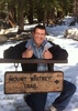
| no partners | | I did this hike as part of a group to raise money for the eradication of Polio. This past spring all the 120 Rotary Clubs in Arizona decided to raise money by walking the entire Arizona Trail. Our club, the Kingman Route 66 Rotary Club, selected the Grand Canyon portion and began training in July. Most of our training was done in the Hualapai Mountains every weekend.
Along with the 12 hikers, we had 8 "Sherpa's" who were there to help us out. The Sherpa's tore down the camp and moved all of our stuff from the North Rim to the South Rim.
We left Kingman at 7:00 AM and traveled North across the new bridge at the Hoover Dam and met up in Hurricane, UT for lunch. Some of us went through the Lake Mead National Rec area, others went through Vegas. From Hurricane, we traveled together to the North Rim.
Before setting up camp we went to the lodge, to look at the view, take some pictures and many of us said, Oh My Goodness, what have we gotten ourselves into! LOL After spending some time at the Lodge and Rim, we went back to the camping area where we set up camp, had dinner and hit the sack by 8:00 PM.
We were up the next morning at 4 AM and left the campsite around 5:15. Before leaving camp I had a clif bar, 2 hard boiled eggs a bowl of oatmeal and some orange juice. We hit the trail head at 5:30 and began a great day hiking the Grand Canyon!
At 5:30 AM it was still dark out and most of us had headlamps on. It was very neat at about 6 AM, as we were descending the switchbacks I looked up and saw a zig-zag of headlights in the darkness coming down the same path we had been on a little while ago! So surreal!
At about 6:30 we were able to take off our headlamps and walk in the daylight. I was surprised by the number of bridges, over the Roaring Springs creek, that we crossed. Did not keep real accurate track of the time but think I got to Phantom Ranch about 11:15. I had hoped to make it to Phantom Ranch in 5 hours, but the descent was very painful on my knees and I had to go much slower than planned.
At the Ranch, I crossed over to the Bright Angel Campground, where I found a nice place alongside the creek to stop and have lunch. I had a PBJ Sandwich (heavy on the Peanut Butter) a bottle of cold milk, some granola, a beef jerky stick and an apple. After eating, soaking my feet a little, shedding the long sleeve shirt and unzipping the legs from my pants and making them shorts, I was ready to start the hike up. I stopped at the water spigot, filled my 2 liter camel pack and 2 additional 20 ounce bottles of water. Total water to climb up the South Kaibab was about 3/4 of a gallon.
Re-started my GPS and timer and began the walk to the Black Bridge and began the ascent up the South Kaibab. I had calculated that I would take 5 hours to go up (7 miles @ 1.4 mph) but surprised myself that I did it in 4 hours, 2 minutes!
When I got about a mile and a half from the top, I ran out of water in my camel pack and had to stop to pour the two bottles of water into the pack. When I got to the top I had very little water left. The two guys that got out before me both ran out of water on their way up.
On this trip, which lasted 10 hours 20 minutes, I ate 2 clif bars, 2 beef jerky sticks, 2 packages of clif shots, a PBJ Sandwich, a little granola, an apple and about a gallon and a half of water, which I flavored with powdered grape gatorade (total of 8 packs)
What a great hike! |
| _____________________
| | |
|
|
|
 Route Editor