|
| | | |
| |
|
| Hiking | 2.93 Miles |
1,015 AEG |
| | Hiking | 2.93 Miles | 2 Hrs 9 Mns | | 2.02 mph |
| 1,015 ft AEG | 42 Mns Break | 5 LBS Pack | | |
|
|
| |
| Linked |
|
none
[ show ]
| no linked trail guides |
| Partners |
|
none
[ show ]
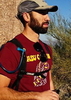
| no partners | | | Well, we had planned to Cholla trail on Camelback, but got there too late and the parking was all gone. Next we tried for Piestewa but, again, no parking. Finally, we decided to check out this hike and I'm glad we did! A little easier than Piestewa, I'd say, but not nearly as crowded. The trail is easy to follow and the wildflowers made for nice scenery. |
|
Wildflowers Observation Moderate
|
|
| _____________________
| | |
|
|
|
 Route Editor


 Yeah, a quarter of the way was fine, haha.


