|
| | | |
| |
|
| Hiking | 5.00 Miles |
2,300 AEG |
| | Hiking | 5.00 Miles | 3 Hrs 35 Mns | | 1.54 mph |
| 2,300 ft AEG | 20 Mns Break | | | |
|
|
| |
| Linked |
|
none
[ show ]
| no linked trail guides |
| Partners |
|
none
[ show ]
| no partners | | | apparently this member prefers to keep an air of mystery... | | | |
|
|
|
|
|
| | | |
| |
|
| Hiking | 15.27 Miles |
4,530 AEG |
| | Hiking | 15.27 Miles | 11 Hrs 57 Mns | | 1.55 mph |
| 4,530 ft AEG | 2 Hrs 6 Mns Break | | | |
|
|
| |
| Partners |
|
none
[ show ]
| no partners | | 2.13mi - 7:41am | 0h 57m
Slight split. Blocked off with cairns. Very steep
2.31mi - 7:51am | 1h 6m
Erosion barriers
6.07mi - 10:53am | 4h 9m
Downed tree
6.70mi - 11:33am | 4h 48m
Tree down
12.12mi - 4:45pm | 10h 0m
Cool photo opp of Tucson |
| | |
|
|
|
|
|
| | | |
| |
|
| Hiking | 7.16 Miles |
1,099 AEG |
| | Hiking | 7.16 Miles | 3 Hrs 30 Mns | | 2.44 mph |
| 1,099 ft AEG | 34 Mns Break | | | |
|
|
| |
| Linked |
|
none
[ show ]
| no linked trail guides |
| Partners |
|
none
[ show ]
| no partners | | | presumably took memories and left without a trace... | | | |
|
|
|
|
|
| | | |
| |
|
| Hiking | 5.77 Miles |
2,558 AEG |
| | Hiking | 5.77 Miles | 4 Hrs 7 Mns | | 1.55 mph |
| 2,558 ft AEG | 23 Mns Break | | | |
|
|
| |
| Linked |
|
none
[ show ]
| no linked trail guides |
| Partners |
|
none
[ show ]
| no partners | | | presumably took memories and left without a trace... | | | |
|
|
|
|
|
| | | |
| |
|
| Hike & Climb | 16.11 Miles |
6,240 AEG |
| | Hike & Climb | 16.11 Miles | 10 Hrs 54 Mns | | 1.69 mph |
| 6,240 ft AEG | | | | |
|
|
| | |
| Partners |
|
none
[ show ]
| no partners | | 3.20mi - 4:59am | 2h 26m
Linda Vista Saddle
4.69mi - 6:03am | 3h 30m
Finger Rock trail #42 and Pima Canyon trail 62 connecting junction
6.41mi - 6:53am | 4h 20m
Blue flag on steel wire
6.50mi - 6:56am | 4h 23m
Finger Rock trail #42 END
Ventana trail #98
Esperero trail #25
connecting junction
7.65mi - 7:47am | 5h 13m
“The Window”
8.17mi - 8:36am | 6h 3m
Window Peak |
| | |
|
|
|
|
|
| | | |
| |
|
| Hiking | 5.23 Miles |
2,283 AEG |
| | Hiking | 5.23 Miles | 2 Hrs 52 Mns | | 1.94 mph |
| 2,283 ft AEG | 10 Mns Break | | | |
|
|
| |
| Linked |
|
none
[ show ]
| no linked trail guides |
| Partners |
|
none
[ show ]
| no partners | | 0.92mi - 5:27am | 0h 23m
410 and 411 connection
1.16mi - 5:34am | 0h 29m
Small lookout 1 on right
1.58mi - 5:46am | 0h 42m
Small lookout 2
2.62mi - 6:34am | 1h 30m
Top
4.33mi - 7:37am | 2h 3
410/411 junction (gps accuracy check) |
| | |
|
|
|
|
|
| | | |
| |
|
| Hiking | 14.57 Miles |
4,729 AEG |
| | Hiking | 14.57 Miles | 8 Hrs 49 Mns | | 1.79 mph |
| 4,729 ft AEG | 40 Mns Break | | | |
|
|
| |
| Linked |
|
none
[ show ]
| no linked trail guides |
| Partners |
|
none
[ show ]
| no partners | | 7.23mi - 10:54am | 4h 22m
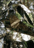
Rocks
7.50mi - 11:09am | 4h 37m
If you’re like me,
You touch this tree
8.32mi - 11:41am | 5h 9m
Erosion barrier
8.36mi - 11:43am | 5h 11m
Erosion barrier
8.68mi - 11:57am | 5h 25m
Pima Saddle sign and turn
8.86mi - 12:13pm | 5h 41m
Pima Saddle
10.38mi - 1:24pm | 6h 52m
Skinny dipping location?
10.87mi - 1:47pm | 7h 11m
Good view of Pontatoc Ridge here
12.91mi - 2:41pm | 8h 9m
Snake here |
|
Wildflowers Observation Substantial
|
|
| | |
|
|
|
|
average hiking speed 1.78 mph
WARNING! Hiking and outdoor related sports can be dangerous. Be responsible and prepare for the trip. Study the area you are entering and plan accordingly. Dress for the current and unexpected weather changes. Take plenty of water. Never go alone. Make an itinerary with your plan(s), route(s), destination(s) and expected return time. Give your itinerary to trusted family and/or friends.