Overview
An easy, maybe moderate CCW lasso loop whose shape somewhat resembles the mystical Sun Shield spectacle described on a recent sign near the trailhead. Depending on the season, one's constitution, and timing, this loop may transpire as quite the spiritual experience and/or be a corporeal butt-kicking.
Hike
The beginning and end of this route are straightforward, utilizing the northern section of the recently renamed Thash Kavid Loop (formerly Warpaint Loop). The second leg tracks the Desert Classic west for only fifteen-hundreds of a mile, then follows a short part of the Secret Trail east, where it ascends the Corona de Loma East - AKA Old Man Trail up to the National Trail. Continuing west for 0.7 miles past Buena Vista Lookout enables one to then descend Corona de Loma to round out the noose.
Synopsis
It's common for hikers to add on some of the north side SoMo trails, e.g., Holbert Trail or Tondum Wihom to increase their daily challenge. Peevish hikers may continue to dally and complain that the lower section of this hike is still Warpaint Loop, perhaps ignoring the phenomenon that the only thing constant is change1. Nevertheless, most neoteric hikers will be enlightened and embrace the spiritual aspect of this respectful renaming and still enjoy this loop hike.
WARNING! Hiking and outdoor related sports can be dangerous. Be responsible and prepare for the trip. Study the area you are entering and plan accordingly. Dress for the current and unexpected weather changes. Take plenty of water. Never go alone. Make an itinerary with your plan(s), route(s), destination(s) and expected return time. Give your itinerary to trusted family and/or friends.
Permit $$
None
Directions
Road
Paved - Car Okay
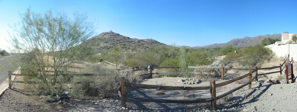
To Warpaint Trailhead Take the I-10 to exit 159 for Ray Road. Travel west on Ray Road about 1/4 mile until you reach the signaled intersection for 48th Street. Take 48th Street north until you reach the signaled intersection for E. Knox Road. Travel west on E. Knox Road until you reach Warpaint Drive. Travel north on Warpaint Drive about 1/4 mile. There is parking on the street. Trail head is on the west side of Warpaint Drive.
From PHX (I-10 & AZ-51) 14.0 mi - about 21 mins From TUC (Jct 1-10 & Grant) 99.7 mi - about 1 hour 32 mins From FLG (Jct I-17 & I-40) 158 mi - about 2 hours 27 mins
 Route Editor

 Overview
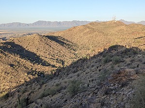


