Overview
Thunderbird Conservation Park, a 1,185-acre park in the Hedgpeth Hills, is a conservation park dedicated to preserving the desert environment. The hills were named for Robert Hedgpeth, an early homesteader in the area. The park took its name from the World War II pilot training facility located four miles south of the park. The city of Glendale acquired the park in 1951 through a lease with the federal government. Ownership came in 1956 with the assistance of the Glendale Women’s Club and Glendale Rotary Club. Maricopa County operated the park from 1963 to 1984 and many of the park improvements were made during this time. In 1984 the park was returned to the city. Park activities include picnicking, hiking, horseback riding, mountain biking, jogging, and bird watching. About 15 miles of multi-use trails have been constructed, thanks to the efforts of many volunteer groups.
When hiking several trails on a single "hike", log it with a generic name that describes the hike. Then link the trails traveled, check out the example.
WARNING! Hiking and outdoor related sports can be dangerous. Be responsible and prepare for the trip. Study the area you are entering and plan accordingly. Dress for the current and unexpected weather changes. Take plenty of water. Never go alone. Make an itinerary with your plan(s), route(s), destination(s) and expected return time. Give your itinerary to trusted family and/or friends.
Permit $$
None
Directions
Road
Paved - Car Okay
To hike Take the 101 West to 59th ave. Take 59th ave north, pass a few stoplights, as 59th ave takes a sharp turn right, the park entrance is to the left. The very first parking lot is for H-1
*** Added by joe ***
Roger & Ethel Freeman best describe the area & history in their book 'Day Hikes and Trail Rides in and around Phoenix'. Interesting, check it out!
Trail data given here is wishy-washy at best. Until I plot it myself use the book!
 Route Editor

 Overview
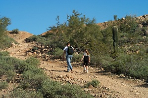


