 Route Editor

| Guide | ♦ | 86 Triplogs | 0 Topics |
details | drive | no permit | forecast | route |
stats |
photos | triplogs | topics | location |
| 150 | 86 | 0 |
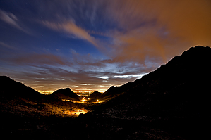
Give it a chance by joebartels  Overview OverviewThis is a moderate loop in the Phoenix Preserves. A quarter-mile section of neighborhood houses and a hint of Lincoln Street noise slightly take from the experience. On the other hand, it's a true loop with each turn offering new views. The elevation changes are enough to keep you interested but subtle enough to enjoy without being painful. For easier ascents (and fewer city views) hike the loop counter-clockwise as described below. Though I like to switch it up and go clockwise too. Read the directions below carefully as to where this hike starts, of course, you could park anywhere and hike to it also.
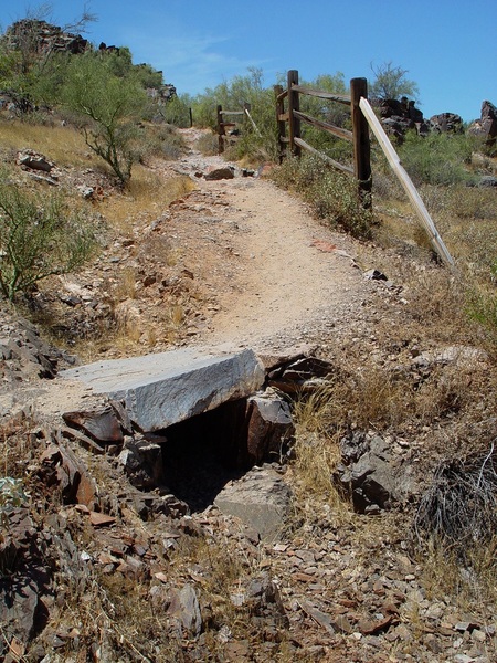
Head down the road to Mohave Trail #200. Like nearly all the other trails in the preserves, it's well maintained and easy to follow. It starts off switchbacking up a ravine going past one of the ramadas. On this memorial day afternoon, there was a drummer beating away in the shade of the ramada. Next you pass a small rock slab bridge just prior to some fencing. 0.25 mi The first saddle comes quick at about 0.25 mi into the hike. It's pretty clear at this point you are surrounded by a big city! Continue left on Mohave Connector Trail #202. 0.5 mi The trail curves away from the houses at 0.5 mi. 1.15 mi Well marked 200/8A junction, go left/up Quartz Ridge Trail #8A heading into the preserves and away from the city. 1.3 mi Dip through the ravine and start ascending. This is my favorite section going up the easy draw into the preserves. 2.1 mi Ruth Hamilton Trail #8B heading left/up at the saddle junction. You could make the loop more robust by continuing on 8A to 8. 2.2 mi The second saddle between 2141 & 2095 is at 2.2 mi just before you head back down. This loop seems to be quite a bit more popular than the Piestewa Peak Circumference Trail. It's a half-mile less and more notably 400 ft less AEG. You can continue on 8A to 8 and back on the 304.
Check out the Official Route and Triplogs. Leave No Trace and +Add a Triplog after your hike to support this local community. | ||||||||||||||||||||||||||||||||||||||||||||||||||||||||||||||||||||||||||||||||||||||||||||||||||||||||||||||||||||||||||||||||||||||||||||||||||||||||||||||||||||||||||||||||||||||||||||||||


