 Route Editor

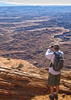
Lots of activity in Springerville this morning, with the Prescott Hot Shots arriving at Safeway for a snack, and other buses full of firefighters seen on the highway heading for the "Wallow Fire" in Bear Wallow Wilderness Area, south of Hannagan. The smoke is not that visible, although my daughter was over at Hulsey yesterday and saw the smoke. I was up at Big Lake early this morning and could see only a haze of smoke south of there, not a big plume. I think winds too strong for it to plume up much. I'm back in Flag now, so I won't get the firsthand news any more.
Oh, and no campfires or charcoal grills allowed in the campgrounds since last night in Apache-Sitgreaves NF (Big Lake, Hannagan, etc.) I think stoves still allowed. Not sure about non-campgrounds.
Here's a news story on the Wallow Fire, but as of this writing it has not made it to inciweb yet. (Maybe tomorrow?)
( dead link removed )
Perimeter Map [ Wallow Fire Map 2011-06-27 :: map ]
Inciweb ( dead link removed )
"Wallow Fire" in Bear Wallow Wilderness
Moderator: HAZ - Moderators
Linked Guides • Aker Lake Trail #17, AZ ♦ • Bear Wallow Trail #333, AZ ♦ • Bear Wallow Trail #63, AZ ♦ • Fish Creek Trail #60, AZ ♦ • Thompson Trail #629, AZ ♦ • West Fork Trail #628 - Black River, AZ ♦ • Gobbler Point Trail, AZ ♦ • Overland Trail, AZ ♦ • Escudilla Trail, AZ
Linked Area, etc none
-
 azbackpackrGuides: 34 | Official Routes: 30Triplogs Last: 37 d | RS: 0Water Reports 1Y: 8 | Last: 47 d
 - Joined: Jan 21 2006 6:46 am
- City, State: Eagar AZ
"Wallow Fire" in Bear Wallow Wilderness
Last edited by azbackpackr on Jun 12 2011 10:52 am, edited 1 time in total.
There is a point of no return unremarked at the time in most lives. Graham Greene The Comedians
A clean house is a sign of a misspent life.
A clean house is a sign of a misspent life.
contribute to this member driven resource
ie: RS > Save/Share after hikes 

-
 trekkin_geckoGuides: 10 | Official Routes: 45Triplogs Last: 1 d | RS: 293Water Reports 1Y: 0 | Last: 710 d
 - Joined: Nov 17 2008 4:30 pm
- City, State: phoenix, az
Re: "Wallow Fire" in Bear Wallow Wilderness
found this:azbackpackr wrote: New fire near Bear Canyon Lake on the Rim above Payson
http://www.azein.gov/azein/Lists/Announ ... px?ID=1788
would guess sitgreaves will be closing the black mesa district soon
hazhole
contribute to this member driven resource
ie: RS > Save/Share after hikes
-
 nonotGuides: 107 | Official Routes: 108Triplogs Last: 111 d | RS: 0Water Reports 1Y: 9 | Last: 111 d
 - Joined: Nov 18 2005 11:52 pm
- City, State: Phoenix, AZ
Re: "Wallow Fire" in Bear Wallow Wilderness
Wallow Fire reported at 511k acres this evening.
East and Southeast side of the fire is not well contained, and there is still a troublesome portion near Greer.
East and Southeast side of the fire is not well contained, and there is still a troublesome portion near Greer.
http://hikearizona.com/garmin_maps.php
Hike Arizona it is full of sharp, pointy, ankle-twisting, HAZmaster crushing ROCKS!!
Hike Arizona it is full of sharp, pointy, shin-stabbing, skin-shredding plants!
Hike Arizona it is full of striking, biting, stabbing, venomous wildlife!
Hike Arizona it is full of sharp, pointy, ankle-twisting, HAZmaster crushing ROCKS!!
Hike Arizona it is full of sharp, pointy, shin-stabbing, skin-shredding plants!
Hike Arizona it is full of striking, biting, stabbing, venomous wildlife!
contribute to this member driven resource
ie: RS > Save/Share after hikes
-
 haggsterGuides: 1 | Official Routes: 0Triplogs Last: 3,563 d | RS: 0Water Reports 1Y: 0 | Last: never
 - Joined: Oct 18 2006 10:56 am
- City, State: Farmington, UT
Re: "Wallow Fire" in Bear Wallow Wilderness
Yes, but it really depends on the percentage of burn and how much rain and snow those areas receive in the next few years. If a total burn occurred in most of the watershed areas, then they will likely have a lot of erosion and debris problems in the coming years. I am hopeful that it wasn't a total burn. I think Fish Creek and Bear Wallow Creek were burned pretty bad. Also, the East Fork of the Black looks like it was burned pretty bad in the campground areas according to the MODIS IR maps. However, from Diamond Rock to Three Forks and above, it looks spotty. IMO, that is the best section of the East Fork. Hopefully that area will recover faster. I think it will be 5-10 years before the streams and rivers are healthy and can support aquatic life again.big_load wrote:Won't the post-fire erosion threaten the viability of those streams as trout habitat for a while?
I would be very interested to hear what that specialist has to say.azbackpackr wrote:A friend of mine is a fisheries biologist who used to work in Alpine district, now is working out of state. They brought him in to do some evaluating last week, since he knows the area's watersheds better than anyone who actually works for the A-S now. I am hoping to talk to him or to his wife about some of these things later on.
contribute to this member driven resource
ie: RS > Save/Share after hikes
-
azbackpackrGuides: 34 | Official Routes: 30Triplogs Last: 37 d | RS: 0Water Reports 1Y: 8 | Last: 47 d
- Joined: Jan 21 2006 6:46 am
- City, State: Eagar AZ
Re: "Wallow Fire" in Bear Wallow Wilderness
Will post when I have the info.
There is a point of no return unremarked at the time in most lives. Graham Greene The Comedians
A clean house is a sign of a misspent life.
A clean house is a sign of a misspent life.
contribute to this member driven resource
ie: RS > Save/Share after hikes
-
azbackpackrGuides: 34 | Official Routes: 30Triplogs Last: 37 d | RS: 0Water Reports 1Y: 8 | Last: 47 d
- Joined: Jan 21 2006 6:46 am
- City, State: Eagar AZ
Re: "Wallow Fire" in Bear Wallow Wilderness
Greer area now open to the public, and so is Sunrise Resort. I am sure that does not mean Greer trails are open, just the commercial interests there. However, probably at Sunrise you can buy a hiking permit to hike on the rez. I may drive up to Greer tomorrow.
There is a point of no return unremarked at the time in most lives. Graham Greene The Comedians
A clean house is a sign of a misspent life.
A clean house is a sign of a misspent life.
contribute to this member driven resource
ie: RS > Save/Share after hikes
-
 TrishnessGuides: 14 | Official Routes: 0Triplogs Last: 4,313 d | RS: 0Water Reports 1Y: 0 | Last: 5,004 d
 - Joined: May 21 2003 9:33 pm
- City, State: Apache Junction, AZ
Re: "Wallow Fire" in Bear Wallow Wilderness
Liz,
Please let me know if you drove up to Greer the other day and what you found. I just got back from Chaco so have been a little out of touch!
Please let me know if you drove up to Greer the other day and what you found. I just got back from Chaco so have been a little out of touch!
Trish-Kabob
"May your trails be crooked, winding, lonesome, dangerous, leading to the most amazing view. May your mountains rise into and above the clouds" Ed Abbey
"May your trails be crooked, winding, lonesome, dangerous, leading to the most amazing view. May your mountains rise into and above the clouds" Ed Abbey
contribute to this member driven resource
ie: RS > Save/Share after hikes
-
azbackpackrGuides: 34 | Official Routes: 30Triplogs Last: 37 d | RS: 0Water Reports 1Y: 8 | Last: 47 d
- Joined: Jan 21 2006 6:46 am
- City, State: Eagar AZ
Re: "Wallow Fire" in Bear Wallow Wilderness
I drove to Nutrioso and Alpine yesterday. The towns both looked very good. Hills surrounding them, some are totally scorched, others untouched. Escudilla looked completely totally torched from every direction I saw it.
I heard my favorite creek, Fish Creek, really burned extremely hot except for lower 1.5 miles near Black River. I heard that both Black River and Bear Wallow Wilderness are "spotty" or "patchy." I heard that from that trail crew guy I know, I ran into him in Alpine. He flew over everything the other day.
Flooding is the major worry now.
There are still open places to hike up here, and I saw fishermen at Nelson Reservoir. State land is open for hiking and mtn. biking, etc.
There is a point of no return unremarked at the time in most lives. Graham Greene The Comedians
A clean house is a sign of a misspent life.
A clean house is a sign of a misspent life.
contribute to this member driven resource
ie: RS > Save/Share after hikes
-
 whereveriroamGuides: 8 | Official Routes: 0Triplogs Last: 909 d | RS: 0Water Reports 1Y: 0 | Last: 916 d
 - Joined: Mar 07 2003 3:14 pm
- City, State: Apache Junction, AZ
Re: "Wallow Fire" in Bear Wallow Wilderness
The BAER team issued their "Final (I hope) Soil Burn Severity" map today of the Wallow fire. I'm guessing you can figure out what areas crowned and what areas burned at low intensity by the map. Very interesting to look at and of higher quality then the one they put out yesterday of the Chiricahua damage. According to the map this fire did burn most of the forest however it looks like alot of the forest burned at a low intensity. The Blue looks for the most part to be burning at a low intensity. Surprisingly the Bear Wallow Wilderness doesn't appear to have burnt very hot with a bunch of land around Gobbler point untouched. Buffalo Crossing didn't burn hot but after the rains it'll probably not look the same. Escudilla is toast as well as ALOT of other places. I can't figure out how to put these maps on this site but you can find them on the inciweb site on the Wallow home page, it'll be on the maps link on the top of the page.
contribute to this member driven resource
ie: RS > Save/Share after hikes
-
 JimmyLydingGuides: 111 | Official Routes: 94Triplogs Last: 769 d | RS: 0Water Reports 1Y: 0 | Last: 2,341 d
 - Joined: Feb 16 2007 3:17 pm
- City, State: Walnut Creek, CA
Re: "Wallow Fire" in Bear Wallow Wilderness
Pictures from a satellite. Not very current.
http://earthobservatory.nasa.gov/Natura ... p?id=50872
I think this is the map that whereveriroam is referring to:
https://inciweb.nwcg.gov/ftp/InciWeb/AZ ... 436-0.jpeg
http://earthobservatory.nasa.gov/Natura ... p?id=50872
I think this is the map that whereveriroam is referring to:
https://inciweb.nwcg.gov/ftp/InciWeb/AZ ... 436-0.jpeg
contribute to this member driven resource
ie: RS > Save/Share after hikes
-
 NighthikerGuides: 0 | Official Routes: 0Triplogs Last: 1,645 d | RS: 0Water Reports 1Y: 0 | Last: never
 - Joined: Feb 03 2002 6:59 am
- City, State: Payson
contribute to this member driven resource
ie: RS > Save/Share after hikes
-
azbackpackrGuides: 34 | Official Routes: 30Triplogs Last: 37 d | RS: 0Water Reports 1Y: 8 | Last: 47 d
- Joined: Jan 21 2006 6:46 am
- City, State: Eagar AZ
Re: "Wallow Fire" in Bear Wallow Wilderness
They keep saying it was in Bear Wallow Wilderness.Nighthiker wrote:Actual location or locations of the fire's orgin ?
Just as I had posted earlier, Bear Wallow looks patchy, whereas, Fish Creek, Horton Creek, and Bear Creek look pretty well torched, although maybe Fish Creek on its lower reaches, where I usually hike it, is not as bad as the upper reaches. I had heard this from the trail crew person I know, who flew the Alpine RD a couple weeks ago.
Incidentally, just FYI, YESTERDAY IT RAINED ALL OVER THE WHITE MOUNTAINS!!!!!!!!!!!!!!!!!!!!!!
There is a point of no return unremarked at the time in most lives. Graham Greene The Comedians
A clean house is a sign of a misspent life.
A clean house is a sign of a misspent life.
contribute to this member driven resource
ie: RS > Save/Share after hikes
-
azbackpackrGuides: 34 | Official Routes: 30Triplogs Last: 37 d | RS: 0Water Reports 1Y: 8 | Last: 47 d
- Joined: Jan 21 2006 6:46 am
- City, State: Eagar AZ
Re: "Wallow Fire" in Bear Wallow Wilderness
I just looked at Inciweb, and wanted to put up a quote and comment on it:
"Elk are continuing to create a safety hazard as they are present on or near most of the highways and roads. The Apache-Sitgreaves National Forest is asking that speed be held down to a maximum of 50 mph during dusk to dawn and at night. Holding speeds below 50 mph, especially from dusk to dawn when elk are most active, will greatly reduce the risk of an accident."
Drive to Alpine in the afternoon, doesn't even have to be late afternoon. I personally have never seen so many elk alongside the road. They are everywhere, especially in the late afternoon. So, if you have never seen very many elk, now's your chance, and you can also help the people of the White Mtns. by eating in a restaurant and staying at lodgings, etc.
Once again state lands are open for hiking and mtn. biking, such as G&F White Mtns. Grasslands Area, Wenima Wildlife Area, and any state lands in between.
There is a point of no return unremarked at the time in most lives. Graham Greene The Comedians
A clean house is a sign of a misspent life.
A clean house is a sign of a misspent life.
contribute to this member driven resource
ie: RS > Save/Share after hikes
-
 joebartelsGuides: 264 | Official Routes: 224Triplogs Last: 1 d | RS: 2065Water Reports 1Y: 28 | Last: 14 d
 - Joined: Nov 20 1996 12:00 pm
Re: "Wallow Fire" in Bear Wallow Wilderness
Inciweb wrote:areas of steep terrain which will make numerous locations vulnerable to flash floods and debris flows even in moderate intensity (10 - 15 minutes) rains. Some area streams and rivers are likely to see flows beyond anything seen in decades if typical or above average rains occur
- joe
contribute to this member driven resource
ie: RS > Save/Share after hikes
-
azbackpackrGuides: 34 | Official Routes: 30Triplogs Last: 37 d | RS: 0Water Reports 1Y: 8 | Last: 47 d
- Joined: Jan 21 2006 6:46 am
- City, State: Eagar AZ
Re: "Wallow Fire" in Bear Wallow Wilderness
We aren't going to see any of that. We are not allowed into the areas where any of that is going to happen.
There may be some homes in Nutrioso and Alpine which are going to be in a flood path, however. If you want to volunteer, they are filling sandbags. Not sure when or where. I know they were doing it in Nutrioso the other day, and they were planning on doing it in Eagar as well. I'm back in Flagstaff for a few days.
Speaking of flooding, Omaha is taking a direct hit, I hear. I have a friend who lives across the Missouri River and commutes to work at a hospital in Omaha. Crazy stories she's been telling us.
There is a point of no return unremarked at the time in most lives. Graham Greene The Comedians
A clean house is a sign of a misspent life.
A clean house is a sign of a misspent life.
contribute to this member driven resource
ie: RS > Save/Share after hikes
-
trekkin_geckoGuides: 10 | Official Routes: 45Triplogs Last: 1 d | RS: 293Water Reports 1Y: 0 | Last: 710 d
- Joined: Nov 17 2008 4:30 pm
- City, State: phoenix, az
Re: "Wallow Fire" in Bear Wallow Wilderness
half of my family lives thereazbackpackr wrote:
Speaking of flooding, Omaha is taking a direct hit, I hear. I have a friend who lives across the Missouri River and commutes to work at a hospital in Omaha. Crazy stories she's been telling us.
they have to take crazy detours to get places
unable to access much of the riverfront
it's worse in western iowa
omaha.com is the omaha world-herald website
good photos and updates each day
concerns regarding both nuclear power plants which are along the river
hazhole
contribute to this member driven resource
ie: RS > Save/Share after hikes
-
azbackpackrGuides: 34 | Official Routes: 30Triplogs Last: 37 d | RS: 0Water Reports 1Y: 8 | Last: 47 d
- Joined: Jan 21 2006 6:46 am
- City, State: Eagar AZ
Re: "Wallow Fire" in Bear Wallow Wilderness
We're going off-topic, but thanks for the info. Will check it out.
There is a point of no return unremarked at the time in most lives. Graham Greene The Comedians
A clean house is a sign of a misspent life.
A clean house is a sign of a misspent life.
contribute to this member driven resource
ie: RS > Save/Share after hikes
-
 SkyIslander18Guides: 4 | Official Routes: 0Triplogs Last: 7 d | RS: 0Water Reports 1Y: 5 | Last: 150 d
 - Joined: Sep 29 2004 6:42 pm
- City, State: Small Town USA
Re: "Wallow Fire" in Bear Wallow Wilderness
This was just sent to me showing the Escudilla lookout tower.
- Attachments
-
- Escudilla Lookout
contribute to this member driven resource
ie: RS > Save/Share after hikes
-
 big_loadGuides: 0 | Official Routes: 1Triplogs Last: 510 d | RS: 3Water Reports 1Y: 0 | Last: 2,713 d
 - Joined: Oct 28 2003 11:20 am
- City, State: Andover, NJ
Re: "Wallow Fire" in Bear Wallow Wilderness
@AZWaterRat
I wonder how much erosion the rains will bring.
I wonder how much erosion the rains will bring.
contribute to this member driven resource
ie: RS > Save/Share after hikes
-
 PaleoRobGuides: 171 | Official Routes: 78Triplogs Last: 673 d | RS: 24Water Reports 1Y: 0 | Last: 1,061 d
 - Joined: Apr 03 2006 12:21 pm
- City, State: Pocatello, ID
- Contact:
contribute to this member driven resource
ie: RS > Save/Share after hikes
-
azbackpackrGuides: 34 | Official Routes: 30Triplogs Last: 37 d | RS: 0Water Reports 1Y: 8 | Last: 47 d
- Joined: Jan 21 2006 6:46 am
- City, State: Eagar AZ
Re: "Wallow Fire" in Bear Wallow Wilderness
Probably a lot of erosion. I have so far visited Nutrioso, Alpine, Hannagan Meadow and Greer. I've posted about those visits elsewhere. Suffice to say, the towns look fine, hills around them are pretty scorched. What we can't see from the highway are the many incinerated drainages which go into the Black River. I have not yet been to Big Lake, since they are only letting people get there in a roundabout way (at least, from where I am it is roundabout.).
There is a point of no return unremarked at the time in most lives. Graham Greene The Comedians
A clean house is a sign of a misspent life.
A clean house is a sign of a misspent life.
contribute to this member driven resource
ie: RS > Save/Share after hikes