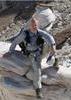
Here's a picture of the area that I searched today. While I didn't get to the specific location that I was asked to look at, I did do a fair amount of that area. The area is incredibly difficult to hike when you go off-trail as I did. One possibly significant event occurred during my search. I've marked the location with a way-point. Here's what happened:
I was trying to work my way up to the Peeley summit. In the area of the way-point, the shrubbery was less intense so I tried to zig-zag as best I could. During my entire hike today, where possible, I took several steps and then looked all around to try to cover as much area as possible and from several angles. Anyway, I was traversing the marked area and as I rounded the corner of an outcropping, the wind suddenly stopped. I don't know if the side of the area I was in momentarily blocked the wind or what, but the very slight breeze that was present seemed to swirl a bit. I caught an odor that seemed like something was possibly rotting (at waypoint N33 59.7394 W-111 29.0467). I can't say that the odor was as intense as a decaying animal but it had a slightly putrid quality, but slightly sweet. It's difficult to describe and I only caught the odor for a few seconds. I honestly don't know what it was. I sniffed the area trying to fill my lungs with it and turned to try to locate the source. Suddenly, the wind kicked up again from the South-East and the odor was gone.
I searched all I could, trying to traverse as many areas as I could. I ended up going across a drainage and gaining elevation while constantly surveying the area all around me. Nothing. I searched until I realized that I couldn't summit Peeley due to time and extreme fatigue. I then traversed across and dropped down to the switchback area and met up with Linda Beckett who searched areas along the Mazatzal Divide Trail.
I'm pretty battered and bruised from the brutal vegetation. I don't think that I can make my way back to that way-point tomorrow but I feel that a search should be undertaken in the general area I've circled. The problem is that it's so exhausting to get to that point that it will be difficult to get there and search effectively. Maybe some of the younger guys that are in better shape may be able to put together a team to try. I'm not saying for certain that Joe is in that circled area, but I searched pretty extensively everything to the East including drainages.
I hope that this information helps. I'm not sure that putting all of the community's resources in this area is the way to go, but perhaps worth further investigation. Maybe from the Cornucopia trail, up the first drainage and then traversing North-West. That's not an easy route.
One note about this picture, the track does not seem to be registered very well with the map. Not sure why, but the track seems to be drawn quite a bit South of the trail on the map. I realize that the maps aren't perfect but this is the furthest off I've seen them. My point is that the way-point is actually much further North of the trail. Maybe the track file that I sent Hank will register more precisely with the Garmin maps.
I plan to be back out there tomorrow morning but I'm not sure that I'm up for another brutal day of fighting manzanita! We'll see...

Hopelessly lost... but makin' good time!! (David Letterman)
 Route Editor