username
X
password
register
for free!
help
ArticlesGuidesRoutes
 
Photosets
 
 Comments
triplogs   photosets   labels comments more
Samaniego Peak - 7 members in 23 triplogs have rated this an average 3.4 ( 1 to 5 best )
1, 2  Next
23 triplogs
login for filter options
Oct 20 2017
avatar

 Guides 187
 Routes 989
 Photos 12,068
 Triplogs 864

72 male
 Joined Jun 27 2015
 Tucson, Arizona
Samaniego Peak, AZ 
Samaniego Peak, AZ
 
Hiking avatar Oct 20 2017
markthurman53Triplogs 864
Hiking14.00 Miles 4,322 AEG
Hiking14.00 Miles   8 Hrs   56 Mns   2.19 mph
4,322 ft AEG   2 Hrs   33 Mns Break20 LBS Pack
 
1st trip
Partners none no partners
I am not a Peak person, I do not go out of my way to bag peaks as they say. I usually only go to a peak if there is a trail heading there with a few exceptions and this is one of them. I have been looking at this peak over the last few years from different directions and this one was calling my name. I started from the Mount Lemmon Trail #5 on Mount Lemmon and continued down the Sutherland Trail. While at the Sutherland Trail/Samaniego Ridge Trail junction I headed further down the Sutherland Trail to where my legs petered out the week before, about .6 miles. Had to finish this trail, I hate leaving a trail unfinished, it's an OCD thing. Once back on the Samaniego Ridge trail I headed toward Samaniego Peak. I thought the Samaniego Ridge trail was easy to follow and appeared to be in better shape than a year or so ago. That's not to say long pants and shirt aren't a good thing to have, My hands donated their share of blood. A good pair of sunglasses are advisable if you don't want to donate an eye to a stray branch. The trail gets a little fuzzy around Walnut Spring but with a GPS It is fairly easy to stay on track. Once at the infamous camp site/fire pit I headed up to Samaniego Peak. There are rock cairns marking the way, if you loose one trail there always seams to be another set of cairns marking another possible route. They all seam to converge on the peak, imagine that. The route up is steep in places and requires rock hopping and maybe a little rock climbing. A lot of brush to maneuver through if you don't pick the right route. At one point I got grabbed by some brush and before I knew it I was on the ground trying to get untangled. All in all the .5 mile trek up is worth it, the views are spectacular. Signed the log book and took a 20 minute break at the top. The way down was easier, maybe because I was a little wiser about picking the path.
This was a great hike, I estimated an elevation gain of 2000 feet for this hike and was amazed when my GPS said 4200 feet (I didn't account for the trip further down the Sutherland Trail). I am actually not surprised because the Trail is a ridge trail and drops down into every saddle and then back up the other side, all these ups and downs adds up. My Legs performed much better than the week before, I don't climb hills like I did 20 or 30 years ago but had no energy problems. I brought more food with me this time and ate something better for breakfast. Amazing what the legs will do if you just feed them.
_____________________
 
Oct 11 2017
avatar

 Guides 1
 Routes 1
 Photos 44
 Triplogs 38

35 male
 Joined Feb 01 2013
 Tucson, AZ
Samaniego PeakTucson, AZ
Tucson, AZ
Hiking avatar Oct 11 2017
jajohnson11Triplogs 38
Hiking12.00 Miles 2,000 AEG
Hiking12.00 Miles
2,000 ft AEG
 no routesno photosets
1st trip
Linked   none no linked trail guides
Partners none no partners
Been on my radar for quite some time. Had a couple of days off so I decided I'd go bag it, and why not make an overnight out of it? Started hiking about 4:30 and made it to the junction of the CDO shortcut trail and the Samaniego Ridge trail where I cowboy camped. Got up early and wow, to say that this trail is overgrown is an understatement. Many sections I literally had to just barrel through the vegetation, which is all plants with thorns! Route finding wasn't too difficult until the last quarter or mile or so to the base of the summit, not sure if I was on the trail for any of that section, but I honestly don't think it would've mattered. From the base of the summit the footpath to get up there I thought was quite obvious. That started near an old fire ring and headed left. Followed the cairned route up and it was honestly a nice break from the so called trail I had just come from (wasn't this supposed to be the off trail part!) Needless to say, amazing, fun, rock covered summit. Great views of the front range peaks, cathedral, window, table, pusch, kimball, bighorn. Awesome views of Lemmon, reef of rocks behind. If the trail wasn't completely overgrown I will definitely be back.

Took the CDO shortcut trail on the way back, not sure the distances are any different than the trail that goes over the ridge. There was quite a bit of wildlife as well, a very slow to leave animal was near my campsite. I'm suspicious it was a bear but obviously can't be certain. Multiple deer sightings in the AM, bear scat in two places along the ridge, and also a skunk! Near the base of the peak, glad it wasn't in the overgrown section so I could see it. All in all a great trip and a very worthwhile summit!
_____________________
 
Oct 05 2017
avatar

 Guides 36
 Routes 310
 Photos 2,235
 Triplogs 241

79 male
 Joined Mar 27 2008
 tucson, az
Samaniego PeakTucson, AZ
Tucson, AZ
Hiking avatar Oct 05 2017
rvcarterTriplogs 241
Hiking12.74 Miles 3,337 AEG
Hiking12.74 Miles   8 Hrs   21 Mns   1.60 mph
3,337 ft AEG      22 Mns Break
 
Linked   none no linked trail guides
Partners partners
Mountain_Rat
NIEL CHRISTENSEN
This is my second try at this. I had a triplog ready to go and clicked on "add pooch advice" (don't take one), and lost what I had written by not backing out properly. Grrrrrrrrrr.

After reading the recent triplogs of a couple of Tucsonans who did this hike, Matt and I decided to give it a try, and dragged Niel into it. We actually didn't tell Niel where we were going til halfway up Mt. Lemmon. This is a deceptively difficult hike to a wonderful destination. The peak affords spectacular views of Reef of Rocks and the west side of Mt. Lemmon across the CDO. An added feature for the next few weeks is the considerable leaf color, but hurry, the aspen are already starting to shed their leaves.

I've hiked to Samaniego Peak 4 times, once from the west (trail is now gone), and 3 times from Radio Ridge. As usual, 3 years dulls the memory. When I last did this, the trail was clean and free of overlapping vegetation, thanks to maintenance by the Forest Service. The trail is now quite overgrown, especially past the junction with the CDO trail, with lots of thorny bushes, locust bushes, you name it. I can't emphasize this enough: WEAR LONG PANTS!. If you don't, expect your legs look and feel like you've been through a sandstorm/meat grinder. The bushes just wear the skin off your legs from the thighs down.

The vegetation growth and downed trees mean you'll occasionly need to stop and relocate the trail. I wouldn't say a gps loaded with my track is critical, but it would be greatly helpful. As a minimum, take a good topo map, even though it is not likely you will get very far off the ridge, and there are good metal signs at all the main intersections. The first time we did this hike from the top, the bushwhack to the ridge from just above Walnut Spring was a fight through manzanita and thorn bushes over some considerable boulders. Now, with the well-cairned and trimmed path, it's much easier, but still not a walk in the park. Beware that the cairns are not frequent on the lower part. On the upper part, you can pretty much see from one cairn to the next pretty easily. Just take your time and pick the path of least resistence. Once you reach the ridge, you still have some heavy class 3 boulder scrambling to reach the high point. There is a sign-in tube.

All in all, this is a great hike, but be aware that the climb out is considerable and takes place when you are most tired. The distance and ascent numbers don't provide a complete picture of difficulty. Take plenty of liquids and energy snacks. The hike is best suited for experienced, fit hikers. It is all to easy to get down to the Walnut Spring area, but the climb out can takes its toll, especially in warm weather. We were three tired puppies when we reached the car.
_____________________
Check out my Instagram posts at "cartershift", and videos on my Rumble channel "rvcarter".
 
Oct 01 2017
avatar

 Routes 30
 Triplogs 186

37 male
 Joined May 15 2015
 Tucson
Samaniego PeakTucson, AZ
Tucson, AZ
Hiking avatar Oct 01 2017
jrousoshammondTriplogs 186
Hiking12.73 Miles 3,842 AEG
Hiking12.73 Miles   7 Hrs   58 Mns   1.70 mph
3,842 ft AEG      30 Mns Break
 
no photosets
Linked   none no linked trail guides
Partners partners
MSimmons
Glad to have figured this one out after a frustrating outing a few years ago! Started off on the Meadow Trail and it was easy going out onto the ridge. The closer we got to the peak, the more route-finding and catclaw-fighting we had to do, but it was pretty manageable.

Do not use the ascending track I've posted for the bushwhack to the peak - it starts off on a good path but eventually takes you through catclawmageddon. Where the upward and downward tracks converge below the summit is where we found the well-cairned use trail. The descending track follows this trail quite a ways down, and though we weren't able to follow cairns all the way back to the Samaniego Ridge Trail, the remaining distance was through really easy terrain/brush.

Hopefully there's enough info from our descending route to make it easy on the next party that gives this a shot. Around the point where our track takes a big jog to the south (north if you're ascending) you'll have to scramble up some rocks and be on the lookout for cairns. This was the trickiest spot. After you get the trail it should be pretty straightforward. This summit is worth it.
_____________________
  1 archive
Oct 01 2017
avatar

 Photos 4
 Triplogs 62

37 male
 Joined Jan 30 2016
 Tucson, AZ
Samaniego PeakTucson, AZ
Tucson, AZ
Hiking avatar Oct 01 2017
MSimmonsTriplogs 62
Hiking12.73 Miles 3,842 AEG
Hiking12.73 Miles   7 Hrs   58 Mns   1.70 mph
3,842 ft AEG      30 Mns Break
 no routesno photosets
1st trip
Partners partners
jrousoshammond
A deceptively tough hike to one of the coolest peaks in the range.

It's relatively smooth sailing out to Walnut Spring. Some blowdowns and catty overgrowth along Samaniego Ridge put us a slightly off track once or twice, but no big deal. We rested at the spring, which is a little ways past the metal sign that identifies it. From there we headed directly toward the peak, tooth-and-nailin' it every step of the way. I found a good stick and did my best to beat down the bush before pressing through, but still we got thoroughly minced, and they could probably hear us cursing and howling down in Saddlebrook. After a few hundred yards we found a cairn, which to our great relief marked a clear route up. Views from the summit were top shelf, and we were able to follow that route all the way back to the ridge trail.

Don't make for the summit from Walnut Spring itself. Instead, you wanna turn left at the metal sign. Follow cairns and natural paths through a lovely, meadowy area, and then to the summit. You may not have a cairn in view at all times, but you shouldn't go too far without spotting one, and you shouldn't have to do any hard bushwhacking.
_____________________
  3 archives
Oct 29 2016
avatar

 Guides 1
 Routes 12
 Photos 17
 Triplogs 80

35 male
 Joined Oct 05 2017
 Tucson, AZ
Samaniego PeakTucson, AZ
Tucson, AZ
Hiking avatar Oct 29 2016
jladderudTriplogs 80
Hiking12.00 Miles 2,000 AEG
Hiking12.00 Miles
2,000 ft AEG
 no routesno photosets
1st trip
Linked   none no linked trail guides
Partners none no partners
Route/trail was really overgrown. Lots of bear scat but didn't see any bears. Not surprisingly, I didn't see any people on the hike.
_____________________
 
Jul 01 2015
avatar

 Guides 11
 Routes 123
 Photos 818
 Triplogs 257

62 male
 Joined Jul 14 2011
 Tucson, AZ
Samaniego Ridge Trail #7Tucson, AZ
Tucson, AZ
Hiking avatar Jul 01 2015
Mountain_RatTriplogs 257
Hiking11.96 Miles 2,840 AEG
Hiking11.96 Miles   5 Hrs   47 Mns   2.23 mph
2,840 ft AEG      25 Mns Break10 LBS Pack
 
no photosets
1st trip
Partners none no partners
Nothing to really write home about, just a stroll from Mt Lemmon to Walnut Spring to collect some gear I cached last summer. Mostly cloudy, and very pleasant out. The trail is becoming quite overgrown again and just vanishes about 100 yards beyond Walnut.

water 1 out of 5water less than maxwater less than maxwater less than max Walnut Spring Dripping Dripping
Despite recent rains, not much water
_____________________
🥓🥓🥓
 
Jun 06 2015
avatar

 Routes 30
 Triplogs 186

37 male
 Joined May 15 2015
 Tucson
Samaniego PeakTucson, AZ
Tucson, AZ
Hiking avatar Jun 06 2015
jrousoshammondTriplogs 186
Hiking12.00 Miles 2,000 AEG
Hiking12.00 Miles
2,000 ft AEG
 
no photosets
Partners none no partners
Couldn't hike until later in the day, so we did something that started higher. We got going a little after noon. Weather was absolutely perfect. The Mount Lemmon Trail was crowded but mellowed out a bit. Holy crap the top of the Sutherland Trail has some incredible views - maybe the nicest view of the window you can get without sitting in it... The upper part of the Samaniego Ridge Trail was great as well, but the trail got messier the further down we went. The trail sticks to the the top of the ridge for the most part, so route finding isn't too bad. However...

Getting to the peak was a bit of an issue (does anyone have suggestions other than GPS and wearing multiple pairs of pants?). We bushwhacked around halfway from the spring to the summit before running into a seemingly impenetrable wall of scratchy/pointy brush. Since it was late in the day and we were sick of the sharp bushes we turned back, but on the way, we found a row of cairns. We tried to see where they pointed, but it was hard to tell, and we ended up following a flatter, more open path that headed uphill, roughly to the southwest. We ran into the same wall of brush, but we were a bit closer to the peak this time (although it's a bit steeper the further south you go). We gave up and headed back. We walked right past the trail on the way back, but it's hard to go very far off-course, since the ridge drops off pretty quick to the east of the trail. We found it less than a minute after we realized we had gone too far.

I ended up not caring too much that I missed the summit, because the return hike is pretty tough - in my opinion, as taxing as some of the big 4000-plus-ft of gain hikes around Tucson. The views are certainly worth it though...
_____________________
 
May 28 2014
avatar

 Guides 11
 Routes 123
 Photos 818
 Triplogs 257

62 male
 Joined Jul 14 2011
 Tucson, AZ
Samaniego PeakTucson, AZ
Tucson, AZ
Hiking avatar May 28 2014
Mountain_RatTriplogs 257
Hiking12.64 Miles 2,000 AEG
Hiking12.64 Miles   9 Hrs      1.58 mph
2,000 ft AEG   1 Hour    Break16 LBS Pack
 
1st trip
Partners none no partners
Warning, delayed posting

I spent the night in Spencer canyon, sleeping in a bit the next morning. By 7:30, I was on the trail with temps in the mid 50s and spotty clouds. I've wanted to do this one for several years, but could not justify 4 hours of driving for 6 hours of hiking. This week I would spent a couple of nights on the mountain, so this was the op.

I started off at a blazing pace, but with a tweak in the back, so the plan was to average about 1.5 mph with a decent break/s. On my way down the Mt Lemmon #5, I ran into turkey :0 At least 4, at most 7. They had no fear of me at all. From there on to Shovel Spring all I saw were Abert's squirrels and, oddly, I think, I saw some gold fish in one of the springs on the #5 (NO ALCOHOL INVOLVED!!!). I got to Shovel Spring( which I found NO trace of ) and encountered 3ish whitetailed deer. I heard a lot of them, but only saw 3 tails.

As I reached Walnut Spring, my back was feeling fine and I just had to scuffle the 1/2 mile to the peak :) Somebody put great effort into carving a path to the peak, though it's starting to be reclaimed. Though I managed to loose most of my tracks for the day, I was able to salvage the segment from the peak back down to Walnut Spring. It's posted, and would be quite helpful if you plan to hit the summit.

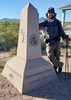
I located the register ( a 3" ABS tube with dry fitted ends), but upon opening it was taken breathless by a thriving mold inside. I left it to aire out whilst taking in the views, but upon later inspection decided to have no further contact with is decaying contents.

With peak in bag, I headed back. Usually, this is where I start the cruise home ( yea, usually down hill not up ), but it was getting hotter and I was gaining a bunch of elevation. Within the first mile of my return, my back was barkin' so bad that I dumped my last liter of water, cached my basic survival stuff and bino's ( 3 or 4 lbs means A LOT right now), put my head down and trudged on. The GeePuS died just where the 5 and the 5A meet, from there, I think I slept the remaining stretch to the parking lot. Reaching the 'Exploder', I now had access to water, gatorade, back brace, etc...

Now the adventure is done. I have a nice little cocktail lounge, kitchen, DVD player ( Trailer Park Boys, season 5 tonight) and a 7' x 9', nylon bedroom all to myself. SUCCESS!..
 Fauna
 Fauna [ checklist ]
[ checklist ]  Wild Turkey
 Named place
 Named place [ checklist ]
[ checklist ]  Mule Ears  Walnut Spring
_____________________
🥓🥓🥓
  1 archive
Jun 02 2013
avatar

 Triplogs 108

51 male
 Joined Feb 19 2012
 Tucson, AZ
Samaniego PeakTucson, AZ
Tucson, AZ
Hiking avatar Jun 02 2013
camilesTriplogs 108
Hiking12.00 Miles 3,000 AEG
Hiking12.00 Miles
3,000 ft AEG
 no routesno photosets
1st trip
Partners none no partners
Started the AM observing the Hummingbird Banding/Monitoring session that was going on at the Mount Lemmon Observatory (http://humbander.net/humbander.net/Page_Four_-_ML.html) - highly recommended, to see the Hummingbirds up close - and maybe even hold one in your hand - is awesome!

After that we got started - Mount Lemmon Trail/Sutherland/Samaniego Ridge/CDO Shortcut/Samaniego Ridge/Walnut Spring. The Samaniego Ridge trail out to Walnut Spring was mostly easy to follow (only one spot where we stopped and had to search) - it winds in and out of older growth and areas regrowing from the Aspen fire - there are a couple of spots with great views!

Walnut Spring was an unexpected pleasure - a small bit of flow, green grass and trees to provide shade - a nearly mandatory break. After Walnut Spring we started to the peak - we just tried to keep picking the easiest path but by 2/3rds of the way up it turned out our path was less than ideal, we resorted to crawling on hands and knees at one point... But we made it! Great views - nice location. We found a better way down (not great, just better) and made our way back without incident (picking up the small section of the Samaniego Ridge Trail we bypassed on the way out and adding the Meadow Trail for fun).

Hummingbird Banding Pictures http://www.flickr.com/photos/cmiles/sets/72157633938784912/

Hike Pictures http://www.flickr.com/photos/cmiles/sets/72157633938911648/

water 1 out of 5water less than maxwater less than maxwater less than max Walnut Spring Dripping Dripping
Basin was holding water, there was flow in the drainage and I would likely go downstream from the basin where there were some small pools for water.
_____________________
 
Oct 16 2012
avatar

 Guides 2
 Routes 4
 Photos 3,873
 Triplogs 362

51 female
 Joined Feb 12 2008
 Tucson, AZ
Samaniego Ridge Trail #7Tucson, AZ
Tucson, AZ
Backpack avatar Oct 16 2012
sirenaTriplogs 362
Backpack19.10 Miles 2,174 AEG
Backpack19.10 Miles2 Days         
2,174 ft AEG
 no routes
Solo backpack to see some fall colors and summit Samaniego. I stayed near Walnut Spring- love the views from the rocks nearby! I'm still in boating shape, not backpacking shape and I was definitely feeling my pack. The sunset was amazing and I spent a bunch of time writing in my journal.

The next morning, I set out to summit Samaniego. At first I was following pink flagging tape, but I eventually lost it and set out on my own. My route was pretty brushy in parts, but I got to see a gigantic Madrone tree growing right out of the side of the summit. The summit block is tiny, but the views are spectacular and totally worth it. This part of the mountain is so beautiful, with giant granite boulders and cliffs. I had an easier time getting down from the peak to the trail, but still cut my legs a bunch on the evil ceanothus bushes.

I had lunch, filled up my water from the spring, and headed toward the Corkscrew of Death (CSOD). Always a good time. I slip-slided down the hill and across to the rocky climb. Someone has installed a handline up the rock face.

After the CSOD, I ambled along the ridgeline past the Mule Ears and steeply up 7091. Took a break at the top of 7091 and looked at the amount of mileage vs. the amount of daylight and realized that I'd probably be walking Charoleau Gap road in the dark. After my break, I picked up the pace. I was practically running as I hiked north.

The trail wound through the grasslands for a lot longer than I had remembered before starting the drop to Charoleau Gap. I was wearing my old boots instead of trailrunners because of grass seeds this trip and they were starting to really bother my feet.

Finally, I reached the Gap at 4:30. No time to take a break, though. I still had six miles out on rough Charoleau Gap Rd. The surface is less than ideal- granite covered with small pebbles, kind of like walking on ball bearings. I find it's easier to run down. My feet were not happy and it felt like someone was hitting my baby toes with a hammer. There were fantastic views of the ridgeline and a beautiful sunset. I didn't have to walk too long in the dark before I reached Mr. Sirena waiting for me at the trailhead.
foliage observationfoliage observationfoliage observationfoliage observationfoliage observation
Autumn Foliage Observation Moderate

water 1 out of 5water less than maxwater less than maxwater less than max Walnut Spring Dripping Dripping
Two good-sized pools in the drainage just below the metal tank.
_____________________
 
Oct 13 2012
avatar

 Photos 69
 Triplogs 4

53 male
 Joined Oct 09 2011
 Gilbert AZ
Samaniego PeakTucson, AZ
Tucson, AZ
Hiking avatar Oct 13 2012
sguffeyTriplogs 4
Hiking12.00 Miles 2,000 AEG
Hiking12.00 Miles
2,000 ft AEG
 no routes
1st trip
Linked   none no linked trail guides
Partners partners
Carioca43
Camped at Spencer canyon campground about 4 miles south of Summerhaven, then drove to the trail head. Set off on the hike from the parking lot, near the power-station, near the Mount Lemon Peak, skycenter. The morning weather was particularly spectacular as a cold front came through and brought low clouds, rain, and much colder temperatures -- very welcome considering the hot weather we came from in the valley. We loved the feeling as were literally "Walked through the clouds". However this provided a bit of a challenge for navigation, because of the low visibility, we had to rely on our maps and GPS since we couldn't see landmarks very well, and there are several trail splits in this area. Here is the route we used to Samaniego Peak: We followed the Mt. Lemon trail #5, but taking the Meadow Trail alternate segment #5a (0.8 mi.). We noted that the meadow would make a great camp spot, for tents in good weather (could be really really bad in a thunderstorm). Continued on Mt. Lemon Trail #5 (0.7mi) to junction with Sutherland Trail. Continued on Southerland Trail #6 (0.8 mi.) to junction with the Samniego Ridge Trail #7. Then took Samaniego Ridge Trail to Walnut Springs, which is at the base of the peak (3.3 mi.). Then we bushwacked to the peak (no trail) about (0.6 mi.). There are two spots where there are junctions with trails that lead east, down the ridge to Canada del Oro Trail #4, of course, just stay on the ridge to continue on to the peak. Total trip distance one way was 6.8 mi. (13.2 mi. RT). Our ultimate goal was to find a geocache near the peak -- Good job Dave for finding it! The elevation gain is about 2000 ft returning to Mt. Lemon Peak to the parking lot, but this is a bit deceiving as the trail follows the ridge which goes up and down enough that it feels like the actual elevation change may be much more -- be prepared for it to take longer that you think. Overall it was a perfect day -- a nice strenuous hike, with perfect cool weather, and absolutely gorgeous views of the valley below.
 Flora
 Flora [ checklist ]
[ checklist ]  Manzanita
foliage observationfoliage observationfoliage observationfoliage observationfoliage observation
Autumn Foliage Observation Moderate
wildflower observationwildflower observationwildflower observationwildflower observationwildflower observation
Wildflowers Observation Moderate

water 1 out of 5water less than maxwater less than maxwater less than max Walnut Spring Dripping Dripping
The spring flow was sufficient to fill the round tank, but not much flow was evident
_____________________
 
Oct 12 2012
avatar

 Routes 1
 Photos 150
 Triplogs 35

58 male
 Joined Nov 03 2008
 QC AZ
Samaniego PeakTucson, AZ
Tucson, AZ
Hiking avatar Oct 12 2012
Carioca43Triplogs 35
Hiking13.20 Miles 4,200 AEG
Hiking13.20 Miles   10 Hrs      1.32 mph
4,200 ft AEG
 no routes
1st trip
Partners partners
sguffey
8) So nice to cool off and get out of the Valley of the Sun. Had a great time on this one with Sguffey. Enjoyed exploring a new area for me and a nice challenging hike. On the way down I enjoyed the ups and downs but not so much on the way back. Huge amount of variety on this one and noted the first evidence of tree rain I have encountered in AZ. You know where the clouds roll through and the trees capture the moisture from the air the a subsequent wind blow the drops off the tree creating a wet circle on the ground of the windward side of the tree. I had witnessed this in some wetter coastal areas but never in AZ. Also in the Walnut Spring area I encountered the most deer activity I have ever found. More deer acitivity here than Elk activity on Elk Point off of Volunteer/Sycamore canyons. Also the fall colors were quite nice :FG:

So many great backpacking camping spots this trail would make for a great loop out to mule ears and around to Catalina Camp and back up Red Ridge. (Yeah I think I will do that one next time) Btw I got lucky getting to the Peak only had crash through one scrub oak & nasty thorny bush barrier about 15' deep was able to find a couple of deer trails which got me close to the peak and rock scrambled the rest of the way.

Best part was finding Sawmill Restaurant Open in Summerhaven after finishing a very chilly climb as dark arrived. Car Temp guage read 38* on top. 8)

water 1 out of 5water 2 out of 5water less than maxwater less than max Walnut Spring Quart per minute Quart per minute
Looked pretty good to me from an end of summer perspective several pools large enough to filter and flow fairly well.
_____________________
 
Aug 11 2012
avatar

 Guides 1
 Routes 11
 Photos 691
 Triplogs 94

45 female
 Joined May 14 2008
 Tucson, AZ
Samaniego PeakTucson, AZ
Tucson, AZ
Backpack avatar Aug 11 2012
SaraeTriplogs 94
Backpack12.00 Miles 2,843 AEG
Backpack12.00 Miles2 Days         
2,843 ft AEG
 no routes
1st trip
Partners none no partners
Managed a quick backpack to Walnut Spring with Tyler to check out the Samaniego Ridge. We haven't been out much lately, so we knew this was sure to kick our pumpkins a bit. Headed up the Catalina Hwy early on Sat. morning after some caffeine and Quiche at Le Buzz. Hit the trail by 8am and immediately enjoyed excellent views, tons and tons of wildflowers, and much cooler temps.

The hike to Walnut Spring went quickly. The spring was actually not as pretty as I was expecting with all the recent rain (can't believe I forgot to take a pic). I had known the tank would be skanky, but had thought the pool below the tank that is mentioned by multiple triplogs would be much nicer. It was better than the tank, but there was only a very slight trickle filling the pool, so it seemed a bit stagnant. Shovel Spring was better looking when we passed it, but we really wanted to stay on the ridge, so we decided to make do. We filtered the mosquito larve and other large bits out with a bandana, let my gravity filter do it's job, and then added chlorine tabs for extra insurance. The taste was still slightly yucky, but we managed.

We finished setting up camp around 11am. By then, clouds were starting to roll in, so we decided to nix our plan to try to bag the peak and instead took the best naps ever, snug in our hammocks. :D A series of pretty good storms rolled through with lots of rain and a bit of hail and LOTS of lightning. :scared: I was quite thankful that the cuben fiber tarp held up! It stopped storming by 4:30ish and we spent the rest of the evening soaking in the views of the Reef of Rocks and CDO below the ridge. There were so many different types of flowers to enjoy, too.

Sunday morning we headed back up the mountain. We didn't end up starting as early as we had wanted and the sun-exposed slopes were most certainly warmer than we had hoped for, but we made better time than we expected and were back at the top in time to have lunch on the patio of the Iron Door.

This was a great place to enjoy some much needed wilderness time. Next time we visit, I think we will either do a shuttle hike to Charouleau Gap, or do a loop with the Canada del Oro Trail.
 Named place
 Named place [ checklist ]
[ checklist ]  Reef of Rock

water 1 out of 5water less than maxwater less than maxwater less than max Shovel Spring Dripping Dripping
Good looking water in the tank.

water 1 out of 5water less than maxwater less than maxwater less than max Walnut Spring Dripping Dripping
The tank itself is murky. The pool below the tank had a tiny amount of water flowing in, but was smelly. We filtered and added chlorine tabs and were fine.
_____________________
In every walk with nature one receives far more than he seeks. ~John Muir
 
May 12 2012
avatar

 Guides 1
 Routes 269
 Photos 613
 Triplogs 1,360

50 male
 Joined Dec 22 2003
 Tucson, AZ
Samaniego PeakTucson, AZ
Tucson, AZ
Backpack avatar May 12 2012
RedwallNHopsTriplogs 1,360
Backpack16.00 Miles 4,362 AEG
Backpack16.00 Miles2 Days         
4,362 ft AEG
 no routesno photosets
Linked   none no linked trail guides
Partners partners
TUB - Group
GrottoGirl
_____________________
 
May 12 2012
avatar

 Guides 3
 Routes 569
 Photos 11,976
 Triplogs 1,634

50 female
 Joined Sep 18 2009
 Tucson, AZ
Samaniego PeakTucson, AZ
Tucson, AZ
Backpack avatar May 12 2012
GrottoGirlTriplogs 1,634
Backpack16.00 Miles 4,362 AEG
Backpack16.00 Miles2 Days         
4,362 ft AEG34 LBS Pack
 
Linked   none no linked trail guides
Partners partners
TUB - Group
RedwallNHops
Day 1
9 miles
1600 feet elevation gain
Backpacked into the nice flat area near Walnut Spring/Samaniego Peak. We checked out Shovel Spring to make sure it had water in it just in case Walnut was dry.

We set up camp then some of us wandered down the trail to Mule Ears to meet one of our other backpackers who was coming up from Catalina.

Right before Mule Ears, we encountered what the mountain bikers call the "Corkscrew of Death". We got to the edge of a cliff and then the trail cut around and down. Then it went up in a crumbly area. There were some diagonal slabs of rock you could walk on which was helpful. But one wrong move would have been disastrous. There were two "hand rails" made of a rope covered by webbing that had been attached to a vertical slab which we used only on the return trip.

At Mule Ears, I noticed that the topo on my GPS has it label incorrectly (at least this is our opinion). It shows Mule Ears as further on down the ridge. We scrambled around on one of the Mule's Ears, but only one of our party actually went to the top. There was a lot of exposure which was different then what I had encountered lately so I wasn't mentally prepared for it. It was fun all the same.

We returned to camp and just hung out for a while. I managed to put olive oil in my tea - the container looks just like the container for my sugar. I guess a label would be helpful. For dinner, I had one of my favorite commercial backpacking foods: Austintacious Tortilla Soup from Packit Gourmet. I supplemented it with an avocado. It was wonderful!

We had a great group from all walks of life so good conversation was had. After dinner we watched the sunlight disappear from the Reef of Rocks from a nice rock outcropping close to our camp.

Day 2
7 miles
2762 feet elevation gain

We bagged Samaniego Peak this morning. It is still very brushy to the top, no matter which way you try to go. We did find a way that included some good rock scrambling! It was nice to be on the top in the morning so we had a great view of the backside of the front range. We also spotted a weather station which Joel and I went down to check out. Nothing too exciting but it's always interesting to see where weather data is being collected.

After we got down from the peak, we grabbed our packs and started the climb out to the top of Mt Lemmon. I had a great surprise along the way, one of my friends came to deliver a birthday card, on her birthday! It was nice to chat and catch up with her on the way out.

Part of our party was pretty slow, so we made sure they knew the way and left arrows in the dirt on the trail to help direct them. We also asked that their passengers notify us when they got done. Alls well that ends well...

water 1 out of 5water less than maxwater less than maxwater less than max Shovel Spring Dripping Dripping
Some water in the catchment and a slow drip.

water 1 out of 5water 2 out of 5water less than maxwater less than max Walnut Spring Quart per minute Quart per minute
There was a nice tiny pool in the drainage to get good water from with the filters. Just enough water being added to see a bit of flow in the drainage.
_____________________
 
May 11 2012
avatar

 Guides 34
 Routes 249
 Photos 2,197
 Triplogs 592

38 male
 Joined Aug 16 2006
 Portland, OR
Meadow Trail #5ATucson, AZ
Tucson, AZ
Backpack avatar May 11 2012
keepmovingTriplogs 592
Backpack26.10 Miles 6,999 AEG
Backpack26.10 Miles2 Days         
6,999 ft AEG34 LBS Pack
 no routes
Partners none no partners
Day 1: 15.4 Miles, On trail for 7 hours & 47 Minutes
Started on Meadow Trail at 12:44pm and worked my way down to the Samaniego Ridge Junction. I turned right at the junction and worked my way down the ridge for the first time. Enjoyed the great views of Cathedral Rock, The Window, and Pusch Ridge. I took a slight detour at the CDO Shortcut trail and hiked to CDO and back so I could cross it off my to do list. At Walnut Spring I took a short lunch break. After the spring, I attempted to get to the top of Samaniego Peak, but I started too far north and ended up getting cliffed out. I returned to the trail and considered making a second attempt at the peak, but the day was growing late and I wanted to set up camp that night on CDO, so I knew I didn't have enough time.

The trail after Samaniego Peak gets a little sketchy in a couple places. There is one section where it steeply switchbacks down the side of a ridge in some very loose soil. I ended up stepping in a particularly loose patch of soil, started a rock/dirt slide and slipped about 6 feet below the trail. I have no idea how mountain bikers manage to ride this trail without getting killed...

By the time I reached Charouleau Gap it was already 7:56pm and I was almost out of daylight. I was too stubborn to stop for the day, so I began the 3.5 mile trek along the jeep road to reach the CDO trail. I was hoping I would encounter someone friendly enough to let me hitch a ride to the trailhead, but didn't see a vehicle the entire time. By the time I made it to CDO it was completely dark out and I was navigating by flashlight. I didn't know how far I would have to travel on CDO to find a campsite and was ready to set up camp in the middle of the trail- but luckily there is a large campsite only a couple hundred feet from the trailhead.

Day 2: 10.7 Miles, On trail for 5 Hours & 56 Minutes
Despite being completely exhausted from the previous day, I only managed to get about 3 hours of sleep the whole night. As soon as it began to get light out, I ate breakfast and packed up my camp and was on trail at 5:45am. I knew it was going to be hot out, so I wanted to gain as much elevation as I could before the sun hit the canyon. I had some confusion just up trail from my campsite and followed an ATV trail across the creek, not noticing that the trail departed the ATV trail and continued to follow the east side of the creek. After some backtracking, I was able to correct my mistake and get back on the proper trail.

I had no idea how much water I would encounter along CDO, and was blown away that the trail followed a flowing creek for almost 5 hours! The area is so lush and green, with large trees that provide plenty of shade for much of the hike. The trail can be a little faint in areas due to all the leaves on the trail, but it generally sticks to the creek and is not too difficult to follow if you pay attention.

After leaving the creek, the trail goes through a burned area, then begins to switchback its way up to the CDO shortcut trail. The switchbacks provided excellent views down into the CDO and out towards Reef of Rock and Rice Peak. The rest of the hike was uneventful as the trail continued to gain elevation as it works its way back to the top of the mountain.

But wait, there's More!
I was so physically & mentally exhausted when I got back to the parking lot that I left my backpack on the ground next to my truck and drove away. I only realized my mistake when I got home and noticed my pack wasn't in my truck :doh: . I contacted the Sheriffs Dept and had the Mt Lemmon deputy check the parking lot for my backpack- but they couldn't locate it. I contacted the Palisades Ranger station and luckily a ranger showed up with my pack while I was on the phone with them :y: ! I drove back up the mountain and collected my pack from the ranger (with nothing missing) and drove back home again.
 Culture
 Culture [ checklist ]
[ checklist ]  Horseshoe
 Named place
 Named place [ checklist ]
[ checklist ]  Walnut Spring

water 1 out of 5water less than maxwater less than maxwater less than max Walnut Spring Dripping Dripping
The catchment has approximately 5 inches of water in it, with lots of mosquito larvae. There is also some water in the creek immediately above and below the catchment.
_____________________
 
Jul 23 2011
avatar

 Guides 36
 Routes 310
 Photos 2,235
 Triplogs 241

79 male
 Joined Mar 27 2008
 tucson, az
Samaniego PeakTucson, AZ
Tucson, AZ
Hiking avatar Jul 23 2011
rvcarterTriplogs 241
Hiking12.00 Miles 2,000 AEG
Hiking12.00 Miles   8 Hrs      1.50 mph
2,000 ft AEG
 
Linked   none no linked trail guides
Partners none no partners
I read Brianb's log of this hike after our hike yesterday. Wish I had done so before. This is indeed a deceptively hard hike. The 1/2 mile bushwhack after leaving the trail near Walnut Springs to Samaniego Peak (we didn't find a good route) is through brambles and over and around boulders up an extremely steep slope. Expect this portion to take over an hour and to sap your energy. And dress defensively, because nearly every plant has thorns. We got cut up quite a bit. A machete wouldn't hurt.

Our departure from the trail was about the same place as Brian's but we went up almost directly west toward the peak. Coming back to the trail seemed easy but we needed a gps fix and a good map to intersect the faint trail.

This hike is extremely rewarding (especially the fantastic views from the peak, and Window Rock near Cathedral Peak) but expect nearly 3500 feet accumulated gain over a lot of rocky trail. However, thanks to some work by the forest service in the summer of 2010, the trail from Radio Ridge to Walnut Spring is now in good shape and pretty easy to follow (except for the bushwhack). We didn't generate a gps track to post, but Brian's is accurate.
_____________________
Check out my Instagram posts at "cartershift", and videos on my Rumble channel "rvcarter".
 
May 22 2011
avatar

 Guides 1
 Routes 269
 Photos 613
 Triplogs 1,360

50 male
 Joined Dec 22 2003
 Tucson, AZ
Samaniego PeakTucson, AZ
Tucson, AZ
Hiking avatar May 22 2011
RedwallNHopsTriplogs 1,360
Hiking12.60 Miles 3,400 AEG
Hiking12.60 Miles   8 Hrs   8 Mns   2.20 mph
3,400 ft AEG   2 Hrs   24 Mns Break
 no routesno photosets
Linked   none no linked trail guides
Partners none no partners
wildflower observationwildflower observationwildflower observationwildflower observationwildflower observation
Wildflowers Observation Isolated
_____________________
 
May 22 2011
avatar

 Guides 3
 Routes 569
 Photos 11,976
 Triplogs 1,634

50 female
 Joined Sep 18 2009
 Tucson, AZ
Samaniego PeakTucson, AZ
Tucson, AZ
Hiking avatar May 22 2011
GrottoGirlTriplogs 1,634
Hiking12.60 Miles 3,400 AEG
Hiking12.60 Miles   8 Hrs   8 Mns   2.20 mph
3,400 ft AEG   2 Hrs   24 Mns Break20 LBS Pack
 
Partners partners
Baja Arizona Hiking
clouise58
RedwallNHops
This hike is a lot easier than it used to be. But it's still pretty darn hard! The trail has been cleared and it is very easy to follow - which was not the case when we did it in May 2008. It's funny that Joel and I did this hike on my birthday 3 years ago. I knew we had done the hike, I just hadn't realized it was on my birthday.

There are great views from the ridge line of the front range of the Catalinas. You can see Cathedral, Window Peak, the Window, Little Kimball, Mt. Kimball and more. In the aftetnoon you can actually see light through the Window. The views from the peak are wonderful. Well worth the pain caused by some of the bushes on the way up.

We checked out Walnut Spring, which surprisingly had water. We also took the Cut-off Trail to check out Shovel Spring, which also had water. For our last push back up to the top of Mt. Lemmon we took the Meadow Trail which is really nice compared to the old road.
wildflower observationwildflower observationwildflower observationwildflower observationwildflower observation
Wildflowers Observation Isolated

water 1 out of 5water less than maxwater less than maxwater less than max Shovel Spring Dripping Dripping
It's probably a bit more than dripping. The plastic trough has water in it that looks like it's in pretty good condition. No water in the drainage.

water 1 out of 5water less than maxwater less than maxwater less than max Walnut Spring Dripping Dripping
It's probably between dripping and a quart per minute. The catchment has water in it with all kinds of bugs swimming around. There is also water in the drainage.
_____________________
 
average hiking speed 1.82 mph
1, 2  Next

WARNING! Hiking and outdoor related sports can be dangerous. Be responsible and prepare for the trip. Study the area you are entering and plan accordingly. Dress for the current and unexpected weather changes. Take plenty of water. Never go alone. Make an itinerary with your plan(s), route(s), destination(s) and expected return time. Give your itinerary to trusted family and/or friends.

helpcommentissue

end of page marker