username
X
password
register
for free!
help
ArticlesGuidesRoutes
 
Photosets
 
 Comments
triplogs   photosets   labels comments more
Hawes Trail System - 14 members in 105 triplogs have rated this an average 3.6 ( 1 to 5 best )
1, 2, 3, 4, 5, 6  Next
105 triplogs
login for filter options
Jun 22 2025
avatar

 Guides 27
 Routes 669
 Photos 12,096
 Triplogs 856

56 male
 Joined Jul 05 2006
 Mesa, AZ
Hawes Trail SystemPhoenix, AZ
Phoenix, AZ
Hiking avatar Jun 22 2025
DarthStillerTriplogs 856
Hiking7.79 Miles 1,003 AEG
Hiking7.79 Miles   3 Hrs   48 Mns   2.10 mph
1,003 ft AEG      5 Mns Break
 
Route Scout Route Recorded  on Route Scout | Pop | Map | Popup | MapDEX
Hiked a nearly 8 mile loop in this area from the Power Road TH. I can never keep track of the names of the trails in this area. I tried to keep it kind of level but I still got over 1K AEG. The climbs kind of sneak up on you. Lots of bikers early, no one at all the last 3.5 miles. Then when I got back there were hikers going out starting after 10am.

Only interesting thing to see were the 2 coyotes checking out the bikers helping out another biker who's bike was broken. they seemed to be hovering over them, like they sensed a woundedness. When they spotted me getting pics of them, they got spooked and took off. :lol:

Seemed kind of hot at first after sitting in the AC, but then the temperature was actually very mild for late June in Phoenix. The low humidity has been a big plus lately.
 Fauna
 Fauna [ checklist ]
[ checklist ]  Coyote
_____________________
 
Feb 23 2025
avatar

 Guides 27
 Routes 669
 Photos 12,096
 Triplogs 856

56 male
 Joined Jul 05 2006
 Mesa, AZ
Twisted Sister - HawesPhoenix, AZ
Phoenix, AZ
Hiking avatar Feb 23 2025
DarthStillerTriplogs 856
Hiking8.53 Miles 1,243 AEG
Hiking8.53 Miles   3 Hrs   32 Mns   2.43 mph
1,243 ft AEG      1 Min Break
 
1st trip
Route Scout Route Recorded  on Route Scout | Pop | Map | Popup | MapDEX
Started just before 7am at the Power Road TH. Took the Roadrunner Trail to Hawes, then Saguaro, and up to the Twisted Sister Trail, which I haven't hiked in several years. Before heading down Twisted Sister, I hiked over to the mine, which is listed as a prospect on the topo. It's kind of a let down since there's a grate over the entrance, and it's so far in that you can't even get good pictures. It was weird that as I got up to grate and inside the entrance, my camera battery dies even though it has a full charge. Once I was out of the mine area, it was fine. It did this same when I was at the Clapp Mine 2 months ago :-k .

The hike down Twisted Sister is very easy and enjoyable, the hike back on the Riverview trail is not. That's getting to be my least favorite trail in this area. It stays in the same elevation "range", which is to say that it's constantly either going up or down, and can be steep in some areas. One of the benefits of climbing up on a trail is that you'll get nice views, but on this trail, as soon as you climb, you immediately descend the same amount, then immediately climb again, etc. :x . I know it's designed more for the bikers and that's why it's like that. I would rather that they extend the Bush Lite Trail further west down by the highway so you can complete a loop between the two sides of this trail system without having to deal with this trail. :SB: :M2C:

I saw as many hikers as bikers this time, which is kind of rare in this area, which is mostly used by the bikers. I think the west half is where the hikers use it more.
_____________________
 
Apr 24 2024
avatar

 Guides 13
 Photos 15,617
 Triplogs 323

male
 Joined Oct 23 2010
 mesa
Hawes Trail SystemPhoenix, AZ
Phoenix, AZ
Hiking avatar Apr 24 2024
gummoTriplogs 323
Hiking5.00 Miles 400 AEG
Hiking5.00 Miles
400 ft AEG
 no routes
Linked   none no linked trail guides
Partners none no partners
Finally had a good day of finding snakes. I was just as upset as you guys from the lack of snake photos on here recently. Thankfully, the temps stayed warmer than usual tonight and I was able to sneak out of work early enough to get a good start. 3 gopher snakes, 1 threadsnake, 1 kingsnake, and one coachwhip.
_____________________
 
Apr 21 2024
avatar

 Guides 27
 Routes 669
 Photos 12,096
 Triplogs 856

56 male
 Joined Jul 05 2006
 Mesa, AZ
Saguaro Trail #50 - HawesPhoenix, AZ
Phoenix, AZ
Hiking avatar Apr 21 2024
DarthStillerTriplogs 856
Hiking4.17 Miles 470 AEG
Hiking4.17 Miles   2 Hrs   27 Mns   1.70 mph
470 ft AEG
 
1st trip
Partners none no partners
Went up to the Power Road TH by Hawes to get a few miles in for a Sunday morning. Woke up with very stiff and sore legs from the hike to 5057 the day before and as a result, I didn't get far on this hike. Any downhill grade was hard to do, and steep sections were a bit outright painful. The first drop into the wash from Power Road was rough. I was able to press on for a couple miles when the trail that parallels the Bush Hwy started to gain elevation (signs there call it Riverview, but i've seen other names online). I didn't have a problem going up, but after 2 miles my legs weren't getting any looser so it seemed like the best idea to head back and not push it too much. Took a couple spur trails get a little more mileage in with an easy grade. Still feeling it later in the day, but it's only muscle soreness to overall that's actually a good thing. Time for a few cans of non-aspiring pain reliever :D :D .
_____________________
  1 archive
Feb 17 2024
avatar

 Guides 27
 Routes 669
 Photos 12,096
 Triplogs 856

56 male
 Joined Jul 05 2006
 Mesa, AZ
Boulderdash Trail - HawesPhoenix, AZ
Phoenix, AZ
Hiking avatar Feb 17 2024
DarthStillerTriplogs 856
Hiking9.20 Miles 1,455 AEG
Hiking9.20 Miles   4 Hrs   8 Mns   2.23 mph
1,455 ft AEG
 
1st trip
Been meaning to hike the newly built Boulderdash Trail over by Hawes and finally got to it. Hiked it downhill to make it easier, although the steep drops can be dicey with the scree. My general thought is that it's probably safer to hike these types of trails uphill since they're built more for the bikers and you can see them when they're coming. It's pretty much impossible for a biker to go uphill on this trail. I only encountered 2 bikers on this trail coming downhill behind me and was able to get out of their way. The trail is fun to hike, but you have to be careful on the steep drops.

Started from the Power Rd/Bush Hwy TH and took the Ridge, Saddle and Saguaro Trails over to the Lower Gidro and hiked up that to get to the top of the Boulderdash, then hiked back mostly the same route. Only saw 4 or 5 bikers until the last mile, then a lot of hikers and bikers. Early start in the dark makes for less crowded trails for most of the hike, especially at the higher elevations.
_____________________
 
Dec 28 2023
avatar

 Routes 189
 Photos 7,236
 Triplogs 1,740

57 male
 Joined Apr 25 2011
 Goodyear, AZ
Hawes Trail SystemPhoenix, AZ
Phoenix, AZ
Mtn Biking avatar Dec 28 2023
NightstalkerTriplogs 1,740
Mtn Biking15.80 Miles 1,669 AEG
Mtn Biking15.80 Miles   2 Hrs   14 Mns   7.52 mph
1,669 ft AEG      8 Mns Break10 LBS Pack
 no routes
1st trip
Parked on Bush Hwy across from Mesquite trail and took Riverview east to Lower Mine, Granite, Ridge, Saguaro, Twisted Sister, down Big Sister, Wild Horse all the way to Scorpion, Bush Lite East, Bush Lite Loop, and Bush Lite West back to the start. First time riding trail on both the east and west side. Lots and lots of climbing. Interesting observation. Saw mostly hikers on the eastern trails, Granite, Ridge, Saguaro and bikers on the western trails, Wild Horse etc.
_____________________
 
Dec 24 2023
avatar

 Guides 27
 Routes 669
 Photos 12,096
 Triplogs 856

56 male
 Joined Jul 05 2006
 Mesa, AZ
Hawes Trail SystemPhoenix, AZ
Phoenix, AZ
Hiking avatar Dec 24 2023
DarthStillerTriplogs 856
Hiking8.47 Miles 1,322 AEG
Hiking8.47 Miles   3 Hrs   52 Mns   2.21 mph
1,322 ft AEG      2 Mns Break
 
I started from the Power Road TH early at 6am in the dark and did a loop counter clockwise. I just wanted to get some mileage in quick before getting ready for Xmas Eve and this fits the bill nicely being so close to home. Getting the early start in the dark reduced the amount of overall traffic for a while, especially bikers. Although I did see one biker farther ahead of me with a headlamp.

The fog made for some nice pictures. It seemed to clear up a little after a couple of hours and then a second wave seemed to roll in. I was expecting to have sunny skies but the entire time it was overcast and foggy. The last couple of miles the amount of foot traffic increased. It was chilly at the start but remained cool the entire time. Higher up there were some breezes.
_____________________
 
Sep 10 2022
avatar

 Guides 27
 Routes 669
 Photos 12,096
 Triplogs 856

56 male
 Joined Jul 05 2006
 Mesa, AZ
Hawes Trail SystemPhoenix, AZ
Phoenix, AZ
Hiking avatar Sep 10 2022
DarthStillerTriplogs 856
Hiking8.97 Miles 1,618 AEG
Hiking8.97 Miles   4 Hrs   10 Mns   2.16 mph
1,618 ft AEG      1 Min Break
 
Partners none no partners
I hadn't hiked up to cell tower on the Usery Mountains in well over a decade. I've balked at this one before since it's so steep on the last climb. The weather was supposed to be cooler and the rain the night before seemed like it might help. It did not. From the get go the humidity was oppressive.

It's a gradual climb from Power Road to the base of mountain, then a slog up to the road. I was pretty drenched by the time I got up there. I spotted another trail that continues to the peaks, but I wasn't having it. I barely had enough water left to get back to the car. Save that for another, cooler day.

The hike back down was easier. Scenery at the start was amazing with fog banks rolling through the hills.

There is new signage when you enter the trails stating that E-bikes are prohibited. I still saw a few bikers who had them, however. Hopefully that doesn't grow into a problem.
_____________________
 
Apr 10 2022
avatar

 Guides 27
 Routes 669
 Photos 12,096
 Triplogs 856

56 male
 Joined Jul 05 2006
 Mesa, AZ
Hawes Trail SystemPhoenix, AZ
Phoenix, AZ
Hiking avatar Apr 10 2022
DarthStillerTriplogs 856
Hiking10.12 Miles 1,235 AEG
Hiking10.12 Miles   4 Hrs   41 Mns   2.19 mph
1,235 ft AEG      4 Mns Break
 
Had some chores to do on Saturday so I moved the hike this weekend to Sunday. Decided on the Hawes area because it's the closest drive. Parked at the new MT trailhead along the transition from Power Road to the Bush Highway and did a big clockwise loop, finishing with a little spur to get my mileage up to 10. At the start I hiked the Mo Ridge Trail, which is one of the new official ones being built in the master plan.

Found an unmarked trail but I decided to follow it for this hike since I was so far in on my loop and I wasn't sure how much it would add. marked it with a waypoint for another day. Also hiked up to a knob that has a social trail on it from previous use.

Didn't see too many people on the trails this week as compared to 2 weeks ago. the forecast was for temps in the 90s, but all morning it was pretty nice and breezy at times. Saw more bikers but by the end there seemed to be more hikers. Nice to get a respectable AEG in with the mild climbs throughout this area. Not flat, but not too strenuous for an easy Sunday morning hike.
_____________________
 
Mar 27 2022
avatar

 Guides 27
 Routes 669
 Photos 12,096
 Triplogs 856

56 male
 Joined Jul 05 2006
 Mesa, AZ
Hawes Trail SystemPhoenix, AZ
Phoenix, AZ
Hiking avatar Mar 27 2022
DarthStillerTriplogs 856
Hiking9.18 Miles 1,384 AEG
Hiking9.18 Miles   3 Hrs   58 Mns   2.31 mph
1,384 ft AEG
 
Partners none no partners
Had some chores to do at home over the weekend, so hiking on sunday was the only option. got to "sleep in" a little and started on the trail just at dawn. Parked at the new Bush Highway Trailhead that looks to have been built by Maricopa County, so no Tonto Pass necessary. A new trail spur was built just across the street from the trailhead so you dont have to hike a quarter mile on the berm of the road to get to the other entrance trail across from the defunct parking lot.

I hiked the Hawes Trail almost to the microwave tower. just before that junction, there is a lasso loop trail that I've never seen before. I did that and decided to head back instead of going to the microwave tower. Saw the junctions for the newly built trails and some newer unofficial trails.

Most bikers on the trails. all were nice with the exception of one guy who was a little overly aggressive with the downhill speed and personal space while zipping by.

Overall nice hike close to home with a decent mileage and AEG and time to spare for the rest of the day.
_____________________
 
Jan 11 2022
avatar

 Guides 21
 Routes 1,182
 Photos 36,858
 Triplogs 1,570

69 female
 Joined Feb 26 2004
 Phoenix, AZ
Hawes Meander, AZ 
Hawes Meander, AZ
 
Hiking avatar Jan 11 2022
tibberTriplogs 1,570
Hiking8.69 Miles 1,247 AEG
Hiking8.69 Miles   4 Hrs   17 Mns   2.35 mph
1,247 ft AEG      35 Mns Break
 
1st trip
Route Scout Route Recorded  on Route Scout | Pop | Map | Popup | MapDEX
Since Deborah was in town, I wanted to continue a new tradition we started last year (San Tans) which was to do a hike together, and Duke too. Since last year I've wanted to give this trail system a spin... well not a spin on a bike but in my hiking shoes. Linda was game and she let me pick the start time of 9AM. Kelly was going to join us but her plane was late. Kelly would have liked this hike plus I wanted her to hook up with my friend Debbie since they have running in common.

Finding a parking area was a bit of a challenge so I PMed @adenium (thank you) and he gave us four possibilities so we picked the one just to the east of Granite Reef Rec area. There were quite a few cars at this lot and we encountered this group fairly early on during our hike. We would see another large group and then about half-dozen other hikers and about the same number of bike riders, so not bad. The tread was very nice and it proved to be a roller coaster hike which I like. We had a couple good hills mixed in.

The scenery was typical desert that teased us with several good views of Red Mountain :) . We came upon an area with two roads and a blowout to the north that was a mystery that we eventually figured out was part of the canal system; exactly what part we're not positive about... The hike got particularly interesting, on the south side, after we got past the first row of very nice homes and headed east and then north and then east back down by another set of houses before making the final turn north. The rockery and steeper mountains to our east were impressive. Linda labeled our hike description appropriately as the trail really starts some serious meandering from area to area.

The trail erosion efforts were interesting; something I've not seen before. I'll post a picture.
We stopped for a little break before finishing off the last 1/2 or so of the hike. From here we encountered some steeper parts of the hike going down into the narrow wash as the trail was a little slippery from the loose granite. We checked out a wounded saguaro and a couple very green, very little plants. We saw some cool rock formations and Red Mountain would pop up into view here and there.

As we finished off the last leg that took you up to a saddle and side of a mountain we were treated to good views of the river and then were rewarded with a mine area on the Mineshaft Trail. The quartz in this area was very pretty. And fortunately, Linda's curiosity struck again as we went to the top of the hill above the mine and got a spectacular treat with some great 360 views. It was a clear day in almost every direction too. You get a couple long switchbacks to get you down the mountain with just a couple slippery areas. The views to the river kept us entertained too📷.

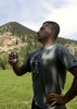
We enjoyed our Huckleberry Wheat Lager before going our separate ways. It was nippy and windy in the morning to start and in less then a couple miles later it warmed enough to take off my jacket. It was nice for the rest of the hike with only a slight breeze as we did the interior and then got windy again once we got to the north high part of the hike.

WATCH: 8.5 miles with a starting temp of 47.7 and 40% humidity (high point 1876, low point 1257) Avg bpm 127, max 167 with 33% at zone 3, 52% at zone 2 and 12% at zone 1 burning 1604 calories finishing at 1:15PM
_____________________
For me, sometimes it's just as much about the journey as the destination.
Oh, and once in awhile, don't forget to look back at the trail you've traveled.
 
Dec 29 2021
avatar

 Guides 1
 Routes 5
 Photos 656
 Triplogs 512

47 male
 Joined Jul 20 2007
 Gilbert, AZ
Hawes Trail SystemPhoenix, AZ
Phoenix, AZ
Mtn Biking avatar Dec 29 2021
jtaylorTriplogs 512
Mtn Biking8.00 Miles 587 AEG
Mtn Biking8.00 Miles
587 ft AEG
 no routesno photosets
1st trip
Linked   none no linked trail guides
Partners none no partners
I swore off mountain biking years ago because it stained my lower back. But Sam and Chris insisted that things are different now with these “new”dropper posts, so I agreed to give it a shot. This was an intro ride that included Scorpion, Stinger, and some other trail I don’t recall. Beautiful area and a fun ride. My back felt fine. Just not sure I’m ready to spent big $$ on a new hobby yet.
_____________________
“...wilderness is not a luxury but a necessity of the human spirit, and as vital to our lives as water and good bread.”
-Edward Abbey, Desert Solitaire
 
Mar 04 2021
avatar

 Routes 105
 Triplogs 105

52 male
 Joined Nov 14 2014
 Phoenix, AZ
Hawes Trail SystemPhoenix, AZ
Phoenix, AZ
Hiking avatar Mar 04 2021
RoadrunnerAZTriplogs 105
Hiking4.29 Miles 851 AEG
Hiking4.29 Miles   2 Hrs   14 Mns   2.13 mph
851 ft AEG      13 Mns Break
 
no photosets
1st trip
Linked   none no linked trail guides
Partners none no partners
Route Scout Route Recorded  on Route Scout | Pop | Map | Popup | MapDEX
Wanted to explore this hiking/biking trail system for quite some time especially from this entrance and today we finally had a couple hours in the evening after work for exploration. The climb from the parking lot on the route we took was a bit strenous with the trail being quite eroded in places. We also met quite a few bikes in this first stretch. The further we went the fewer people and bikes - that was true especially in the Twisted Sisters portion of the hike. There is also a small mine along the way and some great views after you reach the crest. We stayed there a bit at sunset and watched the sun set over downtown Phoenix while bats were flitting above us - fun.
wildflower observationwildflower observationwildflower observationwildflower observationwildflower observation
Wildflowers Observation Light
_____________________
 
Feb 27 2021
avatar

 Guides 27
 Routes 669
 Photos 12,096
 Triplogs 856

56 male
 Joined Jul 05 2006
 Mesa, AZ
Hawes Trail #52 - HawesPhoenix, AZ
Phoenix, AZ
Hiking avatar Feb 27 2021
DarthStillerTriplogs 856
Hiking9.95 Miles 1,486 AEG
Hiking9.95 Miles   4 Hrs   30 Mns   2.23 mph
1,486 ft AEG      2 Mns Break
 
I had some errands to run today, so I picked hiking at the closest trails to my house. I picked a route to hike sections of trail that I hadn't hike in well over 10 years.

I started a figure 8 circuit with the Mineshaft Trail from the parking area east of Granite Reef on the Bush Highway. At the top there, I took the Saguaro Trail all the way down to the Hawes Trail and headed east again. There is a little unofficial trail that goes to the top of Peak 1970. It's pretty steep and loose towards the top, so I decided to bushwhack my way down. Looks like there were signs that others had done the same, the route was pretty easy to walk, not too loose, steep, or overgrown anywhere. at the end of the Hawes I took the Saddle Trail north, then cut to the west on the Upper Ridge and Ridge Trails, and back on the Granite with where I started. At that point I had only done 8 miles, so I went out and back on the Riverview Trail to get my mileage up to 10. The riverview trail has so much ups and downs on it, it's more work than it seems at first.

Looking forward to the new trails they'll be adding this area in the coming year or so.
_____________________
  1 archive
Jan 16 2021
avatar

 Guides 3
 Routes 632
 Photos 8,235
 Triplogs 604

54 male
 Joined Apr 13 2011
 Gilbert, AZ
Hawes Trail SystemPhoenix, AZ
Phoenix, AZ
Hiking avatar Jan 16 2021
ddgrunningTriplogs 604
Hiking11.51 Miles 2,644 AEG
Hiking11.51 Miles   3 Hrs   43 Mns   3.56 mph
2,644 ft AEG      29 Mns Break
 
Route Scout Route Recorded  on Route Scout | Pop | Map | Popup | MapDEX
Another day of exploration on the Hawes trail system. Hit up some of the newly opened mountain biking trails, including Iron Goat and Cactus Nectar. Really impressed with some of the trail work. Shared the trail with a whole family of javelina. There was about a dozen of them.
_____________________
  1 archive
Jan 10 2021
avatar

 Guides 7
 Routes 19
 Photos 3,021
 Triplogs 191

67 male
 Joined Jun 01 2010
 Mesa, AZ
Hawes Trail SystemPhoenix, AZ
Phoenix, AZ
Hiking avatar Jan 10 2021
paulhubbardTriplogs 191
Hiking5.70 Miles 400 AEG
Hiking5.70 Miles   2 Hrs   15 Mns   2.53 mph
400 ft AEG
 no routes
It's been a few years since we hiked the Hawes Trails north of Las Sendas. Not much has changed, except the trails are obviously getting lots of use by the mountain bikers, and one of my favorite cactus' growth seems to have been stunted. Great day to get out!
 Fauna
 Fauna [ checklist ]
[ checklist ]  Javelina
_____________________
Good judgement comes from experience. Experience comes from bad judgement.
  1 archive
Dec 07 2020
avatar

 Routes 181
 Photos 901
 Triplogs 259

50 female
 Joined Mar 09 2010
 Chandler, AZ
Hawes Trail SystemPhoenix, AZ
Phoenix, AZ
Hiking avatar Dec 07 2020
azlaurieTriplogs 259
Hiking5.78 Miles 715 AEG
Hiking5.78 Miles   2 Hrs   10 Mns   2.87 mph
715 ft AEG      9 Mns Break10 LBS Pack
 
1st trip
Linked   none no linked trail guides
Partners none no partners
Route Scout Route Recorded  on Route Scout | Pop | Map | Popup | MapDEX
_____________________
♥ Timing is Everything ♥
  1 archive
Nov 02 2020
avatar

 Routes 174
 Photos 471
 Triplogs 184

51 male
 Joined Mar 16 2019
 Phoenix
Hawes Trail SystemPhoenix, AZ
Phoenix, AZ
Run/Jog avatar Nov 02 2020
AugustWestTriplogs 184
Run/Jog2.52 Miles 278 AEG
Run/Jog2.52 Miles      30 Mns   5.21 mph
278 ft AEG      1 Min Break
 
no photosets
1st trip
Partners none no partners
Route Scout Route Recorded  on Route Scout | Pop | Map | Popup | MapDEX
I like Hawes. These trails are first and foremost great mt. bike trails and secondarily good trails for running. Great views of Red Mountain. 95 degrees at the start with the trail system all to myself at 3. I passed 3 bikers on the way out. I've got some work to do before I hit my goal of stringing three 10 minute miles together.
_____________________
Wildflower seed in the sand and wind
May the four winds blow you home again
 
Sep 07 2020
avatar

 Routes 189
 Photos 7,236
 Triplogs 1,740

57 male
 Joined Apr 25 2011
 Goodyear, AZ
Hawes Loop, AZ 
Hawes Loop, AZ
 
Mtn Biking avatar Sep 07 2020
NightstalkerTriplogs 1,740
Mtn Biking8.70 Miles 1,120 AEG
Mtn Biking8.70 Miles   2 Hrs   5 Mns   6.37 mph
1,120 ft AEG      43 Mns Break12 LBS Pack
 no routesno photosets
First time riding Hawes trail system. Lots of fun. Loads of other bikers, hikers, and joggers out enjoying the holiday as well.
_____________________
 
May 13 2020
avatar

 Guides 13
 Photos 15,617
 Triplogs 323

male
 Joined Oct 23 2010
 mesa
Hawes Trail SystemPhoenix, AZ
Phoenix, AZ
Hiking avatar May 13 2020
gummoTriplogs 323
Hiking5.00 Miles 400 AEG
Hiking5.00 Miles
400 ft AEG
 no routes
Linked   none no linked trail guides
Partners none no partners
A lot of people were happy to see more springtime snakes on their hikes, but now it seems like scorpions are starting to decorate the nighttime trails with their presence. Snake activity seems to be slowing down a bit in the East Valley, so we need to change up our hiking habits to increase the likelihood to seeing them. I'll stick to my nightly habits for now because coral snake season is here until mid-June.
_____________________
 
average hiking speed 2.26 mph
1, 2, 3, 4, 5, 6  Next

WARNING! Hiking and outdoor related sports can be dangerous. Be responsible and prepare for the trip. Study the area you are entering and plan accordingly. Dress for the current and unexpected weather changes. Take plenty of water. Never go alone. Make an itinerary with your plan(s), route(s), destination(s) and expected return time. Give your itinerary to trusted family and/or friends.

helpcommentissue

end of page marker