username
X
password
register
for free!
help
ArticlesGuidesRoutes
 
Photosets
 
 Comments
triplogs   photosets   labels comments more
Black Hills - AZT #14 - 19 members in 109 triplogs have rated this an average 3.1 ( 1 to 5 best )
1, 2, 3, 4, 5, 6  Next
109 triplogs
login for filter options
Mar 08 2025
avatar

 Guides 34
 Routes 138
 Photos 931
 Triplogs 111

68 male
 Joined Dec 26 2018
 Phoenix, AZ
Black Hills - AZT #14Tucson, AZ
Tucson, AZ
Backpack avatar Mar 08 2025
GrangerGuyTriplogs 111
Backpack17.75 Miles 2,237 AEG
Backpack17.75 Miles1 Day   3 Hrs   21 Mns   
2,237 ft AEG23 LBS Pack
 
1st trip
Linked   linked  
Partners none no partners
I had planned to lead an ABC party up on Passage 23 of the AZT this weekend, but snow the day before made even driving to the Peeley Trailhead a doubtful proposition. So I aimed for a section of the AZT I had not done, the northern third or so of Passage 14. Two of us drove to the Freeman Road Trailhead. The drive on Freeman Road from AZ 79 is very smooth. Good parking at the trailhead. The hike south starts on two-track for a mile or two, before becoming singletrack as the trail ambles around Antelope Peak. We met two through-hikers and 2 segment hikers, and ran into a party of ATVs at the well. We made good time getting to Beehive Well, which had awesomely good water in a full tank. We found a nice campsite on top of a small hill just south of the well with a 360 degree view, and no cow or rodent deposits. On day 2, we headed back north, discovering that we hadn't noticed how much downhill we had made the day before. Saw lots of wildlife: 3 mule deer bucks, 1 doe, several hawks, quail, chipmunks, and heard two owls. The sunset was definitely outdone by the sunrise.

water 1 out of 5water 2 out of 5water 3 out of 5water 4 out of 5 Beehive Well 76-100% full 76-100% full
Water was clear and the tank was full.
 
Dec 02 2023
avatar

 Guides 27
 Routes 669
 Photos 12,096
 Triplogs 856

56 male
 Joined Jul 05 2006
 Mesa, AZ
Black Hills - AZT #14Tucson, AZ
Tucson, AZ
Hiking avatar Dec 02 2023
DarthStillerTriplogs 856
Hiking19.33 Miles 2,938 AEG
Hiking19.33 Miles   8 Hrs   4 Mns   2.53 mph
2,938 ft AEG      26 Mns Break
 
Linked   none no linked trail guides
Partners partners
wallyfrack
Finally got to finish this passage. We had hiked the north and south ends doing about 9.5 miles each time, leaving the middle section to complete it. The drive out was more of an adventure than the hike itself.

I found a road on GoogleMaps that intersects the AZT. Looking at the satellite images, it appeared to be a wash, but there are prominent tire tracks for the entire length. The directions GoogleMaps gave us was to go through what looked like a residential area on the way to the road/wash. We started going that way and soon encountered a gate, which was unlocked. There were no warning signs for trespassing of any sort, so I got out and opened the gate for Wally to drive thru.

Immediately the road got narrower and rough. It also was noticeably muddy, making the tires slip. Soon there was parked military vehicle, kind of like a monster oversized pickup. The road appeared to end at a house. In fact, the road turned to the right, which had another gate to open, but since it was still pretty dark, it was hard to tell. Several lights were on at the house. I got out to open the gate and immediately notice a padlock. Fortunately, it was at the end of the chain that secured the gate and not locking it. I got out again, opened the gate, and turned around to see Wally go thru the gate. It was at this time that I saw two pit bulls charging directly at me. My stomach sank for a second until I noticed that their tails were wagging. As they got to me, I could hear them panting and they ran around me trying to play. I closed the gate and made sure that they didn't get out, which wasn't easy.

Once we got to the next road, which is Camino Rio, it was noticeably flat, wider, and very well graded. I checked the map and this road goes all the way out to SR77. We were railroaded by another GoogleMaps detour that only looks for the shortest distance. It turns out this place with the dogs is called River Bottom Ranch, which seems like an appropriate name. On our way out we stayed on Camino Rio to 77. this added a few miles, but was the same amount of driving time, maybe even less.

The unnamed road was pretty easy to drive for the first several miles. Once you make a couple turns it gets narrower and has some washouts, but nothing crazy. Conditions were pretty sandy, but the recent rains compacted it, making the driving easier. We parked right next to the AZT and started our hike.

We started southbound, hiking to where we left off last week. It was only a little over 4 miles in that direction. We marked our spot last week with a cairn and an "X" in the dirt, making it easy to spot. Clouds to the south blocked the sun, making it cooler as we hiked uphill. This was the highpoint of our hike today, which gave the best views all around. Lot of morning clouds were visible further away making interesting scenery.

We got back to the car and ate lunch before heading northbound. The trail went uphill about 200' or so before making a big drop into Bloodsucker Wash. The profile on the track made it look like the drop was only about 500', but it seemed more like 1000 as we descended. There were alot of switchbacks, which made the grade not too steep, but seemed to add to the mileage. Once we got to Bloodsucker Wash, I checked the mapping and noticed that it was possible to follow the wash to the southwest until it intersected with the road that we parked on. Our turnaround point was 2 miles north of Bloodsucker Wash, so we got there and back and headed down the wash.

We had to get out of the wash after a half mile and do some bushwhacking as we hugged the foothills to the east of the wash, making the overall route shorter to the road. It wasn't too overgrown, and the ground was more solid than the sand in the wash. In about 10-15 minutes we found the road and soon were back to the car. I was a little concerned before we took this route that it would add mileage. It was at the very least the same mileage, and likely we saved a half mile or more. Not to mention that we avoided the big climb back over the hill on our 18th and 19th miles of the day.

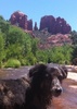
We saw a few jackrabbits, and Wally saw a few deer (I missed them). Only saw one thru hiker. Lots of 4 wheelers in Bloodsucker Wash, we could see and hear them from far distances.

Got back without incident and avoided River Bottom Ranch on the way back.
_____________________
  1 archive
Dec 02 2023
avatar

 Routes 93
 Photos 7,758
 Triplogs 1,691

64 male
 Joined Mar 11 2003
 AZ
Black Hills - AZT #14Tucson, AZ
Tucson, AZ
Hiking avatar Dec 02 2023
wallyfrackTriplogs 1,691
Hiking19.33 Miles 2,938 AEG
Hiking19.33 Miles   8 Hrs   4 Mns   2.53 mph
2,938 ft AEG      26 Mns Break
 no routes
Linked   none no linked trail guides
Partners partners
DarthStiller
Section 14 complete. The weather was nice and it actually got a bit warm on the later in the day. The drive in was a little adventure but no real trouble. The trail is good as expected. I saw two deer briefly but not long enough for a photo. Chris wasn't liking the potential climb on the way back so we opted for a side trip up the wash to the 4x4 road. A nice to get out and stretch the legs.
_____________________
  2 archives
Nov 25 2023
avatar

 Guides 27
 Routes 669
 Photos 12,096
 Triplogs 856

56 male
 Joined Jul 05 2006
 Mesa, AZ
Black Hills - AZT #14Tucson, AZ
Tucson, AZ
Hiking avatar Nov 25 2023
DarthStillerTriplogs 856
Hiking19.40 Miles 3,018 AEG
Hiking19.40 Miles   8 Hrs   38 Mns   2.25 mph
3,018 ft AEG
 
Linked   none no linked trail guides
Partners partners
wallyfrack
Wally and I started from the Tiger Mine TH at about 7am to a steady rain. The rain started on our way down 79 and seemed to pick up the closer we got to the TH. Wally decided to leave his glasses in the car because they fog up in rain and I decided to leave my sun screen gloves because we didn't think we would much sun or clear skies the whole day. 20 minutes after we started, the rain stopped. Two hours later, the sun was peeking thru the clouds and 4 hours later it was steady sunlight.

We hiked out a little past Hidden Well and took a lunch break at 11am. The last mile or so on the way out it really started to heat up a bit with the steady sun and uphill grades. After lunch on the way back, the clouds rolled in a little more giving some intermittent moments of shade. There was a very noticeable difference in temperature once the shade hit.

After the rain and clouds had rolled out for the day, the views really opened up. Looking off to the east at the Galiuros was really nice scenery. Wally missed all of that because he didn't have his glasses. Only saw 1 biker the entire day, no hikers. Everyone must have taken the holiday weekend off for thru hiking. No fauna other than the cattle everywhere. Wally spotted a rabbit running away early on and thought it might be a deer as all he could make out was the white dot.
_____________________
 
Nov 25 2023
avatar

 Routes 93
 Photos 7,758
 Triplogs 1,691

64 male
 Joined Mar 11 2003
 AZ
Black Hills - AZT #14Tucson, AZ
Tucson, AZ
Hiking avatar Nov 25 2023
wallyfrackTriplogs 1,691
Hiking19.40 Miles 3,018 AEG
Hiking19.40 Miles   7 Hrs   58 Mns   2.44 mph
3,018 ft AEG
 no routes
Linked   none no linked trail guides
Partners partners
DarthStiller
At the start of the hike it was cold and raining but fortunately that didn't last. About 20 minutes in the rain stopped and the hiking was cool and easy going. Not too many critters out (that I could see) but the clouds were nice and the distant views okay. I hiked without my glasses due to the rain but I still had an impressionist view of the outdoors. The trail is in good shape and the grades not too steep. Another small part of the AZT in the books.
_____________________
  2 archives
Nov 11 2023
avatar

 Guides 2
 Routes 267
 Photos 9,816
 Triplogs 402

62 male
 Joined Dec 02 2014
 Mesa, AZ
Black Hills - AZT #14Tucson, AZ
Tucson, AZ
Hiking avatar Nov 11 2023
adillingTriplogs 402
Hiking18.43 Miles 2,125 AEG
Hiking18.43 Miles   7 Hrs   53 Mns   2.50 mph
2,125 ft AEG      31 Mns Break
 
1st trip
Linked   none no linked trail guides
Partners partners
DarthStiller
wallyfrack
Route Scout Route Recorded  on Route Scout | Pop | Map | Popup | MapDEX
Chris has resumed his section by section AZT quest. He invited me and Wally to join him for the top 1/3 section of AZT Section 14 starting a Freeman Road Trailhead.

We arrived about 7am and the weather was very cool and pleasant. Cloudless skies awaited. We started down the initial portion that runs along a jeep road. Once you get to the base of Antelope Peak, it turn to a single track trail for most of the rest of the section.

The terrain is a mix of yucca, ocotillo, lots of cholla and saguaros in some areas.

The section moves up and down along rolling hills and gentle sloped ridgelines.

Near our turn around point we came across a large corral with a large tank - Beehive Tank. The windmill looked worse for wear, but there was solar panels on the Pumphouse.

We made it to about 9.5 mile down and turned around to.

Our lunch spot was along the Wash that is part of the G.E.T. Trail.

The hike back up had more elevation to navigate, but there were no major steep areas and it gradual grades and switchback.

Wally turned on the jets and left us in the dust on the way back. I made ok time and my knee didn’t give me any new pains. It feels pretty good a day later. That’s good news for me.

This section, along with the portions of section 15 I’ve done with Chris are not the most scenic, but it was a solid hike along some nice terrain.
_____________________
"Jobs fill your pockets, adventures fill your soul."

instagram: @andydilling
 
Nov 11 2023
avatar

 Guides 27
 Routes 669
 Photos 12,096
 Triplogs 856

56 male
 Joined Jul 05 2006
 Mesa, AZ
Black Hills - AZT #14Tucson, AZ
Tucson, AZ
Hiking avatar Nov 11 2023
DarthStillerTriplogs 856
Hiking18.93 Miles 2,286 AEG
Hiking18.93 Miles   8 Hrs   3 Mns   2.45 mph
2,286 ft AEG      20 Mns Break
 
Linked   linked  
Partners partners
adilling
wallyfrack
After some downtime (some planned, some not), I got back to another section of the AZT. Started from Freeman Road and headed south 9.5 miles and then turned around. The trail starts as a very short section of singletrack until it crosses Freeman Road, then it's a road until it gets to Antelope Peak. After that, it's singletrack until about Beehive Well, where you follow the wash and then another road.

didn't see any wildlife, only a few cattle here and there. Saw 2 other thru hikers, one NB, the other SB.

Had lunch just north of Beehive Well in a drainage by the wash. We looked for the spot with the least amount of cow patties, but ended up fighting off the ants. Temperature was chilly at the start, but warmed up after the sun hit it warmed up fast. Never got hot at all, which is very nice for a longer hike like this. I was surprised that my legs weren't really sore at all for the last mile. Had more elevation gain on the way back out, but the gradual grades made that pretty easy to deal with.
_____________________
 
Nov 11 2023
avatar

 Routes 93
 Photos 7,758
 Triplogs 1,691

64 male
 Joined Mar 11 2003
 AZ
Black Hills - AZT #14Tucson, AZ
Tucson, AZ
Hiking avatar Nov 11 2023
wallyfrackTriplogs 1,691
Hiking18.93 Miles 2,286 AEG
Hiking18.93 Miles   7 Hrs   30 Mns   2.64 mph
2,286 ft AEG      20 Mns Break
 no routes
Linked   none no linked trail guides
Partners partners
adilling
DarthStiller
Another section of the AZT. I don't actually plan on ever completing the AZT ever but if I end up with 50% of the sections it will be a nice sample of the terrain. This section was easy with a smooth trail and gentle grades. The critters were hiding but the views were okay. Only one mountain biker and two backpackers were out on great day with nice temps and a breeze. I felt good on the return trip so I cruised back but lost a little steam on the last two miles.
_____________________
  1 archive
Mar 25 2023
avatar

 Guides 93
 Routes 397
 Photos 4,984
 Triplogs 4,124

49 male
 Joined Jun 20 2003
 Tucson, AZ
Black Hills - AZT #14Tucson, AZ
Tucson, AZ
Run/Jog avatar Mar 25 2023
fricknaleyTriplogs 4,124
Run/Jog21.60 Miles 3,327 AEG
Run/Jog21.60 Miles   5 Hrs   4 Mns   4.41 mph
3,327 ft AEG      10 Mns Break7 LBS Pack
 
no photosets
Linked   none no linked trail guides
Partners none no partners
I did this segment a long time ago and i believe there has been some rerouting since then? if not it was much prettier than i remember. either way it was delightful. some nice flowers too. I ran out to just shy of the 11 mile mark. way back was tougher than the way out with most of the climbing at the end on tired legs.

bluebird day
_____________________
hi
 
Feb 03 2023
avatar

 Routes 34
 Photos 313
 Triplogs 42

86 male
 Joined Dec 11 2005
 Phoenix, AZ
Black Hills - AZT #14Tucson, AZ
Tucson, AZ
Hiking avatar Feb 03 2023
muskybankrTriplogs 42
Hiking9.10 Miles 1,898 AEG
Hiking9.10 Miles   5 Hrs   35 Mns   2.60 mph
1,898 ft AEG   2 Hrs   5 Mns Break10 LBS Pack
 
1st trip
Linked   none no linked trail guides
Partners none no partners
Hiking the AZ Trail Passage 14 from the Beehive Well to Freeman Road, Phil and Brian bagging Antelope Peak.


Perfect weather to hike some of the AZ Trail around Oracle. Our trip was originally scheduled for four days in which we would hike everything from American Flag Ranch up to Freeman Road, 40 miles, give or take, but alas, was not to be as we didn’t get down to Oracle until day 2 so we bypassed the 12 mile stretch from Tiger Mine TH(mm=207) to mm= 219 but we did a small portion of Oracle Ridge until we realized we were going the wrong way and some of us added side trips and peak baggings so we got up to about 30 miles. Trail angels left water at a few of the trailheads. While there were gallons upon gallons of water from a spring or two crossing Putnam Wash, and running down the side a few inches deep, we believe the tank and water at Beehive Well belongs to the rancher there. Antelope Tank appeared full but we didn't walk over and look closely.

One idea we learned from the Apache’s, which takes some training to master. Take a mouthful of water, don’t drink it but start hiking. When you’re done hiking, spit out the water, which has forced you to breathe long and slow breaths through your nose. It took some effort to summit some of those ridges with what I’ll call a 1 Apache mouthful. Some hills took 4 mouths full. It’s an acquired capability but it does slow you down, calm you down and make your hike more consistent.

We didn’t see many people out on the trail. It was 32 degrees in the morning cold spots and 68 degrees in the warmer ones, which, at the end of a hike, is almost too warm. Putnam Wash was a delight, with pretty good footing for a wash(although we used 4WD for some of the deeper sand sections) featuring some canyons and a surprising amount of water. We drove six miles up the wash to Beehive Well which had a tank full of water which we estimated held 75,000 gallons, about 8 gals a day, for the each of the couple of dozen cattle we saw, assuming no evaporation, which might be a little extreme. One of the fords crossing the San Pedro River by Dudleyville was washed away which would have provided access from the north and although there was a Road Closed sign on Camino Rio off to the side, that ford was actually passable with a 4WD, high clearance vehicle.

Four fighter jets came out of nowhere during the hike, from below the level of the high ridges, a delightful surprise. There were acres upon acres of chain fruit cholla and a several very white thorny bushes with no leaves as of yet. Saguaro looked numerous and very healthy below the 3600 foot level. I’ll include a picture of one growing out of rocks and seemingly winning the battle for space, its roots knocking rock off the wall.

Our long stopped time was created by Phil and Brian hiking up Antelope Peak while Virginia and I lingered over lunch. After about 7 miles on a nice trail, you take a two track up to Freeman Rd. and the parking lot to finish the hike.
wildflower observationwildflower observationwildflower observationwildflower observationwildflower observation
Wildflowers Observation None
Lots of juniper, live oak, saguaros, chain fruit and the old faithful, prickly pear. No wild flowers that I noticed.
_____________________
  1 archive
Mar 17 2022
avatar

 Guides 99
 Routes 1,484
 Photos 16,072
 Triplogs 1,374

male
 Joined Jan 07 2017
 Fountain Hills,
Antelope Peak - Peak 4676, AZ 
Antelope Peak - Peak 4676, AZ
 
Hiking avatar Mar 17 2022
DixieFlyerTriplogs 1,374
Hiking11.17 Miles 2,423 AEG
Hiking11.17 Miles
2,423 ft AEG      18 Mns Break
 
1st trip
Route Scout Route Recorded  on Route Scout | Pop | Map | Popup | MapDEX
I decided to head a bit southeast of Phoenix and bag a couple of peaks:
* Antelope Peak
* Peak 4676

These were 2 separate hikes, but the trailheads weren't TOO far apart.

Antelope Peak
I started and ended this one at the AZT TH on Freeman Road. I could have easily driven to within 1/2 mile of Antelope Peak, but what is the fun in that.

Most of the hike was on the AZT/GET, and the walking was nice and easy -- it was relatively flat and tread was very gentle, as it was smooth dirt with virtually no rocks.

The off-trail portion up to the peak was straightforward, although it was a bit steep and the tread was a bit loose -- it was mostly dirt and pea sized gravel. There was little solid ground, which made it slippery on the relatively steep grade. I took my time and made it up-and-down without incident. There was a bit of brush and some assorted cacti and cholla, but it was easy to walk around it. I had some gaiters in my backpack, but I never bothered to put them on.

When I got to the summit there was an eagle there, but it flew off before I could get a picture of it. There were nice 360 degree views at the summit, and I enjoyed being up there to check them out.

Peak 4676
Peak 4676 is in the Dripping Springs Mountains. Access was on a mining road off of Highway 177, a few miles north of Winkelman. Peak 4676 has 1,033 feet of prominence, which caught my interest by being over the 1,000 foot threshold and was the reason that I did the hike.

You'd need 4WD with some decent tires to drive to where I parked, which was just outside an open metal gate. I decided not to drive past the gate lest it be shut when I got back. However, as it turned out the gate was still open when I returned.

The mining roads that I hiked on were mostly pretty rocky. I was on a road most all of the way to the peak -- I went off-trail for probably no more than 1/2 mile to get to the summit. There was a bit of brush, but it was easy enough to walk around and I did not bother to put gaiters on. Most of the elevation gain was on the mining roads, so there was not much additional elevation gain on the off-trail portion.

I made my way to the summit and enjoyed the nice 360 degree views. There was a nice view of Tam O'Shanter Peak, which is only one mile away.

I saw a height of light but did not see any flivers. There was a cairn a bit north of the obvious highpoint, and it had a pill bottle containing a mining claim. There was a large cairn on the NE side of the summit, and I was wondering what it was for -- possibly another mining claim. To get to this cairn would have required a class 3 downclimb and upclimb; while it looked doable, I decided not to take the time to go there.

Synopsis
I enjoyed being on both of these peaks, and I was glad that I did them. I thought that Antelope Peak was the more enjoyable of the two, largely because hiking on the AZT was better than hiking on rough mining roads.

Distance and elevation gain for the 2 hikes is below. Stats above are sum of the two.
Antelope Peak: 5.21 miles with 767 feet of AEG
Peak 4676: 5.96 miles with 1,656 feet of AEG
wildflower observationwildflower observationwildflower observationwildflower observationwildflower observation
Wildflowers Observation Isolated
_____________________
Civilization is a nice place to visit but I wouldn't want to live there
  1 archive
Jan 29 2022
avatar

 Photos 4
 Triplogs 1

female
 Joined Jun 22 2019
 Mesa, AZ
Black Hills - AZT #14Tucson, AZ
Tucson, AZ
Backpack avatar Jan 29 2022
ButterPocketsTriplogs 1
Backpack27.60 Miles 4,702 AEG
Backpack27.60 Miles2 Days   14 Hrs   41 Mns   
4,702 ft AEG29.5 LBS Pack
 no routes
1st trip
Linked   none no linked trail guides
Partners none no partners
Great trail with rolling hills. Lots of cactus, so bring your combs/tweezers. Headed North from the Tiger Mine Trailhead to the Freeman Rd Trailhead. Antelope Peak was a great beacon for the majority of the trip. Please note: Cowhead Well is not on the trail as marked on the route! When you walk through Bloodsucker Wash, there is an AZ Trail gate and a campsite just behind that. Take a left on the dirt road and walk about 1/4 - 1/2 mile West. There is a corral you'll see first and then a giant water tank.

water 1 out of 5water 2 out of 5water 3 out of 5water 4 out of 5 Beehive Well 76-100% full 76-100% full


water 1 out of 5water 2 out of 5water 3 out of 5water 4 out of 5 Cowhead Well 76-100% full 76-100% full
Fresh dripping water into full tank. Note: this is not on the trail itself. After Bloodsucker Wash, you pass through an AZ Trail gate. Hang a left onto a dirt road and walk 1/4 - 1/2 mile West to the corral/well.
  1 archive
Jan 21 2022
avatar

 Guides 1
 Routes 61
 Photos 604
 Triplogs 79

male
 Joined May 28 2019
 Phoenix, AZ
Black Hills - AZT #14Tucson, AZ
Tucson, AZ
Backpack avatar Jan 21 2022
kyleGChikerTriplogs 79
Backpack31.21 Miles 5,543 AEG
Backpack31.21 Miles2 Days   3 Hrs   57 Mns   
5,543 ft AEG40 LBS Pack
 
1st trip
Linked   none no linked trail guides
Partners none no partners
We did this passage as a three day backpacking trip, which worked out well with where the water sources were. With such a wet winter/spring, there was plenty of water, especially at Mountain View and Beehive.
The road and car-staging was pretty self-explanatory this time, although the driving time was great, with one vehicle at Tiger Mine Road TH, and the other at Freeman Road TH. After setting up the cars, we spend the night at Tiger Mine Road before heading off in the morning. It was chilly and there was a fair amount of wind, so that meant quite nice hiking in the morning. We passed/cross numerous gravel roads and hunters (rifle and archery). I presume they were hunting deer or javelina. Eventually, after what seemed like a very long day of hiking, we made it to Mountain View Tank and spent the night near there. The next day was actually more exciting. As we were packing up camp, a mountain biker went whizzing past us on the AZT. Turns out there were more than 25 riders going a group ride of passage 14. It was quite fun to talk with them and hear more about mountain biking on the AZT.
The whole second day, we could see Antelope Mountain off in the distance, and gradually, we got closer and closer to it, until eventually on the third day we arrived at Freeman Road immediately past Antelope Mountain. The second night we camped up on a ridge overlooking the valley below. It was quite the campsite!

dry Antelope Tank Dry Dry

water 1 out of 5water 2 out of 5water 3 out of 5water 4 out of 5 Beehive Well 76-100% full 76-100% full
This tank was overflowing. A little algae, but filtered well.

dry Corner Tank Dry Dry

dry Cowhead Well Dry Dry

dry Hidden Well Dry Dry

water 1 out of 5water 2 out of 5water 3 out of 5water 4 out of 5 Mountain View Tank 76-100% full 76-100% full
Almost overflowing. Water was within six inches of the top of the tank. Fairly clear water. Filtered well.
 
Apr 10 2021
avatar

 Triplogs 43

70 female
 Joined Jan 01 2019
 Sierra Vista
Black Hills - AZT #14Tucson, AZ
Tucson, AZ
Hiking avatar Apr 10 2021
clyde_joelleTriplogs 43
Hiking27.60 Miles 4,702 AEG
Hiking27.60 Miles   17 Hrs      1.62 mph
4,702 ft AEG
 no routesno photosets
1st trip
Linked   none no linked trail guides
Partners none no partners
Backpacked Pass 14 South-North in a 3-day backpack camping at Mountain View Tank and Beehive Well, which were full. Cow tank was full too
wildflower observationwildflower observationwildflower observationwildflower observationwildflower observation
Wildflowers Observation Isolated
Ocotillo in bloom and a few cactus. Drought conditions due to failure of 2020 monsoon and dry winter
 
Jan 23 2021
avatar

 Guides 12
 Routes 192
 Photos 863
 Triplogs 356

42 male
 Joined Nov 30 2015
 Phoenix, AZ
Black Hills - AZT #14Tucson, AZ
Tucson, AZ
Run/Jog avatar Jan 23 2021
ShatteredArmTriplogs 356
Run/Jog28.33 Miles 4,011 AEG
Run/Jog28.33 Miles   6 Hrs   32 Mns   4.40 mph
4,011 ft AEG      6 Mns Break
 
no photosets
1st trip
Linked   none no linked trail guides
Partners none no partners
Decided it would be perfect weather to continue on the AZT. So headed out to do Passage 14, next on the list - which I had already done the other direction as part of the AZT race series. Weather was cool and breezy, with partial cloud cover - can't really ask for better.

Felt pretty good; outside of a sore toe from the cactus soccer, Monday's adventure didn't seem to have much of an effect. Found a nice big water cash almost half way through, and decided to refresh my electrolyte drink since it said "public after Y20". Plenty more to go around.

Didn't really start to hurt until Putnam Wash (mile 20 or so), but still moved OK on the gradual stuff, and managed to finish right around 6.5 hours, better than I was expecting.

This passage is more enjoyable than it should be on paper.
_____________________
 
Mar 21 2020
avatar

 Guides 2
 Routes 10
 Photos 42
 Triplogs 893

58 male
 Joined Jul 12 2012
 Oro Valley, AZ
Black Hills - AZT #14Tucson, AZ
Tucson, AZ
Run/Jog avatar Mar 21 2020
SpiderLegsTriplogs 893
Run/Jog8.20 Miles 1,450 AEG
Run/Jog8.20 Miles   1 Hour   40 Mns   4.92 mph
1,450 ft AEG
 no routesno photosets
1st trip
Linked   none no linked trail guides
Partners none no partners
Left from the Tiger Mine entrance a few miles off the highway. Easy road to drive, only one hidden water bar that rattled my car a bit before I got to the parking area. Was hoping to get away from the crowds at Sabino Canyon, Catalina State Park and all points in between. But was greeted by 8 other vehicles in the lot. Half the vehicles were towing motorcycles, so I knew I wouldn't bump into them. The other half had bike racks and kept my fingers crossed I wouldn't see them.

One of my reoccurring dreams is that I leave for a run or hike and leave a shoe behind or something else I really need for hitting the trail. Well today that happened, started pulling things together and noticed that I had left my watch and my backpack at home. Started pacing around my car trying to figure out what to do and a guy heading to his car rolled up on his bike. We started chatting and discovered we had probably met 25 years ago when I managed a bike shop and had 4-5 friends in common. Found out he lived along my drive home and offered up a spare backpack he had in his trunk if I wanted it. Instead I found an old water bottle rolling around the floor of my car and just went that route.

Filled up my water bottle and then went out to see just how far I could get on half a bottle. Did a simple out and back and once on the trail I had the whole place to myself. Trail is in great condition and 100% runnable. I cruised along at a snails pace, walking up the hills and running the flats and descents. Pretty scenic, just continuous rolling up and down and greeted by thousands of wildflowers. Ended up right around the four mile mark when I hit the halfway point of my water bottle and turned around.

As an aside, if you hear about a cluster of Coronavirus from north Pima County and southern Pinal County don't be shocked. I saw a farmer's market going on in Oro Valley, then up in Catalina there were two estate sales and a number of real estate open houses. Plus saw one of the local cowboy bars flaunting the shutdown with their doors wide open and a dozen pick up trucks in the parking lot.
wildflower observationwildflower observationwildflower observationwildflower observationwildflower observation
Wildflowers Observation Substantial
_____________________
See my pics on Instagram @tucsonexplorer
 
Jan 25 2020
avatar

 Guides 4
 Routes 491
 Photos 10,890
 Triplogs 1,257

55 male
 Joined Nov 20 2012
 Phoenix, AZ
50 for 50K Oracle Rumble, AZ 
50 for 50K Oracle Rumble, AZ
 
Run/Jog avatar Jan 25 2020
BiFrostTriplogs 1,257
Run/Jog32.80 Miles 4,887 AEG
Run/Jog32.80 Miles   8 Hrs   28 Mns   37 Secs3.99 mph
4,887 ft AEG      15 Mns Break
 no routesno photosets
1st trip
Linked   linked  
Partners partners
slowandsteady
We participated in the Oracle Rumble running the 50k and Kathy the half marathon. Just turned 50 so I thought another 50K would be cool. It was not my best effort with the time being an hour off last years. Training was hampered by injuries so was pretty sure the time would be slow. The main focus was just finishing and finding a good pace.

The course itself is fun but challenging with quite a bit of AEG most of it in last 19 miles. It follows the Black Hills AZT section southbound from Freeman Road to Oracle State Park. Several aid stations along the way were stocked with plenty of snacks, electrolytes, and drinks to keep powered up. The volunteers do an excellent job running these remote stations!

At the finish line Kathy was there after she had completed the half marathon. The half marathon was also a challenging course with about 2000 feet of AEG. Great day out on the trail for both of us!
_____________________
  1 archive
Nov 23 2019
avatar

 Guides 1
 Routes 226
 Photos 1,675
 Triplogs 1,867

65 male
 Joined Oct 17 2008
 Phoenix, AZ
AZT Passages 14-17, AZ 
AZT Passages 14-17, AZ
 
Backpack avatar Nov 23 2019
rcorfmanTriplogs 1,867
Backpack95.35 Miles 11,510 AEG
Backpack95.35 Miles4 Days         
11,510 ft AEG25 LBS Pack
 
no photosets
1st trip
So with a new job on the horizon, I figured I better get out for one last hurrah before reintegrating into the rat race...

Day 0
Got everything packed and ready to go. Used food from my aborted L2H attempt last month. Easy peasy prep, no shopping necessary. About 7pm, I hopped in my truck and headed to the Picket Post trailhead with daughter and her boyfriend following. Stopped for a quick bite at the Mickey Ds nearing the Renaissance Festival grounds.

Made it to the trailhead where I parked my truck and loaded my gear into the car. Camp host came up wondering what the heck we were doing and spouting how the FS was supposed to lock the gate. He pointed out three stars and said they showed up about every three days then flare real bright and disappear. He must be on drugs, they were Orion's belt.

Left the trailhead and started the long winding drive to Tiger Mine trailhead. There were picketers/protesters at Winkelman, Kearny and other towns. Don't know why, perhaps because the proposed Rosemont Mine was stopped? Made it to Tiger Mine trailhead a bit past 10pm and said goodbye to daughter and boyfriend while they drove off. Found a couple geocaches nearby then set up my tarp in the parking area as it was damp and I knew the dew would be heavy. Forgot my hiking sticks but found a large wood stake and used the hitching post to tie off the ridgeline instead. Tucked in at 11pm.

Day 1 - 22 miles
Alarm went off at 6am. I'm no longer used to getting up and going in the dark and cold. Finally roused half hour late. Tarp completely soaked. Stuffed it in its bag and put it in an OPSak to keep everything else dry. On trail at half past seven. My morning routine sure is off.

First few miles I amused myself finding a series of ten geocaches named after Arizona pioneers. After that I just walked, enjoying the trail along with one other geocache about 13 miles out. I enjoy this section, watching Antelope Peak get ever closer. I pass two other backpackers hiking the Black Hills passage south. We had a chat and one asked for my Instagram. Later I see two bike packers that started in Utah.

Made it to Camp Grant Wash where there was a water cache at the AZT gate. I stopped and hung up my tarp and groundsheet to dry and had some food. Hiker Abe Lincoln passed by and topped off his water and we had a short chat. He started at Utah Nov. 1 so is making good time. I decided to get water here instead of at Beehive well so I wouldn't have to bother filtering. I packed up and got back on trail. Not too far later, I met another hiker sectioning from Flagstaff to Tucson.

After passing Beehive Well and climbing out Putnam Wash, I started thinking about looking for a place to camp as it was near sunset. In the gloaming a large Diamondback let me know to stay back. It was a big one with a good 3" diameter body. As it darkened, I found a couple of agave stocks for pitching the tarp and continued along the ridge. The cactus were thick along the ridge and I never spotted a satisfactory place to spend the night until I dropped down to Dodson Wash where there was a nice clear level area. I knew it was going to be another damp night at this location but was able to get a good pitch to keep things as dry as possible considering. Tucked in at 8pm.

Day 2 - 23.5 miles
Alarm went off at 6am. I was just as slow as the previous day and made it on the trail at half past seven. I spent the morning working my way around Antelope Peak. About a quarter mile before Freeman Rd, saw a herd of six or seven does and fawns run across. I reached the Freeman Road trailhead about 10am. I hung the tarp out to dry and held the groundsheet in the wind for a bit while it dried. I ate some and filled up on water and was back on trail about 11am.

I find four geocaches today, all are near the trail, the farthest being about 150' off. They are a nice distraction and I time them to take my pack off and get food to eat while I walk. I see no one today, except for someone next to a truck off in the distance.

My plan was to get water at a stock tank about 12 some miles past Freeman Rd, but I notice another water source just off the trail about 4 miles farther. Last report was dry but that was before last weeks rains. I decide to go there instead. It's getting dark before I arrive so I have to pull my headlamp out to hopefully find it. I do, without too much trouble. The pipe into the trough is no longer running but the trough has enough clear water for my needs.

It's cold and damp in the wash the trough is in, so I continue walking. The trail turns on a road and climbs up to a ridge where I decide to camp. I toss the agave stock I'd been carrying for the last mile or so and cowboy camp. Tucked in at 8pm and enjoy watching the stars as I fall asleep.

Day 3 - 25 miles
Alarm went off at 6am. I wasn't quite as slow as the previous two days and made it on the trail at twenty past seven. There was a dew on the ridge but not too bad. I wipe my quilt off and pack it up. Is it bad to dig a cat hole where rodents burrow? I hope the tunnel was abandoned. If not it probably is now.

The trail starts off dropping down to Ripsey Wash where I look for a geocache that's supposed to be in a trail marker. I completely disassemble it but don't find the cache. There's a lizard in the rocks so I pick it up by the tail and move it away so it doesn't get squished by a rock. I inadvertently step on it a few minutes later. So sad. I fix the trail marker and continue up into the Tortilla Mountains. I contemplate how so many hikers live off of tortillas, but I never pack them.

So far, the terrain has been fairly tame, but that all ends now and for most of the rest of this trip. The climb into the Tortillas is managed and the views are spectacular. Once I reach the top, I can see over to Kearny and the Ray Mine complex. I enjoy walking the ridge and the views that go with it. It is cool, I've kept my wind jacket on and wear it most of the way to the Florence-Kelvin trailhead but it warms as I descend and I'm finally able to take it off.

I stop shortly before the Gila River and pull my quilt out to dry, draping it across a Jojoba I pull other things out that are damp so they can also dry. I eat and drink and relax while everything dries and then pack things back up and head down to the spigot at the county work yard where I fill up with water. I leave with 4 liters plus a 20oz Gatorade bottle. More than I need, but I want to limit how much water I'll grab from the Gila River.

There is a lot of up and down in and out of washes undulation along the Gila River. I pass the AZT completion marker. I enjoy walking through the mesquite groves though the scent of cattle is strong in the damp air. The trail goes in and out of the desert and to the river. I see a javelina in a desert section. The sun starts to set but I want to get a bit farther so I can finish tomorrow. I pull my headlamp out and continue. The trail meets a road and follows it down. I turn up the road to rise above the dampness. I find a small clear spot in all the rocks next to the road where I camp for the night. A breeze starts and it gets windier as the night progresses. There's no dew where I'm at this night.

Day 4 - 23.2 miles
Alarm went off at 6am. I fell back asleep but woke up again soon enough. I'm getting better and was on trail about 7am. I have about 1.5 miles to the Gila river, where I stop to get water. I know exactly where to go as I camped there almost five years ago when I first hiked this section. I filtered water into the Gatorade bottle. It didn't filter clear which was disconcerting. I have a new Sawyer Squeeze; is it bad? I drink several gulps of the water, then fill the bottle up again. I leave with a Gatorade bottle of filtered Gila and a liter of unfiltered Gila. As I walk back to the trail, I hear coughing and then see a man. We talked. He drove and camped there and asked how to get to the river. As the trail climbs up I saw him by the river. He looked up and we waived to each other.

The trail reaches Rincon Rd and climbs up away from the river. There is a lot of climbing for the next many miles but the geology and the views are some of the best the AZT has to offer. I really like this bit of trail, it's very beautiful. The day warms some but I get very sweaty from the climbing. As I near the end of the climbing, I stop to fix a chafing issue. Bringing the Body Glide wasn't a waste after all. I eat some and mix some Gatorade. Somehow I accidentally pour some water in the Gatorade powder. Oops. At least the bin was almost empty.

I finish the first big climb crossing over a saddle. It's much colder on the other side. I put my wind jacket on and enjoy the views of the other side. Somewhere things warm back up and I take it off again. I pass to southbound hikers. They started at Utah but are going to get off at Kearny as weather is coming in and so is Thanksgiving.

After the last ascent I have about ten miles to go, almost all down hill and four hours to sunset. Things are good. At 7.5 miles to go, I reach FSR4 and a resupply box. There are a couple of bike packers that took off when I arrived and another southbound hiker. We talked for a bit and told him where I found water. He mentioned that the trail through the Superstitions was fun but pretty messed up after the rains with parts he had to more or less scramble across.

This stretch is fun, Picket Post comes in and out of view and the setting sun shining on it as I neared the end was a nice way to end the day. As the sun lowered it started to cool off and I put the wind jacket back on. I was tired but happy to reach the trailhead a bit past sunset. It was cold too. My truck's thermometer said 45 degrees when I started the drive home.
_____________________
Go find a LonelyCache
 
Oct 05 2019
avatar

 Guides 13
 Routes 38
 Photos 1,651
 Triplogs 577

60 male
 Joined Nov 15 2005
 Jackson, CA
Black Hills - AZT #14Tucson, AZ
Tucson, AZ
Hiking avatar Oct 05 2019
toddakTriplogs 577
Hiking27.60 Miles 4,702 AEG
Hiking27.60 Miles   12 Hrs      2.30 mph
4,702 ft AEG
 no routesno photosets
1st trip
Linked   none no linked trail guides
Partners none no partners
NOBO all day roller coaster through the Bleak Hills with three rattlesnake encounters. Two in the morning curled up silently in the shade at the edge of the trail waiting for the sun to find them. A third in late afternoon crossing the road ahead but who then had to stop and get all riled up even though I waited patiently from a distance. A few handfuls of gravel gently tossed in his direction finally encouraged him to continue.

The cache box at Tiger Mine TH was stuffed with mostly public water, and the box at Freeman TH had at least a dozen gallons. The large metal tank at Beehive Well was full and overflowing slightly with decent water.

water 1 out of 5water 2 out of 5water 3 out of 5water 4 out of 5 Beehive Well 76-100% full 76-100% full
full and slightly overflowing
_____________________
 
Feb 03 2019
avatar

 Photos 71
 Triplogs 40

60 female
 Joined Jul 28 2015
 Gilbert, AZ
Black Hills - AZT #14Tucson, AZ
Tucson, AZ
Backpack avatar Feb 03 2019
ttrettaTriplogs 40
Backpack27.60 Miles 4,702 AEG
Backpack27.60 Miles   12 Hrs   30 Mns   2.21 mph
4,702 ft AEG
 no routes
1st trip
Linked   none no linked trail guides
Partners none no partners
Left my car and 3 gallons of water at the Freeman Rd. trailhead Saturday morning. My husband dropped me off at the junction of Tiger Mine Rd and the 77 and I walked the 1.5 miles to the trailhead. Mostly sunny day, actually got a little toasty at times. Ran into a group of day hikers and chatted a while, but no other people on the trail. The long, rocky descent into Camp Grant wash seemed to take forever, but finally made it and set up camp. Plenty of water at Cowhead well. The big tank was completely full and water pipe dripping. The two smaller troughs were both full as well but also full of bees and tadpoles. It rained off and on during the night, and then rained steadily through the remaining 11 or so miles. Had my trusty trekking umbrella and my rain jacket, so the upper half stayed dry and warm, but my feet and pants were pretty soggy by the time I made it to the car. Very sketchy drive west on Freeman Rd. It was very gloppy and no other cars had been on it yet. Very slow, scary 19 miles! I really loved this passage. Beautiful rolling desert, available water sources and perfect temperatures!!
wildflower observationwildflower observationwildflower observationwildflower observationwildflower observation
Wildflowers Observation Light

water 1 out of 5water 2 out of 5water 3 out of 5water 4 out of 5 Beehive Well 76-100% full 76-100% full
Large tank was full

water 1 out of 5water 2 out of 5water 3 out of 5water 4 out of 5 Cowhead Well 76-100% full 76-100% full
Big tank and both small troughs were full. Pipe was actively dripping
_____________________
  1 archive
average hiking speed 2.37 mph
1, 2, 3, 4, 5, 6  Next

WARNING! Hiking and outdoor related sports can be dangerous. Be responsible and prepare for the trip. Study the area you are entering and plan accordingly. Dress for the current and unexpected weather changes. Take plenty of water. Never go alone. Make an itinerary with your plan(s), route(s), destination(s) and expected return time. Give your itinerary to trusted family and/or friends.

helpcommentissue

end of page marker