username
X
password
register
for free!
help
ArticlesGuidesRoutes
 
Photosets
 
 Comments
triplogs   photosets   labels comments more
Walkin' Jim Loop Trail - 29 members in 99 triplogs have rated this an average 3.4 ( 1 to 5 best )
1, 2, 3, 4, 5  Next
99 triplogs
login for filter options
Feb 17 2025
avatar

 Guides 110
 Routes 2,246
 Photos 8,982
 Triplogs 2,600

45 female
 Joined Dec 24 2007
 Ahwatukee, AZ
Peak 3465 - Hieroglyphic MountainsPhoenix, AZ
Phoenix, AZ
Hiking avatar Feb 17 2025
LindaAnnTriplogs 2,600
Hiking11.58 Miles 2,468 AEG
Hiking11.58 Miles   6 Hrs   39 Mns   1.90 mph
2,468 ft AEG      33 Mns Break
 
Linked   linked  
Partners none no partners
Route Scout Route Recorded  on Route Scout | Pop | Map | Popup | MapDEX
Jill usually has Mondays off work, and no school for the kids made it easy to plan for a hike. We got to the trailhead around 0700. Lots of cars in the parking area, but we saw nobody all day. Headed west on the northern half of Walkin Jim trail. Could hear some burros. Trail is in okay shape, but vague in a lot of places.

Took the turn up to the peak. Jill was feeling tired, so we took our time. Had a break at the summit, then half heartedly looked for the inscription on the rock. I’ve seen it a few times, but haven’t been able to remember where it was the last couple of visits. Headed back down to the loop.

Once back at Walkin Jim, we continued onto the southern half of the loop. For maybe the first time ever on this one, I did not get off track a single time. There also seemed to be more cairns. Saw a lot of burros, which Jill had never seen before. There were a few pools of water in the creekbed, but you’d have to be pretty desperate. Took the small shortcut towards the finish. It was warm by then, and I was ready to be done.
_____________________
Stop crying and just go do the hike.
 
Feb 04 2024
avatar

 Routes 386
 Photos 49
 Triplogs 792

43 female
 Joined Jun 23 2015
 Phoenix, AZ
Pikes Peak - Hieroglyphic MtnsPhoenix, AZ
Phoenix, AZ
Hiking avatar Feb 04 2024
emilystardustTriplogs 792
Hiking12.26 Miles 2,046 AEG
Hiking12.26 Miles   7 Hrs   30 Mns   1.82 mph
2,046 ft AEG      46 Mns Break
 
no photosets
1st trip
Linked   linked  
Partners none no partners
Route Scout Route Recorded  on Route Scout | Pop | Map | Popup | MapDEX
Nice morning to head back out. We were able to head up Pikes Peak and then over to Mill before heading back down. There was one cholla field to navigate but the off trail portion wasn’t too bad.
_____________________
 
Jan 28 2024
avatar

 Routes 386
 Photos 49
 Triplogs 792

43 female
 Joined Jun 23 2015
 Phoenix, AZ
Walkin' Jim Loop TrailPhoenix, AZ
Phoenix, AZ
Hiking avatar Jan 28 2024
emilystardustTriplogs 792
Hiking2.38 Miles 413 AEG
Hiking2.38 Miles   2 Hrs   43 Mns   2.01 mph
413 ft AEG   1 Hour   32 Mns Break
 no routesno photosets
1st trip
Linked   none no linked trail guides
Partners none no partners
_____________________
 
Jan 24 2024
avatar

 Guides 41
 Routes 1,626
 Photos 14,983
 Triplogs 2,760

69 male
 Joined Jan 20 2009
 Far NE Phoenix,
Peak 3465 and the Jims, AZ 
Peak 3465 and the Jims, AZ
 
Hiking avatar Jan 24 2024
The_EagleTriplogs 2,760
Hiking13.25 Miles 2,236 AEG
Hiking13.25 Miles   5 Hrs   54 Mns   2.39 mph
2,236 ft AEG      22 Mns Break10 LBS Pack
 
1st trip
Partners partners
LindaAnn
Route Scout Route Recorded  on Route Scout | Pop | Map | Popup | MapDEX
This was our plan B for the day. The rain yesterday parked over the area we wanted to get to. 5 lbs of mud on each foot for 14 miles did not seem appealing.

This is one of the first hikes I did after moving to AZ in 1999. I've done it numerous times since. It's close to the valley, but you get the feeling of being much further away from civilization.

After Linda saw her future ex-boyfriend at the TH, we started our CCW trek. The first time I did the northern part of the loop, I had trouble following it. That's not the case anymore.

We hit the Big Jim Trail and started our climb to the peak. This section is also much easier to follow. We took a short break on the initial climb and passed our first person since Linda's future ex-boyfriend.

We had lunch up top and made it our goal on the day to find the rock with the HT Sprouse inscription from Jan 26th, 1902.
[ youtube video ]
If you look at either one of our tracks, you'd say it looks like we were wandering around aimlessly. You'd be correct. We never did find it. Tails between our legs, we retreated down the mountain.

The southern section of the Walkin' Jim, as always, is a bit more of a challenge to follow. Bring a GPS track with you. We did run into another burro on the way back. Other than this and Linda proclaiming her love for the varied bird species we heard, that was it for fauna. I was shocked that she was unable to call in any of her snakes.

Perfect weather, good conversation, and an enjoyable track made for a nice day. Thanks for joining me, Linda.
 Culture
 Culture [ checklist ]
[ checklist ]  Military Aircraft
_____________________
There is a very fine line between "hobby" and "mental illness."
Dave Barry 🦅
  1 archive
Jan 24 2024
avatar

 Guides 110
 Routes 2,246
 Photos 8,982
 Triplogs 2,600

45 female
 Joined Dec 24 2007
 Ahwatukee, AZ
Peak 3465 - Hieroglyphic MountainsPhoenix, AZ
Phoenix, AZ
Hiking avatar Jan 24 2024
LindaAnnTriplogs 2,600
Hiking12.75 Miles 2,231 AEG
Hiking12.75 Miles   5 Hrs   55 Mns   2.38 mph
2,231 ft AEG      34 Mns Break
 
Linked   linked  
Partners partners
The_Eagle
Route Scout Route Recorded  on Route Scout | Pop | Map | Popup | MapDEX
This was our backup plan for the day since neither Bruce, nor I, wanted to deal with a mucky muddy trail. More vehicles than expected at the trailhead. We got started under mostly cloudy skies and cool temps, but no breeze.

Headed west on the northern half of the loop. Saw one burro right off the bat. Trail was in reasonably okay shape, and mostly easy to follow. I think we double checked our track twice.

Once on Big Jim Trail, the uphill fun began. Felt a little warm. Saw one hiker descending while we were taking a short break. Noticed a very slight reroute higher up, starting near the washed out section of trail. The reroute is better than the original track. Made our way to the summit, the path is pretty clearly defined these days. Bruce nicely let me lead uphill so I wouldn’t die trying to keep up with him. Or, maybe he was painting graffiti on my pack and hair… Had lunch up top, then spent some time looking for the inscription on the rock. Both Bruce and I had similar memories of where the rock was, but never found it despite wandering back and forth a few times. We even pulled up a geocoded pic and Bruce’s track from a few years ago. Oh well, just another reason to go back at some point.

More clouds on the descent, which was uneventful. Headed back east on the southern half of the loop. Staying on trail on this half is never easy, and today was no exception. Having a track to follow is quite helpful and saves a lot of time. Some pools of water in the washes, but not a ton. Saw one more burro, and two hikers with their two dogs. As always, this is a great hike for a cool day. Fun to hike with Bruce again, thanks for the invitation!
_____________________
Stop crying and just go do the hike.
 
Mar 28 2023
avatar

 Routes 70
 Photos 3,081
 Triplogs 601

70 male
 Joined Feb 10 2019
 Cave Creek, AZ
Walkin' Jim Loop TrailPhoenix, AZ
Phoenix, AZ
Hiking avatar Mar 28 2023
LosDosSloFolksTriplogs 601
Hiking5.53 Miles 680 AEG
Hiking5.53 Miles
680 ft AEG6 LBS Pack
 
1st trip
Partners none no partners
Route Scout Route Recorded  on Route Scout | Pop | Map | Popup | MapDEX
We've been wanting to hike in this area for quite some time. Cathy has recovered from her transplant enough to give it a go so off we went with a bit of encouragement from @DixieFlyer. Cathy opted out of the full 9 mile loop so we used the "Little Jim" crossover trail to cut a few miles off.

From satellite view this trail looks like a giant nothing burger but the first few miles had us oohing and aahing over the views. The superbloom was just an added bonus. We've never seen so much Owl Clover, Lupine, and Globemallow among others.

The Little Jim trail doesn't get a lot of use I guess as it was virtually non-existant for much of the way. Route Scout saved the day along with the cairns. The southern section of the Walkin' Jim loop was very rocky and reminded us a lot of Limestone Trail #252 north of Spur Cross. The clouds we were counting on went away early on and it got pretty warm the last three miles.

Next time out we plan to use the Cottonwood Creek Bed to hike west and then return along the northern section of the Walkin' Jim.
 Named place
 Named place [ checklist ]
[ checklist ]  Lake Pleasant
wildflower observationwildflower observationwildflower observationwildflower observationwildflower observation
Wildflowers Observation Substantial
More Owl Clover and Lupine than I've ever seen. Whole slopes of Desert Globemallow. Also Brittlebush, Coulters Lupine, Arizona Lupine, Narrow Leafed Popcorn Flower, Lesser Yellowthroat Gilia, and Blackfoot Daisy. This area qualifies as a superbloom in my book.

water 1 out of 5water less than maxwater less than maxwater less than max Cottonwood Creek Pools to trickle Pools to trickle

water 1 out of 5water less than maxwater less than maxwater less than max Walkin' Jim Spring Dripping Dripping
_____________________
"If you wait, all that happens is you get older"
 
Mar 24 2023
avatar

 Guides 99
 Routes 1,484
 Photos 16,072
 Triplogs 1,374

male
 Joined Jan 07 2017
 Fountain Hills,
Peak 3465 - Hieroglyphic MountainsPhoenix, AZ
Phoenix, AZ
Hiking avatar Mar 24 2023
DixieFlyerTriplogs 1,374
Hiking12.23 Miles 2,337 AEG
Hiking12.23 Miles   6 Hrs   49 Mns   2.07 mph
2,337 ft AEG      55 Mns Break
 
Partners partners
SecretMtnLover
Route Scout Route Recorded  on Route Scout | Pop | Map | Popup | MapDEX
I decided to do this hike today in order to check out the wildflowers on the trails. The flowers were nice, although I'd say that they'll be better in another week or so. Poppies, lupine, blue ricardos, and globemallow all stood out today. There is lots of owl clover, but it is only about 4 inches high right now. If we get some sunny days the owl clover should look a lot better in 7-10 days.

On the way in we stopped off in a wash and saw a bit of rock art.

I did an inverse lasso loop on this hike: I went on the northern half of the Walkin' Jim loop to the Big Jim Trail, which I took up to Peak 3465. I retraced my route on the way back until I got to the Little Jim Trail, and I took it over to the south end of the Walkin' Jim Trail, which I took back to the TH.

I enjoyed hiking up to Peak 3465 again, but the hike got a bit long on the way back.

We heard some burros on the way back, but we never saw any. I have hiked on these trails several times, and this is the first time that I never saw any burros.

After the hike we stopped off at the Scorpion Bay Grill on Lake Pleasant for a late lunch and a cold beverage.
wildflower observationwildflower observationwildflower observationwildflower observationwildflower observation
Wildflowers Observation Substantial
There was a good display of wildflowers today. Owl clover was only about 4 inches high, so I'd say that the flowers will be better in another week or so.
_____________________
Civilization is a nice place to visit but I wouldn't want to live there
  3 archives
Dec 10 2022
avatar

 Guides 5
 Routes 27
 Photos 189
 Triplogs 26

70 male
 Joined Dec 06 2002
 Phoenix, AZ
Walkin' Jim Loop TrailPhoenix, AZ
Phoenix, AZ
Hiking avatar Dec 10 2022
MoovyoazTriplogs 26
Hiking9.00 Miles 1,082 AEG
Hiking9.00 Miles
1,082 ft AEG
 no routes
1st trip
Linked   none no linked trail guides
Partners none no partners
Friends
Beautiful day for Walkin' Jim trail for Friends Hiking Club. At the start we followed Cottonwood Creek to the petroglyphs, then popped up to the trail. The return was more sketchy, and we varied some from the HAZ track, but our route was about as easy as the trail in the right direction to cut Little Jim Trail. For the last 1.5 miles, instead of climbing the faint trail up and south around the last hill, we dropped back into Cottonwood Creek, which was easier and saved about .5 miles. Total 8.1 miles.
 Named place
 Named place [ checklist ]
[ checklist ]  Hieroglyphic Mountains
_____________________
A drunkard's dream if I ever did see one
 
Oct 30 2022
avatar

 Guides 1
 Routes 226
 Photos 1,675
 Triplogs 1,867

65 male
 Joined Oct 17 2008
 Phoenix, AZ
Walkin' Jim Loop TrailPhoenix, AZ
Phoenix, AZ
Hiking avatar Oct 30 2022
rcorfmanTriplogs 1,867
Hiking12.01 Miles 2,163 AEG
Hiking12.01 Miles   5 Hrs   34 Mns   2.19 mph
2,163 ft AEG      5 Mns Break
 
Partners none no partners
I took the Walkin' Jim loop counterclockwise, with a detour up the Big Jim Trail to Peak 3465.

I seem to have trouble staying on trail, so I loaded some tracks on my GPSr last night. No big goofs today, but I did make many corrections. I was glad I had the tracks on my handheld; that's for sure. After all the rain we've had and it being early season for this hike, the trail is difficult to follow in places. Some areas on the north side are completely washed out or overgrown. A McLeod, loppers, and a day might be in order.

There were pools on the north side of the loop and the unnamed creek on the south side, had lots of pools and was trickling.

Looking at Peak 3465 on the approach is always a bit daunting. Love the views from the top of it. It gives me a smug sense of accomplishment looking back up at it on the return.
_____________________
Go find a LonelyCache
 
Apr 13 2022
avatar

 Guides 99
 Routes 1,484
 Photos 16,072
 Triplogs 1,374

male
 Joined Jan 07 2017
 Fountain Hills,
Peak 3465 - Hieroglyphic MountainsPhoenix, AZ
Phoenix, AZ
Hiking avatar Apr 13 2022
DixieFlyerTriplogs 1,374
Hiking12.40 Miles 2,430 AEG
Hiking12.40 Miles   7 Hrs      1.93 mph
2,430 ft AEG      34 Mns Break
 
Linked   linked  
Partners none no partners
Route Scout Route Recorded  on Route Scout | Pop | Map | Popup | MapDEX
I have not done this hike in a while, so I decided to take advantage of a relatively cool day and check it out.

The north part of the walking jim loop is much better than the southern part. It is difficult to follow the trail on the southern part, and next time I will likely just do an out-and-back on the northern part of the loop.

I saw 19 wild burros: a group of 12 in the morning, and then 2 groups of 3 and one loner on the way back.
 Fauna
 Fauna [ checklist ]
[ checklist ]  Wild Burro
wildflower observationwildflower observationwildflower observationwildflower observationwildflower observation
Wildflowers Observation Light
Ocotillo flowers and staghorn cholla were the highlights. There was also some creosote bush and strawberry hedgehog, along with one buckhorn cholla. I did not see any owl clover at all, which is unusual for this area at this time of year.
_____________________
Civilization is a nice place to visit but I wouldn't want to live there
 
Feb 27 2022
avatar

 Guides 25
 Routes 376
 Photos 5,897
 Triplogs 346

40 male
 Joined Mar 01 2018
 Chandler, AZ
Hieroglyphic Pikes Peak - 3465 - 2191 - Mill, AZ 
Hieroglyphic Pikes Peak - 3465 - 2191 - Mill, AZ
 
Hiking avatar Feb 27 2022
John10sTriplogs 346
Hiking15.81 Miles 3,365 AEG
Hiking15.81 Miles   10 Hrs   22 Mns   1.91 mph
3,365 ft AEG   2 Hrs   5 Mns Break
 
1st trip
Route Scout Route Recorded  on Route Scout | Pop | Map | Popup | MapDEX
We returned to Hells Canyon Wilderness a few months after our first visit to check out some new peaks. We started counter-clockwise on the Walkin' Jim Loop and left the trail early to hike up to Peak 2191, which was more hill than peak. It served as a nice warmup--pretty easy off-trail hiking and less than 400 feet of elevation gain to the top. A few javelinas ran off as we made our way up, and even though it's a fairly low peak, it offered nice views of Lake Pleasant just after sunrise. On the way back down toward the trail, we saw our first wild burro of the day.

Based on the guides for Pike's Peak and 3465, it sounded like the latter would be the slower of the two, with more bushwhacking and scrambling required to reach the top. With that in mind, we decided to hike 3465 next and get complete the bigger challenge first, so we headed west and continued onto Big Jim Trail. It's a beautifully rugged area as the trail starts to climb toward the saddle at the end of Big Jim, and we saw three wild burros up on the hillside. @TBoneKathy waited part way up Big Jim while I continued toward the peak. The burros ended up leading the way for a while, staying on the trail and jogging ahead of me as I approached before they finally ran down a steep hillside...their surefootedness on steep, loose terrain in impressive. [ youtube video ]

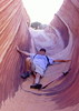
The route to 3465 was well-cairned, relatively brush-free, and easy to follow. I saw another group of javelinas on the way up, and the few areas that required some scrambling were straightforward. The lid on the summit register jar had rusted through, and the papers inside had suffered water damage. I had an empty plastic container with me, so I put all the old papers inside and added a few new sheets.

[ youtube video ]

On the way back down, I found a random piece of pottery near Big Jim Trail at the saddle, which I didn't expect out there. I rejoined TboneKathy, and we headed for Pike's Peak next. That proved to be a much slower bushwhack than 3465, with a lot more brush and loose rock to contend with and no informal trail to follow. With time constraints, TboneKathy waited partway up the slope to the saddle while I continued on. It wasn't particularly steep or difficult and didn't have any exposure; it was just slow going beteween rocky terrain and plenty of sharp desert foliage to dodge. One I reached the saddle, it was a much faster final climb up to the summit, where there were two memorials, one for someone named Bill Marsh and one for Bob Marsh. I didn't find a summit register up there...perhaps I should have saved the plastic bottle I'd left to replace the one on 3465...

[ youtube video ]

Still short on time, I rushed over toward Mill 3189, passing a few more wild burros along the way. On the scramble up to the peak, I ended up with a teddy bear cholla stuck in my right calf, in the exact same spot I'd already removed one earlier in the day...ouch. I found the benchmark on the top but didn't see a summit register or go off the ridgeline to look for Frustum #18 before I started back down.

[ youtube video ]

It was nice to be back on flat trail again after a lot of bushwhacking, and we had a few more wild burro encounters on the hike out--some we saw, some we only heard braying nearby...a much more welcome sound than the shooting range off in the distance. Overall, it was a really nice day, with visits to four new peaks, perfect weather, and relative solitude--we only saw four other people all the trails all day--two bow hunters and two hikers.
 Geology
 Geology [ checklist ]
[ checklist ]  Natural Arch

water 1 out of 5water less than maxwater less than maxwater less than max Walkin' Jim Spring Dripping Dripping
Some pools in the wash nearby
  1 archive
Feb 27 2022
avatar

 Routes 18
 Photos 79
 Triplogs 23

female
 Joined Apr 28 2018
 Chandler, AZ
Hieroglyphic Pikes Peak - 3465 - 2191 - Mill, AZ 
Hieroglyphic Pikes Peak - 3465 - 2191 - Mill, AZ
 
Hiking avatar Feb 27 2022
TboneKathyTriplogs 23
Hiking12.20 Miles 1,945 AEG
Hiking12.20 Miles   10 Hrs   12 Mns   1.73 mph
1,945 ft AEG   3 Hrs   10 Mns Break
no photosets
1st trip
I've had problems with Route Scout crashing on hikes, so my stats are little off, but @John10s has a better route for this hike. If we compared our routes, mine would show the main loop, but most of the out-and-back arms would be truncated. Those would be the peaks that I enjoyed from part way up. John10s is a lot faster than I am, but while waiting for him to go up, I end up seeing a lot of things I wouldn't have seen otherwise.

I did reach the top of Peak 2191 early in the hike. When the steep and loose began to dominate enroute to Peak 3465, I found a seat where I could observe the wild burros as John10s went for the peak. With limited time, I wanted to be sure we'd have time to reach Pikes Peak. Burro viewing was cut short as they were right on John10s’s trail to the peak. They were very obliging, moving on for him and posing for pictures.

I enjoyed the call of a canyon wren. Then a hawk of some type soared near and perched on the cliffs across the way, and then was joined by another.

Pikes Peak ended up requiring more bushwhacking than expected. Checking the time, it was clear we wouldn't both have time to make it. I found a seat again and soon heard footsteps. Trying to locate the source, a large black spot caught my eye across the canyon. It looked a lot like a black bear rump. Until it turned. A dark burro! It turned out there were several of various colors and on this still day, I could hear their footsteps across the wide canyon.

A turkey vulture soared and circled. Then a smaller, jay-sized bird showed up and harassed it. An even smaller bird joined in, and right in front of me, the smaller bird closed in on the vulture and I could clearly see the vulture snap and barely miss it! Another noise distracted me and I turned to see a black-throated sparrow (?) in the bush just 5 feet away.

I heard a cactus wren, and realizing that I had an internet connection, played some cactus wren calls to encourage it to continue and perhaps even move in closer, but I don't think I really made any difference.

We had a long walk out, with the southern part of the loop being rougher than the north. As we neared the end, we were treated to a long, loud and varied wild burro braying party.

So John10s and I had more divergent experiences on this hike than on most, but both experiences were fulfilling.
 
Jan 01 2022
avatar

 Routes 386
 Photos 49
 Triplogs 792

43 female
 Joined Jun 23 2015
 Phoenix, AZ
Peak 3465 - Hieroglyphic MountainsPhoenix, AZ
Phoenix, AZ
Hiking avatar Jan 01 2022
emilystardustTriplogs 792
Hiking11.85 Miles 2,141 AEG
Hiking11.85 Miles   7 Hrs   12 Mns   1.92 mph
2,141 ft AEG   1 Hour   1 Min Break
 no routesno photosets
1st trip
Linked   linked  
Partners none no partners
This was a new area for me. The peak and surrounding area was pretty cold and windy so we took a few photos and then hid behind some rocks on the way down. I was pleasantly surprised that the trail was pretty easy to find and follow. New year is starting out solid.
_____________________
  1 archive
Nov 30 2021
avatar

 Guides 110
 Routes 2,246
 Photos 8,982
 Triplogs 2,600

45 female
 Joined Dec 24 2007
 Ahwatukee, AZ
Peak 3465 - Hieroglyphic MountainsPhoenix, AZ
Phoenix, AZ
Hiking avatar Nov 30 2021
LindaAnnTriplogs 2,600
Hiking11.53 Miles 2,218 AEG
Hiking11.53 Miles   6 Hrs   35 Mns   1.84 mph
2,218 ft AEG      19 Mns Break
 
Partners none no partners
Route Scout Route Recorded  on Route Scout | Pop | Map | Popup | MapDEX
Decided to head up to Peak 3465 today. Started on the northern half of the Walkin Jim Loop, which is the better half of this loop. The trail is rocky enough that you can never quite get a good pace going. Enough cairns to stay on track in the vague spots. Saw several burros.

Headed up Big Jim Trail and made my way up to 3465. Steep and rocky, but easy to follow. One washout has a detour above it. None of the scrambling really requires hands except for balance. Took a break and had a snack at the summit before heading back down.

Since I was low on water, I decided to head back on the northern half of Walkin Jim, rather than completing the loop. The trail on the southern half of the loop (especially the western side) is hard to follow in places, and I didn’t want to waste time or water.

When I was at the junction with Little Jim, I decided to head south on that and reconnect with the rest of the loop after all. Again, Little Jim was vague in places, but I just kept heading the correct direction and always found the trail or cairns again. Once on the southern side of Walkin Jim, I headed east, finishing out the loop, and taking my usual shortcut as I approached the traihead.

Saw a lot of burros today. Tons of birds. Zero people. Warm, too warm for the end of November. No breeze. No clouds. Still a nice day though.
_____________________
Stop crying and just go do the hike.
 
Oct 02 2021
avatar

 Guides 1
 Routes 226
 Photos 1,675
 Triplogs 1,867

65 male
 Joined Oct 17 2008
 Phoenix, AZ
Walkin' Jim Loop TrailPhoenix, AZ
Phoenix, AZ
Hiking avatar Oct 02 2021
rcorfmanTriplogs 1,867
Hiking14.13 Miles 1,716 AEG
Hiking14.13 Miles   6 Hrs   5 Mns   2.39 mph
1,716 ft AEG      10 Mns Break
 
Linked   none no linked trail guides
Partners none no partners
This ended up being a rough day for me. First the road was blocked off for a triathlon so I started walking along the road for 1.6 miles just to get to the trailhead. In hindsight, I probably could have got permission to drive to the trailhead.

I never really felt good today and once the Big Jim trail started climbing things went from bad to worse. I finally stopped and sat on a rock and ate some food and drank some Gatorade then headed back down to the Walkin' Jim loop. The south side of the loop was harder to follow than the north side. I had trouble the last time I was on it so loaded a track in my GPS so I'd be prepared this time. Glad I did as I made use of it a few times. I was moving slow for me and was out of breath a lot. I think I was a bit dehydrated and needed more Gatorade or some form of electrolytes.

I really wished my truck was at the trailhead, but I had a ways to go to get to it. I ran out of water about a quarter mile from the truck - I was really glad I turned around when I did.

I saw several different groups of wild burros throughout the hike today and I heard a couple of others that were in a gulch out of view.

There was several pools of water all along Cottonwood Creek and the other creeks and washes the trail passes by.
_____________________
Go find a LonelyCache
 
Feb 21 2021
avatar

 Routes 105
 Triplogs 105

52 male
 Joined Nov 14 2014
 Phoenix, AZ
Walkin' Jim Loop TrailPhoenix, AZ
Phoenix, AZ
Hiking avatar Feb 21 2021
RoadrunnerAZTriplogs 105
Hiking5.37 Miles 823 AEG
Hiking5.37 Miles   4 Hrs   23 Mns   1.52 mph
823 ft AEG      51 Mns Break
 no routesno photosets
1st trip
Linked   linked  
Partners none no partners
Enjoyed the shorter loop hike through the area using the Walkin' Jim Loop and the Little Jim shortcut. Beautiful desert scenery and views of the surrounding mountains. No one else on the trail even though the parking lot is full with trucks that unloaded ATVs - luckily no ATVs were seen or heard near the hiking trail. Following the trail is mostly easy but still more effort is needed not to lose the trail compared to other more established trails.
wildflower observationwildflower observationwildflower observationwildflower observationwildflower observation
Wildflowers Observation Light
_____________________
 
Feb 20 2021
avatar

 Guides 264
 Routes 2,797
 Photos 14,494
 Triplogs 5,894

55 male
 Joined Nov 20 1996
 
Peak 3465 - Hieroglyphic MountainsPhoenix, AZ
Phoenix, AZ
Hiking avatar Feb 20 2021
joebartelsTriplogs 5,894
Hiking12.50 Miles 2,232 AEG
Hiking12.50 Miles   7 Hrs   12 Mns   2.05 mph
2,232 ft AEG   1 Hour   6 Mns Break
 
1st trip
Linked   linked  
Partners partners
The_Eagle
Tortoise_Hiker
Route Scout Route Recorded  on Route Scout | Pop | Map | Popup | MapDEX
Team Grandpa allowed me into the club, sans credentials. The first 1.5 miles were cold without a golden ray of sun. Shockingly noticed tiny clear water pools, glorified puddles, in the creekbed of Cottonwood Creek. Walkin' Jim is aptly named on the north side of the loop we hiked in on, gaining a whopping 150-ft in 1.5 miles.

About a third of this hike is in the Hells Canyon Wilderness. While I never lose sleep over the area, it always leaves me thinking, "that was pretty cool". Being the closest wilderness to home, it loses brownie points right outta the starting gate. There's just some sick reset to life by getting further away and punishing your muscles silly. Overkill on the build-up, but damn, the topography out here intrigues.

Around 3 miles in the tread would be considered mild rocky by anti-Y-Bar strollers. Bruce and I hiked this last April at the tail end of a super bloom, where I wrote, "By two and a half miles in there was Owl Clover at least every two yards". Since so little rain has occurred since then, I anticipated a total letdown. It was not a letdown, but I was perplexed why. The difference was half of that hike was needle-sharp foxtail torture, trying to snag Mill & Pikes peaks. Without further ado, short-n-boring trail hikes slathered in olive drab are my new favorites! Well... in perfect weather, with decent company anyhow.

After last week's hit lunch, I brought half an Italian wrap for an early lunch at Peak 3465. More of a chore vs. the savory smoked-chicken bacon wrap last week.

It would appear Bob has been working overtime. The final ~four miles, the semi-challenging navigational segment, on the south side of the loop is cairned very well.
 Flora
 Flora [ checklist ]
[ checklist ]  Saguaro
 Named place
 Named place [ checklist ]
[ checklist ]  Red Mountain 4722  Sweat Peak
wildflower observationwildflower observationwildflower observationwildflower observationwildflower observation
Wildflowers Observation Isolated
a lackluster instance of Indian paintbrush & 3 Wiry Lotus
_____________________
- joe
 
Feb 20 2021
avatar

 Guides 1
 Routes 148
 Photos 9,924
 Triplogs 3,652

63 male
 Joined Apr 02 2005
 Mesa, AZ
Peak 3465 - Hieroglyphic MountainsPhoenix, AZ
Phoenix, AZ
Hiking avatar Feb 20 2021
Tortoise_HikerTriplogs 3,652
Hiking12.60 Miles 2,128 AEG
Hiking12.60 Miles   7 Hrs   13 Mns   1.75 mph
2,128 ft AEG
 
1st trip
Linked   linked  
Partners partners
joebartels
The_Eagle
I talked Bruce and Joe into letting me join them for a hike. Bruce picked one in my mileage range that I hadn’t done before. It was nice to get out with the boys again. Trail is in pretty good shape with cairns here and there to keep you from taking burrow trails by mistake. We did see burrows three different times. Some nice cacti and lots of jojoba in the area. A nice area and pretty clean for being so close to town. Nice summit and lunch spot. Great views, weather, and company!! Need to get out with these gents more often! Of course, like HAZ, they rock!
 Culture
 Culture [ checklist ]
[ checklist ]  Ray Bain de Soleil
_____________________
Tortoise Hiking. Stop and smell the Petrichor.
 
Feb 20 2021
avatar

 Guides 41
 Routes 1,626
 Photos 14,983
 Triplogs 2,760

69 male
 Joined Jan 20 2009
 Far NE Phoenix,
Peak 3465 via the Jims, AZ 
Peak 3465 via the Jims, AZ
 
Hiking avatar Feb 20 2021
The_EagleTriplogs 2,760
Hiking13.08 Miles 2,148 AEG
Hiking13.08 Miles   7 Hrs   13 Mns   2.05 mph
2,148 ft AEG      50 Mns Break12 LBS Pack
 
1st trip
Partners partners
joebartels
Tortoise_Hiker
Route Scout Route Recorded  on Route Scout | Pop | Map | Popup | MapDEX
This is a favorite of mine close to the valley. You get the feeling of remoteness, without a long drive. It's a nice leg stretcher with the roller coaster of the Walkin' Jim Loop. It also has enough elevation gain on the Big Jim Trail and the the mild off trail to Peak 3465 to get the heart beating.

Denny was kind enough to fit us into his schedule, so the Stooges were together again. It was a brisk start to the day until the orb rose high enough in the sky.

We almost always see wild burros and this hike was the same. 3 separate groups were seen.

We took a break for an early lunch on top of 3465. I really enjoy the 360's from up there.

On the way back we ran in to 2 groups climbing Big Jim to the peak. I think this was the first time I've seen people on this section.

good to get the gang back together again.
_____________________
There is a very fine line between "hobby" and "mental illness."
Dave Barry 🦅
 
Jan 10 2021
avatar

 Routes 105
 Triplogs 105

52 male
 Joined Nov 14 2014
 Phoenix, AZ
Peak 3465 - Hieroglyphic MountainsPhoenix, AZ
Phoenix, AZ
Hiking avatar Jan 10 2021
RoadrunnerAZTriplogs 105
Hiking12.26 Miles 2,409 AEG
Hiking12.26 Miles   10 Hrs      1.46 mph
2,409 ft AEG   1 Hour   36 Mns Break
 
no photosets
1st trip
Linked   linked  
Partners none no partners
Route Scout Route Recorded  on Route Scout | Pop | Map | Popup | MapDEX
Finding parking is always an adventure for this trail due to the number of ATV trailers parked in the parking lot. After finding a spot the trail starts deceptively easy through beautiful desert terrain. We saw a few donkeys along the trail which certainly was great. Then the climb started and that was quite strenous at least for us but for most of the time the trail was easy enough to follow and the views made it worthwhile. The false peak certainly was deflating a bit but in the end we made it to the true peak - yoohoo! Returning we barely made it down before darkness came (which was great as we didn't want to do the descent at night) and then continued to the parking lot while getting quite scared along the way by a floating set of red eyes (that we finally identified as being a donkey :)).
wildflower observationwildflower observationwildflower observationwildflower observationwildflower observation
Wildflowers Observation Isolated
_____________________
  1 archive
average hiking speed 1.96 mph
1, 2, 3, 4, 5  Next

WARNING! Hiking and outdoor related sports can be dangerous. Be responsible and prepare for the trip. Study the area you are entering and plan accordingly. Dress for the current and unexpected weather changes. Take plenty of water. Never go alone. Make an itinerary with your plan(s), route(s), destination(s) and expected return time. Give your itinerary to trusted family and/or friends.

helpcommentissue

end of page marker