username
X
password
register
for free!
help
ArticlesGuidesRoutes
 
Photosets
 
 Comments
triplogs   photosets   labels comments more
Tonto Trail: Hermit Trail to Boucher Trail - 21 members in 54 triplogs have rated this an average 4 ( 1 to 5 best )
1, 2, 3  Next
54 triplogs
login for filter options
Feb 06 2025
avatar

 Guides 8
 Routes 10
 Photos 1,028
 Triplogs 40

44 male
 Joined Jun 14 2019
 nomadic
Hermit Boucher Topaz Grand Canyon Loop, AZ 
Hermit Boucher Topaz Grand Canyon Loop, AZ
 
Backpack avatar Feb 06 2025
eruTriplogs 40
Backpack
Backpack4 Days         
 no routes
1st trip
The GC is overdone in terms of write-ups, but I figure I'll write up something quick for Boucher trail conditions and some out of the way water sources.

Day 1 - Mid morning start and took our time getting down, poking around the old stonework outhouses below Santa Maria (one had it's lock unscrewed), going out to lookout and breezy points (and a bit past I guess), and then the old tourist tramway ruins. From the drop from Hermit Flats through the Grand Staircase this was neater than the rest of the drops I've done (Bright Angel, Kaibab, Grandview) between the long traverses sometimes under undercuts, the view into upper hermit creek narrows, and the view of the granite staircase section. The last bit down to the tonto and the tonto itself was a bit sloggy and after all the rock on the trail my feet were a bit tired. A section before Breezy Point had slid out, and the trail wasn't clear but there's limited options to scope out and it was quick to figure out. Had the hermit creek camp to ourselves, woot.

Day 2 - we dayhiked down to the rapids, taking down a lot of stupid cairns along the way. Chatted with a group we saw cutting across the tonto from lookout the day before and met with a few rafters heading up canyon with a guide. Wandered the beach a bit then went upstream, seeing some cairns rebuilt. Knocked down some of the non creek crossing ones again. Chatted with NPS after the hike giving conditions and all the low stuff gets ripped out by a flash every once in a while, so they don't really care about keeping people on a set path to save vegetation etc. Poked up the little lower side canyon and a bit above the camp, then left properly around 2:45. It was warm, but we were in shade a lot - Travertine canyon was really neat but fairly hard to access. Some nice low impact viewpoints off the tonto. Ended up just staying in the camp ghetto area near the stone cabin in Boucher but again had it to ourselves.

Day 3 - day hiked down to Boucher rapids after chatting with the thru-hiker group we met the day before. The canyon is a bit less interesting than hermit, but the rapids had a lot of cool rock. River was low so we were able to head upstream a bit on some driftwood beaches from the eddy of the rapids. Got warm heading up canyon, we were going to poke up Topaz until it cliffed out, never did. Instead of dry camping at whites buttes that night we decided to poke up. Mostly boulder filler, but some neat spots and easy obstacles. Had the first significant bypass around 3pm, could have backtracked a bit and bushwhacked past up climber left, but decided it was time to drop. Got to camp a bit before sunset which was unusual this trip.

Day 4 - The Boucher trail was the only thing I researched ahead of time based on the description via NPS site aside from confirming water sources, opinions varied but the one trip report with good photos and a level head made it look straightforward with indirect exposure and a short pitch of Class 3. Routefinding was never an issue, a few times you have to stop and look around. A fast packer heading down to Boucher beach for the night had the same impression. The first push up to whites butte was in shadow, yay. The top of it up the drainage is straightforward chunky class 2 that has been blasted for convenience. The top of the second push up to Yuma Point was a bit rough, some slanted less than proper single track bits and then a simple class 3 short pitch of a few moves and then some more loose but non-consequential class 2. From Yuma on it was simple, though again some slanted sections and some inconsequential slides. Definitely better going up than down, but it'd be fine with decent shoes and trekking poles (we were wearing some nearly shot TX4's). Had some decent shade heading over, dripping springs creek was dry at the trail but didn't need water so just went for the push out. Had clouds for the final ascent from Hermit Flat, though the old 1950s knee+ high stonework steps were my least favorite part of the ascent. The vert is nicely broken up with traverses and we exited a bit before 5pm.

Have more water reports I did immediately after, but they're not available to sync - I guess just compressing this triplog to one day keeps the later ones from showing as addable?

water 1 out of 5water 2 out of 5water 3 out of 5water less than max Hermit Creek Medium flow Medium flow
Good flow in creek, some nice cascades. E/W short side canyon had some pools, but no need to grab there.

water 1 out of 5water 2 out of 5water 3 out of 5water less than max Hermit Rapids Medium flow Medium flow

dry Travertine Canyon Dry Dry
Dry at both trail crossings, some water in the lowest section connecting to the Colorado.
  6 archives
Jan 03 2025
avatar

 Guides 2
 Routes 21
 Photos 64
 Triplogs 7

male
 Joined Oct 30 2024
 Kenilworth, NJ
Boucher Hermit Loop, AZ 
Boucher Hermit Loop, AZ
 
Backpack avatar Jan 03 2025
ckoss_Triplogs 7
Backpack29.19 Miles 6,937 AEG
Backpack29.19 Miles2 Days   6 Hrs   21 Mns   
6,937 ft AEG25 LBS Pack
 
1st trip
Started off 2025 with the Boucher - Hermit Loop over 3 days. 25lb pack including 2 cameras + equipment.

Day 1
Stepped off down the canyon at 8AM down Hermit Trail and made it to the Boucher Trail junction after an hour. Conditions were partly cloudy all day and 40s in the sun, along with the droning noises of helicopter ally. Made it to Yuma Point for lunch at 11:30 and enjoyed the first view of the river. The trail was easy to follow along the Esplanade. The infamous Supai descent lived up to the hype. It was straightforward to tackle for me despite the steepness and loose rocks, but my partner repeatably asked me how do people enjoy this type of hiking? I kept laughing. As we continued our descent down Travertine canyon towards White Butte, a solo backpacker was making his ascent citing the onset of illness and we offered fresh water, but he declined. At 2PM we made it to the base of White Butte and atop of the Redwall descent to Boucher Creek. Arrived at the footprint of Boucher's old cabin at 4PM and setup camp nearby.

Day 2
Most of my previous trips have been near/during summer so this time I was able to get a full 8hrs of sleep and hit the Tonto trail at 8:30am. The Tonto was more of the usual experience. The most notable part of this short section to Hermit Creek was the epic view of Hermit Rapids from the trail. Made it to Hermit Creek by 11:30 after a few breaks taking in the views of the river from above. I should have spent more time perusing through the ruins, but I will be back. We arrived at Monument Creek around 2:30PM and met a group of people listening to music on a speaker, bummer. Throughout the night we were visited by some rodents, but not too bad.

Day 3
Hit the trail by 8AM and listened to the tune of NPS helicopters nearby flying in equipment for the pipeline project. My previous time to Monument was mostly in the dark due to a late start down Hermit, so this time I was able to experience Cathedral Stairs in all of its beauty. We met an older man sitting on Lookout Point mentioning that it was 17th time down Hermit Trail and shared stories of his thru-hike of the Tonto trail. All morning we were in the shade until we got to Hermit Basin and completed the loop. We enjoyed the warmth of the sun and made it back to the trailhead by 2:30PM. Until next time.

water 1 out of 5water 2 out of 5water 3 out of 5water less than max Boucher Creek Medium flow Medium flow

water 1 out of 5water 2 out of 5water 3 out of 5water less than max Hermit Creek Medium flow Medium flow

water 1 out of 5water 2 out of 5water less than maxwater less than max Monument Creek Light flow Light flow

water 1 out of 5water 2 out of 5water 3 out of 5water less than max Santa Maria Spring Gallon per minute Gallon per minute
  1 archive
Oct 17 2024
avatar

 Guides 2
 Routes 10
 Photos 42
 Triplogs 893

58 male
 Joined Jul 12 2012
 Oro Valley, AZ
Hermit-Tonto-Boucher Loop, AZ 
Hermit-Tonto-Boucher Loop, AZ
 
Hiking avatar Oct 17 2024
SpiderLegsTriplogs 893
Hiking22.00 Miles 5,800 AEG
Hiking22.00 Miles   11 Hrs   45 Mns   1.87 mph
5,800 ft AEG16 LBS Pack
 no routesno photosets
1st trip
Caught the last bit of good weather for this week and hit the Hermit Trail bright and early on Thursday morning. Had my usual group of friends fly in from Michigan & Idaho for our annual trip to the Grand Canyon. If used to going down a main corridor trail, Hermit will get your attention. It's steep and full of potential ankle twisting hazards. Crisp and about 50 degrees to start. Couple of fairly fresh looking rock slides to traverse on the way down, so that kept us engaged.

Then off across the Tonto plateau, which was quite enjoyable for the most part. Hermit's Creek was flowing really well and we all stopped to filter and top off our bottles and hydration bladders. Temps built up to maybe the low 80's and a smattering of cloud cover continued to make the hike a fun time. Trail is a bit overgrown in spots and everyone in our group got to experience what it's like to brush up against hidden cactus obscured by tall grass or bushes.

Heading up Boucher was the highlight of the day. Steep, tough and full of scrambling & route finding. Route is cairned fairly well and we only got off course a few times. The overgrown grass and bushes along the trail would either obscure the route or hide the cairns. Most of this was shaded by the time we hit Boucher. But once we got to Dripping Springs, the high winds bringing in Friday's storm and made the last mile or so a bit miserable.

Had a tight group with equal abilities and we all finished within about 15 minutes of each other. Then off to Tusayon for pizza and a drive back down to Valle to our hotel.

water 1 out of 5water 2 out of 5water 3 out of 5water less than max Hermit Creek Medium flow Medium flow
_____________________
See my pics on Instagram @tucsonexplorer
 
May 14 2023
avatar

 Guides 38
 Routes 182
 Photos 1,602
 Triplogs 232

40 male
 Joined Dec 09 2014
 Gilbert, AZ
Hermit - Boucher Loop, AZ 
Hermit - Boucher Loop, AZ
 
Hiking avatar May 14 2023
jacobemerickTriplogs 232
Hiking25.86 Miles 6,263 AEG
Hiking25.86 Miles   15 Hrs   55 Mns   2.14 mph
6,263 ft AEG   3 Hrs   49 Mns Break
 
1st trip
Route Scout Route Recorded  on Route Scout | Pop | Map | Popup | MapDEX
Laid in the hammock at Long Jim for a few hours before driving into the park and parking in Backcountry Lot. Biked the Rim Road and got a surprise rain shower along the way. Locked up bike at the racks near the restrooms and started down the trail at 3AM.

Hermit Trail
Last time I was out here I climbed up Hermit, so figured it was time to go down. Those stairs are steep. Made okay time, kept getting distracted by a thunderstorm out west. Large group of Moms at the Tonto junction who were gearing up to hike out after a few days at Monument Creek. Now that's a solid way to celebrate Mother's Day.

Hermit Creek
Booked over to the campsite & restrooms first to deal with some... gut issues. Need to stop doing fast food before these early mornings. After that unpleasantness, followed the creek directly down to the river from the campsite. Only one tricky spot that required down-climbing. The geology along the creek was super cool, that nonconformity was a pleasant surprise. Had breakfast at the river, than hiked up, this time sticking to the trail, which made for quick going.

Tonto Trail
Temps were already toasty at 9AM, and I kept looking around for the promised "more clouds than sun" forecast. Oh well. This section of Tonto is an easy cruise, some re-routes to navigate and plenty of wow moments. Travertine Canyon caught my attention, maybe accessible from the river? Something to look into for a future trip. Needed water refill at the end and continued to Boucher Creek - the marked spring before that was flowing loud enough to hear, accessing it would have been painful.

Boucher Trail
After a lengthy lunch break it was time to climb. Cloud cover helped with the heat, and I had a full 5 liters, so took my time. This trail is no joke. There were multiple sections, especially on the climbs, that were barely defined, with few cairns and faint tread. That second climb by upper Travertine was sketch, lots of loose rocks and dirt. Felt like it took forever to reach the long traverse. Eventually made it back to Hermit junction and crawled back up to the rim.

My stubborn plan was to bike out, even with the buses still running. After the third uphill section that my tired legs failed on, even on the lowest gear, I hopped on a bus at Mohave Point and then started the long drive home.
 Named place
 Named place [ checklist ]
[ checklist ]  Travertine Canyon

water 1 out of 5water 2 out of 5water 3 out of 5water less than max Boucher Creek Medium flow Medium flow

water 1 out of 5water 2 out of 5water 3 out of 5water less than max Hermit Creek Medium flow Medium flow

water 1 out of 5water 2 out of 5water 3 out of 5water less than max Santa Maria Spring Gallon per minute Gallon per minute
_____________________
 
Oct 27 2022
avatar

 Guides 94
 Routes 840
 Photos 22,055
 Triplogs 1,993

52 male
 Joined Sep 18 2002
 Tempe, AZ
Boucher Hermit, AZ 
Boucher Hermit, AZ
 
Backpack avatar Oct 27 2022
chumleyTriplogs 1,993
Backpack43.69 Miles 10,811 AEG
Backpack43.69 Miles4 Days         
10,811 ft AEG
 no routes
9L put together a plan and secured the necessary permits and whatnot a few months ago. Something came up at the last minute and he had to bail, but as good friends must, we happily carried on without him! In fact, I've adopted Ryan as my new 9L-replacement figure. He even drives! :)

We set out from the valley Thursday morning for the drive to the canyon and set foot on trail before noon. Ryan hadn't been to Dripping Springs before so I made sure we took that short side-trip. A ranger was day-hiking the route and I was happy to have our permit checked along the way.

Once on Boucher we encountered nobody else until settling in at camp. Along the way, we took the side trip to Whites Butte. It was the 4th Grand Canyon Summit I'd done that FOTG hadn't :o , and my 8th overall. This one is 100% worth the price of admission, assuming you're already walking by it for some other reason.

There was a lone hiker at Boucher when we arrived and we set up camp and got chores done before darkness set in. It was COLD! There's something about the temperature extremes at the beginning of a new season, and combined with the lack of cold-cutting warmth of a fire, it was sleeping bag time by 7pm. My thermometer showed the low to have dropped to 38 ... exactly as forecast. But it felt like 18 when sitting out under the stars.

Friday we headed five miles across the Tonto to Slate Creek where we had intended to explore downstream to Crystal Rapid. Just before reaching the drainage we encountered our only other hiker on the day — it was Dave1 :sweat: — who informed us that he had not found any water there. The Colorado was muddy and I was counting on something in Slate and didn't fully load up before leaving Boucher, so with no extra water we wouldn't be able to make the full 15 mile day plan.

Nonetheless, we continued on and found the route down into Slate and were relieved to find numerous, large, clear, and cold pools in the bedrock narrows. After a few minutes of filtering and topping off, we set off downstream. A few minutes later Ryan let out a blood-curdling scream (possible exaggeration) as he sipped from his bladder and learned that our life-saving water would plummet to the bottom of the Great Salt Lake. I subsequently dipped my tongue in a few other pools to find the same result. As neither of us now had any drinkable water, we turned around and headed back to Boucher, appreciative of the cool weather and light breeze.

All rehydrated there, we took a leisurely trip down to Boucher Rapid before heading back up to camp as daylight waned. It was somewhat warmer, but we still sat in sleeping bags in camp. The low showed 42.

Saturday we made the short trip across the Tonto over to Hermit Creek. We arrived before anyone else and secured the penthouse spot in the overhung cliff band. Despite my plans for OnlyFans stardom in the open air toilet there, I was surprised to find a pfancy new solar facility! A two-holer with all the amenities one could ever imagine to find at such a remote camp including doors and a roof! I wonder if other high-use canyon campsites have upgraded facilities too? If nothing else, the legacy of the last administration should include this pristine poo'er thanks to the GAOA!

Afternoon took us down Hermit to the river ... truly one of the little gem hikes the canyon has to offer. My OnlyFans must not be the only talent I have because I was successful like no other trip before when mooching a beer from the rafters scoping the rapid. And with that, Ryan and I carried 8 of the best canned macro-swill one could hope for back to camp to share with five ladies who had arrived while we were gone. Of course they were asleep before it got dark, so we shared with the grungy hippie from Flagstaff instead. ](*,) It was noticeably warmer, both in the evening and overnight, dropping only to 46.

The five ladies quietly departed for the rim at 3:45am (hoping to beat the heat!?) while Ryan and I waited until a little bit after 9 :lol: . We placed a friendly wager on if we would pass them on the way out, but despite making it back up before 1pm, we could not make up the 5-hour head-start they had on us.

Ice cream cookie sandwiches are a requirement for any hike that ends at Hermit's Rest, and we cursed 9L's name the whole way home, wondering what kind of person makes a permit plan that ends on a Sunday necessitating a post-trip drive on I-17? In the end, I didn't care, because I wasn't driving! What a game changer! :lol:

Deets
Thursday to Boucher: 11.28mi, 1684aeg, 5:42
Friday to Slate: 10.85mi, 2034aeg, 4:40
Friday River: 4.28mi, 579aeg, 2:22
Saturday to Hermit: 5.43mi, 1029aeg, 2:16
Saturday to River: 4.74mi, 799aeg, 3:38
Sunday to Rim: 7.96mi, 4569aeg, 3:51
 Named place
 Named place [ checklist ]
[ checklist ]  Cope Butte  Whites Butte
_____________________
I'm not sure what my spirit animal is, but I'm confident it has rabies.
  2 archives
Oct 04 2022
avatar

 Guides 59
 Routes 1,100
 Photos 1,176
 Triplogs 1,290

male
 Joined Jan 01 2023
 Arizona
Cope ButteNorthwest, AZ
Northwest, AZ
Backpack avatar Oct 04 2022
pseudalpineTriplogs 1,290
Backpack14.35 Miles 6,313 AEG
Backpack14.35 Miles   7 Hrs   48 Mns   2.30 mph
6,313 ft AEG
 
no photosets
Partners none no partners
Boucher Camp, Tonto Trail east to Hermits Rest and Cope Butte.
  2 archives
Apr 17 2022
avatar

 Routes 5
 Photos 435
 Triplogs 119

female
 Joined Mar 26 2022
 Flagstaff, AZ
Tonto Trail: Bright Angel Trail to Hermit TrNorthwest, AZ
Northwest, AZ
Hiking avatar Apr 17 2022
shelby147Triplogs 119
Hiking25.00 Miles 5,500 AEG
Hiking25.00 Miles   10 Hrs      2.94 mph
5,500 ft AEG   1 Hour   30 Mns Break13 LBS Pack
 no routesno photosets
1st trip
Partners none no partners
Headed out for my third(?) Hermit-Bright Angel day trip. The route is familiar by now and felt shorter because I wasn't breaking in new boots this time. The beavertail, prickly pear, and hedgehog cacti were blooming along tonto. Some flowering and fragrant shrubs higher on Hermit and Bright Angel. Agave shoots are up but flowers aren't out yet. Spotted a pair of condors high above the Horn drainage, that was fun. Trail was somewhat more crowded than previous trips - the spring hoardes have returned.
wildflower observationwildflower observationwildflower observationwildflower observationwildflower observation
Wildflowers Observation Light
Beavertail, prickly pear, hedgehog cacti along Tonto (mostly east of Horn drainage). Lots of Mariposa lillies in one area - now I know why they have the name. Agave shoots are up but not blooming yet.

dry Cedar Spring Dry Dry
Few potholes left

water 1 out of 5water 2 out of 5water less than maxwater less than max Horn Creek Light flow Light flow

water 1 out of 5water 2 out of 5water 3 out of 5water less than max Monument Creek Medium flow Medium flow

water 1 out of 5water 2 out of 5water less than maxwater less than max Salt Creek Light flow Light flow
 
Apr 03 2022
avatar

 Guides 17
 Routes 297
 Photos 1,808
 Triplogs 276

female
 Joined Mar 11 2002
 Gilbert, AZ
Hermit Trail - Grand CanyonNorthwest, AZ
Northwest, AZ
Hiking avatar Apr 03 2022
VashtiTriplogs 276
Hiking7.80 Miles 4,214 AEG
Hiking7.80 Miles   7 Hrs   47 Mns   1.39 mph
4,214 ft AEG   2 Hrs   10 Mns Break
 
Partners none no partners
Route Scout Route Recorded  on Route Scout | Pop | Map | Popup | MapDEX
Day 3 of our backpack: up to hermit TH from hermit creek Campground. A bit of a slog at times, but still beautiful views, interesting rocks, and thankfully no people until the last 1.5 miles or so. We enjoyed a nice day at the Santa Maria rest house which had lots of water and lush shrubs providing shade even in the afternoon.

Going up the cathedral stairs wasn't as bad as I thought it would be. It passed quickly, and there is a nice spot to sit at the top of the stairs. We had breakfast there. :)

The trail is very well maintained, even in the rock slide areas, and exposure is low.

water 1 out of 5water 2 out of 5water 3 out of 5water less than max Hermit Creek Medium flow Medium flow

water 1 out of 5water 2 out of 5water 3 out of 5water 4 out of 5 Hermit Rapids Heavy flow Heavy flow
_____________________
:D
 
Apr 01 2022
avatar

 Guides 17
 Routes 297
 Photos 1,808
 Triplogs 276

female
 Joined Mar 11 2002
 Gilbert, AZ
Hermit Trail - Grand CanyonNorthwest, AZ
Northwest, AZ
Hiking avatar Apr 01 2022
VashtiTriplogs 276
Hiking9.37 Miles 594 AEG
Hiking9.37 Miles   7 Hrs   59 Mns   1.44 mph
594 ft AEG   1 Hour   29 Mns Break
 
Route Scout Route Recorded  on Route Scout | Pop | Map | Popup | MapDEX
What a great weekend to head down to Hermit rapid and creek! We spent 3 days/2 nights. The weather was perfect mostly, if a bit hot during the afternoon at hermit creek by the campsite. It was a problem easily solved by swimming in pools by waterfalls! :). There was no snow on the upper parts of hermit trail.

We had an uneventful trek down to hermit rapid. Lots of water at Santa Maria spring. The whole trough was full, and the water was leaking onto the trail. Lots of water in hermit creek. We camped upsteam of the rapid. The only other group on the beach was a 10 person + 2 guide group from REI, but they were downstream of the rapid.

We slept in, enjoyed the rapid area for a while, and then headed out to hermit creek campsite to avoid the heat of the day. It was a quick jaunt through the canyon, which is just so beautiful. Lots of wildflowers starting already! :) We meant to follow the creek all the way to the campsite, but instead auto-piloted back to the tonto trail. Oops! But no harm. This way we were able to see the corral on the way to camp site. We got in early, and the campsite was empty but for 2 campers. They had the best camp site up in a cave. However that campsite probably wouldn't have been a good choice for us given my tarptent needing stakes. We were happy in the campsite just above the waterfall and pool on the way downstream from camp. We set up camp (all tent stakes went in the ground, yippee!), filtered water, and explored the hermit creek area. What an amazing way to spend a day! :)

The next day we got started early to avoid having to do the cathedral stairs in the heat of the day. We left camp at 540a in twilight, and hiked with our headlamps for maybe 20 minutes if that. We were the first out of camp, and it was fun to look down and see the other groups coming up. Only one group of 2 young guys passed us at the top of the cathedral stairs. At the campsite, there was our group of 6,another group of six, and two groups of 2. Not too crowded.

It was nice that we were alone on the trail until we hit santa maria spring. After that we hit two huge groups going down.

We had cached water at the waldron Junction and also at lookout point, but we didn't need to given how much water was at the spring. But that is ok. It's nice to be safe!

We were glad to be in the shade during much of the ascent. We only really had the sun starting just past the spring. The last 1.5 miles was exposed and hot, as expected. And tiring! :) But we made good time (for us!) and had an excellent time! Now time to plan the next one!
wildflower observationwildflower observationwildflower observationwildflower observationwildflower observation
Wildflowers Observation Moderate
So many colorful wild flowers!

water 1 out of 5water 2 out of 5water 3 out of 5water less than max Hermit Creek Medium flow Medium flow
Lots of water!

water 1 out of 5water less than maxwater less than maxwater less than max Santa Maria Spring Dripping Dripping
Trough full of water, but pipe was dripping fast.
_____________________
:D
 
Dec 12 2021
avatar

 Guides 59
 Routes 1,100
 Photos 1,176
 Triplogs 1,290

male
 Joined Jan 01 2023
 Arizona
Tonto Trail: Hermit Trail to Boucher TrailNorthwest, AZ
Northwest, AZ
Backpack avatar Dec 12 2021
pseudalpineTriplogs 1,290
Backpack5.48 Miles 1,041 AEG
Backpack5.48 Miles   2 Hrs   12 Mns   2.67 mph
1,041 ft AEG
 
Linked   linked  
Partners none no partners
 Named place
 Named place [ checklist ]
[ checklist ]  Cope Butte
  1 archive
Dec 08 2021
avatar

 Guides 99
 Routes 1,484
 Photos 16,072
 Triplogs 1,374

male
 Joined Jan 07 2017
 Fountain Hills,
Hermit Trail - Grand CanyonNorthwest, AZ
Northwest, AZ
Hiking avatar Dec 08 2021
DixieFlyerTriplogs 1,374
Hiking18.54 Miles 5,213 AEG
Hiking18.54 Miles   9 Hrs   44 Mns   2.17 mph
5,213 ft AEG   1 Hour   11 Mns Break
 
Route Scout Route Recorded  on Route Scout | Pop | Map | Popup | MapDEX
I had never hiked from the Hermit TH down to the Colorado River, so I decided to change that today.

We only saw 3 people on the trail, so we pretty much had the canyon to ourselves.

The weather was near perfect -- a cloudy day with very little wind and good hiking temperatures.

I enjoyed our lunch spot down at the Hermit Rapids -- that is hard to beat.

There was a bit of route finding along Tonto Creek down to the River -- that section was harder than it should have been.

The last mile back to the TH kinda sucked -- lot of stair stepping.

This was an enjoyable hike though -- great scenery; a great destination down at Hermit Rapids; and it was almost eerily quiet for most of the hike.

As far as I am concerned, wintertime is the best time to be at the Grand Canyon!
 Named place
 Named place [ checklist ]
[ checklist ]  Hermit Creek  Hermit Rapids
foliage observationfoliage observationfoliage observationfoliage observationfoliage observation
Autumn Foliage Observation Isolated
There were a few cottonwoods with yellow leaves near the river

water 1 out of 5water less than maxwater less than maxwater less than max Santa Maria Spring Dripping Dripping
The tank is full
_____________________
Civilization is a nice place to visit but I wouldn't want to live there
 
Jan 17 2021
avatar

 Photos 117
 Triplogs 23

48 male
 Joined Apr 25 2017
 Phoenix, AZ
Hermit/Tonto/Boucher Loop, AZ 
Hermit/Tonto/Boucher Loop, AZ
 
Hiking avatar Jan 17 2021
desertadaptedTriplogs 23
Hiking20.00 Miles 5,300 AEG
Hiking20.00 Miles
5,300 ft AEG
 no routes
1st trip
I’m in the very early stages of trying to hike the Canyon’s named trails. This weekend was supposed to be the Hermit/Boucher loop on Sunday and an out-and-back on New Hance or Tanner on Monday. Only finished the first.

I’d done Hermit before, and love it. Started at ~6:15. I really enjoy the extended lateral hikes between the steep drops on Hermit. It feels so much more organic to me than Bright Angel or Kaibab (though it lacks Kaibab’s huge views). It’s also not as brutally steep as Grandview. I had the trail to myself, and trail conditions remain excellent. I encountered four backpackers coming out of Hermit Camp. I imagine they had a really cold night but they looked in good spirits. I refilled a liter there and continued on the Tonto. Conditions were chilly, clear and beautiful. I was feeling kind of weak for some reason, which was going to punish me on the way up Boucher. It also took away my motivation to take pictures – I just wanted to keep moving.

Reports that you should go up Boucher, rather than down, are absolutely spot on. Steep and pebbly in some sections, scrambly in a few others, it was definitely a chore going uphill, but it’s not something I would have wanted to go down. It’s striking how much less maintained it is than Hermit, given their proximity. It also suffers from repeatedly entering drainages, which I imagine makes maintenance challenging. There was no water on trail. I have to say, I don’t anticipate going out of my way to take Boucher again. Hermit is just so much easier to climb. I was pooped by the end, and scuttled the idea of New Hance or Tanner, while putting away a pizza and some beer. It’s a bit of a schlep to drive from the Valley to the Canyon for a single day hike, but I just couldn’t motivate. Next time!

water 1 out of 5water 2 out of 5water 3 out of 5water 4 out of 5 Hermit Creek Heavy flow Heavy flow
_____________________
 
Apr 15 2017
avatar

 Guides 264
 Routes 2,797
 Photos 14,494
 Triplogs 5,894

55 male
 Joined Nov 20 1996
 
Boucher Hermit Loop, AZ 
Boucher Hermit Loop, AZ
 
Hiking avatar Apr 15 2017
joebartelsTriplogs 5,894
Hiking22.94 Miles 5,800 AEG
Hiking22.94 Miles   12 Hrs   32 Mns   2.16 mph
5,800 ft AEG   1 Hour   55 Mns Break14 LBS Pack
 
1st trip
Partners partners
Dave1
Tortoise_Hiker
wallyfrack
T'was the day before Easter and all through the canyon we searched for companions. A bunny was not to be found yet the buttonose chipmunk near and dear emitted strange sounds.

Shivering was the name of the game for the first hour followed by perfection for the balance. After five miles it felt like we were still near the rim.

Just a nice hike until the mother of all wildflower shows along my least favorite Tonto killed the pace.

Lunched in the shade of the narrows along Hermit Creek before hiking out. Denny didn't care for the ascent but found the gear to get us out before the buses stopped.

Great to hike new terrain and Dave had a funny or two to share. Big thx to Wally for driving, he's been under the weather this week.
wildflower observationwildflower observationwildflower observationwildflower observationwildflower observation
Wildflowers Observation Extreme
Bazillion Sego Lilies, brittlebush gone wild

water 1 out of 5water 2 out of 5water less than maxwater less than max Hermit Creek Light flow Light flow
water report recorded in the field on our app Route Scout

water 1 out of 5water less than maxwater less than maxwater less than max Santa Maria Spring Dripping Dripping
water report recorded in the field on our app Route Scout One drip a second
_____________________
- joe
 
Apr 15 2017
avatar

 Guides 1
 Routes 148
 Photos 9,924
 Triplogs 3,652

63 male
 Joined Apr 02 2005
 Mesa, AZ
Boucher Hermit Loop, AZ 
Boucher Hermit Loop, AZ
 
Hiking avatar Apr 15 2017
Tortoise_HikerTriplogs 3,652
Hiking21.69 Miles 5,800 AEG
Hiking21.69 Miles   12 Hrs   34 Mns   2.04 mph
5,800 ft AEG   1 Hour   55 Mns Break
 no routes
1st trip
Partners partners
Dave1
joebartels
wallyfrack
Full disclaimer: I tanked it on the climb out and was praying God would get me up the last 2.2 miles. Joe's mileage is a little more for coming back down and carrying me out.
Wally wasn't feeling good but still drove us up, hiked the first couple miles, then hiked and napped on top until I dragged myself out. He rocks!
The hike itself was a good one and the trails are in pretty good shape. A couple small rock slides but the trail is still visible. This is a good loop. With the wildflowers putting on a show and Joe and Dave joining me it really was enjoyable for the most part. I would say if your going to filter do it at Hermits creek as it's on the way. Santa Maria spring has water in the tank you could filter but not as clean. The pipe was not dripping enough to filter from.
After the hike we took an adventurous ride on the shuttle and meet back up with Wally. We all went over to Maswik food court to eat before the drive home. Thanks to Joe,Dave and Wally for another great outing,like HAZ, :yr:
 Named place
 Named place [ checklist ]
[ checklist ]  Whites Butte
wildflower observationwildflower observationwildflower observationwildflower observationwildflower observation
Wildflowers Observation Extreme
_____________________
Tortoise Hiking. Stop and smell the Petrichor.
 
Mar 11 2017
avatar

 Routes 67
 Photos 966
 Triplogs 694

51 female
 Joined Jan 05 2012
 Phoenix,AZ
Boucher Rapids Hermit Loop, AZ 
Boucher Rapids Hermit Loop, AZ
 
Hiking avatar Mar 11 2017
slowandsteadyTriplogs 694
Hiking35.65 Miles 9,452 AEG
Hiking35.65 Miles   18 Hrs   14 Mns   2.20 mph
9,452 ft AEG   2 Hrs   3 Mns Break
 no routesno photosets
1st trip
We had to renew our "You're an idiot" badges. :y:
_____________________
 
Mar 11 2017
avatar

 Guides 4
 Routes 491
 Photos 10,890
 Triplogs 1,257

55 male
 Joined Nov 20 2012
 Phoenix, AZ
Boucher Rapids Hermit Loop, AZ 
Boucher Rapids Hermit Loop, AZ
 
Hiking avatar Mar 11 2017
BiFrostTriplogs 1,257
Hiking35.65 Miles 9,452 AEG
Hiking35.65 Miles   18 Hrs   14 Mns   2.20 mph
9,452 ft AEG   2 Hrs   3 Mns Break
 
1st trip
We had done this loop before but without going down to Boucher Rapids so this time we added that piece. Down Boucher went without any issues and all the steep sections were easy to navigate. Took short break at Boucher Creek before heading out to the rapids. Lunch at Boucher Rapids getting there about noon and took 45 minute break to enjoy the river which was unfortunately muddy brown but still nice to see.

After lunch headed back to Tonto Trail junction above Boucher Creek and started the traverse over to Hermit Creek. We had forgotten how long this section is at about 5 miles but made it to Hermit Creek and took another break to fill up water and recharge for the climb out. It was almost 4pm and Hermit camp site was filling up so we talked to couple of the guys. Water topped off and ready to go we headed up Hermit and the long climb. Slow going uphill and reached Santa Maria Spring as it was getting dark. Another short break and last push to the top.

We knew the last bus was about 730 so at this point we were pretty sure wouldn't make that arriving about 1 hour late. Backup plan was to call taxi from Hermits Rest which would have worked if the signal was strong enough. Tried several times but the call kept dropping before I could tell the guy to send taxi to Hermit's Rest. So we started walking the road back to the Bright Angel Lodge where the vehicle was parked. Long day made longer by extra walk but cool to see the rapids!
 Named place
 Named place [ checklist ]
[ checklist ]  Boucher Creek  Boucher Rapids
_____________________
  1 archive
Mar 31 2016
avatar

 Guides 19
 Routes 40
 Photos 5,624
 Triplogs 341

52 female
 Joined Nov 22 2005
 Tucson, AZ
Tonto Trail: South Bass to Hermit, AZ 
Tonto Trail: South Bass to Hermit, AZ
 
Backpack avatar Mar 31 2016
writelotsTriplogs 341
Backpack50.00 Miles 5,600 AEG
Backpack50.00 Miles6 Days         
5,600 ft AEG
 no routes
1st trip
And now, ladies and gentleman, an epic tale of adventure, danger and triumph in the grandest canyon on earth...

I've been trying to "get er done" with this hike for years. My concept of hiking the whole of the Tonto from the LCR to Royal Arch Creek seemed doable enough back in 2009 - and now 7 years later I can finally count it finished :y: . The Gems passage between South Bass and Hermit may not be the most difficult portion of this route, but it has proven over the years to logistically challenging and down right elusive. Cancelled shuttles, sick hiking partners and bad weather have cancelled my prior 3 attempts at this stretch of the trail. I vowed that come hell, high water or bad roads I would complete it this year - and the canyon pulled out some of her best attempts at stopping me.

Oh, and doing the trip this way means you have to hike out Hermit, which I hate by the way. Just sayin'.

The days before our hike, a storm blew into Northern AZ which threatened to make the roads impassable out to South Bass. A stroke of luck kept the worst of the moisture away from our area, and the roads were dry and safer than expected. It seemed almost a let-down that there was no mud on the road in, as I'd really sold it hard to my hiking companions not familiar with that road that as was gnarly and potentially dangerous. Of course, the fact that I was still finding red mud in my Subaru 3 years after driving it to do Royal Arch should have been evidence enough. Thanks to Tim for getting us out there safe and happy!

We originally had permits to camp at South Bass TH the night before our hike in, and we were VERY glad we changed our itinerary to drive in and hike down on the same day. Although it meant a very LONG hike in, it also let us spend that 11 degree night in a camping trailer (provided by the most generous Scat Daddy) rather than cowboy camping it. It ALSO meant that we didn't have to carry the gear needed for 11 degree camping with us for the remaining 5 nights ... none of which dropped below about 40. All around, a great choice!

Day 1: South Bass and Rainbows
I love this trail...up and down it is a delight to hike. The little break you get crossing the Esplanade under the watchful eye of Mount Huethawali feels like a piece of heaven. I was making up a little tune (think along the lines of Gentle On my Mind) as we hiked in...

"Well I'm back here on the Esplanade,
Making up a country song,
Hiking in with some of my good friends,
I feel I'm back where I belong,
in spite of this here country song,
walkin' through the canyon once again..."


If you read Sirena's trip report, you'll note that a couple of the folks we ran into that day either knew her or me or both of us, which made for a fun bit of conversation. I love knowing that our community of Grand Canyon devotees is not as big as one might fear, and that we all congregate in season about the waterholes and overhangs of our favorite side canyons.

Our trip for water down to Bass Tanks was hot and stressful, but in the end we got enough to drink to support a dry camp out on the point (always a preference!). I'd like to say that we took the wrong route to the tanks (following the creek instead of the trail) on purpose, looking for waterholes we'd found before. But the truth was that we really had no idea what we were doing, and we made a long trip even longer. Luckily, no permanent harm was done and the worst thing that happened was that we were short on mileage for day 1. We made camp on the plateau just before the trail turned back to the south.

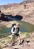
When we set our packs down, I pointed out a substantial storm that was building over the Powell Plateau. We all excitedly headed down to the edge of the plateau to see the river, and the storm kept building. Once we realized that it was actually going to hop across the canyon at us, we rushed back to try to make camp before it hit. Instead, we made camp as it hit - with strong winds whipping our tents and tarps out of our hands and strong spray blinding us as we tried to stake everything down. I think the strongest rain was falling for about 5-10 minutes after we got the tents and all up, but it was never really a downpour. When the drops got more infrequent we crawled back out and were treated to that golden-light show that only a sunset shower in the canyon can give you. Even rainbows to play in!

"There's a storm brewin' across the rim,
but Roger says the chance of rain is slim.
Well either way the wind begins to blow.
The rain it beats upon my face
putting me back in to my place
I just hope it doesn't turn to snow."


Day 2: Helicopters and Bright Sunshine

The morning was brilliant as we watched a (much less spectacular) sunrise. We decided to try to follow a pattern of breaking camp before breakfast and eating later on the trail to make the most of our cooler morning hours. We figured it was about 2.5 miles into Serpentine, and we made it in a little over an hour. The hike back into the back of the canyon was a little more challenging than I'd anticipated - the Tonto platform is narrow going into the back of the canyon, and there were many little twists and turns to navigate. None the less, it was a spectacular morning for hiking - with blooming prickly pear abundant, the sage busting out with dark green foliage and delicate yellow flowers and a cloudless blue sky.

"We're Tontouring into Serpentine,
The rocks are brown, the sage is green,
The cacti have such lovely bright pink blooms,
I hope the canyon's kind to me,
I hope I hike out gracefully,
and not have this big rock hole be my tomb...
"

We filled up a few containers with water in Serpentine. Reports of the quality of this water vary from "just fine" to "damn near poison", and we weren't sure which to believe. Like any seasoned canyon hiker, though, we were aware that passing a water source with empty bottles is tantamount to running with scissors - so we topped of. Some people tried a "blend" of Serpentine water, while others kept it in a separate emergency storage device. In the end, after all was said and done, our feelings on the water were mixed. No one reported major intestinal issues, but I've always had difficulties with my inards on backpacking food and water, so it's tough to say what the culprit might have be.

Like most groups, we don't always hike close to each other, but instead accordion out across the trail. John (who earned the trail name BBJ) was out in the lead - still nervous that he wouldn't be able to keep up (obviously he hadn't hiked with me before!). Sirena was cruising in second, a real force of nature out there on the trail. Then the accordion collapsed behind her when she stopped with some unexplained leg pain.

I'll refer you to her very detailed and fascinating triplog for details on her injury, call for help and subsequent rescue: [ triplog ]. We waved goodbye to the helicopter (video here: ) and then encountered that very surreal moment where there's nothing left to do but pick up your pack and start walking again. Minus one.

The rest of the day felt decidedly anticlimactic. We Tontoured in and out of Emerald and Quartz canyons - both of which were very standard, easy Tonto canyons. As we headed back into Ruby our water bottles were getting down to just the Serpentine blends and we were glad to be approaching what we'd been told was a pretty dependable source. The sun went behind the canyon walls while we collected water and chatted with the group planning to camp there (they were curious about the helicopter since they'd all spoken to Sirena as they passed us).

"I'm looking into Ruby now,
my feet are tired, and are they how,
I'm hoping for just one small bit of shade.
The ground is hard, the sun is hot,
for water we've just this one shot
and miles to go before our camp is made."


We watered up and kept on hiking out to a sweeping vista overlooking a particularly pretty piece of marbled schist. A point camp on the Le Conte Plateau made a wonderful place to watch the stars, regain some much needed nutrients and wonder how our friend was doing up on the rim.

Day 3-4: Slogging Out the Miles

The trail description written by the NPS on this portion of the Tonto is full of warnings about the remoteness and challenge of this piece of the Tonto (which felt misleading since we leap-frogged with 2-3 groups the whole way). However, in the end they say, "..it is mostly just a question of slogging out the miles".

If this is slogging, sign me up for a lifetime of it.

We hiked through Jade and Jasper quickly in the morning before breakfast. We knew from the day before that the heat was on its way, and we wanted to water up before it hit too hard. The Shaler Plateau is beautiful with its Muave cliffs and views of the greater canyon's constriction at the Scorpion Ridge on the north side of the river.

"Turquoise is up around the bend
the trail's red, it's green, it's brown again
It's changing just as quickly as my mind.
I love the canyon's morning light
the wren's call and the raven's flight
the worries of the modern world they mend."


Turquoise is a delightful tributary to hike back into, with lots of great views down into the Tapeats narrows and across the very narrow canyon. The big natural rock tank near the trail junction was a delightful place to rest and filter water - with some amorous frogs to keep us entertained and plenty of beautiful ledges to rest on.

After departing Turquoise, the trail becomes more Tonto like than ever, with a long, relatively flat hike around Castor Temple. It started to get quite hot, and so when we started back into Sapphire, we were really hoping for a shady afternoon siesta. The canyon is quite open compared to the previous Tapeats gorges, though, and the floor is baking in the sun...

...except for the space just under 2 Apache pines at the base of the canyon just below the trail crossings. Glorious pine tree shade! We napped until the sun dipped behind the walls of the rim, then gathered water from the slick rock pools upstream. We hiked on, determined to make enough miles to give us some room for a trip to the river the next day, and we ended up at a glorious rock shelf suspended in the middle of the rocky and dry Agate Canyon.

That night, we played with our headlamps and long-exposure camera shots to pay tribute to our lost comrade. We watched the stars (so brilliant with the late moon rise) and contemplated the nature of the universe that was laid out before us.

Then its back on the Tonto - singing my new lyrics and enjoying the eternal views. Scylla Butte made me think of my favorite Stripey Butte on the AZT Passage 17a, and it made me miss my hiking buddy even more.

"I'm out here on the wide plateau,
how far it goes, it's hard to know
you walk until your feet can go no more.
The side creeks all fall into line
already eight, or was it nine?
the Tonto always has some more in store."


Water was plentiful in Slate Creek, once you get down to it. Of course, like all of the Tonto canyons that deliver a big drop through the Tapeats to get to their floor, you get a nice healthy climb to get back out and up on the plateau again. By this time, though, we were feeling quite strong and it was fun to climb. Besides, it was but a warm up for the big show coming our way at Boucher Creek.

Hiking around Marsh Butte involves navigating some massive landslides that are reasonably recent as Grand Canyon landslides go. We picked our way through boulder fields and dry moraines, hiding from the intense sun under the cover of my umbrella. rounding the corner into Boucher is like entering a whole new type of canyon - the amphitheater created by Topaz and Boucher Creek is MASSIVE, crowned by Vesta Temple.

The descent into Boucher follows a huge collapse in the Tapeats that keeps you looking upstream in Topaz Canyon. It was steep and rugged enough to motivate us to put away the umbrellas and use both poles (and our full concentration) on keeping our feet where they belonged and our pumpkins off the dirt. There was nowhere to hide from the shade, except for about a 3 square foot space at the base of a boulder, where we found our companion John resting and waiting for us to finish the descent. Then we headed over to the babbling base of Boucher Creek to top off our water bottles, dump water over our dry, sweaty heads, and begin the final descent to the river (at last! The river!).

The hike from Boucher creek to the beach is a beautiful and easy walk down the gravel creek bed. I didn't bother to keep my feet dry, but enjoyed the cool water washing through my shoes and soaking my socks. There were lots of new flowers and plants down here, including some gorgeous scarlet monkey flower. By the time we made the beach, there was ample shade and just enough sun to indulge the skinny dipper in the party.

We watched a boat trip run the rapid, wistfully I might add, wishing that we could ride along (freezing water notwithstanding). Though I'd originally intended to camp upstream of the creek confluence, I'd completely forgotten about the GIANT beach downstream. The boys went off exploring and their excited discovery of a practically virgin stretch of white sand where the boaters usually camped got us to pack up what we'd spread out and move. Thus ensued one of the more delightful nights I've ever spent backpacking - with barefoot dancing on the beach, long ballads being sung and Scat Daddy's first cowboy's night out (of the tent). The rapid sang us to sleep and woke us in the morning again, refreshed, rehydrated and ready to climb.

"I'm still singing this here country song,
aren't you glad you've come along
on my travels through the canyon wide?
Camped under a starlit sky
the sand is soft, the hikers high
I wish the boats could offer me a ride..."


Day 5: Finishing the Tonto
The day went precisely as planned. We woke early, followed the winding stream up to its travertine dome and ate breakfast next to a gushing waterfall. We explored the ruins of Boucher's cabin briefly before beginning the climb back out of the canyon behind White's Butte. Then it was across the Tonto again to the next (dry) tributary. There's a beautiful if small campsite at Travertine which was still in the shade when we arrived at lunch time, so we took our siesta there. It was a little difficult to be still, knowing that I was so SO close to my finish point, but the clouds which had kept us cool in the first part of the day had burned off and hiding from that sun was a important part of keeping things fun. Once the death-orb had moved into position to erase our shade, we picked up and started the final leg into Hermit Creek and my last little piece of un-explored Tonto Trail.

I loved the little stretch that skirted the cliffs just above Hermit Rapid, ducking around an ancient juniper that clung to the slopes like a stubborn old man. My vertigo liked it less, though, so I didn't linger. By 3:45 we were in Hermit Camp, doing my happy dance and throwing Wendy's all over the place like I'd done something special. Yes - I was doing the happy dance with my pack ON - that's how excited I was!

We managed to snag the awesome ledge camp just as it got shady and we settled in for a delightful afternoon and evening of story swapping and booze finishing. A wonderful night's sleep was all that was in between me and the only part of this trip that I hadn't looked forward to: the hike out on the Hermit Trail.

Day 6: Did I Mention I Hate Hiking Out Hermit?
Okay... I guess this has become an epically long triplog, and all you really need to know at this point is that I successfully hiked out the Hermit Trail. We did have one fun encounter along the way: a young woman who was traveling from Grandview to Hermit met us on our hike up. She was a solo hiker from Australia by way of British Colombia, and would be traveling into the canyon once more the next day to help bring some food down to a group traveling very slowly from South Bass and out the Bright Angel. She was fun to talk to, and we helped her a little with rides once we got to the rim.

The Hermit is just a frustrating hike out. I actually enjoy the Cathedral Stairs...it's those "paved" ramps in the Coconino that really kill me. My feet don't like that steeply angled tread, I'd rather do steps up any day. But, for all the bitching it wasn't that bad and we were out in time for showers before grabbing an early dinner in Tusayan.

"As I climb all those Cathedral Stairs
the condors circle up in pairs
but they won't get a feast from me today.
I'm feeling good and pretty strong,
though the canyon sometimes proves me wrong
I think I'm gonna make it all the way"


As the sun set on yet another wonderful adventure in the canyon I began thinking about my next big goals, both in the canyon and beyond. I hope all of them provide me with as much challenge, satisfaction and sheer magnificent beauty that this one has.

But maybe, if at all possible, a couple fewer side canyons.

"I'll be back, I don't know when
to hike the Grand Canyon again
You know, I just can't seem to stay away.
There's something there I can't resist
a special kind of magic bliss
Come with me friend next time, and we will play...

...another stupid country song,
I promise it won't be so long,
but then again I always tend to lie.
I'm better off just walking there
deep inside the great rock lair
lets go and hike the canyon one more time.
 Fauna
 Fauna [ checklist ]
[ checklist ]  Garter Snake
wildflower observationwildflower observationwildflower observationwildflower observationwildflower observation
Wildflowers Observation Isolated
Prickly pear and black sage were blooming a lot. Cliff rose and the redbuds in the canyons up above the plateau.

water 1 out of 5water 2 out of 5water 3 out of 5water less than max Boucher Creek Medium flow Medium flow
Flow varied by location


water 1 out of 5water 2 out of 5water 3 out of 5water less than max Hermit Creek Medium flow Medium flow
Looked wonderful!


water 1 out of 5water less than maxwater less than maxwater less than max Ruby Creek - GC Pools to trickle Pools to trickle

water 1 out of 5water less than maxwater less than maxwater less than max Sapphire Creek - GC Pools to trickle Pools to trickle

water 1 out of 5water less than maxwater less than maxwater less than max Serpentine Creek - GC Pools to trickle Pools to trickle
100' of flow at trail junction

water 1 out of 5water less than maxwater less than maxwater less than max Slate Creek Pools to trickle Pools to trickle
Flowing nicely at the trail crossing

dry Topaz Canyon Dry Dry

water 1 out of 5water less than maxwater less than maxwater less than max Turquoise Creek - GC Pools to trickle Pools to trickle
No flow - 200+ gallons in rock pool above trail junction
_____________________
-----------------------------------
Change will not come if we wait for some other person or some other time. We are the ones we've been waiting for. We are the change that we seek.- Barack Obama
 
Mar 07 2016
avatar

 Guides 26
 Routes 21
 Photos 562
 Triplogs 1,393

female
 Joined Jan 04 2011
 Las Vegas, NV
The Gems - Grand Canyon, AZ 
The Gems - Grand Canyon, AZ
 
Backpack avatar Mar 07 2016
autumnstarsTriplogs 1,393
Backpack52.59 Miles 10,895 AEG
Backpack52.59 Miles7 Days         
10,895 ft AEG
 no routes
1st trip
Day 0
A simple drive over to the canyon to camp at Mather turned unexpectedly interesting. Just as I was setting up my "rim tent," heavy wet snow began to fall. It snowed heavily for many hours, a fun turn of events for a Las Vegas resident. Still managed to make it to the ranger talk about mountain lions. Who knew they have a 5.5m (18ft) vertical leap?

Day 1
The day began by scraping my car windows clean of snow and ice - thank goodness for that ice scraper my dad insisted on giving me when I moved to Vegas! :lol: Wanting to get an earlyish start, I moved my pack to the passenger seat and crammed the wet, snowy tent in the trunk. After some snowy road conditions, and obligatory elk stops (No, I'm not a touron - they were IN the road), the Hermit parking lot was pleasantly sunny, and I took my time prepping to head down. Hermit was mainly snow free, but the logs were slick with frost and best avoided. The hike down was uneventful and the familiar landmarks seemed to pass quickly. As the first arrival at Hermit Creek, I picked a site and settled in. It was by no means a quiet night at Hermit with a large boyscout group plus an arguing couple beside me, and I was happy to have the sound of the creek nearby to help drown it out.

Day 2
The goal today was Slate Creek, 10.8 mi away. I was excited to be headed toward unfamiliar territory and get started on The Gems in earnest. The section of the Tonto Trail between Hermit and Boucher provides stunning views of the Colorado River, and I spent some time soaking in the scenery. At some point before Boucher, there were 2 men headed in the opposite direction and we talked for a bit. They were doing a Boucher :next: Bright Angel Loop, and were the only people I interacted with until hiking out of the canyon 5 days later. :y:
With no recent water reports, I made a stop at Boucher Creek to top off my water load at 2 full days' worth. This was a theme for the trip - always carrying too much heavy, heavy water. Guess it was good for my fitness level, though, and it was definitely good for my peace of mind. The rest of the hike to Slate was mostly scenic, if uneventful. The climb out of Boucher via Topaz was initially steep, but my legs were happy to go up after all of yesterday's down. Hiking toward the back of Slate, the water in the drainage sparkled invitingly. Nice campsite and flowing water for tonight's supply.

Day 3
Today's goal was Turquoise, 9.3 mi away. Although some find it tedious, I find something strangely game-like about "Tontouring" around the drainages. It's a puzzle to assess where the trail will come out and how it will avoid or traverse the various obstacles you can see across each side canyon. The views aren't half-bad, either. Arriving at Turquoise, it was a bit of a downer to find no flowing water at the crossing after Sapphire was flowing nicely. Could have hiked down-canyon ~30 min to flowing water (heard and seen from above), but I simply didn't feel like it and ended up filtering from a pool below the dry falls. Enjoyed some exploration up-canyon, above the seeps. When backpacking, it is a wonderful feeling to walk around free of your pack! Another nice campsite tonight.

Day 4
The park had inserted an extra night in the Ruby Use Area to my permit, expanding my options for today. Ruby was a beautiful canyon of ledges complete with a small waterfall, and I decided to spend the night. Nice campsite and again flowing water for tonight's supply.

Day 5
I reluctantly broke camp and left Ruby, possibly my favorite camp spot of the trip. Today was short mileage, and it passed quickly. As expected, Quartz and Emerald were both dry. Reaching Serpentine Canyon, there was flowing water and lots of frogs. They didn't seem deterred by the alleged poor quality of the water here.

After a long break, complete with foot soak in the icy waters of Serpentine, I made a fateful decision... To decrease my mileage the next day, I decided to push on past Serpentine to near the boundary of the use zone and set up a dry camp on a point overlooking the Colorado and Bass Canyon. The nicely sheltered spot I noted in Serpentine Canyon would have been a better choice. Weather predictions had run out by this time, but I was not worried as I settled down for the night under cloudless skies. At approx 2:30 am, the warning sprinkles began and I jumped out to set up the rain fly. Out on the point, the wind gusts were intense, and I had staked my tent lazily. With the wind, I couldn't get out to fix the staking problem without having the tent potentially escape entirely. Although the most important things (sleeping bag and clothes) stayed dry, the bottom half of my ground pad and inside the bottom of the tent were pretty soaked by the time the rain and wind let up at approx 4 am. Pack towel to the rescue! I placed it between the wet ground pad and my dry sleeping bag and caught a few hours of sleep.

Day 6
What should have been a mellow day was derailed somewhat by low-lying clouds and sleepiness from my rude awakening by the storm. Snow was visible on both rims, lasting well into late morning. The trail through Bass Canyon passed quickly, but the trek from there to Copper Canyon seemed endless. With grey skies overhead, I was anxious to find a protected camping spot, resulting in many stops to check every ledge. At Copper, I spotted the perfect overhang, clearly used previously, as evidenced by rock "seats" and a pile of very old cans on a shelf. After the early morning rain, I found enough water in shallow potholes along the canyon bed - score! Time to explore. Shortly, I noticed a very weathered coil of rope behind a rock above a dry fall. At some point, someone must have left it there for "next time," but next time never came. Interesting. The sky finally cleared up and the night was beautifully star-filled.

Day 7
Hike out day. I had no idea what to expect from South Bass Trail, and it turned out to be an interesting change. Odd how, in caparison to most trails in Grand Canyon, you hardly notice the Redwall ascent, at least not in the sense of one continuous push. Unique trail that I would hike again. Met 2 maximum-size (or slightly above) groups on my way up. They wanted to talk way too much for a person who hadn't had any human contact in several days, but at least I could help them out with a very recent water report. Didn't head over to the granary, so I have something new to look forward to the next time. A few small patches of snow near the top, but mostly melted. Climbing the last bit of trail, I saw my ride standing at the trailhead. Nice timing, as he had arrived only 5 minutes before me. Also, he had a delicious sandwich, fresh carrots, and fresh fruit in hand for a lunch. :y:
wildflower observationwildflower observationwildflower observationwildflower observationwildflower observation
Wildflowers Observation Isolated
Just beginning

water 1 out of 5water 2 out of 5water less than maxwater less than max Boucher Creek Light flow Light flow


water 1 out of 5water 2 out of 5water 3 out of 5water less than max Hermit Creek Medium flow Medium flow
Normal flow conditions

water 1 out of 5water less than maxwater less than maxwater less than max Jade Canyon (Gems unofficial) Pools to trickle Pools to trickle
Pools near Tonto crossing


water 1 out of 5water 2 out of 5water less than maxwater less than max Ruby Creek - GC Light flow Light flow
Flow at Tonto crossing.

water 1 out of 5water less than maxwater less than maxwater less than max Santa Maria Spring Dripping Dripping
Only dripping from pipe, but trough full.

water 1 out of 5water 2 out of 5water less than maxwater less than max Sapphire Creek - GC Light flow Light flow
Flow <1 min above Tonto crossing

water 1 out of 5water 2 out of 5water less than maxwater less than max Serpentine Creek - GC Light flow Light flow
Flow at Tonto crossing.

water 1 out of 5water 2 out of 5water less than maxwater less than max Slate Creek Light flow Light flow
Flow <1 min above Tonto crossing

dry Topaz Canyon Dry Dry


water 1 out of 5water less than maxwater less than maxwater less than max Turquoise Creek - GC Pools to trickle Pools to trickle
Pools at Tonto crossing. Flow ~30-45 min down-canyon from crossing.
_____________________
"Let it ride / Let it roll / Let it go"
 
Feb 16 2015
avatar

 Guides 4
 Routes 491
 Photos 10,890
 Triplogs 1,257

55 male
 Joined Nov 20 2012
 Phoenix, AZ
Boucher Hermit Loop, AZ 
Boucher Hermit Loop, AZ
 
Hiking avatar Feb 16 2015
BiFrostTriplogs 1,257
Hiking21.00 Miles 5,341 AEG
Hiking21.00 Miles   11 Hrs   47 Mns   2.04 mph
5,341 ft AEG   1 Hour   28 Mns Break
 
Partners partners
slowandsteady
End of Presidents Day weekend so after doing Humphrey's on Sunday we decided to follow up with Boucher Hermit Loop in the Canyon on Monday. First time down the Boucher Trail for either of us so the Supai and Redwall sections would be interesting. Turned out to be nothing too difficult but it was pretty slow down climb. However the traverse along Boucher Trail before dropping into Supai is very cool out to Yuma Point. After making it through the climbing sections we finally made the Boucher Tonto junction. Would have been nice to see Boucher Creek but time was not on our side. Tonto Trail was faster and we made it over to Hermit Creek quickly. First time seeing Hermit Creek and definitely have to be back to see more and hike down to the rapids. Took our longest break at Hermit and then started the long climb up Tonto and onto Hermit Trail. We had previously done Hermit Trail so we knew what to expect. Not sure if that's a good thing or not but it is an amazing trail regardless. Through the Cathedral Stairs and Redwall section which is always cool and on to the traverse over to Santa Maria Spring. We took one last break at the spring....tanked up on gatorade and snacks for the final push up the rim. We made it to the rim just as it was getting completely dark...long but great day hike in the Canyon!
 Geology
 Geology [ checklist ]
[ checklist ]  Supai Group
_____________________
  1 archive
Feb 16 2015
avatar

 Routes 67
 Photos 966
 Triplogs 694

51 female
 Joined Jan 05 2012
 Phoenix,AZ
Boucher - Hermit Loop, AZ 
Boucher - Hermit Loop, AZ
 
Hiking avatar Feb 16 2015
slowandsteadyTriplogs 694
Hiking21.49 Miles 5,291 AEG
Hiking21.49 Miles   11 Hrs   48 Mns   1.98 mph
5,291 ft AEG      58 Mns Break
 
We earned our "You're an Idiot" badges on this hike. :y: (To be fair to the Ranger that said that...since it took me twice as long as Dave1 to do this hike, she probably would have been correct calling me an idiot)

We headed down Hermit as the sun was coming up. We turned onto the Boucher trail and headed for Yuma Point. Pretty quickly we realized our 10 hour plan might not work out, as HAZ Tracks was telling us we were doing 30 minute miles. I was nervous about what I would find on the Supai layer. It felt like the "flat" of Boucher had exposure. We ran into a group of three backpackers heading up who had spent the night at Yuma Point. They seemed to be enjoying themselves and didn't mention anything sketchy. I tried to calm my nerves,then I tripped over my own feet and fell down. Now my nerves were on full alert. We cruised by Yuma Point, finally dropping down into the supai layer, I just sat on my bum and scooted down a few spots. Anticipation was probably worse then what we encountered. I just took all the time I needed to go slow and careful.

Heading over to the red wall, another group of six was heading up from Hermit Creek. We chatted and this young girl said this was her first backpack! Way to go big! I asked her about exposure, she said she was just watching her feet and not looking around. She was a calming force, she came across that she was genuinely enjoying her hike. Hiking down Travertine Canyon called for a little more bum scooting but without exposure, it was enjoyable. Then it is never ending down until finally reaching the Tonto. We took a break and a deep breath.

Now for the Tonto, it felt good to be away from exposure and on nice trail. We could get Haz Tracks down to 22 minute miles, rebuilding my confidence. Just gorgeous scenery, we could see Boucher and Hermit Rapids and the Colorado was pretty green. Tonto was up and down and in and out. We spooked four deer before arriving at Hermit Creek. Karl pumped water and filled up our Camelbacks in the cool clear creek. After a short break we headed up to the Tonto-Hermit trail junction.

Now we just had Hermit left, approximately seven miles and done. I put my HAZ Tracks at half mile intervals, in hopes it would motivate me. During the initial switchbacks a large group of ten were headed down to Hermit Creek. Then on Cathedral Stairs we passed four more headed down to Hermit. We got to Breezy Point and I caught my breath. Now I just needed to do the three rolling miles to Santa Maria Spring, where I could take a nice break in a rocking chair. It is those giant steps and hauling yourself up that get you. The wind picked up a little, but it felt good. It got chilly quickly resting at Santa Maria. Ok, only 2.2 miles to go and done. With barely half a mile to go, we pulled out the headlamps and then finished in the dark. But, we finished!

Last May on our hike from Phantom Ranch to the rim via Bright Angel-Tonto-Hermit, we were racing the clock too. At the time we had a conversation wondering how long it would take to forget how painful that journey was. Apparently nine months.

Thank you Karl for taking me on these adventures and for having the patience to see that we both finish!
_____________________
 
average hiking speed 2.11 mph
1, 2, 3  Next

WARNING! Hiking and outdoor related sports can be dangerous. Be responsible and prepare for the trip. Study the area you are entering and plan accordingly. Dress for the current and unexpected weather changes. Take plenty of water. Never go alone. Make an itinerary with your plan(s), route(s), destination(s) and expected return time. Give your itinerary to trusted family and/or friends.

helpcommentissue

end of page marker