username
X
password
register
for free!
help
ArticlesGuidesRoutes
 
Photosets
 
 Comments
triplogs   photosets   labels comments more
Cave Creek Trail #4 - 47 members in 225 triplogs have rated this an average 3.7 ( 1 to 5 best )
1, 2, 3, 4, 5 ... 12  Next
225 triplogs
login for filter options
Aug 16 2025
avatar

 Guides 27
 Routes 669
 Photos 12,096
 Triplogs 856

56 male
 Joined Jul 05 2006
 Mesa, AZ
Cave Creek Indian Ruins at Chalk CanyonPhoenix, AZ
Phoenix, AZ
Hiking avatar Aug 16 2025
DarthStillerTriplogs 856
Hiking11.40 Miles 1,290 AEG
Hiking11.40 Miles   5 Hrs   26 Mns   2.12 mph
1,290 ft AEG      3 Mns Break
 
Linked   linked  
Partners partners
wallyfrack
Route Scout Route Recorded  on Route Scout | Pop | Map | Popup | MapDEX
I picked this area because it's just a little higher than metro Phoenix so it's a few degrees cooler, especially with an early start. I did this hike 7 or 8 years earlier, but in the opposite direction.

We actually skipped the ruins by Chalk Canyon. Once we got out of Chalk Canyon, we headed north on the Cave Creek Trail for another mile and then got off trail to check out the plane wreck. Before we even found the plane wreck, Wally spotted the remains of some ruins, which I knew were in this area as well. After checking out the plane wreck, we made our way down to Cave Creek where what's left of a ranch is there. There is a cairned route down there that eventually turns into a primitive road, of sorts. This entire area is full of ruins and sherds all over the place. We could have easily spent hours checking out a huge area here of ruins. It looks like another pueblo and is within eyeshot of the Skull Mesa ruins up above. There area also several flat areas on the way down the hill that have a look of human activity, certainly not natural looking to have a flat area on the hill.

Once the cairned route turns into the road, there a very large petroglyph on a flat rock. A mile south of the ranch were we got down to the creek, we checked out the petroglyphs that are just below the Cave Creek Ruins by Chalk Canyon.

On the way back Wally kicked out 3 deer by a dwindling water source and we spotted a bee swarm hanging out on a branch by the junction of trails 4 and 247. On they way out and again on the way back Wally started hiking up Trail 252, which would have taken him completely off course. Fortunately on the way back I spotted him taking the wrong trail.

It was warm here and there on the way back, but there were several breezes that kept it pleasant. Stayed under 100 the entire time, which is unheard of for August.
_____________________
 
Apr 09 2025
avatar

 Guides 116
 Routes 337
 Photos 11,399
 Triplogs 894

63 male
 Joined Dec 20 2010
 Sunnyslope, PHX
Cave Creek Trail #4Phoenix, AZ
Phoenix, AZ
Hiking avatar Apr 09 2025
kingsnakeTriplogs 894
Hiking13.05 Miles 1,003 AEG
Hiking13.05 Miles   5 Hrs   30 Mns   2.37 mph
1,003 ft AEG
 no routes
1st trip
Linked   none no linked trail guides
Partners none no partners
It’s been eight years since I’ve been out to Seven Springs. The one thing I remember from 2017 is that the first week in April had great flowers: At least twenty different species, including dudleya, which I don’t find too often. On the other hand, 2025’s spring flower season has largely been a bust. Oh well, let’s give this a shot!

When I started hiking at 8:00 a.m., it was 56°, with a predicted high of 85°. By the time I finished., it reached 93°. I kept to task: No exploring, no scrambling for better photos (which the prolific ocotillo could have used.) Had to save energy.

As far as mile 5, the creek was sometime above ground, sometimes under, and occasionally audible. On the 10+ crossings, I only got my foot wet once.

The saguaros between mile 3 and 4 were awesome as always. Despite looking, missed the AB 1917 rock. Anybody know who AB was?

Following a use trail through the creek side grass, I somehow wandered off route near Trail 246. After five minutes, I realized I was fifty feet offline. I got back on trail, doubling back to the Trail 246 junction. That’s about where I bumped into a ranch hand, his pup, and string of horses. As he commented, nice day, but getting hot. 🌡

From the corral at mile 5, the trail climbs 330 ft. in the next mile -- the only climb of the day. The fun part over, I began grinding.

“If something happens, or I burn out, does Cave Creek Trail #4 have any bail points?” No. In for a penny, in for a pound.

“What about snakes?” Glad you asked. I get rattled literally every time I am in this area. In fact, the first place I ever got rattled was on Trail #4 fourteen years ago. Ironically, it was no more than a quarter mile away from where I got rattled today, near Chalk Canyon.

“Spur Cross Trailhead”, is the end of the official 10.1 mile distance. Which is nice — but you have two miles to go before you reach the nearest parking lot. Wearing a doo rag to screen the now blazing sun, I dipped it for some extra relief. 🥵

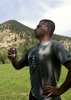
I finally dragged into the parking area at 2:30 p.m. I was spent. So it was off to The Grotto Cafe, in Cave Creek, for delicious bacon grilled cheese, southwestern soup and, of course, restorative beers. (Recommended by @LosDosSloFolks , who unfortunately could not join us.)

Rumble Video: https://rumble.com/v6s4l5h-hiking-cave- ... cross.html
Vimeo Video: https://vimeo.com/1075726095
wildflower observationwildflower observationwildflower observationwildflower observationwildflower observation
Wildflowers Observation Isolated
Near the ranch, red barberry, and some small purple flower I didn't want to get down for. Monkeyflower along moist, grassy, creeksides. Strawberry hedgehog and blue richie in saguaro zone. Mexican gold poppy. Lots of blooming ocotillo.
_____________________
http://prestonm.com : Everyone's enjoyment of the outdoors is different and should be equally honored.
  1 archive
Jan 08 2025
avatar

 Guides 2
 Routes 251
 Photos 4,593
 Triplogs 3,212

63 male
 Joined Feb 26 2008
 Scottsdale, AZ
Quien Sabe PeakPhoenix, AZ
Phoenix, AZ
Hiking avatar Jan 08 2025
BobPTriplogs 3,212
Hiking7.95 Miles 2,124 AEG
Hiking7.95 Miles   4 Hrs   39 Mns   1.90 mph
2,124 ft AEG      28 Mns Break
 
1st trip
Partners none no partners
Route Scout Route Recorded  on Route Scout | Pop | Map | Popup | MapDEX
Started about 915ish in sub 50 degree weather. The high at the end was 58. The hike starts on trail 4 then crosses the road and the creek and then becomes a dirt road. I left the road headed towards the spring and stayed in the drainage for awhile. It was good until it wasn't. I headed out of the drainage and looked for a ridge to the cool peak. I love cows for many reasons but today because they opened up some pathways. There were also some game trails. The last climb up to QSM was so windy, I needed to take my hat off or risk losing it. The route off QSM was filled with shrubbery but not much catclaw. My hiking pole was my best friend today! My phone battery died a little before the end but RS saved everything up to then. Fun day!

water 1 out of 5water less than maxwater less than maxwater less than max Quien Sabe Spring Dripping Dripping
The box was about 3/4 full
_____________________
https://www.seeitourway.org
Always pronounce Egeszsegedre properly......
If you like this triplog you must be a friend of BrunoP
 
Oct 26 2024
avatar

 Guides 2
 Routes 267
 Photos 9,816
 Triplogs 402

62 male
 Joined Dec 02 2014
 Mesa, AZ
Cave Creek Trail #4Phoenix, AZ
Phoenix, AZ
Hiking avatar Oct 26 2024
adillingTriplogs 402
Hiking11.03 Miles 1,129 AEG
Hiking11.03 Miles   5 Hrs   51 Mns   2.04 mph
1,129 ft AEG      26 Mns Break
 
1st trip
Linked   linked  
Partners partners
DarthStiller
Route Scout Route Recorded  on Route Scout | Pop | Map | Popup | MapDEX
Chris invited me to hit a couple of trails in the Seven Springs area. I haven’t been up in this area since the 1990’s.

We arrived right after sunrise and my truck’s dash was showing 41 degrees.

Chris wanted to hike from the Cave Creek trail over to the Cottonwood Trail and try to finish off the section he missed the week before. He came from the other direction and the trail was hard to follow. We hiked down to the creek, crossed and made it up the Skunk Tank/Cottonwood junction.

The trail was not “groomed”, but it was fairly clear. It looks like the official route for that one has been reclaimed by Mother Nature. The trail we followed was higher up on the ridge and stayed out of the wash. We hiked down about 1.5 miles before we turned around and headed back to the Cave Creek Trail.

The Cave Creek Trail follows Cave Creek right along the banks and then higher up when it gets further in. The riparian area was really nice. Lots of shady sections, water pools and some autumn leaves starting up on the cottonwoods and sycamores.

As it climbs out of shady creekside area, it started looking like I was hiking in the Superstitions. Saguaros started appearing and the creek became a canyon. We came across the only other humans we encountered as we climbed down to the creek.

Chris pointed out a cool crested saguaro right after we crossed the creek. Looks like the elements got it a little as one of the crested arms had fallen off. We hiked down another mile or two before we stopped for a snack break.

Hiking back, I could feel the heat and was longing for that 41 degrees we had at the start. When we got back to the trailhead it was showing 91 degrees on the dash, a 50 degrees difference!
This area is really nice, especially along the creek. I will have to come back when the water is flowing. Thanks for the invite Chris.
_____________________
"Jobs fill your pockets, adventures fill your soul."

instagram: @andydilling
 
Oct 26 2024
avatar

 Guides 27
 Routes 669
 Photos 12,096
 Triplogs 856

56 male
 Joined Jul 05 2006
 Mesa, AZ
Cave Creek Trail #4Phoenix, AZ
Phoenix, AZ
Hiking avatar Oct 26 2024
DarthStillerTriplogs 856
Hiking10.90 Miles 1,427 AEG
Hiking10.90 Miles
1,427 ft AEG
 
Linked   linked  
Partners partners
adilling
It was a pretty chilly start, colder than the previous week at the same TH. Once the sun hit, however, it ended up much hotter than the previous week. I wanted to start out by hiking the north end of the Cottonwood Trail because when I did it last time a few years ago, it faded away and I couldn't find where it joined the Skunk Tank Trail. I expected we would go a half mile past the junction to where I kept the end of that track. Instead, as we approached that area, where we were was significantly far off from the official track. We hiked almost an extra mile to where our position matched the official track, and at that point it was very visible that the trail splits there. There is a plastic "247" marker, but the rerouted section of the trail looks less developed than the older abandoned section at that point. the new trail ascends as you go northbound, and the older trail descends into the wash and is much wider. Mystery solved.

that first part of the hike was mostly in the shade. As we got back to the north end of it, we were out in the sun. Along the first mile back on the Cave Creek Trail, we were in the shade of the trees, but then as the trail ascends after it crosses the creek, it was sun the rest of the day.

All the trails here are significantly rocky, which took its toll on my feet. The views inside the narrow canyon part of Cave Creek are very nice, but the climbs and descents on the ankle breakers made for slow going. We spotted the crested saguaro in this section of the trail, and half of the crest has fallen off.

We stopped at the creek crossing right before the Skunk Tank and took a break. Made our way back slowly as the temperature began to climb. We went up this way to try to escape the heat for this weekend and kind of did, kind of didn't.
_____________________
 
Dec 25 2023
avatar

 Routes 70
 Photos 3,081
 Triplogs 601

70 male
 Joined Feb 10 2019
 Cave Creek, AZ
Trail 1533 Loop TNF, AZ 
Trail 1533 Loop TNF, AZ
 
Hiking avatar Dec 25 2023
LosDosSloFolksTriplogs 601
Hiking6.79 Miles 897 AEG
Hiking6.79 Miles   3 Hrs   22 Mns   2.18 mph
897 ft AEG      15 Mns Break6 LBS Pack
 
Partners none no partners
Christmas morning hike. I had to get out of the house today to stay sane. CCW double lasso loop close to home that has good vistas and a show of fall color. The high point has a nice rock ledge overlook with great views. It was always a favorite of Cathy's. :)

1533 is actually a forest road but I refer to it as a trail since it is 95% single track. The Forest Service has awarded a new 10 year grazing contract to someone and the trail has been udderly destroyed by the cows. Pardon the pun. Not to mention all the nice smooshy cairns that are now all over the place.

Still a fun hike but the tread is treacherous. Had the trails to myself and didn't see anyone until a got back in on the Metate Trail close to the parking lot. Saw a handful of people gold panning at the first crossing as I was finishing up. I doubt that it is allowed but I hope they struck it rich on Christmas. The parking area for The Jewel of the Creek was an absolute cluster wad as I drove out. There were maybe 25 cars vying for 12 spots. Cue the Benny Hill music. :lol: Huge lot just 300 yards to the north.
Merry Christmas to everyone!
 Flora
 Flora [ checklist ]
[ checklist ]  Arizona Sycamore
 Meteorology
 Meteorology [ checklist ]
[ checklist ]  Autumn - Color Foliage
foliage observationfoliage observationfoliage observationfoliage observationfoliage observation
Autumn Foliage Observation Substantial
Substantial as far as Cottonwoods and Sycamores go.

water 1 out of 5water less than maxwater less than maxwater less than max Cave Creek - SPRCA Pools to trickle Pools to trickle

water 1 out of 5water 2 out of 5water 3 out of 5water 4 out of 5 Metate Pond 76-100% full 76-100% full
_____________________
"If you wait, all that happens is you get older"
  1 archive
Nov 22 2023
avatar

 Routes 70
 Photos 3,081
 Triplogs 601

70 male
 Joined Feb 10 2019
 Cave Creek, AZ
Trail #4 from Seven Springs, AZ 
Trail #4 from Seven Springs, AZ
 
Hiking avatar Nov 22 2023
LosDosSloFolksTriplogs 601
Hiking5.31 Miles 448 AEG
Hiking5.31 Miles
448 ft AEG6 LBS Pack
 
Linked   linked  
Partners none no partners
Route Scout Route Recorded  on Route Scout | Pop | Map | Popup | MapDEX
I saw a couple of recent posts on HAZ showing the autumn colors up at Seven Springs so I drove up this morning to take it in before it went away. Mixed bag as some areas were past prime and some were still green. Plenty of orange Sycamores and yellow Cottonwoods and Willows to make the trip worthwhile though. Temps were perfect and Seven Springs road was in great shape albeit very dusty. The best part was hiking through all the leaf litter and watching it fall like snow. Good flow in the creek made for an enjoyable morning. Happy Thanksgiving to all. :)
 Fauna
 Fauna [ checklist ]
[ checklist ]  Cow
 Named place
 Named place [ checklist ]
[ checklist ]  Humboldt Mountain
foliage observationfoliage observationfoliage observationfoliage observationfoliage observation
Autumn Foliage Observation Moderate

water 1 out of 5water 2 out of 5water 3 out of 5water less than max Cave Creek West of Seven Springs Medium flow Medium flow

water 1 out of 5water 2 out of 5water less than maxwater less than max Seven Springs Wash Light flow Light flow
_____________________
"If you wait, all that happens is you get older"
 
Nov 18 2023
avatar

 Guides 37
 Routes 556
 Photos 10,872
 Triplogs 1,052

43 male
 Joined Jan 21 2013
 AZ
Cave Creek Trail #4Phoenix, AZ
Phoenix, AZ
Hiking avatar Nov 18 2023
FOTGTriplogs 1,052
Hiking15.68 Miles 2,338 AEG
Hiking15.68 Miles   7 Hrs   17 Mns   2.33 mph
2,338 ft AEG      33 Mns Break
 
Linked   linked  
Partners partners
chumley
John9L
We made a nice little loop in the northern CCRP on Saturday. We utilized Cave Creek Trail #4, Skunk Tank Trail #246 and an off-trail jaunt down Mattys Fork to connect our loop. Steady rain when we began, a lite drizzle for a few more miles, then a little 15 minute shower before the sun came out and conditions became downright pleasant. The cabin is no more and is well on its way to becoming a pile of junk in the forest. Similarly, the famed crested Saguaro along the Cave Creek Trail is down, but not entirely out, after shedding one of its heavy crested arms. Its still a nice crested, however, its certainly lost some of its mystique. Great day out overall and it was nice to get out with John and Chumley again. Its been awhile since I stretched my legs to the tune of 15 plus miles.
foliage observationfoliage observationfoliage observationfoliage observationfoliage observation
Autumn Foliage Observation Isolated
Nice color in some spots and in particular near the start, but still a lot of green down stream.
_____________________
  2 archives
Nov 18 2023
avatar

 Guides 94
 Routes 840
 Photos 22,055
 Triplogs 1,993

52 male
 Joined Sep 18 2002
 Tempe, AZ
Mattys Cave Creek Loop, AZ 
Mattys Cave Creek Loop, AZ
 
Hiking avatar Nov 18 2023
chumleyTriplogs 1,993
Hiking14.98 Miles 2,295 AEG
Hiking14.98 Miles   6 Hrs   56 Mns   2.33 mph
2,295 ft AEG      30 Mns Break
 no routes
1st trip
Partners partners
FOTG
John9L
We decided to get out and appreciate the weather, since you can hike on a dry sunny day any damn time you want here. It was raining so hard on the drive in that Rackensack Creek was unexpectedly flowing at the 24 crossing. Once on trail, steady rain eventually tapered off into occasional showers before stopping and turning into one of those sunny days we have plenty of.

Skunk Tank is a hella boring road walk. I forgot how long it is to get up and around. We decided to skip the side trip to the summit and headed south on QS250 until it crosses Mattys Fork. From here it was off-trail adventure. Occasional signs of an old route appeared on the banks but were overgrown. The rain made everything wet and hopping down the canyon bottom was the better option.

The old cabin lost its legs and will not remain standing much longer. Lee pushed for the western high route which led us far astray and got us into some tricky terrain getting back to the creek bottom. The lower half of Mattys is a bit more open than the upper half and travel was quicker here.

Back on CC4 we made good time heading upstream, enjoying the flowing water, and early fall colors, encountering a couple walking their horses through one of the rougher sections of trail -- the only people we saw all day.

Lee wandered around Ashdale in a figure-8 pattern to make sure he got the extra .02 miles to say he did 15 ;) A handful of deer were the wildlife highlights on the day. It's always a great day when you hike with somebody else who doesn't mind driving!
foliage observationfoliage observationfoliage observationfoliage observationfoliage observation
Autumn Foliage Observation Isolated
Early colors getting started in the drainages with a stretch of pure gold near the ranch.
_____________________
I'm not sure what my spirit animal is, but I'm confident it has rabies.
  2 archives
Nov 17 2023
avatar

 Photos 115
 Triplogs 31

male
 Joined Sep 15 2020
 Phoenix, AZ
Cave Creek Trail #4Phoenix, AZ
Phoenix, AZ
Backpack avatar Nov 17 2023
xsproutxTriplogs 31
Backpack10.10 Miles 1,834 AEG
Backpack10.10 Miles
1,834 ft AEG
 no routes
1st trip
Linked   none no linked trail guides
Partners none no partners
Quick overnight trip to my normal spot on Cave Creek trail, looking to see how the leaves were looking, starting from the seven springs area. The road is never bad but has obviously seen recent grading and I don't think there was a single pothole or bump. I went to the area last year and found this spot and ended up going once a month to document the changes in the creek/flora. With that said, my first trip last year was not the right time; not a leaf to be found in a tree. This year, it was quite nice! I think i was still a week or two past prime but it's also a weird area where there are many trees that won't be prime for another week or two and many that are past... I need to research and learn more about the various species. Either way, spent a very pleasant night alongside the creek with a small rainstorm hitting around 0200. Around 0550 or so, it picked back up again and continued with various intensity until around 1000. I had stuff downloaded from netflix and no plans, so I just relaxed in my tent until it stopped which was early enough to meet my wife for a late lunch at Local Johnnys in Cave Creek. Overall, nice for the first backpack of the season in the lower desert and I've enjoyed documenting the same campsite month after month.

water 1 out of 5water 2 out of 5water 3 out of 5water less than max Big Maggie May Medium flow Medium flow

water 1 out of 5water 2 out of 5water 3 out of 5water less than max Seven Springs Wash Medium flow Medium flow

water 1 out of 5water 2 out of 5water 3 out of 5water less than max Seven Springs Wash Medium flow Medium flow
  4 archives
Aug 06 2023
avatar

 Guides 1
 Routes 226
 Photos 1,675
 Triplogs 1,867

65 male
 Joined Oct 17 2008
 Phoenix, AZ
Skunk Tank Trail #246Phoenix, AZ
Phoenix, AZ
Hiking avatar Aug 06 2023
rcorfmanTriplogs 1,867
Hiking14.77 Miles 2,399 AEG
Hiking14.77 Miles   8 Hrs   21 Mns   2.01 mph
2,399 ft AEG   1 Hour    Break
 
no photosets
1st trip
Linked   linked  
Partners none no partners
Went out with a friend to find four geocaches hidden in May that had yet to be found. We started at the Seven Springs trailhead and took trail 4 to trail 246 and followed it up to around where the Quien Sabe trail starts. We hoped to make a loop of it, but there was an issue with one of the caches that we were able to resolve at our turn around point where we had just enough cell service to send and receive texts. So instead of the loop, we made the trip an out and back.

It was almost cold when we started at 6:00 AM with my truck's thermometer showing only 63 degrees. It was actually pretty nice all the way out but was getting hot on the descent back to trail 4. There was a bulldozer at Skunk Tank where a lot of work was being done to the tank. There was no water in it whatsoever.

My pack was heavier than normal at the start with 3L of water, 20oz of Gatorade and a beer. There was a really nice shady tree shortly before our turn around point where we stopped and had our beers and listened to AC/DC (the theme of the geocaches).

The few miles on trail 4 from Seven Springs go along a creek that had intermittent flow and a lot of shade. On the way back, we stopped to mix up some Gatorade, as I had brought my filter. We both needed that. I probably had one sip left and the man I was with didn't have much more. I'm really glad I thought to bring the filter as it would have been very unpleasant finishing the hike without it as we both would have been dry and it was probably around 100 degrees then.
_____________________
Go find a LonelyCache
 
May 14 2023
avatar

 Guides 10
 Routes 673
 Photos 7,281
 Triplogs 4,660

67 female
 Joined Nov 17 2008
 phoenix, az
Cave Creek Trail #4Phoenix, AZ
Phoenix, AZ
Hiking avatar May 14 2023
trekkin_geckoTriplogs 4,660
Hiking11.68 Miles 1,349 AEG
Hiking11.68 Miles   4 Hrs   27 Mns   2.75 mph
1,349 ft AEG      12 Mns Break
 
Partners partners
johnlp
Route Scout Route Recorded  on Route Scout | Pop | Map | Popup | MapDEX
we wanted a hike near cave creek so john picked out the [ Cave Creek Indian Ruins at Chalk Canyon ]
set out around 0520 or so on spur cross trail, then cave creek trail
everything past the 1533 turnoff at the gate was new to me
we had shade for the first few miles, pleasant temps and a nice breeze which helped keep the gnats at bay
there is a large cairn at the turn west to the ruins
given the amount of foxtails and other types of stickers, we decided not to cross the mesa
instead, we continued north on cave creek trail for awhile and then retraced our steps
there were enough stickers to pick out of our shoes and socks just from the trail
also an annoying number of gnats
we took the metate trail on the return and started seeing a few people
still a good hike, but we'd like to go back for the ruins, petroglyphs and the ranch
the highlight of the trip was seeing a rattlesnake and a gila monster
after the hike we had a great visit with cathy and greg, aka @losdosslofolks
followed by brunch at the brass rail
pretty nice morning :) thanks, john
_____________________
hazhole
  1 archive
May 14 2023
avatar

 Guides 1
 Routes 14
 Photos 7,202
 Triplogs 5,208

68 male
 Joined Mar 16 2008
 chandler,az
Cave Creek Trail #4Phoenix, AZ
Phoenix, AZ
Hiking avatar May 14 2023
johnlpTriplogs 5,208
Hiking11.68 Miles 1,349 AEG
Hiking11.68 Miles   4 Hrs   27 Mns   2.75 mph
1,349 ft AEG      12 Mns Break
 no routes
1st trip
Partners partners
trekkin_gecko
Our initial plan was to hike one of two loops off of Cave Creek #4. Due to the tremendous amount of foxtail etc., we ended up just doing an in and out. The use trails down to the creek and ruins looked like murder.
The Good:
Nice scenery & weather, rattlesnake and gila monster sightings
The Bad:
Missed out on the ruins, petroglyphs, and ranch
The Ugly:
Foxtail and gnats.
After the hike we had a great visit with @losdosslofolks, followed by breakfast at the brass rail.
Very nice day. Thanks Kelly, Cathy and Greg. :)
 Fauna
 Fauna [ checklist ]
[ checklist ]  Rock Squirrel
wildflower observationwildflower observationwildflower observationwildflower observationwildflower observation
Wildflowers Observation Light
_____________________
“Good people drink good beer.” Hunter S Thompson
 
May 05 2023
avatar

 Guides 3
 Routes 632
 Photos 8,235
 Triplogs 604

54 male
 Joined Apr 13 2011
 Gilbert, AZ
Cave Creek Trail #4Phoenix, AZ
Phoenix, AZ
Backpack avatar May 05 2023
ddgrunningTriplogs 604
Backpack8.00 Miles 900 AEG
Backpack8.00 Miles2 Days         
900 ft AEG
 no routes
1st trip
Linked   none no linked trail guides
Partners none no partners
Took a group of youth on an overnight backpack to the area. I had scouted this out back in February, and wanted to return when there were leaves on the trees. It did not disappoint. The creek was lined with green foliage with birds chirping and spring life in abundance.

We arrived in the late afternoon and started from the Seven Springs TH, near the campground. Hiked in about 2.5 miles and enjoyed pleasant temperatures and a fine sunset along the way. Arrived at our camp just past dusk and camped about a 1/4 mile beyond the first creek crossing--a beautiful spot on a ledge overlooking the creek with a nice fire ring and makeshift chairs of logs.

The evening featured a full moon and fun times around the campfire.

The next morning, we left our backpacks and ventured another 1.5 miles downstream to the swimming hole, where we hung hammocks and cliff jumped into the pool, which at its deepest, was about 11 feet.

Some caught crawdads, which we brought back to camp and boiled up. Not much meat, but didn't taste too bad.

After lunch at camp, we packed up and hiked out, arriving at the TH in mid-afternoon. The weather was perfect.
_____________________
 
Mar 20 2023
avatar

 Routes 70
 Photos 3,081
 Triplogs 601

70 male
 Joined Feb 10 2019
 Cave Creek, AZ
Trail 1533 Loop TNF, AZ 
Trail 1533 Loop TNF, AZ
 
Hiking avatar Mar 20 2023
LosDosSloFolksTriplogs 601
Hiking6.93 Miles 897 AEG
Hiking6.93 Miles   3 Hrs   37 Mns   2.18 mph
897 ft AEG      26 Mns Break6 LBS Pack
 
Partners none no partners
Route Scout Route Recorded  on Route Scout | Pop | Map | Popup | MapDEX
This close to home double lasso loop hike is one of our favorites in the Tonto National Forest. Rain in the forecast over the next couple of days so today was the day. The creek was flowing strong and after the first few crossings out of Spur Cross I gave up trying to stay dry and just waded across on the remainder.

FR 1533 is a single track so I refer to it as a trail rather than a forest road. The northern sections have been decimated by newly introduced cattle. The Forest Service recently signed a new grazing lease with someone and the cows are really tearing things up. :( The lower areas south of the fence line are still in good shape. The horseback ride concessionaire has been doing some wonderful maintenence on Cottonwood Trail 247 so hopefully they find the time to give 1533 some much needed love.

Saw no hikers after leaving Spur Cross but ran into the unwashed masses on the Metate Trail towards the end of the hike. : wink :
wildflower observationwildflower observationwildflower observationwildflower observationwildflower observation
Wildflowers Observation Substantial
Lots of Lupine, Poppies, Fiddleneck. Scorpionweed,and Chuparosa. Brittlebush and Desert Globemallow soon to bloom.

water 1 out of 5water 2 out of 5water 3 out of 5water 4 out of 5 Cave Creek - SPRCA Heavy flow Heavy flow

water 1 out of 5water 2 out of 5water less than maxwater less than max Cottonwood Creek Light flow Light flow

water 1 out of 5water 2 out of 5water 3 out of 5water 4 out of 5 Metate Pond 76-100% full 76-100% full
_____________________
"If you wait, all that happens is you get older"
 
Feb 25 2023
avatar

 Guides 3
 Routes 632
 Photos 8,235
 Triplogs 604

54 male
 Joined Apr 13 2011
 Gilbert, AZ
Cave Creek / Skunk Tank LoopPhoenix, AZ
Phoenix, AZ
Hiking avatar Feb 25 2023
ddgrunningTriplogs 604
Hiking11.46 Miles 1,995 AEG
Hiking11.46 Miles   4 Hrs   42 Mns   2.59 mph
1,995 ft AEG      17 Mns Break
 
1st trip
Linked   linked  
Partners none no partners
Route Scout Route Recorded  on Route Scout | Pop | Map | Popup | MapDEX
Hadn't ever ventured up to this area. My assessement:

--Cave Creek trail: would be great in the spring/summer when there are leaves on the trees, and in the fall, when colors are popping. 2-3 nice swimming holes along the way, for warmer weather.

--Skunk Creek trail: the initial climb is a good workout with decent views, but from Skunk tank on, it's basically a somewhat drab road walk.

I off-trailed up to the Quien Sabe mine. Entrance imploded; not a lot to see.

The highlight of the hike for me was the impressive crested saguaro off the side of the trail on Cave Creek.
_____________________
 
Feb 04 2023
avatar

 Guides 27
 Routes 669
 Photos 12,096
 Triplogs 856

56 male
 Joined Jul 05 2006
 Mesa, AZ
Elephant Mountain Trail - Spur CrossPhoenix, AZ
Phoenix, AZ
Hiking avatar Feb 04 2023
DarthStillerTriplogs 856
Hiking10.22 Miles 2,043 AEG
Hiking10.22 Miles   5 Hrs   33 Mns   1.88 mph
2,043 ft AEG      6 Mns Break
 
Partners partners
mt98dew
I hadn't hiked the Elephant Mt. trail a good 20 years, and my memories were of it being extremely steep with very loose scree. This turned out to be much easier than I remember. Good idea to go back to trails after so many years (decades?) to refresh your memory.

I met Brian at the Spur Cross TH at about 6:30am. It was still very dark and just windy enough to want to wear gloves, which I took off after a half mile, as usual. We did a clockwise loop from Spur Cross on the Spur Cross Trail to Elephant Mt, then Limestone to Cave Creek and back to the TH. On the way out to the bottom of the Elephant Mt trail, we met several trail runners who were running the Aravaipa race that day, which was either a 50 or 35 MILE route from the CCRA. :o

At the saddle of the Elephant Mt Trail we took the "closed area" spur to the lower peak and checked out the views and the ruins. The views there were the highlight of the day. From that peak there were good views to check the route to the Elephant Mt summit, which looked doable, although still challenging. the visible trail at the bottom was encouraging. 20 years ago I don't know that any of these trails or routes existed, but I may have easily missed them if they were there as I was a novice then.

Once we got down off Elephant Mt we headed out on the Limestone Trail which we almost immediately regretted since it's so rocky and slow going. the further we got along, the more I remembered from my previous hikes the last 4 years. My main takeaway was that I knew why I decided to do this route clockwise so that we weren't burnt out by the time we got to the base of Elephant Mt.

We only saw 2 hikers on Limestone, a couple with their dog who were from out of state visiting. On the Cave creek trail on the way back we ran into several people, many of whom asked for directions to the trails they wanted to get to. It was very strange that the temperature along the Cave Creek Trail seemed cooler than the higher elevations on the Limestone.

We finished up around noon and I had lunch at the picnic tables there before I headed out. Very nice weather for the day and very cool to check out an area I had never been to before.
_____________________
  2 archives
Jan 11 2023
avatar

 Routes 70
 Photos 3,081
 Triplogs 601

70 male
 Joined Feb 10 2019
 Cave Creek, AZ
Trail #4 from Seven Springs, AZ 
Trail #4 from Seven Springs, AZ
 
Hiking avatar Jan 11 2023
LosDosSloFolksTriplogs 601
Hiking5.96 Miles 536 AEG
Hiking5.96 Miles
536 ft AEG4 LBS Pack
 
Linked   linked  
Partners none no partners
Route Scout Route Recorded  on Route Scout | Pop | Map | Popup | MapDEX
This trip started out to be an out and back on Trail #245 from the Bronco TH on Seven Springs Road. When we arrived we saw that the area was still looking like a bit of a moonscape from the Cave Creek Complex fire back in 2005. Seven Springs Rd. was in the best condition we've ever seen it and as a bonus there was no dust due to recent rains. We changed plans and headed north to the Cave Creek TH to put in some mileage on Trail #4.

This was a good decision as it turned out to be one of the nicest out and back hikes we've ever done this close to home. Even with all the Sycamores and Cottonwoods being dormant the riparian bosque areas were gems. Many sections in the first 3 miles of this trail remind me of a mix of the Salida Gulch Trail outside of Prescott and the Hassayampa River preserve.
Cave Creek was running strong but we had no trouble at the crossings. The CFM picked up as we got farther from the TH, likely due to the influx from Quien Sabe and Big Maggie May creeks.

Our new goal was to make our turnaround point at the crested saguaro about 3.5 miles out. Cathy took a bad fall at the 3 mile mark due to stepping on a shoelace that had come untied. She received a nasty gash on her forearm from hitting the only rock around on her way down. Her blood platelet levels are still low due to her bone marrow transplant so we quickly ran out of all the bandages we had with us. The bleeding subsided enough to start the hike back out.

We made OK time back to the TH and had the added excitement of be strafed twice by a couple of very loud and low flying fighter jets. We drove back into town to the new Abrazo Cave Creek Hospital on Carefree Highway. I've included a couple of photos from the ER at the end of the photoset. View with caution. As Hazel always tells us..."Be careful, it is a jungle out there".
 Geology
 Geology [ checklist ]
[ checklist ]  Unidentified Geology
 Culture
 Culture [ checklist ]
[ checklist ]  HAZ - Hike HAZard
 Named place
 Named place [ checklist ]
[ checklist ]  Humboldt Mountain

water 1 out of 5water 2 out of 5water 3 out of 5water less than max Cave Creek West of Seven Springs Medium flow Medium flow

water 1 out of 5water 2 out of 5water less than maxwater less than max Seven Springs Wash Light flow Light flow
_____________________
"If you wait, all that happens is you get older"
 
Oct 29 2022
avatar

 Guides 27
 Routes 669
 Photos 12,096
 Triplogs 856

56 male
 Joined Jul 05 2006
 Mesa, AZ
Cottonwood Spring Loop - Cave CreekPhoenix, AZ
Phoenix, AZ
Hiking avatar Oct 29 2022
DarthStillerTriplogs 856
Hiking10.08 Miles 1,861 AEG
Hiking10.08 Miles   5 Hrs      2.02 mph
1,861 ft AEG      1 Min Break
 
Partners none no partners
got started from Spur Cross after 6am. did the lasso counter clockwise. 247A is rougher than I remember it. Definitely moved slower along that trail mainly due to how rocky it is. It's faint in some spots, but still fairly easy to find.

the huge crested saguaro below 247 in the wash looks like it might be sick or dying. Looks like it's seen better days. the westernmost section of 247 I hadn't hiked in over 12 years, so it was like a new hike again to do that section.

saw a trail maintenance crew on 247 a mile or so east of the junction with the Cave Creek Trail. After that I began to see other hikers. Took Metate back instead of Spur Cross. The closer I got to the TH, the more hikers there were.

ended up doing 10 miles. Weather was cool and windy early on. got warmer once the sun hit, but not hot. Kept my sweatshirt on the whole time and didn't feel overheated.
_____________________
 
May 07 2022
avatar

 Routes 39
 Photos 64
 Triplogs 42

58 male
 Joined Mar 29 2015
 Chandler, AZ
skull mesa hike May '22, AZ 
skull mesa hike May '22, AZ
 
Hiking avatar May 07 2022
AndrewrdcTriplogs 42
Hiking12.83 Miles 2,970 AEG
Hiking12.83 Miles   6 Hrs   7 Mns   2.27 mph
2,970 ft AEG      28 Mns Break10 LBS Pack
 
1st trip
Partners none no partners
Great solo hike up to Skull Mesa! This was my first time hiking in this area just north of Cave Creek. First thing to know is that in order to access this area from the south, the trailhead begins at the Spur Cross Ranch Conservation. This gives you an additional 2-mile hike along an old jeep trail before reaching the Cottonwood trail or the Cave Creek #4 trailheads. At this entrance, there is a $3 fee (cash only!) paid via envelopes and an honor system but the fee is well worth it as the rangers do an amazing job managing the trails and park area! OK... lets get to the hike: I started hike at about 7:15am on a Saturday... as mentioned the first 2-miles or so is along Spur Cross trail... about half way along, you will leave the conservancy land and enter National Forest. This is an old Jeep trail that quickly becomes a nice, easy and well maintained trail. Once you get to the Cottonwood trail, the fun begins. Over the next 3 miles, total AEG is only about 700', and the trail is easy to follow, though its definitely rocky and undulating. This was, for me, a very enjoyable trail... great hiking with total solitude. At about the 5 mile mark, you get to a fence (see pic) and your opportunity to head north (and UP) along Skull Mesa Trail (#248) to ascend to the top of Skull Mesa. I must admit, I stood there for a few minutes contemplating my options. The mesa is high and intimidating... 1,000' up over a single mile This is where your training and cardio will kick in. During my contemplation, along came the first other hiker I had seen all morning... Mark and I chatted for a few minutes and (maybe out of shame) I made my decision and started up Skull Mesa trail. This trail is not quite as clear but easy enough to follow if you pay attention. Yes, it is a tough assent, but elevation was gained quickly so it was actually not as difficult as it looked. Reaching the top of Skull Mesa is well worth it... amazing views in almost any direction and I even found a little shade to sit and have lunch (pic). After about :30 min of R&R and realizing that it was going to be approaching 100 degrees by the time I got back to my car... I started my descent.

Unfortunately, all the creeks and marked water sources were bone dry except for one area (ironically, unmarked) along cave creek just before Cottowood trailhead where there was still a large shallow accumulation of water in the wash (pic)... unfortunately, I dont expect anything will be left in a week or two.

All in all, this is a hike well worth doing but, at 12 miles, definitely requires a level of physical fitness. Plus, during the entire hike, I only ran into two other hikers. While this gave me the solitude I was looking for, I do not recommend for anything but a seasoned hiker that knows their limitations and (if solo) brings some sort of emergency beacon... just in case.

Andrew
 Culture
 Culture [ checklist ]
[ checklist ]  HAZ - Selfie
_____________________
  3 archives
average hiking speed 2.25 mph
1, 2, 3, 4, 5 ... 12  Next

WARNING! Hiking and outdoor related sports can be dangerous. Be responsible and prepare for the trip. Study the area you are entering and plan accordingly. Dress for the current and unexpected weather changes. Take plenty of water. Never go alone. Make an itinerary with your plan(s), route(s), destination(s) and expected return time. Give your itinerary to trusted family and/or friends.

helpcommentissue

end of page marker