username
X
password
register
for free!
help
ArticlesGuidesRoutes
 
Photosets
 
 Comments
triplogs   photosets   labels comments more
Butterfield / Pedersen / Coldwater Loop - 3 members in 8 triplogs have rated this an average 2 ( 1 to 5 best )
8 triplogs
login for filter options
Feb 25 2018
avatar

 Guides 27
 Routes 669
 Photos 12,096
 Triplogs 856

56 male
 Joined Jul 05 2006
 Mesa, AZ
Butterfield / Pedersen / Coldwater LoopPhoenix, AZ
Phoenix, AZ
Hiking avatar Feb 25 2018
DarthStillerTriplogs 856
Hiking15.30 Miles 1,195 AEG
Hiking15.30 Miles   6 Hrs      2.55 mph
1,195 ft AEG
 
1st trip
My daughter's friend at school scored them and my wife and son tickets for Hamilton at ASU. Between that and the cooler weather in the desert now, this was the perfect opportunity to knock out this longer trail in the Estrellas. I hiked this once before nearly 16 years ago, but I can barely remember it at all. I think I did the loop counter-clockwise last time, but I'm not sure. This time I did it clockwise, noting that the last 2 miles would be an easy downgrade on the service road that serves as the Coldwater Trail.

Got started just after 6:30am, with just enough light to not need a headlamp. The first mile was chilly enough to need gloves and my hoodie up. Once the sun hit the horizon and the blood got flowing from the slight uphill grade, the hoodie came off quickly.

The Pedersen Trail starts to get interesting as it nears the Estrella Mountains. Lots of wash crossings on that east part of the loop, making for most of the AEG on this hike. Surprising how deep and wide some of the washes are here, but it is near the mountain, so I guess not so much.

The southernmost part of the loop where the Pedersen Trail runs east and west actually have better views than I expected, although the trail itself is just a service road that's so sandy it's like walking in a wash. I walked the edges of it for nearly 2 miles before I finally just got off trail on the north side, where it looked like mountain bikers and horse riders had done the same thing. It's the first time I can remember that hiking off trail was actually easier than hiking on the actual designated trail. :-k

Took a lunch break just after the 10 mile mark under the shade of a mesquite tree. It was interesting how quickly it got cool sitting in the shade and not moving. That normally happens at higher elevations. Nice to have that kind of weather in a Sonoran environment, even briefly.

Saw the first people just after lunch, 2 mountain bikers. After that I saw 2 trail runners and some hikers in the distance I neared the trailhead where you can see the other trails since they're so close.

Finished up about 1pm, 6 hours to hike over 15 miles.
_____________________
 
Jan 19 2018
avatar

 Guides 116
 Routes 337
 Photos 11,399
 Triplogs 894

63 male
 Joined Dec 20 2010
 Sunnyslope, PHX
Butterfield / Pedersen / Coldwater LoopPhoenix, AZ
Phoenix, AZ
Hiking avatar Jan 19 2018
kingsnakeTriplogs 894
Hiking15.79 Miles 1,022 AEG
Hiking15.79 Miles   5 Hrs   28 Mns   2.89 mph
1,022 ft AEG
 
The last time I hiked in Estrella Mountain Regional Park was six years ago. Other than Gadsden Trail being miles of deep, sandy, wash, Estrella’s trails were very mellow. Large mileage is available without doing an out & back, which I always try to avoid.

In 2011, took Gadsden Trail from Corgett Wash to Coldwater Trail. This time I did all of Pedersen Trail. (Three Es in the correct spelling.)

I ate breakfast at the Waffle House on Dysart, but still got to the trailhead before sunrise, which was typically Arizona awesome.

Throughout my hike, there were directional signs for a trail running ultramarathon. (The longer distances did five laps of this loop.) It made me think of “Signs”, by Five Man Electrical Band.

From Gadsden Trail, the stock cars at Phoenix International Raceway, five miles away, were clearly audible. And that was only one or two cars: Imagine if there were 43!

Pederson, south of Gadsden, has a TON of cholla, mostly teddy bear, though I also spotted some buckhorn. Six years ago, the cholla actually blocked the trail at points; now it is clear, except for the odd fallen ball.

After a long break at the far southeast corner of Pedersen -- 3 bar Verizon reception -- I continued west on Pedersen. Or just off it, in the desert, as the jeep trail was deep sand. I found one saguaro that was leaking so much sap it had a puddle at its base. Pretty cool.

At "155th Avenue" -- that is its real name -- I turned north, still on Pedersen. A mile up, I thought I saw a trailer, but it turned out to be large tent full of tables, chairs, cots, Coleman stoves, and two liter bottles of soda for the trail runners. Unfortunately, no beer. I took advantage of the shade, for my second break.

Just north of Corgett Wash, I could see I-10 against the White Tank Mountains.

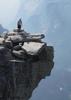
Still on Pedersen, just before the intersection with Toothaker Trail, there is an interesting out crop of white rocks. (Smaller white rocks are scattered all over the park.)

Lots of small planes overhead, taking off from and landing at Goodyear Airport, which is visible from the west flank of Knobb Hill on Coldwater Trail.

The trail runners had another support tent at the corral. While the day started out cool & breezy, it had become warm & sunny, so I took a short break in the shade. I only had a mile to go, but I earned it.

In 2011, I said this was a really boring loop. This time, it was not so bad. Mostly, I did it for the miles. I know it's not a lot for many folks on here, but I'm trying to get 100 miles for the month. :)

Hike Video: [ youtube video ]
 Meteorology
 Meteorology [ checklist ]
[ checklist ]  Sunburst  Sunrise
_____________________
http://prestonm.com : Everyone's enjoyment of the outdoors is different and should be equally honored.
 
Mar 14 2016
avatar

 Routes 14
 Photos 187
 Triplogs 17

49 female
 Joined Dec 26 2013
 Anthem, AZ
Butterfield / Pedersen / Coldwater LoopPhoenix, AZ
Phoenix, AZ
Hiking avatar Mar 14 2016
laissezfaireTriplogs 17
Hiking14.66 Miles 1,195 AEG
Hiking14.66 Miles
1,195 ft AEG
 
no photosets
1st trip
Linked   none no linked trail guides
Partners none no partners
A great long hike if your looking for distance without too much elevation change. Watch out for sand! A huge section of the hike is a completely sand road that is crazy difficult to hike through.
wildflower observationwildflower observationwildflower observationwildflower observationwildflower observation
Wildflowers Observation Light
_____________________
 
Dec 13 2014
avatar

 Photos 99
 Triplogs 872

male
 Joined Mar 18 2012
 Goodyear, AZ
Butterfield / Pedersen / Coldwater LoopPhoenix, AZ
Phoenix, AZ
Hiking avatar Dec 13 2014
MikeSTriplogs 872
Hiking15.80 Miles 899 AEG
Hiking15.80 Miles   3 Hrs   1 Min   5.42 mph
899 ft AEG      6 Mns Break
 no routesno photosets
1st trip
Parked at the arena and did Toothaker>Dysart>Butterfield>Gadsen>Pedersen>Homestead>Pedersen>Coldwater>Dysart>Toothaker. Only saw one other person. Great cool weather after the rain. Trying to get ready for Coldwater Rumble in 6 weeks but going twice as much as today is going to be a challenge.
_____________________
Subscribe to my adventure videos at: [ youtube video ]

Follow my adventures on Instagram at: adventures_az
 
Dec 29 2013
avatar

 Guides 9
 Routes 33
 Photos 780
 Triplogs 4,634

44 male
 Joined Nov 25 2008
 Scottsdale, AZ
Butterfield / Pedersen / Coldwater LoopPhoenix, AZ
Phoenix, AZ
Run/Jog avatar Dec 29 2013
BoonemanTriplogs 4,634
Run/Jog19.25 Miles 1,258 AEG
Run/Jog19.25 Miles   2 Hrs   54 Mns   6.64 mph
1,258 ft AEG
 no routesno photosets
1st trip
Arrick and I got together on the West side for a nice loop run in the Estrellas.
_____________________
 
Mar 02 2012
avatar

 Photos 47
 Triplogs 155

49 male
 Joined Apr 22 2008
 Goodyear
Butterfield / Pedersen / Coldwater LoopPhoenix, AZ
Phoenix, AZ
Hiking avatar Mar 02 2012
asu9165Triplogs 155
Hiking14.70 Miles 1,195 AEG
Hiking14.70 Miles   4 Hrs   28 Mns   3.35 mph
1,195 ft AEG      5 Mns Break
 no routesno photosets
1st trip
Linked   none no linked trail guides
Partners none no partners
Well finally did it. Want to get used to longer distances and this was in my area. I notice another trail towards the South of the Petersen which was unmarked. I think this will the the Estrella connector for the future Mountain Trail(Which is supposed to actually loop into the mountain)
_____________________
 
Nov 19 2011
avatar

 Guides 69
 Routes 37
 Photos 3,010
 Triplogs 2,387

55 male
 Joined Oct 24 2010
 Phoenix,Az
Dysart Trail - Estrella Mtn RPPhoenix, AZ
Phoenix, AZ
Hiking avatar Nov 19 2011
mt98dewTriplogs 2,387
Hiking5.47 Miles 920 AEG
Hiking5.47 Miles   1 Hour   14 Mns   4.44 mph
920 ft AEG
 no routes
Didn't have a lot of time, but I hadn't hiked in a couple of days so I NEEDED to do something. The Estrellas are relatively close to my abode and I'd never done the Dysart Trail in its entirety. (I'd done portions of it before. It is a great connector. Most trails out there go north-south, the Dysart goes east-west). I took the Rainbow trail in, which gave me some elevation. At about the 2 mile mark the Dysart trail appears. I took this east for about 2 miles where it ends at the Butterfield trail. Take this trail back to the parking lot and you've done a nice 5.5 mile loop :D
_____________________
 
Apr 30 2011
avatar

 Guides 116
 Routes 337
 Photos 11,399
 Triplogs 894

63 male
 Joined Dec 20 2010
 Sunnyslope, PHX
Butterfield / Pedersen / Coldwater LoopPhoenix, AZ
Phoenix, AZ
Hiking avatar Apr 30 2011
kingsnakeTriplogs 894
Hiking15.05 Miles 1,557 AEG
Hiking15.05 Miles   4 Hrs   57 Mns   3.04 mph
1,557 ft AEG
 
Linked   linked  
Partners none no partners
Did this last weekend, as I wanted to test myself at a longer distance. Mostly, it turned out to be a mental test, as Pedersen Trail is seriously boring. Like walking across the Sahara, minus the dunes. (And I've been there.) Saw my first on trail, non-rabbit, non-lizard, wildlife ... ever. Never have seen any critters, not even in Aravaipa. I saw a snake in the middle of "W. Queen Creek Rd." (See the trail description I just uploaded.) Was not paying attention as I was just putting one foot in front of the other ... whoa! What's that. Check the tail. No rattle. *whew* Some kind of garter snake. Definitely not a kingsnake. I would recognize one of those. ;) Found a .22 rimfire casing, a 12 gauge casing, and -- most a rare -- a 30-30 casing. To keep myself entertained, on this slog, I speculated on what a 30-30 might do to various small critters. I was keeping detail split times on my paper map, but managed to lose that half way up Coldwater, with maybe a mile left in the hike. Back tracked a few hundred yards before coming to my senses, then continuing on.
 Flora
 Flora [ checklist ]
[ checklist ]  Desert Ironwood
_____________________
http://prestonm.com : Everyone's enjoyment of the outdoors is different and should be equally honored.
 
average hiking speed 2.72 mph

WARNING! Hiking and outdoor related sports can be dangerous. Be responsible and prepare for the trip. Study the area you are entering and plan accordingly. Dress for the current and unexpected weather changes. Take plenty of water. Never go alone. Make an itinerary with your plan(s), route(s), destination(s) and expected return time. Give your itinerary to trusted family and/or friends.

helpcommentissue

end of page marker