|
| | | Boulder Bobs Cabin and a mine, AZ | | | |
|
|
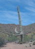
Boulder Bobs Cabin and a mine, AZ
| | |
| |
|
| Hiking | 10.48 Miles |
1,628 AEG |
| | Hiking | 10.48 Miles | 5 Hrs 15 Mns | | 2.43 mph |
| 1,628 ft AEG | 56 Mns Break | | | |
|
|
| | | Another New Years Eve hike and all sorts of fun hikers in the group this year, plus Bruce. Some new territory for me, which was a bonus.
Cool temps as we headed out from the Bushnell Tanks TH and hopped onto a segment of the AZT. Easy hiking, with nice views. Wally pointed out Mt Ord off to our left. The offtrail was our biggest climb of the day, but the route was better than anticipated. Enough catclaw to grab your attention (and clothing, long pants were helpful), but nothing terrible. I brought clippers just in case, but they really weren’t needed, although Dave used them to widen the path for the shorts wearing crowd. Lots of quartz dotted the ground.
Quick break at the saddle, then we descended the other side in search of the no longer there cabin. Some of us spotted a chimney to the left, but we continued on to the area a bit farther that was marked as the cabin location. Some terraced paths above the creekbed, and an old wall with a window remained. There was a spot with barbed wire and rock that looked like an old corral or pen. Lots of rock was placed around this area, but nothing resembling a cabin. Boulder Bob was more like Bob the Builder given the amount of rock he moved around.
After some pics, we meandered over towards the rock chimney, passing an arrastra and more rock walls along the way. Johnlp found the cabin footprint just south of the chimney, including some of what was left of glass bottles mortared into the walls. From there, we took a slightly better route back up and over the saddle. Once back on the trail, we retraced our steps over to some abandoned cars, the decided to check out the mine.
The mines were a short detour south of our trail, following an old roadbed gently uphill. Most of the group went into the mine ahead of me. I’m generally very claustrophobic, so being last in and first out works well for me. The adit was tall enough to almost stand upright, and the first thing I noticed was how warm it was in there, which made me wonder what might be living in such a cozy place. As I caught up with the group, who had stopped maybe 100’ in, I heard what sounded like running water. A split second later, I realized it was a rattlesnake I was hearing, and that’s why everyone had stopped. After seeing its eyes reflecting off someone’s light, I said a few choice words and turned right around. Once out of the mine, JJ said it was a huge dback. On our way back to the main trail, Johnlp looked at another adit Denny & I had noticed higher on the hill, and JJ walked up some of the higher road.
The rest of us continued up the planned route on an old, eroded road then dropped down to a corral on FR22 which looked to still be in use. From there, it was an easy road walk back to the trailhead, passing tons of huge sycamore trees. A couple of easy creek crossings along the way. Saw two other hikers and their chonky blue heeler.
Fun day with some nice territory. Great conversation within the group and it was good to see everyone again. Thank you to Bruce & Denny for organizing and for the invitation. |
|
Autumn Foliage Observation Isolated
|
|
| _____________________
| Stop crying and just go do the hike. |
| | |
|
|
|
 Route Editor


 . It was a great group and a very enjoyable outing!! Nice one to end the year!!Thanks everyone! Like HAZ, you rock!! Happy New Year to all the Hazers, family and friends!!


 The area is now heavily grazed with a lot of cattle. I'm not sure it helps the "Vegetation rehabilitation" per TNF special order 12-216