|
| | | |
| |
|
| Backpack | 7.30 Miles |
1,400 AEG |
| | Backpack | 7.30 Miles | 2 Days | | |
| 1,400 ft AEG | | 38 LBS Pack | | |
|
|
| |
| Partners |
|
none
[ show ]
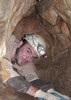
| no partners | | My wife and I did the Dorsey/Kelsy Winter/Hog Hill loop as a one night backpack, staying at Winter Cabin for the night. The roads (FR 231 and 538)to the TH were passable by any passenger vehicle- we took our minivan that bottoms out with about 4" of clearance. We did have to stop about .25 miles before the TH because where you turn off 538 onto 538E is surely high clearance. No biggie though. The trail down to Dorsey Spring is steep and rocky. This trail is fairly scenic, as you pass through ponderosa forest and gambel oaks. You do not get any big views of sycamore. If I rated this trail alone, it would be a 2 or 3. dorsey Spring is nice- several gallons per minute on this trip were flowing out of the pipe. We had lunch there and saw a gopher snake. Or rather, I stepped over a gopher snake and my wife leaped over it and showed me it was there. 
We got a bit turned around searching for the Kelsey Winter Trail, but figured it out- you go to the right at the spring and through the campground area before you get to the intersection. This section of the trail was pretty crummy. There are a little bit of up and down sections, and then you get to the exposed section where it it pretty overgrown with locust and other grabby shrubs. Plus, there's no shade in sight. It was a pretty hot day, about 90 and this section stunk. You go over several rockslide areas as well. Not very exciting. This is also the only realy area where you get big canyon views, which isn't great when you're running for shade. When you get up into the Winter Cabin area the forest closes in and it is nice and shady again. This section of trail gets a 1 rating from me.
The Winter Cabin area is ok. The cabin is in bad shape and the camping area was a mess when we got there. I would expect an area that is that secluded to be in more pristine shape, but there was lots of litter that I cleaned up. Bear hunters were out en masse, which made for some consternation on my wife's part, as this was her first backpack trip. The Cabin Spring was seeping out of the ground and had a few bigger pools for filtering from, and cooling off the feet. Our night was peaceful and not a bear or even chipmunk visited us.
The Hog Hill trail was a leg burner for the first .3 miles, then it was a steady uphill for awhile. This trail is very faint in many areas and we were saved by flagging and cairns on a few occasions. This trail ascends into some more open areas of juniper forest and would be very hot in midday. There were many Elk prints along the trail, but we didn't see the real thing, again- there were hunters out. This trail also gets a 2 rating from me. Not much to see, and the condition it was in was pretty rough. I won't come back here, there are many more places I'd rather visit that take less effort to get to and have more to offer. Some other hikers mentioned that the Kelsy/Dorsey loop is the way to go- it's a bit shorter but nicer. Take that as you will. |
 |
Dorsey Spring |
Gallon + per minute |
Gallon + per minute |
| | | Seems likely to flow year round. |
 |
Winter Cabin Spring |
Dripping |
Dripping |
| | | Water seeping from the ground into 2 moderate pools 2' deep. The trough is full of silt and doesn't have water in it- more of a garden now. | | _____________________
| | |
|
|
|
 Route Editor


 .Thanks for the adventure Joe,Wally and Bruce!Good times