|
| | | Eastern Superstitions Tramp, AZ | | | |
|
|
Eastern Superstitions Tramp, AZ
| | |
| |
|
| Backpack | 39.00 Miles |
9,500 AEG |
| | Backpack | 39.00 Miles | 6 Days | | |
| 9,500 ft AEG | | | | |
|
|
| |
| Partners |
|
none
[ show ]
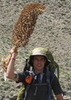
| no partners | | | Best spring break ever! Started late Sunday afternoon from Reavis 109 north, went down to the falls and camped until Tuesday.. I then headed over to plow springs which is flowing at just over a quart per minute.. Met a fellow HAZ'er Jay, or brougham86 and chilled with him for a few minutes, then he made his way over to Reavis ranch.. The next day, Wednesday I made my way down into paradise canyon along frog tanks trail- which was flowing as well at many points- and then over to angel basin and up to the ruins and then along rogers canyon (h20 flowing for most the way down to angel basin) where I met another HAZ'er Mitch and his 2 sons, had a nice chat then headed up to the Reavis 109 and along that for maybe a half mile where I bivvey'ed literally next to the trail as it was getting dark and there was a pool of water, and as it ended up being the only one until Reavis.. My dog nearly ate a group of hikers at about 1am after startling us from our sleep coming down the trail, I wouldnt have blamed her for doing so.. after getting some sleep I woke up and headed up to Reavis ranch Thursday morning and made really good time in getting there.. There was a large group of people with dogs and horses at the main camp spot in the center of the valley, very nice people I talked to for quite a while as the dogs got to know each other.. After setting up my camp and returning to talk to the group and let the dogs romp I was surprised to look down the trail to see my dad and sister, dog in tow, heading towards us.. What a great surprise to spend the last night with familiar faces by the fire. Friday the group with horses and about 6 dogs took off up Reavis gap at about 9am, well about an hour later one of their pointers came running down from Reavis 109 looking for the group.. He had apparently thought they were going that way and gone off ahead of the group as I guess he normally does.. Well I spent about 30 minutes chasing the damn bird dog around Reavis valley until I finally got a hand on his pack, I decided right then that until i get him into my truck I wasnt letting go of this wild-man.. With an unwilling dog on leash on my dog following behind I literally drug the stubborn mule 9 miles out of Reavis and back to my truck at 109 north where I called the owner (thanks to his tags) and ended up meeting up with them at the silver spring store along the 188 where I returned a pooped dog, and a happy mom thanked me with cold beers and great food at the restaurant/bar.. I ended up meeting some really cool people on this trip and to be honest I least expected to take that away from such a long solo trip through remote wilderness.. My mileage and aeg is a rough guess from the beartooth map and info on haz, feel free to give me more correct value if that exists...? |
|
Wildflowers Observation Light
|
|
  |
Lime Mountain Spring |
Quart per minute |
Quart per minute |
| | | I didnt actually see the spring but the creek it feeds was flowing and there were some good deep pools as well.. |
|
Plow Saddle Springs |
Quart per minute |
Quart per minute |
| | | At least a quart per minute flow, but no deep pools.. More than filterable you just gotta look for spots.. |
|
Roger's Creek |
Light flow |
Light flow |
| | | Deep pools in spots, underground in others.. Flowing for the most part however.. |
|
Willow Creek |
Light flow |
Light flow |
| | | Pools in some spots, and a definite flow for most sections of the creek near the trail.. | | _____________________
"Rather love, than money, than fame, give me truth."
-Henry David Thoreau |
| | |
|
|
|
 Route Editor


 . This was going to be a long trudge. I was discouraged since the last time I came out of the falls trail, I didn't have to stop a single time before hitting 109. Now I was dragging myself from patch of shade to patch of shade. I was beginning to worry about making it back to the trailhead since we weren't even halfway done with our hike at that point. I finally started seeing 109 in the distance and it looked like the climb was coming to an end. I felt better about things and knew with the elevation and dropping sun that I would soon recover.


 I went down first and thankfully I was able to safely reach the bottom with a whole 2 feet of extra rope.
