|
| | | |
| |
|
| Hiking | 21.89 Miles |
4,299 AEG |
| | Hiking | 21.89 Miles | 10 Hrs 36 Mns | | 2.07 mph |
| 4,299 ft AEG | | | | |
|
|
| |
| Partners |
|
[ show ]
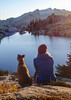
| partners | | One of my greatest days in the Superstitions. Met up with the guys at first light, 7am at First Water. Took Dutchman over toward Malapais, past Squaw Canyon over to Deering Canyon. Just after meeting Toughboots on the trail, we turned off-trail up Deering. It wasn't too bad at first, then it started getting a little tricky. When we reached the big boulder in the narrow opening of the canyon we realized that it wasn't a good idea to go any further. Large boulders were stacked there loosely, if one of them came loose we were writing the sequel to 127 Hours, so we gave up there. Appeared from signage to be a mine just above the spot where we were, would be interesting to drop down Deering from the top. We ended up deciding to follow around the shelf toward Squaw Canyon.
Up on the shelf we found the area Wally says was Crazy Jake's mining area in the 1980s, but some of the items we found pre-dated the 80s. Among the cans out there was a can of PREM Swift's Premium, which it looks like they stopped making in the 60s. We also found an old metal liquor canteen and two-burner Coleman Stove still sitting up there. Took the model number down and found out they started selling these in the late 1940s. Had lunch up there before heading down Squaw Canyon toward Cavalry Trail.
We then made our way to a spur trail along the east side of Battleship to LaBarge Box, which was awesome. Lots of water in the Supes today, and lots in the Box. Probably my favorite spot in the Supes! We then followed the creek up to see the Cave of the Spanish Cross, Aylor's Cabin, and Indian Paint Mine.
On our way back out, the guys lost me and I took a little detour up toward Cholla Tank...a little side excursion...don't ask if it was intentional, doesn't matter  . Almost made it to the tank before I realized it and made it back toward Second Water. . Almost made it to the tank before I realized it and made it back toward Second Water.
At the intersection of Second Water and Black Mesa Trail, we checked out the ruins there, then headed back to the car just before dark.
Thanks for the great trip Wally, you're becoming a regular Supes historian! Denny, great hiking with you as always...even though we didn't see a rattler this time |
| _____________________
| "I went to the woods because I wished to live deliberately, to front only the essential facts of life, and see if I could not learn what it had to teach, and not, when I came to die, discover that I had not lived." — Henry David Thoreau |
| | |
|
|
|
 Route Editor


 From the summit altar you can see Four Peaks, which is hidden to much of the valley. Obviously the canyon walls are higher and much can be seen from the perimeter areas. Also the sight line from the Stone Alter to Four Peaks coincidentally passes through the alleged Stone Idol.


