|
| | | |
| |
|
| Hiking | 12.18 Miles |
845 AEG |
| | Hiking | 12.18 Miles | 4 Hrs 54 Mns | | 2.49 mph |
| 845 ft AEG | | | | |
|
|
| |
| Linked |
|
none
[ show ]
| no linked trail guides |
| Partners |
|
none
[ show ]
| no partners | | Wow, what a crappy week I’ve had since I hiked Turkey Creek and Gentry Ridge. I wish I was still hiking the Mogollon Rim. But you are here to read about a hike, not sob over Dear Abby. Onwards!
Turkey Creek certainly was no Crackerbox Canyon! [ photoset ]
The hike starts out the back of the trailhead, past a fire ring, and down a decommissioned jeep trail. The ferns along the jeep trail were a beautiful blend of summer green and winter orange. If you consider that ‘fall color‘, it was the only fall color I saw the whole day. (With one isolated exception.) 
The next four miles in Turkey Creek alternate between hiking flat, shaded, creekside shelves and slighty sloped grassy hillsides. There were tons of yellow cornflower along Turkey Creek, but very few still had petals. Most had gone fallow for the fall. There were very few other flowers in the canyon bottom and none on Gentry Ridge.
There were very few use trails, or animal trails, in Turkey Creek. Certainly nothing like the freeway in Beaver Canyon.
North of the use trail to FR 92E, Turkey Creek loses its easy bank travel. Though the creek bottom never gets tangled in underbrush or deadfall, it is very rocky, slow, going the next 1.5 miles to McGuire Crossing.
Turkey Creek was totally dry, with the exception of the middle section, roughly between 2.4 and 3.7 miles downstream. Mostly small, isolated pools, though there was decent water in the “tripod moment” prairie. No flow.
It was hard to tell the difference between Turkey Creek and FR 91 at McGuire Crossing, so rocky was the forest road. I would not feel comfortable driving it in my SUV. High clearance recommended.
After a couple of miles, FR91's rocks gave way to a road surface that was often quite sandy. That was an issue because the wind which was howling all day, was at its peak mid-afternoon on the elevated ridge top. I haven’t had sand blow in my eyes like that since Desert Storm.
There was plenty of shade along Gentry Ridge. Whereas Turkey Creek was almost all pine, the ridge top had lots of aspen, plenty of oak, and a scattering of other deciduous species.
There was quite a bit of traffic along FR 91, south of FR 40, which descends to Camp Bonito and Open Draw (both on my list of future Mogollon Rim hikes). I saw Arizona Game & Fish twice, and there were probably twenty vehicle camps scattered along Gentry Ridge.
Considering the mileage, I was feeling pretty good when I finished my hike. On the way out along Rim Road, my wife & I stopped at my favorite place in Arizona, Woods Canyon Lake, for ice cream and ice cold beer.   
Hike Video: https://vimeo.com/485456068 |
|
Wildflowers Observation Isolated
|
|
| _____________________
| http://prestonm.com : Everyone's enjoyment of the outdoors is different and should be equally honored. |
| | |
|
|
|
 Route Editor


 Had to jump on the brakes on the way up to miss a
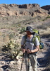
  So close! Bruce was a little grumpy but Joe and I did our best to cheer him up. Nice area. Lots of flowers, ferns, and greenery. We did get rained on after lunch but we were prepared. Nice hike, weather, and company. Thanks gents, you rock!


