username
X
password
register
for free!
help
ArticlesGuidesRoutes
 
Photosets
 
 Comments
triplogs   photosets   labels comments more
Don Joaquin's Lost Spanish Mine - 9 members in 20 triplogs have rated this an average 3 ( 1 to 5 best )
20 triplogs
login for filter options
Jan 11 2025
avatar

 Guides 94
 Routes 840
 Photos 22,055
 Triplogs 1,993

52 male
 Joined Sep 18 2002
 Tempe, AZ
Montezuma Peak Summit 4354Phoenix, AZ
Phoenix, AZ
Hiking avatar Jan 11 2025
chumleyTriplogs 1,993
Hiking3.78 Miles 2,648 AEG
Hiking3.78 Miles   6 Hrs   30 Mns   2.31 mph
2,648 ft AEG   4 Hrs   52 Mns Break
 no routes
1st trip
Linked   linked  
Partners partners
BobP
John10s
LindaAnn
The_Eagle
Eagle thought it would be a good day to meet for lunch in the desert. I was feeling lazy so I agreed to join. Unfortunately, Bob, John, and Linda wanted to climb a mountain instead. Whatever. I'm easygoing, so I agreed to the plan.

We set out a couple of hours before normal adult humans start their day. I pre-complained the day before but only mentioned it five or six times during the hike. Bruce sold a story about Don Joaquin's huge shaft, but we were all disappointed to find nothing more than some old tailings.

We also learned that the less-talented offspring of the architects of Notre Dame de Paris found their way to Arizona and built the earliest European structure that still exists here. Apparently they learned from the native population how to stack rocks rather than using any of those pfancy things they had learned across the pond. A bizarre remnant in an unexpected spot.

Proceeding upcanyon, it was time for first lunch. Or was it second lunch? I forget. There's some nice granite stretches with scrambly dryfalls that were pretty fun. The bell curve kept curving, and things gained a little steepitude. Route Scout repeatedly told me how long my previous break had been -- despite not having ever stopped. Apparently the software thinks you have to cover a certain distance in less than a certain amount of time to be considered movement. And that threshold was not being met. :sweat:

I was reminded to not follow Bob. This is a lesson I have learned before. The saddle at the crest provided lovely views across the Gila Valley. There was some more aggressive scrambling along the ridge and up the north chute before reaching the summit. Once all had arrived, we settled in for 4th lunch.

Air quality was surprisingly nice with clear views of Mingus, Pine, the entire Mogollon Rim, Mazzies, Ancha, Supes, Pinals, Catalinas, Ritas, Babo, and all the notable western peaks and ranges. Only some low agricultural haze obstructed the near surface areas looking to the south.

With getting back to the truck before sunset now in serious doubt, we began our descent, stopping for lunch two final times to appreciate the rugged geology and share further tales of fantasy and adventure.

Another lunch was on tap before making the drive back. Not all vehicles are made for 5 adults, and the drive provided more soreness and pain than the hike. At least for me. ](*,)

All told, a very enjoyable day. It was nice to meet John, reacquaint with Bob, and to share a trail mile with Linda and Bruce as always. Thanks to Linda for planning and driving, two things for which I rarely get a reprieve. Much appreciated!
 Flora
 Flora [ checklist ]
[ checklist ]  Elephant Tree
 Culture
 Culture [ checklist ]
[ checklist ]  Benchmark
_____________________
I'm not sure what my spirit animal is, but I'm confident it has rabies.
  1 archive
Jan 11 2025
avatar

 Guides 25
 Routes 376
 Photos 5,897
 Triplogs 346

40 male
 Joined Mar 01 2018
 Chandler, AZ
Montezuma Peak Summit 4354Phoenix, AZ
Phoenix, AZ
Hiking avatar Jan 11 2025
John10sTriplogs 346
Hiking4.18 Miles 2,690 AEG
Hiking4.18 Miles   6 Hrs   28 Mns   1.03 mph
2,690 ft AEG   2 Hrs   24 Mns Break
 
1st trip
Linked   linked  
Partners partners
BobP
chumley
LindaAnn
The_Eagle
Route Scout Route Recorded  on Route Scout | Pop | Map | Popup | MapDEX
We met up at 6:30AM, and after brief introductions and a few rounds of "You're the guy who broke Joe!", we headed for the Sierra Estrellas. This was my first time back there in 8+ years and my first time hiking with anyone in this group, and it made for a fun day.

We had a short road walk and a photo op at some random lawn chairs before picking up an easy-to-follow use trail that led up the drainage. We reached the stone structure for Don Joaquin's lost mine...for some reason, I was expecting something more than stacked rocks, but cool history there. The lost mine, like Bruce's phone yesterday, remains lost--other than a few filled-in holes across from the structure, we failed to locate the long mineshaft that he promised us and had marked on his route.

The use trail died out as we continued up the drainage, but route finding was easy--with the peak directly above us early on, it was a straight shot up the drainage. It became increasingly steep as we continued, with a series of dry falls in the middle, but there was a lot of fun scrambling, and when one side didn't look good, we'd find a better option on the other.

Higher up we split up, and Bruce and I followed Bob up to the right as we veered a little off the route, and chumley and Linda stayed left. More loose rock and brush to deal with up high, but Bob led us through and we met up with chumley and Linda on the ridge, then made our way up a short chute to the summit. There's a benchmark on top (not shown on the map), but no summit register that we found, though we didn't look very hard. Views were clearer than expected with the recent air quality, and chumley pointed out landmarks on the horizons.

After a long snack break at the top, we started down and I followed Bob again as he led the way down our same path, with Bruce, chumley, and Linda taking the other route until we regrouped farther down. We took a few more long breaks and crossed paths with a group of four who weren't headed for the peak but were out there "looking for plants and animals and stuff." As we finished off the hike, we played a game of "guess what type of vehicle they're driving" and nailed it as we drove past them on the way out.

It was really nice meeting everyone, and great hearing all the HAZ stories from the group. Happy I was able to join them and be there for Bruce's record-setting "longest non-lunch break." Big thank you to Linda for driving and for organizing the hike--it was a fun day!
 Culture
 Culture [ checklist ]
[ checklist ]  Benchmark  Bushwhack
 Named place
 Named place [ checklist ]
[ checklist ]  Montezuma Peak  Sevenmile Mountain
 
Jan 11 2025
avatar

 Guides 110
 Routes 2,246
 Photos 8,982
 Triplogs 2,600

45 female
 Joined Dec 24 2007
 Ahwatukee, AZ
Montezuma Peak Summit 4354Phoenix, AZ
Phoenix, AZ
Hiking avatar Jan 11 2025
LindaAnnTriplogs 2,600
Hiking3.77 Miles 2,655 AEG
Hiking3.77 Miles   6 Hrs   30 Mns   0.90 mph
2,655 ft AEG   2 Hrs   20 Mns Break
 
1st trip
Linked   linked  
Partners partners
BobP
chumley
John10s
The_Eagle
Route Scout Route Recorded  on Route Scout | Pop | Map | Popup | MapDEX
I’d had Montezuma Peak on my list for a while, then finally decided to throw it out there publicly to see if anyone else was interested. Ended up with a good group, and Chumley was overjoyed to get the middle seat on the drive. On the way out, we watched temps dip as low as 25 degrees, but it was closer to 40 at our start point, which was about a quarter mile before the road ended.

As for the hike, we walked the final bit of road, then Bruce and Bob took a nap on some lounge chairs. After that, there is a trail to the ruins of Don Joaquin’s Mine. We looked at the old building for a few minutes, then dropped into the drainage. Poked around for the mines and found a few that were filled in.

The drainage got steeper and steeper as we slowly made our way up. Bob tried to lead us astray. The lower half of the drainage is steep, but not particularly difficult. The upper half is steeper, and more difficult in my opinion. At one point, Chumley and I stayed left, while Bob, John, and Bruce went to the right. Left was probably the better call. Once on the crest of the Estrellas, it was still a steep scramble up to the summit, but the best route was fairly obvious. The entire ascent had been in the shade, but the summit was sunny, and views were clearer than expected.

After a snack break, we carefully picked our way downhill, which took almost as much effort as the ascent. Loose rock/soil in the upper part threatened to send you sliding with every step. Lower down, the footing on the bare rock of the drainage was generally better, but the boulder hopping was tiring on the knees. During one break, we could hear voices, and eventually encountered an odd group of four other hikers who seemed to be wandering around with no particular, or realistic, goal.

Saw tons of bighorn evidence, but I’m guessing a chatty group of five hikers encouraged them to hang out elsewhere for the day. One fox leg. Feathers, and a bird (probably hawk) skeleton with an intact skull and jaw. The road from the powerlines starts out very sandy then becomes rocky. We parked right where the road deteriorates to serious 4wd.

Great day, with perfect weather, and a fun group with entertaining conversation. Despite the low mileage, this was one of the harder hikes I’ve done in recent memory.
 Culture
 Culture [ checklist ]
[ checklist ]  Benchmark
_____________________
Stop crying and just go do the hike.
 
Jan 11 2025
avatar

 Guides 41
 Routes 1,626
 Photos 14,983
 Triplogs 2,760

69 male
 Joined Jan 20 2009
 Far NE Phoenix,
Montezuma Peak Summit 4354Phoenix, AZ
Phoenix, AZ
Hiking avatar Jan 11 2025
The_EagleTriplogs 2,760
Hiking3.80 Miles 2,700 AEG
Hiking3.80 Miles   6 Hrs   30 Mns   0.91 mph
2,700 ft AEG   2 Hrs   20 Mns Break5 LBS Pack
 
no photosets
1st trip
Linked   linked  
Partners partners
BobP
chumley
John10s
LindaAnn
I joined Linda and the gang last minute for a hike up to Montezuma Peak. All five of us were virgins on this peak. Linda drove us close to the end of the road to begin the hike. Unfortunately, I'd left my phone in the car back at the meetup spot, so no photos today.

We stopped at the rock house, which is right along the use trail—interesting! We also examined a few mines that had been filled in but never managed to find the "Don Joaquin Mine" ruins.

The farther you go on this trail, the steeper it gets. I followed Bob and John (Not a morning radio show) to the right towards the top, while the others hung to the drainage. I had a few times where I thought I would need to retreat, but things worked out. You encounter a bit more brush towards the top. We had a great time, taking it slow and steady, with numerous breaks and some interesting conversations. I think I took more breaks on this hike than on any other—and I didn't feel guilty about it.

At the summit, the theme was, once again, taking a break. We waited for a helicopter or zip-line that never showed up, so we eventually turned back and made our way down.

It was chilly to start, with shade all the way up. The summit was breezy and sunny—almost perfect weather all day.

I was a little worried John might feel out of place on this hike with our group of deviants from the "Island of Misfit Toys," but he fit right in.

Fauna on the day, a hawk skeleton with an intact skull and a fox leg. Chums took the skeleton back with him to add to the collection in his closet.

Back at the Jeep, Bob and I embraced "Moist January" with a barley pop.

Thanks, Linda, for setting this one up and getting us misfits to and from the hike safely.
_____________________
There is a very fine line between "hobby" and "mental illness."
Dave Barry 🦅
  2 archives
Feb 11 2024
avatar

 Guides 59
 Routes 1,100
 Photos 1,191
 Triplogs 1,290

male
 Joined Jan 01 2023
 Arizona
Torote Loop - SouthPhoenix, AZ
Phoenix, AZ
Hiking avatar Feb 11 2024
pseudalpineTriplogs 1,290
Hiking16.59 Miles 4,439 AEG
Hiking16.59 Miles   7 Hrs   56 Mns   2.24 mph
4,439 ft AEG      31 Mns Break
 
1st trip
Broke two of my loose rules on this one by starting the road walking first, into the low morning sun. But once turning north on the ascent up to Montezumas Head, the sun was at my back for the rest of the day, which was definitely better. It would have been cold and slippery in that Montezuma Peak ravine early in the morning anyway. At least I didn't shuttle, since I loathe that! :) The muscle cars racing at Apex Motor Club could be heard roaring for a bit on the south side of the route and there were quite a few small planes buzzing around from the various close by airfields. I skipped a few of the side peaks just to make sure I got back to see how Tay-Tay's beau was doing in the big game. I suppose the idiotic government psyops cult conspiracy theory is going to be on steroids now!?! WWG1WGA. Whatever! :lol: On the drive out, I spent about an hour pruning some of the major desert pin-stripers along the approach road. One still needs to be adept, but it's better now than it was. I also find it strange that four wheelers can still drive vehicles into the wilderness area at the Montezuma Peak TH.
 Meteorology
 Meteorology [ checklist ]
[ checklist ]  Fog  Snow
wildflower observationwildflower observationwildflower observationwildflower observationwildflower observation
Wildflowers Observation Isolated
  26 archives
Jan 28 2023
avatar

 Guides 59
 Routes 1,100
 Photos 1,191
 Triplogs 1,290

male
 Joined Jan 01 2023
 Arizona
Torote LoopPhoenix, AZ
Phoenix, AZ
Hiking avatar Jan 28 2023
pseudalpineTriplogs 1,290
Hiking15.56 Miles 5,184 AEG
Hiking15.56 Miles   8 Hrs   13 Mns   2.04 mph
5,184 ft AEG      35 Mns Break
 
1st trip
Route Scout Route Recorded  on Route Scout | Pop | Map | Popup | MapDEX
Peak after peak after peak... Reminded me of the Four Peaks Mother Lode, just not as technical. Flushed about twenty sheep when nearing Butterfly. It's always cool to see the rate at which they can move through rough terrain. Can't wait for Torote Loop north!
  9 archives
Aug 24 2022
avatar

 Guides 59
 Routes 1,100
 Photos 1,191
 Triplogs 1,290

male
 Joined Jan 01 2023
 Arizona
Montezuma Peak Summit 4354Phoenix, AZ
Phoenix, AZ
Hiking avatar Aug 24 2022
pseudalpineTriplogs 1,290
Hiking7.91 Miles 2,931 AEG
Hiking7.91 Miles   3 Hrs   35 Mns   2.23 mph
2,931 ft AEG      2 Mns Break
 
no photosets
1st trip
Linked   linked  
Partners none no partners
Not too shabby of a scramble and the approach road sucks. Parked west of the TH and walked from there to avoid scrappage. Signs of sheep at the summit.
  3 archives
Oct 22 2019
avatar

 Guides 73
 Routes 176
 Photos 10,174
 Triplogs 2,324

46 male
 Joined Sep 08 2006
 
Montezuma Peak Summit 4354Phoenix, AZ
Phoenix, AZ
Hiking avatar Oct 22 2019
JimTriplogs 2,324
Hiking9.00 Miles 2,900 AEG
Hiking9.00 Miles   7 Hrs      1.42 mph
2,900 ft AEG      40 Mns Break10 LBS Pack
 no routes
Linked   linked  
Partners none no partners
I would like to think that today's hike opens the 2019-2020 winter desert peak bagging season. So, it does, for me at least. Consider it preseason scrimmage time if still too hot for you.

Parked near the north end of the Seven Mile range and walked across the open desert to the official TH. Linda and I couldn't find the access road in April, and this time I did notice it while driving by, but I felt safer not going up a wash. My hike added miles and AEG, so it was fine. It was too hot for us in April, anyway. Perfect weather for me today.

These Estrella summits are always an earned summit. Even with the trail to the mine, or whatever that is, the rest of the hike is typically rough. Perhaps because so steep, or because I haven't been out here off trail since December, this felt especially hard at the upper levels.

The summit was enjoyable, and the last scramble parts are always the best. Montezuma Peak was woke up, but felt a lot like Montezuma Sleeping's last 100'.
_____________________
🍭
 
Nov 18 2018
avatar

 Guides 264
 Routes 2,797
 Photos 14,494
 Triplogs 5,894

55 male
 Joined Nov 20 1996
 
Montezuma Peak Summit 4354Phoenix, AZ
Phoenix, AZ
Hiking avatar Nov 18 2018
joebartelsTriplogs 5,894
Hiking3.50 Miles 2,619 AEG
Hiking3.50 Miles   5 Hrs   38 Mns   0.71 mph
2,619 ft AEG      41 Mns Break12 LBS Pack
 
1st trip
Linked   linked  
Partners partners
johnlp
JuanJaimeiii
trekkin_gecko
We found trophy mica on route to Don Wahkeen's Cabin along a better than expected trail. Then it's a scramble to the summit. It's a double if not triple shot Hieroglyphic experience yet loaded with rubble. I'm a fan of the SW landscape views. Seven mile mountain is like parsley. Few indulge but it compliments the visual appeal.

Drive
If the sand to Quartz is questionable in your book this isn't for you. Reminded me of my high school introduction to desert 4WD where talking stick has turned dust to gold. Slightly different at the speed of jj in a rig three times the size of a samurai.

Synopsis
Liked this much more than anticipated. Patience of the group made it possible, greatly appreciated. Left knee got worked triangulating points of contact. Right fingerprint to unlock my phone wore off. Left arm got the best therapy to date!
 Named place
 Named place [ checklist ]
[ checklist ]  Montezuma Peak
wildflower observationwildflower observationwildflower observationwildflower observationwildflower observation
Wildflowers Observation Isolated
Paintbrush and a few I didn't get to capture. Wooly Tidestromia, thx to superhero Storm for the identification!
_____________________
- joe
 
Nov 18 2018
avatar

 Guides 1
 Routes 14
 Photos 7,202
 Triplogs 5,208

68 male
 Joined Mar 16 2008
 chandler,az
Montezuma Peak Summit 4354Phoenix, AZ
Phoenix, AZ
Hiking avatar Nov 18 2018
johnlpTriplogs 5,208
Hiking3.98 Miles 2,693 AEG
Hiking3.98 Miles   5 Hrs   41 Mns   0.76 mph
2,693 ft AEG      27 Mns Break
 no routes
1st trip
Linked   linked  
Partners partners
joebartels
JuanJaimeiii
trekkin_gecko
Recently JJ and I were atop Picketpost with JJ pointing out Montezuma Peak in the Sierra Estrella. A plan was born.

October rains have made the drive to the trailhead excessively rough. The JJmobile passed with flying colors though. Looking at the peak on the drive in it is apparent that this hike gets very steep. JJ and I hiked this one a few years ago, but the memories had faded a bit. I didn't recall how steep this one gets. Great thing about Sierra Estrella hikes is that the steep washes aren't too brushy, see very little traffic, and the scenery is awesome. Good stuff!

Fun hike. Joe's performance was inspirational as was JJ's patience. Kelly and I got in some bonus sight seeing as we missed the turnoff to the mine and jeep on the descent. Great day! Thanks all. :)
_____________________
“Good people drink good beer.” Hunter S Thompson
 
Nov 18 2018
avatar

 Guides 10
 Routes 673
 Photos 7,281
 Triplogs 4,660

67 female
 Joined Nov 17 2008
 phoenix, az
Montezuma Peak Summit 4354Phoenix, AZ
Phoenix, AZ
Hiking avatar Nov 18 2018
trekkin_geckoTriplogs 4,660
Hiking3.98 Miles 2,693 AEG
Hiking3.98 Miles   5 Hrs   41 Mns   0.76 mph
2,693 ft AEG      27 Mns Break
 no routes
1st trip
Linked   linked  
Partners partners
joebartels
johnlp
JuanJaimeiii
was excited to get an invite for this one, as montezuma peak would complete the five major summits in the estrellas
quartz, estrella/hayes, butterfly and montezuma sleeping are the other four
all except quartz are off trail
this one might have been the most difficult at least per mile due to terrain and steepness
jj drove us in the jeep from the south
about 50 degrees as we set out toward the mine on a cairned trail
the old building was interesting, but the mines were mostly filled in
the route then goes up a drainage, featuring some nice smooth bedrock and a few pour offs that have to be negotiated
the drainage fades out and the grade steepens with some loose rock and sticker bushes
finally hit a ridgeline, and went to the peak through a gap on the east side of it
spent some time checking out the benchmark, views and summit register, taking photos and snacking
think joe and i were dreading the descent, mostly because of footing and the time it takes
the upper part was a challenge, and going was easier once back in the drainage
johnlp and i stayed in the drainage too long, and ended up north of the jeep, having to cut back
since neither of us recorded the track, we don't get any extra credit for that
it's a worthy peak, and not many people go up there
weather was perfect, although it was pretty hazy; now i'm hearing the haze might be from the california wildfires
always enjoy looking at the estrella mountain ridgeline from the valley, knowing that i've been on top of all those peaks :)
a good day out with the boys - a tough hike
 Culture
 Culture [ checklist ]
[ checklist ]  Benchmark
_____________________
hazhole
  3 archives
Nov 18 2018
avatar

 Routes 596
 Photos 9,604
 Triplogs 2,400

58 male
 Joined Jan 30 2011
 Chandler, AZ
Montezuma Peak Summit 4354Phoenix, AZ
Phoenix, AZ
Hiking avatar Nov 18 2018
JuanJaimeiiiTriplogs 2,400
Hiking3.98 Miles 2,693 AEG
Hiking3.98 Miles   5 Hrs   41 Mns   0.76 mph
2,693 ft AEG      27 Mns Break
 
Linked   linked  
Partners partners
joebartels
johnlp
trekkin_gecko
The Gecko needed this one to round out completing all 5 of the Estrella named Summits. Today was a perfect day to get that done. Weather was perfect for us all day. Road in and out to the base of Montezuma is in the worst shape I have ever seen it. 4 Wheel drive is HIGHLY recommended.

The hike itself is always a fun one and is super steep. The views from the summit never disappoint. Kudos to Joe for sticking in there and going the distance. The footing on this one isn't the best.

Great Hike with a Great Group!
 Culture
 Culture [ checklist ]
[ checklist ]  Benchmark
_____________________
 
Apr 30 2017
avatar

 Routes 596
 Photos 9,604
 Triplogs 2,400

58 male
 Joined Jan 30 2011
 Chandler, AZ
Montezuma Peak Summit 4354Phoenix, AZ
Phoenix, AZ
Hiking avatar Apr 30 2017
JuanJaimeiiiTriplogs 2,400
Hiking3.98 Miles 2,738 AEG
Hiking3.98 Miles   3 Hrs   52 Mns   1.08 mph
2,738 ft AEG      10 Mns Break
 
Linked   linked  
Partners none no partners
So I was going out to do Quartz Peak when all of a sudden I got a wild hair to do Montezuma Peak instead. It has been rattling around in the back of my mind for awhile and every time I go out to Quartz I think "I need to go back and do that again soon". Well today was the day. All was going great until I got about 1200 feet up where I stepped on a rock that rolled and I went straight down onto another. Boom-Crack went my leg as it hit just below my right knee. Extreme pain set in so I hobbled off an sat on a rock and rubbed it for awhile.

As I sat there I was thinking I sure hope I can get back down on this thing. Then I got up and walked around a bit and started heading up again. I took it real slow and easy and kept thinking I should turn back. It felt okay for awhile and then would act up from time to time. Eventually I found myself sitting on the summit of Montezuma enjoying the breeze and the fantastic views. This may be my favorite peak on the Sierra Estrella Range. Quartz doesn't count which leaves Montezuma Sleeping and Hayes. Hayes is too mucked up with all the electronics and Montezuma Sleeping and Montezuma are neck and neck.

After resting and enjoying the views I started to head back down. This is where the real pain kicked in. Holy Moly it hurt! I went slow and took very deliberate steps and eventually was back down by the mine and thr old stone building.

Then as I was driving out I saw a red Dodge Dart stuck in the sand at the north end of 7 mile. :o I got out and looked around to see where the person was to lend a hand but nobody was in sight. I drove back to the turn for Quartz and then turned back and headed out the south end. I was hoping to find the unfortunate one that got stuck and pull them out with the Cherokee. No such luck.

Once home I pulled up my pant leg and took a look. Huge lump on the side of my leg and a scrape about 9 inches long. Depending on how it feels in the morning I may need to go get an X-Ray? ](*,)
 Culture
 Culture [ checklist ]
[ checklist ]  Benchmark
_____________________
 
Dec 20 2015
avatar

 Routes 596
 Photos 9,604
 Triplogs 2,400

58 male
 Joined Jan 30 2011
 Chandler, AZ
Montezuma Peak Summit 4354Phoenix, AZ
Phoenix, AZ
Hiking avatar Dec 20 2015
JuanJaimeiiiTriplogs 2,400
Hiking3.96 Miles 2,765 AEG
Hiking3.96 Miles   3 Hrs   19 Mns   1.36 mph
2,765 ft AEG      24 Mns Break
 
Linked   linked  
Partners partners
FOTG
This was "The Hike of the Day", however we added in Quartz Peak first for good measure. A week ago I was hiking on South Mountain when I gazed over at the Estrella's. Looking from north to south I thought about what a cool range it is. Then when my eyes got to Montezuma Peak a light went off and I thought to myself "boy I bet Lee would dig that one". So I sent him a quick text and we had ourselves a plan.

This one hasn't changed much since my last trip up with LP. Still steep as can be and a killer summit just waiting for anyone to stop by and say hello.

One of my favorite summits and in my opinion 100 times better than Estrella Peak. It may be higher but it is nowhere near as cool. Not to mention it is littered with radio towers. The ones here aren't at the summit since it is too rocky and jagged.
_____________________
 
Dec 20 2015
avatar

 Guides 37
 Routes 556
 Photos 10,872
 Triplogs 1,052

43 male
 Joined Jan 21 2013
 AZ
Montezuma Peak Summit 4354Phoenix, AZ
Phoenix, AZ
Hiking avatar Dec 20 2015
FOTGTriplogs 1,052
Hiking3.83 Miles 2,730 AEG
Hiking3.83 Miles   3 Hrs   23 Mns   1.34 mph
2,730 ft AEG      32 Mns Break
 
1st trip
Linked   linked  
Partners partners
JuanJaimeiii
JJ suggested we do Montezuma Peak a few weeks back, because he thought it may be, "up my alley." He was right! My type of peak and hike. A nice challenging rugged scramble with some history near the bottom.

The legs may have been slightly fatigued from Quartz, but we still seemed to knock out the predominantly off trail scramble/climb pretty quickly and without any issue. The climb reminded me of something on the lines of Flat Iron, or Picket Post, but before there were trails there. After that it was a few minutes debating unnecessary risks versus the less direct stroll to the top. The less direct won over and we were on the summit. A register with far fewer names than Quartz, but a worthy peak nonetheless. There were some tremendous views of the entire Sierra Estrella range, complemented by a full 360 degree views of the entire surrounding area and great views to the south as you come down the drainage that serves as the off-trail route.

It was a tad bit of a knee jarring, slipping and sliding, branch grasping, ground cursing ride back down the wash, but we made it in one piece. I then experienced nearly the exact same knee jarring, slipping and sliding, door handle grasping, ground cursing experience in the passenger seat of JJ's jeep, as we made our way rather quickly back to the pavement.
 Culture
 Culture [ checklist ]
[ checklist ]  Benchmark
_____________________
  4 archives
Apr 13 2014
avatar

 Guides 1
 Routes 14
 Photos 7,202
 Triplogs 5,208

68 male
 Joined Mar 16 2008
 chandler,az
Montezuma Peak Loop, AZ 
Montezuma Peak Loop, AZ
 
Hiking avatar Apr 13 2014
johnlpTriplogs 5,208
Hiking8.61 Miles 3,323 AEG
Hiking8.61 Miles   6 Hrs   26 Mns   1.69 mph
3,323 ft AEG   1 Hour   21 Mns Break
 no routes
1st trip
Partners partners
JuanJaimeiii
JJ had one last segment to finish off a full traverse of the Sierra Estrella ridgeline. No easy task. I offered to join him on the Montezuma south leg. I hadn't been to this prominent peak yet and it fullfills my quest of hitting the major Sierra Estrella peaks. The list includes Estrella/Hays Peak, Montezuma Sleeping (my favorite), Quartz Peak, Butterfly Peak, and Montezuma Peak. All but one I hiked with John, and I thank him for the company and assistance.

The hike up is interesting and challenging, like all the others. Besides Quartz Peak, the Sierra Estrella sees little foot traffic. It feels remote and old, but is only a few miles from the fifth largest city in the USA.

From the peak we hiked south to where John had hiked north from the southern end of the range yesterday. This completed John's ridgeline journey. We then hiked west down to the desert and back to the jeep.

Along the way John showed me the sherd and glyphs he discovered yesterday. Very cool.

Another great hike in the Estrellas. Congrats JJ! :)
 Flora
 Flora [ checklist ]
[ checklist ]  Saguaro
_____________________
“Good people drink good beer.” Hunter S Thompson
 
Apr 13 2014
avatar

 Routes 596
 Photos 9,604
 Triplogs 2,400

58 male
 Joined Jan 30 2011
 Chandler, AZ
Montezuma Peak Loop, AZ 
Montezuma Peak Loop, AZ
 
Hiking avatar Apr 13 2014
JuanJaimeiiiTriplogs 2,400
Hiking8.61 Miles 3,323 AEG
Hiking8.61 Miles   6 Hrs   26 Mns   1.69 mph
3,323 ft AEG   1 Hour   21 Mns Break
 
1st trip
Partners partners
johnlp
I've been working on traversing the entire Sierra Estrella Ridgeline for the last year or so. I did it in sections and some I did with friends and some I did solo.

Today commenced the last piece to complete the project. JohnLP and I headed out early and were on the trail by 7:05am. We went up the wash past the Don Joaquin Lost Mine and the old structure. From there it is pretty much straight up the ravine. It is steep but manageable. A little over a year ago Mike (RockadoodoodleDude) and I came down this same ravine. We had traversed from Quartz Peak to Montezuma Peak.

Montezuma Peak is an outstanding summit and is worth a trip up if you have the gumption. Funny enough the last two to visit the summit and sign the register were a couple HAZer's. They were there since Mike and I went but that was the only other party to sign the register in the last year.

Views are great and it just feels good to sit on top of something that we see all the time. Once we took it all in we were on our way heading south. We went to the next peak that has an antenna on it and then down, down, down. Steep and full of cacti land mines made for an intense trip. Then we rode the rugged ridge to the spot where I turned and exited yesterday. I placed a 5 hour energy bottle as my marker. Today I retrieved it and we then headed down the ravine back to the desert floor.

On the way down we took a side trip to a spot where I saw some pottery shards and petroglyphs yesterday. My GPS track shows where that spot is should you want to check it out for yourself.

This is a cool hike and I would highly recommend it as a loop like we did. It's nothing to crazy but packs a punch and really delivers in many ways.

It's important to note that it requires a high clearance vehicle to get to the Trailhead. I also have a GPS route to the Trailhead that you are welcome to use.
_____________________
 
Feb 02 2013
avatar

 Routes 596
 Photos 9,604
 Triplogs 2,400

58 male
 Joined Jan 30 2011
 Chandler, AZ
Montezuma Peak Summit 4354Phoenix, AZ
Phoenix, AZ
Hiking avatar Feb 02 2013
JuanJaimeiiiTriplogs 2,400
Hiking12.15 Miles 5,008 AEG
Hiking12.15 Miles   8 Hrs      1.58 mph
5,008 ft AEG      20 Mns Break
 
Partners none no partners
I talked Mike into joining me for one AWESOME hike! He likes a bit of off trail adventure and I knew this one wouldn't disappoint. The other day when Hiking Quartz with Nick I got to eyeing the ridgeline and thought how great it would be to hike across to Montezuma Peak. From there a decision could be made to hike back to Quartz Peak and head down or drop down from Montezuma and take the desert floor back.

This gem is a BRUTE and will kick you in the Pumpkin! We started at 10 and went up to Quartz Peak. From there we took the Ridgeline all the way across. I thought the hike would take us 4.5 hours. Mike thought 5.5. We were both wrong! It took 8 hours and we weren't messing around up there. Much of the Ridgeline could best be described as a "Razorback" so careful footing was essential. There is a narrow rocky bridge at one point that makes the one on Battleship look easy. It got both our adrenaline pumping! For those who don't care for such a thing there is a way around it but much less exciting!

Along the way I climbed up to Butterfly Peak and as it would turn out JohnLP and I were the last to sign in up there 9 months ago. Prior to that it had been 6 years since the last entry.

This hike is a hard core roller coaster ride which is quite different than the Ridgeline in the Supes. Somehow it seemed that Montezuma Peak just kept getting farther and farther away. This was taxing on our spirits and bodies however we were determined and on a mission. There were a few times I had to tease Mike about his whining telling him I was going to get him a skirt. Truth be told he was a solid trooper and hung in there all the way!

Montezuma Peak was a welcome site after passing some old and out of use antennas. We made our way to the top and took in the views. While doing so I read a couple of the posts in the register. This peak is clearly visited with some regularity based on the number of sign ins. Nothing like Quartz Peak of course but much more than Butterfly. From the posts I could see that most hikers take the direct route straight up from the base to the peak. This would only be a 3.5 mile hike round trip but with a bunch of gain.

We took the wash down and on the way checked out Don Joaquin's Lost Spanish Mine and Stone Cabin. SUPER COOL in my book! There was a family there checking it out as well. They had come in on Quads and then hiked a half mile up the wash to explore. Around this point my GPS battery took a pumpkin on me but it was on as we passed the mine and building.

From the stone structure there is a trail down the rest of the wash. Once at the bottom we simply cut across the desert floor and back to the Quartz Peak Trail Head.

This was some hike! One I won't soon forget!

Thanks for coming along on this one Mike!
_____________________
 
Feb 27 2012
avatar

 Guides 1
 Routes 1
 Triplogs 24

45 male
 Joined Feb 27 2012
 Cochise County
Montezuma Peak Summit 4354Phoenix, AZ
Phoenix, AZ
Hiking avatar Feb 27 2012
AndrewAZTriplogs 24
Hiking5.00 Miles 2,708 AEG
Hiking5.00 Miles
2,708 ft AEG
 
no photosets
1st trip
Linked   linked  
Partners none no partners
Like Hayes Peak (Estrella Peak 4512), Montezuma Peak is a rugged backcountry hike. There is no trail and no obvious reason to hike to the peak since it isn't the highest point in the Sierra Estrellas. Throw in difficult access, and most hikers probably give this one a pass. However, if solitude, desert scenery, and great views are your goal, this is an ideal hike.

The hike is fairly short. It is roughly half a mile to the stone house and one and a quarter miles from the house to the peak. However, it gains 2,550 feet of elevation in that 1.8 miles. Be prepared for a leg workout.

I've had my eyes on Montezuma Peak for some time. I live in Ahwatukee, so staring at the Sierra Estrellas is a daily thing. I've been to Quartz Peak twice and Hayes Peak twice, which left Montezuma Peak as the remaining challenge in the Estrellas (aside from traversing the ridge line from Montezuma Peak to Hayes Peak--someday!).

On 2/25, I met up with two friends to give it a try. We left from Tempe around 5:00 a.m., and approached the Estrellas using the I-10/Sierra Estrella Parkway/Elliot Road route. We reached the intersection of Riggs Road and Rainbow Valley Road around 6:00 a.m., and shortly thereafter entered the wilderness area using the Riggs Road alignment. It was obvious that it's been a dry winter: the usually sandy and loose road was packed hard and heavily washboarded.

We passed Rainbow Rancho, which would be easy to miss if you weren't looking for it. When I first saw it in 2005, there were still several structures, a hangar, a mortar launcher, and signs of recent occupation. The mortar is gone now, the hangar has collapsed, and the other structures have been torn down (or burned down). In the early morning light, it looked like the set from a horror movie.

We hit the T junction at the power lines, turned right, and continued south. We passed the turn-off for the Quartz Peak trail head at 1.9 miles and found our turn-off 1.2 miles after that. We followed this road for about 2 miles and reached a wide area with several campfire rings. It looked like most people park at this point, but since we had a high-clearance vehicle with four-wheel drive, we kept going. The road rapidly deteriorates and becomes extremely steep and rocky. It ends a half mile past the wide area, so stopping at the wide area doesn't add much distance to the hike.

We got started around 6:45 a.m. with temperatures around 60. We all had long-sleeve shirts on but took them off with the first quarter-mile of the hike. We were surprised to find a trail starting where the road ends. There is clearly a great deal of foot traffic on the trail, as it's extremely obvious and easy to follow. There are also cairns every 50 feet, so while some care must be taken to avoid rocks and cacti, getting lost at this point would take talent.

After a half mile of hiking, we reached the remains of the stone house at Don Joaquin's Lost Spanish Mine. We took a look at the house and the mine shaft, and decided which route we wanted to take to the peak. We chose to continue up the wash, which would have the benefit of being in the shade all morning. At this point, the trail and cairns ended.

From the stone house to the ridge line just below the peak, hiking followed a consistent pattern: survey the terrain for the best route, hike 10-50 feet while choosing the best footing for each step, and then reassess the situation. There was plenty of brush, so many times the best route was the one that required the least fighting with cacti and catclaw.

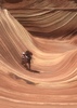
The biggest challenge while moving up the wash (aside from the catclaw) was the amount of slick rock. There are a dozen or so slick rock areas that must be surmounted. Some can be directly overcome by zigzagging up through them and using any rough spots as stairs, but others are too smooth and steep and have to be circumvented entirely by going far to the right or left. This is where good route-finding skills will pay off the most.

Montezuma Peak was visible the entire time, so we followed the wash all the way to the ridge line just north of the peak. We took frequent breaks to enjoy the scenery. Rainbow Valley was gorgeous in the early morning sun, and it remains amazing that such an empty and desolate place is so close to Phoenix. We saw a caravan of vehicles appear from the other side of Seven Mile Mountain (they must have approached from AZ-238 at Mobile), but we never saw them again, so perhaps they went to Quartz Peak or Hayes Peak.

We reached the ridge line with Montezuma Peak off to our right. We were finally in the sun, and shade would be scarce for the remainder of the day. We worked our way up the peak using an obvious ravine on the east side of the peak. It requires some scrambling and using one's hands, but nothing too tough or scary. The official summit has a USGS marker (4,337 feet) and a coffee can with a collection of notes inside.

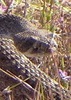
It was sunny and the temperature was perfect. The views were great in all directions, or would've been if it hadn't been so hazy. Phoenix was clearly visible, and South Mountain looked rather sad and small. It was possible to see Woolsey Peak, Big Horn Peak, and Table Top, but beyond that, most peaks were not easy to see due to the haze. Other than the tarantula hawks that were cruising around, we appeared to have the whole Estrella wilderness to ourselves.

Or so we thought. After a moment, we heard a sustained screeching, and noticed a peregrine falcon perched on some rocks about 20 feet away. It appeared to be less than thrilled with our presence, and continued to screech at us for several minutes. It stopped, but it remained rooted in place and eyeing us balefully. We stayed on the peak for 20 minutes and it never moved from its position, so we assumed it was guarding a nest.

We started back down the wash and mostly used the same route to head down that we did on the way up. The falcon actually followed us down the mountain, circling and occasionally landing to screech at us some more. We were in the sun for the trip down, so it was much warmer (close to 80 degrees) and not quite as much fun as the trip up. We stopped again at the stone house and mine shaft to take some pictures with better lighting, and then continued back to the vehicle.

On the way out, we noticed that the road split at the wide area with the fire rings. We took the road to the left, which took us south. The road ran between the Estrellas and Seven Mile Mountain and there were plenty of tracks to indicate that the road sees lots of use. Whenever we reached a fork or split, we continued generally south on the road that looked like it had the most tracks.

Shortly before the road broke free from the hills between the Estrellas and Seven Mile Mountain, we crossed a cattle guard and went through a barbed wire fence. After that, the road became much sandier and a maze of splits and forks. We could see Maricopa in the distance and see the cattle feed lots along AZ-238, so we generally aimed in that direction. It took some wandering, but we hit AZ-238 at Rio Bravo Road, which is just a few miles outside Maricopa. We took AZ-347 back to the metro area and quickly reached Tempe. With a good map, taking the Rio Bravo route would probably cut 15-25 minutes off the drive to the trail head from the east valley.

Overall, it was a great day. The weather was ideal, the scenery was amazing, and the hike was strenuous enough to feel like we had accomplished something. It was a great hike and worth doing, but it probably won't be high on the list of hikes to repeat. It's a long drive for a short hike, and the views from Hayes Peak are generally better.
_____________________
 
Dec 27 2010
avatar

 Photos 392
 Triplogs 67

54 male
 Joined Mar 23 2009
 Central AZ
Don Joaquin's Lost Spanish MinePhoenix, AZ
Phoenix, AZ
Hiking avatar Dec 27 2010
trekkintooTriplogs 67
Hiking1.00 Miles 608 AEG
Hiking1.00 Miles
608 ft AEG
 no routesno photosets
1st trip
Linked   none no linked trail guides
Partners none no partners
Have been wanting to do this trip for a long time, was well worth the wait. I had come from the southern end of the estrellas, between estrella mtns and seven mtns. I highly recommend coming from the north end, road is windy and rough from the south. You can take estrella parkway and follow the huge power lines south will lead you right to it. Basically follow the directions to quartz peak, then follow the power lines about another 2 miles and take a left, will eventually wind you to the western base of montezumas peak. Once you come to the end of the old jeep road/ancient spanish route, follow a well worn trail to the right of ravine, it fades off in parts but easy to pick up. The ruins are still in very good shape, i signed in at the glass jar in the ruins. Someone thought it was appropriate to build a lil warming fire in the middle, not cool. But the structure itself is in very good condition for almost 300 years. The well shaft is further up the ravine about 50 yards on n. side of ravine. Its pretty precarious around the edge and still very deep! I would not recommend going to close with out a tied off rope. The place is amazing, had it to myself. Its funny how on the western slope of estrellas you feel so far away from civilization, yet phoenix is just on the other side. I recommend this hike for the treasure hunt feel of looking for it and feeling like you accomplished something when you find it! Be aware of your surroundings, this corridor is a well known drug route thru arizona.
_____________________
  1 archive
average hiking speed 1.38 mph

WARNING! Hiking and outdoor related sports can be dangerous. Be responsible and prepare for the trip. Study the area you are entering and plan accordingly. Dress for the current and unexpected weather changes. Take plenty of water. Never go alone. Make an itinerary with your plan(s), route(s), destination(s) and expected return time. Give your itinerary to trusted family and/or friends.

helpcommentissue

end of page marker