|
| | | |
| |
|
| Hiking | 4.68 Miles |
710 AEG |
| | Hiking | 4.68 Miles | 2 Hrs 8 Mns | | 2.34 mph |
| 710 ft AEG | 8 Mns Break | | | |
|
|
| |
| Partners |
|
[ show ]
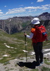
| partners | | Our get out of town hike didn't start out too well as we circled the north Bell Rock/Courthouse TH a couple times hoping for a parking spot. Fortunately, we were able to find a place to park at the south Bell Rock TH along with the rest of the horde. It was a little warm with not much breeze.
We took off and did the Loop clockwise; when I last did this loop in 2009 with my brother, niece and cousin we went counterclockwise. The closer we got to Bell Rock the more crowded it got pretty much until we hooked up with the Courthouse part of the hike. Like most Sedona hikes, this one has some great views which really started to kick in once you get to the northside of the loop as you can see Cathedral Rock, Doe and Bear Mountain area, Thunder Mountain, Airport Mesa, Brins Mesa area and Twin Buttes. And then there's the Baby Bell Rock you can do a quick loop around if you want.
You kind of have to pay attention as you hook up with Courthouse Butte Loop when you start heading ESE. The breeze picked up just a tad here as well as some cool clouds in the sky. As you round the corner you can see the Rabbit Ears which are always fun to photograph. My niece and brother created this photo here, it is so cool [ photo ]  The area has lots of brush and trees including prickly pear with very big ears which I've noticed quite a bit up here. The area has lots of brush and trees including prickly pear with very big ears which I've noticed quite a bit up here.
We encountered a few other hikers on this leg as you enter and leave the wilderness part of the hike. It's a $300 fine if a bike rider passes through here. A little further south and the Spaceship Rock (also apparently called Muffin Rock but we went with Spaceship in 2009, thus this picture [ photo ] ) finally shows up. As we passed by we noticed an ocotillo garden and took some photos. As you get more to the other side of the rock, it looks more like a spaceship.
We continued hiking to the southeastern side to a junction in this drainage area. Here you have the option to continue west on the loop but Ambika noticed that the Big Park Loop takes us to the TH so we opted to do that. I had not been on the Big Park Loop so we were pleasantly surprised. It is a fairly busy bike route though so keep your eye out. It's not easy for them either as it does involve a couple little uphills if you're coming from the west. I don't remember there being a Big Park Loop when we hiked this area in 2009. Anyway, we really liked it as you really got a longer view to the Butte and Bell Rock and with the cool little clouds swirling around, it made for some nice photos.
The TH was even busier when we got back. We were surprised to see so many people of all ages and dogs as it was now in the high 80s. We grabbed the cut watermelon out of the cooler and munched on that before taking off to PJs in the Village for lunch. The ribs are great!
I did post some more views from our balcony at the beginning of the Photoset as well as a couple other touristy things... in remembrance of Randall from back in the day.
WATCH: 4.47 miles. Avg bpm 116, Max 142 - most in Zone 3 burning 690 calories finishing at 11:29AM. Temp start 80.5 and 11% humidity. |
|
Wildflowers Observation None
prickly pear were blooming and some apache plume. |
|
| _____________________
For me, sometimes it's just as much about the journey as the destination.
Oh, and once in awhile, don't forget to look back at the trail you've traveled. |
| | |
|
|
|
 Route Editor


 . Easy decision and one that will get me up there for regular visits
