|
| | | |
| |
|
| Hiking | 17.20 Miles |
4,124 AEG |
| | Hiking | 17.20 Miles | 10 Hrs 57 Mns | | 2.00 mph |
| 4,124 ft AEG | 2 Hrs 22 Mns Break | | | |
|
|
| |
| Partners |
|
none
[ show ]
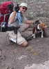
| no partners | | Went out yesterday for a hike with my mom to do the Mazatzal Peak Loop. It was our first time to the Mazzies, but we are very experienced hikers, so we felt comfortable taking on such a formidable hike. The expected weather for Payson was 85 degrees and sunny. The actually temperature on the hike was 65 when we started at 7:30 AM, and 82 when we finished at 7:00 PM. In between, probably the warmest it got was around 85, due to being at higher elevations than the trailhead during the hottest part of the day.
We started the day awaking at 5:00 AM, knowing we had a long day ahead of us. After gathering a few last minute items, we drove the 1:45 to the trailhead. Two vehicles were in the parking lot when we arrived, and two more arrived around the time we got there. From what I've heard, this is a very sparse crowd, with the parking lot being large enough to accommodate easily 40-50 vehicles.
We did the loop counter-clockwise, meaning we started by going up the Barnhardt trail, then took the Mazatzal Divide trail to the Y Bar trail, and then descended down the Y Bar trail. This turned out to by the ideal direction of travel for multiple reasons. First, this way means the sun is at your back more. This is helpful so you're not looking in the sun in the morning and evening. Also, as a photographer, it means the good light is always in front of you. Second, the Barnhardt trail is a very smooth, gradual trail for the 2,000 ft ascent, while the Y Bar trail is much rockier. Your preferences may be different, but I prefer the loose rocky trail for going down because it makes it very fast (i.e. assume the rocks will slide and you can go further faster). Lastly, it really kept us in suspense, as this was our first time to the Mazzies, and going counter-clockwise you don't even see the summit till 6-7 miles into the hike! 
About 5 miles in, we encountered a prairie rattlesnake very slowly making its way across the trail. We waited a few minutes for it to move on, then continued on our hike. In this same area, we saw a very adorable "Greater Short-Horned Lizard." I had to look that one up...apparently there are about 8 different species of horned lizards in Arizona. Who would've guessed? Generally, the hike presented much more wildlife than other areas of Arizona we've hiked in, especially the Superstition Mountains. We saw a roadrunner, two jackrabbits, abundant lizards of various types, vultures, various other species of birds, and some unusual and interesting-looking insects. There were also an abundance of little flying creatures that loved to fly in your face as you hiked. They were somewhere in size between gnats and flies, didn't buzz, but could fly fast enough to keep up with fast hiking. One guy was flying right by my sunglasses for over 30 minutes continuously! Another interesting note on the fauna side was the large number of anthills observed. I only counted for about 10 minutes, and observed in excess of 30 anthills. The entire hike had many anthills. If I had counted the whole day, there would have been 1000 anthills no doubt. Go ants! 
The trails were in great condition, especially the Barnhardt and Mazatzal Divide trails. The Y Bar trail was more rocky, and some parts of it were a little fainter. But there were abundant cairns that were very large in size. By abundant I mean at least every 30 feet, and by very large I mean an average height of 2-3 feet tall. If you have any ability to follow cairns, you'll have no problems on this trail.
The scenery was great, as well as very unusual. We noted that in all our hiking around AZ, we've never seen scenery and vegetation quite like in the Mazatzals. On the subject of flora, we saw around 15 species of wildflowers, but they were generally in small localized areas. For example, there were some blooming hedgehog cactus, but only for a 0.25 mile section of trail.
What else can I say? It was a long hike. The miles just keep accumulating, and somehow you find the energy to go on. We did it with only four breaks, but they were relatively long breaks. One break was at Big Kahuna falls, one at each trail junction, and one most of the way down the Y Bar trail. Our average hiking speed was 2.0 miles per hour, meaning that with breaks, we completed the 17.2 miles in 11 hours. Oh, I almost forgot! According to my pedometer, it was 40,000 steps. A good start to the month of May!  |
|
Wildflowers Observation Light
I'm not good with wildflowers, but we saw all the usual ones like dandelions, lupine, daisies, wild rose, blackberry, the commonly seen orange flowers, and paintbrush. We were pleased to see hedgehog cactus blooming in a few places. The agaves were sending up their shoots, and we saw some blooming yuccas as well. |
|
  |
Barnhardt Creek at Half Moon Trail |
Medium flow |
Medium flow |
| | | Didn't hike the Half Moon trail, but this same creek comes from up-canyon at Big Kahuma Falls, and it was flowing good up there. For several miles along the Barnhardt trail, we could hear all the water running down in the canyon below. |
|
Big Kahuna Falls - Mazatzal Wilderness |
Medium flow |
Medium flow |
| | | Difficult to quantify the amount of water, but probably 50+ gallons per minute. I've never been to the waterfall during peak spring runoff, so I have nothing to compare it to. I filtered from a pool 4 feet by 3 feet by 1 foot deep near the base of the waterfall. The water went underground within 50 yards of the falls, but then reappeared and was flowing down the entire canyon towards the trailhead. |
|
Hawaiian Mist |
Pools to trickle |
Pools to trickle |
| | | Just a very light trickle across the trail. |
 |
Windsor Spring |
Dry |
Dry |
| | | I walked up and down the (dry) creekbed looking for it...all I found was one slightly damp spot (I mean, very slightly). |
|
Y Bar Spring |
Gallon per minute |
Gallon per minute |
| | | I was pleasantly surprised to see this much water at Y Bar spring! | | | |
|
|
|
 Route Editor