username
X
password
register
for free!
help
ArticlesGuidesRoutes
 
Photosets
 
 Comments
triplogs   photosets   labels comments more
Elden Lookout Trail #4 - 60 members in 451 triplogs have rated this an average 3.5 ( 1 to 5 best )
1, 2, 3, 4, 5 ... 23  Next
451 triplogs
login for filter options
Jul 31 2025
avatar

 Routes 46
 Photos 253
 Triplogs 47

19 male
 Joined Aug 13 2023
 Phoenix, AZ
Elden Lookout Trail #4Flagstaff, AZ
Flagstaff, AZ
Hiking avatar Jul 31 2025
diabloTriplogs 47
Hiking7.01 Miles 2,454 AEG
Hiking7.01 Miles   2 Hrs   22 Mns   3.14 mph
2,454 ft AEG      8 Mns Break
 no routes
1st trip
Linked   none no linked trail guides
Partners none no partners
 
Jul 05 2025
avatar

 Guides 41
 Routes 1,627
 Photos 14,983
 Triplogs 2,762

69 male
 Joined Jan 20 2009
 Far NE Phoenix,
Elden Loop, AZ 
Elden Loop, AZ
 
Hiking avatar Jul 05 2025
The_EagleTriplogs 2,762
Hiking19.29 Miles 4,447 AEG
Hiking19.29 Miles   8 Hrs   26 Mns   2.60 mph
4,447 ft AEG   1 Hour    Break12 LBS Pack
 
Route Scout Route Recorded  on Route Scout | Pop | Map | Popup | MapDEX
Fresh off vacation on the East Coast, I got an invite from Chums to escape to cooler country in Flagstaff. For various reasons, I'd had hikes with nothing but minimal mileage, elevation gain, or actual elevation for over a month. So, when he threw out a hike with 5,200+ feet of gain, I politely poo-pooed the invite. He came back with a more reasonable 11-mile, 3,200-foot gain hike, and I was in.

The plan was to drive into Friedlein Prairie to cut a bit more mileage off, but we quickly found a locked gate. So, back to the original idea to start at Schultz Tank, only to find another locked gate. Later searching showed that these areas close during the current Stage 2 fire restrictions. On to Plan C.

Neither of us are fans of the trail leaving the Elden Trailhead to the tower, so we headed over to the less busy Sandy Seep Trailhead, with plans to start up the Heart Trail and wing it from there. The burn is still quite evident up here, but you still get sections of unburned forest. We fashioned a loop, mostly of things I'd done before. On Brookbank #2, we smartly off-trailed and short-cutted Hill 8747 to save some mileage. It worked out. We were now starting our climb back up. The Oldham Trail has been completely rerouted going back uphill. It only touches the old trail in a couple of spots. Chums thought there were too many switchbacks. Me, being just a few years older, found them to be appropriate.

We bypassed the Elden Tower and hiked through the aspen thickness of the Sunset Trail to the Elden Lookout Trail. For me, this trail makes tired legs even more tired with all the rocks to negotiate.

Reaching the Fatman's Loop, we made the decision to go cross-country/follow use trails to get our way back to the start.

So much for taking it easy. Temperatures were mostly nice all day, especially in the shade or when the wind decided to blow. Thanks for driving, Chums. Good catching up.
wildflower observationwildflower observationwildflower observationwildflower observationwildflower observation
Wildflowers Observation Light
_____________________
There is a very fine line between "hobby" and "mental illness."
Dave Barry 🦅
 
Jul 05 2025
avatar

 Guides 94
 Routes 842
 Photos 22,068
 Triplogs 1,994

52 male
 Joined Sep 18 2002
 Tempe, AZ
Elden Loop, AZ 
Elden Loop, AZ
 
Hiking avatar Jul 05 2025
chumleyTriplogs 1,994
Hiking19.26 Miles 4,088 AEG
Hiking19.26 Miles   8 Hrs   26 Mns   2.77 mph
4,088 ft AEG   1 Hour   29 Mns Break
 no routes
The I-17 Flex Lanes are in operation. :y:

Since Bruce hadn't been higher than 76 feet ASL in over a month, and certainly hadn't ascended more than that, I dialed back a 5k+ day plan to something that might ease beachboy into the mountains. The best laid plans ... blah blah blah ... I had forgotten that Coconino NF closes some roads near Flagstaff during stage 2 fire restrictions. People can still recreate wherever they want, because people don't pose a potential fire danger. But motor vehicles are prohibited from some dirt roads, because vehicles apparently do risky things that people do not do when not in the proximity of their vehicles. I would argue that this wouldn't stand up in court, or make any sense, except I think it may be factual that people in the proximity of their vehicles cause more fires than people not near vehicles. :-k

So, anyway, we quickly pulled up some HAZ maps and came up with other options that might justify the drive and wouldn't be a holiday weekend clusterflock. I offered up a 10mi/2kft option kicking the O'leary lantern, but ptown thought doubling it would be more fun. I have no immediate objections until I complain later. :)

I don't usually drive two hours to hike another town's version of Camelback, and apparently it's been a decade since I did this last (and first/only!).

It took about 6 miles to get up the hill, way more than I was planning. There's some interesting trail routing down below which seems to attempt to maximize mileage over efficiency, a theme we would later learn is common here. Heart is exposed, but it was a nice day so a little sun wasn't awful.

Sunset hits the burn area pretty quickly, but is still enjoyable and scenic. It has a couple of new switchbacks climbing out of the Down Under junction west of Little Elden.

Brookbank has new tread north of peak 8819 and takes a much wider loop north of 8747 and downhill west of there. We took an "offtrail" shortcut down the drainage between 8747 and 8819 (there was a nice old cut to follow) that saved about 4.5 miles off the new official Brookbank route.

From here, we discovered that Upper Oldham has been decommissioned from top to bottom. The first part follows a cut that used to be called Middle Oldham, and the rest of it is all new trail (there are apparently no longer lower, middle, or upper versions; just one complete Oldham). Formerly 2 miles, the route is now nearly doubled at 3.7 miles. Previously this was a steep trail. Now, the switchbacks are so plentiful and mild that they are ideal for ebike riders with dead batteries. Going uphill it was tolerable. Going downhill you'd lose your mind.

I'm not trained in trail building, but I'm naturally gifted in complaining about what clearly doesn't meet the quality of all those old skool CCC trails we have all become so accustomed to. This new trail cut makes a horrible attempt at a consistent grade, with numerous 10-15 foot stretches of staircase-type grade, followed immediately by a short flat or drop. There is no way to establish or maintain a comfortable hiking pace. It's probably a whole lot of fun whoopdeedoo on a bike though. And maybe that was the point?

Finally back up top, we took south Sunset up toward the summit before cutting across to the descent via Lookout. Bruce bitched more than my last 5 paragraphs, but I sort of enjoyed this stretch. Afternoon shade, cool temps, and a nicely worn path took us down quite efficiently. A refreshing change in trail design!

We took the north route on Fatman and missed a turn. Did a short XC before piecing together about 12 different unofficial user routes along the foothill slopes back to the truck. Almost certainly created by mountain bikers, these were somehow naturally created without unnecessary switchbacks. Weird.

Good to see 1-800 back out west. It was an enjoyable holiday weekend with a refreshing Sunday swimming in the back seat. ;) Whining aside, it was a great day, and I'd do it again!
 Flora
 Flora [ checklist ]
[ checklist ]  Nodding Thistle
 Fauna
 Fauna [ checklist ]
[ checklist ]  Bumblebee
_____________________
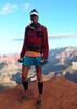
I'm not sure what my spirit animal is, but I'm confident it has rabies.
  1 archive
Feb 01 2025
avatar

 Routes 386
 Photos 49
 Triplogs 792

43 female
 Joined Jun 23 2015
 Phoenix, AZ
Elden Lookout Trail #4Flagstaff, AZ
Flagstaff, AZ
Hiking avatar Feb 01 2025
emilystardustTriplogs 792
Hiking11.93 Miles 2,759 AEG
Hiking11.93 Miles   7 Hrs   7 Mns   1.98 mph
2,759 ft AEG   1 Hour   5 Mns Break
 
Linked   none no linked trail guides
Partners none no partners
Route Scout Route Recorded  on Route Scout | Pop | Map | Popup | MapDEX
Theoretically this should have been covered in snow, but this has been quite the dry winter. More snow than expected on the backside of the loop but no gear needed.
_____________________
 
Nov 07 2024
avatar

 Routes 255
 Photos 8
 Triplogs 261

54 male
 Joined Feb 19 2015
 Phoenix
Elden Lookout Trail #4Flagstaff, AZ
Flagstaff, AZ
Hiking avatar Nov 07 2024
bjonsonTriplogs 261
Hiking5.12 Miles 2,045 AEG
Hiking5.12 Miles   2 Hrs   28 Mns   2.28 mph
2,045 ft AEG      13 Mns Break
 
no photosets
Linked   none no linked trail guides
Partners none no partners
_____________________
 
Nov 06 2024
avatar

 Routes 255
 Photos 8
 Triplogs 261

54 male
 Joined Feb 19 2015
 Phoenix
Elden Lookout Trail #4Flagstaff, AZ
Flagstaff, AZ
Hiking avatar Nov 06 2024
bjonsonTriplogs 261
Hiking7.40 Miles 2,516 AEG
Hiking7.40 Miles   2 Hrs   58 Mns   2.54 mph
2,516 ft AEG      3 Mns Break
 
no photosets
Linked   none no linked trail guides
Partners none no partners
Route Scout Route Recorded  on Route Scout | Pop | Map | Popup | MapDEX
_____________________
 
Oct 09 2024
avatar

 Routes 44
 Photos 2,133
 Triplogs 82

female
 Joined Dec 09 2024
 
Elden Lookout Trail #4Flagstaff, AZ
Flagstaff, AZ
Hiking avatar Oct 09 2024
DesertNymphTriplogs 82
Hiking7.24 Miles 2,403 AEG
Hiking7.24 Miles   7 Hrs   7 Mns   1.17 mph
2,403 ft AEG      55 Mns Break
 
1st trip
Linked   none no linked trail guides
Partners none no partners
A much delayed triplog...

This was my first foray back into hiking after a many year hiatus....probably could have picked something easier, but I've never been one to be tentative 😆 a friend was volunteering to do the driving, and the leaves should have begun turning. Worst case, it would get me out of the heat of the valley for an afternoon.

Since it was a weekday with a later start thanks to the commute from the Valley, the parking lot was nearly empty. Was thankful for cloud cover for the initial portion of the climb, it was cooler up in Flag, but still plenty warm.

The trail starts out gradually enough through open pines as it approaches Elden's base, then turns into a steady upward grind with a fairly steep grade. The tree cover is sparse enough to afford good views of the surrounding areas during my frequent stops toiling uphill to the summit and the lookout tower.

Stopped at the top to take in the views, find the survey marker, and eyeball the buildings around the lookout. Heading back was also a bit slow going due to the steep grade, with us arriving back at the car right around sunset.

It was great re-intro to hiking complete with beautiful views and some autumnal colors.
 Named place
 Named place [ checklist ]
[ checklist ]  Elden Mountain Lookout Tower
foliage observationfoliage observationfoliage observationfoliage observationfoliage observation
Autumn Foliage Observation Moderate
The aspens were golden, with a fair number of trees with little foliage remaining.
_____________________
Happier when hiking....I may not move fast (and I'm often distracted by wildflowers), but I'll get there eventually 😆
 
Sep 22 2024
avatar

 Guides 3
 Routes 633
 Photos 8,249
 Triplogs 605

54 male
 Joined Apr 13 2011
 Gilbert, AZ
Elden Lookout Trail #4Flagstaff, AZ
Flagstaff, AZ
Hiking avatar Sep 22 2024
ddgrunningTriplogs 605
Hiking6.92 Miles 2,454 AEG
Hiking6.92 Miles   3 Hrs   54 Mns   1.89 mph
2,454 ft AEG      14 Mns Break
 
1st trip
Linked   none no linked trail guides
Partners none no partners
Route Scout Route Recorded  on Route Scout | Pop | Map | Popup | MapDEX
Quick side trip up to the lookout on our way home from Utah.

The new, expanded parking area was totally full when we arrived around 1:30 pm. We ended up parking by the visitor center.

Passed a father and his 6 yr old daughter, who told us we were “killing it” and was impressed that we planned to go all the way to the top. Glad to know that our feats are still impressive to 6 year olds. Haha!

It’s been about 10 years since I’ve done this one. Glad to see the aspens on north side of the mountain maturing. The fall colors are starting to pop was well.

Good times.
_____________________
  1 archive
Jun 24 2024
avatar

 Routes 43
 Photos 4
 Triplogs 43

male
 Joined May 15 2023
 Flagstaff
Elden Lookout Trail #4Flagstaff, AZ
Flagstaff, AZ
Hiking avatar Jun 24 2024
aarontTriplogs 43
Hiking5.94 Miles 2,438 AEG
Hiking5.94 Miles   4 Hrs   4 Mns   1.87 mph
2,438 ft AEG      53 Mns Break
 
no photosets
1st trip
Linked   none no linked trail guides
Partners none no partners
Route Scout Route Recorded  on Route Scout | Pop | Map | Popup | MapDEX
Good hike with Mike. Cloudy breezy on top
 
May 04 2024
avatar

 Guides 73
 Routes 176
 Photos 10,174
 Triplogs 2,324

46 male
 Joined Sep 08 2006
 
Elden Lookout Trail #4Flagstaff, AZ
Flagstaff, AZ
Hiking avatar May 04 2024
JimTriplogs 2,324
Hiking5.40 Miles 2,422 AEG
Hiking5.40 Miles
2,422 ft AEG10 LBS Pack
 
Linked   none no linked trail guides
Partners none no partners
The wind forecast is up, [ Deception Peak ] is out, and Elden was in. Deception is probably far nicer in summer when not snow covered. Maybe someday.

It wasn't too bad for this considering the forecast, and I am pretty happy that I was able to hike something else in state and substantial after Fremont Peak, yesterday. Elden was my first real hike in Arizona, so it is poetic that it be the last. Technically, I did a small off trail hike around the San Francisco River, just west of the state line, north of US 180, and east of Luna Lake near Alpine, in August of 2003, but that doesn't really count.

The trailhead is closed for the remodel, and there was ample parking over at the FS Office next door. A trail crew was also out and there has been extensive work done on most of the lower section. I wonder if they will go to the summit? One hopes.

It was windy on the summit, but tolerable for the rest of the hike. Drab clouds moved in making it less scenic, but I didn't mind. With the wind, birds were not as noticeable as I would have expected, but I did hear a hummingbird in the middle sections. I always enjoyed those guys in summer, and their sounds are a memory I recall from my time living in Flag, as well as the very first hike up there in early August of 2006. Nothing is green and the oaks are just starting to leaf out, so it will be a while before any flowers are available for the hummingbirds. I hope it is a good summer rainy season and there is a lot available for them in a few months. These late snows usually mean a dry summer.
_____________________
🍭
 
Dec 16 2023
avatar

 Routes 255
 Photos 8
 Triplogs 261

54 male
 Joined Feb 19 2015
 Phoenix
Mount Elden Loop, AZ 
Mount Elden Loop, AZ
 
Hiking avatar Dec 16 2023
bjonsonTriplogs 261
Hiking10.27 Miles 2,418 AEG
Hiking10.27 Miles   4 Hrs   59 Mns   2.17 mph
2,418 ft AEG      15 Mns Break
 
no photosets
1st trip
Route Scout Route Recorded  on Route Scout | Pop | Map | Popup | MapDEX
This is a fairly challenging hike incorporating several trails into a loop. Start by following the Elden Lookout Trail #4 and
Fatmans Loop Trail #25 to the top of Mount Elden at 9,299 feet. Then start your gradual descent on the “back side” of the mountain via the Sunset Trail #23. Turn right (east) on the Heart Trail #103 and follow it until it intersects the Christmas Tree Trail #160 which will merge eventually with the Fatman’s Loop trail and lead you back to the parking lot.
_____________________
 
Sep 27 2023
avatar

 Triplogs 71

male
 Joined Jan 23 2025
 Seattle, WA
Elden Lookout Trail #4Flagstaff, AZ
Flagstaff, AZ
Hiking avatar Sep 27 2023
dhelderTriplogs 71
Hiking5.40 Miles 2,422 AEG
Hiking5.40 Miles
2,422 ft AEG
 no routesno photosets
1st trip
Linked   none no linked trail guides
Partners none no partners
 
Sep 19 2023
avatar

 Guides 104
 Routes 256
 Photos 16,118
 Triplogs 528

53 male
 Joined Dec 30 2005
 Tucson, AZ
Elden Lookout Trail #4Flagstaff, AZ
Flagstaff, AZ
Hiking avatar Sep 19 2023
Mike_WTriplogs 528
Hiking6.10 Miles 2,417 AEG
Hiking6.10 Miles   3 Hrs   20 Mns   1.83 mph
2,417 ft AEG
 no routes
1st trip
Linked   none no linked trail guides
Partners none no partners
It was my first time finishing this hike. I believe I walked part of it the day before my Mt Humphreys summit or one of the Grand Canyon hikes several years ago. Today I decided to hike all the way to the top. I started hiking around 1:30 pm and reached the summit around 3:20 pm. It was a bit windy up there. I passed a 4 or 5 person group about halfway up. I met a girl named Jordan at the summit and she was from Wyoming. She said she was learning Spanish so I gave her info on my ocean front condo in Rocky Point (Puerto Penasco), which is a 4 hour drive from Tucson or Phoenix. On the way down, 2 guys caught up to me and we ended up talking for about 45 minutes. Toby was one of the guys and he was from Vermont, I believe. I spent some time in upstate NY recently and we talked about some of the hiking back there including Mt Marcy. Toby said he hiked some 14ers before and it was nice to share some stories and info on those hikes. I would guess there were a total of 20 hikers on the mountain that day. It was possible to see Mt Humphreys from the top.
_____________________
Michael Williams
IT Professional
Rocky Point Vacation Rentals
Ocean Front Condo in Rocky Point, Sonora, Mexico
www.beachfrontmexico.us
Image
 
Sep 07 2023
avatar

 Guides 2
 Routes 251
 Photos 4,593
 Triplogs 3,214

63 male
 Joined Feb 26 2008
 Scottsdale, AZ
Elden Lookout Trail #4Flagstaff, AZ
Flagstaff, AZ
Hiking avatar Sep 07 2023
BobPTriplogs 3,214
Hiking5.40 Miles 2,422 AEG
Hiking5.40 Miles
2,422 ft AEG
 no routes
Linked   none no linked trail guides
Partners none no partners
_____________________
https://www.seeitourway.org
Always pronounce Egeszsegedre properly......
If you like this triplog you must be a friend of BrunoP
 
Sep 05 2023
avatar

 Guides 2
 Routes 251
 Photos 4,593
 Triplogs 3,214

63 male
 Joined Feb 26 2008
 Scottsdale, AZ
Elden Lookout Trail #4Flagstaff, AZ
Flagstaff, AZ
Hiking avatar Sep 05 2023
BobPTriplogs 3,214
Hiking5.40 Miles 2,422 AEG
Hiking5.40 Miles
2,422 ft AEG
 no routes
Linked   none no linked trail guides
Partners none no partners
Route Scout was 5ft less.
_____________________
https://www.seeitourway.org
Always pronounce Egeszsegedre properly......
If you like this triplog you must be a friend of BrunoP
 
Aug 29 2023
avatar

 Guides 73
 Routes 176
 Photos 10,174
 Triplogs 2,324

46 male
 Joined Sep 08 2006
 
Elden Lookout Trail #4Flagstaff, AZ
Flagstaff, AZ
Hiking avatar Aug 29 2023
JimTriplogs 2,324
Hiking5.40 Miles 2,422 AEG
Hiking5.40 Miles
2,422 ft AEG10 LBS Pack
 
Linked   none no linked trail guides
Partners none no partners
My hike on the way to the Grand Canyon was trying to do too much on too little time and I did not have as much time as I wanted inspecting the seedlings. So, while leaving I budgeted a bit more time and hiked this again. Still my favorite Trail in the Flagstaff area even if I don't like Flagstaff. I got to a few different areas where they had planted trees and survival is better in the less exposed location. Unfortunately, there is some natural regeneration already existing in these places and the problem is wind damage and herbivory damage. In a few years when the trees grow over the protectors these damaging agents will not go away. It will remain to be seen if a forest can actually be re-established here.

One hopes that perhaps in 20 or 25 years there are some 15 ft tall trees here and maybe even a few taller trees. In 50 years it may be possible that a forest once again dots the slopes of Mount Elden. When coming into town on 89 and looking at the San Francisco Peaks on their East slope it is obvious that this area is not going to be replanted as it is wilderness. One can expect that in 50 years those barren windy slopes will be about as barren as the windy slopes of Mount Elden are today.
Unfortunately, this will likely include everything from the Schultz fire to the now pipeline fire scar. At least it does reestablish the grassy slopes and Meadows on places like Schultz Peak and the South slopes of Fremont Peak.
wildflower observationwildflower observationwildflower observationwildflower observationwildflower observation
Wildflowers Observation Moderate
Red penstemon is abundant attracting hummingbirds.
_____________________
🍭
 
Aug 26 2023
avatar

 Guides 73
 Routes 176
 Photos 10,174
 Triplogs 2,324

46 male
 Joined Sep 08 2006
 
Elden Lookout Trail #4Flagstaff, AZ
Flagstaff, AZ
Hiking avatar Aug 26 2023
JimTriplogs 2,324
Hiking5.40 Miles 2,422 AEG
Hiking5.40 Miles
2,422 ft AEG10 LBS Pack
 
Linked   none no linked trail guides
Partners none no partners
Low survival in the seedlings planted last Summer. Lush and green here, you can tell that Flagstaff has gotten a lot of rain in the last few weeks.
_____________________
🍭
 
Aug 08 2023
avatar

 Guides 27
 Routes 518
 Photos 5,861
 Triplogs 883

72 female
 Joined Jan 21 2006
 Eagar AZ
Elden Lookout Trail #4Flagstaff, AZ
Flagstaff, AZ
Hiking avatar Aug 08 2023
azbackpackrTriplogs 883
Hiking5.76 Miles 2,421 AEG
Hiking5.76 Miles   4 Hrs   30 Mns   1.38 mph
2,421 ft AEG      20 Mns Break
 
Linked   none no linked trail guides
Partners none no partners
I'm back to doing some hiking again. My aches and pains seem less right now, so I'm taking advantage of that situation. This was my first hike to this summit in two years.

When I had almost reached the summit it became really windy and cold. I hadn't brought a jacket. Silly me. There was a big cloud sitting right on top of the big Peaks (see photos). It seemed like a storm could blow in any minute, so I didn't linger on the summit. It warmed up a lot halfway down.

I have a list of 6 peaks for the summer, although I am still mostly biking. Have hiked 3 of them so far: Mormon, Elden and Bill Williams. The rest are Kendrick, O'Leary and Humphreys. I plan on doing Elden again on Friday, since it is a quick workout about a mile from where I'm living.

I need to start posting some of those hikes, plus my 3-day dirt road bike tour.
wildflower observationwildflower observationwildflower observationwildflower observationwildflower observation
Wildflowers Observation Isolated
_____________________
There is a point of no return unremarked at the time in most lives. Graham Greene The Comedians
A clean house is a sign of a misspent life.
  2 archives
Jul 29 2023
avatar

 Routes 9
 Photos 9
 Triplogs 12

59 female
 Joined Feb 22 2019
 CHANDLER, AZ
Elden Lookout Trail #4Flagstaff, AZ
Flagstaff, AZ
Hiking avatar Jul 29 2023
mntncrvrTriplogs 12
Hiking5.40 Miles 2,422 AEG
Hiking5.40 Miles
2,422 ft AEG
 no routesno photosets
1st trip
Linked   none no linked trail guides
Partners none no partners
A good huff and puff hiking Elden Lookout trail #4. There was a thunderstorm threat the entire time. Trail was in good shape for the most part with a few erosion issues and rebar sticking out of worn out wooden steps as well as the ground in some places. There was a trail maintenance team addressing erosion issues which was good to see.
 
Jun 29 2023
avatar

 Guides 10
 Routes 673
 Photos 7,281
 Triplogs 4,660

67 female
 Joined Nov 17 2008
 phoenix, az
Elden Lookout Trail #4Flagstaff, AZ
Flagstaff, AZ
Hiking avatar Jun 29 2023
trekkin_geckoTriplogs 4,660
Hiking6.10 Miles 2,456 AEG
Hiking6.10 Miles
2,456 ft AEG
 
Linked   linked  
Partners partners
tibber
angela and i made a two day trip to flagstaff so she could continue her preparation for a bigger trip
her first choice was fatman's loop
we got going on the loop counterclockwise
nice fresh air, pine trees and a cool breeze
at the intersection with elden lookout trail, we parted ways and i hiked up to the summit
spent a few minutes wandering around and taking photos, then descended to complete fatman's loop
this combo is one of my favorite hikes
we met back at the trailhead and then had some lunch at nimarco's - yum
 Culture
 Culture [ checklist ]
[ checklist ]  Benchmark
_____________________
hazhole
 
average hiking speed 2.04 mph
1, 2, 3, 4, 5 ... 23  Next

WARNING! Hiking and outdoor related sports can be dangerous. Be responsible and prepare for the trip. Study the area you are entering and plan accordingly. Dress for the current and unexpected weather changes. Take plenty of water. Never go alone. Make an itinerary with your plan(s), route(s), destination(s) and expected return time. Give your itinerary to trusted family and/or friends.

helpcommentissue

end of page marker