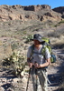
username
X
password
register
for free!
help
ArticlesGuidesRoutes
 
Photosets
 
 Comments
triplogs   photosets   labels comments more
Tapeats Creek - 25 members in 46 triplogs have rated this an average 4.7 ( 1 to 5 best )
1, 2, 3  Next
46 triplogs
login for filter options
Sep 15 2023
avatar

 Guides 59
 Routes 1,100
 Photos 1,191
 Triplogs 1,290

male
 Joined Jan 01 2023
 Arizona
Tapeats Redux, AZ 
Tapeats Redux, AZ
 
Backpack avatar Sep 15 2023
pseudalpineTriplogs 1,290
Backpack26.55 Miles 8,594 AEG
Backpack26.55 Miles3 Days         
8,594 ft AEG
 
1st trip
Partners partners
shelby147
 Fauna
 Fauna [ checklist ]
[ checklist ]  Chuckwalla
  6 archives
Oct 23 2022
avatar

 Guides 59
 Routes 1,100
 Photos 1,191
 Triplogs 1,290

male
 Joined Jan 01 2023
 Arizona
Tapeats CreekNorthwest, AZ
Northwest, AZ
Backpack avatar Oct 23 2022
pseudalpineTriplogs 1,290
Backpack9.42 Miles 5,390 AEG
Backpack9.42 Miles   5 Hrs   40 Mns   2.07 mph
5,390 ft AEG
 
no photosets
1st trip
Linked   linked  
Partners none no partners
  5 archives
Oct 22 2022
avatar

 Guides 59
 Routes 1,100
 Photos 1,191
 Triplogs 1,290

male
 Joined Jan 01 2023
 Arizona
Lower Tapeats, AZ 
Lower Tapeats, AZ
 
Hiking avatar Oct 22 2022
pseudalpineTriplogs 1,290
Hiking5.65 Miles 1,340 AEG
Hiking5.65 Miles   5 Hrs   29 Mns   1.50 mph
1,340 ft AEG   1 Hour   43 Mns Break
 
no photosets
1st trip
Linked   linked  
Partners none no partners
  4 archives
Oct 20 2022
avatar

 Guides 59
 Routes 1,100
 Photos 1,191
 Triplogs 1,290

male
 Joined Jan 01 2023
 Arizona
Thunder River TrailNorthwest, AZ
Northwest, AZ
Backpack avatar Oct 20 2022
pseudalpineTriplogs 1,290
Backpack9.73 Miles 807 AEG
Backpack9.73 Miles   4 Hrs   24 Mns   2.47 mph
807 ft AEG
 
no photosets
Linked   linked  
Partners none no partners
  3 archives
Oct 19 2022
avatar

 Guides 3
 Routes 632
 Photos 8,235
 Triplogs 604

54 male
 Joined Apr 13 2011
 Gilbert, AZ
Thunder River & Deer Creek Loop, AZ 
Thunder River & Deer Creek Loop, AZ
 
Backpack avatar Oct 19 2022
ddgrunningTriplogs 604
Backpack39.81 Miles 12,760 AEG
Backpack39.81 Miles5 Days   4 Hrs   25 Mns   
12,760 ft AEG
 
1st trip
I had been angling for a permit to hike the Royal Arch route, but with the access issues, I decided to put in for a return trip to Thunder River and Deer Creek. We did this loop with a few of our younger kids several years ago, but this time, I added two more days to the schedule, for a more relaxed pace, and an opportunity to hike the off-trail route to Tapeats Spring.

I invited my oldest daughter--now a mom of three herself, to join me for a father-daughter adventure. She has often complained that she missed out on the really cool family hikes we've done because she left home before the younger kids were old enough for us to take on many ambitious adventures. So, it was something of a "make-up" trip. I also invited a good friend and GC hiking companion, whose youngest daughter also joined. Then, somewhat last minute, my wife came down with a case of FOMO and decided she wanted in after all. Luckily, getting an extra spot on the permit was as easy as a call to the BCO (which also adjusted our itinerary to get us what I considered the ideal camping spots :y: ).

Day 0--Drive to the TH and Camp on the Rim: Four of us drove up to Jacob Lake, where we rendezvoused with my daughter, who drove down from Utah. We parked her car at the Kaiabab Lodge (with the owner's permission) and headed off towards the Bill Hall TH.

The temperatures had been relatively warm and many of the aspens were still looking green and leafy. On our return a week later, not so much ...

The drive out to Crazy Jug Point was uneventful, and the roads were in good condition. At the four-way intersection just before Crazy Jug Point, we turned right to find the sweet camp spot right on the edge of the rim. Unfortunately, it was already taken, so we continued on towards the TH, where there are two other nice pull outs for camping (but with the views of the canyon more obstructed by trees). We set up camp in one of these, then drove back to Crazy Jug Point and hiked down a bit to enjoy a beautiful sunset. Once there, we wished we had set up camp at the nice camping spot next to the parking area for CJ Point. Oh well.

We enjoyed a cool night, but with a blazing campfire for company!

Day 1 Bill Hall TH to Upper Tapeats: Woke early and drove the 1/2 mile or so to the TH. Several cars in the parking area. Off we went, starting with the counterintuitive uphill climb to the drop in spot at Monument Point. The initial descent was as steep and rocky as I remember. With a little more familiarity with the landscape, I looked down on the Tapeats Amphitheater, eyeing what would be the off-trail destination for Day 2--Tapeats Spring.

Rounding the corner below Monument Point offers the equivalent of the South Kaibab "Ooh Ah" Point, where the Esplanade comes into view, along with miles and miles of zig-zagging Canyon, heading off towards Havasupai and beyond, with Mt. Trumbull providing some contour to the north rim landscape.

The "tricky" downclimb at about 1.5 miles was fine, generally requiring handing down packs. That was followed by another steep drop via dozens of short switchbacks, which we dubbed "squiggle-backs," until reaching the junction with the Thunder River trail at the edge of the Esplanade.

As we crossed the Esplanade, we cached water for our night 5 camp and continued on. the Esplanade is a very cool, Sedona-like area, and I was excited to return and enjoy the Esplanade a little more fully than can be taken in during a crossing on the way to somewhere else.

At the south edge of the Esplanade, we stopped for lunch and looked down on the most desolate area of the trip--Surprise Valley. We wondered where the name came from and speculated that, with all of the amazing surrounding territory, the desolation of the valley was "surprising." Turns out that the name was actually tied to John Wesley Powell's second expedition, when the crew's photographer, E. O. Beaman, "accidentally" stumbled upon the Deer Creek valley. Per some authorities, and for unknown reasons, the U. S. Geological Survey moved the map location around 1960 to its current inaccurate location between Deer Creek and Thunder River. http://www.allhikers.com/Other/Grand-Ca ... ames.htm#S.

Anywhoo, we descended the rocky route down into the Valley and hung a left at the trail junction. At this point, I began thinking of the NAU student, Bryce Gillies, who died near here in July 2009 after erroneously following the route down the Bonita Creek drainage and getting cliffed out, instead of continuing over to the Thunder River drainage. I remember reading about this tragedy and wondering how he could have made that mistake. But after hiking it this time, I can definitely see why--first, the trail across Surprise Valley to Thunder River requires going both UPHILL and AWAY from the Colorado River--both of which would seem very counterintuitive, if one didn't know better.

Luckily, we knew better and headed away and uphill, eventually coming into earshot and then seeing Thunder River pouring out of the side of the canyon wall like a giant faucet, several hundred feet below. It is truly an amazing sight.

We hung out at the falls/spring for awhile and then finished our descent into the Upper Tapeats campground, securing the large camping spot. Surprisingly, we had no company in the campground and only passed one other set of hikers the entire day. We would stay here for two nights.

No marauding mice, but I did make the mistake of putting a fresh apple at the bottom of my ratsack, and a ringtail spent a good chunk of time overnight nibbling tiny very tiny bites out of it through the small metal mesh. :-/

Day 2--Rest Day OR Tapeats Spring: On day 2, my buddy and I had our eyes on making our way up to Tapeats Spring. Our two daughters were up for some exploration up Tapeats Creek, but turned around after about a mile up canyon. My wife was content to take the day off and relax and read around camp. After turning up the Tapeats drainage at about 1.5 miles from camp, the going gets rough--and sketchy (which is saying something on this hike, where the trail portions can get pretty sketchy).

After a lot of hard work and a lot more up and down than I was anticipating (crossing boulder slides and side drainages), we made it to the spring. Very cool area, where once again the creek literally emerges from the rock. It's not as spectacular an exit as Thunder Spring, but still worth a visit.

It took us about 4 hours to cover the 3.2 miles from camp. The return trip was not as long or strenuous, but honestly, going down was more nerve-wracking than going up. Thankfully, we navigated it all well and arrived back at camp by late afternoon.

Another pleasant night on in the campground.

Day 3--Upper Tapeats to 135 mi. Rapid: Day three was a short jaunt down to a camp on the River at 135 mile rapids. We played in the creek and hung out at the confluence of Tapeats Creek and the Colorado, watching rafters and kayakers run the rapids. Several NPS rafts were tied up at the confluence, and a team had headed up creek to scope out a replacement for the bathroom facilities at Upper Tapeats. The remaining crew were relaxing at the river. I chatted with them and they graciously filled our water bladders for our dry camp that night (the River was silty).

As planned, we camped at 135 mile rapid. It was more rocky than last time and we wished we had set up camp at a nice, but small beach a little further up river.

Day 4--River to Deer Creek: I got up early on Day 4 and wandered down towards Granite Narrows to watch the sun rise. It was a beautiful morning. After breakfast, we packed up and headed over to Deer Creek. There is some solid uphill climbing to get to the saddle before descending back to the Deer Creek drainage.

Given the short distance, we arrived fairly early and headed up to snag the large campsite on Deer Creek. After setting up camp and eating lunch, we headed back downstream to the Patio, Narrows, and Deer Creek Falls. All were a major highlight of the trip, though the Patio was swarming with rafters on our way down--probably about 25-30 people lounging in the area.

When we got to the falls, there were about 15 rafts or dories tied up. Luckily, while the rafters were at the Patio, we enjoyed the falls in relative solitude. Then, when we headed back to camp, the rafters had all retreated and we had the patio to ourselves in the late afternoon.

That night, after we hit the hay, it started raining--and it continued raining all night long, literally 6-7 hours non-stop. Thankfully, the storm tuckered out by the time we got up in the morning, and we didn't have to hike in the rain or set up/take down camp in the rain. We did note by looking across the canyon at the south rim that there was snow at the higher elevations.

Day 5--Deer Creek to Esplanade: We shared the Deer Creek camping area with two other groups. In the morning, we packed up and headed out for our biggest climbing day--first up to Surprise Valley and then up to the Esplanade. Along the way, we stopped at the now-dry Deer Spring, and hung out and relaxed in the "Throne Room," which has around a dozen or so "thrones."

We arrived at our camping spot on the Esplanade by mid-late afternoon. It was chilly, with a stiff breeze whipping up the wind-chill factor. We adjusted our camping location to take advantage of some natural wind breaks. The wind mostly died down around sunset, which was spectacular, with the clouds providing an amazing backdrop, and the water-filled potholes on the Esplanade reflecting all of the light.

Before bed, the breeze kicked in a bit and wafted down some brief snow flakes (but nothing that stuck). We went to bed at 7 and stayed in the tents for a good 12 hours. :-) My daughter (and mom to 3 boys--5, 3, and 2) said she got more sleep on our backpacking trip than she's had in years!

Day 6--Esplanade Out: Our last day was a relatively short (but steep) hike out to the TH. We passed a couple of groups and asked about road conditions. Apparently, the rain from the prior night dropped 4-5 inches of snow on the rim, but all reports were that he roads were okay. Once at the TH, we found snow on the car and icicles hanging from the bumper. The drive out was fine, but there were more ruts and an occasional slight fishtail here and there.

Once back on the main road to Jacob Lake, we found the aspens to have quickly shed their leaves and winter had set in. We had hoped to catch a shower at the Kaibab Camper Village, only to find that they had closed for the season one week earlier. :-( We stopped at Jacob Lake for a hot meal, and then headed to public showers near the Marble Canyon Lodge. I give them a one-star rating--one was too hot; another too cold; and a couple that just ate quarters without any shower at all. Despite that, we managed to get relatively clean and had an uneventful return to civilization--and an inbox with about 700 emails in it. Welcome back to reality!
_____________________
  1 archive
Sep 15 2022
avatar

 Routes 5
 Photos 435
 Triplogs 119

female
 Joined Mar 26 2022
 Flagstaff, AZ
Cranberry Canyon attempt, AZ 
Cranberry Canyon attempt, AZ
 
Backpack avatar Sep 15 2022
shelby147Triplogs 119
Backpack42.00 Miles 10,500 AEG
Backpack42.00 Miles4 Days         
10,500 ft AEG28 LBS Pack
 no routesno photosets
1st trip
Took 4 days to backpack around Deer and Tapeats creeks. We were hoping to return to Indian Hollow via the cranberry route but couldn't find the redwall route before it got very hot. Overall the trail was slow (or NPS mileages were off) but it was very rewarding.

Day 1: Indian Hollow to Deer Creek. There were thunderstorms the previous afternoon and for a couple hours fog was evaporating off the esplanade - what a pretty effect. Potholes were abundant on our hike down and somewhat more limited on the return trip. We didn't have trouble following the old trail along the esplanade to Bill Hall jct although others reported it was difficult.

It was already warm by the time we reached Surprise Valley but we promptly found a big rock with ample shade. We made sure to stay on top of food and electrolytes and still got hot by the time we reached the creek, where we took a long break in the water. The trail to deer creek is slow over boulders and talus, but the rocks are stable. On the way to the campsite we found some flowers which were absolutely swarmed by tarantula hawks. I got excited about the photo opportunity until I noticed a truly giant wasp....

After setting our tents we continued to the patio and the beach. Wow. Possibly my favorite mile in the whole canyon. We debated and decided you'd likely die if you fell off the ledges above the narrows so we made sure to return to camp sober and before dark. As soon as we arrived on the beach a boater walked straight over and offered us beers and trash service - how wonderful! We had enough time for a quick dinner and wade around the falls before heading up to bed.

Day 2: loop through Thunder River/ Tapeats Creek. We started early and were treated to beautiful light once we got over our intial hill - golden beams shining onto the opposite side of the canyon. The trail was easy walking for about a mile and reminded me of Beamer. Some big pontoon boats passed below - that was my first time seeing them and... they're a bit much.

After a quick wade in the river we started up into Tapeats Creek. It got hot fast when we were on the hotter rocks. The trail was a little exposed on both sides of the river, but river left was worse. The Thunder River crossings weren't evident so we made our best guess. We found a nice pool and probably spent a good hour sitting in the river around noon. This paid off later because our hike out to Surprise Valley was cooler than the rest of the day had been. There were also two easy access points to the waterfall and we took advantage to keep cool. Back in Deer Creek we enjoyed dinner at the patio and filtered lots of water (thank goodness for gravity filters) to prepare for our tough next day.

Day 3: Cranberry crack attempt. We got an early start and each carried 7-8L water. Right off the bat we took the hard way up to the ancient lake bed, going over the lower saddle instead of the upper. The lakebed was very cool and the easiest walking of the entire trip. We lost elevation rather than try to sidewalk on the talus below our goal slope. First we headed straight up and lost access to cross the big ravine to climbers right. We descended partway after realizing and found a cairn indicating where to enter the ravine. There was another cairn in the ravine that wasn't visible from the first cairn, so we added one to fill the gap. The scrambling got easier for a little while, although it continued heating up. The nastiest section was talus at the base of the redwall.

Thinking our chute was at climber's left, we climbed to the base of the redwall and used handholds on the cliff to stay secure on this nastiest bit of talus. My friend climbed to the only possible chute we saw and said it was no-go. We'd already decided that was our last ditch and we weren't wasting time in the heat searching for our chute, so we promptly turned around. I think the proper chute was actually slightly to the right above us but I'd accidentally deleted my reference photos, GPX, and notes - ugh! We had a hot, slippy, slow climb back down the talus and were relieved to return to a semblance of flat ground. This time we took the higher saddle to exit the ancient lakebed with much better results. When we reached the trail he proceeded to the patio for a very welcome rest, then down to the beach/ falls again for dinner.

Day 4: Missing the Cranberry route meant we had a long hike out. We hit the trail at 5:15am and worked hard to ascend out of Surprise Valley before the sun hit us. We took a bit more time on the esplanade, finding a few nice shady spots on the slickrock where we couldn't resist breaking. Only the largest/ most sheltered potholes were still full.

I had some nasty hot spots developing (strangely, I never noticed them until I took my shoes off each evening so they got quite bad) and I was quite "over it" by the time we began our final ascent to Indian Hollow. After dumping excess water (my pack was probably now below 15lbs) I got a second wind and was marching along... until the trail routed around a dead tree. The tedium of scrambling 15ft down loose talus just 5 minutes from the trailhead nearly broke me. Once on the rim, I was hardly interested in a last look into the canyon, but that's about normal for me. Happily, I had grilled cheese fixings waiting in my car.
 
Apr 17 2022
avatar

 Routes 137
 Photos 1
 Triplogs 105

44 female
 Joined Oct 21 2016
 Tempe, AZ
Bill Hall TrailNorthwest, AZ
Northwest, AZ
Backpack avatar Apr 17 2022
MAPTriplogs 105
Backpack23.72 Miles 7,727 AEG
Backpack23.72 Miles4 Days   3 Hrs   52 Mns   
7,727 ft AEG
 
no photosets
1st trip
Most magical hike of the GC so far! This is the GC spectacular. Seriously, this hike has it all. All the indescribable views, all the adventure, all the giant waterfalls, narrows, springs, wide open esplanade, ALL the fantastic ups, everything wonderful and nothing terrible.

DAY 1: Bill Hall TH to Deer Creek Camp AX7 (~8 hours, 8.7 miles, 634 ft aeg)
We camped up near the Bill Hall TH Saturday evening and started hiking around 7:30 am Sunday. Got all warmed up hiking the little bit of up to Monument Point before heading down down down...and then some more down. The views the entire hike down this section through the Kaibab, Toroweap, and Coconino Sandstone Formations are majestic. There are a couple of areas we had to sit & scooch or drop a bag down but nothing of any difficulty. It is pretty slow moving over the first couple of miles though. We reached the Thunder River Trail connection around 9:30 am and a couple of people in our group stashed water for the hike back out. From this point, the hike down is less steep and fairly smooth moving across the Esplanade. The Esplanade is an alien world and I love everything about it. Some of the people in our group were starting to get pretty warm hiking across the Esplanade; the rest of us were just in awe of the wild rock sculptures. We stashed water in the rock pockets just above the Redwall decent, chatted with a Park Ranger and showed him our permit, and headed down around 11:30 am. We were all feeling the heat now. The hike down the Supai and Redwall Formations to Surprise Valley is really hot mid-day, even in the cool Spring months. And it's A LOT, even going down. But the views are fantastic and that helps to ease the physical part. The fork in the trail (right to Deer Creek, left to Thunder River and Tapeats Creek) is marked by a couple of tall sticks haha. No formal sign or anything so keep an eye out. At the intersection, we headed west on the Deer Creek Trail. This is where it began to feel like the trail would never end & the sun/heat was sucking the energy out of me. I got a boost of energy as we started to descend toward Deer Creek buuuuut slowly realized there was still a long way to go. There's a sketchy turn in the descent and a sketchy crossing of scree but the narrow turn is super short and the scree is stable. AND this is right around the point where Deer Spring is visible. Finally FINALLY beautiful cold water! We played in the spring for a while, climbed up behind the waterfall, got refreshed and cooled down. There were rafters at the spring who had hiked up from the river and they looked much less rough than we did. We left the spring and just a few hundred feet down reached Deer Creek. A few from our group were hanging out under the big beautiful Cottonwood tree just as the trail meets Deer Creek. We all trudged the final half mile to the campground in a daze. Everything looked like a paradise after the hot long miles we had just come from. We got to Deer Creek camp (AX7) around 3:30 pm and found our perfect shady spots to set up camp.

DAY 2: Deer Creek Camp to Deer Creek Falls and Back (~2 hours hiking time, 1.5 miles, 500 ft aeg)
After a peaceful and beautiful night's sleep in the canyon, we woke up Monday and packed day packs to head down to Deer Creek Falls and the Colorado River. Whatever we were feeling from the day before, the Deer Creek Narrows awakened something special in every one of us. This is a sacred place. I felt like I was moving through a place where words lost meaning and people were instantly calmed and quiet. The narrows feel enormous but there are a handful of tight squeezes as you move closer to the river. A small daypack was fine but I would not want to carry a backpacking pack through the tight parts. There were groups of rafters moving through the Narrows as we headed down and everyone was kind and friendly. At the end of the Narrows you walk out of the canyon and get a spectacular view of the Colorado River...and 50 rafts on either side. Woah. It's a strange feeling to go from quiet & solitude to a bustling city of rafting trips. After a few switchbacks and a steep drop down along the trail...the great ginormous Deer Creek Falls in all its glory. We hung out at the falls (most of our group jumped in!) for about an hour before the people thinned out & the rafts left & we had the place to ourselves. What a treat! The GC is amazing. There are entire perfect worlds tucked away in her canyons. Deer Creek Falls and the Narrows are definitely one of the most magical canyon worlds. We hiked back up to camp & got ready for our early start the next day. Oh and hikers who came in late saw the pink rattler up near the toilet! We tried to find them but weren't as lucky.

DAY 3: Deer Creek Camp AX7 to Upper Tapeats Camp AW7 (~6 hours, 5.5 miles, 1,400 ft aeg)
Got up early to beat the heat & started hiking around 4:30 am. About a half mile in the trail splits & we stayed left to take the high route. We hiked a few miles of the river trail in darkness but it was straightforward to navigate. As soon as the sky started to fill with light the views of the Colorado River were unbelievable. We came to the "climb" at the mouth of Bonita Creek around 7 am and it is not bad at all coming from the Deer Creek side. Most of our group scrambled up with no problem. I passed my bag up & someone threw a handline down to me but I didn't need it. Honestly, it looked like a totally different story looking down from the top so I'm happy we got to climb up instead of down. We got to Tapeats Creek, took a break, and headed up and up and up and up. It felt like the up was never-ending. The trail along Tapeats Creek definitely had the most sketchy sections of trail (narrow trail with steep drops) and there were many of these sections. Those actually didn't bother me even though I'm afraid of heights but they bothered others in our group who are good climbers so go figure. The hike up Tapeats Creek has the most insanely incredible views of the entire trip the ENTIRE hike up! Maybe I was too obsessed with the views to notice how sketchy the trail was. We got to Upper Tapeats campsite (AW7) around 10:30 am and basically plopped down in the creek & sat there forever to cool down. There is not much shade during the day at the Upper Tapeats camp but luckily the water is right there & is nice & cold. We explored the little moss-covered waterfalls upstream and explored the rock ledges above our camp where my friend found a sleepy rattlesnake. One person in our group had bad blisters and another was feeling very anxious about the heat so we decided to only stay one night out of our planned two nights at Upper Tapeats. It was for the best since a group the same size as ours came to camp and wanted to stay at the site we were already set up at. We decided to hike to Thunder Spring in the morning and hang out there all day until evening when the sun would be blocked.

DAY 4: Upper Tapeats Camp AW7 to the Esplanade (~4.5 hours, 3.4 miles, 3,160 ft aeg)
Got started around 10:30 am and hiked one hour (0.7 miles and around 1000 ft elevation gain) to reach Thunder Spring. And that's where we stayed until 5 pm. :sweat: Thunder River Falls is like a magical fairyland if fairies were into death metal. There are beautiful moss-covered pockets and crystal clear water and it is LOUD. It was a fun relaxing place to spend the day. We all made some food & filled up with cold water and headed on up to Surprise Valley with the sun blocked the whole way up. Surprise Valley was lovely in this light and seemed more lovely and interesting on this side compared with the Deer Creek side. We powered up the Redwall (which surprisingly felt much better going up vs going down - probably because of the lack of direct sun) and made it to the top and to the Esplanade just as it got dark (around 7:10 pm). The rest of our group got to the top and we found our water cache in the rock pockets where we had left it. At that point, it was 8:30 pm & dark dark. Hiking the Esplanade in the dark was too difficult so we decided to sleep on the rocks (not disturbing the cryptobiotic soil) and hike out in the morning. It was a crazy windy night but we were happy to have one big "up" behind us and a great view of the stars above.

DAY 5: Esplanade to Bill Hall TH (~4 hours, 4.6 miles, 2,025 ft aeg)
Morning Esplanade! I sure love this place. Started hiking at 7 am and reached the Thunder River Trail connection and the second stash of water an hour & 20 minutes later. Now for the real fun part. Those final 2.25 miles were a struggle and a half. But I just kept up my little train that could - slow & steady choo choo. We saw a number of groups heading down as we went up. It's funny, everyone wants to chat heading down but the feeling is not mutual going up. We took a break in the cave and kept going for the final push to the top. Made it to Monument Point at 10:30 am and what a relief! It did not feel like 3 1/2 hours...more like 10. Epic epic everything.

Seriously, I want to live here. Or visit all the time. It's all hard. And usually hot. And pretty darn real. And I think people probably come out changed. These places will be a part of me forever. They are that special and I'm grateful to get to visit.
_____________________
 
Apr 10 2022
avatar

 Guides 1
 Routes 269
 Photos 613
 Triplogs 1,360

50 male
 Joined Dec 22 2003
 Tucson, AZ
Crazy jug and Steamboat, AZ 
Crazy jug and Steamboat, AZ
 
Backpack avatar Apr 10 2022
RedwallNHopsTriplogs 1,360
Backpack27.00 Miles 11,800 AEG
Backpack27.00 Miles
11,800 ft AEG
 no routes
1st trip
Linked   linked  
Partners none no partners
Drove up on Saturday and camped near the drop in for Crazy jug.

Sunday:Descended Crazy Jug. Fun canyon. We had some debate on trying to bypass a couple of pools in the narrows as none of us brought wetsuits. We decided to go for it. With some teamwork we didn't get too wet.
Fun canyon. We explored up Timp canyon a waze till we got to a big pretty waterfall. Camped at the muav ledges near the junction with Saddle Canyon.

Monday: Steamboat mountain. We had a bit of beta and it didn't sound too challenging so we didn't bring the harnesses but we did bring an 80 foot rope for a handline. We headed up Saddle a couple miles. The Muav narrows were amazing and we could not avoid getting wet. We eventually left saddle and climbed steeply up through the Supai. A couple challenges there but nothing too bad. The Coconino was mostly a steep walkup with a short scramble near the top. The next challenge was the cruz - the Toroweap. We had info from Harvey logs where there is an easy way though around the mountin - but we didn't want to go that far - so our plan was to figure out the chimney route. We knew it went but that's about it. WE tried a couple spots and finally decided on a spot to climb. It took a few of us to do the climb as it was pretty sketchy and loose. Felt like 5th class to me. We set a handline for the upper part. After the climb we decided to find another way down. We had one more climb in the Kaibab. It was a loose chimney. After that we found the summit and had a nice break.
On the way down we found a different way through the Toroweap. It was better but still fairly sketchy. Kinda wished I had a harness as I would have preferred to rap instead of handline.

Tuesday: Down Saddle to Tapeats. Hiked up Tapeats a waze without packs. Camped down Tapeats past the junction. The water was high and we did some team swiftwater crossings to stay safe

Wed: Out via Bill hall
_____________________
 
Oct 08 2021
avatar

 Routes 8
 Photos 2,243
 Triplogs 204

38 male
 Joined Mar 07 2009
 Colorado Springs
Thunder River loop, AZ 
Thunder River loop, AZ
 
Hiking avatar Oct 08 2021
ultrazonaTriplogs 204
Hiking13.00 Miles 4,260 AEG
Hiking13.00 Miles4 Days         
4,260 ft AEG
 no routes
1st trip
Fall colors popping on the rim. Did loop clockwise. Lots of pools on Espande. Attempted hike up Tapeats to cave, but ran out of time (overgrown/slow going), probably need the better part of a day. Thunder River Trail, Deer Creek Trail and parts of Tapeats Creek have washouts and need some repair. Took full lower route from lower Tapeats to Deer Creek. One section of lower route (past Western junction with Upper Route) has a narrow ledge and exposure (see photos). All toilets at mass capacity! Lots of road closures in area, consult FS before planning route. Route from Fredonia in great shape.
foliage observationfoliage observationfoliage observationfoliage observationfoliage observation
Autumn Foliage Observation Light
Light below the rim. Peaking up took in areas.
_____________________
  2 archives
Oct 28 2020
avatar

 Guides 59
 Routes 1,100
 Photos 1,191
 Triplogs 1,290

male
 Joined Jan 01 2023
 Arizona
Thunder River TrailNorthwest, AZ
Northwest, AZ
Backpack avatar Oct 28 2020
pseudalpineTriplogs 1,290
Backpack9.73 Miles 807 AEG
Backpack9.73 Miles
807 ft AEG
 
no photosets
Linked   linked  
Partners none no partners
  2 archives
Nov 09 2019
avatar

 Photos 392
 Triplogs 25

38 male
 Joined Apr 01 2018
 Phoenix, AZ
Bill Hall TrailNorthwest, AZ
Northwest, AZ
Backpack avatar Nov 09 2019
bretinthewildTriplogs 25
Backpack24.00 Miles 9,855 AEG
Backpack24.00 Miles3 Days         
9,855 ft AEG
 no routes
1st trip
Check this one off the bucket list. :DANCE: Awesome trip with friends over Veteran's Day weekend. We had a permit for Upper Tapeats on Saturday and Esplanade on Sunday.

Friday -- Called in some Cornish Pasty for pick-up on the way through Flagstaff. Got up to Jacob Lake and car camped off FR 461 in the pines. With a long drive from Phoenix and having not been to Bill Hall previously we opted to do most of the forest roads the following morning.

Saturday -- Drove to Bill Hall trailhead; roads all in really good shape. Hiked down and we each cached 2-3L water on the Esplanade, which we saved for the hike out on Monday. Made it down the Red Wall Break, through Surprise Valley and past Thunder River to Upper Tapeats for the night. It's a nice camp; sites are pretty spread out for privacy. Easy access to the creek. Toilet was super full (gross) and there were mice at our site. But we enjoyed nonetheless and let the creek roll us off to sleep. 8.8 miles.

Sunday -- This was our big day. Our group split up in 2 pairs. One group decided to hike back up to the Esplanade the way we came, knowing it was going to be tough enough just to get back up the Red Wall section. I opted with a friend to take the "scenic" route looping around along the Colorado River to Deer Creek Falls and back up. It did not disappoint and was probably my toughest day in the canyon yet.

Leaving Upper Tapeats, we took the route west of the creek down to the river. We thought about doing the east route but couldn't quickly find a suitable place to cross the creek. After turning up the river we opted for the lower route once it splits off, mostly because it looked shorter. There were a couple places where the trail was pretty narrow with some exposure, but it's definitely passable. Reminded me of some tight spots on the Tonto and Clear Creek trails.

We dropped our big packs at Deer Creek, got through the narrows and to Deer Creek Falls for lunch. Had the falls to ourselves for about 10 minutes before some rafting folks came by. Filled up our water at Deer Creek and started the grueling last part of our day up into Surprise Valley and over the Red Wall Break.

Sun went down on us at the beginning of the wall so we did most of it in the dark. On the Esplanade someone has tied very small reflective string to guide the route, which was super helpful at night. Made it to camp exhausted and happy. 11.5 miles.

Monday -- Relatively quick hike out but all uphill. Glad we camped at the Esplanade to cut down on some of the mileage and elevation. 3.7 miles. Called in some Diablo Burger for pick-up on the way back through Flagstaff.

Overall, great trip to a special place... If we had more time I would've liked to stay an extra night at Deer Creek to split up the hike, which would have let the others in our group experience it as well. Next time...
 
Oct 10 2019
avatar

 Guides 4
 Routes 93
 Photos 302
 Triplogs 697

51 male
 Joined Jul 05 2008
 Gilbert, AZ
Tapeats CreekNorthwest, AZ
Northwest, AZ
Backpack avatar Oct 10 2019
adeniumTriplogs 697
Backpack36.75 Miles 6,836 AEG
Backpack36.75 Miles4 Days         
6,836 ft AEG40 LBS Pack
 no routes
1st trip
Linked   none no linked trail guides
Partners none no partners
This trip has been on my radar since a friend of mine talked it up. He walked from Bill Hall Trailhead to Thunder Springs and back in a day. An amazing feat, in my estimation. More amazing is that this was the first hike on which he took his novice hiker girlfriend. More amazing still, they're now happily married.

DAY ONE: I slept poorly the previous night. No particular reason, other than a cat that expresses her adoration for her humans in the small hours of the morning. I arose (or gave up trying to sleep) at 3:30a, showered, and ate. I bade farewell to the family at 4:30a, and soundly beat the Phoenix morning rush hour out of town. Six-and-a-half hours and several podcasts later, I arrived at the Bill Hall Trailhead. A last minute review of my pack had me adding my fleece (ouch, like 2 lbs!) and deciding against ditching my Helinox chair. Both decisions were correct in retrospect. Shortly I was hiking down... or up, actually. Bill Hall starts with a hill.

Upon reaching the REAL trail, the bit that tips down into the canyon, I almost slipped and fell on my butt. I wasn't mentally prepared for the steepness nor the loose rock. From there on, I was on alert. No daydreaming, especially in certain sections further down in the shale layers. I really didn't grasp the steepness going down... it wasn't til I came back up that I realized what kind of sadistic SOBs the trail crews truly were. Going down, I was just glad that it went quickly and I didn't fall and break my coccyx.

After the first drop, through the Coconino and Hermit Formations, came the Esplanade... two plus miles of rolling slick rock and easy packed sand trails. Coming and going, it's a great respite from the hard climbs. I had originally planned to camp here, on the edge. In my mind's eye, four months prior, I imagined cowboy camping under the stars on the edge of the Esplanade overlooking Surprise Valley, needing only my sleeping bag for warmth. :lol: Yeah, so NWS issued a freeze warning for Prescott, which happens to be roughly the same elevation as the Esplanade. Plus, at 2 in the afternoon it was windy and already kinda chilly... I decided that despite what the itinerary on my backcountry permit said, I was going to drop down into Surprise Valley. Thus, my first day hike included a drop through the Redwall. By the end of this, I had some serious jelly legs. I pressed on to just before the drop into the Tapeats Creek area. The wind was crazy at this point, and I set up my tent in the shelter of a large rock, weighing it down with my pack. About 5:30p the wind stopped just long enough for me to move to a better spot and stake out my tent. Golden Hour came, and the walls of the canyon lit up like molten gold and all was well.

DAY TWO: Slept in, which is rare for me when camping. I attribute this to being tired from lack of sleep the previous night and also to getting my first new ground pad in 20 years. YES! After 20 years, I ditched the old self-inflating Therm-a-rest for a newfangled Nemo. Anyway...

I had sneaked a peak over the edge at Thunder Springs the night before, so I had an idea of what was next. The hike down was full of expectation and every bend gave me a new and better view of Thunder Springs. This thing just makes my mind reel... maybe I've lived in the desert too long. This spring discharges 21 million gallons of water per day from a cave in the side of a cliff. Standing under it is a constant roar, and depending on where you stand, a constant cool spritz

After this, I knew I had a short jaunt to Upper Tapeats campground. The trail is fairly easy here, although there is one section that demands focus on the trail, lest the unwary hiker take a long and tragic tumble. Reaching the campground, I was at a loss as to what was a campsite, being oblivious to the prominent signs that mark out the three designated camp sites. The first, and most obvious, is the large group site. I gave this a pass as I was neither "large" nor a "group." Also there was no shade. The second, and most choice site, was occupied. This site has nice access to Tapeats Creek and large Cottonwood Trees. Further down, is the third site... my little home for two days. Not a bad site, but poor access to the creek. I mean, it's THERE, thundering at you. It's just not reasonably safe to get down to for filtering water. Not a big deal, as there were a couple of sites upstream at which to filter.

After setting up camp, I struck out upstream determined to reach the source of Tapeats Creek. What happened is that I realized I should have brought my Chacos because there were a ton of water crossings. I did the old "shoes-and-socks-off"" routine about five times before I decided that I hate the old "shoes-and-socks-off" routine and went back to camp. I wasn't too disappointed, it's just too damned pretty to be mad at nature for making me take of my shoes and socks repeatedly.

DAY THREE: Colorado River day. I took the path on the west side of the creek, because... well, we've discussed water crossings haven't we? The east side route demands you cross the creek first thing. So, I headed down the west side path. There are four progressively large hills to pass. These trend with the rock layers that dip to the north. Heading south, you have to work your way up each of these four major "hard" layers then down the other side through "softer" layers. The last is some sort of metamorphic layer (not the Vishnu Schist as I had thought) that places you far up above the confluence of Tapeats Creek and the Colorado River. The payoff is a great view of the confluence... but you end up descending a steep trail with plenty of loose rock.

Having reached the confluence, I decided to head toward Deer Creek, because... sure, why not. The route along the river is easy for the most part, but there is a point before Bonita Creek that looks like a rough descent. I decided at this point that I didn't have enough water to continue on, and I turned back.

At the confluence, I decided to once again wade across the creek. Yes, "shoes-and-socks-off" routine again. But there was a sandy beach on the other side and that made everything OK. On the east side, I tried to find a route shown on the Gaia GPS app that runs along the east side of the creek, but it looks like that route has not been used in a while. No cairns or signs of recent travel on the most obvious route (a rather steep, hand over hand climb). I gave this a pass and returned to camp via the west side route along Tapeats Creek.

After lunch, I relished in the camp chair I almost left in the Jeep. I think I sat creekside for about two hours, just listening to the water.

At about 2 in the afternoon, the sun had moved into a position to bathe my campsite in its full glory. I decided to chug up to Thunder Springs again to both avoid the midday sun and to burn some calories before dinner. I made it to Thunder Springs in about 45 minutes from camp, sat for a spell, and then headed back down. On the way, about 4:30p, I ran into a guy coming up the trail. :o He carried a gallon jug of Arizona Ice Tea and was dressed in cutoff jeans and an improvised tank top. I work in downtown Phoenix, so my first thought was "What's this homeless guy doing up here?" OK, sanity check... he came up from the River, must have come around Deer Creek? After him, were a group of four people, one of whom was wearing flip-flops. Beyond them, a... ... portly gentleman... huffing and puffing up the hill. There was this vibe about this bunch. They were different from the few hikers I'd seen on the trail. Then it occurred to me... they're rafters! No shade being thrown here, just culture shock on my part. They were coming up from the river, 2.5 miles down from my camp, to see Thunder Springs. I get that... but, IN FLIP FLOPS?!

That night I had my first mice in camp. Two little scuffling critters. One of the little F-ers started crawling up the side of my tent so I did the first thing that came to mind, which was to hiss like a pissed off kitty cat. I never heard from them again. For the record, I hung my food in a ratsack from a cottonwood tree.

DAY FOUR: I awoke at 3:30a. I slept well, but at 3:30 my body said it was done sleeping and I should do something else. I arose and packed, made water (which is a joke between a friend and me... it just means filtering... Time to make water! HA HA!), ate and headed out. It was dark for the first hour or so. By the time I reached my first night's campsite it was civil twilight and I could stash my headlamp. I crossed Surprise Valley quickly and started up the ramp to the Redwall. About this time, daylight broke across sections of the canyon and I was in and out of daylight. I had dreaded this climb up because it had taken such a toll on my legs coming down. But coming back up, it was much less difficult than I imagined. I mounted the Esplanade about an hour after starting up and had a commanding view of the morning on the inner canyon.

I crossed the Esplanade quickly, my legs still aching from climbing out of Tapeats Creek and then up the Redwall. Finally, I reached the part I really did not look forward to: the last push up. Coming down I had thought, you're really gonna hate this part later. True enough, I hated this part. It's not that I hate the effort or the exertion... it's being reduced to taking a hundred steps and then resting. That's humbling. On this last section, the trail makers seem to have decided that switchbacks were for chumps and ran the trail right up the freakin hill. Needless to say, it's steep. I zoned out for a long time on this bit, focusing on my breathing, my steps, and the fossils along the way. And when I woke up it was over and I was on top!

The route down the other side of the hill to the parking lot seemed endless. At my Jeep, a cooler full of cold La Croix was waiting. It was probably in the 30s at night the whole time I was gone, so those waters stayed cold, and I was grateful for it.

I changed clothes, back into cotton things that didn't reek of exertion. One very curious wasp taught me that wasps like the color blue... which is, like, EVERYTHING I'M WEARING. :o

Changed, hydrated, and safely away from wasps, I drove over to the Indian Hollow Trailhead, just to see what was there. Another nice trail, as it would turn out, and another great view of the Canyon. I then drove into Jacob Lake, stayed at the lodge, and enjoyed a hot meal and some wine.

Postscript: I have a history of buying hiking boots/shoes that feel great on short hikes and then cause wailing and gnashing of teeth on longer trips. I am now wearing a Keen Voyageurs as my main hiking shoes. On this trip, I developed my customary blisters on my big toes, but they caused me NO pain whatsoever! I attribute that to the Keen's wide toe-box.
_____________________
 
Apr 04 2018
avatar

 Routes 8
 Photos 2,243
 Triplogs 204

38 male
 Joined Mar 07 2009
 Colorado Springs
Tapeats CreekNorthwest, AZ
Northwest, AZ
Hiking avatar Apr 04 2018
ultrazonaTriplogs 204
Hiking20.70 Miles 6,836 AEG
Hiking20.70 Miles
6,836 ft AEG
 no routesno photosets
1st trip
Linked   none no linked trail guides
Partners none no partners
_____________________
 
Mar 16 2017
avatar

 Guides 59
 Routes 1,100
 Photos 1,191
 Triplogs 1,290

male
 Joined Jan 01 2023
 Arizona
Deer Creek Falls to Tapeats RapidsNorthwest, AZ
Northwest, AZ
Hiking avatar Mar 16 2017
pseudalpineTriplogs 1,290
Hiking7.33 Miles 2,576 AEG
Hiking7.33 Miles
2,576 ft AEG
 
1st trip
Partners none no partners
'Plan A' river trip: Day 15 generic boater's loop.
 Named place
 Named place [ checklist ]
[ checklist ]  Deer Creek Falls
  4 archives
Oct 28 2016
avatar

 Guides 264
 Routes 2,797
 Photos 14,494
 Triplogs 5,894

55 male
 Joined Nov 20 1996
 
Deer Creek - Tapeats - Thunder River Loop, AZ 
Deer Creek - Tapeats - Thunder River Loop, AZ
 
Backpack avatar Oct 28 2016
joebartelsTriplogs 5,894
Backpack26.00 Miles 7,660 AEG
Backpack26.00 Miles3 Days         
7,660 ft AEG32 LBS Pack
 
1st trip
FR22 to Bill Hall TH was in very good condition. Only two shallow pools across the entire road were of slight concern. Most could navigate a Yugo. I'd imagine it gets messy in the mud after rain. Currently it's 2wd for drivers with a clue.

After twenty two miles through a maze of forest the Bill Hall TH was almost full. We passed several one to two inch shallow pools in the pockets of the Esplanade.

Surprise Valley sage has a crisp scent that raises your head to fully inquire.

My first trip two years ago was a shock treatment of wow. This round I came back with a better understanding of the surrounding area. We crossed paths with several groups going both directions. One group camped in Surprise Valley then did the loop as a day hike. Only a couple of them even had day packs, oh the jealousy.

Russ brought his daughter Katie. With no recent hikes this journey started cursing her world 8 miles in on day 1. Despite blisters, shaky legs and regurgitating reflexes she defeated the odds! This was my second hike with Fan. Realized she is resilient and adaptable. Appreciate that she let us drive her car. Especially since she replaced the wind chimes on the mirror with a quiet stuffed pillow!

Despite trying to talk someone* out of eating at the crap hole inn we finally got our gasping dry burgers on stale ciabatta in a couple hours.

Big thanks to * for putting together this group hike, most appreciated!

water 1 out of 5water 2 out of 5water 3 out of 5water 4 out of 5 Deer Creek Heavy flow Heavy flow

water 1 out of 5water 2 out of 5water 3 out of 5water 4 out of 5 Deer Creek Falls Heavy flow Heavy flow

dry Deer Spring Dry Dry

water 1 out of 5water 2 out of 5water 3 out of 5water 4 out of 5 Tapeats Creek Heavy flow Heavy flow
crystal clear several feet deep even with the high turbulence

water 1 out of 5water 2 out of 5water 3 out of 5water 4 out of 5 Thunder River Heavy flow Heavy flow
bone dry, oh who are we kidding it was raging

water 1 out of 5water 2 out of 5water 3 out of 5water 4 out of 5 Thunder Spring Gallon + per minute Gallon + per minute
amazing as always
_____________________
- joe
 
Oct 12 2016
avatar

 Guides 37
 Routes 556
 Photos 10,872
 Triplogs 1,052

43 male
 Joined Jan 21 2013
 AZ
Bill Hall TrailNorthwest, AZ
Northwest, AZ
Backpack avatar Oct 12 2016
FOTGTriplogs 1,052
Backpack36.42 Miles 9,015 AEG
Backpack36.42 Miles3 Days         
9,015 ft AEG
 
This was the main reason for my week long trip to the north rim and it did not disappoint. This backpack had been on my mind for a few years now. My permit was for four days, however, I was ok with returning a day earlier, as I had already had a very eventful fall break.

Day one was a pretty standard hike down Bill Hall and the Deer Creek Trail. I really enjoyed the esplanade portion of the hike and think that this section of trail may get overlooked a little because of the attractions at the CO and along Thunder and Tapeats. However, I think its right up with them, in terms of scenery and beauty. Only two people at the Deer Creek site so that was nice. I was a little surprised at how rugged and steep the drop was into Deer Creek was, but I kind of enjoyed it and put it on par with other more rugged descents, such as Boucher. The narrows of Deer Creek were absolutely amazing and rival the attraction of the falls in my opinion. The only issue was the dozen or so rafters lounging around the narrows, makes for poor photos. It made me think, that the real threats to the canyon's treasures and solitude are not from the foot traffic on the rim, but the traffic coming up from the river. I kept chuckling to myself about how different the partying schlubs beached on the narrows and down by the falls were in comparison to the characters I was reading about in The Emerald Mile. I ended up being pretty beat, despite the modest day and was in bed not to long after the sunset.

On day two I took the traditional route back to Tapeats Creek and had my camp set up in the AV9 use area pretty early in the morning. I spent the rest of the afternoon exploring Tapeats Creek and it was simply amazing on so many levels. I got back to camp reeling with some adrenaline from the awesome day, but it quickly wore off and I was in bed again very shortly after sunset. The moon kept it pretty well lit in my area for most of the night and the temps were nearly perfect, as I never even crawled into my bag. I made the wet hike back to the Thunder River Trail the next morning, stopped for some pictures of the waterfalls and took some long breaks on the way up to soak it all in. I had to walk a little over a mile to get back to my campsite, but there waiting for me safe and sound was Jackie and the pups, so all was well.

A tremendous area, a tremendous hike and maybe my most memorable trip in the canyon to date!
 Geology
 Geology [ checklist ]
[ checklist ]  Cave popcorn
_____________________
  6 archives
Aug 30 2016
avatar

 Guides 8
 Routes 12
 Photos 1,918
 Triplogs 662

39 female
 Joined Dec 02 2009
 Grand Canyon
Deer Creek - Thunder River Loop, AZ 
Deer Creek - Thunder River Loop, AZ
 
Backpack avatar Aug 30 2016
HippyTriplogs 662
Backpack29.50 Miles 8,700 AEG
Backpack29.50 Miles2 Days   4 Hrs      
8,700 ft AEG
 no routesno photosets
1st trip
Limited days off leads to some epic hiking.

Friday night Jamie, myself and our North Rim buddy Kevin drove to Monument Point.

Spotted a GORGEOUS bobcat on FR206!

Camped.
It poured.

Our tent stake camp out in the toe of the tent. Our down bags and my new down puffy were soaked.
Oh well, onward!

We awoke with the sun...uhhh...the dim haze that may have been the sun that just barely shone through a.thick cloud cover and gentle misting rain...as I said....onward!!

Saturday morning we shimmied down from the Rim to the Esplanade, checked out some rock art then went on down in Surprise Valley. It really is a surprise isn't it! First time I'd seen it, SO pretty!

The break down into SV is a knee jammer but it went swiftly and smoothly for we three.

(On a side note, Cogswell Butte is now in my sights and we'll be tackling it and Bridger's Knoll on our next trip out there...anyone want in on this let me know? I'll get the permits!)

Quick break at the junction then hung a right down toward Deer Creek. Surprise Valley is quiet and quick walking!

The amount of Limestone in this break made me swoon, Limestone bites are the best! There's one section that requires what some might consider scrambling.
Jamie sent me over it first and described me as "dancing" across the rock. Sounds about right.
Awesome scree chute down to The Throne Room, be careful on that! Whoo!

Deer Creek Springs at the Throne Room was bone dry... :(
Last time I saw this was also my first, back in March 2015 from our private river trip and it was a gusher!
We'll be back on another river trip in December, wonder if it will be flowing then...

The Patio was covered in mud and Deer Creek itself was mud mud muddy!!
We set up in the campsite and had the place to ourselves all night. Saw a small private trip down at the falls, they went up as we came down, it was raining and slippery as all!! Watch your step!
The Creek was higher than last year and the Falls louder, we almost held our breath awaiting a flash!! Lucky us, no flash. He river runners left, we had dinner on the Patio and went to bed to a drizzling rain.

Next morning is day 2, Sunday, we will camp on the Esplanade tonight but first we have to complete the loop.
Up out of the Patio we rode the low route from DC to Tapeats Creek, it was warm but not stifling hot...strange for August thank goodness for clouds.

I played in the river, we watched dories sweep by, no beers, the 135mi Eddy is too hard to maneuver in and out of before the rifle.

Tapeats Creek was clear! We headed up he break, slip sliding and enjoying the views.

This one break up from Tapeats Creek is the reason I'm SO grateful Jamie suggested a counterclockwise loop! I would not enough going DOWN that break, it's doable and safe-ish, but with a loaded pack it'd be a *****!

I'd suggest counterclockwise to any new folk considering this loop.

Sea Turtle Falls in Tapeats Creek was shortly after our first crossing, the creek was flowing nicely, Jamie said it's slightly deeper than usual and evidence pointed to some "overflowing" of the banks in the past few days but again, we were lucky!

Up the Creek was quick, warm and easy moving! We crossed again below Thunder River and began the climb up, up, up it goes!

Every twist in the trail opened up new views, wow!
We spent an hour and a half at Thunder River way up top, and as tradition mandates we.filled direct from the source, no filtering needed, yummmmm! Best water ever!
Ate dinner here and dried our socks in the sun.

Up we went again into Surprise Valley where we stopped to check out The Blue Eyed Indian, then across the smooth, quick and silent Valley, the sun setting in our eyes as we head west.

Started up the Redwall break towed the Esplanade well before the sun said it's goodnights.

About a quarter mile from the top of the break we turned on our headlamps and visions of warm sleeping bags danced in our heads.

Jamie played with his camera and got some Gorgeous clear night sky shots, the milky way lit up our tent and my socks dried on the bushes nearby...

Monday morning, we sauntered out on stiff toes well after the sunrose, yesterday was a lot of UP even for a Canyon junkie haha
We were out before 11am and dilly-dallied at the trail head enjoying the views cloudless sky afforded us today!

All in all this was easier than anticipated.
I definitely suggest a counterclockwise loop because Thunder River draws you up up up and is a stellar place to kick back before that last push to surprise Valley.

Deer Creek is amazing but it wouldn't have the motivation for me as TR Did...also that break up Tapeats Creek would be a pain in the butt to down climb for new folk...i dunno why Backpacker magazine suggests a clockwise loop...anyone know why??
Counterclockwise just makes more sense!

Anyway...awesome weekend. Back to work...I'm serious about anyone wanting to tackle Bridger's Knoll and Cogswell Butte though...let me know, they look relatively "easy"... :lol:
_____________________
Canyon Freak Adventures!
  2 archives
Oct 26 2015
avatar

 Guides 14
 Routes 9
 Photos 1,378
 Triplogs 287

61 male
 Joined Dec 20 2002
 Phoenix, AZ
Deer Creek / Thunder River AZ, AZ 
Deer Creek / Thunder River AZ, AZ
 
Backpack avatar Oct 26 2015
BarrettTriplogs 287
Backpack26.00 Miles 9,000 AEG
Backpack26.00 Miles4 Days         
9,000 ft AEG
 no routes
1st trip
Day 1
Despite getting lost on the way to the trailhead by a Ranger supplied incorrect map, getting rained on at 1:30 am in the back of my pickup after a 4 day 0% chance forecast, and an aggravated nerve in my back from scar tissue sending flashes of pain through my shoulder and arm with each step, I made my way toward Monument Point in the dark with a smile on my face. The rain had stopped and the smells and sounds of the North Rim swirled around me, the Canyon to my left a beautiful abyss of silence, it's depth beyond the reach of my tiny headlamp. After 8 trips, my love for this place has only grown deeper. I hope someday to travel the world with my wife and see other amazing places, but I know now this will always be Home.
The down climb at the alcove wasn't bad - somewhat polished and slippery but big holds everywhere. I had planned on seeing the Esplanade in morning light, but unfortunately the overcast skies lent no color to the amazing sandstone. I kept an eye open for good camp sites for my return, and cached 3 x 32 oz. water bottles before I headed down the red wall. Surprise Valley was easy going, with the descent to Deer Spring punctuated with killer views and the wonderful arrival of the sound of falling water. I spent almost an hour and a half at the amazing Throne Room, enjoying the sound of Deer Spring as I had lunch, relaxed, and enjoyed all 12 thrones for good measure.
Heading down to Deer Creek I met 3 guys in their 20's from Kingman who had just passed Deer Spring without even stopping in (?). We would leapfrog for the rest of the day, with me moving faster but stopping often for pictures and video. The Patio arrived and did not disappoint my high expectations, the narrow ledges not as bad as I thought, and the down climb to Deer Creek Falls more work than I expected. After cooling off at the spectacular falls, I started back up, noticing the 3 guys trying to head east along the river. I asked them if they were trying to get to Lower Tapeats, and they said yes. After a short talk it was apparent how poorly prepared they were. No map, no information on the river route at all. I shared my info with them and we all hiked back up to the Patio for the River Route turnoff and headed toward camp as the inner canyon filled with shadow, and finally darkness. I reached Lower Tapeats at 6:20 pm, the 14 mile day taking it's toll, and I was in bed by 8.
Day 2
Woke up and met Frank, Kevin, and Mark while breaking camp. They were turning back on a loop attempt in the opposite direction. Frank was 71 and though quite the bad :pk: back in the day, he was really struggling. They informed me that Tapeats Creek was running high from all the rain, and the crossings impossible - requiring the far less desirable western route. I went up to the crossing just in case, but ended up opting for the west as well. Obnoxious. Huge up and downs with little forward travel, really steep, slippery off camber shale sections with lethal exposure. I was glad to reach Upper Tapeats Camp.
I had hoped to explore up the Creek, but with the high water I ended up spending the afternoon exploring the amphitheater above camp, as well as some serious housekeeping. The older trio arrived and hung out for a while. Fascinating group - ex-owner of an aerospace company, a CFO and a CEO, all involved in charities to help orphans from developing countries. One had a rescue farm with over 30 large animals, and another 3 adopted children from places including Kazakhstan.
Awesome to see rich people doing the Right Thing.
Humbling.
Day 3
Hit the trail and enjoyed early light on Thunder River. A perfect climax to the sound of water nonstop for the last 40 hours. What a place.
The relative quiet of Surprise Valley arrived, and then a trip up the red wall as the air warmed up. I picked up my water and was happy as a clam to find my 1st choice site not taken! Once again I had time to explore a bit - I have to say the views may not be as big on the 'Nade, but the terrain is awesome slickrock.
Had a great evening - my only decent sunset color, followed by a blast with camera and tripod, topped off with my only visible full moon rise for the trip!
Day 4
Up before dawn as usual, this time thanking my choice of campsite. The overhang provided shelter to break camp under the light rain that had begun. The trip up Bill Hall was really enjoyable - without any real wind I was able to use my GoLite umbrella. The gentle cadence of raindrops and footfall, the smell of evergreen and wet earth made for a perfect ending to the hike.

There are a few really good videos on YouTube of this hike. Solid camera work, informative maps and graphics, etc.
Mine isn't one of them. https://youtu.be/uq ... r2_c

Post Hike
Checked out Crazy Jug on the way out- very cool formations below and some good views of the canyon.
Checked into the North Rim Campground and took the Transept Trail to the Lodge. I had been here 40 years ago but don't remember much. Love the overlooks, Bright Angel Point kicks :pk: .
After a fizzle sunset, I invited some guys I met from the U.K., Colorado, and North Dakota over from their dark camps to my fire of dry wood I had brought up. Will was on Holiday with about 5K in camera gear, and Chris and Johnny were in AZ to see Tool in Phoenix. They had a bottle of Caduceus, and I some heavy Malbec, which paired perfectly with the cold wind and warm fire. The conversation flowed, with comparisons of Tool/A Perfect Circle/Puscifer mixed in with explanations of white balance settings. Sufficiently toasted, we wandered off to tents when the wood ran out and the rain began anew. The wind picked up as well, and by morning a layer of ice covered everything as we all met for a sunrise jaunt out to the Point. Once again, cloud cover kind of killed it, and we all decided to hit the road.
Snow covered the trees all the way to Jacob lake, and the drive back across the Vermillion Cliffs was gorgeous.
I don't know when I'll be back to the North Rim. It's a long drive -
but sometimes you have to drive a long way to get Home.

water 1 out of 5water 2 out of 5water 3 out of 5water less than max Deer Creek Medium flow Medium flow

water 1 out of 5water 2 out of 5water 3 out of 5water 4 out of 5 Deer Spring Gallon + per minute Gallon + per minute
30 gpm

water 1 out of 5water 2 out of 5water 3 out of 5water less than max Thunder River Medium flow Medium flow

water 1 out of 5water 2 out of 5water 3 out of 5water 4 out of 5 Thunder Spring Gallon + per minute Gallon + per minute
_____________________
The past, the present, and the future walked into a bar.
It was tense.
  4 archives
Oct 22 2015
avatar

 Routes 4
 Photos 134
 Triplogs 19

54 male
 Joined Jan 07 2004
 Phoenix, AZ
Tapeats CreekNorthwest, AZ
Northwest, AZ
Backpack avatar Oct 22 2015
louieTriplogs 19
Backpack25.40 Miles 5,200 AEG
Backpack25.40 Miles4 Days         
5,200 ft AEG
 no routesno photosets
1st trip
Linked   none no linked trail guides
Partners none no partners
A bit of a late triplog as we did this hike Oct. 22-25th, but still some worthwhile notes from the journey. It had rained the night before and there was water everywhere on the esplanade on the way down. When we returned three days later there were still enough shallow pools that were filterable. Daytime temps on the esplanade were in the low 70's during this time. Something to ponder if you ever do this hike after a rain and want to avoid caching water. I'm sure if it was warmer the pools would have dried up quicker.

There were four of us in our mid forties in decent enough shape and a patient 22 year old and it took us nine hours to get to upper tapeats. I continue to find the downhill more troublesome than the uphill. It's tough on the old joints! Hiking poles or staff are most helpful keeping balance and putting a little less stress on the body. I found some parts of the trail from thunder river falls to upper tapeats camp a bit unnerving. With the recent rains there was a one foot exposed section that had washed out and you had to stomp a foothold into the soft dirt to get through it. On the way back some brave soul had stomped out a more stable path and the dirt had hardened which made it less sketchy.

We stayed at the group site which is the first site you come to which was nice as there were rock benches and the stream was close by. However, we ventured up Tapeats creek beyond the confluence of Thunder River and there are nice secluded sites that involve one or two stream crossings that would have fit us and maybe more people that I would consider for future trips. Not sure what the rules are on that as these are not signed as designated sites, but it's clear people camp here.

We had big plans to do a loop day-hike down to the Colorado River and over to Deer Creek Falls, but we were just two beat from the hike down so day hiked to the Colorado River. Took the low route on the east side of the creek which involved a cairned stream crossing either just below or above the third site. And later another crossing back to the west side and then a high trail above the river with some occasional exposure that I again was not a fan of. This being from someone who has a fear of heights.

The next day before hiking out to the esplanade we hiked up Tapeats creek and made it to the fall. Pretty cool, but no real safe way to actually get under it. There are plenty of sites on the esplanade so if you ever get into a bind and think it would be too much coming up from deer creek or tapeats in a day then better to poach a site on the esplanade vs. a rescue out of the canyon.

Enjoy!
_____________________
Not all who wander are lost...
 
Oct 08 2015
avatar

 Triplogs 1

84 female
 Joined Jan 04 2016
 Phoenix, AZ
Bill Hall TrailNorthwest, AZ
Northwest, AZ
Backpack avatar Oct 08 2015
dianeoutbackTriplogs 1
Backpack
Backpack5 Days         
 no routesno photosets
1st trip
Partners none no partners
By the end of the first day I had descended 5,000 feet, struggled with the weight of extra water to cache, been stung twice by a scorpion, and realized that I might be in over my head.

Six of us had set out from Monument Point on the Bill Hall Trail to Deer Creek about 9:30 in the morning in early October. I was the oldest hiker at 75 and the only female. My son, Cliff, was the youngest at 45. We had spent the previous night at Jacob Lake Inn. Their pleasant rooms and restaurant made it a good jumping off point for our hike.

It took more time than we anticipated to cover the 9.5 miles to camp. We did not take long breaks, but I think I was the one who held us up. I am small and had trouble with the huge steps down. I believe short hikers are at a disadvantage on this entire loop. Where others are able to take long strides up and down the large rocks, short people have to climb up and down.

What surprised me about Surprise Valley was that the Red Wall break leading into the valley was fairly gentle - for the Red Wall. It was the large, broken blocks of the Muav Limestone and Bright Angel Shale formations on the descent into camp at Deer Creek that I found challenging. Surprise Canyon is nothing more than landslide rubble. The landslide occurred in the geologic past, but it looks as though it could have happened yesterday. My friends were patient with me, but dusk was falling before we reached camp.

The scorpion was in my tent. It was never found, which gave me something to think about over the four nights of the trip. My arm and finger throbbed during that first night, but I was so fatigued I was able to get enough sleep and was pleased I didn't experience more serious toxicity.

On day two we dropped our packs at the "patio" on the way to Deer Creek Falls on the Colorado River. We realized the temperatures were far warmer than had been predicted. The falls are impressive, but with at least 12 rafting groups gathered there, congenial though they all were, it wasn't much of a wilderness destination. I regretted that I had not waited for my group at the patio area where Deer Creek has carved lovely terraces in the Tapeats Sandstone.

Our traverse along the Colorado River to the camp at Lower Tapeats, via the "high route," was in full sun at 95 degrees; another long, hot day. The best part of this section are the fabulous river views. There is a steep descent towards the end of this traverse that looks worse than it actually is. The Colorado was carrying a lot of silt and was running chocolate brown - very dramatic.

As we set up camp at Lower Tapeats we spotted three bark scorpions, including one that ran across my knee as I knelt setting up the tent. I didn't need any more scorpion drama.

It is more fun to write about tribulations, but none of us, for even a moment, failed to enjoy and appreciate the beauty and glory of this hike. Being so immersed in the Grand Canyon is an indescribable joy. One member of our group, Nyal, is an Arizona geologist and was able to give us detailed and enthusiastic information on every aspect of Canyon geology.

And speaking of joy, the hike up Tapeats Creek on day three was a delight. It was still too hot and the climb too steep, but we enjoyed it. I was the only one who found the two crossings of Tapeats Creek any problem. Cliff, who had already taken my pack across the creek, rushed back to help when he realized I might be swept down. Again, being short was a disadvantage.

We enjoyed the spacious, shady campsites of the Upper Tapeats camp. Cliff had carried in fly fishing gear and was in fisherman's heaven in Tapeats Creek. He is a catch-and-release guy and that is what he did.

We noticed that Nate, ordinarily the strongest hiker, was lying down after we got into camp. He didn't say much, but we all realized he wasn't feeling well. By the next morning he had a high fever, rapid pulse and respiration, swollen lymph nodes in his neck, and was faint and light-headed. Damn.

We all hiked slowly that forth day between Upper Tapeats and the Esplanade, with Cliff pacing Nate who slept (passed out?) on our short breaks and for a bit longer at lunch. We were so concerned about getting Nate out that we did not linger at Thunder River Falls or give it our full attention. The falls are quite photogenic, however, and the photos we quickly snapped are dramatic. We topped off our water there and headed for the Esplanade. By mid-afternoon, when most of the others had gone ahead to find our water cache, I realized that Nate was swaying and about to go down. He recognized he had little choice and allowed me to take his pack. His brother Nyal carried his own pack and my lighter one and I carried Nate's. I had gotten my canyon legs under me by this time and was hiking easily.

Friends can be a mixed blessing; in camp, the others happily commented on Nate letting me carry his pack. Part of the fun was that Nate is usually the strongest, and most confident, hiker.

Our camp on the Esplanade was my favorite. I have always liked the Esplanade with its weird hoodoos. The eroded sandstone forms convenient benches and tables. We filtered water from potholes that remained from a rain about 8 days prior. We would have had adequate water anyway, but it was a luxury to have abundant water.

Perhaps it was the cooler temperatures of the Esplanade, but we were all ravenous that evening. We were also anxious to consume everything to avoid carrying it out. We shared most of our remaining meals. When someone would ask, "What about the stroganoff (or whatever), should we cook it?" we would all reply, "Sure, might as well."
We slept without tents that night. The stars were incredible and I stayed awake as long as I could to enjoy the Milky Way. It isn't only the beauty of the canyon that takes your breath away on this hike.

Nate was stoically silent the next morning as we divided up the contents of his pack four ways. I was the only one who did not share the load. We gave him his empty pack to carry and he and Rich headed out.

I had cached an additional liter of water near the base of the Coconino. When I went slightly off-trail to retrieve it I found a 4-foot, pink Grand Canyon rattlesnake was moving slowly about 18 inches from my foot. It was not coiled at that time so I didn't feel threatened, but it unnerves me to have a close encounter. I waited for John, Cliff, and Nyal to join me so they could see Pinkie. The snake never did rattle. Cliff informed us that this pink snake is found only at the Grand Canyon (and perhaps in Utah) and is pretty laid-back for a rattlesnake.

A few yards further up the trail we met a ranger coming down. As he checked our permit he reported that Nate was ill, but still climbing and was confident he would make it up through the Coconino and Toroweap. The ranger told us we were fortunate to see the pink rattlesnake as they are fairly common, but rarely spotted. He was going to look for it when he left us.

I was slow going up the Coconino, but we caught up with Rich and Nate before we topped out. The approximately half mile of trail along the rim, that was so short on the way in, seemed to go on and on and on. Thanks to Cliff's fancy, new cooler we had cold beers, sodas, and water waiting for us at the trailhead.

I would like to blame much of my difficulties on my small size, but Rich, who is not a great deal bigger than I am, and also in his 70s, had no problems at all. He is from Salt Lake City and was able to hike all summer. We Phoenix folks had a nasty summer and it was difficult to get in shape with the awful heat. Cliff trained hard anyway, but the rest of us, while in good shape, were not in top shape.

I find I am already forgetting the toil and remembering only the beauty. Don't forgo this hike because of your age or your size; do all the research, lighten your pack as much as possible, and get in the best shape you possibly can. If I had been in better condition I would have enjoyed the hike more and struggled less. Even without the heat, this is not a hike to take lightly.
_____________________
 
average hiking speed 2.01 mph
1, 2, 3  Next

WARNING! Hiking and outdoor related sports can be dangerous. Be responsible and prepare for the trip. Study the area you are entering and plan accordingly. Dress for the current and unexpected weather changes. Take plenty of water. Never go alone. Make an itinerary with your plan(s), route(s), destination(s) and expected return time. Give your itinerary to trusted family and/or friends.

helpcommentissue

end of page marker