|
| | | |
| |
|
| Hiking | 6.81 Miles |
1,408 AEG |
| | Hiking | 6.81 Miles | 3 Hrs 18 Mns | | 2.32 mph |
| 1,408 ft AEG | 22 Mns Break | | | |
|
|
| |
| Linked |
|
none
[ show ]
| no linked trail guides |
| Partners |
|
none
[ show ]
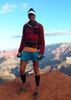
| no partners | | Kelly and I had talked about doing this one some time ago and this made a good way to end our jaunt to Flagstaff. After a small breakfast at the Super 8 NAU, we headed out of town passing by the Lakes which all had a lot of water still. We were duly impressed and I did stop between the St Mary Lakes so we could get a picture. Once into Double Springs Campground, just follow the signs all the way back to the very limited trailhead parking; there seems to have been an issue as to where to park for this hike. Two other gents headed out ahead of us and we would see them a couple miles later on their way back. It was a little warmer than I would like so I was glad we got out of town sooner.
I didn't realize this mountain was actually a volcanic mound. The trail eventually crosses over where the AZT passes and then UP and UP you go. You do get a reprieve from the continual up before the UP and UP starts again. I think we went up nearly 550 feet in the first mile. Most of the time on this part, the trail only got rocky in parts and that would continue until you top out. The rocky part is not fun at all but at least you have to concentrate on that rather than breathing  . Sometimes the grade up was not so bad and others, took a little more effort on my part. The views, as most people have mentioned previously, are quite limited. You basically hike through a forest until you top out and you eventually enter a small meadow with some great aspen on its outskirts. . Sometimes the grade up was not so bad and others, took a little more effort on my part. The views, as most people have mentioned previously, are quite limited. You basically hike through a forest until you top out and you eventually enter a small meadow with some great aspen on its outskirts.
Once through the meadow you hang a west where you eventually meet up with the forest road and then the UP continues; but at least you don't have to worry about the tread. As you get higher you now see the first couple antenna towers and as you get closer to the top there are even more towers; I was surprised at how many. They are rather sculptural too. It was interesting to walk around. We eventually found a log to sit on to take a snack break. Kelly decided she wanted to find the official high point/benchmark so she went in pursuit of that and felt she got pretty close. It was nice sitting in the shade and slight breeze before we headed out.
We took some pictures of the aspen as the light was a little better being behind us. We saw some lupine too but not as much as I had hoped. The forest is real nice up here and we did enjoy it as we headed down, however, it was warm and I was grateful for the three or four times we got filtered sun. It did seem the ravens found us rather entertaining as they dive bombed a couple times. We did see two other hikers on their way up; he had a rather heavy pack on too. It was the area where you get the view of Mormon Lake. I was able to zoom and catch a herd of elk drinking so that was pretty cool  . We could also hear the noise from the camp that is not far from this campground. . We could also hear the noise from the camp that is not far from this campground.
This hike isn't too bad and would be more tolerable if not for the rocky sections. Do I feel the need to do it again? No. But if you made me choose between this and Elden, Mormon Mountain would be it. I was glad to get it done. It confirmed that it would be pretty difficult for me to do the Fifty Mountain 3-nite backpack in Glacier Park of 12 miles with a three mile 1500 foot elevation gain in the last part. So that one is off the table. Next summer, depending on how I'm doing, we might try it from Canada instead as it's only 8 miles and 2000 feet elevation gain.
Thanks Kelly for getting me trained up and ready for my trip. She's so patient and supportive of me. We had lunch at Mormon Lake Lodge which has been good in the past but not this time; altho the fries were fine. There aren't a lot of eating choices close by so sometimes you just need to know what to order. We ended up taking the Stoneman Lake Road to join up with I-17. I haven't been on that road since my AZT days. It was in pretty nice shape and the holiday traffic was just starting, so not bad. Today we took the time to pullover and check out the lake too.
My best June ever, 76 miles, beating my old record of 56 miles in 2013. Whew, I got all my trip reports done as tomorrow, July 5th, I'm on my way to Glacier Park via a 3 nite drive.
WATCH 8:20-11:39 AM, 6.35 miles, 7277-8594 elevation. 120 avg bpm/151 max (kind of surprising that it's so low). 23% Zone 5 max, 21% Zone 4 anaerobic, 32% Zone 3 aerobic, 14% Zone 2 weight control, 10% Zone 1 low intensity burning 1165 calories. Surprisingly I did the first mile in 36 minutes with a couple stops to take pictures and get my poles out. Starting temp 59 but that's from the last time I had internet, sunny and 32% humidity. |
|
Wildflowers Observation Isolated
|
|
| _____________________
For me, sometimes it's just as much about the journey as the destination.
Oh, and once in awhile, don't forget to look back at the trail you've traveled. |
| | |
|
|
|
 Route Editor