|
| | | |
| |
|
| Hiking | 5.00 Miles |
330 AEG |
| | Hiking | 5.00 Miles | 7 Hrs | | 0.71 mph |
| 330 ft AEG | | 17 LBS Pack | | |
|
|
| |
| Partners |
|
none
[ show ]
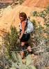
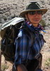
| no partners | | This was day 2 of a 3-day stay near Sedona in the red rocks. I joined a hike/learning opportunity co-sponsored by the Grand Canyon Trust (based in Flag, works on preservation of the entire Colorado Plateau) and the Natural History Institute (based in Prescott). The event was called "Natural History of Sedona and the Edge of the Colorado Plateau." The trail mileage of Baldwin Loop trail is tiny, but we detoured off the trail several times, both to minimize impact of our large group (24 people) on other trail users, and to have some shady places in washes and such, for discussions to take place. The hiking speed calculated by HAZ is going to look ridiculous, but much of the time we were standing still, listening -- I didn't time those periods. Among things I learned: The Mogollon Highlands area, being a place of contact between very different life zones (the higher Colorado Plateau vs the Basin and Range, pinyon-juniper country below the rim), is one of the most species-diverse places on the planet. For example, it's the most southern place that Utah Junipers are found, and also the most northern place for ocotillo. I learned to identify Arizona cypress, which likes to grow in washes where it gets a bit more water and some shade for part of the day from the rock walls (blue-green foliage, shaggy bark, and spherical cones - it's the only woody cone-producing species that has these round cones, rather than elongated ones). In the dry wash, rocks of Coconino Sandstone and the Schnebly Hill Formation mingled with dark gray rocks, and we saw a couple of dark gray bands of rock in one of the bluffs above. A young geologist who was with the leader team (named Kellen) explained that these gray rocks are basalt, the result of a lava flow that came all the way to Sedona from the San Francisco Peaks. That must have been something to see.
The group event lasted from 10AM to 4PM, and then I hiked a couple extra miles to the end of the road, to see Red Rock Crossing and the surrounding area. (I'd never been there yet.) The Crossing itself was crowded with families with children, and I did some wading in Oak Creek, too, to cool off. I recommend it highly, as a way to end a warm hiking day. |
| _____________________
"Sunshine on my shoulders makes me happy . . ." -- John Denver  |
| | |
|
|
|
 Route Editor