username
X
password
register
for free!
help
ArticlesGuidesRoutes
 
Photosets
 
 Comments
triplogs   photosets   labels comments more
Paradise Trail # 271 - 23 members in 54 triplogs have rated this an average 3.6 ( 1 to 5 best )
1, 2, 3  Next
54 triplogs
login for filter options
Jan 18 2025
avatar

 Guides 2
 Routes 208
 Photos 93
 Triplogs 205

male
 Joined Aug 08 2020
 Phx az
Bull Basin Loop - Eastern SuperstitionsGlobe, AZ
Globe, AZ
Hiking avatar Jan 18 2025
ScaredyCatTriplogs 205
Hiking10.77 Miles 2,821 AEG
Hiking10.77 Miles   7 Hrs   26 Mns   1.73 mph
2,821 ft AEG   1 Hour   13 Mns Break
 
1st trip
Partners none no partners
Route Scout Route Recorded  on Route Scout | Pop | Map | Popup | MapDEX
This outing had been on my want list since Oct 2022. A friend had been wanting to go to the E Supes. Two others were also up for this mega adventure. Met in Tempe at 7:30.

Turn off into Pinto Mine area. Once onto forest land the road grows rougher. There is a drop off on one side. Between Paradise Trail & Myles TH is the roughest patch. Start hike 10 am 37 degrees. Cold hands 1st mile. Jacket off after 2 miles.

We were thrilled by the beauty and solitude. Wildlife tracks and scat. Primarily bear & deer. No human prints. Bull Basin seriously overgrown. Expect to bleed. RF rating of 1 on here clearly needs to be updated. No possible way to justify a rating below 3.

Bout the time I was finally growing tired of getting smacked in the face by vegetation, we hit Haunted Canyon. Steep ascent with switchbacks. Paradise Trail-actually rocky and steep. This eventually gives way to a magnificent stroll. Plus skunks. 🦨
  2 archives
Mar 30 2024
avatar

 Routes 93
 Photos 7,758
 Triplogs 1,694

64 male
 Joined Mar 11 2003
 AZ
Paradise Trail # 271Globe, AZ
Globe, AZ
Hiking avatar Mar 30 2024
wallyfrackTriplogs 1,694
Hiking5.40 Miles 1,659 AEG
Hiking5.40 Miles   2 Hrs   33 Mns   2.12 mph
1,659 ft AEG
 no routes
Linked   none no linked trail guides
Partners none no partners
A trip to check out trail conditions. I was thinking about hiking into Haunted Canyon this week but longhiker asked about trail conditions on Paradise trail. I didn't know but changed trailheads to take a look. The road to Miles Ranch is bumpy with a few ruts but passable by most medium clearance vehicles. I didn't see another vehicle beyond the campsite at the turn beyond the bridge. The road is narrower than I remember it being but no fallen rocks or trees. I parked across from Paradise trail and started the hike up realizing I've only ever hiked down the trail in the past. The morning was cool but no wind down in the lower section. There are several downed trees but most are easy to bypass. One area has a tree tangle that will take some work to clean up. The brush is encroaching the trail higher up but not bad enough to impede progress. Once I got to the saddle by Government Hill the wind picked up and it was nice and cool. I hiked down to the junction with Haunted Canyon trail and turned back. I would have continued but have had some minor respiratory symptoms so kept this one short and easy. The hike down Paradise trail was much better. The temperature was pleasant the entire hike.
_____________________
  1 archive
Jun 16 2023
avatar

 Guides 59
 Routes 1,100
 Photos 1,191
 Triplogs 1,290

male
 Joined Jan 01 2023
 Arizona
Government HillGlobe, AZ
Globe, AZ
Hiking avatar Jun 16 2023
pseudalpineTriplogs 1,290
Hiking11.80 Miles 3,196 AEG
Hiking11.80 Miles   5 Hrs   3 Mns   2.59 mph
3,196 ft AEG      30 Mns Break
 
1st trip
Route Scout Route Recorded  on Route Scout | Pop | Map | Popup | MapDEX
In regard to the Bull Basin Trail, the same as what Ms. Stardust said previously. Essentially a one-off in its current lousy condition. I regularly thought I was going to step on a viper or come face-to-face with a bear tunneling through the vegetation from about miles three through six (CW loop ascending). Gritty and painful chaparral slogging with not many views. Don't plan on making good time through this section. I had researched FOTG's and some others routes for Government Hill and was strongly drawn to bailing from the Bull Basin Trail on GH's western side and traversing over the top, but stuck it out like a bull because I wanted to complete the whole trail and not have to go back and repeat the torture again. Once reaching the Haunted Canyon Trail, the hiking was more enjoyable and quicker. I ascended/descended the standard Government Hill route, which was surprising good (practically zero bushwhacking). The views were better than expected also. The descent of Paradise was unique and quite pretty with plentiful water sources still. Someone has pruned recently, but there is one massive deadfall that blocks the whole trail on the lower section. One of the best highlights was two small yellow/black birds (orioles?) that were battling a Hau'Pal on the trail in front of me. Another significant observation was all the bear scat and tracks throughout the loop. The cypress groves are also neat and remind me of Stewart Pocket. Yup, Supes hiking in mid June! :?
 Fauna
 Fauna [ checklist ]
[ checklist ]  Tarantula Hawk
 Culture
 Culture [ checklist ]
[ checklist ]  Benchmark
  9 archives
Mar 17 2023
avatar

 Guides 1
 Routes 8
 Photos 202
 Triplogs 9

65 male
 Joined Sep 02 2003
 Phoenix, AZ
Paradise-Haunted Canyon Loop, AZ 
Paradise-Haunted Canyon Loop, AZ
 
Backpack avatar Mar 17 2023
johnmc22Triplogs 9
Backpack9.00 Miles 2,500 AEG
Backpack9.00 Miles2 Days         
2,500 ft AEG
 
1st trip
Partners none no partners
Six of us did a 1-night backpack on the west end of Haunted Canyon. We left a car shuttle at the Upper Haunted Canyon Trailhead and then proceeded to the Paradise Trail TH to start the hike. The plan was to hike in the Paradise Trail and then connect with the Haunted Canyon Trail going southeast. We would camp overnight at a campsite near Tony Ranch and then retrace our steps along Haunted Canyon Trail, following it all the way back to the Upper Haunted Canyon TH along FR 287A (with a car shuttle back to the Paradise Trail TH to complete the loop).

We did this hike just a little more than one day after a fairly significant rain soaked the area, so there were streams everywhere. The waterfall about 1/2 mile in along the Paradise Trail was absolutely raging. In hindsight, I wish we had stopped and spent more time there, but you encounter it so quickly after you start the hike that you are inclined to keep going rather than to stop and enjoy it. Oh well... next time. As we continued on the Paradise Trail, there was quite a bit of overgrowth that we had to plow through. Fortunately, on this stretch of trail, the overgrowth was mostly that AZ shrub with the holly-like leaf (name?) without too much of the catclaw (which would have made things much worse). There's a fairly significant vertical climb on the Paradise Trail (~1500') and when you combine that with the trail overgrowth, this was not my favorite section of the hike. Plus, the weather was starting to turn by that point and a light rain started to fall. As we approached the 5000' saddle (adjacent to Government Hill), that rain turned to a light hail which made our planned lunch stop at the saddle pretty cold and a wet. Fortunately, the rain/hail moved on after that and we remained dry for the rest of the trip.

Once we got within a mile or two of Tony Ranch, we encountered a few stream crossings that were tricky due to the high water, but there was nothing we couldn't handle. We arrived at the planned campsite and setup camp, but we soon realized our planned short hike to see Tony Ranch was in question due to the high level of water in Haunted Canyon (nowhere to cross). We've been to this exact campsite before and the stream was dry that time, but it was a different story this time (March '23). Eventually, a few of us persevered and found a place to jump/rockhop across the stream with only a moderate amount of boot soaking, but most of the group avoided this entirely by staying in camp.

Overnight, we were reminded of a very strange phenomenon within Haunted Canyon (which we've seen before). Namely, the low temperatures are significantly below what is expected for a 3800' elevation. Case in point, the Globe forecast (at 3500' elevation) for this particular evening showed a low of 42 degrees. The temperature we experienced that night in Haunted Canyon was 26 degrees! Now, we always account to a colder low temp than the nearest town, but that adjustment is nearly always 5-10 degrees. A 16 degree delta is significant. Keep this in mind if you ever plan to backpack to Tony Ranch in the colder months.

The hike out the next day was uneventful. Another 1000'+ climb, but it just didn't seem that bad without the overgrowth, rain or hail. We passed "Dirt Tank" on our way out and it was a gorgeous lake due to all the recent rains. On the last leg of the hike between Dirt Tank and the Upper Haunted Canyon TH, we encountered a large crew of volunteers clearing brush along the trail and moving some fallen trees. We were extremely grateful to the group and mentioned that maybe they should tackle Paradise Trail next (but I don't think that was in their plans for that day).

Overall, this is a short backpack with a lot of elevation gain, a significant amount of overgrowth and a camp area that seems eternally cold. Compared to hiking in Haunted Canyon the "normal way" (off FR 287), this route is quite a bit more difficult, but if you're looking for something different this just might be the thing.
wildflower observationwildflower observationwildflower observationwildflower observationwildflower observation
Wildflowers Observation Light
We were still a little early in the season for wildflowers, but it will undoubtedly be a strong season starting around the end of March.

water 1 out of 5water 2 out of 5water 3 out of 5water 4 out of 5 Dirt Tank - Haunted Canyon 76-100% full 76-100% full
Dirt Tank was a gorgeous lake on this visit. There has been significant rain recently.

water 1 out of 5water 2 out of 5water less than maxwater less than max Grapevine Spring Quart per minute Quart per minute
Trough was full.

water 1 out of 5water 2 out of 5water less than maxwater less than max Paradise Spring Quart per minute Quart per minute
There was so much water everywhere (due to recent rains) that it was hard to estimate whether the spring was generating any.

water 1 out of 5water 2 out of 5water less than maxwater less than max Tony Ranch Spring Quart per minute Quart per minute
Trough was full. Streambed was full. Lots of water on this visit.
_____________________
 
Jan 08 2023
avatar

 Guides 37
 Routes 556
 Photos 10,872
 Triplogs 1,052

43 male
 Joined Jan 21 2013
 AZ
Rock Creek Trail #195 - SuperstitionsGlobe, AZ
Globe, AZ
Hiking avatar Jan 08 2023
FOTGTriplogs 1,052
Hiking7.20 Miles 550 AEG
Hiking7.20 Miles   3 Hrs   6 Mns   2.62 mph
550 ft AEG      21 Mns Break
 
I have always liked the Miles area after a nice precipitation event. There are three worthwhile little waterfalls that can be accessed from there and today we visited two of them.

Our first stop of the day was a chilly stop at the mostly shaded Paradise Trail to visit the little slab waterfall that forms in the trailside drainage about a half mile in on the trail. It was a scenic little hike into the falls. The creek had a light flow as did the falls and the trail was in excellent condition for the portion we hiked.

Our second stop of the day was the falls on Rock Creek. Although, I should say, "my" second stop of the day, as Katie set up a hammock just over a mile in to wait at for me with the pups, while I hiked up to the falls. We had Blanco with us who is pretty limited these days and she had a nice day in the Supes yesterday, so she let me get in the little extra hiking to see the falls. There was a nice flow at the falls and stunning hike along that creek in general. After my return and some leisure, we returned the way we hiked in, with some detours to play in the water along the way. We only ran into two hunters all day.

A nice quiet Sunday at Miles with a lot of water flowing and a lot of fun had by the pups.

water 1 out of 5water 2 out of 5water 3 out of 5water less than max Rock Creek Medium flow Medium flow
_____________________
  2 archives
Apr 10 2022
avatar

 Routes 31
 Photos 4,724
 Triplogs 187

50 male
 Joined Mar 14 2016
 Gold Canyon, AZ
Paradise Trail # 271Globe, AZ
Globe, AZ
Hiking avatar Apr 10 2022
00blackoutTriplogs 187
Hiking2.10 Miles 450 AEG
Hiking2.10 Miles
450 ft AEG
 no routes
1st trip
Linked   none no linked trail guides
Partners none no partners
Decided I was going to take stay home today, but by late morning boredom kicked in, so I quickly gathered my pack and headed out. Headed up the 60 past Superior, turned off on Pinto Valley Mine Road and headed up 287A. Made a quick stop at Miles to enjoy the scenery (no other vehicles were at the TH) and drove back up and parked at the Paradise Trail parking area. It was a bit warm and already after 1 so a quick hike up to Paradise Spring was the plan. About a quarter mile from the spring I came across an open area that had a pink tent setup underneath some trees. There were some shoe prints around it, however, it didn't look like anyone had been there in awhile. I called out to see if anyone was in it and with no answer I unzipped it. Completely empty, weird. On the way down, I caught a quick glimpse of something running through the brush on my left side. I didn't get a good enough look to see what it is, but whatever it was it was about knee high. Threw some rocks over in the brush to try and chase whatever it was out but no dice. By the time I was almost all the way down the wind had picked up a lot, which made the sun not quite as warm. Not a long hike today but still got in some wilderness time.
wildflower observationwildflower observationwildflower observationwildflower observationwildflower observation
Wildflowers Observation Moderate
_____________________
Hiking is just walking where it’s okay to pee. :y:
 
Jan 29 2022
avatar

 Routes 386
 Photos 49
 Triplogs 792

43 female
 Joined Jun 23 2015
 Phoenix, AZ
Bull Basin Loop - Eastern SuperstitionsGlobe, AZ
Globe, AZ
Hiking avatar Jan 29 2022
emilystardustTriplogs 792
Hiking10.31 Miles 2,699 AEG
Hiking10.31 Miles   6 Hrs   17 Mns   1.81 mph
2,699 ft AEG      36 Mns Break
 
no photosets
1st trip
Partners none no partners
Route Scout Route Recorded  on Route Scout | Pop | Map | Popup | MapDEX
Started at Paradise and came back through Bull Basin. Several miles of Bull Basin were pretty choked with all the pokey plants, the worst being catclaw. Seeing a few manzanitas to push through was a welcome break. :) Pretty decent water out there and saw no one on trail, just campers at Miles TH. Probably wouldn’t do Bull Basin all the way through again unless there’s future maintenance.
_____________________
 
Oct 30 2021
avatar

 Routes 93
 Photos 7,758
 Triplogs 1,694

64 male
 Joined Mar 11 2003
 AZ
Haunted Paradise, AZ 
Haunted Paradise, AZ
 
Hiking avatar Oct 30 2021
wallyfrackTriplogs 1,694
Hiking23.94 Miles 3,708 AEG
Hiking23.94 Miles   9 Hrs   50 Mns   2.77 mph
3,708 ft AEG   1 Hour   11 Mns Break
 no routes
1st trip
A trip to the wilderness with the Eagle. The morning started out cool and stayed that way almost to Toney's cabin. I did take a tumble along the way but the damage was cosmetic. :o Bull Basin trail is overgrown so plan for some route finding and scrapes if you decide to hike it. The climb up Haunted Canyon trail to the saddle on Paradise trail was toasty. The hike down Paradise trail was nice and shaded. Bruce did a slide on the way down but recovered well. There was tree fall/limbs in several areas and we removed some. The road hike from Paradise trailhead to the upper Haunted Canyon trailhead went by pretty quick. The road there was in good shape. The hike up Haunted Canyon trail was warm but once we started down the rest of the hike was mostly shaded and temps were dropping. Not sure I was in shape for a 20 miler but we made decent time and I can walk today. I could have used more water because of the warm climbs. A good hike with normal BS & banter. In the end we agreed that anything that went wrong was Denny's fault. :lol:
foliage observationfoliage observationfoliage observationfoliage observationfoliage observation
Autumn Foliage Observation Substantial
wildflower observationwildflower observationwildflower observationwildflower observationwildflower observation
Wildflowers Observation Light
_____________________
  4 archives
Oct 30 2021
avatar

 Guides 41
 Routes 1,627
 Photos 14,983
 Triplogs 2,762

69 male
 Joined Jan 20 2009
 Far NE Phoenix,
Haunted Paradise, AZ 
Haunted Paradise, AZ
 
Hiking avatar Oct 30 2021
The_EagleTriplogs 2,762
Hiking23.94 Miles 3,708 AEG
Hiking23.94 Miles   9 Hrs   50 Mns   2.77 mph
3,708 ft AEG   1 Hour   11 Mns Break
 
Route Scout Route Recorded  on Route Scout | Pop | Map | Popup | MapDEX
I can't believe it's been 6 years since I've been out this way.

Joe put together some options and Wally and I opted for the longer lasso loop. At the last minute, Joe had to back out , so Wally and I carried on.

Haunted Canyon #203
A chilly 41 degrees at the beginning. 1 truck at the TH. The road walk lasts for just under 2 miles. We checked out the Perez Cabin, before hitting the trail. The trail is generally in decent shape, but be forewarned that long pants are recommended because of the PI. It's easy to spot currently in it's beautiful fall red.

3.5 miles itn, Wally worked on his triplog, with his Autumn entry. He used his head and all was well. He was now in full Halloween form.

The Sycamores were in full fall color. The Tony Ranch springbox was full and due to get a workout after the afternoon campers would arrive.

After a stop at Tony Ranch, we headed for Bull Basin.

Bull Basin #270
We only made it .3 miles on the trail, before we bailed. We had some decent miles to cover and the trail was way overgrown. We retreated to the Paradise trail.

Paradise Trail #271
The climb to the saddle was warm in the sun. We both looked forward to the shade of the trees once we dropped down from the saddle. This section is special.

We needed to do a roadwalk to get to the Upper TH for Haunted Canyon #203. It went by quickly.

Haunted Canyon West
It's a bit more that a 1.6mile climb to get back to the Paradise intersection. Wally promised to show me the Grapevine spring box. We passed the location on the Topo map, nope. We passed the location on RS, nope. finally we ran across the actual location.

Back in the area close to Tony cabin, we started running into people coming in to camp for the Halloween weekend. We chatted with @laurabalaura for a while, before Wally ran into others he knew.

The colorful sycamores looked a bit erie in the afternoon light on the final push to the vehicle
5 vehicles at the Lower TH and 2 at the upper TH when we left.

The only wildlife seen all day were 2 javelina and a deer that were sleeping next to the road on the way in.

Good hiking with the Supesaholic again.
 Flora
 Flora [ checklist ]
[ checklist ]  Sacred Datura
 Culture
 Culture [ checklist ]
[ checklist ]  HAZ - Hike HAZard
foliage observationfoliage observationfoliage observationfoliage observationfoliage observation
Autumn Foliage Observation Substantial
wildflower observationwildflower observationwildflower observationwildflower observationwildflower observation
Wildflowers Observation Light

water 1 out of 5water 2 out of 5water 3 out of 5water less than max Dirt Tank - Haunted Canyon 51-75% full 51-75% full

water 1 out of 5water less than maxwater less than maxwater less than max Grapevine Spring Dripping Dripping
Spring box full

water 1 out of 5water less than maxwater less than maxwater less than max Paradise Spring Dripping Dripping
water report recorded in the field on our app Route Scout Pools

water 1 out of 5water less than maxwater less than maxwater less than max Tony Ranch Spring Dripping Dripping
Spring box is full
_____________________
There is a very fine line between "hobby" and "mental illness."
Dave Barry 🦅
 
Oct 16 2021
avatar

 Guides 25
 Routes 377
 Photos 5,927
 Triplogs 347

40 male
 Joined Mar 01 2018
 Chandler, AZ
Haunted Canyon Paradise Loop, AZ 
Haunted Canyon Paradise Loop, AZ
 
Hiking avatar Oct 16 2021
John10sTriplogs 347
Hiking17.54 Miles 2,599 AEG
Hiking17.54 Miles   9 Hrs   19 Mns   2.30 mph
2,599 ft AEG   1 Hour   42 Mns Break
1st trip
Partners partners
TboneKathy
I'd had Haunted Canyon on my list for quite a while, and this seemed like a good time of year to finally check it out. We started from the eastern trailhead, and it was surprisingly chilly...nearly 70° when we left the valley, but just above 40° when we started hiking. The was a little water in Pinto Creek early on, but that first stretch following the dirt road along the creek wasn't my favorite area with all the pipes and fenced-in areas for valves and other mining structures. It got a lot more scenic once we were on the actual trail and started the climb up above Haunted Canyon.

There was quite a bit of catclaw along the trail, though it wasn't terribly overgrown and was mostly avoidable. Once the trail descended back into the creek bed, there was poison ivy everywhere. It was impossible to avoid touching it completely, so we had to just minimize contact with it and hope for the best...a few days later and no reactions, thankfully :). At least the a lot of the poison ivy was turning yellow before the other plants, so it tended to stand out.

I had a general sense where the Jose Periz homestead was located, but we had a lot of ground to cover, so we didn't take the time to look for it. I confirmed later that I had the right area in mind, so we'll have to visit it on a future trip. On the way to Toney Cabin, I saw Skull Cave in the canyon wall, so we went over for a closer look. There's one break in the cliff that offers a straightforward scramble up to the cave, and it's surprising how deep into the mountain it extends. As I entered the cave, something big flew deeper in ahead of me, likely a bat. I didn't go very far inside knowing there was stuff flying around back in there...no need to risk ending the day with a rabies shot :). I've read that the cave extends back ~100 yards, but I was satisfied just exploring closer to the entrance. Whatever flew in later flew back out over my head as I ducked down. I didn't get a good look, but my partner had waited down below and said it looked like an owl...

There was a full basin at Toney Ranch Spring, but the pipe feeding the basin wasn't flowing. The next stop was Toney Cabin, and it was a really nice setting for a homestead. We explored the area and signed the register inside. I found it interesting that SALT has no trespassing signs outside, but one of the first entries in the register notebook inside, from 2015, was from an executive director at SALT encouraging people to donate money, and there were donation slips on the table nearby. So...don't trespass, but if you do trespass, please donate to SALT? :)

After leaving the cabin, we continued west on Haunted Canyon Trail. We'd considered a longer loop back, taking Bull Basin to FR 287A, but we weren't sure about the trail conditions and what the pace would be on Bull Basin, so we stayed on #203 but did add some distance by taking Paradise Trail back to the road. Near the intersection of #203/#271, Dirt Tank had quite a bit of water in it...a surprise since a lot of the springs to that point had been mostly dry. Paradise Trail was a little overgrown in some places, but never consistently bad, and not too many thorns or spines in the brush. Paradise Spring had a few small pools, and there was a clearing nearby with a tent set up, though we didn't see anyone at the campsite.

We completed the loop along FR 287A, where we saw a few ATVs/vehicles over the last few miles. I'm not a big fan of road hiking, but there was some nice scenery along this one aside from the Pinto Valley mine operations that came into view again as we appeached our starting point. We only saw a few campers and two other hikers all day, and it's an area I'd like to come back and explore a little more, with Periz cabin, some potential ruins/pottery sites, and other points of interest we didn't get to look for today.
 Flora
 Flora [ checklist ]
[ checklist ]  Poison Ivy

dry Bath Tub Spring Dry Dry
water report recorded in the field on our app Route Scout

water 1 out of 5water 2 out of 5water less than maxwater less than max Dirt Tank - Haunted Canyon 26-50% full 26-50% full
water report recorded in the field on our app Route Scout

dry Haunted Canyon Dry Dry
water report recorded in the field on our app Route Scout

water 1 out of 5water less than maxwater less than maxwater less than max Haunted Canyon Spring Dripping Dripping
water report recorded in the field on our app Route Scout A few small pools nearby


water 1 out of 5water less than maxwater less than maxwater less than max Paradise Spring Dripping Dripping
water report recorded in the field on our app Route Scout Small pools

water 1 out of 5water less than maxwater less than maxwater less than max Tony Ranch Spring Dripping Dripping
water report recorded in the field on our app Route Scout

dry Wood Creek Dry Dry
water report recorded in the field on our app Route Scout
  1 archive
May 01 2021
avatar

 Guides 38
 Routes 183
 Photos 1,605
 Triplogs 233

40 male
 Joined Dec 09 2014
 Gilbert, AZ
Haunted-Paradise Loop, AZ 
Haunted-Paradise Loop, AZ
 
Hiking avatar May 01 2021
jacobemerickTriplogs 233
Hiking6.42 Miles 1,974 AEG
Hiking6.42 Miles   6 Hrs   2 Mns   1.41 mph
1,974 ft AEG   1 Hour   28 Mns Break
 
1st trip
Partners none no partners
Route Scout Route Recorded  on Route Scout | Pop | Map | Popup | MapDEX
Hike w/ kids. Camped at Miles TH the night before, had a great time with brats and s'mores, cold sink got cold overnight. Left vehicle at camp and road-walked, then did the @ShatteredArm shortcut, which started easy and quickly devolved until it was easier to carry the kids, one at a time, over the catclaw and manzanita, instead of convincing them that cuts are temporary. We'll do the long switchback next time. Reached Haunted Canyon TH and we really enjoyed the well-maintained trail and ample shade, especially on the first mile. Dropping down to the Tank was easy and we had a long break here, huddled together under a small spot of shade, as it was getting pretty warm already. Paradise Trail was in worse shape, more overgrowth to push through and a generally steeper tread with a few washouts. Once we entered the shaded section we all had more fun. Returned to the Jeep later than expected, I overestimated the kids pace on these hot, rocky trails. Peaceful day out there, only one other group camping at Miles TH, no one on the trails.
 Culture
 Culture [ checklist ]
[ checklist ]  Campsite
 Named place
 Named place [ checklist ]
[ checklist ]  Paradise Spring

water 1 out of 5water 2 out of 5water less than maxwater less than max Dirt Tank - Haunted Canyon 26-50% full 26-50% full

water 1 out of 5water less than maxwater less than maxwater less than max Grapevine Spring Dripping Dripping
Several pools glinting near the spring. Also, circle trough along the trail was full and looked okay.

water 1 out of 5water 2 out of 5water less than maxwater less than max Paradise Spring Quart per minute Quart per minute
Water above and below the site of the spring. Some trickle. Not enough flow for waterfall.
_____________________
 
Apr 18 2021
avatar

 Guides 1
 Routes 259
 Photos 10,458
 Triplogs 293

male
 Joined Jan 28 2010
 Fountain Hills,
Peak 5501 and Govt Hill BM, AZ 
Peak 5501 and Govt Hill BM, AZ
 
Hiking avatar Apr 18 2021
FLYING_FLIVERTriplogs 293
Hiking7.55 Miles 2,873 AEG
Hiking7.55 Miles   7 Hrs   40 Mns   1.68 mph
2,873 ft AEG   3 Hrs   10 Mns Break
 no routes
1st trip
Bear with me
Seven years ago I did a hike and started my triplog by saying:
"This hike is all Hansenaz’s fault. (I’ve never met the gentleman, but I still blame him)" :)  

Then after a hike in Jan 2020:
"This hike is all Outdoor_Lover's fault. (I’ve never met the young lady, but I still blame her)" :)  

Well, for this hike I say:
"This hike is all wallyfrack’s fault. (I’ve never met the gentleman, but I still blame him)" :)  
============
In Jan 2017 I did a hike I named - Government Hill and "GOVT HILL” BM.
I hiked to Government Hill in the SE Superstitions and easily located a USGS "No-Name" benchmark. It's a nice little disk, but it has no name on it.
I know many HAZ members have been to Government Hill, and have viewed this no-name disk.
I emailed the USGS with the LAT/LONG of the no-name disk, and their answer, "We have no record of that disk". HMMM ….

On TOPO maps, about 1 mile west of Government Hill, there's a mountain named, Peak "5501 BM". It's basically a no-name mountain, and uses the BM's elevation for its designation.
Well, I have a datasheet for that "5501 BM" benchmark disk, and it's named ….
"Govt Hill". Another - HMMM .…

On that hike in 2017, I hiked west, off Government Hill to Bull Basin Tr, and attempted to climb up to Pk 5501. I failed.
I fought through about 100 feet of thick, intertwined vegetation and gave up. That stuff was like hiking through a chain link fence. Up to Pk 5501 was another 500 Ft up, but no way.

Fast forward to last year. Wallyfrack tried to get up to Pk 5501, using my 'track up', and also stopped, due to vegetation.
However, after his hike, he did some great research, and got up to Pk 5501.
He used a different, zig-zagging, and less dense vegetation track, and located the BM disk named "GOVT HILL" (1946).

After his successful hike, the "King of the Supes" graciously sent me a 'HAZ PM', and included his GPS track up to Pk 5501 from Bull Basin Tr.
Well, I made it up there on this hike, using his expert info.
Thank-you, wallyfrack.

Now, here is why I blame wallyfrack for this hike.
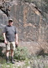
Yes, he confided in me his 'track up', and then he enticed me to get up there by offering me a money reward. (Photo from wallyfrack's successful hike photoset).
[ photo ]
Well, I couldn't pass up that reward. 😀

So, off I went to retrieve my reward. I located the GOVT HILL BM disk, and the summit log — With my reward inside. 😀

I also located 'where' Ref Mark #1 used to be located, and I did locate RM #2.
Note - The two RMs are not disks. They are etched crosses in boulders.
RM #1's etched cross has chipped away, and that 'chip-away' appears to be a natural occurrence. RM #2 was over 29 Ft away, but easily located, and in perfect shape.

One more point of interest.
I included Google Earth screenshots of my track. You'll notice it stops at Bull Basin Tr, and does not include wallyfrack's track-up portion. He did the work on that part, and it's his.

So, I'm glad I finally got atop Pk 5501, and I'm very thankful for the King of the Supes's assistance. My photoset will explain what I actually did with my reward. 😀
 Named place
 Named place [ checklist ]
[ checklist ]  Government Hill
_____________________
Not All Those Who Wander Are Lost
J.R.R.TOLKIEN
 
Dec 13 2020
avatar

 Routes 175
 Photos 2,335
 Triplogs 191

44 female
 Joined Jan 21 2019
 Pine, AZ
Paradise Trail # 271Globe, AZ
Globe, AZ
Hiking avatar Dec 13 2020
jillyonanadventureTriplogs 191
Hiking5.86 Miles 1,516 AEG
Hiking5.86 Miles   3 Hrs   30 Mns   1.75 mph
1,516 ft AEG      9 Mns Break
 
1st trip
Linked   none no linked trail guides
Partners partners
jharvey33
klfranz
Route Scout Route Recorded  on Route Scout | Pop | Map | Popup | MapDEX
We were super slow at packing up camp because it was chilly in the morning, so a bit of a late start to this hike. The drive from haunted canyon over to paradise TH took around ~25 minutes. The road was in decent condition but did have just a few spots where careful maneuvering was needed. Also, there is a sheer drop off to the left so if you have heights fears, it could be an issue. I personally loved the drive since there was so much to see of a wilderness area I haven’t hiked too much in! As for the trail, I will say we really didn’t do much research other than quickly looking at the guide, some photo sets and downloading the route. I think our experience could be a bit biased, because I suspect the trail would be much prettier with flowing water. It was ALL dry - no water crossings, no waterfall, etc. Also, it goes uphill the whole time, mostly under a tree line with no views. Our legs were a tad tired from the 12 miles the day prior, so it felt harder than it should have. It does gain ~1600 feet in a short distance so you’ll get a decent workout. When we were nearing the top, we finally had some views and were really intrigued by a red colored mountain in the distance. There was a TON of bear scat all along the trail and zero people out there, so I was thinking this was going to be my lucky day! (I had spilled hot cocoa all over my pants the night prior, so I was especially thinking I was going to attract those bears :lol: ) Sadly, we didn’t see any bears this trip, but they were definitely out there; oh well, my dream will come true one of these days. We reached the top of the saddle and enjoyed the views for a bit. It got quite windy and cold up there, so we didn’t stay too long. Coldness and downhill made me much faster on the exit, and we made very good timing. SO... we didn’t find this trail to be very paradise- like, BUT it was due to our lack of research on timing. This trail would be much prettier after rainfall, snowmelt, etc. as we saw so much potential there. I would not recommend doing this one unless there is water flowing, or it’s part of a larger loop. The solitude was a plus though!
foliage observationfoliage observationfoliage observationfoliage observationfoliage observation
Autumn Foliage Observation None
Big huge leaves on the ground!

dry Paradise Spring Dry Dry
water report recorded in the field on our app Route Scout
_____________________
Restless between adventures...
 
May 01 2020
avatar

 Photos 22
 Triplogs 12

36 male
 Joined Aug 09 2017
 Chandler
Haunted Paradise, AZ 
Haunted Paradise, AZ
 
Hiking avatar May 01 2020
GostrichTriplogs 12
Hiking17.74 Miles 3,022 AEG
Hiking17.74 Miles   10 Hrs   21 Mns   2.43 mph
3,022 ft AEG   3 Hrs   3 Mns Break25 LBS Pack
 
no photosets
1st trip
Partners none no partners
Route Scout Route Recorded  on Route Scout | Pop | Map | Popup | MapDEX
I arrived at the TH of Haunted Canyon approx. @ 0830. An earlier start would have been preferred. But once stepping out and entering into the canyon, the cooler air from the flowing creek and shade provided by the trees made the hike very enjoyable. The trail was relatively easy to follow, but no ways that I could see avoiding getting your feet wet. I stopped by at Tom's Ranch for lunch and was back on the trail by noon. I took the left at the intersection, leaving Haunted and going up to Paradise. The climb out of the canyon felt pretty intense and definitely the day's fatigue was setting in. I was glad to soak my feet in the creek along the trail for a few minutes before exiting Paradise unto FR287. the approx. 7ish mile walk to my truck was a relief and I enjoyed the views and colors on along the landscape as the sunset behind me. I really enjoyed this hike and will do it again sometime. Preferably with a bike for the ride back.
_____________________
  8 archives
Mar 07 2020
avatar

 Routes 93
 Photos 7,758
 Triplogs 1,694

64 male
 Joined Mar 11 2003
 AZ
Bull Basin Loop - Eastern SuperstitionsGlobe, AZ
Globe, AZ
Hiking avatar Mar 07 2020
wallyfrackTriplogs 1,694
Hiking10.30 Miles 2,812 AEG
Hiking10.30 Miles   6 Hrs      1.83 mph
2,812 ft AEG      23 Mns Break
 no routes
Another stroll in the Supes. The morning started off with some miss cues but it all worked out. The forest road is in okay shape with a few small washed out bumps but nothing too bad. The Bull Basin trail could use a trim but I had no problem following the trail. We somehow walked past the unknown cowboy grave but then noticed two ruins the trail runs through the middle of. The creek was flowing but easy crossing and there where a few trees down on Paradise trail to keep the wild in wilderness. :lol: We noticed the short cut route at the fence line that goes over Government Hill ridge but saved that for another trip. No critters on the hike but I did slow down for 4 mules does on the drive out. All in all a successful hike with good company.
_____________________
  2 archives
Mar 07 2020
avatar

 Guides 27
 Routes 670
 Photos 12,111
 Triplogs 857

56 male
 Joined Jul 05 2006
 Mesa, AZ
Bull Basin Loop - Eastern SuperstitionsGlobe, AZ
Globe, AZ
Hiking avatar Mar 07 2020
DarthStillerTriplogs 857
Hiking10.30 Miles 2,812 AEG
Hiking10.30 Miles   6 Hrs      1.83 mph
2,812 ft AEG      23 Mns Break
 
1st trip
Finally got some new tires on the Stillermobile, so I'm good to dare out on the rougher roads of the eastern Supes. This was one I had my eye on to do for a little while, and this time of year is probably the best. At the end of last week's hike to Broadway Cave, I mentioned it to Wally and he liked it. I told him I would send my usual follow up confirmation email next week to confirm. But, sometimes, things fall thru the cracks.

I arrived at Wally's darkened house at 5:28am, with no Wally outside. Uh-oh. Oh yeah, I forgot to send that email. I decided to go ahead and ring the doorbell, as soon as I could find it in the dark. The door opened just enough for him to stick his head out, no glasses and squinty eyes.

"You weren't gonna do it. It's not on the Wishlist."
"I forgot to email you. I'm sorry. My fault. I almost forgot to message Andy until yesterday afternoon. I kept meaning to email you..." :sorry:
"No problem. I meant to email you."
"Yeah, I was supposed to email you, anyway, my bad, I'm sorry. :doh: "
"ok"

and the door was closed. :scared: Now, if I hadn't known Wally for 13 years now, this might seem rude. But I knew what the abrupt shutting of the door meant. He wasn't going back to sleep. And he knew where we were going. We was going to catch up with us. there was a precedent set for this 11 (OMG, THAT long ago?) years ago. I had to move, Andy was waiting.

Andy said to meet at the Safeway at Ellsworth and Baseline. I pulled in and saw no Safeway. then I could tell after a few minutes that the Safeway had closed. After a few more minutes, Andy pulled in. I drove over to him.

"I forgot to do the confirmation email to Wally, so he might be out. But, maybe not. He's probably going to catch up with us."
"we can call him to see"
"yeah, that's not how this works. :SB: "

We arrived at the trailhead about 7:30am, and got ready. Within 5 minutes, I could hear a car driving up.

"Here he is."
"You guys haven't started yet? I even stopped for gas."
"Oh man, you were right!"

And we did the hike.

Bull Basin is kind of overgrown. Not terrible. Uphill with the overgrowth, loose rock, and steep. At the saddle we all felt pretty spent. On the way up to the saddle, Wally pointed out some not at all obvious ruins and casually found several pottery sherds along way and set them on rocks so we could see them. Andy and I had to concentrate on keeping our balance and breathing. We noticed the faint trail shortcut over Govt Hill to Paradise along that ridgeline. Another day. : rambo :

Downhill felt better at first, then it seemed like a slog until the low point. The lower we got, the worse the overgrowth at points. Finally I reached the bottom with Wally waiting and had lunch while we waited for Andy. He had some work related satellite texts to deal with that held him up, so Wally started to head back up the trail before he found him almost immediately (after I wolfed down my lunch).

The hike back uphill wasn't so bad. We knew we did 1700' out of 2600', this should be a cakewalk. :y: Bit of a slog in places, not very bad. At the 2nd saddle it was all downhill from there. the trail was much less overgrown, but still a bit in spots. A protruding branch smacked me in my temple on the way down at one point. Other than, that, the last mile the soreness kicked in and slowed me down a bit.

Lots of water out there still. Very nice to hear the running water and make the many stream crossings necessary. Several spots on all the trails seemed to follow the stream bed at times, making it a little confusing at first, but easy to navigate. Very fun day in the Supes with great weather and great company. :rollH:
_____________________
  1 archive
Jan 26 2020
avatar

 Guides 12
 Routes 192
 Photos 863
 Triplogs 356

42 male
 Joined Nov 30 2015
 Phoenix, AZ
Haunted Canyon / Paradise loop, AZ 
Haunted Canyon / Paradise loop, AZ
 
Hiking avatar Jan 26 2020
ShatteredArmTriplogs 356
Hiking7.01 Miles 1,852 AEG
Hiking7.01 Miles   3 Hrs   16 Mns   2.17 mph
1,852 ft AEG      2 Mns Break
 
1st trip
Partners none no partners
Headed out to the Eastern Superstition Wilderness with a couple of friends today. Originally planned on running with them, but I got my ankle in a bit of a twist yesterday coming down the mountain, so I decided to just hike around. Dropped them off at Haunted Canyon TH (on Pinto Creek), and continued up the road to Paradise TH. The plan was to meet them along the way and do Paradise Trail with them.

I started up the road towards Haunted Canyon trail, and decided to try and find a way up the canyon to skip the long road switchback. Didn't find a very good path, but I did see a band of coatimundi at least a half dozen strong. I always consider it a good day when I get to see coatis in the wild.

The west end of Haunted Canyon trail was nice. Intermittent water all the way up to the saddle. View from up there was expansive.

The original plan was to head down Haunted Canyon Trail until I ran into the others, but the farther I went down past the Paradise junction (currently unsigned), the less I wanted to hike back up. So I stopped under a copse of trees, had a snack, and headed back up to the junction.

At the top of Paradise Trail, I decided to traverse the ridge to the northeast for a bit to get a better view. It worked out well. Found a bunch of garbage from what appeared to be some kind of camp, with a tarp and a bunch of water jugs (some with water, but the dry parts cracked).

The hike down Paradise Trail was gorgeous. Nice lush forest, lots of the red-trunked trees (I think they're Arizona Cypress?), and pretty good flow most of the way down. The little mossy cascade was one of the cooler things I've found in the Superstition Wilderness - near Paradise Spring on the map.

The more I explore this area, the better it gets.

water 1 out of 5water 2 out of 5water 3 out of 5water 4 out of 5 Dirt Tank - Haunted Canyon 76-100% full 76-100% full
Some flow out of the tank.

water 1 out of 5water 2 out of 5water less than maxwater less than max Grapevine Spring Quart per minute Quart per minute

water 1 out of 5water 2 out of 5water 3 out of 5water less than max Paradise Spring Gallon per minute Gallon per minute
_____________________
 
Dec 31 2019
avatar

 Guides 37
 Routes 556
 Photos 10,872
 Triplogs 1,052

43 male
 Joined Jan 21 2013
 AZ
West Pinto Trail #212 - SuperstitionsGlobe, AZ
Globe, AZ
Hiking avatar Dec 31 2019
FOTGTriplogs 1,052
Hiking
Hiking
 
Linked   linked  
Partners none no partners
Set off to climb again, got rained out, went to a familiar place and made the best of it.

Paradise Falls had a modest flow.

West Pinto experienced a flash flood that must have been historic in nature sometime recently. However, the trail was still generally good and discernible. The Woodbury fire did not get Miles, but it got a lot of the sycamores along the trail shortly after leaving the ranch area. We only went in as far as we could make it without getting our feet wet. The devastation in this area was a tad surreal and disheartening for me to see.

water 1 out of 5water 2 out of 5water 3 out of 5water 4 out of 5 Pinto Spring Gallon + per minute Gallon + per minute
_____________________
 
Dec 09 2019
avatar

 Guides 187
 Routes 991
 Photos 12,084
 Triplogs 866

72 male
 Joined Jun 27 2015
 Tucson, Arizona
Bull Basin Paradise Loop, AZ 
Bull Basin Paradise Loop, AZ
 
Hiking avatar Dec 09 2019
markthurman53Triplogs 866
Hiking10.46 Miles 3,055 AEG
Hiking10.46 Miles   5 Hrs   38 Mns   2.29 mph
3,055 ft AEG   1 Hour   4 Mns Break15 LBS Pack
 
1st trip
The second day hike was on the Bull Basin, Middle Haunted Canyon and the Paradise Trail. Really nice weather for this what seems to be a natural connection of trails to form a loop. There was water everywhere, all the creeks and what ever cracks in the ground that water could squeeze through. I was going to do a water report but I don't believe I really saw any springs and wasn't really looking since it was coming out of every little nook and cranny. The clear weather made for great views when on the high points, Bull Basin Saddle and Paradise Saddle (I made those names up not sure what those saddles are really called). Also had cell service when I hit those points, Pinal Peak was in sight so there must be cell towers on them or it could be the Pinto Mine. Either way I got a couple of texts from Texas while up there. Was nice to text to a person since I was getting tired of talking to the crows.

Bull Basin Trail #270
fair to good condition all the way. Looks like the first 2.5 miles from the Miles Ranch Trail Head were recently manicured. The rest of the trail all the way to Haunted Canyon Trail was a little overgrown. Required some light pushing through some brush but I had no issues staying on trail. It is sporadic, some sections were really clear others not. May be more of an issue come spring when the new growth comes in. Overall I would say it was in fair condition but then I may be comparing it to some of the trails in the Chiricahua Mountains that would have a hard time even making it to the really poor condition.

Haunted Canyon Trail #203
This section of the Haunted Canyon Trail (Bull Basin to Forest Service road 287) is in good condition. I don't think I had to push through any brush or step over any dead fall. The junction at Bull Basin and Haunted Canyon is signed at least for the Haunted Canyon Trail. I did not see a sign for the Bull Basin Trail but it was rather obvious. I actually thought the Haunted canyon sign could be a bit confusing if you didn't know the trails, it pointed in two directions one heading down canyon the other heading up canyon but if you followed the arrows you might take the Bull Basin Trail, the Haunted Canyon Trail makes a hard turn to the north. I guess if you don't know where you are going you will probably get lost anyway on your own and don't need the sign to help you along (although the sign will give you an excuse).

Paradise Trail #271
Somewhere I read that this trail was decommissioned and doesn't exist anymore so I was expecting this portion of the loop to take a little while. Don't know where I read that or if I just dreamed it but this trail was in the best condition of all the trails I have been on so far. The trail for this hike starts at Dirt Tank along the Haunted Canyon Trail. There is a very short climb up to a saddle and then down hill all the way to 287. Not a real scenic trail. Other than the views from the saddle you spend the rest of the time in a canyon that looks very much like any other canyon in the area.
_____________________
 
Nov 17 2019
avatar

 Guides 94
 Routes 842
 Photos 22,068
 Triplogs 1,994

52 male
 Joined Sep 18 2002
 Tempe, AZ
Tonys Paradise Bull, AZ 
Tonys Paradise Bull, AZ
 
Hiking avatar Nov 17 2019
chumleyTriplogs 1,994
Hiking13.03 Miles 3,096 AEG
Hiking13.03 Miles   5 Hrs   44 Mns   2.48 mph
3,096 ft AEG      29 Mns Break
 no routes
1st trip
Recent triplogs made me think this would be a good loop. Nope. Bull Basin needs some work again. I wonder if it was the heavy snow last winter, but there's a lot of taller stuff that has bowed over into the trail that has to be pushed through. The tread is clear though. It got progressively worse on the climb from Bull Basin up to the saddle, and the entire downhill side south of the saddle to the Haunted Canyon junction was a mess of overgrowth and a lot of catclaw. The initial descent off the saddle has some pretty good water erosion, with several of the water bars completely gone.

The rest of the hike was great. The northern section of Bull Basin is beautiful, as is the lower part of Paradise. In the middle, the trip to Tonys and back is very nice. It was warm in the sun for November and while we had planned for that, we had not anticipated how cold it would be to start. Temps in the 30s made the first couple of miles a real chill.

Stupid amount of bear poop on Bull Basin. The most I've seen on a single trail ever. Several were still warm. No direct sightings though.
_____________________
I'm not sure what my spirit animal is, but I'm confident it has rabies.
  1 archive
average hiking speed 2.15 mph
1, 2, 3  Next

WARNING! Hiking and outdoor related sports can be dangerous. Be responsible and prepare for the trip. Study the area you are entering and plan accordingly. Dress for the current and unexpected weather changes. Take plenty of water. Never go alone. Make an itinerary with your plan(s), route(s), destination(s) and expected return time. Give your itinerary to trusted family and/or friends.

helpcommentissue

end of page marker